 Old Cumbria Gazetteer
 |
 |
|
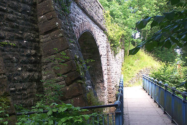
| Stenkrith Bridge, Kirkby Stephen | ||
| Stenkrith Bridge | ||
| site name:- | Eden, River | |
| locality:- | Stenkrith | |
| locality:- | Kirkby Stephen | |
| civil parish:- | Kirkby Stephen (formerly Westmorland) | |
| civil parish:- | Nateby (formerly Westmorland) | |
| county:- | Cumbria | |
| locality type:- | bridge | |
| coordinates:- | NY77290747 | |
| 1Km square:- | NY7707 | |
| 10Km square:- | NY70 | |
|
|
||
 BNX61.jpg (taken 8.8.2007) 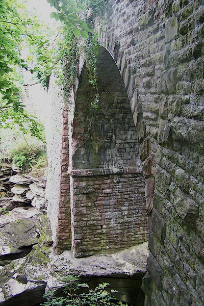 BOC60.jpg (taken 5.9.2007) |
||
|
|
||
| evidence:- | old map:- OS County Series (Wmd 23 15) placename:- Stenkrith Bridge |
|
| source data:- | Maps, County Series maps of Great Britain, scales 6 and 25
inches to 1 mile, published by the Ordnance Survey, Southampton,
Hampshire, from about 1863 to 1948. |
|
|
|
||
| evidence:- | old map:- Bowen and Kitchin 1760 |
|
| source data:- | Map, hand coloured engraving, A New Map of the Counties of
Cumberland and Westmoreland Divided into their Respective Wards,
scale about 4 miles to 1 inch, by Emanuel Bowen and Thomas
Kitchin et al, published by T Bowles, Robert Sayer, and John
Bowles, London, 1760.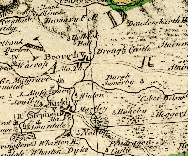 BO18NY71.jpg road across the Eden item:- Armitt Library : 2008.14.10 Image © see bottom of page |
|
|
|
||
| evidence:- | old map:- Jefferys 1770 (Wmd) placename:- Stenkrith Bridge |
|
| source data:- | Map, 4 sheets, The County of Westmoreland, scale 1 inch to 1
mile, surveyed 1768, and engraved and published by Thomas
Jefferys, London, 1770.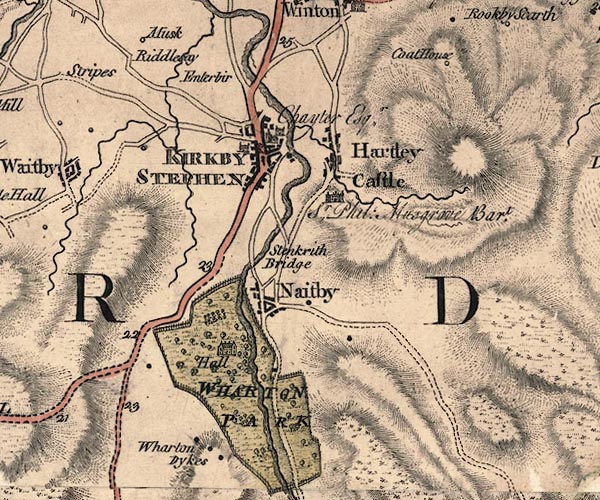 J5NY70NE.jpg "Stenkrith Bridge" double line, road, across a stream; bridge item:- National Library of Scotland : EME.s.47 Image © National Library of Scotland |
|
|
|
||
| evidence:- | old text:- Pennant 1773 placename:- Stencrake Bridge |
|
| source data:- | Book, A Tour from Downing to Alston Moor, 1773, by Thomas
Pennant, published by Edward Harding, 98 Pall Mall, London, 1801. goto source goto sourcePennant's Tour 1773, page 134 "... I returned to Kirkby over Stencrake-bridge, a single arch, of a great height, flung over the Eden from rock to rock: ..." |
|
|
|
||
| evidence:- | old map:- Cary 1789 (edn 1805) |
|
| source data:- | Map, uncoloured engraving, Westmoreland, scale about 2.5 miles
to 1 inch, by John Cary, London, 1789; edition 1805.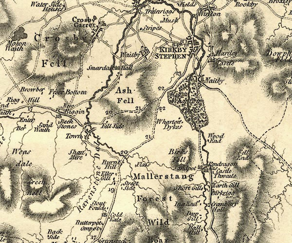 CY24NY70.jpg road across a stream; bridge over the Eden item:- JandMN : 129 Image © see bottom of page |
|
|
|
||
| evidence:- | old text:- Gents Mag placename:- Stankthred Bridge |
|
| source data:- | Magazine, The Gentleman's Magazine or Monthly Intelligencer or
Historical Chronicle, published by Edward Cave under the
pseudonym Sylvanus Urban, and by other publishers, London,
monthly from 1731 to 1922. goto source Gentleman's Magazine 1799 p.642 "Garden-court, Temple, July 18." "Mr. URBAN," "IF an ordinary observer of Nature may find his way into your respectable Magazine as well as the more minute enquirers into that subject, may I beg leave, through the medium of it, to publish a short description of what appears to me a most striking natural curiosity in the North of England? It is called by the country-people STANKTHRED BRIDGE, and is about half a mile West of the town of Kirby Stephen, in the county of Westmorland." He then describes Coopkarnal Hole. |
|
|
|
||
| evidence:- | old map:- Cooper 1808 |
|
| source data:- | Map, hand coloured engraving, Westmoreland ie Westmorland, scale
about 9 miles to 1 inch, by H Cooper, 1808, published by R
Phillips, Bridge Street, Blackfriars, London, 1808. click to enlarge click to enlargeCOP4.jpg road across stream; bridge? item:- Dove Cottage : 2007.38.53 Image © see bottom of page |
|
|
|
||
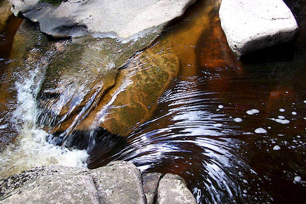 BNX65.jpg View of river. (taken 8.8.2007) |
||
|
|
||
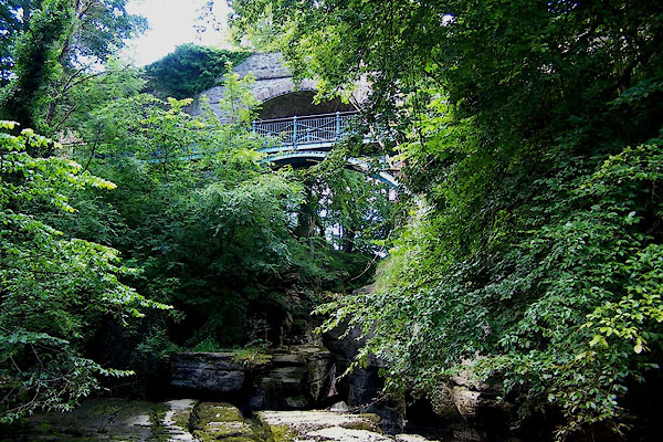 BNX62.jpg The footbridge in front is called the Millennium Bridge. (taken 8.8.2007) |
||
|
|
||
Lakes Guides menu.