 |
 |
|
|
|
|
|
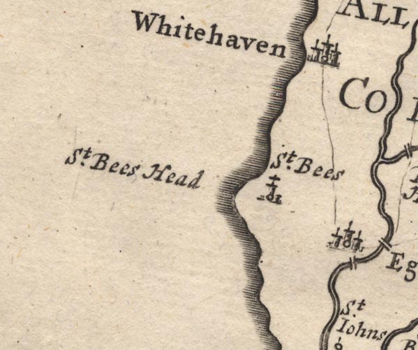
| civil parish:- |
Whitehaven (formerly Cumberland) |
| county:- |
Cumbria |
| locality type:- |
locality |
| locality type:- |
buildings |
| locality type:- |
market town |
| locality type:- |
selected place |
| coordinates:- |
NX97181809 (etc) |
| 1Km square:- |
NX9718 |
| 10Km square:- |
NX91 |
| latitude; longitude:- |
3d 35.4m W; 54d 32.8m N |
|
|
|
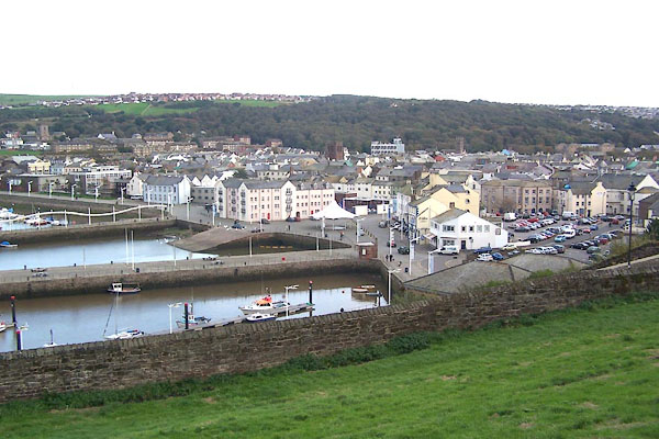
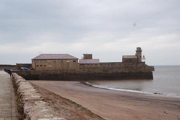
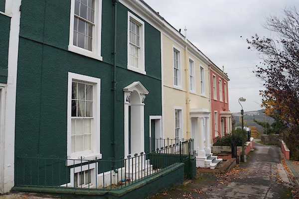
BJY02.jpg (taken 14.10.2005)
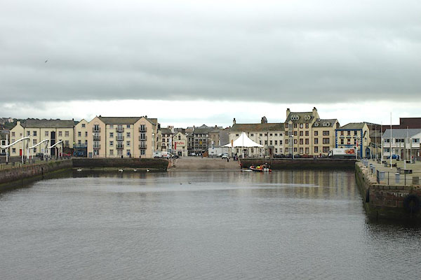
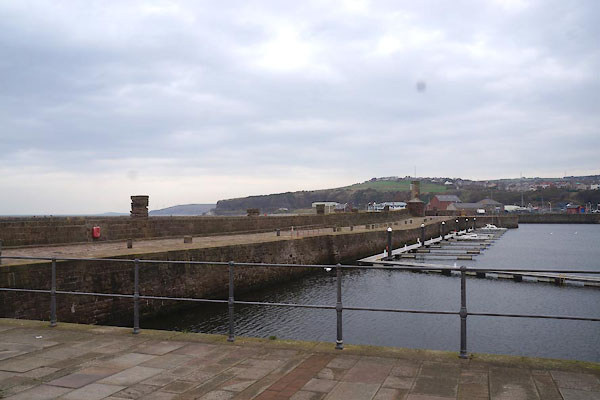
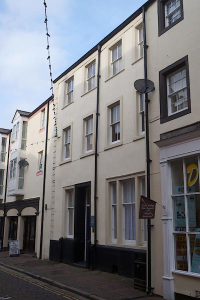
BPM12.jpg (taken 15.7.2008)
|
|
|
| evidence:- |
old map:- OS County Series (Cmd 67 2)
placename:- Whitehaven
|
| source data:- |
Maps, County Series maps of Great Britain, scales 6 and 25
inches to 1 mile, published by the Ordnance Survey, Southampton,
Hampshire, from about 1863 to 1948.
OS County Series (Cmd 67 6)
|
|
|
| evidence:- |
old print:-
|
| source data:- |
Print, view of Whitehaven.
courtesy of the National Trust, Wordsworth House, Cockermouth
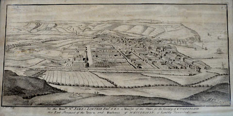 click to enlarge click to enlarge
CHC71.jpg
|
|
|
| evidence:- |
old map:- Gough 1350s-60s
placename:- Withaven
|
| source data:- |
Map, colour photozincograph copy, reduced size facsimile, Gough
Map of Britain, scale about 28.5 miles to 1 inch, published by
the Ordnance Survey, Southampton, Hampshire, 1875.
 click to enlarge click to enlarge
Ggh1Cm.jpg
item:- JandMN : 33
Image © see bottom of page
|
|
|
| evidence:- |
old map:- Gough 1350s-60s
placename:- Withaven
|
| source data:- |
Map, lithograph facsimile, Gough Map of Britain, 20 miles to 1
inch? published by the Ordnance Survey, Southampton, Hampshire,
1935.
 click to enlarge click to enlarge
Ggh2Cm.jpg
item:- JandMN : 34
Image © see bottom of page
|
|
|
| evidence:- |
old map:- Lloyd 1573
placename:- Wythaven
|
| source data:- |
Map, hand coloured copper plate engraving, Angliae Regni,
Kingdom of England, with Wales, scale about 24 miles to 1 inch, authored by Humphrey
Lloyd, Denbigh, Clwyd, drawn and engraved
by Abraham Ortelius, Netherlands, 1573.
 click to enlarge click to enlarge
Lld1Cm.jpg
"Wythaven"
item:- Hampshire Museums : FA1998.69
Image © see bottom of page
|
|
|
| evidence:- |
old map:- Saxton 1579
placename:- Whithaven
|
| source data:- |
Map, hand coloured engraving, Westmorlandiae et Cumberlandiae Comitatus ie Westmorland
and Cumberland, scale about 5 miles to 1 inch, by Christopher Saxton, London, engraved
by Augustinus Ryther, 1576, published 1579-1645.
Sax9NX92.jpg
Church, symbol for a parish or village, with a parish church. "Whithaven"
item:- private collection : 2
Image © see bottom of page
|
|
|
| evidence:- |
old map:- Mercator 1595 (edn?)
placename:- Whit Haven
|
| source data:- |
Map, hand coloured engraving, Northumbria, Cumberlandia, et
Dunelmensis Episcopatus, ie Northumberland, Cumberland and
Durham etc, scale about 6.5 miles to 1 inch, by Gerard Mercator,
Duisberg, Germany, about 1595.

MER8CumE.jpg
"Whit haven"
circle
item:- JandMN : 169
Image © see bottom of page
|
|
|
| evidence:- |
old map:- Keer 1605
placename:- Whithanen
|
| source data:- |
Map, hand coloured engraving, Westmorland and Cumberland, scale
about 16 miles to 1 inch, probably by Pieter van den Keere, or
Peter Keer, about 1605 edition perhaps 1676.
 click to enlarge click to enlarge
KER8.jpg
"Whithanen"
dot, circle and tower; village
item:- Dove Cottage : 2007.38.110
Image © see bottom of page
|
|
|
| evidence:- |
old map:- Speed 1611 (Cmd)
placename:- Whithaven
|
| source data:- |
Map, hand coloured engraving, Cumberland and the Ancient Citie
Carlile Described, scale about 4 miles to 1 inch, by John Speed,
1610, published by J Sudbury and George Humble, Popes Head
Alley, London, 1611-12.
SP11NX91.jpg
"Whithave~"
circle, building, tower
item:- private collection : 16
Image © see bottom of page
|
|
|
| evidence:- |
old map:- Jansson 1646
placename:- Whithaven
|
| source data:- |
Map, hand coloured engraving, Cumbria and Westmoria, ie
Cumberland and Westmorland, scale about 3.5 miles to 1 inch, by
John Jansson, Amsterdam, Netherlands, 1646.
JAN3NY01.jpg
"Whithaven"
Buildings and tower.
item:- JandMN : 88
Image © see bottom of page
|
|
|
| evidence:- |
old map:- Ogilby 1675 (plate 96)
placename:- Whithaven
|
| source data:- |
Road strip map, hand coloured engraving, the Road from Kendal to
Cockermouth, and the Road from Egremond to Carlisle, scale about
1 inch to 1 mile, by John Ogilby, London, 1675.
OG96Bm00.jpg
In mile 0, Cumberland.
Turnings left:- "to Whithaven"
item:- JandMN : 22
Image © see bottom of page
|
|
|
| evidence:- |
old map:- Unknown 1690
placename:- Whitehaven
|
| source data:- |
Town plan, 3 copies, uncoloured lithograph etc, Whitehaven as
Built and Projected c1690, Cumberland, published by the
Cumberland and Westmorland Archaeological and Antiquarian
Society, 1877.
 click to enlarge click to enlarge
M006P.jpg
"Whitehaven"
item:- Carlisle Library : Map 127
Image © Carlisle Library |
|
|
| evidence:- |
old map:- Morden 1695 (EW)
placename:- Whitehaven
|
| source data:- |
Map, hand coloured engraving, England, including Wales, scale
about 27 miles to 1 inch, by Robert Morden, published by Abel
Swale Awnsham and John Churchil, London, about 1695.
 click to enlarge click to enlarge
MRD3Cm.jpg
"Whitehaven"
circle; village or town
item:- JandMN : 339
Image © see bottom of page
|
|
|
| evidence:- |
old map:- Morden 1695 (Cmd)
placename:- Whitehaven
|
| source data:- |
Map, uncoloured engraving, Cumberland, scale about 4 miles to 1
inch, by Robert Morden, 1695, published by Abel Swale, the
Unicorn, St Paul's Churchyard, Awnsham, and John Churchill, the
Black Swan, Paternoster Row, London, 1695-1715.
MD12NX91.jpg
"Whitehaven"
Circle, buildings, towers.
item:- JandMN : 90
Image © see bottom of page
|
|
|
| evidence:- |
descriptive text:- Defoe 1724-26
placename:- Whitehaven
|
| source data:- |
Tour through England and Wales, by Daniel Defoe, published in
parts, London, 1724-26.
"Under this shore, the navigation being secured by this cape of St. Bees, is the town
of Whitehaven, grown up from a small place to be very considerable by the coal trade,
which is encreased so considerably of late, that it is now the most eminent port in
England for shipping off coals, except Newcastle and Sunderland, and even beyond the
last, for they wholly supply the city of Dublin, and all the towns of Ireland on that
coast; and 'tis frequent in time of war, or upon the ordinary occasion of cross winds,
to have two hundred sail of ships at a time go from this place for Dublin, loaden
with coals."
"They have of late fallen into some merchandizing also, occasioned by the great number
of their shipping, and there are now some considerable merchants; but the town is
yet but young in trade, and that trade is so far from being ancient, that Mr. Cambden
does not so much as name the place, and his continuator says very little of it."
|
|
|
| evidence:- |
descriptive text:- Defoe 1724-26
placename:- Whitehaven
item:- coal
|
| source data:- |
Tour through England and Wales, by Daniel Defoe, published in
parts, London, 1724-26.
"... and the sea [Irish Sea] itself seemed desolate and wild, for it was a sea without
ships, here [Lancaster and Cumberland coast] being no sea port or place of trade,
especially for merchants; so that, except colliers passing between Ireland and Whitehaven
with coals, the people told us they should not see a ship under sail for many weeks
together."
|
|
|
| evidence:- |
old map:- Badeslade 1742
placename:- Whitehaven
|
| source data:- |
Maps, Westmorland North from London, scale about 10 miles to 1
inch, and Cumberland North from London, scale about 11 miles to
1 inch, with descriptive text, by Thomas Badeslade, London,
engraved and published by William Henry Toms, Union Court,
Holborn, London, 1742; published 1742-49.
"Whitehaven Market Thursd: Fair September 1st."
|
|
|
| evidence:- |
old map:- Badeslade 1742
placename:- Whitehaven
|
| source data:- |
Map, uncoloured engraving, A Map of Cumberland North from
London, scale about 11 miles to 1 inch, with descriptive text,
by Thomas Badeslade, London, engraved and published by William
Henry Toms, Union Court, Holborn, London, 1742.
 click to enlarge click to enlarge
BD10.jpg
"Whitehaven"
circle, tower/s, upright lowercase text; town
item:- JandMN : 115
Image © see bottom of page
|
|
|
| evidence:- |
old text:- Gents Mag
item:- wool, smuggled
|
| source data:- |
Magazine, The Gentleman's Magazine or Monthly Intelligencer or
Historical Chronicle, published by Edward Cave under the
pseudonym Sylvanus Urban, and by other publishers, London,
monthly from 1731 to 1922.
 goto source goto source
Gentleman's Magazine 1745 p.385
The Historical Chronicle for Thursday 4 July 1745 has:- "WAS a trial in the court of exchequer on an information against one Simpson of Whitehaven,
Cumberland, for running wool to France, when the jury found him guilty of running
2700 lb, the penalty of which is 405 l."
|
|
|
| evidence:- |
old text:- Gents Mag
item:- coal; shipping
|
| source data:- |
Magazine, The Gentleman's Magazine or Monthly Intelligencer or
Historical Chronicle, published by Edward Cave under the
pseudonym Sylvanus Urban, and by other publishers, London,
monthly from 1731 to 1922.
goto source
Gentleman's Magazine 1748 p.5 "..."
"After a fine coast and inland, we came to Whitehaven, which is a thriving and well-built town; it exceeds Carlisle in extent about ⅓, but is thrice as populous. The streets are extremely straight and regular in most places; there is a general appearance of industry amongst the inhabitants, and the hurry and bustle which accompanies their trade seems to be natural and easy. The vast supply of coals in this neighbourhood has rais'd this port from a fishing town to be the next after Bristol and Leverpool on the west sea, and the roads leading to it are equal to the best turnpikes about London, and are every-day improving, and carrying forward. Its situation is low in comparison of the great height of the coast on all side of it, and the harbour barricado'd with several piers to bridle the fury of the west winds, to which it is greatly expos'd. Here the country puts on a much better appearance, and a fine vale encircles Bees-head from Whitehaven to the little brook below Sea-cote, full of pleasant villages, and country seats; so that if you have no accident by the way in so long a journey, you will not repent visiting Whitehaven."
"There is a small fort at the outer pier, to command the harbour, of no great strength
by situation; there seems wanting a lower battery on the pier itself."
|
|
|
| evidence:- |
old text:- Gents Mag
item:- rebellion, 1745; 1745 Rebellion
|
| source data:- |
Magazine, The Gentleman's Magazine or Monthly Intelligencer or
Historical Chronicle, published by Edward Cave under the
pseudonym Sylvanus Urban, and by other publishers, London,
monthly from 1731 to 1922.
goto source
Gentleman's Magazine 1746 p.43
The Historical Chronicle for Wednesday 29 January 1746 has:- "The inhabitants of Whitehaven, having distinguished themselves by the ready assistance
given to the army under the duke of Cumberland, Sir Everard Faulkner, by command of
his R.H. wrote a letter of thanks to them on that account."
|
|
|
| evidence:- |
descriptive text:- Simpson 1746
placename:- Whitehaven
item:- coal; salt; roads; harbour; customs
|
| source data:- |
Atlas, three volumes of maps and descriptive text published as
'The Agreeable Historian, or the Compleat English Traveller
...', by Samuel Simpson, 1746.
goto source
"..."
"Whitehaven is a Market Town, ... so called from a great Rock of hard white Stone,
standing on the W. Side of it, and the Haven which shelters the Vessels that enter
into it from Tempests and Winds. It anciently belong'd to St. Bees, which we shall
speak of hereafter."
"The Town of Whitehaven is grown up by Encouragement of the Lowther Family, from a
small Place"
goto source
"to be very considerable for its Coal Trade, which of late Years is so much increas'd,
that, next to Newcastle, it is the most eminent Port in England for that Trade. The
City of Dublin, and all the Towns of Ireland on that Coast, and some Parts in Scotland,
and the Isle of Man, are wholly supply'd from hence. It is frequent in Time of War,
on Occasion of cross Winds, to have 200 Sail of Ships at a Time go from this Place
to Dublin loaded with Coals. And Sir James Lowther, particularly, is said to send
from hence to Ireland, annually, as many Coals as brings him in near 20,000 l. a Year."
"Here is likewise a good Trade for Salt; and by the Increase of Shipping here, and
the Advantage the Place has received from two Acts of Parliament in Queen Anne's Reign,
to mend and improve the Harbour, and another in his present Majesty's, in 1740, for
the same Purpose, and to repair Roads leading to it, the people are led into Merchandizing,
and it is now on all Accounts reckon'd a considerable trading Town; tho' in Mr. Camden's
Time, it was of so little Consequence that he takes no Notice of it, and his Continuator
but little."
"The King has several Officers here to look after the Customs. It is 227 Miles computed
distant from London, and 289 measured. The Market is kept on Tuesdays, and the Fair
is annually on the 1st of September."
goto source
"... Whitehaven, Sir James Lowther's, the other Representative in Parliament for this
County. ..."
|
|
|
| evidence:- |
old map:- Bickham 1753-54 (Cmd)
placename:- Whitehaven
|
| source data:- |
Map, uncoloured engraving, perspective map, Map of Cumberland
North from London, by George Bickham, James Street, Bunhill
Fields, London, 1753, published by F Jollie and Sons, Carlisle,
Cumberland, 1811.
 click to enlarge click to enlarge
JL05.jpg
"Whitehaven"
view (sort of)
item:- Carlisle Library : 4.2
Image © Carlisle Library |
|
|
| evidence:- |
old map:- Bowen and Kitchin 1760
placename:- Whitehaven
|
| source data:- |
Map, hand coloured engraving, A New Map of the Counties of
Cumberland and Westmoreland Divided into their Respective Wards,
scale about 4 miles to 1 inch, by Emanuel Bowen and Thomas
Kitchin et al, published by T Bowles, Robert Sayer, and John
Bowles, London, 1760.
BO18NX91.jpg
"Whitehaven Mar. Thur."
blocks, street plan, town, market
item:- Armitt Library : 2008.14.10
Image © see bottom of page
|
|
|
| evidence:- |
old map:- Mackenzie 1760s
placename:- Whitehaven
|
| source data:- |
Chart, uncoloured engraving, Solway Firth, Cumberland and
Scotland, scale about 1 inch to 1 mile, by Murdoch Mackenzie
snr, engraved by Thomas Bowen, Fleet Street, published by
Murdoch Mackenzie snr, Kenneth Mackenzie and Murdoch Mackenzie
jnr, London, 1776.
 click to enlarge click to enlarge
MCK9P4.jpg
"WHITEHAVEN"
item:- Carlisle Library : Map 327
Image © Carlisle Library |
|
|
| evidence:- |
old map:- Donald 1774 (Cmd)
placename:- Whitehaven
|
| source data:- |
Map, hand coloured engraving, 3x2 sheets, The County of Cumberland, scale about 1
inch to 1 mile, by Thomas Donald, engraved and published by Joseph Hodskinson, 29
Arundel Street, Strand, London, 1774.
DN04Whth.jpg
"WHITEHAVEN"
Labelled in block caps for a market town; street map on a grid; harbour.
item:- Carlisle Library : Map 2
Image © Carlisle Library |
|
|
| evidence:- |
old map:- Donald 1774 (Cmd)
placename:- Whitehaven
|
| source data:- |
Map, hand coloured engraving, 3x2 sheets, The County of Cumberland, scale about 1
inch to 1 mile, by Thomas Donald, engraved and published by Joseph Hodskinson, 29
Arundel Street, Strand, London, 1774.
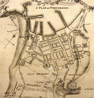 click to enlarge click to enlarge
DN04Wh.jpg
"A PLAN OF WHITEHAVEN"
item:- Carlisle Library : Map 2
Image © Carlisle Library |
|
|
| evidence:- |
old text:- Gents Mag
item:- sailor; Royal Navy
|
| source data:- |
Magazine, The Gentleman's Magazine or Monthly Intelligencer or
Historical Chronicle, published by Edward Cave under the
pseudonym Sylvanus Urban, and by other publishers, London,
monthly from 1731 to 1922.
goto source
Gentleman's Magazine 1776 p.574 "November 22."
"The Magistrates of Whitehaven issued an order, offering two guineas bounty for every
able sailor that should enter voluntarily with the proper officer there, to serve
the royal navy, in which they were followed by the gentlemen of the town; so that
every sailor who enters there will receive 9l. 4s."
"The corporation of Newcastle have offered the same bounty with that of Whitehaven."
|
|
|
| evidence:- |
old map:- Pennant 1777
placename:- Whitehaven
|
| source data:- |
Map, hand coloured engraving, A Map of Scotland, Hebrides and
Part of England, drawn for Thomas Pennant, engraved by J Bayly,
published by Benjamin White, London, 1777.
 click to enlarge click to enlarge
PEN1Cm.jpg
"Whitehaven"
circle with side bars and spike; town
item:- private collection : 66
Image © see bottom of page
|
|
|
| evidence:- |
descriptive text:- West 1778 (11th edn 1821)
|
| source data:- |
Guide book, A Guide to the Lakes, by Thomas West, published by
William Pennington, Kendal, Cumbria once Westmorland, and in
London, 1778 to 1821.
goto source
Account of Ennerdale, late 18th century
Page 295:- "Within these few years, several visitors of the lakes extend their tour, by taking
in Whitehaven, ..."
goto source
Mrs Radcliffe's Ride over Skiddaw, 1794
Page 307:- "..."
"[on Skiddaw] ... Whitehaven, and its white coast, were distinctly seen; ..."
|
|
|
| evidence:- |
old text:- Gents Mag
item:- population, Whitehaven
|
| source data:- |
Magazine, The Gentleman's Magazine or Monthly Intelligencer or
Historical Chronicle, published by Edward Cave under the
pseudonym Sylvanus Urban, and by other publishers, London,
monthly from 1731 to 1922.
goto source
Gentleman's Magazine 1785 p.68 "At Whitehaven, in the course of last year, there were 349 christenings, 91 marriages, 401 burials. Increased in christenings 23; decreased in marriages 20; increased in burials 62."
|
|
|
| evidence:- |
old text:- Clarke 1787
placename:- Whitehebben
|
| source data:- |
Guide book, A Survey of the Lakes of Cumberland, Westmorland,
and Lancashire, written and published by James Clarke, Penrith,
Cumberland, and in London etc, 1787; published 1787-93.
goto source
It is suggested that this dialect writing is invented by James Clark, or an acquaintance,
complete with its 'explanation'. Page 76:- "Copy of a LETTER, WROTE BY A"
"Young Shepherd of Borrowdale,"
"AT HIS Return from Dublin, TO One of his Acquaintance."
"FRIND,"
"I SEND te thisan, to tell the amackily what dreedfull fine things I saw ith rwod tyu,
an at yon Dublin; an t'harships I've bidden. I set forrat o' Midsummer-day, an gat
to Whitehebben a girt sea-side town, whore Sea-Nags eat cowls out o' rack-hurries,
like as barrels dus yale drink: I think Sea-Nags is nut varra wild, for tha winter
them ca girt foalds wi'out yates; an as I was lyukin about to gang to Ierland, I so
twea duzzen o' fellows myakin a Sea-Nag tedder-styack ov iran; I ast yan othum if
I cud git ridin tu Dublin? an a man in a three-nyuk'd hat, at knact like rottin sticks,
telt me I mud gang wid him; for a thing tha caw tide, like t' post oth land, was gangin,
an wadent stay o' nea boddee nivir. Than four men in a lile Sea-Nag, a fwot I think,
at tha caw'd a bwot, helter'd our nag, and led it out oth' foald; than our nag slipt
t' helter an ran away; but tha hang up a deal of wind-clyaths, like blinder-bridles,
we' hundreds o' ryaps for rines. Land ran away an left us, ..."
|
| source data:- |
goto source
Page 78:- "..."
"An Attempt to Explain the above."
"FRIEND,"
"I SEND thee this, to tell thee in some fashion what dreadful fine things I saw in
the road to and at Dublin, and the hardships I have undergone. I set forward on Midsummer-day,
and got to Whitehaven, a great sea-coast town, where Sea-Horses (1) swallow coals
out of rack-hurries (2) as barrels do ale; (I think Sea Horses are not very wild,
for they winter them in great folds;) and as I was looking about to go to Ireland,
I saw two dozen of fellows making a Sea-Horses tedder-stake (3) of iron. I asked one
of them if I could get riding (4) to Dublin? when a man in a three-cornered hat, who
knack'd (5) like rotten sticks, told me I must go with him, for a thing they call
Tide, like the post upon the land, was going, and would never stay for any body. Then
four men in a little Sea-Horse, (a foal I think,) that they called a Boat, haltered
our horse, and led it out of the fold; then our horse slipt his halter and run away,
but they hung up a deal of-wind cloathes (6) like blinder-bridles, (7) with hundreds
of ropes for reins. Land run [away] ..."
"[78] (1) Sea-Horses, ships, which he supposed beasts of burden. (2) Rack-hurries,
the staiths where the coals are poured down into the ships from the waggons. At Whitehaven
staiths are called Hurries, and seemed to him like the filling a rack with hay thro'
a hole in the chamber above. (3) Tedder-stake; a stake driven into the ground, to
which is fastened a rope that confines any animal to the bounds allotted him by his
master, hence its application to an anchor. (4) Riding; conveyance on horse-back,
or in any carriage by land or water, in the phraseology of this country. (5) Knack;
to attempt to speak a genteel dialect; smart, quick, and pert, as rotten sticks are
suddenly broke with a smart report. (6) Wind-clothes; large sheets of coarse cloth
for winnowing corn upon in the open fields, here means sails. (7) Blinder-bridles;
bridles with a flap of leather on each side opposite the eye of the horse, to prevent
his having a side-view of objects, which might frighten him and make him run away."
|
|
|
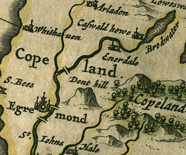
| evidence:- |
old text:- Camden 1789 (Gough Additions)
placename:- Whitehaven
item:- placename, Whitehaven; coal; shipping; harbour
|
| source data:- |
Book, Britannia, or A Chorographical Description of the Flourishing Kingdoms of England,
Scotland, and Ireland, by William Camden, 1586, translated from the 1607 Latin edition
by Richard Gough, published London, 1789.
goto source
Page 180:- "..."
"Below St. Bees and in its parish is Whitehaven a handsome regular town, so called
from the white rocks and cliffs. It is chiefly beholden for its improvement to sir
John Lowther, who took his title of distinction from it, and whose descendants have
a considerable estate here. It contains 1200 inhabitants, and has 190 great ships,
mostly employed in the coal trade; three chapels, four meeting-houses, and a good
artificial harbour with a long pier. The collieries lie at the foot of an hill 80
fathoms deep, by an easy descent bricked and vaulted. The town and collieries produced
a revenue of 16,000 a year to the late sir James Lowther, who had here a magazine
of oats, which he always sold to the colliers at 5s. per bushel Cumberland or three
Winchester measure"
"Whitehaven in 1566 had but six houses and only one pickard of eight or nine tons;
in 1582 twelve small ships. Sir Christopher, 2d son of sir John Lowther, purchased
the lands of St. Bees priory here, and settled here and died 1644. The late sir James
lived to see about 11000 inhabitants, and about 260 sail ships of near 30,000 tuns
burthen. Thirty of them are employed in foreign trade and the rest in the coal trade,
and export yearly above 20,000 tuns. He devised his estates here to sir William Lowther
of Holker, bart. who dying the next year was succeeded in the said estates, reckoned
14,000£. a year, by the present sir James Lowther, created earl of Lonsdale 1780.
..."
|
|
|
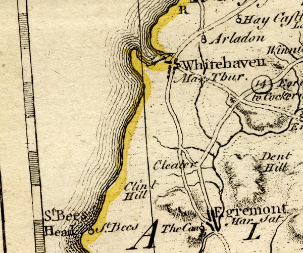
| evidence:- |
old map:- Aikin 1790 (Cmd)
placename:- Whitehaven
|
| source data:- |
Map, uncoloured engraving, Cumberland, by John Aikin, London,
1790.
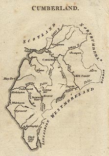 click to enlarge click to enlarge
AIK3.jpg
"Whitehaven"
circle; town
item:- JandMN : 145
Image © see bottom of page
|
|
|
| evidence:- |
old map:- Bailey 1797
placename:- Whitehaven
|
| source data:- |
Map, soil etc, uncoloured engraving, Cumberland, scale about 21
miles to 1 inch, by J Bailey, engraved by Neele, Strand,
published by Messrs Robinson, Paternoster Row and G Nicol, Pall
Mall, London, 1797.
 click to enlarge click to enlarge
BY04.jpg
"Whitehaven"
group of blocks; town
item:- Armitt Library : A680.2
Image © see bottom of page
|
|
|
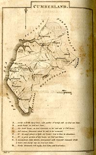
| evidence:- |
road book:- Cary 1798 (2nd edn 1802)
placename:- Whitehaven
item:- boat; steamship; packet boat; letters; post
|
| source data:- |
Road book, itineraries, Cary's New Itinerary, by John Cary, 181
Strand, London, 2nd edn 1802.
goto source
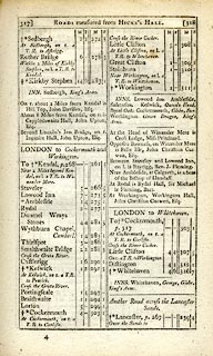 click to enlarge click to enlarge
C38317.jpg
page 317-318 "Whitehaven"
market town, post office "INNS. Whitehaven, George, Globe, King's Arms."
goto source
 click to enlarge click to enlarge
C38319.jpg
page 319-320 "Whitehaven"
market town, post office "INNS. Whitehaven, as p.318"
item:- JandMN : 228.1
Image © see bottom of page
|
|
|
| evidence:- |
road book:- Cary 1798 (2nd edn 1802)
placename:- Whitehaven
item:- boat; steamship; packet boat; letters; post
|
| source data:- |
Road book, itineraries, Cary's New Itinerary, by John Cary, 181
Strand, London, 2nd edn 1802.
goto source
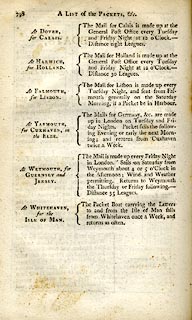 click to enlarge click to enlarge
C38798.jpg
page 798 "At WHITEHAVEN, for the ISLE OF MAN. / The Packet Boat carrying the Letters to and
from the Isle of Man sails from Whitehaven once a Week, and returns as often."
item:- JandMN : 228.2
Image © see bottom of page
|
|
|
| evidence:- |
old map:- Cooke 1802
placename:- White Haven
|
| source data:- |
Map, Cumberland, scale about 15.5 miles to 1 inch, by George
Cooke, 1802, bound in Gray's New Book of Roads, 1824, published
by Sherwood, Jones and Co, Paternoster Road, London, 1824.
 click to enlarge click to enlarge
GRA1Cd.jpg
"White Haven / 322"
blocks, upright lowercase text; town, distance from London
item:- Hampshire Museums : FA2000.62.2
Image © see bottom of page
|
|
|
| evidence:- |
old map:- Cooke 1802
placename:- Whitehaven
|
| source data:- |
Map, The Lakes, Westmorland and Cumberland, scale about 8.5
miles to 1 inch, engravedby Neele and Son, published by
Sherwood, Jones and Co, Paternoster Road, London, 1824.
 click to enlarge click to enlarge
GRA1Lk.jpg
"Whitehaven"
blocks, upright lowercase text; town
item:- Hampshire Museums : FA2000.62.5
Image © see bottom of page
|
|
|
| evidence:- |
old map:- Laurie and Whittle 1806
placename:- Whitehaven
|
| source data:- |
Road map, Completion of the Roads to the Lakes, scale about 10
miles to 1 inch, by Nathaniel Coltman? 1806, published by Robert
H Laurie, 53 Fleet Street, London, 1834.
 click to enlarge click to enlarge
Lw18.jpg
"Whitehaven 297¾/ The Packet sails every Tuesday to, and returns Weekly from, the Isle
of Man; dist. 48 Miles."
market town; distance from London; travellers supplied with post horses or carriages
item:- private collection : 18.18
Image © see bottom of page
|
|
|
| evidence:- |
old text:- Gents Mag
item:- snow; mail
|
| source data:- |
Magazine, The Gentleman's Magazine or Monthly Intelligencer or
Historical Chronicle, published by Edward Cave under the
pseudonym Sylvanus Urban, and by other publishers, London,
monthly from 1731 to 1922.
goto source
Gentleman's Magazine 1807 p.1167
|
|
|
| evidence:- |
old text:- Gents Mag
item:- accident; storm; thunder; Parton Brewery
|
| source data:- |
Magazine, The Gentleman's Magazine or Monthly Intelligencer or
Historical Chronicle, published by Edward Cave under the
pseudonym Sylvanus Urban, and by other publishers, London,
monthly from 1731 to 1922.
goto source
Gentleman's Magazine 1807 p.473
|
|
|
| evidence:- |
old text:- Capper 1808
placename:- Whitehaven
item:- population; market; fair
|
| source data:- |
Gazetteer, A Topographical Dictionary of the United Kingdom,
compiled by Benjamin Pitts Capper, published by Richard
Phillips, Bridge Street, Blackfriars, London, 1808; published
1808-29.
goto source
"..."
"WHITEHAVEN, a sea port and market town situated in the parish of St. Bees, Allerdale ward, above Derwent, Cumberland, lying on a bay of the Irish sea, 5 miles from Egremont, and 307 from London; containing 1776 houses and 8742 inhabitants, viz. 3348 males and 5394 females, of whom 1650 were returned as being employed in various trades. The town is well built, but in 1566 is recorded to have contained only 6 houses. It owes its present thriving situation, to the improvements in its harbour, ... There are 3 churches, St. James, the Trinity and Hold Church: several meeting houses for various sectaries, a public dispensary, charity schools, &c. Besides the extensive coal mines in the neighbourhood, extending 130 fathoms deep, and in many places a considerable way under the sea, there are several copperas works. ... In March 1793, this town suffered by a storm, when the tide rose 6 feet above its usual height. In the American war, the pirate, Paul Jones, landed here, burnt two small ships on the stocks, and spiked the guns on the battery. The market on Tuesday is well supplied with all kinds of provisions, and it has a fair the 12th August; here are two public banks. The churches are curacies, in the patronage of the Lowther family. - Hutchinson's Cumberland."
"..."
|
|
|
| evidence:- |
old map:- Cooper 1808
placename:- Whitehaven
|
| source data:- |
Map, uncoloured engraving, Cumberland, scale about 10.5 miles to
1 inch, drawn and engraved by Cooper, published by R Phillips,
Bridge Street, Blackfriars, London, 1808.
 click to enlarge click to enlarge
COP3.jpg
"Whitehaven"
circle with two side bars; town
item:- JandMN : 86
Image © see bottom of page
|
|
|
| evidence:- |
old map:- Wallis 1810 (Cmd)
placename:- White Haven
|
| source data:- |
Road map, hand coloured engraving, Cumberland, scale about 16
miles to 1 inch, by James Wallis, 77 Berwick Stree, Soho,
London, 1810.
 click to enlarge click to enlarge
WL13.jpg
"White Haven / 322"
town; distance from London
item:- Dove Cottage : 2009.81.10
Image © see bottom of page
|
|
|
| evidence:- |
old map:- Otley 1818
placename:- Whitehaven
|
| source data:- |
Map, uncoloured engraving, The District of the Lakes,
Cumberland, Westmorland, and Lancashire, scale about 4 miles to
1 inch, by Jonathan Otley, 1818, engraved by J and G Menzies,
Edinburgh, Scotland, published by Jonathan Otley, Keswick,
Cumberland, et al, 1833.
OT02NX91.jpg
"WHITEHAVEN"
item:- JandMN : 48.1
Image © see bottom of page
|
|
|
| evidence:- |
old text:- Gents Mag
|
| source data:- |
Magazine, The Gentleman's Magazine or Monthly Intelligencer or
Historical Chronicle, published by Edward Cave under the
pseudonym Sylvanus Urban, and by other publishers, London,
monthly from 1731 to 1922.
goto source
Gentleman's Magazine 1819 part 1 p.506
From the Compendium of County History:- "1778. Whitehaven unsuccessfully attempted by the Pirate Paul Jones."
|
|
|
| evidence:- |
old text:- Gents Mag 1819
item:- population, Whitehaven
|
| source data:- |
goto source
Gentleman's Magazine 1819 part 1 p.508
From the Compendium of County History:- "Whitehaven, in the reign of Elizabeth, contained only six houses. In 1633, it had
only nine thatched cottages. In 1693, under the patronage of Sir John Lowther, it
was inhabited by 2,222 persons, mostly occupied in Sir John's collieries. In 1811
there were 1974 houses and 10,106 inhabitants. In the castle, the seat of the earl
of Lonsdale, are some fine paintings and family portraits."
|
|
|
| evidence:- |
old text:- Gents Mag 1819
item:- shipping
|
| source data:- |
goto source
Gentleman's Magazine 1816 part 2 p.601
Biographical note from the Compendium of County History:- "From Whitehaven a packet to Man, on which isle it is intended to give a separate account."
|
|
|
| evidence:- |
old map:- Hall 1820 (Cmd)
placename:- Whitehaven
|
| source data:- |
Map, hand coloured engraving, Cumberland, scale about 21 miles
to 1 inch, engraved by Sidney Hall, published by S Leigh, 18
Strand, London, 1820-31.
 click to enlarge click to enlarge
HA14.jpg
"Whitehaven / 306"
circle, upright lowercase text; town; distance from London
item:- JandMN : 91
Image © see bottom of page
|
|
|
| evidence:- |
descriptive text:- Otley 1823 (5th edn 1834)
item:- geology; coal
|
| source data:- |
Guide book, A Concise Description of the English Lakes, the
mountains in their vicinity, and the roads by which they may be
visited, with remarks on the mineralogy and geology of the
district, by Jonathan Otley, published by the author, Keswick,
Cumberland now Cumbria, by J Richardson, London, and by Arthur
Foster, Kirkby Lonsdale, Cumbria, 1823; published 1823-49,
latterly as the Descriptive Guide to the English Lakes.
goto source
Page 163:- "... Coal is raised at Greysouthen, Gilcrux, and Plumbland; and there are extensive
fields of coal beneath the town of Whitehaven, at Workington, ..."
|
|
|
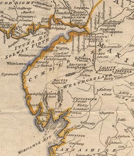
| evidence:- |
old map:- Perrot 1823
placename:- Whitehaven
|
| source data:- |
Map, hand coloured engraving, Cumberland and Westmoreland ie
Westmorland, scale about 38 miles to 1 inch, by Aristide Michel
Perrot, engraved by Migneret, 1823, published by Etienne Ledoux,
9 Rue Guenegaud, Paris, France, 1824-48.
 click to enlarge click to enlarge
PER2.jpg
"Whitehaven"
circle; town
item:- Dove Cottage : 2007.38.45
Image © see bottom of page
|
|
|
| evidence:- |
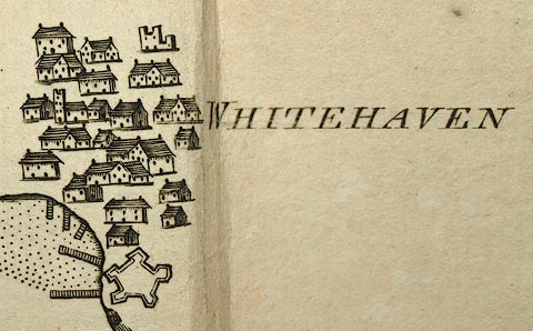
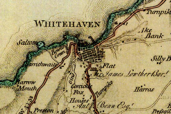
old map:- Greenwood 1824
placename:- Whitehaven
|
| source data:- |
Map, engraving, Map of the County of Cumberland, scale about 1
inch to 1 mile, etc, by Christopher and John Greenwood,
published by George Pringle jnr, 70 Queen Street, Cheapside,
London, 1823.
gw12whth.jpg
"WHITEHAVEN"
street map, laid out on a grid; labelled in block caps for a market town; notice the
large harbour.
item:- National Library of Scotland : EME.b.3.11
Image © National Library of Scotland |
|
|
| evidence:- |
old map:- Cobbett 1832
placename:- Whitehaven
|
| source data:- |
Map, uncoloured engraving, Cumberland, scale about 20 miles to 1
inch, by William Cobbett, 11 Bolt Court, Fleet Street, London,
1832.
 click to enlarge click to enlarge
COB5.jpg
"Whitehaven"
dot and circle; town
item:- JandMN : 117
Image © see bottom of page
|
|
|
| evidence:- |
descriptive text:- Ford 1839 (3rd edn 1843)
placename:- Whitehaven
item:- population, Whitehaven; market day; coal
|
| source data:- |
Guide book, A Description of Scenery in the Lake District, by
Rev William Ford, published by Charles Thurnam, Carlisle, by W
Edwards, 12 Ave Maria Lane, Charles Tilt, Fleet Street, William
Smith, 113 Fleet Street, London, by Currie and Bowman,
Newcastle, by Bancks and Co, Manchester, by Oliver and Boyd,
Edinburgh, and by Sinclair, Dumfries, 1839.
goto source
"..."
"THE order in which the Lakes should be visited, if seen in any prescribed order at
all, can be pointed out much more easily than satisfactorily. Lancaster and Kendal
in the south, Carlisle and Penrith in the north, formerly offered the readiest facilities
of access to this Northern Elysium; but since the improvement of steam navigation,
Whitehaven and other ports have become equally suitable as starting places. One advantage,
however, remains in favour of the old routes, that the direct lines are better, especially
for carriages, although to the pedestrian this will not be a matter of any great importance."
goto source
Page 78:- "..."
"Four miles will carry you from the quiet, studious cloisters of Saint Bees, into the
midst of the bustling and commercial activity of Whitehaven. The piers and coal-pits
are the chief objects of"
goto source
Page 79:- "notice here. The Earl of Lonsdale has also a large mansion, called the Castle. The
tourist from Dublin, Liverpool, or Glasgow, may land here and penetrate into the Lakes
by way of Egremont, Gosforth, Wast Water, over the Stye Head into Borrowdale, and
thence to Keswick or Ambleside."
goto source
Page 172:- "..."
"WHITEHAVEN is a well-built town. During the last century, it has risen into importance
in consequence of its vicinity to the extensive coal-mines of the Earl of Lonsdale.
The harbour is large and safe, being protected by an extensive pier, built after a
design by Sir John Rennie. Upwards of 140,000 chaldrons of coals are annually exported."
goto source
Page 173:- "There are three churches in the town, a Scotch church, and several dissenting meeting-houses.
Steam-packets ply between Dublin and Whitehaven regularly, as well as Liverpool, the
Isle of Man, and Scotland. This town sends one member to Parliament. Population, 11,393;
market-days, Tuesday, Thursday, and Saturday; inns, Black Lion, Golden Lion, and Globe."
|
|
|
| evidence:- |
old map:- Ford 1839 map
placename:- Whitehaven
|
| source data:- |
Map, uncoloured engraving, Map of the Lake District of
Cumberland, Westmoreland and Lancashire, scale about 3.5 miles
to 1 inch, published by Charles Thurnam, Carlisle, and by R
Groombridge, 5 Paternoster Row, London, 3rd edn 1843.
FD02NX91.jpg
"WHITEHAVEN"
item:- JandMN : 100.1
Image © see bottom of page
|
|
|
| evidence:- |
old map:- Garnett 1850s-60s H
placename:- Whitehaven
|
| source data:- |
Map of the English Lakes, in Cumberland, Westmorland and
Lancashire, scale about 3.5 miles to 1 inch, published by John
Garnett, Windermere, Westmorland, 1850s-60s.
GAR2NX91.jpg
"WHITEHAVEN"
blocks, settlement, and a minimal street plan
item:- JandMN : 82.1
Image © see bottom of page
|
|
|
| evidence:- |
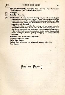
old itinerary:- Tinsley 1877 (Roads/Cum)
placename:- Whitehaven
|
| source data:- |
Itinerary, route 7, London to Whitehaven via the Lake Districts, including from Settle,
Lancashire; through Kirkby Lonsdale, Kendal, Ambleside, Westmorland; then Keswick,
Cockermouth to Whitehaven, Cumberland, published by Tinsley Bros, 8 Catherine Street,
Strand, London, 1877.
 click to enlarge click to enlarge
TLY191.jpg
pp.71-91 in British High Roads, North and North Eastern Routes; pp.84-91.
printed at p.71:- "... / ROUTE VII. - LONDON to WHTEHAVEN via THE LAKE / DISTRICTS. (See Maps 65 to 80.)
/ Hitchin (as per Route I.) 34, Shefford 41, Bedford 50, Higham-Ferrers, / 64¾, Kettering
74½, Rockingham 83¼, Uppingham 88¾, Oakham, / 94¾, Melton Mowbray 104¾, Nottingham
123¼, Rotherham 159¼, / Barnsley 171¾, Huddersfield 188¾, Halifax 196¾, Keighley 208¾,
/ Skipton 218¾, Settle 234¾, Kirkby Lonsdale 252½, Kendal 264½, / Ambleside 278½,
Keswick 293½, Cockermouth 305½, Whitehaven / 319½. / ..."
item:- private collection : 270.2
Image © see bottom of page
|
|
|
| evidence:- |
old strip map:- Tinsley 1877 (Roads/Cum)
placename:- Whitehaven
|
| source data:- |
Strip map, road map, part of London to Whitehaven, including from before Keswick through
Cockermouth to Whitehaven, Cumberland, published by Tinsley Bros, 8 Catherine Street,
Strand, London, 1877.
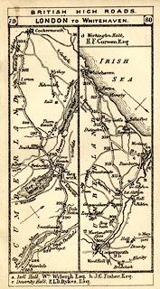 click to enlarge click to enlarge
TLY1M5.jpg
Map pp.79-80 in British High Roads, North and North Eastern Routes.
printed at top:- "BRITISH HIGH ROADS / 79 LONDON TO WHITEHAVEN. 80"
item:- private collection : 270.7
Image © see bottom of page
|
|
|
| evidence:- |
old print:- Bradley 1901
placename:- Whitehaven
|
| source data:- |
Print, uncoloured lithograph, Whitehaven, Cumberland, by Joseph Pennell, published
by Macmillan and Co, London, 1901.
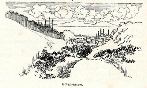 click to enlarge click to enlarge
BRL136.jpg
On page 168 of Highways and Byways in the Lake District, by A G Bradley.
printed at bottom:- "Whitehaven."
item:- JandMN : 464.36
Image © see bottom of page
|
|
|
| evidence:- |
text:- Mason 1907 (edn 1930)
item:- coal
|
| source data:- |
Text book, The Ambleside Geography Books bk.III, The Counties of
England, by Charlotte M Mason, published by Kegan Paul, Trench,
Trubner and Co, Broadway House, 68-74 Carter Lane, and the
Parents' Educational Union Office, 26 Victoria Street, London,
edn 1930.
MSN1P025.txt
Page 25:- "..."
"A coal-field stretches from Wigton to Whitehaven. Maryport, Workington, and Whitehaven
are all busy towns among the collieries, ..."
|
|
|
| evidence:- |
old map:- Postlethwaite 1877 (3rd edn 1913)
placename:- Whitehaven
|
| source data:- |
Map, uncoloured engraving, Map of the Lake District Mining Field, Westmorland, Cumberland,
Lancashire, scale about 5 miles to 1 inch, by John Postlethwaite, published by W H
Moss and Sons, 13 Lowther Street, Whitehaven, Cumberland, 1877 edn 1913.
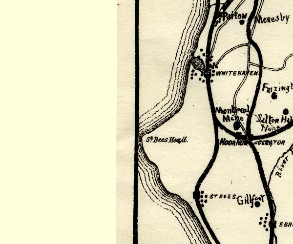
PST2NX91.jpg
"WHITEHAVEN"
dots, roads, station on railways, harbour
item:- JandMN : 162.2
Image © see bottom of page
|
|
|
| evidence:- |
old text:- Admiralty 1933
placename:- Whitehaven
item:- population, Whitehaven; coal; coke; iron; leather; timber; grain; herring
|
| source data:- |
goto source
Page 391:- "..."
"Whitehaven is a parliamentary borough, and, in 1931, had a population of 13,112. Its
chief trade consists in the export of coal, which is extensively worked in the immediate
vicinity, coke, pig iron and all kinds of iron, leather and general goods. The chief
imports are timber, grain, hides, cement, and general produce."
"In the season, there is an extensive herring fishery."
|
|
|
| evidence:- |
market notes:-
item:- market
|
| source data:- |
Owen: 1792: New Book of Fairs: 1889: Market Rights and Tolls: HM GovernmentBowen, Emanuel &Kitchin, Thomas: 1760: New Map of the Counties of Cumberland and Westmoreland |
|
|
|
 Post Office maps Post Office maps |
|
|
| evidence:- |
old print:- Linton 1852
placename:- Whitehaven
|
| source data:- |
Print, engraving, Whitehaven from behind Corkickle, Cumberland, drawn by R Shepherd,
engraved by W H Lizars, Edinburgh, published by Whittaker and Co, London, and by R
Gibson and Son and by Callander and Dixon, Whitehaven, Cumberland, 1852.
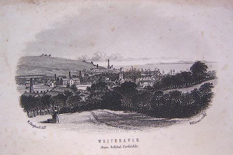 click to enlarge click to enlarge
LN1E02.jpg
Frontispiece to A Handbook of the Whitehaven and Furness Railway, by John Linton.
printed at bottom left, right, centre:- "R. Shepherd delt. / W. H. Lizars sculpt. / WHITEHAVEN. / from behind Corkickle."
item:- Armitt Library : A1158.2
Image © see bottom of page
|
|
|
| evidence:- |
old print:-
placename:- Whitehaven
|
| source data:- |
Print, uncoloured engraving, Whitehaven, Cumberland, drawn by W H Bartlett, engraved
by J C Redaway, published 1840s.
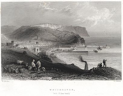 click to enlarge click to enlarge
PR0077.jpg
Probably from Findens Views of the Ports, Harbours, Coast Scenery, and Watering Places
of Great Britain, as continued by W H Bartlett.
printed at bottom left, right, centre:- "W. H. Bartlett. / J. C. Redaway. / WHITEHAVEN, / (with St. Bees-head.)"
item:- Dove Cottage : 2008.107.77
Image © see bottom of page
|
|
|
| evidence:- |
old print:- Rose 1832-35 (vol.3 no.25)
placename:- Whitehaven
|
| source data:- |
Print, uncoloured engraving, Whitehaven, Cumberland, drawn by G Pickering, engraved
by T Jeavons, published by Fisher, Son and Co, London, 1832-35.
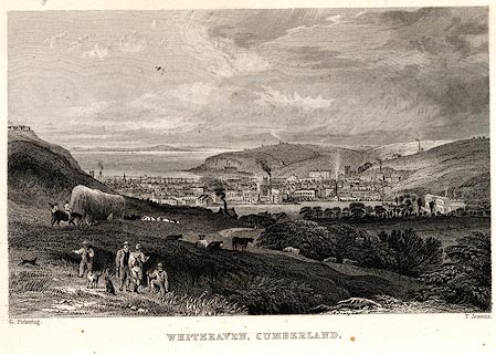 click to enlarge click to enlarge
PR0039.jpg
vol.3 pl.25 in the set of prints, Westmorland, Cumberland, Durham and Northumberland
Illustrated.
printed at bottom left, right, centre:- "G. Pickering. / T. Jeavons. / WHITEHAVEN, CUMBERLAND."
item:- Dove Cottage : 2008.107.39
Image © see bottom of page
|
|
|
| evidence:- |
old painting:-
|
| source data:- |
Painting, oil painting, View of Whitehaven, Cumberland, by Matthias Read, 1690-1706.
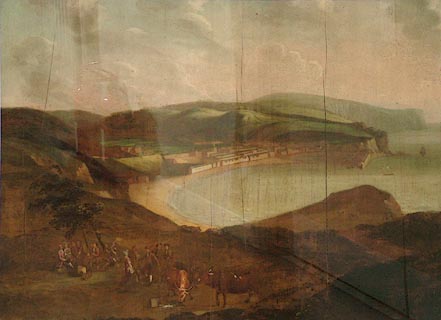 click to enlarge click to enlarge
PR1295.jpg
Distant view of Whitehaven and its environs seen from an elevated perspective. In
the foreground a small group of people has gathered on the hilltop overlooking the
town, an impromptu party resulting. Three of them dance a jig whilst four couples
carouse in the scant shade offered by two stunted trees. Two men stand looking on.
Three cattle wait nearby, one of which has upset a pail of milk.
Four views of Whitehaven by Read survive. This is the earliest and plainest example
which shows only one pier in the harbour and a small number of ships. The town is
still very small and details of the buildings are unfinished. Whitehaven was the earliest
planned town in England thanks to the vision of Sir John Lowther, 1642-1706, the local
landower who built up his wealth in coal. The groups of locals dancing and drinking
in the foreground of the painting bring life to the scene. The small red and yellow
stripe of paint is a mystery.
The painting originally hung in the Grapes Inn, Carlisle.
item:- Tullie House Museum : 1978.108.177
Image © Tullie House Museum |
|
|
|
attack 1778 |
|
|
|
longcase clocks |
|
|
| evidence:- |
town plan:- Unknown 1690 (town-Whth)
placename:- Whitehaven
|
| source data:- |
Town plan, uncoloured lithograph, Whitehaven as Built and Projected c1690, Cumberland,
published by the Cumberland and Westmorland Archaeological and Antiquarian Society,
1878.
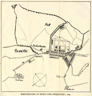 click to enlarge click to enlarge
M069.jpg
Reproduced from an original owned by the Earl of Lonsdale, to accompany an article
Whitehaven, its Streets, its Principal Houses and their Inhabitants, by William Jackson.
No date, but:- "'that may be closely fixed by the fact that the Old Church was built, or at any rate
being built, whilst the site of the Presbyterian Chapel, the ground for which was
granted 14th, February, 1694, is still a blank.'"
printed at bottom:- "WHITEHAVEN AS BUILT AND PROJECTED c.1690."
item:- private collection : 233
Image © see bottom of page
|
|
|
|
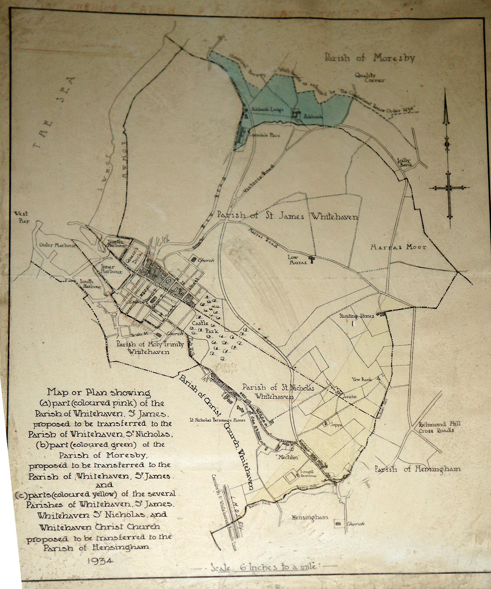
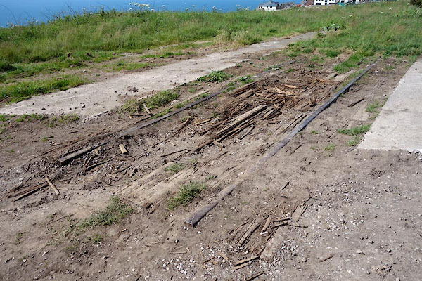
Click to enlarge
CFB10.jpg Map of proposed transfer between local parishes, 1934
(taken 27.5.2016)
|
|
|
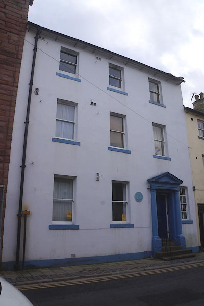
hearsay:-
|
John Fletcher Miller was born here, 1816. He recorded the weather in The Lakes, having
35 rain gauges on the fells. He determined that Sty Head was the wettest place in
England. He was elected a Fellow of the Royal Society, 1850; died 1856.
|
|
|
|
personal |
| person:- |
meteorologist
: Miller, John Fletcher
|
| place:- |
birthplace |
| date:- |
1816
|
|
| places:- |
 |
NX97201811 Admiral Casino (Whitehaven) |
|
|
|
NX97931876 Albert Terrace (Whitehaven) |
|
|
 |
NX97181797 Anchor Vaults (Whitehaven) |
|
|
|
NX96931743 Arrowthwaite (Whitehaven) |
|
|
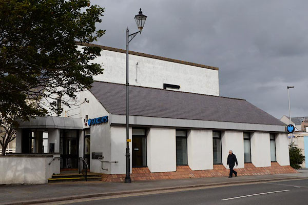 |
NX97141810 Barclays Bank (Whitehaven) |
|
|
|
NX97111787 Barker's Buildings (Whitehaven) |
|
|
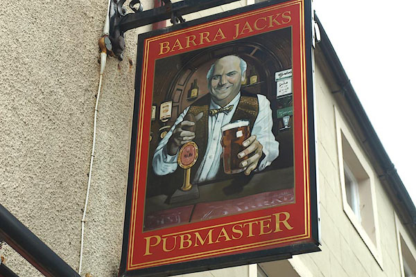 |
NX97191796 Barra Jacks (Whitehaven) |
|
|
|
NX96281600 Barrowmouth (Whitehaven) gone |
|
|
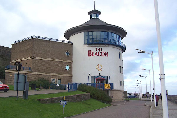 |
NX969182 Beacon, The (Whitehaven) |
|
|
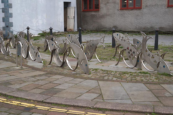 |
NX97201821 bicycle stands, Whitehaven (Whitehaven) |
|
|
|
NX98601920 Bleach Green (Whitehaven) |
|
|
|
NX97301855 boat hoist, Whitehaven Harbour (Whitehaven) |
|
|
|
NX96771806 bowling green, Whitehaven (Whitehaven) once |
|
|
|
NX97431848 Bransty Arch (Whitehaven) gone |
|
|
|
NX97461855 Bransty Hotel (Whitehaven) |
|
|
|
NX97371885 Bransty Junction (Whitehaven) |
|
|
|
NX97691903 Bransty (Whitehaven) |
|
|
|
NX97481681 Brick Barns (Whitehaven) gone |
|
|
|
NX97431670 Brick Field (Whitehaven) once |
|
|
|
NX97381738 bridge, Whitehaven (Whitehaven) |
|
|
|
NX97441851 bridge, Whitehaven (2) (Whitehaven) |
|
|
|
NX97611643 Burnt House (Whitehaven) |
|
|
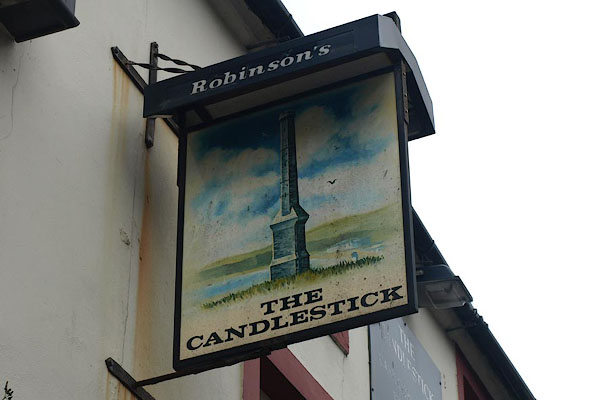 |
NX97381837 Candlestick, The (Whitehaven) |
|
|
|
NX98941684 Cartgate (Hensingham) |
|
|
|
NX97341771 Castle Meadows (Whitehaven) |
|
|
 |
NX97701798 Castle Park (Whitehaven) |
|
|
 |
NX97721767 Castle, The (Whitehaven) |
|
|
 |
NX97361781 Catherine Mill (Whitehaven) L |
|
|
 |
NX97511803 chapel, Whitehaven (Whitehaven) |
|
|
|
NX97671822 chapel, Whitehaven (2) (Whitehaven) gone |
|
|
|
NX97311774 chapel, Whitehaven (3) (Whitehaven) |
|
|
|
NX97771827 chapel, Whitehaven (4) (Whitehaven) gone |
|
|
|
NX97671815 chapel, Whitehaven (5) (Whitehaven) |
|
|
|
NX97201760 Christ Church (Whitehaven) |
|
|
 |
NX97491799 Civic Hall (Whitehaven) |
|
|
|
NX97251743 clay pipe works, Whitehaven (Whitehaven) |
|
|
|
NX97561757 Colliery Schools (Whitehaven) |
|
|
|
NX98061743 Corkickle Brewery (Whitehaven) |
|
|
 |
NX97831756 Corkickle House (Whitehaven) L |
|
|
|
NX97761711 Corkickle No.2 Junction (Whitehaven) |
|
|
 |
NX97761744 Corkickle Station (Whitehaven) |
|
|
|
NX98051733 Corkickle (Whitehaven) |
|
|
 |
NX96601638 Croft Pit tramroad (Whitehaven) |
|
|
|
NX97911790 Crowpark Wood (Whitehaven) |
|
|
 |
NX97081827 Customhouse Dock (Whitehaven) |
|
|
|
NX97061816 Customhouse Quay (Whitehaven) |
|
|
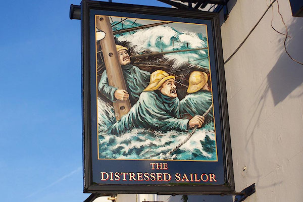 |
NX98581623 Distressed Sailor (Whitehaven) L |
|
|
|
NX97121813 Dobson and Musgrave Warehouse (Whitehaven) L gone |
|
|
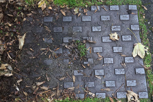 |
NX98081714 drain, Whitehaven (Whitehaven) |
|
|
 |
NX98091716 drain, Whitehaven (2) (Whitehaven) |
|
|
|
NX97001800 Duke Pit (Whitehaven) gone |
|
|
|
NX97111820 Ember Slip (Whitehaven) |
|
|
|
NX97231730 Ginns Engine (Whitehaven) gone |
|
|
|
NX97441859 Bransty Engine Shed (Whitehaven) gone |
|
|
|
NX97391877 Bransty Engine Shed (Whitehaven) |
|
|
|
NX97401690 Female Training School (Whitehaven) |
|
|
|
NX97141816 Fish Market (Whitehaven) gone |
|
|
 |
NX96801847 Flag House (Whitehaven) |
|
|
|
NX97491774 Flat Meadows (Whitehaven) |
|
|
|
NX98051717 Fox Houses (Whitehaven) |
|
|
|
NX97321930 gas works, Whitehaven (Whitehaven) gone |
|
|
|
NX98231916 George Pit (Whitehaven) gone |
|
|
|
NX974182 George, The (Whitehaven) |
|
|
|
NX97271737 Ginns (Whitehaven) |
|
|
|
NX97361748 glass house, Whitehaven (Whitehaven) gone |
|
|
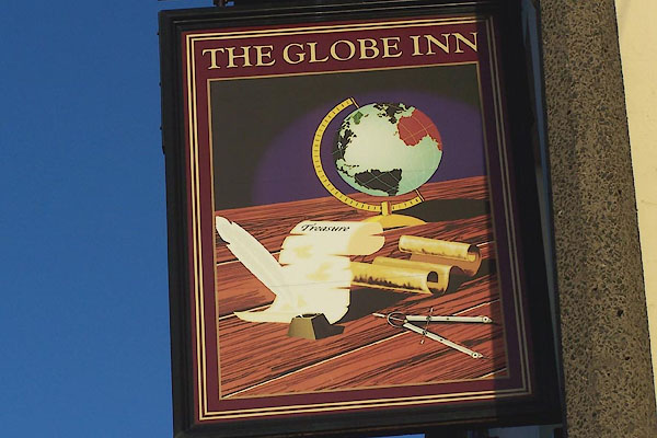 |
NX98651680 Globe Inn (Whitehaven) L |
|
|
|
NX97321790 Golden Ball Inn (Whitehaven) |
|
|
|
NX97771833 Gore's Buildings (Whitehaven) |
|
|
|
NX97721823 Granby Cottage (Whitehaven) |
|
|
|
NX97711818 Granby House (Whitehaven) |
|
|
 |
NX968182 Haig Colliery Railway (Whitehaven) |
|
|
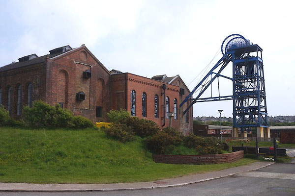 |
NX96721759 Haig Colliery (Whitehaven) L |
|
|
|
NX98171841 Harras Park (Whitehaven) |
|
|
|
NX98401892 Harras Park (Whitehaven) |
|
|
|
NX98611679 Hensingham (Whitehaven) |
|
|
|
NX96851819 Howgill Incline (Whitehaven) |
|
|
|
NX96951824 Howgill Staith (Whitehaven) |
|
|
 |
NX97591817 hydrant plate, Whitehaven (Whitehaven) |
|
|
|
NX97181778 icehouse, Whitehaven (Whitehaven) |
|
|
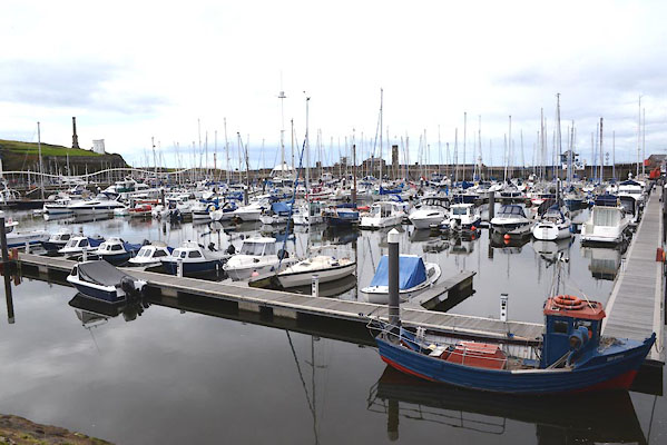 |
NX97161836 Inner Harbour (Whitehaven) |
|
|
|
NX97721842 James's Pit (Whitehaven) gone |
|
|
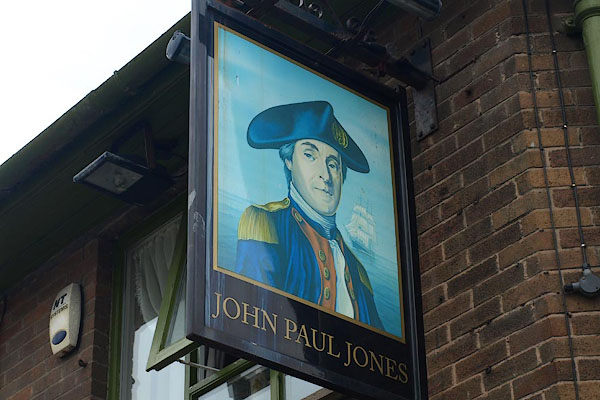 |
NX97321832 John Paul Jones (Whitehaven) |
|
|
|
NX96741815 Jonathan Swift House (Whitehaven) L |
|
|
|
NX966169 Kells (Whitehaven) |
|
|
|
NX974182 King's Arms (Whitehaven) |
|
|
|
NX9718 Labyrinth, The (Whitehaven) |
|
|
|
NX97961872 Lady Pit (Whitehaven) gone |
|
|
|
NX97031798 Leonard's Yard (Whitehaven) gone |
|
|
|
NX974184 Lifeboat House (Whitehaven) once |
|
|
|
NX96471822 Little Hurd (Whitehaven) |
|
|
|
NX97641791 lodge, Whitehaven Castle (Whitehaven) gone? |
|
|
|
NX96961814 Margarry's Buildings (Whitehaven) gone |
|
|
|
NX97691839 Marine School (Whitehaven) gone |
|
|
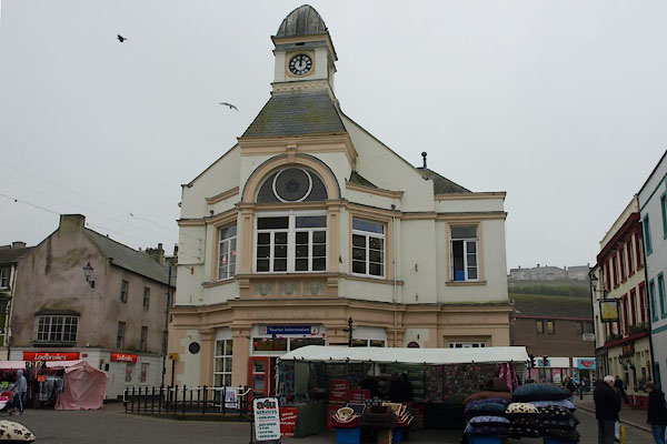 |
NX97161806 Market Hall (Whitehaven) L |
|
|
 |
NX98051714 Meadow House (Whitehaven) L |
|
|
 |
NX97421815 (Whitehaven) |
|
|
|
NX97981930 milestone, Whitehaven (Whitehaven) |
|
|
|
NX982156 Mirehouse (Whitehaven) |
|
|
|
NX97021694 Monkwray (Whitehaven) |
|
|
|
NX98151552 Moor Row South Junction (Whitehaven) |
|
|
|
NX96961810 Mount Pleasant (Whitehaven) once |
|
|
|
NX96891783 Nelson Terrace (Whitehaven) gone? |
|
|
|
NX99651751 New Monkwray (Whitehaven) |
|
|
 |
NX97101829 New Tongue (Whitehaven) |
|
|
|
NX97131785 Newtown Foundry (Whitehaven) |
|
|
|
NX97181888 North Beach (Whitehaven) |
|
|
|
NX97171853 North Harbour (Whitehaven) |
|
|
|
NX97081856 North Jetty (Whitehaven) |
|
|
 |
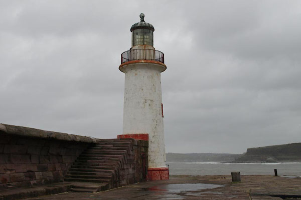
NX96881868 North Pier Lighthouse (Whitehaven) |
|
|
|
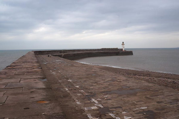
NX97011865 North Pier (Whitehaven) |
|
|
|
NX98611845 North Pit (Whitehaven) |
|
|
|
NX97201859 North Wall (Whitehaven) |
|
|
|
NX97341796 Old Brewery (Whitehaven) |
|
|
 |
NX97231787 Old Brewery, The (Whitehaven) |
|
|
 |
NX97121814 Old Custom House (Whitehaven) L |
|
|
 |
NX96811836 Old Fort (Whitehaven) L |
|
|
 |
NX96771845 Old New Quay (Whitehaven) L |
|
|
|
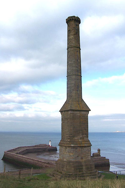
NX97631850 Old Observatory (Whitehaven) |
|
|
 |
NX96951836 Old Quay (Whitehaven) L |
|
|
 |
NX97051825 Old Tongue (Whitehaven) |
|
|
|
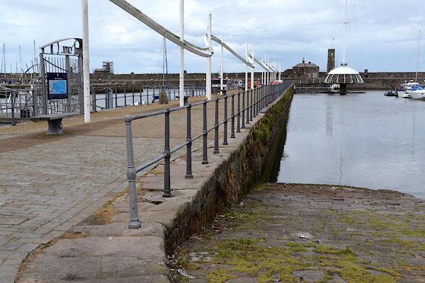
NX96861856 Outer Harbour (Whitehaven) |
|
|
 |
NX97531809 Whitehaven Police Station (Whitehaven) |
|
|
 |
NX97061817 police station, Whitehaven Harbour (Whitehaven) |
|
|
 |
NX97951748 post box, Whitehaven (Whitehaven) |
|
|
 |
NX97381833 post box, Whitehaven (2) (Whitehaven) |
|
|
|
NX97301733 pottery, Whitehaven (Whitehaven) gone |
|
|
|
NX97361732 pottery, Whitehaven (2) (Whitehaven) gone |
|
|
|
NX97221766 Preston Street Goods (Whitehaven) |
|
|
|
NX96861600 Prestonhows (Whitehaven) |
|
|
|
NX97301780 Primitive Terrace (Whitehaven) |
|
|
|
NX96851810 Prospect Hill (Whitehaven) gone |
|
|
 |
NX97301848 Queens Dock (Whitehaven) |
|
|
|
NX97451807 Reckoning House, Whitehaven (Whitehaven) |
|
|
 |
NX98191714 Retreat, The (Whitehaven) L |
|
|
|
NX97301777 Richmond Terrace (Whitehaven) |
|
|
|
NX97451880 rope works, Whitehaven (Whitehaven) |
|
|
|
NX97591760 rope works, Whitehaven (2) (Whitehaven) |
|
|
|
NX97051802 rope works, Whitehaven (3) (Whitehaven) gone |
|
|
|
NX99391895 Round Close (Whitehaven) |
|
|
 |
NX97271805 Royal Apartments (Whitehaven) L |
|
|
|
NX97361779 Royal Cumberland Militia Barracks (Whitehaven) gone? |
|
|
 |
NX97361828 Royal Oak (Whitehaven) |
|
|
|
NX97491792 saw mill, Whitehaven (Whitehaven) gone |
|
|
|
NX97161819 ship yard, Whitehaven (Whitehaven) gone |
|
|
|
NX97311885 ship yard, Whitehaven (2) (Whitehaven) gone |
|
|
|
NX97301874 ship yard, Whitehaven (3) (Whitehaven) gone |
|
|
 |
NX97451849 Shipwrights Arms (Whitehaven) |
|
|
|
NX97601813 smelter, Whitehaven (Whitehaven) suggested |
|
|
|
NX97421897 soap works, Whitehaven (Whitehaven) |
|
|
 |
NX97851868 Solway House (Whitehaven) |
|
|
 |
NX96641841 South Beach (Whitehaven) |
|
|
 |
NX96981826 South Harbour (Whitehaven) |
|
|
 |
NX97111807 Chapel of St Gregory and St Patrick (Whitehaven) |
|
|
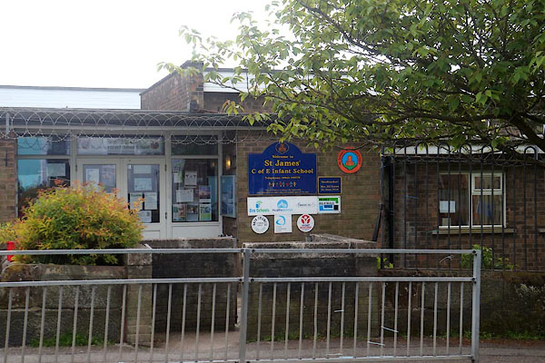 |
NX97611843 St James CoE Infant School (Whitehaven) |
|
|
 |
NX97701848 St James' CoE Junior School (Whitehaven) |
|
|
 |
NX97921888 St James' Vicarage (Whitehaven) |
|
|
|
NX97531808 St Nicholas National School (Whitehaven) |
|
|
 |
NX97391814 St Nicholas's Church (Whitehaven) L |
|
|
|
NX96911823 Staith House (Whitehaven) gone? |
|
|
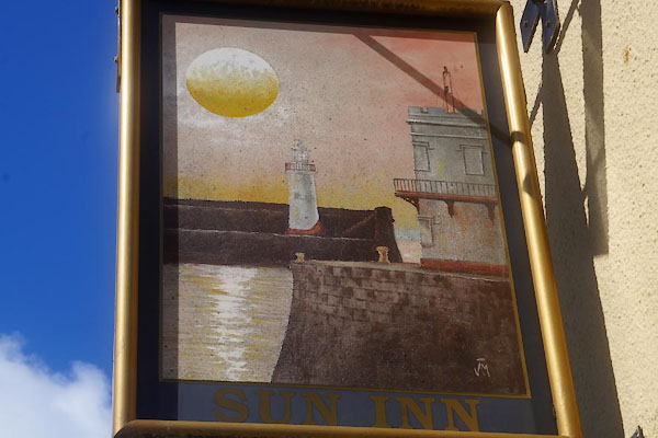 |
NX98631676 Sun Inn (Whitehaven) |
|
|
|
NX97601623 Thicket (Whitehaven) gone |
|
|
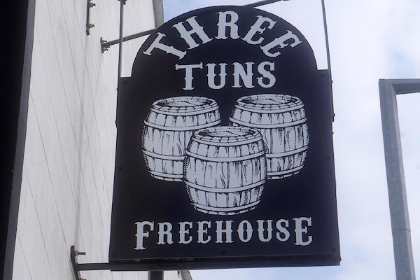 |
NX97601816 Three Tuns, The (Whitehaven) |
|
|
|
NX96901830 tide gauge, Whitehaven Harbour (Whitehaven) |
|
|
|
NX96541824 Tom Hurd Rock (Whitehaven) |
|
|
|
NX9618 tramroad, Ravenhill Pit (Whitehaven) gone |
|
|
|
NY03 West Cumberland Electric Tramways () proposed |
|
|
|
NX97311785 Trinity Church National and Sunday School (Whitehaven) gone |
|
|
|
NX97431792 Trinity Church (Whitehaven) gone |
|
|
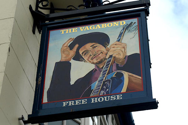 |
NX97181820 Vagabond, The (Whitehaven) |
|
|
|
NX97151808 Vine Inn (Whitehaven) gone |
|
|
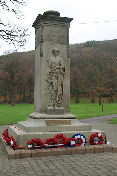 |
NX97621794 war memorial, Whitehaven (Whitehaven) |
|
|
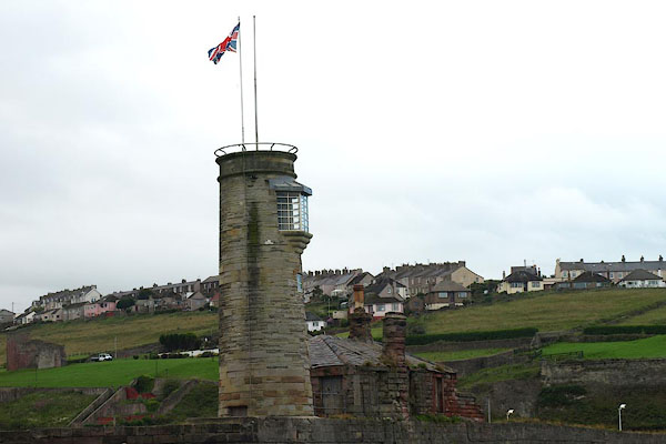 |
NX97031843 Watchtower, The (Whitehaven) L |
|
|
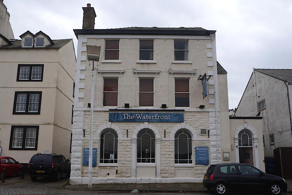 |
NX97091814 Waterfront, The (Whitehaven) L |
|
|
|
NX98301718 weighing machine, Whitehaven (Whitehaven) |
|
|
 |
NX97521846 Wellington House (Whitehaven) L |
|
|
 |
NX96801820 Wellington Pit (Whitehaven) |
|
|
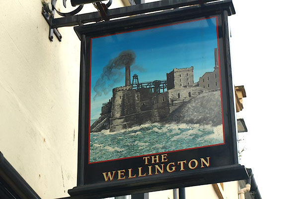 |
NX97171799 Wellington, The (Whitehaven) |
|
|
 |
NX96701868 West Pier Lighthouse (Whitehaven) L |
|
|
 |
NX96661857 West Pier (Whitehaven) L |
|
|
|
NX96951822 Westy Strand (Whitehaven) |
|
|
|
NX97851822 White Park (Whitehaven) |
|
|
|
NX97491658 Whitehaven and Preston Quarter Cemetery (Whitehaven) |
|
|
|
NX97241779 Whitehaven and West Cumberland Infirmary (Whitehaven) gone |
|
|
 |
NX96911829 Whitehaven Battery (Whitehaven) |
|
|
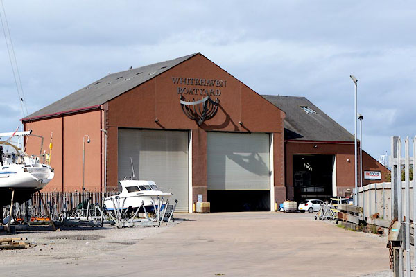 |
NX97261866 Whitehaven Boatyard (Whitehaven) |
|
|
 |
NX97701784 Whitehaven Castle (Whitehaven) L |
|
|
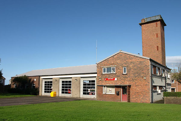 |
NX99051723 Whitehaven Fire Station (Whitehaven) |
|
|
|
NX97491799 Whitehaven Museum (Whitehaven) gone? |
|
|
|
NX975180 Whitehaven Police Station (Whitehaven) |
|
|
 |
NX97561810 Whitehaven Record Office (Whitehaven) |
|
|
 |
NX97451867 Whitehaven Station (Whitehaven) |
|
|
|
NX97421863 Whitehaven Station (Whitehaven) gone |
|
|
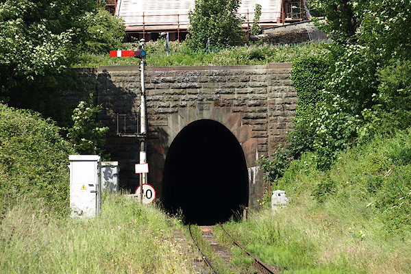 |
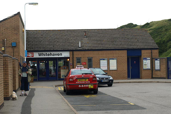
NX975186 Whitehaven Tunnel (Whitehaven) |
|
|
 |
NX97201793 Whitehaven United Reformed Church (Whitehaven) |
|
|
|
NX97361818 Addison Street (Whitehaven) |
|
|
|
NX97121792 Albion Street (Whitehaven) |
|
|
|
NX97151789 Albion Terrace (Whitehaven) gone? |
|
|
|
NX97881756 Back Corkickle (Whitehaven) |
|
|
|
NX97301742 Back Ginns (Whitehaven) |
|
|
|
NX97041811 Bardy Lane (Whitehaven) gone? |
|
|
|
NX97501840 Brackenthwaite (Whitehaven) |
|
|
|
NX97671897 Bransty Road (Whitehaven) |
|
|
|
NX97451851 Bransty Row (Whitehaven) |
|
|
 |
NX97271820 Burton's the tailors (Whitehaven) |
|
|
|
NX97381800 Carter Lane (Whitehaven) |
|
|
|
NX97581801 Catherine Street (Whitehaven) |
|
|
|
NX97281812 Chapel Street (Whitehaven) |
|
|
|
NX97621829 Charles Street (Whitehaven) |
|
|
|
NX97551748 Coach Road (Whitehaven) |
|
|
|
NX97281797 Whitehaven: Coates Lane, 9 (Whitehaven) L |
|
|
|
NX97281742 Cock Pit (Whitehaven) |
|
|
|
NX97391822 College Street (Whitehaven) |
|
|
|
NX97371822 Whitehaven: College Street, 10 (Whitehaven) L gone |
|
|
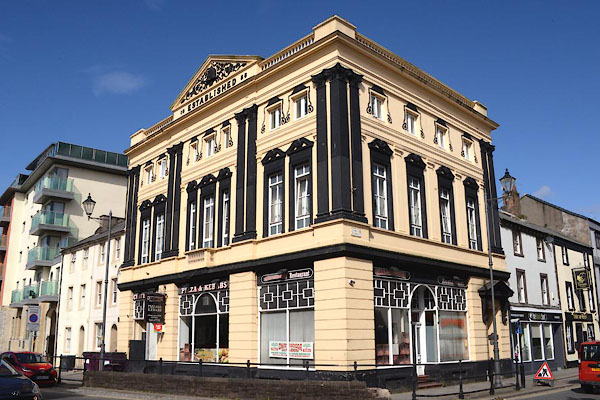 |
NX97351833 Pizzas and Kebabs (Whitehaven) L |
|
|
|
NX97261777 Cricketfield Road (Whitehaven) |
|
|
 |
NX97251794 Cross Street (Whitehaven) |
|
|
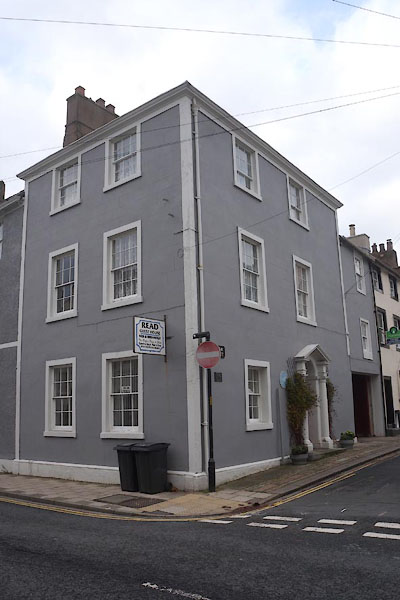 |
NX97251792 Read Guest House (Whitehaven) |
|
|
|
NX97471824 Duke Street (Whitehaven) |
|
|
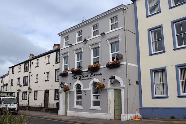 |
NX97581817 Glass House, The (Whitehaven) |
|
|
|
NX97151816 East Strand (Whitehaven) |
|
|
|
NX97211774 Firehouse Lane (Whitehaven) gone |
|
|
|
NX97641778 Flat Walks (Whitehaven) |
|
|
|
NX97421804 Fox Lane (Whitehaven) |
|
|
 |
NX98131715 Whitehaven: Foxhouses Lane (Whitehaven) |
|
|
|
NX98071722 Whitehaven: Foxhouses Road (Whitehaven) |
|
|
 |
NX98021738 Whitehaven: Foxhouses Road, 1 and 2 (Whitehaven) L |
|
|
|
NX98031734 Whitehaven: Foxhouses Road, 3 (Whitehaven) L |
|
|
 |
NX98031733 Whitehaven: Foxhouses Road, 4 and 5 (Whitehaven) L |
|
|
 |
NX98041731 Whitehaven: Foxhouses Road, 6 and 7 (Whitehaven) L |
|
|
 |
NX98051728 Kingston Place (Whitehaven) L |
|
|
 |
NX98061725 Whitehaven: Foxhouses Road, 10 (Whitehaven) L |
|
|
 |
NX98071722 Whitehaven: Foxhouses Road, 11 to 16 (Whitehaven) L |
|
|
 |
NX98081720 Whitehaven: Foxhouses Road, 17 and 18 (Whitehaven) L |
|
|
 |
NX98091718 Whitehaven: Foxhouses Road, 19 and 20 (Whitehaven) L |
|
|
 |
NX98091715 Whitehaven: Foxhouses Road, 22 and 23 (Whitehaven) L |
|
|
 |
NX97861754 Front Corkickle (Whitehaven) |
|
|
 |
NX97821758 Whitehaven: Front Corkickle, 5 and 6 (Whitehaven) L |
|
|
 |
NX97841756 Whitehaven: Front Corkickle, 8 (Whitehaven) L |
|
|
 |
NX97851755 Whitehaven: Front Corkickle, 9 and 10 (Whitehaven) L |
|
|
 |
NX97871753 Whitehaven: Front Corkickle, 12 (Whitehaven) L |
|
|
 |
NX97901751 Whitehaven: Front Corkickle, 15 to 19 (Whitehaven) L |
|
|
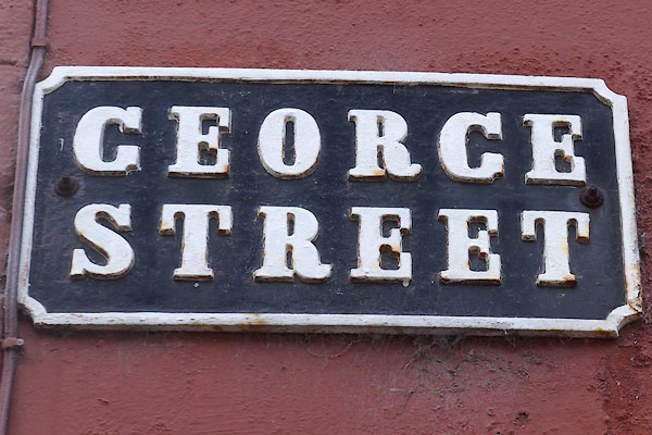 |
NX97571828 George Street (Whitehaven) |
|
|
 |
NX97621822 Whitehaven: George Street, 71 and 72 (Whitehaven) L |
|
|
|
NX97611823 Whitehaven: George Street, 73 (Whitehaven) L not found |
|
|
|
NX97261741 Ginns (Whitehaven) |
|
|
|
NX97511783 Granary Yard (Whitehaven) |
|
|
|
NX97421839 Gregg's Lane (Whitehaven) |
|
|
|
NX97101813 Hamilton Lane (Whitehaven) |
|
|
 |
NX97111814 Whitehaven: Hamilton Lane, 1 (Whitehaven) L |
|
|
 |
NX98021744 Whitehaven: Hamilton Terrace (Whitehaven) L |
|
|
|
NX97031810 Hardy Lane (Whitehaven) gone |
|
|
|
NX97411834 Hicks Lane (Whitehaven) |
|
|
|
NX97651842 High Street (Whitehaven) |
|
|
 |
NX97611846 Whitehaven: High Street, 1 to 11 (Whitehaven) L |
|
|
|
NX97741858 Hilton Terrace (Whitehaven) |
|
|
 |
NX97811865 Whitehaven: Hilton Terrace, 7 and 8 (Whitehaven) |
|
|
 |
NX97241785 Howgill Street (Whitehaven) |
|
|
 |
NX97241781 Whitehaven: Howgill Street, 10 (Whitehaven) L |
|
|
 |
NX97231782 Whitehaven: Howgill Street, 11 (Whitehaven) L |
|
|
 |
NX97231783 Whitehaven: Howgill Street, 12 (Whitehaven) L |
|
|
|
NX97241789 Whitehaven: Howgill Street, 17 and 18 (Whitehaven) L |
|
|
 |
NX98061739 Whitehaven: Inkerman Terrace, 1 and 2 (Whitehaven) L |
|
|
 |
NX98141726 Whitehaven: Inkerman Terrace, 13 and 14 (Whitehaven) L |
|
|
 |
NX98161724 Whitehaven: Inkerman Terrace, 15 and 16 (Whitehaven) L |
|
|
 |
NX98181722 Whitehaven: Inkerman Terrace, 17 and 18 (Whitehaven) L |
|
|
 |
NX97301791 Irish Street (Whitehaven) |
|
|
 |
NX97231792 Whitehaven: Irish Street, 4 and 5 (Whitehaven) L |
|
|
 |
NX97291792 Whitehaven: Irish Street, 8 to 10 (Whitehaven) |
|
|
 |
NX97401792 Whitehaven: Irish Street, 17 (Whitehaven) L |
|
|
 |
NX97381792 Whitehaven: Irish Street, 18 (Whitehaven) L |
|
|
 |
NX97361791 Whitehaven: Irish Street, 19 and 20 (Whitehaven) L |
|
|
 |
NX97211789 Whitehaven: Irish Street, 41 to 43 (Whitehaven) L |
|
|
|
NX97061804 James Place (Whitehaven) gone |
|
|
 |
NX97181794 James Street (Whitehaven) |
|
|
|
NX97421800 John's Lane (Whitehaven) |
|
|
|
NX97711819 John's Square (Whitehaven) |
|
|
|
NX97431836 Kelsick Lane (Whitehaven) |
|
|
|
NX97291819 King Street (Whitehaven) |
|
|
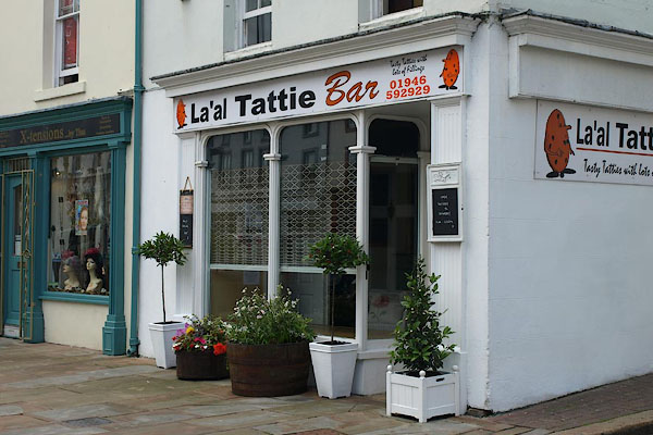 |
NX97411828 La'al Tattie Bar (Whitehaven) |
|
|
|
NX97071807 Littlehall Lane (Whitehaven) |
|
|
|
NX97691799 Love Lane (Whitehaven) |
|
|
|
NX97241810 Low Market (Whitehaven) gone |
|
|
 |
NX97571794 Whitehaven: Lowther Street, 1 (Whitehaven) L |
|
|
|
NX97421801 Whitehaven: Lowther Street, 7 to 17 (Whitehaven) L |
|
|
|
NX97361811 Whitehaven: Lowther Street, 22 to 24 (Whitehaven) L |
|
|
|
NX97361811 Whitehaven: Lowther Street, 25 (Whitehaven) L |
|
|
|
NX97351811 Whitehaven: Lowther Street, 26 (Whitehaven) L |
|
|
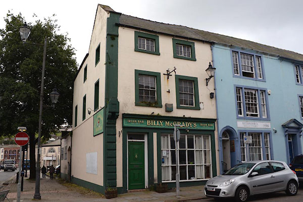 |
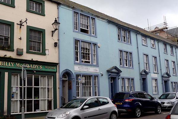
NX97241821 Billy McGrady's (Whitehaven) L |
|
|
 |
NX97231821 Whitehaven: Lowther Street, 38 (Whitehaven) L |
|
|
 |
NX97221823 Whitehaven: Lowther Street, 39 to 42 (Whitehaven) L |
|
|
 |
NX97251825 Whitehaven: Lowther Street, 44 to 47 (Whitehaven) L |
|
|
|
NX97341817 Savings Bank (Whitehaven) L |
|
|
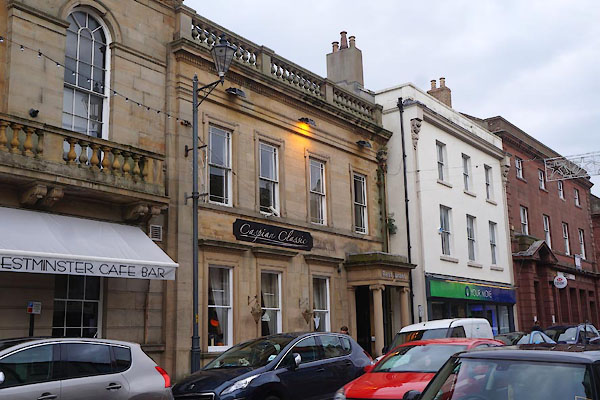 |
NX97431809 Caspian Classic (Whitehaven) L |
|
|
 |
NX97521801 Whitehaven: Lowther Street, 75 to 77 (Whitehaven) L |
|
|
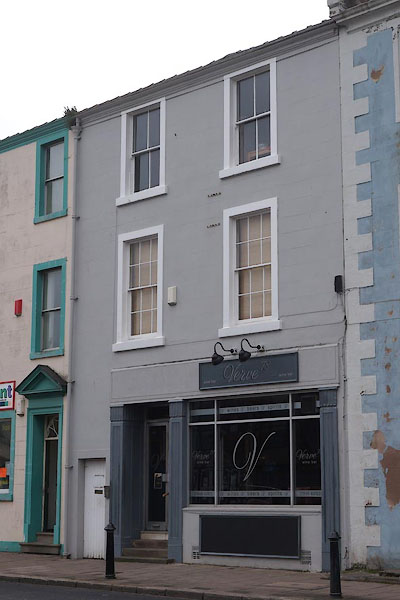 |
NX97531800 Verve wine bar (Whitehaven) L |
|
|
 |
NX97561799 RLS Club (Whitehaven) L |
|
|
 |
NX97571797 Whitehaven: Lowther Street, 81 to 83 (Whitehaven) L |
|
|
 |
NX97901883 Marine Terrace (Whitehaven) L |
|
|
|
NX97281828 Mark Lane (Whitehaven) gone? |
|
|
|
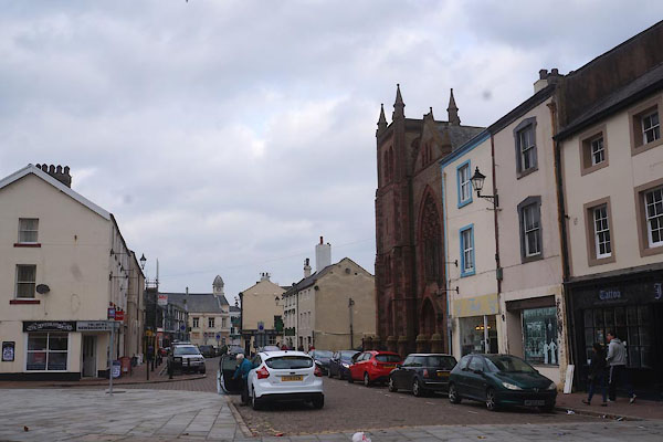
NX97171809 Market Place (Whitehaven) |
|
|
|
NX97201820 Marlborough Street (Whitehaven) |
|
|
 |
NX97181820 Whitehaven: Marlborough Street, 1 (Whitehaven) L |
|
|
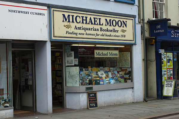 |
NX97421808 Michael Moon Antiquarian Bookseller (Whitehaven) |
|
|
|
NX97691819 Michael Street (Whitehaven) |
|
|
 |
NX97301778 Mill Street (Whitehaven) |
|
|
|
NX97181709 Monkwray Brow (Whitehaven) |
|
|
|
NX97351822 New Street (Whitehaven) |
|
|
|
NX97391827 Whitehaven: New Street, 23 and 24 (Whitehaven) L |
|
|
|
NX97331818 Whitehaven: New Street, 42 (Whitehaven) L |
|
|
|
NX97161791 New Town (Whitehaven) |
|
|
|
NX97151813 Nicholson Lane (Whitehaven) |
|
|
 |
NX97951893 Oak Bank Terrace (Whitehaven) L |
|
|
|
NX97121795 Old Town (Whitehaven) gone? |
|
|
|
NX97671829 Peter Street (Whitehaven) |
|
|
|
NX97521816 Plumbland Lane (Whitehaven) gone? |
|
|
|
NX97191765 Preston Street (Whitehaven) |
|
|
|
NX97091811 Quay Street (Whitehaven) |
|
|
|
NX97461817 Queen Street (Whitehaven) |
|
|
 |
NX97311799 Whitehaven: Queen Street, 16 and 17 (Whitehaven) L |
|
|
|
NX97381807 Whitehaven: Queen Street, 30 (Whitehaven) L |
|
|
|
NX97381807 Whitehaven: Queen Street, 31 and 32 (Whitehaven) L |
|
|
 |
NX97491823 Whitehaven: Queen Street, 35 (Whitehaven) L |
|
|
 |
NX97501824 Whitehaven: Queen Street, 42 (Whitehaven) |
|
|
 |
NX97511825 Whitehaven: Queen Street, 43 (Whitehaven) L |
|
|
 |
NX97521823 Whitehaven: Queen Street, 107 (Whitehaven) |
|
|
|
NX97461814 Whitehaven: Queen Street, 127 to 131 (Whitehaven) L gone |
|
|
 |
NX97421811 Casa Romana (Whitehaven) L |
|
|
 |
NX97371804 Whitehaven: Queen Street, 140 (Whitehaven) L |
|
|
 |
NX97371804 Whitehaven: Queen Street, 141 (Whitehaven) L |
|
|
 |
NX97341800 Whitehaven: Queen Street, 147 (Whitehaven) |
|
|
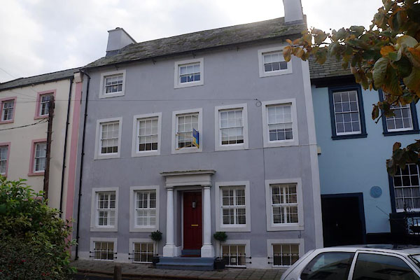 |
NX97321798 Whitehaven: Queen Street, 150 (Whitehaven) L |
|
|
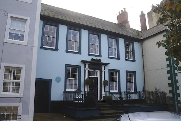 |
NX97291797 Gale Mansion (Whitehaven) L |
|
|
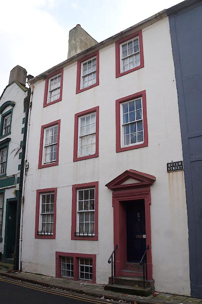 |
NX97281797 Whitehaven: Queen Street, 152 to 155 (Whitehaven) L |
|
|
 |
NX97351814 Richardson and Sons (Whitehaven) |
|
|
 |
NX97201807 Roper Street (Whitehaven) |
|
|
|
NX97311801 Whitehaven: Roper Street, 16 (Whitehaven) L |
|
|
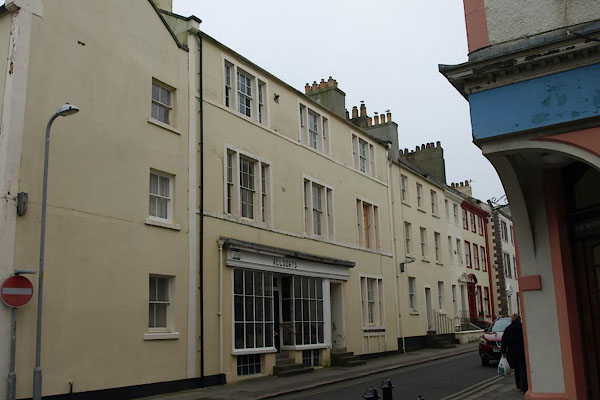 |
NX97341799 Whitehaven: Roper Street, 19 and 20 (Whitehaven) L |
|
|
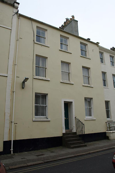 |
NX97351799 Whitehaven: Roper Street, 21 and 22 (Whitehaven) L |
|
|
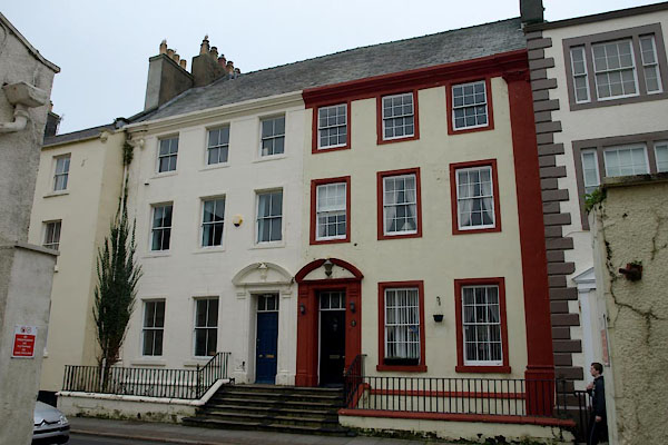 |
NX97371798 Whitehaven: Roper Street, 23 and 24 (Whitehaven) L |
|
|
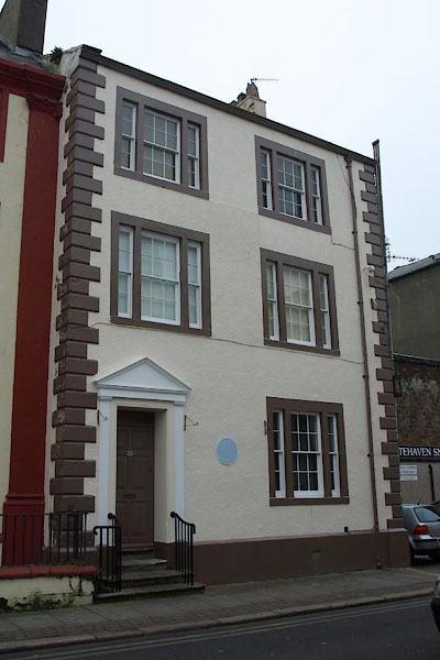 |
NX97371798 Whitehaven: Roper Street, 25 (Whitehaven) L |
|
|
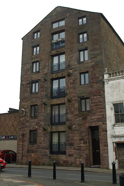 |
NX97391798 Roper Court (Whitehaven) L |
|
|
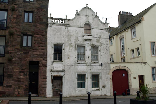 |
NX97401795 Whitehaven: Roper Street, 29 (Whitehaven) L |
|
|
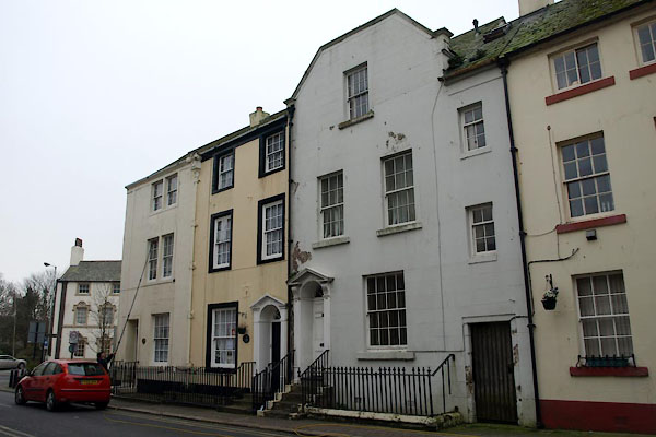 |
NX97381794 Whitehaven: Roper Street, 36 to 38 (Whitehaven) L |
|
|
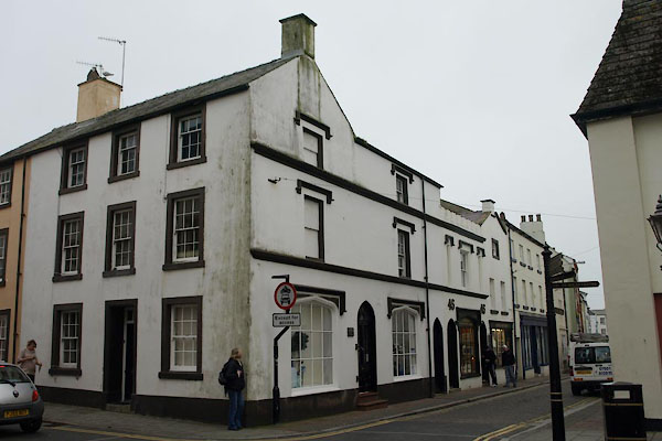 |
NX97311800 Whitehaven: Roper Street, 44 and 45 (Whitehaven) L |
|
|
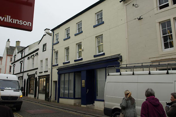 |
NX97301800 Whitehaven: Roper Street, 46 to 49 (Whitehaven) L |
|
|
 |
NX97281802 Whitehaven: Roper Street, 51 (Whitehaven) L |
|
|
 |
NX97281802 Whitehaven: Roper Street, 52 (Whitehaven) L |
|
|
 |
NX97271803 Whitehaven: Roper Street, 53 (Whitehaven) L |
|
|
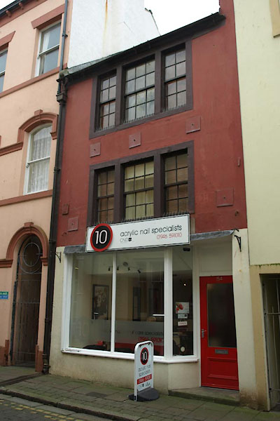 |
NX97261803 Whitehaven: Roper Street, 54 (Whitehaven) L |
|
|
 |
NX97261803 Whitehaven: Roper Street, 55 (Whitehaven) L |
|
|
 |
NX97251804 Whitehaven: Roper Street, 56 (Whitehaven) L |
|
|
 |
NX97221802 Whitehaven: Roper Street, 57 and 58 (Whitehaven) L |
|
|
|
NX97041801 Rosemary Lane (Whitehaven) |
|
|
|
NX97511814 Sandhills Lane (Whitehaven) gone |
|
|
|
NX97481810 Schoolhouse Lane (Whitehaven) |
|
|
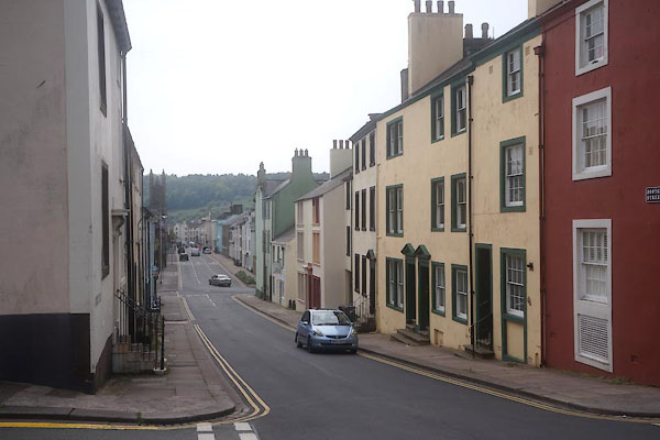 |
NX97501804 Scotch Street (Whitehaven) L |
|
|
 |
NX97431798 Whitehaven: Scotch Street, 5 and 6 (Whitehaven) |
|
|
 |
NX97441799 Whitehaven: Scotch Street, 9 and 10 (Whitehaven) L |
|
|
|
NX97471794 Whitehaven: Scotch Street, 14 (Whitehaven) L |
|
|
 |
NX97601819 Granny Wongs (Whitehaven) L |
|
|
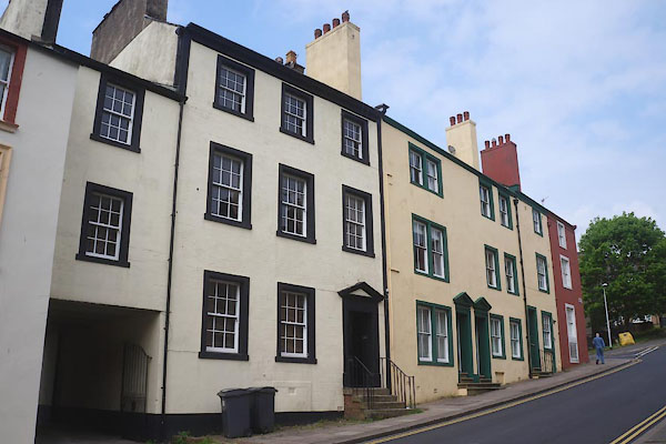 |
NX97611820 Whitehaven: Scotch Street, 32 to 35 (Whitehaven) L |
|
|
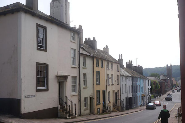 |
NX97621818 Whitehaven: Scotch Street, 84 to 95 (Whitehaven) L |
|
|
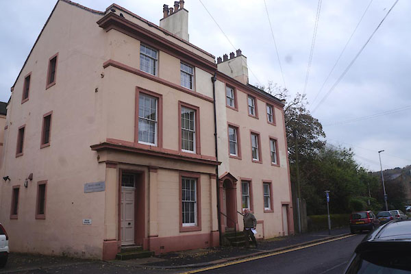 |
NX97451797 Whitehaven: Scotch Street, 112 (Whitehaven) L |
|
|
|
NX97441796 Whitehaven: Scotch Street, 113 (Whitehaven) L |
|
|
|
NX97441833 Senhouse Street (Whitehaven) |
|
|
 |
NX97381830 Shooz'n'Sox (Whitehaven) |
|
|
|
NX97261821 Strand Street (Whitehaven) |
|
|
|
NX97151801 Swing Pump Lane (Whitehaven) |
|
|
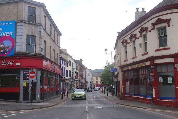 |
NX97381837 Tangier Street (Whitehaven) |
|
|
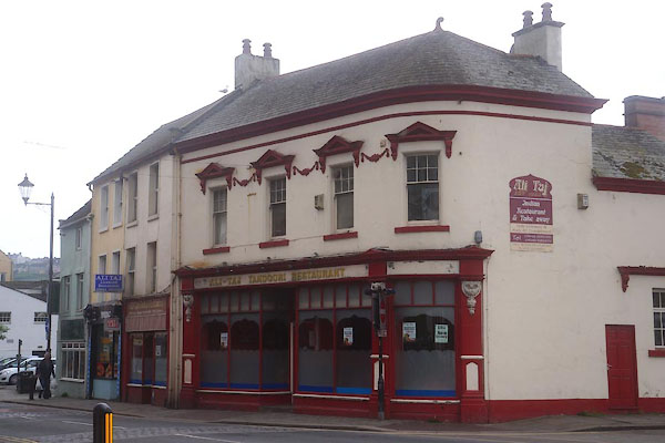 |
NX97401842 Ali-Taj Tandoori Restaurant (Whitehaven) L |
|
|
 |
NX97871750 Whitehaven: Victoria Terrace (Whitehaven) L |
|
|
|
NX97551848 Wellington Row (Whitehaven) |
|
|
 |
NX97641849 Whitehaven: Wellington Row, 16 (Whitehaven) |
|
|
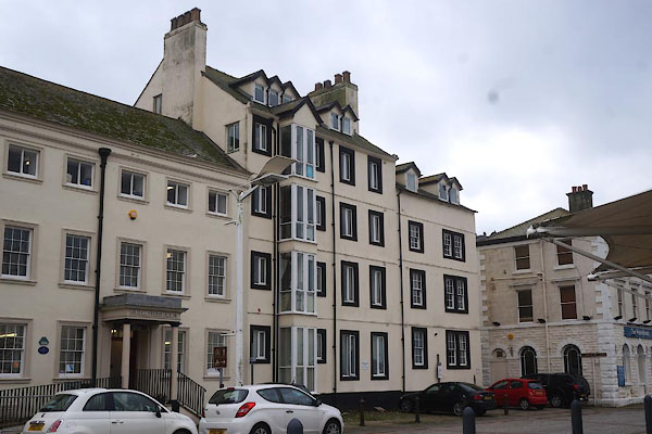 |
NX97111814 Whitehaven: West Strand, 13 (Whitehaven) |
|
|
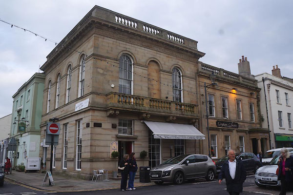 |
NX97421810 Westminster Cafe Bar (Whitehaven) L |
|
|
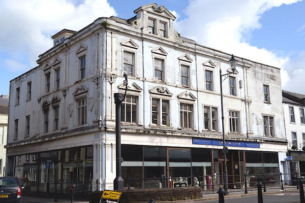 |
NX97371832 Whittles Furniture Store (Whitehaven) L |
|
|
|
NX97621828 Windmill Brow (Whitehaven) |
|
|
|
NX97401910 William Pit (Whitehaven) |
|
|
|
NX971168 Woodhouse (Whitehaven) |
|
|
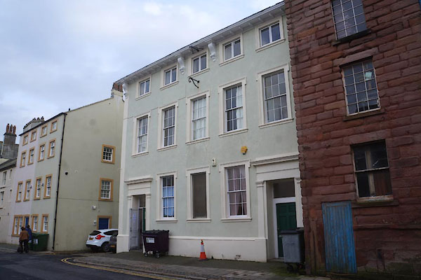 |
NX97381805 Wulstan Hall (Whitehaven) L |
|
|
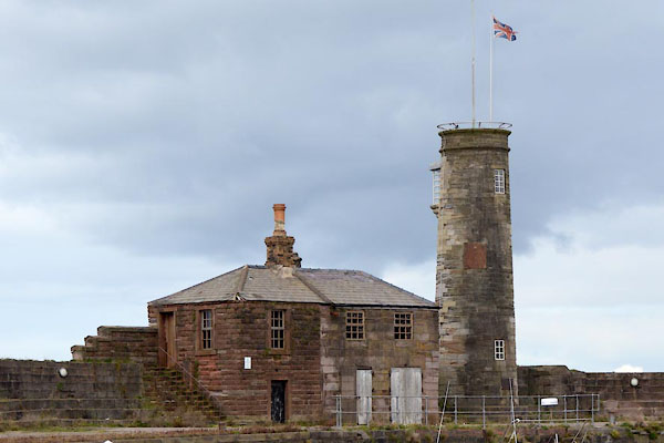 |
NX97021842 Watch House (Whitehaven) L |
|
|
|
NX97701771 bridge, Whitehaven (4) (Whitehaven) suggested |
|
|
 |
NX97391810 Lowther Street (Whitehaven) |
|
|
|
NX973182 Albion Hotel (Whitehaven) |
|
|
|
NX97281818 Black Lion (Whitehaven) |
|
|
 |
NX97201806 Golden Lion (Whitehaven) L |
|
|
|
NX9718 Whitehaven Steam Laundry (Whitehaven) |
|
|
|
NX972180 Callander and Dixon booksellers (Whitehaven) |
|
|
|
NX972180 Crosthwaite and Co booksellers (Whitehaven) |
|
|
|
NX974182 Mr Davidson dentist (Whitehaven) |
|
|
|
NX973182 G Conquest milliner (Whitehaven) |
|
|
|
NX973182 Henry Atkinson vintner (Whitehaven) |
|
|
|
NX973182 J and C D Gordon ironmongers (Whitehaven) |
|
|
|
NX973182 J Booth milliner (Whitehaven) |
|
|
|
NX974180 J Laughlin engraver (Whitehaven) |
|
|
|
NX972180 J Whittle ironmonger (Whitehaven) |
|
|
|
NX972180 John Duggan tailor (Whitehaven) |
|
|
|
NX973182 R Gibson and Son printers (Whitehaven) |
|
|
|
NX976181 Robert Burton cabinet maker (Whitehaven) |
|
|
|
NX9718 Whitehaven Herald (Whitehaven) |
|
|
|
NX96891831 Bath House (Whitehaven) |
|
|
 |
NX97341829 Globe (Whitehaven) L |
|
|
|
NX9718 Gift House, The (Whitehaven) |
|
|
|
NX9718 Leech and Son, tea merchant (Whitehaven) |
|
|
|
NX9718 Whitehaven: Lowther Street, 64 (Whitehaven) |
|
|
|
NX9718 Henry Spencer, vintner (Whitehaven) |
|
|
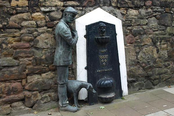 |
NX97591793 drinking fountain, Whitehaven (Whitehaven) |
|
|
|
NX976180 Fisher Memorial (Whitehaven) |
|
|
|
NX97551814 Whitehaven Meeting House (Whitehaven) |
|
|
|
NX972180 Isaac Linton clockmaker (Whitehaven) |
|
|
 |
NX97301818 R Sutton clockmaker (Whitehaven) |
|
|
|
NX97371745 copperas works, Whitehaven (Whitehaven) |
|
|
|
NX97261796 Whitehaven: Cross Street, 1 to 4 (Whitehaven) L |
|
|
 |
NX97241794 Whitehaven: Cross Street, 11 (Whitehaven) L |
|
|
 |
NX97241795 Whitehaven: Cross Street, 12 (Whitehaven) L |
|
|
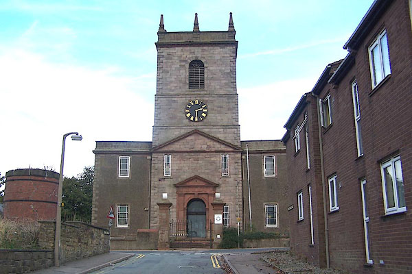 |
NX97671844 St James's Church (Whitehaven) L |
|
|
|
NX97561751 St Gregory's Chuchr (Whitehaven) |
|
|
 |
NX97411795 Whitehaven: Roper Street, 30 (Whitehaven) L |
|
|
 |
NX97631804 water fountain, Whitehaven (Whitehaven) |
|
|
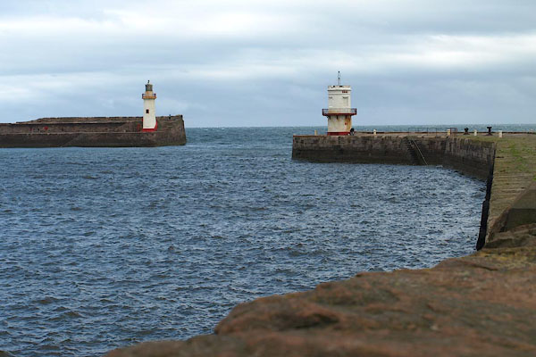 |
NX97131841 Whitehaven Harbour (Whitehaven) L |
|
