 Old Cumbria Gazetteer
 |
 |
|
| Distressed Sailor, Hensingham | ||
| Distressed Sailor | ||
| Street:- | Egremont Road | |
| locality:- | Hensingham | |
| locality:- | Whitehaven | |
| civil parish:- | Whitehaven (formerly Cumberland) | |
| county:- | Cumbria | |
| locality type:- | inn | |
| coordinates:- | NX98581623 | |
| 1Km square:- | NX9816 | |
| 10Km square:- | NX91 | |
|
|
||
 BNC86.jpg Innsign, sailors in a storm. (taken 2.1.2007) 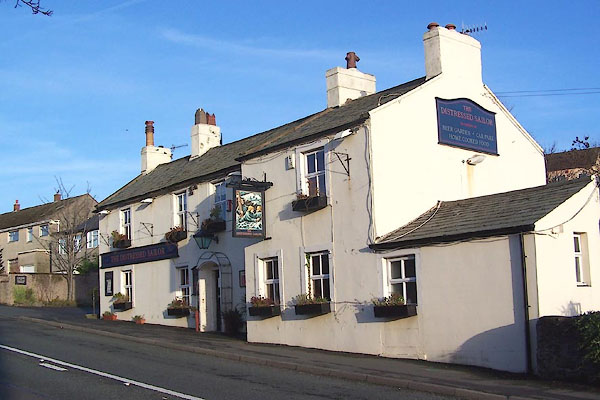 BNC85.jpg (taken 2.1.2007) |
||
|
|
||
| evidence:- | old map:- OS County Series (Cmd 67 6) placename:- Distressed Sailor |
|
| source data:- | Maps, County Series maps of Great Britain, scales 6 and 25
inches to 1 mile, published by the Ordnance Survey, Southampton,
Hampshire, from about 1863 to 1948. |
|
|
|
||
| evidence:- | old map:- Donald 1774 (Cmd) placename:- Distrest Sailor |
|
| source data:- | Map, hand coloured engraving, 3x2 sheets, The County of Cumberland, scale about 1
inch to 1 mile, by Thomas Donald, engraved and published by Joseph Hodskinson, 29
Arundel Street, Strand, London, 1774.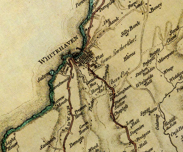 D4NX91NE.jpg "Distrest Sailor" inn item:- Carlisle Library : Map 2 Image © Carlisle Library |
|
|
|
||
| evidence:- | database:- Listed Buildings 2010 placename:- Distressed Sailor |
|
| source data:- | courtesy of English Heritage "THE DISTRESSED SAILOR / / EGREMONT ROAD / WHITEHAVEN / COPELAND / CUMBRIA / II / 75935 / NX9858816259" |
|
| source data:- | courtesy of English Heritage "Circa 1790. Scored stucco, slate roof, doorway with curved hood of local type, 3 sash windows on ground floor and 4 above. Projecting portion to right (South) has a sash window up and 2 down." |
|
|
|
||
 Lakes Guides menu.