 Old Cumbria Gazetteer
 |
 |
|
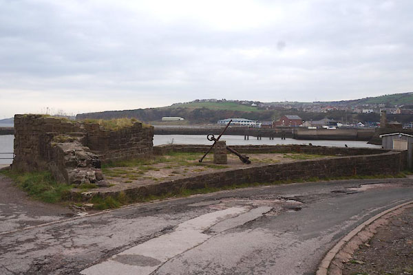
| Old Fort, Whitehaven Harbour | ||
| Old Fort | ||
| locality:- | Whitehaven Harbour | |
| locality:- | Whitehaven | |
| civil parish:- | Whitehaven (formerly Cumberland) | |
| county:- | Cumbria | |
| locality type:- | fort | |
| coordinates:- | NX96811836 | |
| 1Km square:- | NX9618 | |
| 10Km square:- | NX91 | |
| references:- | Listed Buildings 2010 |
|
|
|
||
 CBY91.jpg (taken 31.10.2014) 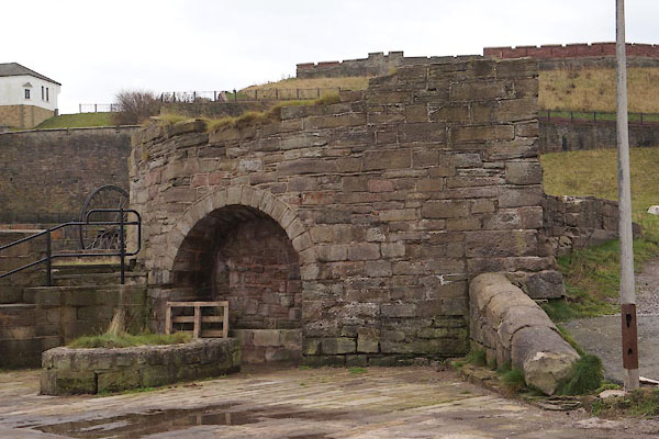 CBY90.jpg (taken 31.10.2014) |
||
|
|
||
| evidence:- | old map:- Donald 1774 (Cmd) placename:- New Fort placename:- Fort, New |
|
| source data:- | Map, hand coloured engraving, 3x2 sheets, The County of Cumberland, scale about 1
inch to 1 mile, by Thomas Donald, engraved and published by Joseph Hodskinson, 29
Arundel Street, Strand, London, 1774.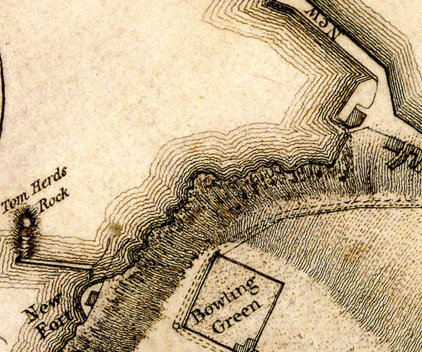 D49618R.jpg "New Fort" fortification item:- Carlisle Library : Map 2 Image © Carlisle Library |
|
|
|
||
| evidence:- | database:- Listed Buildings 2010 placename:- Old Fort |
|
| source data:- | courtesy of English Heritage "OLD FORT / / / WHITEHAVEN / COPELAND / CUMBRIA / II / 75900 / NX9681618361" |
|
| source data:- | courtesy of English Heritage "On quayside between Old Quay and Old New Quay. Scanty remains of fortress built 1639, and attacked by Paul Jones in his celebrated raid on Whitehaven in April 1778." |
|
|
|
||
 Lakes Guides menu.