 Old Cumbria Gazetteer
 |
 |
|
| Ginns, Whitehaven | ||
| Ginns | ||
| locality:- | Whitehaven | |
| civil parish:- | Whitehaven (formerly Cumberland) | |
| county:- | Cumbria | |
| locality type:- | locality | |
| coordinates:- | NX97271737 (etc) | |
| 1Km square:- | NX9717 | |
| 10Km square:- | NX91 | |
|
|
||
| evidence:- | old map:- OS County Series (Cmd 67 6) placename:- Ginns |
|
| source data:- | Maps, County Series maps of Great Britain, scales 6 and 25
inches to 1 mile, published by the Ordnance Survey, Southampton,
Hampshire, from about 1863 to 1948. |
|
|
|
||
| evidence:- | old map:- Donald 1774 (Cmd) placename:- Gins |
|
| source data:- | Map, hand coloured engraving, 3x2 sheets, The County of Cumberland, scale about 1
inch to 1 mile, by Thomas Donald, engraved and published by Joseph Hodskinson, 29
Arundel Street, Strand, London, 1774.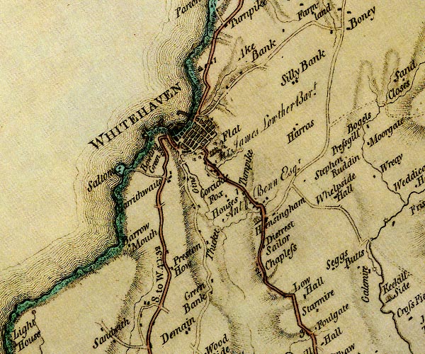 D4NX91NE.jpg "Gins" block or blocks, labelled in lowercase; a hamlet or just a house item:- Carlisle Library : Map 2 Image © Carlisle Library |
|
|
|
||
| evidence:- | old text:- Postlethwaite 1877 (3rd edn 1913) item:- jack rolls; steam engine; horse engine |
|
| source data:- | Book, Mines and Mining in the English Lake District, by John Postlethwaite, Keswick,
published by W H Moss and Sons, Whitehaven, Cumberland now Cumbria, 1877; published
1877-1913. goto source goto sourcepage 152:- "[Whitehaven Coalfield] ... At first the coal was brought up the pits by jack rowls and primitive windlasses, and later by horse windlasses called ginns. The water also had to be drawn up by these ginns, but as the pits became deeper, and the workings more extensive, better and more powerful machinery had to be provided. Sir James Lowther is said to have purchased in London, and brought to Whitehaven by sea, the first steam engine that was erected in the North of England. The engine was erected at the Ginns, a village built for the quarry workmen, and called by the name of the ginns in use there for raising coal and water." |
|
|
|
||
Lakes Guides menu.