 Old Cumbria Gazetteer
 |
 |
|
| Old Quay, Whitehaven Harbour | ||
| Old Quay | ||
| site name:- | Whitehaven Harbour | |
| locality:- | Whitehaven | |
| civil parish:- | Whitehaven (formerly Cumberland) | |
| county:- | Cumbria | |
| locality type:- | quay | |
| coordinates:- | NX96951836 | |
| 1Km square:- | NX9618 | |
| 10Km square:- | NX91 | |
| references:- | Listed Buildings 2010 |
|
|
|
||
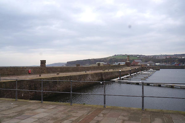 CBY81.jpg (taken 31.10.2014) |
||
|
|
||
| evidence:- | old map:- OS County Series (Cmd 67 2) placename:- Old Quay placename:- Quay, Old |
|
| source data:- | Maps, County Series maps of Great Britain, scales 6 and 25
inches to 1 mile, published by the Ordnance Survey, Southampton,
Hampshire, from about 1863 to 1948. "OLD QUAY / Mooring Posts / Capstan / Storm Signal / ..." |
|
|
|
||
| evidence:- | old map:- Donald 1774 (Cmd) placename:- Old Quay |
|
| source data:- | Map, hand coloured engraving, 3x2 sheets, The County of Cumberland, scale about 1
inch to 1 mile, by Thomas Donald, engraved and published by Joseph Hodskinson, 29
Arundel Street, Strand, London, 1774. D49718C.jpg 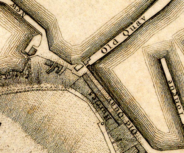 D49618W.jpg "Old Quay" quay item:- Carlisle Library : Map 2 Images © Carlisle Library |
|
|
|
||
| evidence:- | old text:- Admiralty 1933 placename:- Old Quay item:- navigation lights |
|
| source data:- |  goto source goto sourcePage 390:- "..." "A light is exhibited, at an elevation of 25 feet (7m6), from a red mast, 18 feet (5m5) in height, situated on the head of Old quay." |
|
|
|
||
| evidence:- | database:- Listed Buildings 2010 placename:- Old Quay |
|
| source data:- | courtesy of English Heritage "OLD QUAY / / / WHITEHAVEN / COPELAND / CUMBRIA / II / 75894 / NX9695118362" |
|
| source data:- | courtesy of English Heritage "Originally built 1687, stone (parts still remain). Altered in 1792 and 1809. Cobbled floor, with stone bollards." |
|
|
|
||
Lakes Guides menu.