 Old Cumbria Gazetteer
 |
 |
|
| bowling green, Whitehaven | ||
| once | ||
| locality:- | Whitehaven | |
| civil parish:- | Whitehaven (formerly Cumberland) | |
| county:- | Cumbria | |
| locality type:- | bowling green | |
| coordinates:- | NX96771806 (guess) | |
| 1Km square:- | NY9618 | |
| 10Km square:- | NX91 | |
| references:- | Donald 1774 |
|
|
|
||
| evidence:- | old map:- Donald 1774 (Cmd) |
|
| source data:- | Map, hand coloured engraving, 3x2 sheets, The County of Cumberland, scale about 1
inch to 1 mile, by Thomas Donald, engraved and published by Joseph Hodskinson, 29
Arundel Street, Strand, London, 1774.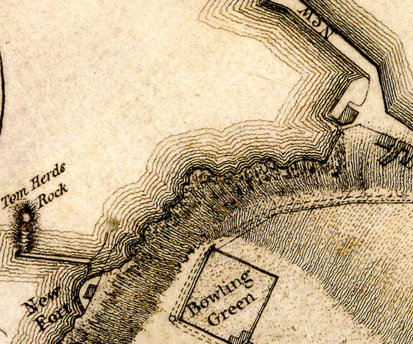 D49618R.jpg 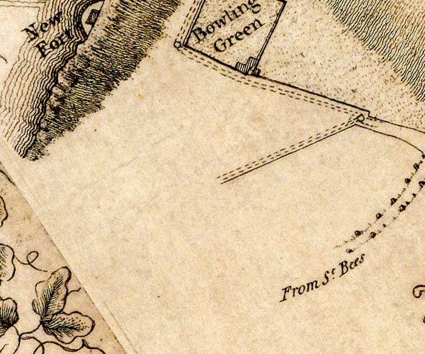 D49618Q.jpg "Bowling Green" area item:- Carlisle Library : Map 2 Images © Carlisle Library |
|
|
|
||
| evidence:- | old map:- Donald 1774 (Cmd) placename:- Bowling Green |
|
| source data:- | Map, hand coloured engraving, 3x2 sheets, The County of Cumberland, scale about 1
inch to 1 mile, by Thomas Donald, engraved and published by Joseph Hodskinson, 29
Arundel Street, Strand, London, 1774. D4NX91NE.jpg "Bowling Green" item:- Carlisle Library : Map 2 Image © Carlisle Library |
|
|
|
||
 Lakes Guides menu.