 Old Cumbria Gazetteer
 |
 |
|
| Watchtower, Whitehaven Harbour | ||
| site name:- | Whitehaven Harbour | |
| locality:- | Old Quay | |
| locality:- | Whitehaven | |
| civil parish:- | Whitehaven (formerly Cumberland) | |
| county:- | Cumbria | |
| locality type:- | watchtower | |
| locality type:- | lighthouse (once?) | |
| coordinates:- | NX97031843 | |
| 1Km square:- | NX9718 | |
| 10Km square:- | NX91 | |
| references:- | Listed Buildings 2010 |
|
|
|
||
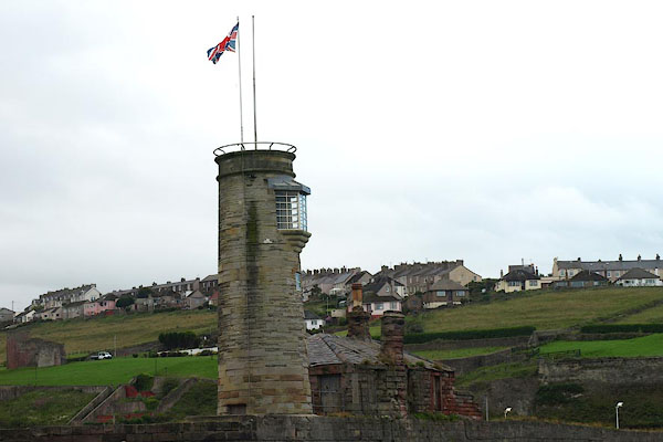 BPM10.jpg (taken 15.7.2008) 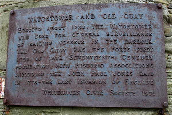 BVS53.jpg Plaque:- "WATCHTOWER AND OLD QUAY / ERECTED ABOUT 1730, THE WATCHTOWER / WAS USED FOR GENERAL SURVEILLANCE / OF SAILING VESSELS IN THE HARBOUR / THE OLD QUAY WAS THE PORT'S FIRST / PIER, OF LATE SEVENTEENTH CENTURY / FOUNDATION, WITH HISTORIC ASSOCIATIONS / INCLUDING THE JOHN PAUL JONES RAID / IN 1778 - THE LAST INVASION OF ENGLAND / WHITEHAVEN CIVIC SOCIETY 1971" (taken 24.11.2011) |
||
|
|
||
| evidence:- | possibly old map:- OS County Series (Cmd 67 2) placename:- Inner Light |
|
| source data:- | Maps, County Series maps of Great Britain, scales 6 and 25
inches to 1 mile, published by the Ordnance Survey, Southampton,
Hampshire, from about 1863 to 1948. |
|
|
|
||
| evidence:- | old map:- Donald 1774 (Cmd) |
|
| source data:- | Map, hand coloured engraving, 3x2 sheets, The County of Cumberland, scale about 1
inch to 1 mile, by Thomas Donald, engraved and published by Joseph Hodskinson, 29
Arundel Street, Strand, London, 1774. D49718C.jpg building on the quay item:- Carlisle Library : Map 2 Image © Carlisle Library |
|
|
|
||
| evidence:- | probably old text:- Admiralty 1933 placename:- item:- storm signal |
|
| source data:- |  goto source goto sourcePage 391:- "... or a red light is exhibited, at an elevation of 40 feet (12m2), from a white circular tower, 50 feet (15m2) in height, situated at the elbow of Old quay, at night, to denote the time of tidal attendance by officials, namely from 2 1/2 hours before until 1 1/2 hours after high water." "Two red flags displayed from a flagstaff on the top of the tower at the elbow of Old quay, by day, or two red lights, vertically disposed 7 feet (2m1) apart, exhibited from the same flagstaff, at night, signify that the harbour is blocked and that entrance is prohibited." "..." "Storm signals. - Storm signals are displayed at the watch tower on Old quay." |
|
|
|
||
| evidence:- | database:- Listed Buildings 2010 placename:- Old Quay Lighthouse item:- sundial |
|
| source data:- | courtesy of English Heritage "OLD QUAY LIGHTHOUSE / / / WHITEHAVEN / COPELAND / CUMBRIA / II / 75895 / NX9703018432" |
|
| source data:- | courtesy of English Heritage "Small and circular, built of stone with a cornice. Canted oriel window on seaward side. Sundial on landward side, with gnomon, dated 1730." |
|
|
|
||
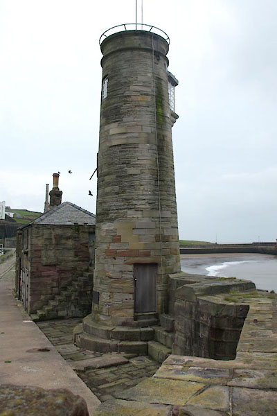 BVS51.jpg (taken 24.11.2011) 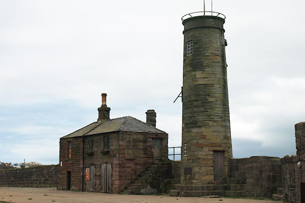 BPM09.jpg The Watchtower and Watch House, built 1730. (taken 15.7.2008) 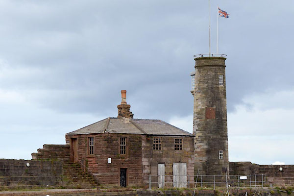 CGN94.jpg Watchtower and Watch House (taken 15.9.2017) 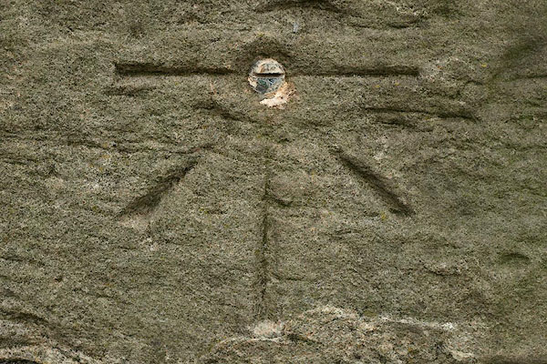 BPM11.jpg Benchmark on the Watchtower. (taken 15.7.2008) |
||
|
|
||
Lakes Guides menu.