 Old Cumbria Gazetteer
 |
 |
|
| South Harbour, Whitehaven Harbour | ||
| South Harbour | ||
| West Strand Marina | ||
| site name:- | Whitehaven Harbour | |
| locality:- | Whitehaven | |
| civil parish:- | Whitehaven (formerly Cumberland) | |
| county:- | Cumbria | |
| locality type:- | dock | |
| coordinates:- | NX96981826 (etc) | |
| 1Km square:- | NX9618 | |
| 10Km square:- | NX91 | |
|
|
||
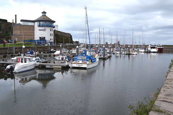 CGN95.jpg (taken 15.9.2017) 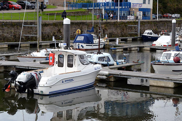 CGN96.jpg (taken 15.9.2017) |
||
|
|
||
| evidence:- | old map:- OS County Series (Cmd 67 2) placename:- South Harbour |
|
| source data:- | Maps, County Series maps of Great Britain, scales 6 and 25
inches to 1 mile, published by the Ordnance Survey, Southampton,
Hampshire, from about 1863 to 1948. |
|
|
|
||
| evidence:- | old map:- Donald 1774 (Cmd) |
|
| source data:- | Map, hand coloured engraving, 3x2 sheets, The County of Cumberland, scale about 1
inch to 1 mile, by Thomas Donald, engraved and published by Joseph Hodskinson, 29
Arundel Street, Strand, London, 1774.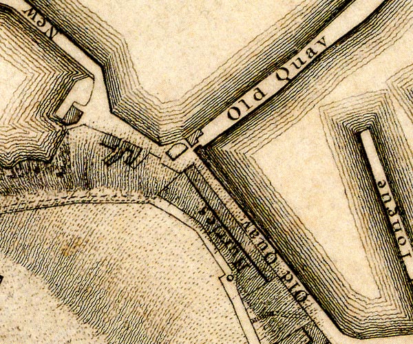 D49618W.jpg harbour protected by quays item:- Carlisle Library : Map 2 Image © Carlisle Library |
|
|
|
||
| evidence:- | old text:- Admiralty 1933 placename:- South Harbour |
|
| source data:- |  goto source goto sourcePage 390:- "..." "Inner harbour ... is divided into South harbour, contained within Old quay and Old Tongue; ..." "... At high water springs, there are depths of 16 feet (4m9) alongside the quays in South harbour; ..." |
|
|
|
||
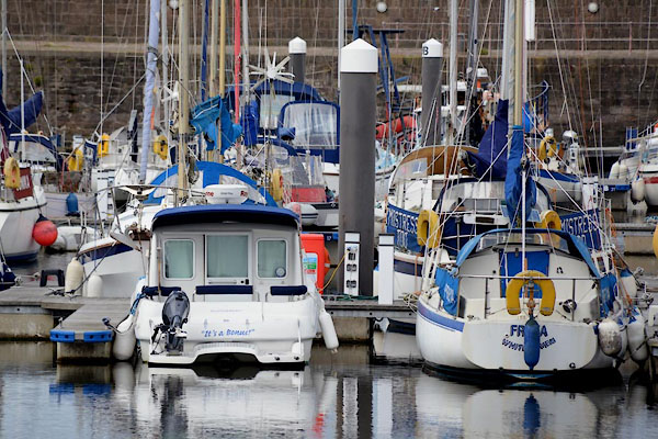 CGN97.jpg (taken 15.9.2017) |
||
|
|
||
Lakes Guides menu.