 Old Cumbria Gazetteer
 |
 |
|
||||||||||||||||||||||||
| Ullswater | ||||||||||||||||||||||||||
| Ousemere | ||||||||||||||||||||||||||
| civil parish:- | Matterdale (formerly Cumberland) | |||||||||||||||||||||||||
| civil parish:- | Patterdale (formerly Westmorland) | |||||||||||||||||||||||||
| civil parish:- | Barton (formerly Westmorland) | |||||||||||||||||||||||||
| civil parish:- | Martindale (formerly Westmorland) | |||||||||||||||||||||||||
| civil parish:- | Dacre (formerly Cumberland) | |||||||||||||||||||||||||
| county:- | Cumbria | |||||||||||||||||||||||||
| locality type:- | lake | |||||||||||||||||||||||||
| coordinates:- | NY42202020 (etc) | |||||||||||||||||||||||||
| 1Km square:- | NY4220 | |||||||||||||||||||||||||
| 10Km square:- | NY42 | |||||||||||||||||||||||||
| 10Km square:- | NY31 | |||||||||||||||||||||||||
| 10Km square:- | NY41 | |||||||||||||||||||||||||
|
|
||||||||||||||||||||||||||
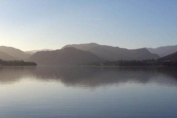 BLN48.jpg From Pooley Bridge Pier. (taken 4.1.2006) 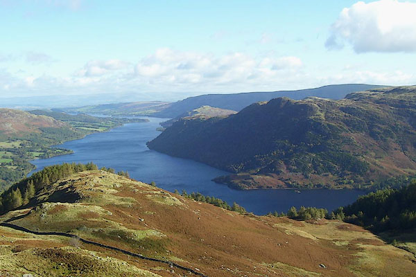 BOH38.jpg From Glencoyne. (taken 17.10.2007) |
||||||||||||||||||||||||||
|
|
||||||||||||||||||||||||||
| evidence:- | old map:- OS County Series (Wmd 12 3) placename:- Ullswater |
|||||||||||||||||||||||||
| source data:- | Maps, County Series maps of Great Britain, scales 6 and 25
inches to 1 mile, published by the Ordnance Survey, Southampton,
Hampshire, from about 1863 to 1948. OS County Series (Wmd 12 4) OS County Series (Wmd 12 6) OS County Series (Wmd 12 7) OS County Series (Wmd 7A 16) OS County Series (Wmd 7 6) OS County Series (Wmd 7 9) OS County Series (Wmd 7 10) OS County Series (Wmd 7 13) |
|||||||||||||||||||||||||
| source data:- | Maps, County Series maps of Great Britain, scales 6 and 25
inches to 1 mile, published by the Ordnance Survey, Southampton,
Hampshire, from about 1863 to 1948. OS County Series (Cmd 66 4) OS County Series (Cmd 66 9) OS County Series (Cmd 65 12) OS County Series (Cmd 65 15) OS County Series (Cmd 65 16) OS County Series (Cmd 66 5) OS County Series (Cmd 66 6) OS County Series (Cmd 66 9) OS County Series (Cmd 66 10) OS County Series (Cmd 66 13) |
|||||||||||||||||||||||||
|
|
||||||||||||||||||||||||||
| evidence:- | old map:- OS County Series (Wmd 12) placename:- Ullswater |
|||||||||||||||||||||||||
| source data:- | Maps, County Series maps of Great Britain, scales 6 and 25
inches to 1 mile, published by the Ordnance Survey, Southampton,
Hampshire, from about 1863 to 1948. "ULLSWATER / Sur. of Water 476.6 / Lowest point of bed of lake 271 feet above O.S. datum" |
|||||||||||||||||||||||||
|
|
||||||||||||||||||||||||||
| evidence:- | old map:- OS County Series (Wmd 12) |
|||||||||||||||||||||||||
| source data:- | Maps, County Series maps of Great Britain, scales 6 and 25
inches to 1 mile, published by the Ordnance Survey, Southampton,
Hampshire, from about 1863 to 1948. OS County Series (Cmd 65) "Lowest point of bed of lake 271 feet above O.S. datum" elsewhere on this map is:- "Sur. of Water 476.6" |
|||||||||||||||||||||||||
|
|
||||||||||||||||||||||||||
| evidence:- | old map:- Saxton 1579 placename:- Ulles Flu. |
|||||||||||||||||||||||||
| source data:- | Map, hand coloured engraving, Westmorlandiae et Cumberlandiae Comitatus ie Westmorland
and Cumberland, scale about 5 miles to 1 inch, by Christopher Saxton, London, engraved
by Augustinus Ryther, 1576, published 1579-1645. Sax9NY42.jpg "Ulles flu"  Sax9NY41.jpg Lake. item:- private collection : 2 Image © see bottom of page |
|||||||||||||||||||||||||
|
|
||||||||||||||||||||||||||
| evidence:- | old map:- Mercator 1595 (edn?) placename:- Uls Water |
|||||||||||||||||||||||||
| source data:- | Map, hand coloured engraving, Northumbria, Cumberlandia, et
Dunelmensis Episcopatus, ie Northumberland, Cumberland and
Durham etc, scale about 6.5 miles to 1 inch, by Gerard Mercator,
Duisberg, Germany, about 1595.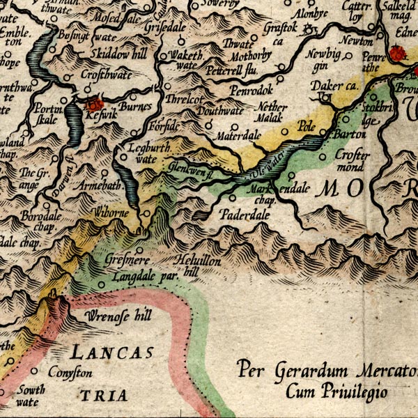 MER8CumF.jpg "Uls Water" outline, coast shaded, tinted blue; lake, on county boundary with Westmorland item:- JandMN : 169 Image © see bottom of page |
|||||||||||||||||||||||||
|
|
||||||||||||||||||||||||||
| evidence:- | old map:- Keer 1605 |
|||||||||||||||||||||||||
| source data:- | Map, hand coloured engraving, Westmorland and Cumberland, scale
about 16 miles to 1 inch, probably by Pieter van den Keere, or
Peter Keer, about 1605 edition perhaps 1676. click to enlarge click to enlargeKER8.jpg "" outline, shaded; lake item:- Dove Cottage : 2007.38.110 Image © see bottom of page |
|||||||||||||||||||||||||
|
|
||||||||||||||||||||||||||
| evidence:- | old map:- Speed 1611 (Cum/EW) |
|||||||||||||||||||||||||
| source data:- | Map, hand coloured engraving, Kingdome of Great Britaine and
Ireland, scale about 36 miles to 1 inch, by John Speed, about
1610-11, published by Thomas Bassett, Fleet Street and Richard
Chiswell, St Paul's Churchyard, London, 1676? click to enlarge click to enlargeSPD6Cm.jpg outline, shaded, misplaced item:- private collection : 85 Image © see bottom of page |
|||||||||||||||||||||||||
|
|
||||||||||||||||||||||||||
| evidence:- | old map:- Speed 1611 (Cmd) placename:- Ulles flu. |
|||||||||||||||||||||||||
| source data:- | Map, hand coloured engraving, Cumberland and the Ancient Citie
Carlile Described, scale about 4 miles to 1 inch, by John Speed,
1610, published by J Sudbury and George Humble, Popes Head
Alley, London, 1611-12.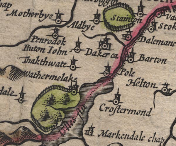 SP11NY42.jpg "Ulles flu" outline, shore shaded; county boundary through the lake item:- private collection : 16 Image © see bottom of page |
|||||||||||||||||||||||||
|
|
||||||||||||||||||||||||||
| evidence:- | old map:- Speed 1611 (Wmd) placename:- Ulles flu. |
|||||||||||||||||||||||||
| source data:- | Map, hand coloured engraving, The Countie Westmorland and
Kendale the Cheif Towne, scale about 2.5 miles to 1 inch, by
John Speed, 1610, published by George Humble, Popes Head Alley,
London, 1611-12. SP14NY42.jpg "Ulles flu" outline, shore shaded; county boundary through lake item:- Armitt Library : 2008.14.5 Image © see bottom of page |
|||||||||||||||||||||||||
|
|
||||||||||||||||||||||||||
| evidence:- | poem:- Drayton 1612/1622 text placename:- Ulls |
|||||||||||||||||||||||||
| source data:- | Poem, Poly Olbion, by Michael Drayton, published by published by
John Marriott, John Grismand and Thomas Dewe, and others?
London, part 1 1612, part 2 1622. goto source goto sourcepage 163:- "... from Ulls, a mightie Mere On Cumberlands confines, comes Eymot neat and cleere, ..." |
|||||||||||||||||||||||||
|
|
||||||||||||||||||||||||||
| evidence:- | old map:- Drayton 1612/1622 placename:- Ulles Mere |
|||||||||||||||||||||||||
| source data:- | Map, hand coloured engraving, Cumberlande and Westmorlande, by
Michael Drayton, probably engraved by William Hole, scale about
4 or 5 miles to 1 inch, published by John Mariott, John
Grismand, and Thomas Dewe, London, 1622.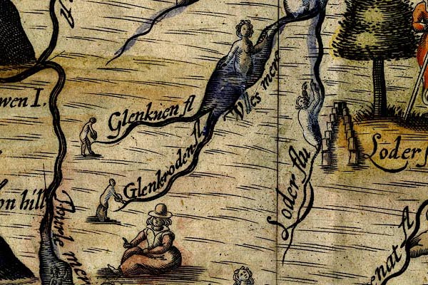 DRY515.jpg "Ulles mere" Lake, naiad. item:- JandMN : 168 Image © see bottom of page |
|||||||||||||||||||||||||
|
|
||||||||||||||||||||||||||
| evidence:- | old map:- Sanson 1679 |
|||||||||||||||||||||||||
| source data:- | Map, hand coloured engraving, Ancien Royaume de Northumberland
aujourdhuy Provinces de Nort, ie the Ancient Kingdom of
Northumberland or the Northern Provinces, scale about 9.5 miles
to 1 inch, by Nicholas Sanson, Paris, France, 1679. click to enlarge click to enlargeSAN2Cm.jpg outline, shore shaded; lake; part of Ulles fl.; across the county boundary item:- Dove Cottage : 2007.38.15 Image © see bottom of page |
|||||||||||||||||||||||||
|
|
||||||||||||||||||||||||||
| evidence:- | old map:- Seller 1694 (Wmd) placename:- Ulles fl. |
|||||||||||||||||||||||||
| source data:- | Map, hand coloured engraving, Westmorland, scale about 8 miles
to 1 inch, by John Seller, 1694. click to enlarge click to enlargeSEL7.jpg "Ulles fl" outline with shaded shore; lake; on the county boundary item:- Dove Cottage : 2007.38.87 Image © see bottom of page |
|||||||||||||||||||||||||
|
|
||||||||||||||||||||||||||
| evidence:- | old map:- Seller 1694 (Cmd) |
|||||||||||||||||||||||||
| source data:- | Map, uncoloured engraving, Cumberland, scale about 12 miles to 1
inch, by John Seller, 1694. click to enlarge click to enlargeSEL9.jpg outline with shaded shore; lake, across county boundary item:- Dove Cottage : 2007.38.89 Image © see bottom of page |
|||||||||||||||||||||||||
|
|
||||||||||||||||||||||||||
| evidence:- | old map:- Morden 1695 (Cmd) placename:- Ulles Flu. placename:- Ulles River |
|||||||||||||||||||||||||
| source data:- | Map, hand coloured engraving, Westmorland, scale about 2.5 miles to 1 inch, by Robert
Morden, published by Abel Swale, the Unicorn, St Paul's Churchyard, Awnsham, and John
Churchill, the Black Swan, Paternoster Row, London, 1695.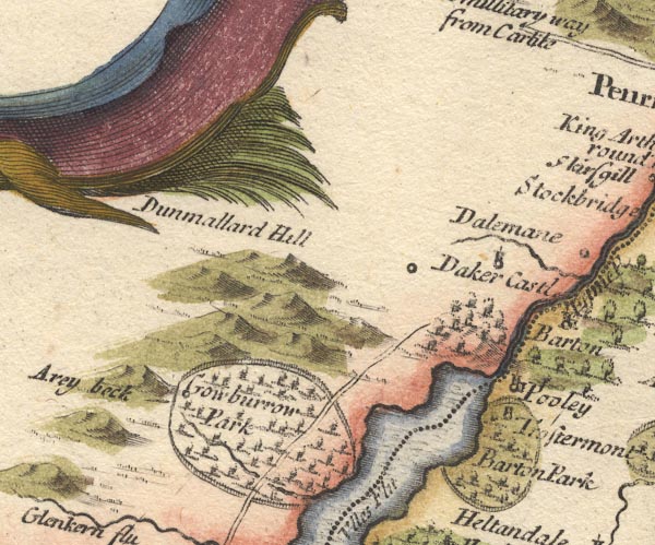 MD10NY42.jpg "Ulles R." 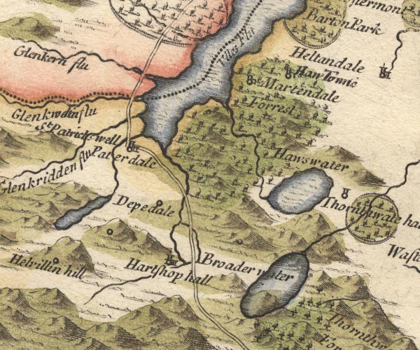 MD10NY41.jpg "Ulles Flu" Outline with shore shading, tinted blue; the county boundary drawn in the lake from Glencoin to Pooley Bridge. item:- JandMN : 24 Image © see bottom of page |
|||||||||||||||||||||||||
|
|
||||||||||||||||||||||||||
| evidence:- | descriptive text:- Fiennes 1698 placename:- Ules water item:- water; hare coursing; deer |
|||||||||||||||||||||||||
| source data:- | Travel book, manuscript record of Journeys through England
including parts of the Lake District, by Celia Fiennes, 1698. "this river together with the additional springs continually running into it all the way from those vaste precipices comes into a low place and form a broad water which is very cleer and reaches 7 mile in length, Ules water its called, ... its full of such sort of stones and slatts in the bottom as the other [Windermere], neer the brimm where its shallowe you see it cleer to the bottom; this is secured on each side by such formidable heights as those rocky fells in same manner as the other was; I rode the whole length of this water by its side sometyme a little higher upon the side of the hill and sometyme just by the shore and for 3 or 4 miles I rode through a fine forest or parke where was deer skipping about and haires, which by meanes of a good Greyhound I had a little Course, but we being strangers could not so fast pursue it in the grounds full of hillocks and furse and soe she escaped us." "... I call this a standing water as the other because its not like other great rivers as the Trent Severne Hull or Thames etc. to appear to run with a streame or current, but only as it rowles from side to side like waves as the wind moves it; its true at the end of this being a low fall of ground it runs off in a little streame; there is exceeding good fish here ..." |
|||||||||||||||||||||||||
|
|
||||||||||||||||||||||||||
| evidence:- | perhaps old map:- Stukeley 1723 |
|||||||||||||||||||||||||
| source data:- | Road map, uncoloured engraving, the Antonine Itineraries through
Britain, scale about 55 miles to 1 inch, plotted by William
Stukeley, 1723, published London, 1724. click to enlarge click to enlargeStu1Cm.jpg item:- Hampshire Museums : FA2001.171 Image © see bottom of page |
|||||||||||||||||||||||||
|
|
||||||||||||||||||||||||||
| evidence:- | old map:- Badeslade 1742 placename:- Ulles Lake |
|||||||||||||||||||||||||
| source data:- | Map, uncoloured engraving, A Map of Cumberland North from
London, scale about 11 miles to 1 inch, with descriptive text,
by Thomas Badeslade, London, engraved and published by William
Henry Toms, Union Court, Holborn, London, 1742. click to enlarge click to enlargeBD10.jpg "Ulles Lake" outline without form lines, across county boundary item:- JandMN : 115 Image © see bottom of page |
|||||||||||||||||||||||||
|
|
||||||||||||||||||||||||||
| evidence:- | old map:- Badeslade 1742 placename:- |
|||||||||||||||||||||||||
| source data:- | Map, uncoloured engraving, A Map of Westmorland North from
London, scale about 10 miles to 1 inch, with descriptive text,
by Thomas Badeslade, London, engraved and published by William
Henry Toms, Union Court, Holborn, London, 1742. click to enlarge click to enlargeBD12.jpg "" outline without form lines, across county boundary item:- Dove Cottage : 2007.38.62 Image © see bottom of page |
|||||||||||||||||||||||||
|
|
||||||||||||||||||||||||||
| evidence:- | descriptive text:- Simpson 1746 placename:- Ulleswater item:- fish, Ullswater; char |
|||||||||||||||||||||||||
| source data:- | Atlas, three volumes of maps and descriptive text published as
'The Agreeable Historian, or the Compleat English Traveller
...', by Samuel Simpson, 1746. goto source Page 1021:- "..." "The Ulleswater is a Lake well-stocked with Fish, and has some Chares too, but not in such Plenty as the former, and is fed with six small Rivers. 'Tis ten Miles North of Winander-meer, and both Cumberland and this County lay Claim to it." |
|||||||||||||||||||||||||
|
|
||||||||||||||||||||||||||
| evidence:- | descriptive text:- Simpson 1746 placename:- Ulles placename:- Ulleswater |
|||||||||||||||||||||||||
| source data:- | Atlas, three volumes of maps and descriptive text published as
'The Agreeable Historian, or the Compleat English Traveller
...', by Samuel Simpson, 1746. goto source "..." "... the River Eimont, which has its Rise from the Lake call'd Ulles or Ulleswater." |
|||||||||||||||||||||||||
|
|
||||||||||||||||||||||||||
| evidence:- | old map:- Simpson 1746 map (Wmd) |
|||||||||||||||||||||||||
| source data:- | Map, uncoloured engraving, Westmorland, scale about 8 miles to 1
inch, printed by R Walker, Fleet Lane, London, 1746. SMP2NYL.jpg 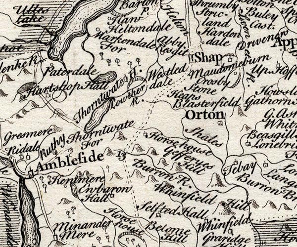 SMP2NYK.jpg "UllesLake" Outline with form lines; the county boundary along its NW shore. item:- Dove Cottage : 2007.38.59 Image © see bottom of page |
|||||||||||||||||||||||||
|
|
||||||||||||||||||||||||||
| evidence:- | old map:- Bickham 1753-54 (Cmd) placename:- Ulles Lake |
|||||||||||||||||||||||||
| source data:- | Map, uncoloured engraving, perspective map, Map of Cumberland
North from London, by George Bickham, James Street, Bunhill
Fields, London, 1753, published by F Jollie and Sons, Carlisle,
Cumberland, 1811. click to enlarge click to enlargeJL05.jpg "Ulles Lake" view (sort of) item:- Carlisle Library : 4.2 Image © Carlisle Library |
|||||||||||||||||||||||||
|
|
||||||||||||||||||||||||||
| evidence:- | old text:- Morgan 1759 placename:- Uls Water |
|||||||||||||||||||||||||
| source data:- | MG02q015.txt "Uls-Water lies a few miles to the east of Keswick, and is a sheet of water nine miles in extent, and above a mile in width. When viewed from an adjoining eminence, you discern all its bays, shores, and promontories, and in the extensive landscape take in a variety of objects, thrown together with all that beauty, which wood and water, lawns rising from sweeps of corn, villas, villages, and cots, surmounted by immense mountains and rude cliffs, can form to the eye. The country to the right, for many miles, is variegated in the finest manner, by enclosures, woods, and villas, among which Graystock, Dacre, and Delmain, are seen; whilst, to the left, nothing but stupendous mountains, and rude projecting rocks, present themselves, vying with each other for grandeur and eminence. "While we sat on one of the islands of this lake to regale ourselves (says the ingenious Mr. Hutchinson) the barge put off from the shore, to a station where the finest echo was to be obtained from the surrounding mountains. On discharging one of their cannon, the report was echoed from the opposite rock, where, by reverberation, it seemed to roll from cliff to cliff, and return through every cave and valley, till the decreasing tumult gradually died away upon the ear. The instant it had ceased, the sound of every waterfall was heard, but for an instant only; for the momentary stillness was interrupted by the returning echo on the hill behind, where the report was repeated like a peal of thunder; and thus running from rock to rock, the report of every discharge was re-echoed seven times distinctly. But a general discharge of six brass cannon roused us to new astonishment. Though we had heard with great surprise the former echoes, this exceeded them so much that it seemed incredible; for on every hand the sounds were reverberated and returned from side to side, so as to give the resemblance of that confusion and horrid uproar, which the falling of those stupendous rocks would occasion, if, by some internal combustion, they were rent to pieces, and hurled into the lake." The effects of music here are equally wonderful and pleasing." |
|||||||||||||||||||||||||
|
|
||||||||||||||||||||||||||
| evidence:- | old map:- Bowen and Kitchin 1760 placename:- Ulles Lake |
|||||||||||||||||||||||||
| source data:- | Map, hand coloured engraving, A New Map of the Counties of
Cumberland and Westmoreland Divided into their Respective Wards,
scale about 4 miles to 1 inch, by Emanuel Bowen and Thomas
Kitchin et al, published by T Bowles, Robert Sayer, and John
Bowles, London, 1760.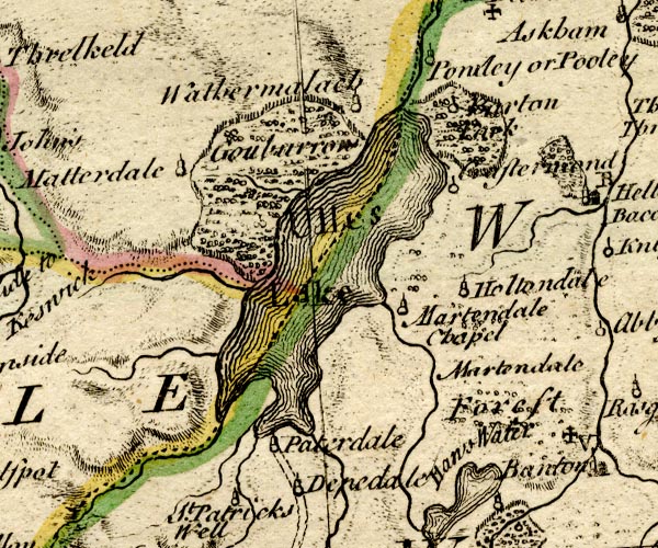 BO18NY31.jpg "Ulles Lake" outline with form lines, county boundary Westmorland Cumberland item:- Armitt Library : 2008.14.10 Image © see bottom of page |
|||||||||||||||||||||||||
|
|
||||||||||||||||||||||||||
| evidence:- | old map:- Jefferys 1770 (Wmd) |
|||||||||||||||||||||||||
| source data:- | Map, 4 sheets, The County of Westmoreland, scale 1 inch to 1
mile, surveyed 1768, and engraved and published by Thomas
Jefferys, London, 1770. J5NY31NE.jpg 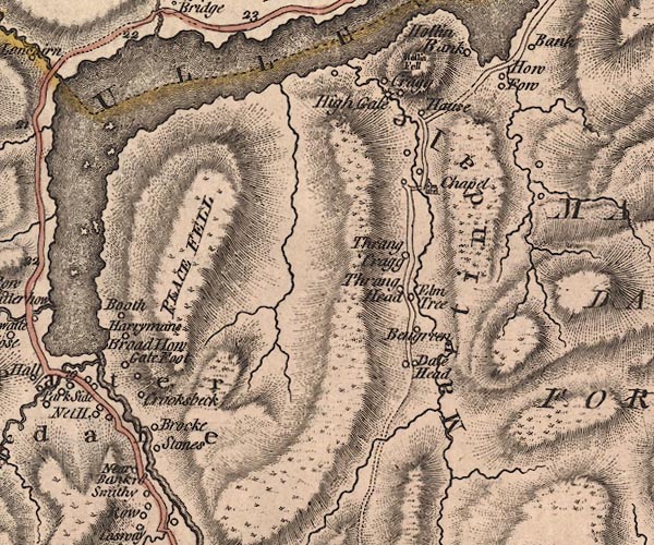 J5NY41NW.jpg 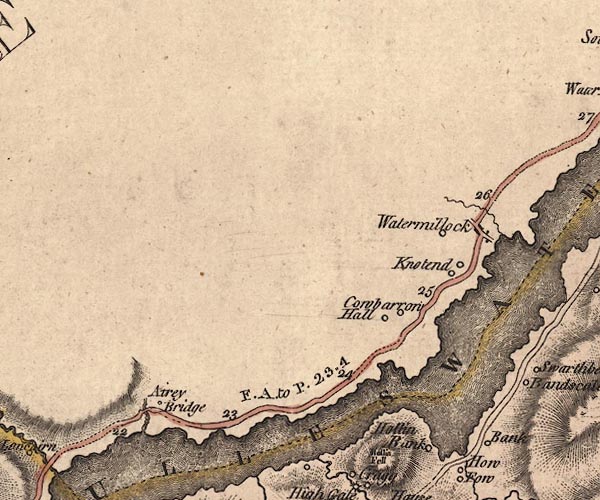 J5NY42SW.jpg 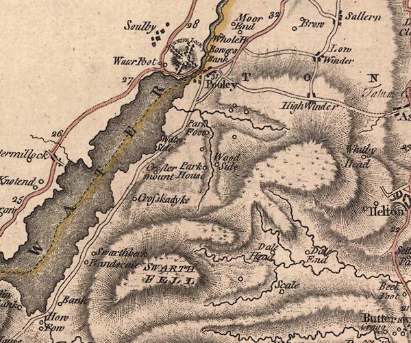 J5NY42SE.jpg "ULLESWATER" outline with form lines; lake or tarn; across county boundary item:- National Library of Scotland : EME.s.47 Images © National Library of Scotland |
|||||||||||||||||||||||||
|
|
||||||||||||||||||||||||||
| evidence:- | old map:- Donald 1774 (Cmd) placename:- Ulles Water |
|||||||||||||||||||||||||
| source data:- | Map, hand coloured engraving, 3x2 sheets, The County of Cumberland, scale about 1
inch to 1 mile, by Thomas Donald, engraved and published by Joseph Hodskinson, 29
Arundel Street, Strand, London, 1774. D4NY42SW.jpg "ULLES WATER" 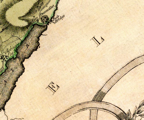 D4NY42SE.jpg 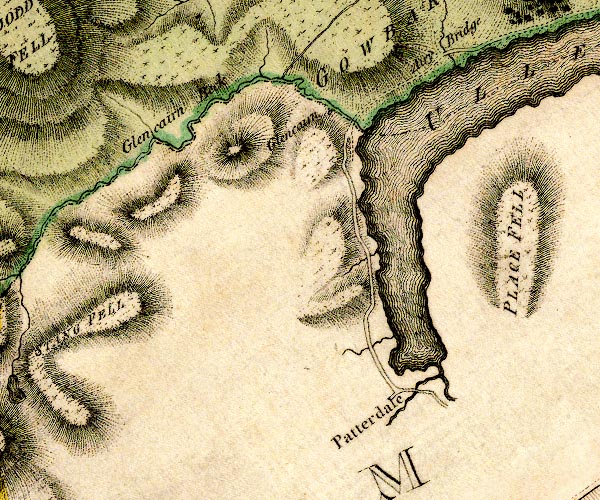 D4NY31NE.jpg "ULLES WATER" lake; the county boundary Cumberland and Westmorland down the middle, but the map colourist has put it in Westmorland only item:- Carlisle Library : Map 2 Images © Carlisle Library |
|||||||||||||||||||||||||
|
|
||||||||||||||||||||||||||
| evidence:- | old map:- Pennant 1777 |
|||||||||||||||||||||||||
| source data:- | Map, hand coloured engraving, A Map of Scotland, Hebrides and
Part of England, drawn for Thomas Pennant, engraved by J Bayly,
published by Benjamin White, London, 1777. click to enlarge click to enlargePEN1Cm.jpg lake item:- private collection : 66 Image © see bottom of page |
|||||||||||||||||||||||||
|
|
||||||||||||||||||||||||||
| evidence:- | descriptive text:- West 1778 (11th edn 1821) placename:- Ulls Water item:- fish, Ullswater; char; trout; poem; Ode to the Sun |
|||||||||||||||||||||||||
| source data:- | Guide book, A Guide to the Lakes, by Thomas West, published by
William Pennington, Kendal, Cumbria once Westmorland, and in
London, 1778 to 1821. goto source Page 151:- "..." "ULLS-WATER." "Those that do not choose to go as far as Penrith, may, near the eighth mile-post," goto sourcePage 152:- "turn off to the right (leaving Mell-fell, a round green hill, on the left) to Matterdale, and proceed to Gowbarrow-park, which will bring them upon Ulls-water, about the middle part of it, where it is seen to great advantage. But here it must be observed, that some of the principal beauties of the lake, and the sweetest pastoral scenes, are entirely lost by this route. Dunmallet, the greatest ornament of the lake, with the whole of the first great bend, cannot here be seen, and much of the dignity of the lake is thereby lost. It is therefore better to ride to the gate on the right, that leads to Dacre, and over Dacre-common, to the foot of Dunmallet. By this course, every part of the lake will be viewed to the greatest advantage." "Mr. Gray's choice of visiting this lake, was from Penrith, up the vale of Emont. 'A grey autumnal day,' he writes, 'went to see Ullswater, five miles distant; soon left Keswick road, and turned to the left, through shady lanes, along the vale of Emont, which runs rapidly on near the way, rippling over the stones; to the right, Dalemain, a large fabric of pale red stone, with nine windows in front, and seven on the side. Further on, Hutton-St.-John, a castle-like old mansion of Mr. Huddlestone. Approach Dunmallet, a fine pointed hill, covered with wood. Began to mount the hill, and with some toil" goto sourcePage 153:- "gained the summit. From hence, saw the lake opening directly at my feet, majestic in calmness, clear and smooth as a blue mirror, with winding shores, and low points of land, covered with green inclosures, white farm houses looking out among the trees, and cattle feeding. The water is almost everywhere bordered with cultivated lands, gently sloping upwards, from a mile to a quarter of a mile in breadth, till they reach the feet of the mountains, which rise very rude and awful, with their broken tops, on each hand. Directly in front, at better than three miles distance, Place-fell, one of the bravest among them, pushes its bold breast into the midst of the lake, and forces it to alter its course, forming first a large bay to the left, and then bending to the right. Descended Dunmallet by a side avenue, only not perpendicular and came to Barton-bridge, over the Emont. Then walked through a path in the wood, round the bottom of the hill, came forth where the Emont issues out of the lake, and continued my way along the western shore, close to the water, and generally on a level with it; it is nine miles long, and at the widest, under a mile in breadth. After extending itself three miles and a half, in a line to the south-west, it turns at the foot of Place-fell, almost due west, and is here not twice the breadth of the Thames at London. It is soon again interrupted by the root of" goto sourcePage 154:- "Helvellyn, a lofty and very rugged mountain, and spreading again, turns off to the south-east, and is lost among the deep recesses of hills. To this second turning I pursued my way, about four miles along its borders, beyond a village scattered among trees, and called Watermillock.' Here Mr. Gray leaves us, and the greatest part of the lake unseen, and its most picturesque parts undescribed. For the last bend of the lake is spotted with rocky isles, deeply indented with wooded promontories on one side, and rocks on the other, from which result many a truly pleasing picture." goto sourcePage 155:- "Opposite to Watermillock, a cataract descends down the front of Swarth-fell, in Martindale-forest. At Skelling-nab, a bold promontory, the lake is contracted to a span, but it soon spreads itself again both ways, forming a variety of sweet bays and promontories. After a reach of three miles, it winds with a grand sweep round the smooth breast of Place-fell, and making a turn directly south, advances with equal breadth towards Patterdale. The western shore is various. Drawing near the second bend, the mountains strangely intersect each other. Behind many wooded hills rises Stonecross-pike, and over all, steep Helvellyn shows his sovereign head. On the western side, Yew-crag, a noble pile of rock, fronts Place-fell, where its streams tumble in a cataract to the lake. Gowbarrow-park opens with a grand amphitheatre of shining rock, the floor of which is spread with soft green pasture, once shaded with ancient oaks, to which many decayed roots bear witness, Scattered thorns, trees, and bushes vary the ground, which is pastured with flocks, herds of cattle, and fallow deer. The road winds along the margin of the lake, and at every turn presents the finest scenes that can be imagined. At the upper end of Gowbarrow-park, the last bend of the lake, which is by much the finest, opens, scattered with small rocky islands. The shores are bold, rocky, wooded, and much embayed." "..." goto sourcePage 156:- "... The ride along the banks, since the repair of the road, is charming." "The upper end terminates in sweet meadows, surrounded to the right by towering rocky hills, broken and wooded. Martindale fell is the opposite boundary, skirted here with hanging inclosures, cots, and farms." "The principal feeders of this lake are Grysdale-beck, on the western corner, and Goldrill-beck, which descends from Kirkston-fell. They enter it in a freer manner than the feeder of Derwent does, and make a much finer appearance at their junction." goto sourcePage 157:- "..." "The lake is of a depth sufficient for breeding char, and abounds with a variety of" Page 157, footnote:- "After crossing the bridge in Patterdale, and ascending the side of Martindale-fell, to a certain height, in the view across the head of the lake, the mountains assume more pointed and Alpine forms than any we have seen in this country. No.12 of Mr. Farrington;s views represents this subject." goto sourcePage 158:- "other fish. Trout of thirty pounds weight and upwards, are said to be taken in it." "The water of the lake is very clear, but has nothing of the transparency of Derwent, and is inferior to Buttermere and Cromack-water also in this respect. The stones in the bottom, and along the shores, are coated with mud." "Mr. Gray viewed this lake in the same manner as that at Keswick, proceeding along its banks, and facing the mountains, judging that the idea of magnitude and magnificence were thereby increased, and the whole set off with every advantage of foreground. But this lake viewed from any height, except Dunmallet, also loses much of its dignity, as a lake, from the number of its flexures, and jutting out of promontories; it nevertheless retains the appearance of a magnificent river ingulphed in rocks." "The bold winding hills, the intersecting mountains, the pyramidal cliffs, the bulging, broken, rugged rocks, the hanging woods, and the tumbling, roaring cataracts, are parts of the sublimer scenes presented in this surprising vale. The cultivated spots wave upward from the water in beautiful slopes, intersected by hedges, decorated with trees, in the most pleasing manner; mansions," goto sourcePage 159:- "cottages, and farms, placed in the sweetest situations, are the rural parts, and altogether form the most delightful and charming scenes. The accompaniments of this lake are disposed in the most picturesque order, bending round its margins, and spreading upwards in craggy rocks and mountains, irregular in outline; yet they are certainly much inferior in sublimity and horrible grandeur, to the environs of Keswick, and the dreadful rocks of Borrowdale. But in this opinion we have Mr. Cumberland against us, who, having visited the other lakes in dark unfavourable weather, when nothing could be seen besides weeping rocks, flooded roads, and watery plains, darkened by sable clouds that hovered over them, and concealed their variegated shores,- entertained an unfavourable idea of them; and being more fortunate in a fine day, in that part of the tour, where he visited Ulls-water, he attuned his lyre in honour of this enchanting lake, and sung its charms not only in preference to Windermere, Grasmere, and the vale of Keswick, but he also raises it above the pride of Lomond, and the marvellous Killarney." "Our bard, in the sweet ode alluded to, represents himself upon the banks of the lake of Ulls-water, bemoaning the hardness of his fate, in being deprived of a fine day" goto sourcePage 160:- "for this view, when the sun, beaming forth, blessed him with a full display of all the beauties of this enchanting lake. In gratitude for so special a favour, in a true poetic rapture, he dedicates this ode to the God of Day, and commemorates his partiality to the lake of Patterdale, in the following harmonious numbers:" "Me turbid skies and threat'ning clouds await, / Emblems, alas! of my ignoble fate." "But see! the embattled vapours break, Disperse and fly, / Posting like couriers down the sky; / The grey rock glitters in the glassy lake:-- / And now the mountain tops are seen / Frowning amidst the blue serene; / The variegated groves appear, / Deck'd in the colours of the waning year; / And as new beauties they unfold, / Dip their skirts in beaming gold. / Thee, savage Wyburn, now I hail, / Delicious Grasmere's calm retreat, / And stately Windermere I greet, / And Keswick's sweet fantastic vale:- / But let her naiads yield to thee, / and lowly bend the subject knee, / Imperial lake of Patrick's dale! / For neither Scottish Lomond's pride, / Nor smooth Killarney's silver tide, / Nor ought that learned Poussin drew, / Or dashing Rosa flung upon my view, / Shall shake thy sovereign undisturbed right, / Great scene of wonder and sublime delight!" goto sourcePage 161:- "Hail to thy beams, O Sun!- for this display, / What, glorious orb, can I repay? / The thanks of an unprostituted muse [1]." "[1] Ode to the Sun, page 18. The whole of this ode is inserted in the Addenda, Article IV." "..." goto sourcePage 190:- "A TABLE OF THE Height of Mountains and Lakes SEEN IN THIS TOUR, ... TAKEN FROM THE LEVEL OF THE SEA. ... by Mr. John Dalton." "Ulls-water ... 106 [yards]" goto sourceAddendum; Mr Gray's Journal, 1769 Page 200:- "... walked up beacon-hill [Penrith], a mile to the top, and could see Ulls-water through an opening in the bosom of that cluster of broken mountains, which the Dr. well remembers, ..." goto sourcePage 201:- "Oct. 1. A grey autumnal day, the air perfectly calm, and mild, went to see Ulls-water, five miles distant [from Penrith]; ... From hence [Dunmallard Hill] saw the lake open directly at my feet, majestic in its calmness, clear and smooth as a blue mirror, with winding shores and low points of land covered with green inclosures, white farm houses looking out among the trees, and cattle feeding.- The water is almost everywhere bordered with cultivated lands, gently sloping upwards from a mile to a quarter of a mile in breadth, till they reach the feet of the mountains which rise very rude and awful with their broken tops on each hand. Directly in front, at better than three miles distance, Place-fell, one of the bravest among them, pushes its bold broad breast into the midst of the lake, and forces it to alter its course, forming first a large bay to the left, and then bending to the right. I descended Dunmallet ... came forth where the Eamont issues out of the lake, and continued my way along its western shore, close to the water, and generally on a level with it. Saw a cormorant flying over it and fishing. The figure of the lake nothing resembles that down" goto sourcePage 202:- "in our maps. It is nine miles long; and at the widest part it is under a mile in breadth. After extending itself three miles and a half to the south-west, it turns at the foot of Place-fell almost due west, and is here not twice the breadth of the Thames at London. It is soon again interrupted by the root of Helvellyn, a lofty and very rugged mountain, and spreading again, turns off to the south-east, and is lost among the deep recesses of the hills. To this second turning I pursued my way about four miles along its border, beyond a village scattered among trees, and called Watermillock, in a pleasant grave day, perfectly calm and warm, but without a gleam of sunshine; then the sky seemed to thicken and the valley to grow more desolate, and the evening drawing on, I returned by the way I came, to Penrith." goto sourceMr Cumberland's Ode to the Sun, 1776 Page 228:- "... / And Keswick's sweet fantastic vale:- / But let her naiads yield to thee, / And lowly bend the subject knee, / Imperial lake of Patrick's dale! [1] / For neither Scottish Lomond's pride, / Nor smooth Killarney's silver tide, / Nor ought that learned Poussin drew, / Or dashing Rosa flung upon my view, / Shall shake thy sovereign undisturbed right, / Great scene of wonder and sublime delight!" "Hail to thy beams, O Sun! - for this display, / ..." "[1] This alludes to the great lake of Ulls-water, situate in Patterdale, i.e. Patrick's dale, a scene of grandeur and sublimity far superior, in my opinion, to the lake of Keswick." |
|||||||||||||||||||||||||
|
|
||||||||||||||||||||||||||
| evidence:- | old map:- Crosthwaite 1783-94 (Ull) placename:- Ulls Water |
|||||||||||||||||||||||||
| source data:- | Map, uncoloured engraving, Accurate Map of the Beautiful Lake of
Ullswater, scale about 3 inches to 1 mile, by Peter Crosthwaite,
Keswick, Cumberland, 1783, version published 1800.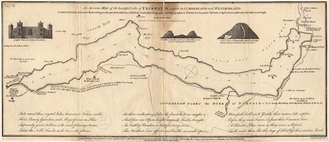 click to enlarge click to enlargeCT05.jpg "An Accurate MAP of the beautiful Lake of ULLS-WATER, situate in CUMBERLAND and WESTMORLAND." Map title. item:- Armitt Library : 1959.191.7 Image © see bottom of page |
|||||||||||||||||||||||||
|
|
||||||||||||||||||||||||||
| evidence:- | old map:- West 1784 map placename:- Ulls Water |
|||||||||||||||||||||||||
| source data:- | Map, hand coloured engraving, A Map of the Lakes in Cumberland,
Westmorland and Lancashire, scale about 3.5 miles to 1 inch,
engraved by Paas, 53 Holborn, London, about 1784.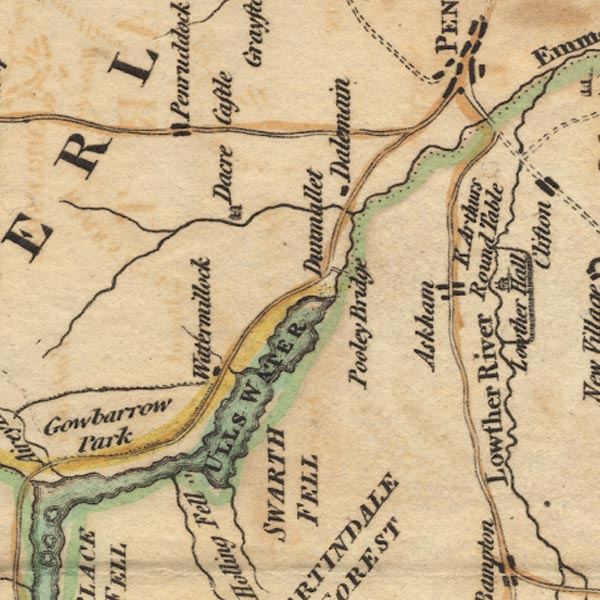 Ws02NY42.jpg  Ws02NY31.jpg "ULLS WATER" The tinted county boundary puts the whole lake in Cumberland. item:- Armitt Library : A1221.1 Image © see bottom of page |
|||||||||||||||||||||||||
|
|
||||||||||||||||||||||||||
| evidence:- | old print:- Middiman 1784-92 placename:- Ulleswater |
|||||||||||||||||||||||||
| source data:- | Print, uncoloured engraving, Ulleswater, Westmorland and Cumberland, painted by G
Barrett, engraved and published by Samuel Middiman, 3 Grafton Street, Tottenham Court
Road, London, 1784.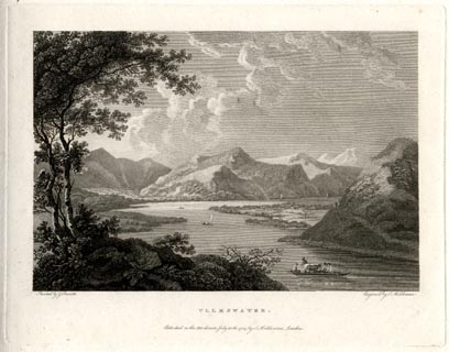 click to enlarge click to enlargeMM0202.jpg "Painted by G. Barrett. / Engrav'd by S. Middiman. / ULLESWATER. / Publish'd as the Act directs, July 30th. 1784, by S. Middiman, London." Accompanying text:- "ULLESWATER" "THE Lake of Ulleswater is inclosed with a Range of Mountains that finely retire from its Margin, which is every where bordered with beautiful Enclosures, that wave upwards in the most Picturesque Manner: The Hills at the Head of the Lake rise abruptly from the Water, rugged and irregular in Outline, yet inferior to the sublime Scenes iin the Environs of Keswick. From Dunmallet, at the Foot of Ulleswater, there is a grand View of the Lake, extending beyond the first great Bend at Hollin-Fell. The numerous Promontories that every where jut into the Water lessen its Dignity as a Lake; yet, when viewed from any Eminence, Dunmallet excepted, it retains the Appearance of a magnificent winding River. This View represents in front, Soulby-Fell, an almost circular Hill, covered with Fern, the Road winding round its Base: Beyond, the white Front of Watermillock, on the Edge of the Lake, backed with cultivated Lands, that are spotted with Farm Houses, form some of the finest rural Accompaniments imaginable." "Opposite Watermillock rises Swarth-Fell, down whose rugged Side Swarth-Beck descends in a Cataract to the Lake. Advancing upwards, the vast Chaos of Mountains that guard the Head of the Lake strangely intersect each other, overtopped by Helvellyn and Stone-Cross Pike." "At Hollin-Fell, a round green Hill in the Center of this View, the Lake is narrowed by a bold Promontory, but soon spreads itself; and, turning at the Foot of Place-Fell, advances in a Reach of near two Miles, with equal Breadth towards Patterdale, decorated with rocky Isles, where it is joined by Goldrill-Beck in the Middle of the Vale." "On the Top of Dunmallet are the Remains of a Fort, still visible; and the Well that supplied the Guard was but a few Years ago filled up with Stones." item:- Armitt Library : A6859.2 Image © see bottom of page |
|||||||||||||||||||||||||
|
|
||||||||||||||||||||||||||
| evidence:- | old sketch map:- Gilpin 1786 placename:- Ulleswater |
|||||||||||||||||||||||||
| source data:- | Sketch map, Ulleswater, Westmorland and Cumberland, by William Gilpin, 1772-74. goto source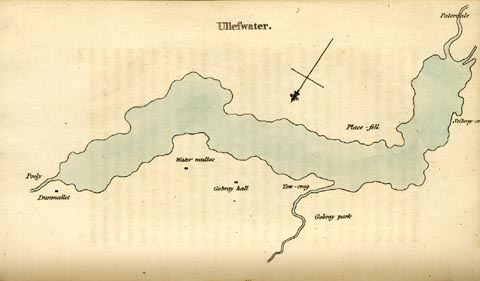 click to enlarge click to enlargeGLP317.jpg Plate vol 2 opposite p.51 in Observations on Picturesque Beauty published by T Cadell and W Davies, Strand, London, 1808. caption from the list of plates:- "This plan of Ulleswater, like the others, is not very exact; but enough so, to give an idea of it's general shape, and the relative situation of the several places on it's shores." item:- Armitt Library : A918.17 Image © see bottom of page |
|||||||||||||||||||||||||
|
|
||||||||||||||||||||||||||
| evidence:- | old print:- Gilpin 1786 placename:- Ulleswater |
|||||||||||||||||||||||||
| source data:- | Print, aquatint, Ullswater, by William Gilpin, 1772-74. goto source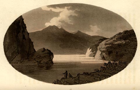 click to enlarge click to enlargeGLP318.jpg plate opposite vol.2 p.55 in Observations on Picturesque Beauty published by T Cadell and W Davies, Strand, London, 1808. caption from the list of plates:- "This print illustrates that kind of scenery, which is presented by Ulleswater. It is, by no means, a portrait: but it gives some idea of the view towards Patterdale, in which the rocky promontory on the left, and the two woody promontories on the right, are conspicuous features." item:- Armitt Library : A918.18 Image © see bottom of page |
|||||||||||||||||||||||||
|
|
||||||||||||||||||||||||||
| evidence:- | old print:- Gilpin 1786 (?edn) placename:- Ulleswater |
|||||||||||||||||||||||||
| source data:- | Print, aquatint, Ullswater, by William Gilpin, 1772-74.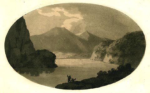 click to enlarge click to enlargePR0457.jpg Included in vol.2 opposite p.53 in Observations, Relative Chiefly to Picturesque Beauty, published by T Cadell and W Davies, Strand, London, 1786. caption from the list of plates:- "This print illustrates that kind of scenery, which is presented by Ulleswater. It is, by no means, a portrait: but it gives some idea of the view towards Patterdale, in which the rocky promontory on the left, and the two woody promontories on the right, are conspicuous features." item:- Dove Cottage : 2008.107.425 Image © see bottom of page |
|||||||||||||||||||||||||
|
|
||||||||||||||||||||||||||
| evidence:- | old text:- Gilpin 1786 placename:- Ulleswater |
|||||||||||||||||||||||||
| source data:- | Book, Observations, Relative Chiefly to Picturesque Beauty, Made
in the Year 1772, on Several Parts of England, Particularly the
Mountains, and Lakes of Cumberland Westmoreland, by Rev William
Gilpin, 1772-74; published 1786-1808. goto source vol.2 p.51 "... and Ulleswater may all be called boundary-lakes. One end of each participates more of the rugged country; and the other of the cultivated: tho each end participates, in some degree, of both. A few traits of romantic scenery are added to the tameness of one end; while the native horror of the other is softened by a few chearful appendages." "The form of Ulleswater resembles a Z; only there is no angular acuteness in it's line. It spreads every where in an easy curve; beautifully broken in some parts by promontories.- The middle reach contains in length near two thirds of the lake. The southern side is mountainous; and becomes more so, as it verges towards the west. As the mountains approach the north, they glide (as we have see is usual in boundary-lakes) into meadows" goto sourcevol.2 p.52 "and pastures. The northern end and western sides contain a great variety of woody and rocky scenes; but these also, as they approach the east, become smooth and fertilized. At the southern point, under impending mountains, lies the village of Patterdale.- With this general idea of Ulleswater, let us return to the descent from Matterdale, where we caught the first view of it." "As we descended a little further, the whole scene of the lake opened before us; and such a scene, as almost drew from us the apostrophe of the inraptured bard," "Visions of glory, spare my aching sight!" "Among all the visions of this inchanting country, we had seen nothing so beautifully sublime, so correctly picturesque as this.- And yet I am averse to make comparisons; especially on seeing a country but once. Much depends on the circumstances of light, and weather. I would wish therefore only to say, that I was more pleased with Ulleswater, than with any lake I had seen; adding, at the same time, that we were fortunate in a concurrence" goto sourcevol.2 p.53 "of incidents, that aided it's beauty. We had hitherto seen all the lakes we had visited, under a rough, or cloudy sky: and tho their dignity was certainly increased by that circumstance; yet the beauty of a lake in splendid, serene weather, aided, at this time, by the powers of contrast, made a wonderful impression on the imagination." ""The effect of the sublime, Mr. Burke informs us, is astonishment; and the effect of beauty, is pleasure: but when the two ingredients mix, the effect, he says, is in a good measure destroyed in both. They constitute a species something different both from the sublime and beautiful, which I have before called fine: but this kind, I imagine, has not such a power on the passions, either as vast bodies have, which are endowed with the correspondent qualities of the sublime; or as the qualities of beauty have, when united in a small object. The affection produced by large bodies, adorned with the spoils of beauty, is a tention conti-" goto sourcevol.2 p.54 "[conti]nually relieved; which approaches to the nature of mediocrity *."" "This refined reasoning does not seem intirely grounded on experience.- I do not remember any scene in which beauty and sublimity, according to my ideas, are more blended than in this: and tho Mr. Burke's ideas of beauty are perhaps more exceptionable, than his ideas of the sublime; yet it happens, that most of the qualities, which he predicates of both, unite also in this scene. Their effect therefore, according to his argument, should be destroyed. But the feelings of every lover of nature, on viewing these scenes, I dare be bold to say, would revolt from such reasoning." "The fore-ground of the grand view before us, is a part of Gobray-park, which belongs to the duke of Norfolk: rough, broken, and woody. Among the old oaks, which inriched it, herds of deer, and cattle grazed in groups. Beyond this is spread an extensive reach of the lake, winding round a rocky promontory on the left;" "[2.54.*] Sublime and beautiful, part IV. sect.25." goto sourcevol.2 p.55 "which is the point of a mountain, called Martindale-fell, or Place-fell: the southern boundary of the lake. This promontory uniting with the mountain, lets it easily down into the water, as by a step. An hesitation, if I may so call it, of this kind, eases greatly the heaviness of a line. In a distance, it is of less consequence: but in all the nearer grounds, it is necessary. ..." "Martindale-fell is entirely unplanted; but it's line, and surface are both well varied. Numberless breaks (little vallies, and knolls) give it a lightness, without injuring it's simplicity." "Such was the disposition of the objects, on the left of the lake: on the right, two woody promontories, pursuing each other in perspective, made a beautiful contrast with the smooth continuity of Martindale-fell." "In front, the distance was composed of mountains, falling gently into the lake; near" goto sourcevol.2 p.56 "the edge of which lies the village of Patterdale." "We took this view at a point, which had just so much elevation, as to give variety to the lines of the lake. As we descended to the water, the view was still grand, and beautiful, but had lost some of it's more picturesque beauties: it had lost the fore-ground: it had lost the sweeping line round the mountain on the left: and it had lost the recess between the two woody promontories on the right. The whole margin of the lake was nearly reduced to one straight line.- The beauty of a view, especially in lake-scenery, we have before observed *, depends greatly on the nice position of it's point." "Having spent some time in examining this very inchanting scene, we skirted the lake towards Patterdale, on a tolerable road, which runs from one end of it to the other: on the south it is continued to Ambleside; on the north to Penrith. I call it a tolerable road; but I mean only for horses. It has not the" "[2.56.*] See page 96. Vol. 1." goto sourcevol.2 p.57 "quartering and commodious width of a carriage road." "As we left Gobray-park, we took our rout along the margin of the first of those woody promontories on the right. We were carried by the side of the lake, through close lanes, and thick groves: yet not so thick, but that we had every where, through the openings of the trees, and windings of the road, views in front, and on the right, into woody recesses; some of which were very pleasing: and on the left, the lake, and all it's distant furniture, broke frequently upon us." "..." |
|||||||||||||||||||||||||
|
|
||||||||||||||||||||||||||
| evidence:- | old text:- Clarke 1787 placename:- Ulswater item:- boat; rowing boat; gun; echoes; fishing |
|||||||||||||||||||||||||
| source data:- | Guide book, A Survey of the Lakes of Cumberland, Westmorland,
and Lancashire, written and published by James Clarke, Penrith,
Cumberland, and in London etc, 1787; published 1787-93. goto source Page 25:- "[at Pooley Bridge] ... As the beauties of the Lake can no otherwise be seen to perfection, we must here embark for that delightful expedition: this we may do either in one of the boats kept by Edward Richardson, at the sign of the Sun, or in that with which the Earl of Surrey politely gives leave to his keeper to accommodate any gentleman who desires it. Richardson's boats are neat and in good repair, but his Lordship's is truly worthy its noble owner. It is adapted for eight rowers, (for whom there are likewise caps and shirts,) and mounts twelve brass swivel guns, for the purpose of trying the echoes: the pay of the rowers here is 2s. a day for each man, and they are always provided with ammunition for the guns." "... It will also much enhance the pleasure, if they previously send notice to the fishermen at How-Town, or Water-Millock, to prepare their boats and nets; so that at their return, which will be about five hours, they may see the manner of taking the different kinds of fish. The price of these fishermen is three draughts for five shillings, and the fish they take is the property of their employers. Those who are fond of angling will do well to take their tackle with them, as perhaps they can no where meet with better sport. I one day caught, in this manner, between Powley and the small island, twenty-nine trouts." "..." |
|||||||||||||||||||||||||
|
|
||||||||||||||||||||||||||
| evidence:- | old text:- Clarke 1787 placename:- Ulswater placename:- Ulphus Water placename:- Wolfs Water item:- placename, Ullswater; wolf |
|||||||||||||||||||||||||
| source data:- | Guide book, A Survey of the Lakes of Cumberland, Westmorland,
and Lancashire, written and published by James Clarke, Penrith,
Cumberland, and in London etc, 1787; published 1787-93. goto source Page 27:- "... a tradition, that Liolf, Lyulph, or Ligwulf, the first owner of this Lake, had a tower here, and gave his name to the Lake. But this is denied by some, who assert that Ulpha, or Ulphus, had this honour, and that the name of Ulswater is merely a contraction of Ulphus-Water. To me it scarce appears credible that ever this Lake had only one owner, and of course, that it had its name on some other account, though perhaps it might be Wolfs-Water, as the deep woods, and almost inaccessible mountains on the banks of the Lake, would undoubtedly afford a safe asylum to these animals." |
|||||||||||||||||||||||||
|
|
||||||||||||||||||||||||||
| evidence:- | old text:- Clarke 1787 |
|||||||||||||||||||||||||
| source data:- | Guide book, A Survey of the Lakes of Cumberland, Westmorland,
and Lancashire, written and published by James Clarke, Penrith,
Cumberland, and in London etc, 1787; published 1787-93. goto source Page 33:- "..." "It is so much to be wished that the inquisitive traveller had some place of tolerable accommodation at the head of the Lake, so that he might employ two days in viewing its beauties; but this is by no means the case, and he is obliged to see so many things in so short a time, that the fatigue sometimes almost counterbalances the pleasure. The top of the Lake is universally allowed to be the finest part of it, though Mr Gray's well-known timidity would not permit him to visit it: the author of the antiquities of Furness and Mr Cumberland have, however, given it their amplest commendations: the latter of these gentlemen was not upon the Lake, but was highly pleased with it in his ride through Glencoyn woods; and particularly delighted with the dashing of the water against the rocks upon a windy day: it is then indeed an ocean in miniature." |
|||||||||||||||||||||||||
|
|
||||||||||||||||||||||||||
| evidence:- | old text:- Clarke 1787 placename:- Ulswater item:- fishing; fish, Ullswater; trout; perch; eels; char; skelly; grey trout; net; draw net; driving net; fishing net; eel spear |
|||||||||||||||||||||||||
| source data:- | Guide book, A Survey of the Lakes of Cumberland, Westmorland,
and Lancashire, written and published by James Clarke, Penrith,
Cumberland, and in London etc, 1787; published 1787-93. goto source Page 37:- "..." "The fisheries of Ulswater belong to many different persons, and pay to the lord of the adjoining soil a very high quit-rent. Mr Hodgkinson has by much the largest share, viz. from Stibray to Hole-Beck in Gowbarrow. The fish found in this Lake are trout, perch, eels, char, skellies; and a fish peculiar to this and buttermere, (where there are very few,) called Grey Trout. These grey trouts in form resemble the other trouts, but are much larger, weighing thirty or forty pounds: one was killed a few years ago which weighed fifty-six; but the ordinary weight is from seven to twenty pounds each. They are found chiefly in the deep water, below House-Holm island: they are, however, sometimes taken in all parts of the Lake, though but seldom, except in October, which is their spawning time. During that month the King of Patterdale usually sets a net across the foot of Coldrill-Beck, where most of them go up to spawn: a few indeed attempt getting up at Glenridding-Beck, but not one has ever been known to enter any other of the streams. Some of the trouts, however, escape the net, but are generally taken by the neighbouring farmers, who strike them at night-time with spears by the light of a torch. These unlawful practices the Gentlemen of the neighbourhood have not been able to prevent: It is indeed impossible they should, for" |
|||||||||||||||||||||||||
| source data:- | goto source Page 38:- "the farmers of the fisheries connive at them, because the grey trouts prey upon the small trouts and char, upon which their profits depend; and so voracious are they, that I have seen two trouts, near a pound weight each, taken out of the belly of one of the large ones. They are taken with nets, but will sometimes rise at the fly: their strength, however, makes them very difficult to kill. One indeed I killed by accident, for it had taken the fly as my rod was lying over the edge of the boat; it dragged the rod into the water, and there struggled with it till weary. The fish weighed upwards of seven pounds, and was the only one I ever caught with a line. They are a very fine fish when caught in proper season, and even those killed in the streams are by some much relished, when pickled or dried." "The char of this Lake are smaller than those of Winandermere, but in my opinion equal in flavour to the best of them: There is indeed one species of char in Winandermere, called Red-bellied Char, which is far inferior to the Ulswater char: these are the kind usually sent to the metropolis, but as they have the name, it is enough. The skelly is remarkable for this, no bait has ever been found which they will take: they seem to be a species of fresh water herrings, as they resemble the sea herring both in size and shape. Like the herring, they assemble in vast numbers during the harvest months, rippling the surface of the water, and are called Schools, or, (in the country dialect,) Skyuls. of Skellies. When they lye in water not too deep, vast numbers are taken at one draught, sometimes ten or twelve thousands. Sometimes the schools lye so near together, and the fishermen take such numbers, that carts are employed to carry them to the adjacent market towns. They weigh about five ounces each, and 800 are commonly reckoned as many as one horse can draw: they are at these times extremely cheap, generally a penny a pound; but I have seen two Winchester pecks of them sold for a shilling." "The smaller trouts, perch, and eels, have nothing peculiar in them: the trouts go up all the small streams, (particularly Sandwich-Beck,) to spawn, and are caught with a fly. The perch lay their spawn in the months of May and June among the tall weeds which grow in the water; they are taken with a worm, but never rise at a fly. The skellies spawn in the Winter among the mud at the bottom of the Lake, and, (as I said before,) take no bait whatever. The eels differ in nothing from those in other waters, and may be caught in the same manner as perch." "There are only two kinds of nets used in Ulswater for the taking of fish, the Drawing Net and the Driving Net. The drawing net is generally about thirty yards long, and four deep; the upper edge floated with cork, and the lower edge weighted with lead. The method of using it is thus: They put the net into the water, and let the ropes, (fastened to each end of it) run to a length proportional to the depth of the water; they then by the help of these ropes drag the net to the shore, and take out the fish. It is evident, however, that this net cannot be used where the shore is stony: to remedy this, therefore, the driving net has been contrived, and has only been lately introduced here. The driving net is made of fine, small, bleached thread, and has only one short rope to it, to the end whereof is fixed a float that enables the fishers to find the net. This net they place parallel to the shore, at the depth of two fathoms, or less, and usually have several of them in the water at once. When they take up one of them, they first row the boat between the net and the shore, disturbing the water as much as they can: this affrights the fish, (who are generally near the shore,) and makes them run for the deeps, when they are intercepted by the small, and almost invisible net, placed to receive them: the fishers then haul the net into their boat, and take out the fish, (which are generally caught either by their gills or middle,) without being obliged to go ashore: it is, however, plain that by these nets neither very large nor very small fish can be taken." "Before the invention of driving nets the greatest part of the Lake was protected by its stony bottom, so that the angler might, in five or six hours, catch from sixteen to" |
|||||||||||||||||||||||||
| source data:- | goto source Page 39:- "twenty pounds of fish: since this invention has taken place, the fish are so far decreased in number, that he will seldom take more than half that quantity." "An expeditious method of taking eels is used here. Two or more persons go in a boat, in a Summer morning, from three till six o'clock; one gently moves the boat by the margin of the Lake, whilst the other looks for eels; he no sooner sees one than he strikes it with an eel spear, and by this method great numbers are sometimes caught. I once saw a perch which weighed five pounds struck in this manner." "..." "Before we quit the Lake, it will be proper to give the reader some account of its dimensions. From the mile post at the foot of the Lake, to the top of it, is eight miles and three quarters, by land; by water it is only eight miles and a quarter: the Lake contains 2563 acres of water when low, which gives the breadth, at a mean, almost half a mile, the difference being only 97 acres; when the water is high, we may reckon the breadth half a mile without any sensible error." |
|||||||||||||||||||||||||
|
|
||||||||||||||||||||||||||
| evidence:- | old text:- Clarke 1787 |
|||||||||||||||||||||||||
| source data:- | Guide book, A Survey of the Lakes of Cumberland, Westmorland,
and Lancashire, written and published by James Clarke, Penrith,
Cumberland, and in London etc, 1787; published 1787-93. goto source Page 42:- "... A few words, however, I shall say concerning the general style of the beauties of Ulswater. This Lake exhibits many striking scenes, but there is a peculiarity in all of them. We find neither the rugged horrors of Derwent Water, nor the cultivated scenes of Winandermere. Here gentle sloping declivities, or rocks softened, (if I may be allowed the term,) by time form the banks. The Lake itself is of that magnitude, that though objects on the each side may be distinctly seen from the middle , it is yet large enough to form a fore screen for a landscape in any one part. I believe we may, without hesitation, give it the first place among the Lakes; for whether we consider it as a fund of materials for the draughtsman, or entertainment for the mere spectator, scarce one point upon the water can be taken which will not afford pleasure to both." |
|||||||||||||||||||||||||
|
|
||||||||||||||||||||||||||
| evidence:- | old text:- Clarke 1787 placename:- Ulswater item:- gun; echoes |
|||||||||||||||||||||||||
| source data:- | Guide book, A Survey of the Lakes of Cumberland, Westmorland,
and Lancashire, written and published by James Clarke, Penrith,
Cumberland, and in London etc, 1787; published 1787-93. goto source Page 65:- "... Mr Hutchinson's account of the echoes at Ulswater, ... "Whilst we sat to regale, the barge put off from shore to a station where the finest echoes were to be obtained from the surrounding mountains. The vessel was provided with six brass cannon mounted on swivels: on discharging one of these pieces, the report was echoed from the opposite rocks, where, by reverberation, it seemed to roll from cliff to cliff, and return through every cave and valley, till the decreasing tumult died away upon the ear." ""The instant it ceased, the sound of every distant water-fall was heard; but for an instant only: for the momentary stillness was interrupted by the returning echo on the hills behind; where the report was repeated like a peal of thunder bursting over our heads, continuing for several seconds, flying from haunt to haunt, till once more the sound gradually declined. Again the voice of water-falls possessed the interval, till, to the right, the more distant thunder arose on some other mountains, and seemed to take its way up every winding dale and creek; sometimes behind, on this side, or on that, in wondrous speed running its dreadful course: when the echo reached the mountains within the line and channel of the breeze, it was heard at once on the right and left at the extremities of the Lake. In this manner was the report of every discharge re-echoed seven times distinctly."" |
|||||||||||||||||||||||||
|
|
||||||||||||||||||||||||||
| evidence:- | old text:- Clarke 1787 placename:- Ulswater item:- eagle; fish; kite; eels |
|||||||||||||||||||||||||
| source data:- | Guide book, A Survey of the Lakes of Cumberland, Westmorland,
and Lancashire, written and published by James Clarke, Penrith,
Cumberland, and in London etc, 1787; published 1787-93. goto source Page 189:- "..." "Some persons about four years ago, being a woodcock-shooting, one of them shot at a hare, but did not hit her, as he believed; keeping his eye upon her, he saw an eagle seize her, and fly across Ulswater with her in his talons, and light upon the other side. I once shot at one of them at about 30 yards distances; it flew abut 90 or 100, when I got near it and fired at him again, and so a third time, but did not kill it; I had shot No.4, but durst not attempt it again, for whilst I was loading my gun the fourth time, it came within six or seven yards of me, so fierce as if to begin an attack, so I left it. One thing is remarkable of these large eagles, that so soon as they hear the report of a gun, they immediately fly to the place, and often seize the fowlers victim, if he hath not taken it up before their arrival: they have often been known to seize a dead and wounded bird within a few yards of the person who has shot it, and one of them actually fought a sportsman for a widgeon he had killed. Some of the eagle species are fishers, indeed most of them will occasionally catch fish; and, strange to tell! I have seen them fall quick upon the Lake and bring out a fish: This is a fact on which, (if need be,) I will place my credit as an author. It seems odd that the fish, whose sight and motion are so quick in their own element, cannot escape these huge animals whose element is so widely different. ..." goto sourcePage 190:- "..." "I cannot help here relating what a Mr George Browne, attorney at law, from Troutbeck near Winandermere, and myself once saw. As we were riding along Ulswater side in Gowbarrow, near Ewe Cragg, we observed a kite in the air that had caught an eel, with which it was struggling, (for the eel we could perceive to be alive;) we rode after it, cracking our whips, and roaring as loud as we could; after some time it let the eel fall, which we took up alive: how this kite could catch such a fish I cannot tell, for it weighed fourteen ounces." |
|||||||||||||||||||||||||
|
|
||||||||||||||||||||||||||
| evidence:- | old print:- Clarke 1787 placename:- Ullswater |
|||||||||||||||||||||||||
| source data:- | part outline with form lines click to enlarge click to enlargeCL18.jpg "Ullswater" item:- Armitt Library : A6615.12 Image © see bottom of page |
|||||||||||||||||||||||||
|
|
||||||||||||||||||||||||||
| evidence:- | old map:- Clarke 1787 map (Ullswater) placename:- Ullswater |
|||||||||||||||||||||||||
| source data:- | Map, A Map of the Lake Ullswater and its Environs, scale about
6.5 ins to 1 mile, by James Clarke, engraved by S J Neele, 352
Strand, published by James Clarke, Penrith, Cumberland and in
London etc, 1787. click to enlarge click to enlargeCL04.jpg "A MAP of the LAKE ULLSWATER and its environs" item:- private collection : 10.4 Image © see bottom of page |
|||||||||||||||||||||||||
|
|
||||||||||||||||||||||||||
| evidence:- | old text:- Camden 1789 (Gough Additions) placename:- Ulleswater |
|||||||||||||||||||||||||
| source data:- | Book, Britannia, or A Chorographical Description of the Flourishing Kingdoms of England,
Scotland, and Ireland, by William Camden, 1586, translated from the 1607 Latin edition
by Richard Gough, published London, 1789. goto source Page 162:- "..." "... Ulleswater, a large mere seven or eight miles in length, of great depth, well stocked with fish." |
|||||||||||||||||||||||||
|
|
||||||||||||||||||||||||||
| evidence:- | old map:- Cary 1789 (edn 1805) placename:- Ulles Water |
|||||||||||||||||||||||||
| source data:- | Map, uncoloured engraving, Westmoreland, scale about 2.5 miles
to 1 inch, by John Cary, London, 1789; edition 1805.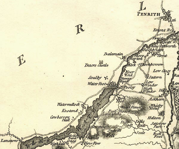 CY24NY42.jpg  CY24NY41.jpg "ULLES WATER" outline with shore form lines; lake or tarn; county boundary item:- JandMN : 129 Image © see bottom of page |
|||||||||||||||||||||||||
|
|
||||||||||||||||||||||||||
| evidence:- | old print:- Farington 1789 placename:- Ulswater |
|||||||||||||||||||||||||
| source data:- | Print, uncoloured engraving, The Lower End of Ulswater, Cumberland, drawn by Joseph
Farington, engraved by W Byrne and T Medland, published by William Byrne, 79 Titchfield
Street, London, 1787.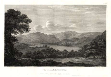 click to enlarge click to enlargeFA0308.jpg printed, top right "No.VIII" printed, bottom left, right, centre "Drawn by Josh. Farington, R.A. / Engraved by W. Byrne &T. Medland. / The lower end of ULSWATER. / Published as the Act directs, 1 January 1787, by W. Byrne, No.79, Titchfield Street, London." item:- Armitt Library : A6668.8 Image © see bottom of page |
|||||||||||||||||||||||||
|
|
||||||||||||||||||||||||||
| evidence:- | old print:- Farington 1789 placename:- Ulswater |
|||||||||||||||||||||||||
| source data:- | Print, uncoloured engraving, The Upper End of Ulswater, Westmorland, drawn by Joseph
Farington, engraved by W Byrne and T Medland, published by William Byrne, 79 Titchfield
Street, London, 1787.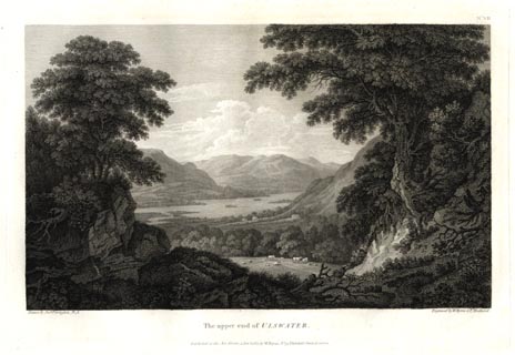 click to enlarge click to enlargeFA0307.jpg printed, top right "No.VII" printed, bottom left, right, centre "Drawn by Josh. Farington, R.A. / Engraved by W. Byrne &T. Medland. / The upper end of ULSWATER. / Published as the Act directs, 1 January 1787, by W. Byrne, No.79, Titchfield Street, London." item:- Armitt Library : A6668.7 Image © see bottom of page |
|||||||||||||||||||||||||
|
|
||||||||||||||||||||||||||
| evidence:- | old print with text:- Farington 1789 (plate 7) |
|||||||||||||||||||||||||
| source data:- | Print, engraving, The Upper End of Ullswater, painted by Joseph Farington, engraved
by W Byrne and T Medland, published by W Byrne, 79 Titchfield Street, London, 1787.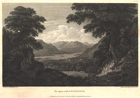 click to enlarge click to enlargeBNF09.jpg Looking north from Martindale fell. Plate 7 from Views of the Lakes, &c, in Cumberland and Westmorland, published 1789; with descriptive text:- "THE UPPER END OF ULLSWATER." "ULLSWATER lies to the east of Derwentwater and to the north of Winandermere. It is size one of the most considerable of the lakes, being in length about eight miles, though it's greatest breadth does not exceed one. It's direction like that of all the others is north and south. In point of beauty is by many thought not inferior to any of them: In one respect it certainly has the superiority, viz. in affording the greatest variety. This advantage it derives from it's shape, which nearly resembles that of the letter Z, but without it's angular sharpness. It is of course separated into three distinct reaches, winding at every turn round some bold projection of the surrounding mountains. This plate presents a prospect of the upper division looking down the lake, as viewed from the skirts of Martindale-fell. The rivulet which serpentizes through the meadows is called Goldrill-beck, and is one of the principal feeders of the lake; it descends from Kirkston-fell, which forms the barrier between Winandermere and Ullswater. This is the only division of the lake, which is adorned with islands." item:- Dove Cottage : Lowther.22 Image © see bottom of page |
|||||||||||||||||||||||||
|
|
||||||||||||||||||||||||||
| evidence:- | old print with text:- Farington 1789 (plate 8) |
|||||||||||||||||||||||||
| source data:- | Print, engraving, The Lower End of Ullswater, painted by Joseph Farington, engraved
by W Byrne and T Medland, published by W Byrne, 79 Titchfield Street, London, 1787.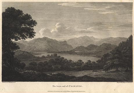 click to enlarge click to enlargeBNF10.jpg Looking south from Bowerbank, Barton. Plate 8 from Views of the Lakes, &c, in Cumberland and Westmorland, published 1789; with descriptive text:- "THE LOWER END OF ULLSWATER." "THIS plate gives a view of the lowest each of Ullswater. It is of a very different character from the other two divisions. Those appear to the eye compleatly environed by impending mountains, whereas this, if Dunmallet were removed, would lie entirely open to the adjacent country. Dunmallet is a hill of a regular conic form, of no great height, and somewhat formally planted with wood. On it's top are the vestiges of a Roman fortress, well adapted, like that on Castle-crag, at the head of Derwentwater, to command all the avenues of the country. The view is taken near a farm-house called Bowerbank overlooking the village of Pooley which stands upon the outlet of the lake. The river here takes the name of Emont and after a course of eight or ten miles falls into the Eden. The wood rising on the right of the fore-ground is part of Dunmallet. In the first distance near the center appears Watermellock, the habitation of Mr. Robinson, charmingly situated upon an eminence. The hills on the left are Place-fell, &c. In the most remote distance rises Helvellyn which disputes pre-eminence in respect of altitude with Skiddaw and Cross-fell." item:- Dove Cottage : Lowther.23 Image © see bottom of page |
|||||||||||||||||||||||||
|
|
||||||||||||||||||||||||||
| evidence:- | old print:- Farington 1789 placename:- Ulswater |
|||||||||||||||||||||||||
| source data:- | Print, uncoloured engraving, The Lower End of Ulswater, Cumberland, drawn by Joseph
Farington, engraved by W Byrne and T Medland, published by William Byrne, 79 Titchfield
Street, London, 1787. click to enlarge FA0308.jpg printed, top right "No.VIII" printed, bottom left, right, centre "Drawn by Josh. Farington, R.A. / Engraved by W. Byrne &T. Medland. / The lower end of ULSWATER. / Published as the Act directs, 1 January 1787, by W. Byrne, No.79, Titchfield Street, London." item:- Armitt Library : A6668.8 Image © see bottom of page |
|||||||||||||||||||||||||
|
|
||||||||||||||||||||||||||
| evidence:- | old print:- Farington 1789 placename:- Ulswater |
|||||||||||||||||||||||||
| source data:- | Print, uncoloured engraving, The Upper End of Ulswater, Westmorland, drawn by Joseph
Farington, engraved by W Byrne and T Medland, published by William Byrne, 79 Titchfield
Street, London, 1787. click to enlarge FA0307.jpg printed, top right "No.VII" printed, bottom left, right, centre "Drawn by Josh. Farington, R.A. / Engraved by W. Byrne &T. Medland. / The upper end of ULSWATER. / Published as the Act directs, 1 January 1787, by W. Byrne, No.79, Titchfield Street, London." item:- Armitt Library : A6668.7 Image © see bottom of page |
|||||||||||||||||||||||||
|
|
||||||||||||||||||||||||||
| evidence:- | old print with text:- Farington 1789 (plate 7) |
|||||||||||||||||||||||||
| source data:- | Print, engraving, The Upper End of Ullswater, painted by Joseph Farington, engraved
by W Byrne and T Medland, published by W Byrne, 79 Titchfield Street, London, 1787. click to enlarge BNF09.jpg Looking north from Martindale fell. Plate 7 from Views of the Lakes, &c, in Cumberland and Westmorland, published 1789; with descriptive text:- "THE UPPER END OF ULLSWATER." "ULLSWATER lies to the east of Derwentwater and to the north of Winandermere. It is size one of the most considerable of the lakes, being in length about eight miles, though it's greatest breadth does not exceed one. It's direction like that of all the others is north and south. In point of beauty is by many thought not inferior to any of them: In one respect it certainly has the superiority, viz. in affording the greatest variety. This advantage it derives from it's shape, which nearly resembles that of the letter Z, but without it's angular sharpness. It is of course separated into three distinct reaches, winding at every turn round some bold projection of the surrounding mountains. This plate presents a prospect of the upper division looking down the lake, as viewed from the skirts of Martindale-fell. The rivulet which serpentizes through the meadows is called Goldrill-beck, and is one of the principal feeders of the lake; it descends from Kirkston-fell, which forms the barrier between Winandermere and Ullswater. This is the only division of the lake, which is adorned with islands." item:- Dove Cottage : Lowther.22 Image © see bottom of page |
|||||||||||||||||||||||||
|
|
||||||||||||||||||||||||||
| evidence:- | old print with text:- Farington 1789 (plate 8) |
|||||||||||||||||||||||||
| source data:- | Print, engraving, The Lower End of Ullswater, painted by Joseph Farington, engraved
by W Byrne and T Medland, published by W Byrne, 79 Titchfield Street, London, 1787. click to enlarge BNF10.jpg Looking south from Bowerbank, Barton. Plate 8 from Views of the Lakes, &c, in Cumberland and Westmorland, published 1789; with descriptive text:- "THE LOWER END OF ULLSWATER." "THIS plate gives a view of the lowest each of Ullswater. It is of a very different character from the other two divisions. Those appear to the eye compleatly environed by impending mountains, whereas this, if Dunmallet were removed, would lie entirely open to the adjacent country. Dunmallet is a hill of a regular conic form, of no great height, and somewhat formally planted with wood. On it's top are the vestiges of a Roman fortress, well adapted, like that on Castle-crag, at the head of Derwentwater, to command all the avenues of the country. The view is taken near a farm-house called Bowerbank overlooking the village of Pooley which stands upon the outlet of the lake. The river here takes the name of Emont and after a course of eight or ten miles falls into the Eden. The wood rising on the right of the fore-ground is part of Dunmallet. In the first distance near the center appears Watermellock, the habitation of Mr. Robinson, charmingly situated upon an eminence. The hills on the left are Place-fell, &c. In the most remote distance rises Helvellyn which disputes pre-eminence in respect of altitude with Skiddaw and Cross-fell." item:- Dove Cottage : Lowther.23 Image © see bottom of page |
|||||||||||||||||||||||||
|
|
||||||||||||||||||||||||||
| evidence:- | old map:- Aikin 1790 (Wmd) placename:- Ulles Water |
|||||||||||||||||||||||||
| source data:- | Map, uncoloured engraving, Westmoreland ie Westmorland, scale
about 8.5 miles to 1 inch, by John Aikin, London, 1790. click to enlarge click to enlargeAIK2.jpg "Ulles Water" outline with form lines; lake; on county boundary item:- JandMN : 51 Image © see bottom of page |
|||||||||||||||||||||||||
|
|
||||||||||||||||||||||||||
| evidence:- | old map:- Aikin 1790 (Cmd) placename:- Ulles Lake |
|||||||||||||||||||||||||
| source data:- | Map, uncoloured engraving, Cumberland, by John Aikin, London,
1790. click to enlarge click to enlargeAIK3.jpg "Ulles Lake" outline with form lines; lake; on county boundary item:- JandMN : 145 Image © see bottom of page |
|||||||||||||||||||||||||
|
|
||||||||||||||||||||||||||
| evidence:- | old painting:- Green 1790s-1820s item:- boat; sailing boat |
|||||||||||||||||||||||||
| source data:- | Painting, watercolour, Ullswater, Westmorland and Cumberland, by William Green, Ambleside,
Westmorland, 1800s-10s?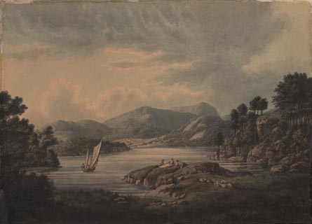 click to enlarge click to enlargePR1744.jpg item:- Dove Cottage : 1998.72.2 Image © see bottom of page |
|||||||||||||||||||||||||
|
|
||||||||||||||||||||||||||
| evidence:- | old map:- Bailey 1797 placename:- Ulles Water |
|||||||||||||||||||||||||
| source data:- | Map, soil etc, uncoloured engraving, Westmoreland, scale about
12 miles to 1 inch, by J Bailey, engraved by Neele, Strand,
published by Messrs Robinson, Paternoster Row and G Nicol, Pall
Mall, London, 1797. click to enlarge click to enlargeBY05.jpg "Ulles Water" outline with form lines; lake; on county boundary item:- Armitt Library : A680.3 Image © see bottom of page |
|||||||||||||||||||||||||
|
|
||||||||||||||||||||||||||
| evidence:- | old map:- Bailey 1797 placename:- Ulles Water |
|||||||||||||||||||||||||
| source data:- | Map, soil etc, uncoloured engraving, Cumberland, scale about 21
miles to 1 inch, by J Bailey, engraved by Neele, Strand,
published by Messrs Robinson, Paternoster Row and G Nicol, Pall
Mall, London, 1797. click to enlarge click to enlargeBY04.jpg "Ulles Water" outline with form lines; lake; on county boundary item:- Armitt Library : A680.2 Image © see bottom of page |
|||||||||||||||||||||||||
|
|
||||||||||||||||||||||||||
| evidence:- | old map:- Housman 1800 map 4 placename:- Ulles Water |
|||||||||||||||||||||||||
| source data:- | Maps, hand coloured engraving, Lakes in Lancashire and Westmorland, 7 lakes on one
sheet, engraved by McIntyre, Edinburgh, published by F Jollie, Carlisle, Cumberland,
and C Law, Ave Maria Lane, London, 1800.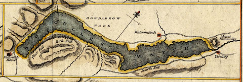 click to enlarge click to enlargeHM02Ull.jpg "ULLES WATER" item:- Dove Cottage : 2007.38.97 Image © see bottom of page |
|||||||||||||||||||||||||
|
|
||||||||||||||||||||||||||
| evidence:- | descriptive text:- Baker 1802 placename:- Ullswater |
|||||||||||||||||||||||||
| source data:- | Perspective road map with sections in Lancashire, Westmorland,
and Cumberland, by J Baker, London 1802. pp.25-26:- "..." "... Hawswater, which with Ullswater, (that may also be reached from a short road, dividing from the next stage), are ornamented with a variety of abrupt and terrific precipices, ..." |
|||||||||||||||||||||||||
|
|
||||||||||||||||||||||||||
| evidence:- | old map:- Baker 1802 |
|||||||||||||||||||||||||
| source data:- | Perspective road maps with sections in Lancashire, Westmorland
and Cumberland, by J Baker, London 1802. Bk03Vg05.jpg item:- private collection : 3 Image © see bottom of page |
|||||||||||||||||||||||||
|
|
||||||||||||||||||||||||||
| evidence:- | old map:- Cooke 1802 placename:- Ulles Water |
|||||||||||||||||||||||||
| source data:- | Map, The Lakes, Westmorland and Cumberland, scale about 8.5
miles to 1 inch, engravedby Neele and Son, published by
Sherwood, Jones and Co, Paternoster Road, London, 1824. click to enlarge click to enlargeGRA1Lk.jpg "Ulles Water" outline with form lines; lake or tarn; across county boundary item:- Hampshire Museums : FA2000.62.5 Image © see bottom of page |
|||||||||||||||||||||||||
|
|
||||||||||||||||||||||||||
| evidence:- | old map:- Cooke 1802 placename:- Ulles Water |
|||||||||||||||||||||||||
| source data:- | Map, Westmoreland ie Westmorland, scale about 12 miles to 1
inch, by George Cooke, 1802, published by Sherwood, Jones and
Co, Paternoster Road, London, 1824. click to enlarge click to enlargeGRA1Wd.jpg "Ulles Water" outline with form lines; lake or tarn; across county boundary item:- Hampshire Museums : FA2000.62.4 Image © see bottom of page |
|||||||||||||||||||||||||
|
|
||||||||||||||||||||||||||
| evidence:- | old map:- Cooke 1802 placename:- Ulles Water |
|||||||||||||||||||||||||
| source data:- | Map, Cumberland, scale about 15.5 miles to 1 inch, by George
Cooke, 1802, bound in Gray's New Book of Roads, 1824, published
by Sherwood, Jones and Co, Paternoster Road, London, 1824. click to enlarge click to enlargeGRA1Cd.jpg "Ulles Water" outline with form lines; lake or tarn, across county boundary item:- Hampshire Museums : FA2000.62.2 Image © see bottom of page |
|||||||||||||||||||||||||
|
|
||||||||||||||||||||||||||
| evidence:- | old print:- Green 1804 (plate 31) placename:- Ulls Water item:- cattle |
|||||||||||||||||||||||||
| source data:- | Print, uncoloured aquatint, Ulls Water, from Martindale, Westmorland, by William Green,
Ambleside, Westmorland, 1804.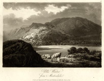 click to enlarge click to enlargeGN1631.jpg Plate 31 from a series. printed at bottom:- "Ulls Water, / from Martindale. / Drawn and Engraved by Wm. Green, and Published at Ambleside, June 24, 1804." printed at top right:- "31" item:- Armitt Library : 2014.179 Image © see bottom of page |
|||||||||||||||||||||||||
|
|
||||||||||||||||||||||||||
| evidence:- | old print:- Green 1804 (plate 32) placename:- Ulls Water item:- deer |
|||||||||||||||||||||||||
| source data:- | Print, uncoloured aquatint, Ulls Water from Lyulph's Tower, Matterdale, Cumberland,
by William Green, Ambleside, Westmorland, 1804.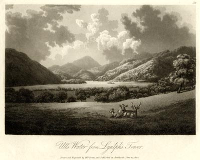 click to enlarge click to enlargeGN1632.jpg Plate 32 from a series. printed at bottom:- "Ulls Water from Lyulph's Tower. / Drawn and Engraved by Wm. Green, and Published at Ambleside, June 24, 1804." printed at top right:- "32" item:- Armitt Library : 2014.182 Image © see bottom of page |
|||||||||||||||||||||||||
|
|
||||||||||||||||||||||||||
| evidence:- | old map:- Laurie and Whittle 1806 placename:- Ulles Water |
|||||||||||||||||||||||||
| source data:- | Road map, Completion of the Roads to the Lakes, scale about 10
miles to 1 inch, by Nathaniel Coltman? 1806, published by Robert
H Laurie, 53 Fleet Street, London, 1834. click to enlarge click to enlargeLw18.jpg "Ulles Water" lake item:- private collection : 18.18 Image © see bottom of page |
|||||||||||||||||||||||||
|
|
||||||||||||||||||||||||||
| evidence:- | old text:- Capper 1808 placename:- Ulswater |
|||||||||||||||||||||||||
| source data:- | Gazetteer, A Topographical Dictionary of the United Kingdom,
compiled by Benjamin Pitts Capper, published by Richard
Phillips, Bridge Street, Blackfriars, London, 1808; published
1808-29. goto source "[Keswick] ... a few miles to the east Ulswater, being about 9 miles long in the shape of an S, and above 1 mile wide. ..." |
|||||||||||||||||||||||||
|
|
||||||||||||||||||||||||||
| evidence:- | old map:- Cooper 1808 placename:- Ulles Water |
|||||||||||||||||||||||||
| source data:- | Map, hand coloured engraving, Westmoreland ie Westmorland, scale
about 9 miles to 1 inch, by H Cooper, 1808, published by R
Phillips, Bridge Street, Blackfriars, London, 1808. click to enlarge click to enlargeCOP4.jpg "Ulles Water" outline, shaded; lake; on county boundary, part in Cumberland item:- Dove Cottage : 2007.38.53 Image © see bottom of page |
|||||||||||||||||||||||||
|
|
||||||||||||||||||||||||||
| evidence:- | old map:- Cooper 1808 placename:- Ulles Water |
|||||||||||||||||||||||||
| source data:- | Map, uncoloured engraving, Cumberland, scale about 10.5 miles to
1 inch, drawn and engraved by Cooper, published by R Phillips,
Bridge Street, Blackfriars, London, 1808. click to enlarge click to enlargeCOP3.jpg "Ulles Water" outline, shaded; lake across county boundary item:- JandMN : 86 Image © see bottom of page |
|||||||||||||||||||||||||
|
|
||||||||||||||||||||||||||
| evidence:- | old text:- Green 1810 placename:- Ulls Water |
|||||||||||||||||||||||||
| source data:- | Set of prints, soft ground etchings, Sixty Studies from Nature,
by William Green, Ambleside, Westmorland, drawn 1808-10,
published 1810. goto source page 110:- "... it will be conveniently seen on their progress from that place [Penrith] to Ambleside, which is twenty-four miles; eighteen or nineteen of this ride (from Penrith to Brother Water) are by turns beautiful and sublime." "Visitors from Scotland or the north of England should take Ulls Water on their road to Ambleside; in this way they face the best scenery of the lake - if this journey is to be performed in one day, the traveller must alight at Gow-barrow Park, to see, from Lyulph's Tower, one of the first-rate views upon the lake ... Those who wish to spend more time at Ulls Water, may discharge their horses at Patterdale; but as there are no post horses there, when wanted, they must be sent for to Ambleside." "Tourists from the south usually enter this country by Kendal or Ulverstone, and such will take the lake of Ulls" page 111:- "Water with most convenience from Ambleside." "..." "The head of Ulls Water lies south-" goto sourcepage 112:- "[south-]west of its foot, the lake is of an irregular figure, and composed of three unequal reaches, the middle of which is somewhat larger than the northern one; the shortest is seen from the inn at Patterdale, and is not half the length of either of the others: Ulls Water is less unequal in its breadth than the other lakes, it is in many places not more than half a mile across, but seldom exceeds three quarters; it is less than Windermere, but larger than the rest of the English lakes." "Ulls Water lies engulphed at the feet of majestic mountains, which rise sublimely from the valley: Place Fell descends shivering into the lake almost perpendicularly from a vast height; it skirts the lake from Birk Fell Force higher than its head. The opposite mountains are less uniform, their summits are removed to various and greater distances from the water, and" page 113:- "the rocks project from their surfaces in a style of superior grandeur." "Were these mountains divested of wood, they would exhibit a vastness and sublimity rivalled only by those of Wast Water." "Nothing can exceed the dresses and the decorations of this sublimity; the whole space from Gow-barrow to the inn at Patterdale is one rich scene of vegetation; oak, ash, birch, alder, and other trees of stately growth, and in the wildest luxuriance, undulating, and impending over the rocky protuberances every where starting from the mountains, render this the loveliest ride amongst the lakes." "..." |
|||||||||||||||||||||||||
|
|
||||||||||||||||||||||||||
| evidence:- | old map:- Wallis 1810 (Wmd/Cmd) placename:- Ulles Water |
|||||||||||||||||||||||||
| source data:- | Road map, Westmoreland, scale about 19 miles to 1 inch, by James
Wallis, 77 Berwick Street, Soho, 1810, published by W Lewis,
Finch Lane, London, 1835? click to enlarge click to enlargeWAL5.jpg "Ulles Water" outline, shaded; lake; county boundary item:- JandMN : 63 Image © see bottom of page |
|||||||||||||||||||||||||
|
|
||||||||||||||||||||||||||
| evidence:- | old map:- Wallis 1810 (Wmd/Cmd) placename:- Ulles Water |
|||||||||||||||||||||||||
| source data:- | Road map, hand coloured engraving, Cumberland, scale about 16
miles to 1 inch, by James Wallis, 77 Berwick Stree, Soho,
London, 1810. click to enlarge click to enlargeWL13.jpg "Ulles Water" outline, shaded; lake; county boundary item:- Dove Cottage : 2009.81.10 Image © see bottom of page |
|||||||||||||||||||||||||
|
|
||||||||||||||||||||||||||
| evidence:- | descriptive text:- Wallis 1810 placename:- Ulleswater |
|||||||||||||||||||||||||
| source data:- | Map, Westmoreland, scale about 19 miles to 1 inch, and
Cumberland, scale about 16 miles to 1 inch, by James Wallis, 77
Berwick Street, Soho, London, 1810; published 1810-36. "... The famous lakes Winander Mere and Ulleswater belong to this county." |
|||||||||||||||||||||||||
|
|
||||||||||||||||||||||||||
| evidence:- | old print:- Wilkinson 1810 (plate 44) placename:- Ullswater |
|||||||||||||||||||||||||
| source data:- | Print, uncoloured soft ground etching, Lyulph's Tower, Ullswater, Cumberland, by Joseph
Wilkinson, engraved by William Frederick Wells, published by R Ackermann, Repository
of Arts, 101 Strand, London, 1810.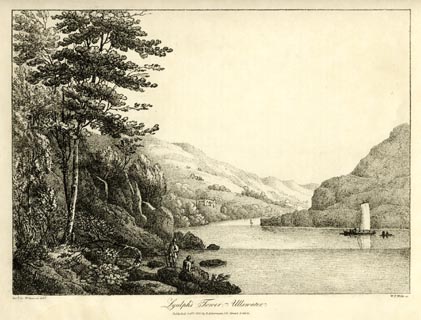 click to enlarge click to enlargeWKN144.jpg Plate 44 in Select Views in Cumberland, Westmoreland, and Lancashire. printed at bottom left, right, centre:- "Revd. Jos: Wilkenson delt. / W. F. Wells sc. / Lyulph's Tower, Ullswater. / Published Octr. 1. 1810. by R. Ackermann. 101. Strand. London." item:- Fell and Rock Climbing Club : MN4.44 Image © see bottom of page |
|||||||||||||||||||||||||
|
|
||||||||||||||||||||||||||
| evidence:- | old text:- Wordsworth 1810 placename:- Ullswater item:- fishing; char; grey trout; trout; skelly; chevin; pike; fish, Ullswater |
|||||||||||||||||||||||||
| source data:- | Guide book, A Description of the Scenery of the Lakes, later A
Guide through the District of The Lakes, by William Wordsworth,
1810-35. goto source page xvii "..." "ULLSWATER," "... perhaps, upon the whole, the happiest combination of beauty and grandeur, which any of the Lakes affords. It lies not more than ten miles from Ambleside, and the Pass of Kirkstone and the descent from it are very impressive; but, notwithstanding, this Vale, like the others, loses much of its effect by being entered from the head: so that it is better to go from Keswick through Matterdale, and descend upon Gowbarrow Park; you are thus brought at once upon a magnifi-" goto sourcepage xviii "[magnifi]cent view of the two higher reaches of the Lake. Ara-force thunders down the Ghyll on the left, at a small distance from the road. If Ullswater be approached from Penrith, a mile and a half brings you to the winding vale of Eamont, and the prospects increase in interest till you reach Patterdale; but the first four miles along Ullswater by this road are comparatively tame; and in order to see the lower part of the Lake to advantage, it is necessary to go round by Pooley Bridge, and to ride at least three miles along the Westmorland side of the water, towards Martindale. The views, especially if you ascend from the road into the fields, are magnificent; yet this is only mentioned that the transient Visitant may know what exists; for it would be inconvenient to go in search of them. They who take this course of three or four miles on foot, should have a boat in readiness at the end of the walk, to carry them across to the Cumberland side of the Lake, near Old Church, thence to pursue the road upwards to Patterdale. ..." "..." goto sourcepage 123 "..." "Friday, November 9th. [1805] - Rain, as yesterday, till 10 o'clock, when we took a boat to row down the lake. The day improved, - clouds and sunny gleams on the mountains. In the" goto sourcepage 124 "large bay under Place Fell, three fishermen were dragging a net, - a picturesque group beneath the high and bare crags! A raven was seen aloft; not hovering like the kite, for that is not the habit of the bird; but passing on with a straight-forward perseverance, and timing the motion of its wings to its own croaking. The waters were agitated; and the iron tone of the raven's voice, which strikes upon the ear at all times as the more dolorous from its regularity, was in fine keeping with the wild scene before our eyes. This carnivorous fowl is a great enemy to the lambs of these solitudes; I recollect frequently seeing, when a boy, bunches of unfledged ravens suspended from the church-yard gates of H___, for which a reward of so much a head was given to the adventurous destroyer. - The fishermen drew their net ashore, and hundreds of fish were leaping in their prison. They were all of the kind called skellies, a sort of fresh-water herring, shoals of which may sometimes be seen dimpling or rippling the surface of the lake in calm weather. This species is not found, I believe, in any other of these lakes; nor, as far as I know, is the chevin, that spiritless fish, (though I am loth to call it so, for it was a prime favourite with Isaac Walton,) which must frequent Ullswater, as I have seen a large shoal passing into the lake from the river Eamont. Here are no pike, and the char are smaller than those of the other lakes, and of inferior quality; but the grey trout attains a very large size, sometimes weighing above twenty pounds." goto sourcepage 125 "This lordly creature seems to know that "retiredness (sic) is a piece of majesty; for it is scarcely ever caught, or even seen, except when it quits the depths of the lake in the spawning season, and runs up into the streams, where it is too often destroyed in disregard of the law of the land and of nature." |
|||||||||||||||||||||||||
|
|
||||||||||||||||||||||||||
| evidence:- | old text:- Gents Mag item:- erosion |
|||||||||||||||||||||||||
| source data:- | Magazine, The Gentleman's Magazine or Monthly Intelligencer or
Historical Chronicle, published by Edward Cave under the
pseudonym Sylvanus Urban, and by other publishers, London,
monthly from 1731 to 1922. goto source Gentleman's Magazine 1813 part 1 p.110 "Sproxton, Jan. 5." "Mr. URBAN," "IN a tour to the Lakes last Summer, I observed a piece of flat ground consisting chiefly of sand and pebbles, which, within forty years, to my knowledge, had been gained from the Lake of Ulleswater by the floods of a rapid brook rolling down earth, stones, and gravel, from the adjoining mountains, &c. which must have been an immense quantity, as the water was ten fathom deep or more, a few yards only from the" |
|||||||||||||||||||||||||
| source data:- | goto source Gentleman's Magazine 1813 part 1 p.111 "shore. On further observation, I remarked other large meadows extending a long way into the Lake, and terminating almost in a point, which had evidently been formed by the floods of insignificant brooks, and which in some cases had cut and torn up the sides of the mountains to a degree of astonishment. So that the Lakes are filling up to a certainty, and faster than we seem to be aware of; I think in two or three thousand years they will be all flat meadows, with a river or main drain in the middle. Such meadows in the valleys frequently occur, and it is more than probable they once were lakes." "If we go upon a larger scale, we find a variety of substances continually pouring into the sea by the great rivers, and never returning, at least beyond the reach of a high tide, from which one would naturally suspect, exclusive of the help of minor causes, that the sea in process of time would be so filled up, as to deluge the whole earth. Those violent efforts of Nature, volcanos and earthquakes, may, indeed, at any time, in an instant, make the sea land, and the land sea; but what is there in the regular course of Nature to prevent the drowning of the earth; unless, to help us over the difficulty, we have recourse to an imperceptible increase in bulk of such strata, as lie below the reach of man, whose intrusion may destroy, or at least check their growth? - And that the earth rises more or less by the organization of strata of different degrees of strength and vigour, and shrinks in a state of decay or decomposition, I have no doubt: hence other lakes and seas, by a greater or less extension or depression of the bowels of the earth, will of course be formed; and the sea thus keep its distance for a time exceeding the calculation of man." "But one word more on the subject of the Lakes. The proprietors of lands are bounded by the lakes on one side: the fisheries have also their bounds and marks; and are generally the property of others, and totally distinct. Now, Mr. Urban, should the Lake be quite filled in, by dreadful and unusual torrents and inundations, in three years instead of three thousand, in point of law how will the matter stand? will the proprietor of five acres become the proprietor of fifty, as his writings will shew his field is bounded on one side by water; or must the fisherman lose his all, or he in exchange become a landed proprietor also, whose writings point him out as a proprietor of water only? or will the lord of the manor cut the matter short, and settle the difference between them? And as the counties of Westmoreland and Cumberland are bounded by the Lake for the whole length of it nearly, - does the Lake itself form no part of either county? or is the real boundary of the counties an imaginary line running in a sort of zig-zag direction in the centre of the Lake, to correspond with the windings of the shores - in cases of arrest, or some other legal process which requires a tolerable degree of certainty?" "W.M." |
|||||||||||||||||||||||||
|
|
||||||||||||||||||||||||||
| evidence:- | old print:- Green 1814 (plate 56) placename:- Ulls Water item:- cattle |
|||||||||||||||||||||||||
| source data:- | Print, tinted soft ground etching, Ulls Water looking towards Grizedale, Patterdale,
Westmorland, by William Green, Ambleside, Westmorland, 1814.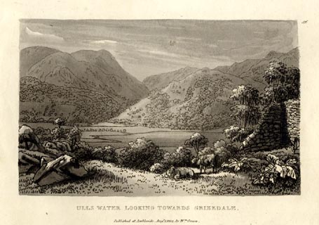 click to enlarge click to enlargeGN1056.jpg Plate 56 in Sixty Small Prints. printed at top right:- "56" printed at bottom:- "ULLS WATER LOOKING TOWARDS GRIZEDALE. / Published at Ambleside Augst. 1, 1814, by Wm. Green." item:- Armitt Library : A6653.56 Image © see bottom of page |
|||||||||||||||||||||||||
|
|
||||||||||||||||||||||||||
| evidence:- | old print:- Green 1814 (plate 56) placename:- Ulls Water item:- cattle |
|||||||||||||||||||||||||
| source data:- | Print, uncoloured soft ground etching, Ulls Water looking towards Grizedale, Patterdale,
Westmorland, by William Green, Ambleside, Westmorland, 1814.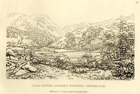 click to enlarge click to enlargeGN0956.jpg Plate 56 in Sixty Small Prints. printed at top right:- "56" printed at bottom:- "ULLS WATER LOOKING TOWARDS GRIZEDALE. / Published at Ambleside Augst. 1, 1814, by Wm. Green." item:- Armitt Library : A6656.56 Image © see bottom of page |
|||||||||||||||||||||||||
|
|
||||||||||||||||||||||||||
| evidence:- | old print:- Green 1814 (plate 54) placename:- Ulls Water item:- sheep |
|||||||||||||||||||||||||
| source data:- | Print, tinted soft ground etching, Ulls Water looking into Glenridden, Patterdale,
Westmorland, by William Green, Ambleside, Westmorland, 1814.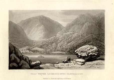 click to enlarge click to enlargeGN1054.jpg Plate 54 in Sixty Small Prints. printed at top right:- "54" printed at bottom:- "ULLS WATER LOOKING INTO GLENRIDDEN. / Published at Ambleside Augst. 1, 1814, by Wm. Green." item:- Armitt Library : A6653.54 Image © see bottom of page |
|||||||||||||||||||||||||
|
|
||||||||||||||||||||||||||
| evidence:- | old print:- Green 1814 (plate 54) placename:- Ulls Water item:- sheep |
|||||||||||||||||||||||||
| source data:- | Print, uncoloured soft ground etching, Ulls Water looking into Glenridden, Patterdale,
Westmorland, by William Green, Ambleside, Westmorland, 1814.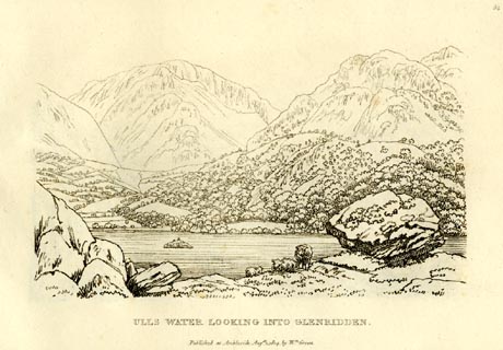 click to enlarge click to enlargeGN0954.jpg Plate 54 in Sixty Small Prints. printed at top right:- "54" printed at bottom:- "ULLS WATER LOOKING INTO GLENRIDDEN. / Published at Ambleside Augst. 1, 1814, by Wm. Green." item:- Armitt Library : A6656.54 Image © see bottom of page |
|||||||||||||||||||||||||
|
|
||||||||||||||||||||||||||
| evidence:- | old print:- Green 1814 (plate 53) placename:- Ulls Water item:- sheep |
|||||||||||||||||||||||||
| source data:- | Print, tinted soft ground etching, Ulls Water Head, Patterdale, Westmorland, by William
Green, Ambleside, Westmorland, 1814.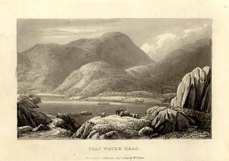 click to enlarge click to enlargeGN1053.jpg Plate 53 in Sixty Small Prints. printed at top right:- "53" printed at bottom:- "ULLS WATER HEAD. / Published at Ambleside Augst. 1, 1814, by Wm. Green." item:- Armitt Library : A6653.53 Image © see bottom of page |
|||||||||||||||||||||||||
|
|
||||||||||||||||||||||||||
| evidence:- | old print:- Green 1814 (plate 53) placename:- Ulls Water item:- sheep |
|||||||||||||||||||||||||
| source data:- | Print, uncoloured soft ground etching, Ulls Water Head, Patterdale, Westmorland, by
William Green, Ambleside, Westmorland, 1814.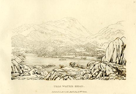 click to enlarge click to enlargeGN0953.jpg Plate 53 in Sixty Small Prints. printed at top right:- "53" printed at bottom:- "ULLS WATER HEAD. / Published at Ambleside Augst. 1, 1814, by Wm. Green." item:- Armitt Library : A6656.53 Image © see bottom of page |
|||||||||||||||||||||||||
|
|
||||||||||||||||||||||||||
| evidence:- | old print:- Green 1814 (plate 52) placename:- Ulls Water |
|||||||||||||||||||||||||
| source data:- | Print, tinted soft ground etching, Ulls Water from Gowbarrow, Patterdale, Westmorland,
by William Green, Ambleside, Westmorland, 1814.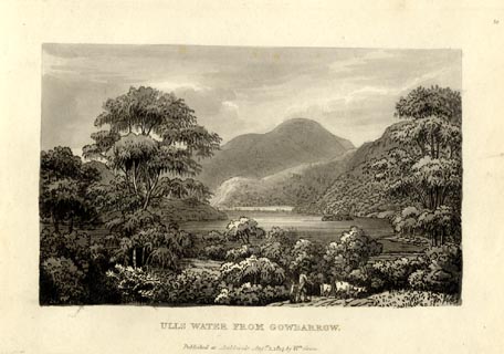 click to enlarge click to enlargeGN1052.jpg Plate 52 in Sixty Small Prints. printed at top right:- "52" printed at bottom:- "ULLS WATER FROM GOWBARROW. / Published at Ambleside Augst. 1, 1814, by Wm. Green." item:- Armitt Library : A6653.52 Image © see bottom of page |
|||||||||||||||||||||||||
|
|
||||||||||||||||||||||||||
| evidence:- | old print:- Green 1814 (plate 52) placename:- Ulls Water |
|||||||||||||||||||||||||
| source data:- | Print, uncoloured soft ground etching, Ulls Water from Gowbarrow, Patterdale, Westmorland,
by William Green, Ambleside, Westmorland, 1814.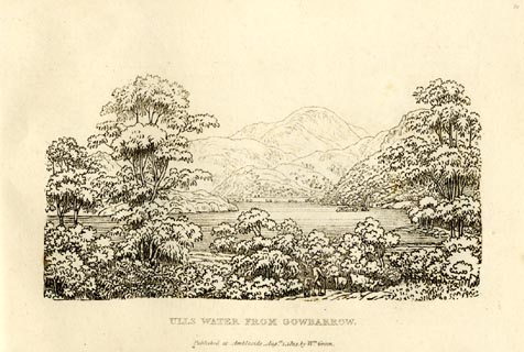 click to enlarge click to enlargeGN0952.jpg Plate 52 in Sixty Small Prints. printed at top right:- "52" printed at bottom:- "ULLS WATER FROM GOWBARROW. / Published at Ambleside Augst. 1, 1814, by Wm. Green." item:- Armitt Library : A6656.52 Image © see bottom of page |
|||||||||||||||||||||||||
|
|
||||||||||||||||||||||||||
| evidence:- | old text:- Green 1814 placename:- Ulls Water |
|||||||||||||||||||||||||
| source data:- | Set of prints, soft ground etchings, Sixty Small Prints, with
text, A Description of a Series of Sixty Small Prints, by
William Green, Ambleside, Westmorland, 1814. goto source page 28:- "..." "The head of Ulls Water lies south-west of its foot; the lake is of an irregular figure, and composed of three unequal reaches, the middle of which is somewhat larger than the northern one; the shortest is seen from the Inn at Patterdale, and not half the length of either of the others. Ulls Water is less unequal in its breadth than the other" goto sourcepage 29:- "lakes; it is in many places not more than half a mile across, but seldom exceeds three quarters; it is less than Windermere, but larger than the rest of the English lakes." "Ulls Water lies engulphed at the feet of majestic mountains, which rise sublimely from the valley: Place Fell descends shivering into the lake, almost perpendicularly, from a vast height; its skirts the lake from Birkfell Force higher than its head. The opposite mountains are less uniform, their summits being removed to various and greater distances from the water, and the rocks project from their surfaces in a bold and imposing manner." "Were these mountains divested of wood, they would exhibit a vastness and sublimity rivalled only by those of Wast Water." "Nothing can exceed the dresses and decorations of this sublimity; the whole space from Gowbarrow to the Inn at Patterdale is one rich scene of vegetation; oak, ash, birch, alder, and other trees of stately growth, and in the wildest luxuriance, undulating and impending over the rocky protuberances every where starting from the mountains, render this the loveliest ride among the lakes." "The mountains on the immediate head of Ulls Water are not so steep as those which border it half way down, but they are rich in wood: St. Sunday, or St. Sundian Crag, swells sublimely above them, and is a fine object from many parts of the valley. From Gowbarrow on one side, and Place Fell on the other side of the lake, the mountains gradually diminish into little hills, and from a gigantic ruggedness into a soft and verdant meadow and pasturage." "Though there is something good in every part of Ulls Water, yet the finest scenes lie between Lyulph's Tower and the Inn at Patterdale; and the best method of seeing this desirable part is to take a boat at the head of the lake, and passing the islands called Cherry-holm and Wall-holm, come within sight of Stybarrow Crag, which is a fine object in various distances; land near the Crag, and walk about half a mile to the farm-house called Glen Coin, occasionally turning round to admire the local beauties of the scenery." |
|||||||||||||||||||||||||
|
|
||||||||||||||||||||||||||
| evidence:- | old text:- Green 1814 placename:- Ulls Water |
|||||||||||||||||||||||||
| source data:- | Set of prints, soft ground etchings, Sixty Small Prints, with
text, A Description of a Series of Sixty Small Prints, by
William Green, Ambleside, Westmorland, 1814. goto source page 31:- "... The finest views on Ulls Water are upon this road [Patterdale to Pooley Bridge], and from several places between it and the water; and the tutored eye will discover, in a variety of distances, when combined with the rocky fore-grounds, a series of pictures perhaps more perfect in their kind than can be found on any other line of the same length in the north of England." "..." "When the spectator is opposite to House Holm, and in such a situation that a line drawn from his eye to the summit of St. Sunday Crag will leave the island called Ling Holm something on the left of that line, he has then, in the opinion of the writer, the best view upon the lake. The beautiful line of shore is enlivened by a few buildings, which though of themselves large, are in comparison with other objects small. The house not long ago erected by the Rev. Henry Askew is on the right, and nearly on the extremity of the northern side of the picture. The wooded promontory which stands on the north side of Purse Bay, is seen about half a mile from the eye on the other side; at the head of the lake observe Patterdale Hall, the seat of John Mouncey, Esq.; above the hall, in swelling majesty, stands St. Sunday Crag, which, with the mountains of Grizedale and Glenridden, close this admirable scene." |
|||||||||||||||||||||||||
|
|
||||||||||||||||||||||||||
| evidence:- | old print:- Green 1815 placename:- Ulls Water item:- cattle |
|||||||||||||||||||||||||
| source data:- | Print, coloured aquatint, Ulls Water from Glen Coin, Patterdale, Westmorland, by William
Green, Ambleside, Westmorland, 1815.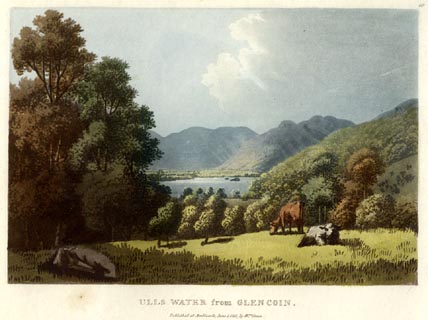 click to enlarge click to enlargeGN0518.jpg Plate 19 in Lake Scenery. printed at upper right:- "19" printed at bottom:- "ULLS WATER from GLEN COIN. / Published at Ambleside, June 1, 1815, by Wm. Green." item:- Armitt Library : A6646.18 Image © see bottom of page |
|||||||||||||||||||||||||
|
|
||||||||||||||||||||||||||
| evidence:- | old print:- Green 1815 placename:- Ulls Water item:- deer; clouds |
|||||||||||||||||||||||||
| source data:- | Print, coloured aquatint, Ulls Water taken near Lyulphs Tower, Patterdale, Westmorland,
by William Green, Ambleside, Westmorland, 1815.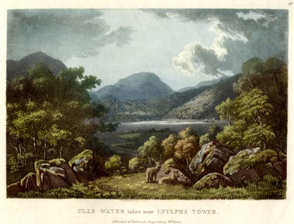 click to enlarge click to enlargeGN0519.jpg Plate 20 in Lake Scenery. printed at upper right:- "20" printed at bottom:- "ULLS WATER taken near LYULPHS TOWER. / Published at Ambleside, June 1, 1815, by Wm. Green." item:- Armitt Library : A6646.19 Image © see bottom of page |
|||||||||||||||||||||||||
|
|
||||||||||||||||||||||||||
| evidence:- | old print:- Green 1815 placename:- Ulls Water item:- cattle |
|||||||||||||||||||||||||
| source data:- | Print, coloured aquatint, Ulls Water from Low Field, Patterdale? Westmorland, by William
Green, Ambleside, Westmorland, 1815.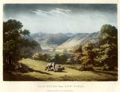 click to enlarge click to enlargeGN0520.jpg Plate 21 in Lake Scenery. printed at upper right:- "21" printed at bottom:- "ULLS WATER from LOW FIELD. / Published at Ambleside, June 1, 1815, by Wm. Green." item:- Armitt Library : A6646.20 Image © see bottom of page |
|||||||||||||||||||||||||
|
|
||||||||||||||||||||||||||
| evidence:- | old print:- Green 1815 placename:- Ulls Water item:- clouds |
|||||||||||||||||||||||||
| source data:- | Print, coloured aquatint, Ulls Water, Patterdale, Westmorland, by William Green, Ambleside,
Westmorland, 1815.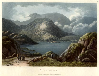 click to enlarge click to enlargeGN0521.jpg Helvellyn behind. Plate 22 in Lake Scenery. printed at upper right:- "22" printed at bottom:- "ULLS WATER. / Published at Ambleside, June 1, 1815, by Wm. Green." item:- Armitt Library : A6646.21 Image © see bottom of page |
|||||||||||||||||||||||||
|
|
||||||||||||||||||||||||||
| evidence:- | old print:- Green 1815 placename:- Ulls Water |
|||||||||||||||||||||||||
| source data:- | Print, coloured aquatint, Ulls Water from the Purse Bay, Patterdale, Westmorland,
by William Green, Ambleside, Westmorland, 1815.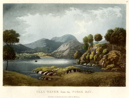 click to enlarge click to enlargeGN0522.jpg Plate 23 in Lake Scenery. printed at upper right:- "23" printed at bottom:- "ULLS WATER from the PURSE BAY. / Published at Ambleside, June 1, 1815, by Wm. Green." item:- Armitt Library : A6646.22 Image © see bottom of page |
|||||||||||||||||||||||||
|
|
||||||||||||||||||||||||||
| evidence:- | old print with text:- Farington 1816 placename:- Ulswater |
|||||||||||||||||||||||||
| source data:- | Print, uncoloured engraving and descriptive text, Ulswater and Liulph's Tower, Matterdale,
Cumberland, drawn by Joseph Farington, engraved by John Pye, published by T Cadell
and W Davies, Strand, London, 1815.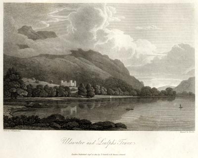 click to enlarge click to enlargeFA0403.jpg printed, bottom left, right, centre "Drawn by J. Farington R.A. / Engraved by John Pye. / Ulswater and Liulph's Tower. / London Published Septr. 15, 1815, by T. Cadell &W. Davies, Strand." Descriptive text:- "ULSWATER" "ULSWATER is the most extensive of all the Lakes of Cumberland, and forms three reaches, each about three miles in length, though its greatest breadth does not exceed one; and in its second reach a vast rock projects, so as to reduce it to less than a quarter of a mile in width. Such are its reputed admeasurements: but the eye loses its power of judging even of the breadth, confounded by the boldness of the shores, and the grandeur of the fells or mountains which rise beyond. The proportions, however, are grand; for the water retains its dignity, notwithstanding the vastness of the accompaniments." "The Lake lies about five miles south-west from Penrith, by a most delightful road: its direction, like that of all the others, is north and south; in point of beauty, it is justly deemed not inferior to any of them; and, in one respect, it certainly possesses the superiority, viz. in affording the greatest variety if views. This advantage it derives from its shape, which nearly resembles that of the letter Z, but without its angular sharpness. After extending itself about three miles in a line to the south-west, Ulswater bends at the foot of Place-fell almost due west, and is soon again interrupted by the foot of the steep and rugged Helvellyn; then spreading again, it turns off to the south-east, and is lost among the deep recesses of the hills." "Our engraving delineates the second reach of Ulswater, which here takes one of its boldest sweeps, "majestic in its calmness clear and smooth as a blue mirror, with winding shores and low points of [ ]and, covered with green inclosures." ..." item:- Armitt Library : A6666.3 Image © see bottom of page |
|||||||||||||||||||||||||
|
|
||||||||||||||||||||||||||
| evidence:- | old print with text:- Farington 1816 placename:- Ulswater item:- echoes |
|||||||||||||||||||||||||
| source data:- | Print, uncoloured engraving and descriptive text, The Head of Ulswater, Patterdale,
and the Mountain Helvellyn, Westmorland, drawn by Joseph Farington, engraved by Samuel
Middiman, published by T Cadell and W Davies, Strand, London, 1815.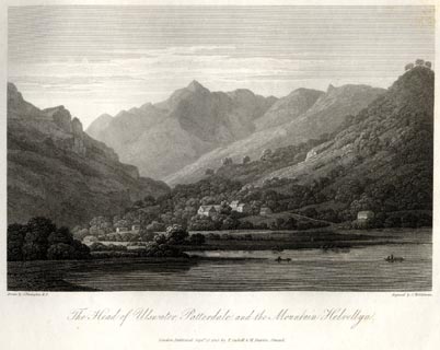 click to enlarge click to enlargeFA0404.jpg printed, bottom left, right, centre "Drawn by J. Farington R.A. / Engraved by S. Middiman. / The Head of Ulswater, Patterdale, and the Mountain Helvellyn. / London Published Septr. 15, 1815, by T. Cadell &W. Davies, Strand." Descriptive text:- "THE HEAD OF ULSWATER, PATTERDALE, AND THE MOUNTAIN HELVELLYN." "THE view, delineated in this engraving, represents the grandest part of the whole scenery. ..." "The rocks of Ulswater and its vicinity are justly celebrated for the grandeur and variety of their echoes: these, indeed, more or less accompany all Lakes which are circumscribed by lofty and rocky screens; but the echoes excited in different parts of this Lake are peculiarly grand and affecting. "The sound of a cannon discharged on it," Mr. Gilpin says, "is distinctly reverberated six or seven times. It first rolls over the head in one vast peal. The, subsiding a few seconds, it rises again in a grand interrupted burst, perhaps on the right. Another solemn pause ensues - then the sound rises again on the left. Thus thrown from rock to rock, in a sort of aerial perspective, it is caught again perhaps by some nearer promontory; and, returning full on the ear, surprises you, after you thought all had been over, with as great a peal as at first. But the grandest effect of this kind is produced by a successive discharge of cannon, at the interval of a few seconds between each discharge. The effect of the first is not over, when the echoes of the second, the third, or perhaps of the fourth, begin. Such a variety of awful sounds. mixing, and commixing, and at the same moment heard from all sides, have a wonderful effect on the mind; as if the very foundations of every rock on the Lake were giving way, and the whole scene, from some strange convulsion, were falling into general ruin." ""But there is another species of echoes, which are as well adapted to the Lake in all its stillness and tranquillity, as the others are to its wildness and confusion; and which recommend themselves chiefly to those feelings which depend on the gentler movements of the mind. Instead of cannon, let a few French horns and clarionets be introduced. Softer music than such loud wind instruments would scarcely have power to vibrate. The effect is now wonderfully changed. The sound of a cannon is heard in bursts - it is the modified music of thunder. But the continuation of musical sounds forms a continuation of musical echoes; which, reverberating around the Lake, are exquisitely melodious in their several gradations, and form a thousand symphonies, playing together from every part. The variety of notes is inconceivable: the ear is not equal to their immeasurable combinations. It listens to a symphony dying away at a distance, when other melodious sounds arise near at hand. These have scarce attracted the attention, when a different mode of harmony arises from another quarter. In short, every rock is vocal; and the whole Lake is transformed into a kind of magical scene, in which every promontory seems peopled by aerial beings, answering each other in celestial music."" "___ ___ How often from the steep" "Of echoing hill, or thicket, have we heard" "Celestial voices to the midnight air," "Sole, or responsive to each others note," "Singing their great Creator? Oft in bands" "While they keep watch, or nightly rounding walk," "With heavenly touch of instrumental sounds." "In full harmonic number joinded, their songs" "Divide the night, and lift our thoughts to Heaven." item:- Armitt Library : A6666.4 Image © see bottom of page |
|||||||||||||||||||||||||
|
|
||||||||||||||||||||||||||
| evidence:- | old print with text:- Farington 1816 placename:- Ulswater item:- echoes |
|||||||||||||||||||||||||
| source data:- | Print, uncoloured engraving and descriptive text, Water Millock and the lower end
of Ulswater, Cumberland, drawn by Joseph Farington, engraved by J Scott, published
by T Cadell and W Davies, Strand, London, 1815.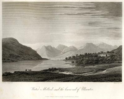 click to enlarge click to enlargeFA0406.jpg printed, bottom left, right, centre "Drawn by J. Farington R.A. / Engraved by J. Scott. / Water Millock and the lower end of Ulswater. / London Published Septr. 15, 1815, by T. Cadell &W. Davies, Strand." Descriptive text:- "WATER MILLOCK AND THE LOWER END OF ULSWATER." "THIS plate gives a view of the lower reach of Ulswater. In the first distance, near the centre, appears Water Millock, the seat of Mr. Robinson, which is sequestered amid beech and sycamore trees. Among the boldest fells that breast the Lake on the left shore, are Hollingfell and Swarthfell, now no longer boasting any part of the forest of Martindale, but presenting huge masses of naked rocks, and scars which many torrents have inflicted. On the left of the Lake is a bay, necessarily given but imperfectly in our view, on the shores of which the traveller may enjoy echoes of peculiar grandeur, whose effect is thus described by an intelligent tourist. While here, Mr. Hutchinson observes, "the barge put off to a station where the finest echoes were to be obtained from the surrounding mountains. The vessel was provided with six brass cannon mounted on swivels: on discharging one of these pieces, the report was echoed from the opposite rocks, where, by reverberation, it seemed to roll from cliff to cliff, and return through every cave and valley, till the decreasing tumult gradually died away upon the ear. The instant it had ceased, the sound of every distant waterfall was heard, but for an instant only: for the momentary stillness was interrupted by the returning echo on the hills behind, where the report was repeated like a peal of thunder rolling over our heads, continuing for several seconds, flying from haunt to haunt, till once more the sound gradually declined. Again the waterfalls possessed the interval, till on the right the more distant thunder arose upon some other mountain, and seemed to take its way up every winding dell and creek, sometimes behind, on this side, or on that, in wonderful speed running its dreadful course. When the echo reached the mountains within the line and channel of the breeze, it was heard at once on the right and left at the extremities of the Lake. In this manner was the report of every discharge re-echoed seven times distinctly." ""At intervals we were relieved from this entertainment, which consisted of a wondrous tumult and grandeur of confusion, by the music of two French horns, whose harmony was repeated from every recess which echo haunted on the borders of the Lake: here the breathings of the organ were imitated; there, the bassoons with clarionets; in this place, from the harsher sounding cliffs, the cornets; in that, from the wooded creek, amongst the caverns and the trilling water-falls, we heard the soft-tuned lute, accompanied with the languishing strains of enamoured nymphs; whilst in the copse and grove was still retained the music of the horns. All this vast theatre seemed possessed by innumerable aerial beings, who breathed celestial harmony."" item:- Armitt Library : A6666.6 Image © see bottom of page |
|||||||||||||||||||||||||
|
|
||||||||||||||||||||||||||
| evidence:- | old print with text:- Farington 1816 placename:- Ulswater |
|||||||||||||||||||||||||
| source data:- | Print, uncoloured engraving and descriptive text, The Head of Ulswater from Gobarrow
Park, Westmorland and Cumberland, drawn by Joseph Farington, engraved by F R Hay,
published by T Cadell and W Davies, Strand, London, 1815.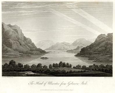 click to enlarge click to enlargeFA0409.jpg printed, bottom left, right, centre "Drawn by J. Farington R.A. / Engraved by F. R. Hay. / The Head of Ulswater from Gobarrow Park. / London Published Septr. 15, 1815, by T. Cadell &W. Davies, Strand." Descriptive text:- "THE HEAD OF ULSWATER, FROM GOBARROW PARK." "GOBARROW PARK ... stocked with several hundred head of fine deer, that add much to the picturesque effect of the surrounding scenery. From this Park we have a noble prospect over the head of the Lake, the only part of it which is adorned with islands. The dark and rugged mountain, on the left of our engraving, is Place Fell. The head of the Lake is skirted by Patterdale, through which a road passes, and pursues its Alpine course to Ambleside, over the lofty mountains which bound the prospect in the back-ground." item:- Armitt Library : A6666.9 Image © see bottom of page |
|||||||||||||||||||||||||
|
|
||||||||||||||||||||||||||
| evidence:- | old print with text:- Farington 1816 placename:- Ulswater item:- char; skelly; scaleys (skellies) |
|||||||||||||||||||||||||
| source data:- | Print, uncoloured engraving and descriptive text, Ulswater from Pooley Bridge, Cumberland,
drawn by Joseph Farington, engraved by Samuel Middiman, published by T Cadell and
W Davies, Strand, London, 1815.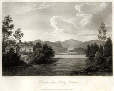 click to enlarge click to enlargeFA0402.jpg printed, bottom left, right, centre "Drawn by J. Farington R.A. / Engraved by S. Middiman. / Ulswater from Pooley Bridge. / London Published Septr. 15, 1815, by T. Cadell &W. Davies, Strand." Descriptive text:- "ULSWATER FROM POOLEY BRIDGE." "..." "In concluding these views of the noble Lake of Ulswater, we may remark, that it is well-stocked with trout and char, and is exclusively celebrated for a species of fish, called scaleys or skellies, which somewhat resemble herrings, and congregate together in vast shoals." item:- Armitt Library : A6666.2 Image © see bottom of page |
|||||||||||||||||||||||||
|
|
||||||||||||||||||||||||||
| evidence:- | old map:- Otley 1818 placename:- Ulls Water |
|||||||||||||||||||||||||
| source data:- | Map, uncoloured engraving, The District of the Lakes,
Cumberland, Westmorland, and Lancashire, scale about 4 miles to
1 inch, by Jonathan Otley, 1818, engraved by J and G Menzies,
Edinburgh, Scotland, published by Jonathan Otley, Keswick,
Cumberland, et al, 1833.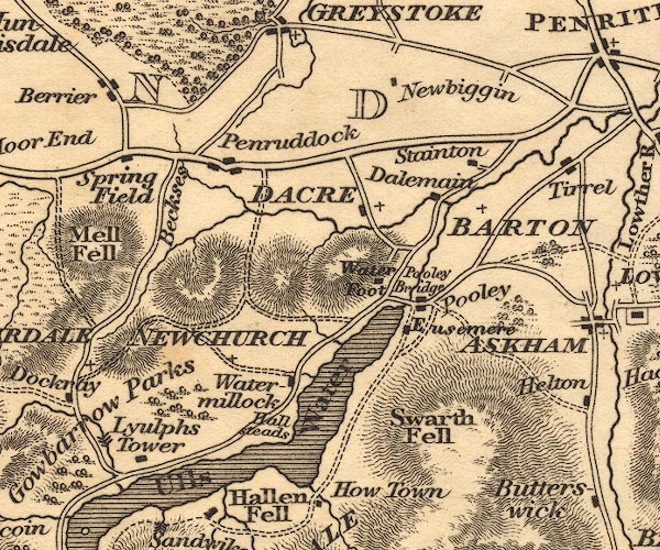 OT02NY42.jpg 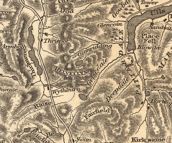 OT02NY31.jpg Some islands are drawn in the lake. item:- JandMN : 48.1 Image © see bottom of page |
|||||||||||||||||||||||||
|
|
||||||||||||||||||||||||||
| evidence:- | old map:- Hall 1820 (Wmd) placename:- Ulles Water |
|||||||||||||||||||||||||
| source data:- | Map, hand coloured engraving, Westmoreland ie Westmorland, scale
about 14.5 miles to 1 inch, by Sidney Hall, London, 1820,
published by Samuel Leigh, 18 Strand, London, 1820-31. click to enlarge click to enlargeHA18.jpg "Ulles Water" outline, shaded; lake; on county boundary item:- Armitt Library : 2008.14.58 Image © see bottom of page |
|||||||||||||||||||||||||
|
|
||||||||||||||||||||||||||
| evidence:- | old map:- Hall 1820 (Cmd) placename:- Ulles Water |
|||||||||||||||||||||||||
| source data:- | Map, hand coloured engraving, Cumberland, scale about 21 miles
to 1 inch, engraved by Sidney Hall, published by S Leigh, 18
Strand, London, 1820-31. click to enlarge click to enlargeHA14.jpg "Ulles Water" outline, shaded; lake; on county boundary item:- JandMN : 91 Image © see bottom of page |
|||||||||||||||||||||||||
|
|
||||||||||||||||||||||||||
| evidence:- | outline view:- Otley 1823 (8th edn 1849) placename:- Ullswater |
|||||||||||||||||||||||||
| source data:- | Engraving, outline view of mountains, Ullswater from Pooley Bridge, drawn by T Binns,
engraved by O Jewitt, opposite p.12 of A Descriptive Guide of the English Lakes, by
Jonathan Otley, 8th edition, 1849.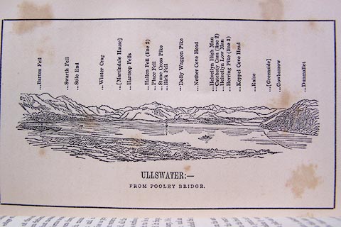 click to enlarge click to enlargeO80E07.jpg item:- Armitt Library : A1180.8 Image © see bottom of page |
|||||||||||||||||||||||||
|
|
||||||||||||||||||||||||||
| evidence:- | descriptive text:- Otley 1823 (5th edn 1834) placename:- Ullswater item:- depth, Ullswater; fishing; char; trout; eel; skelly; road, Patterdale to Penrith |
|||||||||||||||||||||||||
| source data:- | Guide book, A Concise Description of the English Lakes, the
mountains in their vicinity, and the roads by which they may be
visited, with remarks on the mineralogy and geology of the
district, by Jonathan Otley, published by the author, Keswick,
Cumberland now Cumbria, by J Richardson, London, and by Arthur
Foster, Kirkby Lonsdale, Cumbria, 1823; published 1823-49,
latterly as the Descriptive Guide to the English Lakes. goto source Page 8:- "ULLSWATER" "Ranks next in point of size, being nine miles long, but rather wanting in breadth: yet, on account of its winding form, the disproportion is not so much observed. It has the greatest average depth of any of the lakes, being in many places from 20 to 35 fathoms. The country about its foot is rather tame; but its head is situated among some of the most majestic mountains, which are intersected by several glens or small vallies; and their sides embellished with a variety of native wood and rock scenery." "Three rocky islets ornament the upper reach of the lake; they are called Cherry-Holm, Wall-Holm, and House-Holm; the last of which, though houseless, is a fine station for viewing the surrounding scenery.- This lake abounds with trout which are sometimes caught of very large size; here are also some char, but they are neither numerous nor of the best quality. Large shoals of a peculiar kind of fish are met with, called here the skelly; and great quantities of eels are taken in the river Eamont, below Pooley Bridge, as they migrate from the lake in autumn. At the foot of the lake, the water seems to be embanked by a conglomerated mass of pebbles; ... The borders of the lake are ornamented with several handsome villas. ..." goto sourcePage 9:- "..." "The only carriage road lies on the north-west side of the water, sometimes on a level with its surface and commanding an unobstructed view; at other times deeply shaded in ancient woods, permitting only occasional glimpses of the lake; but on the opposite side the pedestrian will be well repaid for a ramble along Placefell and Birkfell. From the slate quarry on Placefell there is a grand view of the mountains, just including the highest point of Helvellyn; and from many parts of the path the views are truly picturesque. If the tourist aspires to more extensive prospects, they may be attained by climbing the mountain to a certain height; where" goto sourcePage 10:- "the lower extremity of the lake may be seen over the beautiful grounds of Hallsteads." "This lake, like others, is most advantageously seen by commencing at its foot; so that, whether by the road, or in a boat, the grandeur of the scenery is continually increasing as the traveller approaches the mountains; but the views from the lake are more open, and the water itself appears more spacious, from the boat on its surface, than from any elevation above it." "There is a comfortable inn at Pooley Bridge, on the foot of the lake; an another at Patterdale, a little distance from its head. They both furnish boats upon the lake: and the long wanted medium of land conveyance is now in part supplied;- horses and jaunting cars can be had at Pooley Bridge; and a post chaise and horses at Patterdale." "..." goto sourcePage 112:- "Ullswater may be visited from Penrith, going either by Eamont Bridge and Tirrel, or by Dalemain, to the Inn at Pooley Bridge; with carriages the former road is generally preferred." "POOLEY BRIDGE is a desirable station for the lovers of angling; or to take a boat for viewing the scenery of Ullswater. ..." |
|||||||||||||||||||||||||
|
|
||||||||||||||||||||||||||
| evidence:- | probably old map:- Perrot 1823 |
|||||||||||||||||||||||||
| source data:- | Map, hand coloured engraving, Cumberland and Westmoreland ie
Westmorland, scale about 38 miles to 1 inch, by Aristide Michel
Perrot, engraved by Migneret, 1823, published by Etienne Ledoux,
9 Rue Guenegaud, Paris, France, 1824-48. click to enlarge click to enlargePER2.jpg outline with form lines; lake item:- Dove Cottage : 2007.38.45 Image © see bottom of page |
|||||||||||||||||||||||||
|
|
||||||||||||||||||||||||||
| evidence:- | old text:- Gents Mag placename:- Ousemere item:- Keld |
|||||||||||||||||||||||||
| source data:- | Magazine, The Gentleman's Magazine or Monthly Intelligencer or
Historical Chronicle, published by Edward Cave under the
pseudonym Sylvanus Urban, and by other publishers, London,
monthly from 1731 to 1922. goto source Gentleman's Magazine 1825 part 1 p.516 "Compendium of County History. - Westmorland." "ULLSWATER or Ousemere, when the day is uniformly overcast, and the air perfectly still, like many other lakes, has its surface dappled with a smooth oily appearance, which is called a Keld." |
|||||||||||||||||||||||||
|
|
||||||||||||||||||||||||||
| evidence:- | old map:- Leigh 1830 map placename:- |
|||||||||||||||||||||||||
| source data:- | Map, Ulles Water, scale about 1.5 miles to 1 inch, engraved by
Josiah Neele, 352 Strand, published by Leigh and Son, 421
Strand, London, about 1830.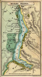 click to enlarge click to enlargeLE06.jpg item:- JandMN : 1.5 Image © see bottom of page |
|||||||||||||||||||||||||
|
|
||||||||||||||||||||||||||
| evidence:- | old print:- Westall 1830s placename:- Ullswater |
|||||||||||||||||||||||||
| source data:- | Print, aquatint panorama, Ullswater, from near Pooley Bridge, Westmorland and Cumberland,
drawn and engraved by William Westall, published by Ackermann and Co, 96 Strand, London,
1834.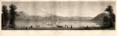 click to enlarge click to enlargeWTL301.jpg "Drawn & Engraved by W. Westall A.R.A. / Swath-fell. Steel-fell. Hallin Crag. Hallin-hag. Place-fell. Place-fell Pike. Watermillock. The Knots. Red Sky head. Helvellin. Nettles. Priest-fell. Great Dod. Soulby-fell. / Ullswater, / from near Pooley Bridge. / Published by Ackermann & Co, 96 Strand. 1834." item:- Armitt Library : A6658.1 Image © see bottom of page |
|||||||||||||||||||||||||
|
|
||||||||||||||||||||||||||
| evidence:- | old print:- Westall 1830s placename:- Ullswater |
|||||||||||||||||||||||||
| source data:- | Print, aquatint panorama, Ullswater, from Gowbarrow Park, Westmorland and Cumberland,
drawn and engraved by William Westall, published by Ackermann and Co, 96 Strand, London,
1834.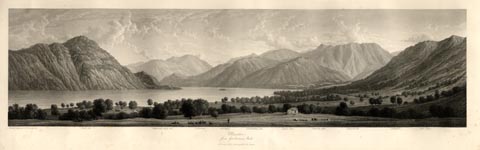 click to enlarge click to enlargeWTL302.jpg "Drawn & Engraved by W. Westall A.R.A. / Place-fell. Catterwall-high-fell. Patterdale. Grisedale. Glenridding-fell. Eagle Crag. Glencoin Vale. Glencoin-fell. Helvellin. Bent Crags. / Ullswater, / from Gowbarrow Park. / Published 1834 by Ackermann & Co, 96 Strand." item:- Armitt Library : A6658.2 Image © see bottom of page |
|||||||||||||||||||||||||
|
|
||||||||||||||||||||||||||
| evidence:- | old print:- Rose 1832-35 placename:- Ulleswater |
|||||||||||||||||||||||||
| source data:- | Print, engraving, Upper Reach, Ulleswater, by Thomas Allom, engraved by S Lacey, 1832.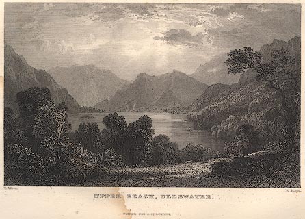 click to enlarge click to enlargeR118.jpg item:- JandMN : 66.58 Image © see bottom of page |
|||||||||||||||||||||||||
|
|
||||||||||||||||||||||||||
| evidence:- | old print:- Rose 1832-35 placename:- Ulleswater |
|||||||||||||||||||||||||
| source data:- | Print, engraving, Second Reach of Ulleswater, by Thomas Allom, engraved by R Sands,
1834.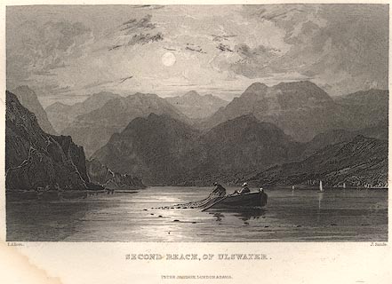 click to enlarge click to enlargeR229.jpg item:- JandMN : 66.32 Image © see bottom of page |
|||||||||||||||||||||||||
|
|
||||||||||||||||||||||||||
| evidence:- | old text:- Gents Mag item:- Observations on the Lakes of Cumberland, ...; picturesque |
|||||||||||||||||||||||||
| source data:- | Magazine, The Gentleman's Magazine or Monthly Intelligencer or
Historical Chronicle, published by Edward Cave under the
pseudonym Sylvanus Urban, and by other publishers, London,
monthly from 1731 to 1922. goto source Gentleman's Magazine 1834 part 1 p.141 Thomas Green's diary for 23 October 1801 - comments on William Gilpin. "... Finished Gilpin's Observations on the Lakes of Cumberland, &c. In the 16th Section he maintains that masterly but unfinished sketches please beyond finished performances, because "they leave to the imagination the power of creating something more;" and not, as Burke affirms, "from the promise of something more in themselves." The difference does not appear very material; both mean that the imagination is stimulated to supply what is not represented. In the 18th Section he contends that beauty and sublimity are both mingled in Ullswater Lake, without destroying each other, as Burke predicts they must. The mediation of Price's doctrine of the picturesque seems adapted to set the whole right. Delighted as I am with Gilpin, I begin to think that for purposes of liberal gratification he views nature too exclusively with an artist's eye, and thus deprives of just praise, many grand and striking scenes in his Tour, while he overrates others. His sketches by no means correspond to the refinement of his ideas; and they are any thing but portraits of the places. ..." |
|||||||||||||||||||||||||
|
|
||||||||||||||||||||||||||
| evidence:- | descriptive text:- Ford 1839 (3rd edn 1843) placename:- Ulles Water item:- depth, Ullswater; boat |
|||||||||||||||||||||||||
| source data:- | Map, uncoloured engraving, Ulles Water, engraved by W H Lizars,
published by Charles Thurnam, Carlisle, and by R Groombridge, 5
Paternoster Row, London, 3rd edn 1843. goto source plate:- 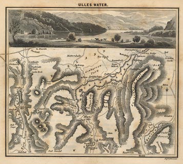 click to enlarge click to enlargeFD05.jpg Map and print, uncoloured engraving, Ulles Water, engraved by W H Lizars, published by Charles Thurnham, Carlisle, and by R Groombridge, 5 Paternoster Row, London, 1843. "ULLES WATER." goto sourcePage 143:- "..." "ULLES WATER" "Is the largest lake, next to Windermere, in the district, being nine miles in length and one in breadth. Its average depth is from twenty to thirty-five fathoms; and its waters abound in excellent trout, and are crowded with shoals of skellies, a kind of fresh-water herring: a few char are also found in the lake, and great quantities of eels are taken in the Eamont, as they migrate from the lake in autumn. The principal feeders are Grisedale Beck, overflowing from a large tarn, high up between Seat-Sandal and Helvellyn, and Goldrill Beck, whose waters are the united streams that pour out of Blea and Angle Tarns. The water is of a zig-zag form, running as it were into the mountains, the hill-sides plentifully covered with wood, and rich meadows lying at its foot. It consists of three reaches: the first or lowest, three miles in length, has pretty sloping banks; the view up this has, in front, Hallin Fell, with Swarth Fell on the left, and on the right, the sweetly-situated villas of Rampsbeck, Beauthorn, Lemon Hall, and the white hamlet of Watermillock. The second reach is four miles long, having the huge Helvellyn" goto sourcePage 144:- "rearing his crested form in front, with Hallsteads on the long low promontory, round which the lake doubles - the woods of Gowbarrow adorning the right - and on the left, Hallin, Birk, and Place Fells. The highest and last reach is two miles long, spotted with a few rocky islands of small importance. The steep and rugged front of Place Fell forms its left boundary, and the precipitous rocks of Stybarrow, oaken-crowned, start up out of the waters on the right, the crags of St. Sunday, Helvellyn, and Fairfield, forming the towering distance." "'Turn where we may, said I, we cannot err In this delicious region.- Cultured slopes, Wild tracts of forest-ground, and scattered groves, And mountains bare, or clothed with ancient woods, Surrounded us; and, as we held our way Along the level of the grassy flood, They ceased not to surround us; change of place, From kindred features diversely combined, Producing change of beauty ever new.'" "On the whole, this water generally stands confessed the most beautiful and grandest of all, affording the greatest variety of views, in which, however, the sublime unquestionably preponderates." "In advancing up Ulles Water, we should recommend the south or Westmorland side of the shore to be taken as far as How Town, where a boat should be in readiness to carry you across to Old Church, Watermillock, inasmuch as the views are incomparably finer, both with regard to the foregrounds and the combinations of the distance." goto sourcePage 145:- "This side cannot be pursued to Patterdale but by pedestrians, who after leaving How Town, penetrate into Martindale, a sequestered spot shut out from the lake; ... A green path leads to the top of the western ridge, whence there is a view of the last reach of Ulles Water, bordered by black steeps - the narrow grassy vale of Bordale immediately beneath - Penrith beyond - and Cross Fell in the extreme verge of the horizon. In passing down to Patterdale, several beautiful views are presented of that dale and of Brother Water, with the heights of Kirkstone." "The carriage-road leads from Pooley Bridge, on the Cumberland side, along the first reach, which is comparatively speaking tame, having Soulby Fell, a smooth green hill, on the right. Near the pleasant village of Watermillock, stood the old church, in a very sequestered bay; ... At the extremity of the church promontory stands Hallsteads, the modern residence of J. Marshall, Esq. Immediately after passing this, on the left, you enter" goto sourcePage 146:- "into the grounds of Gowbarrow Hall; and then the Park, in which is situated Lyulph's Tower, ..." "..." goto sourcePage 147:- "... [on the Dowthwaite Head road] ... On the hill-top there is a magnificent view of the two upper reaches of the lake, having on the left, Silvery Point and Place Fell, the steeps of Glenridding, with Stybarrow Crags and Patterdale Hall; and beyond, the mountains of Graysdale and Hartshope, Scandale Fell, and St. Sunday Crag. Proceeding onwards, on the right, lurking in a recess, is Glencoin, a farm-house belonging to Henry Howard, Esq., in a rich cultivated bottom, with high and splendidly-wooded mountains in the back-ground: the stream here divides the counties of Cumberland and Westmorland. Hence the road ascends, and is cut through the crags of Stybarrow, from which there is a Claude-like view towards the foot of the water. On a grassy promontory stands Glenridding, the seat of the Rev. H. Askew; the dale opening upwards to the right, is adorned with fertile fields, cottages, and natural groves, that agreeably unite with the view of Ulles Water. ..." goto sourcePage 148:- "..." "On the right is Patterdale Hall, the former residence of the kings of Patterdale, but now belonging to W. Marshall, Esq., M.P. for Carlisle. The stream that rushes down across the road, flows out of Graysdale Tarn, through a moist green dale, with one single house embosomed in sycamores." "Patterdale chapel stands on one side of the road, ..." "A little further is the excellent inn, where every accommodation may be had for viewing this sublime nucleus of dales, and where a day or two should be spent for such a purpose. The water should be navigated, the recesses of the dales explored, and Helvellyn ascended. No one, not even the transitory visitor, should omit to walk to Blowick, which may be done while dinner is preparing. It has still" goto sourcePage 149:- "its land-locked bays, and its rocky promontories, though deprived of all its wood - thus displaying all its charms at once, instead of unfolding them in delightful succession." goto sourcePage 177:- "A TABLE" "OF THE LENGTH, BREADTH, &c. OF THE LAKES," "COLLECTED FROM DIFFERENT AUTHORITIES."
Image © see bottom of page |
|||||||||||||||||||||||||
|
|
||||||||||||||||||||||||||
| evidence:- | old map:- Ford 1839 map placename:- Ulles Water |
|||||||||||||||||||||||||
| source data:- | Map, uncoloured engraving, Map of the Lake District of
Cumberland, Westmoreland and Lancashire, scale about 3.5 miles
to 1 inch, published by Charles Thurnam, Carlisle, and by R
Groombridge, 5 Paternoster Row, London, 3rd edn 1843.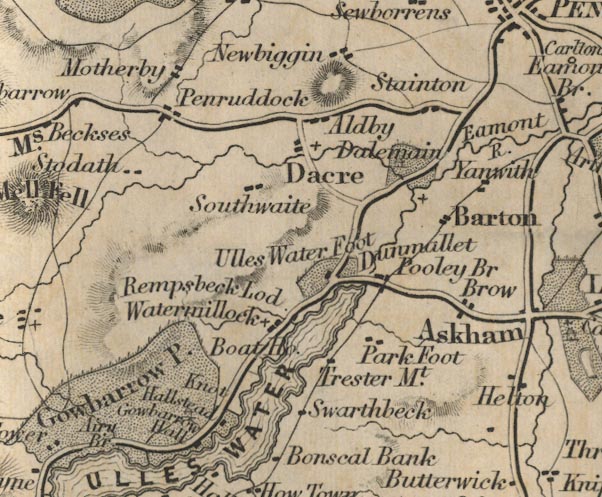 FD02NY42.jpg 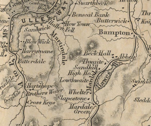 FD02NY41.jpg "ULLES WATER" Outline with form lines. item:- JandMN : 100.1 Image © see bottom of page |
|||||||||||||||||||||||||
|
|
||||||||||||||||||||||||||
| evidence:- | old drawing:- Aspland 1840s-60s placename:- Ulswater |
|||||||||||||||||||||||||
| source data:- | Drawing, pencil, Ullswater, from west of Gowbarrow Hall, Cumberland, by Theophilus
Lindsey Aspland, 1849.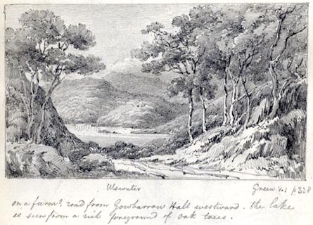 click to enlarge click to enlargeAS0145.jpg "Ulswater / Green V.1 p328 / on a farms. road from Gowbarrow Hall westward, the lake / is seen from a rich foreground of oak trees." item:- Armitt Library : 1958.487.45 Image © see bottom of page |
|||||||||||||||||||||||||
|
|
||||||||||||||||||||||||||
| evidence:- | old drawing:- Aspland 1840s-60s placename:- Ulswater |
|||||||||||||||||||||||||
| source data:- | Drawing, pencil, Ullswater, Westmorland and Cumberland, by Theophilus Lindsey Aspland,
1849.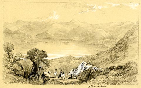 click to enlarge click to enlargeAS0193.jpg "Ulswater" item:- Armitt Library : 1958.487.92 Image © see bottom of page |
|||||||||||||||||||||||||
|
|
||||||||||||||||||||||||||
| evidence:- | old map:- Wyld 1847 placename:- Ulleswater |
|||||||||||||||||||||||||
| source data:- | Map, uncoloured engraving, Ulleswater and Hawes Water,
Cumberland and Westmorland, scale about 3.5 miles to 1 inch, by
James Wyld, published by John Johnstone, Paternoster Row,
London, et al, 1847.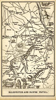 click to enlarge click to enlargeWLD3M4.jpg printed at bottom:- "ULLESWATER AND HAWES WATER." item:- Armitt Library : A1201.67 Image © see bottom of page |
|||||||||||||||||||||||||
|
|
||||||||||||||||||||||||||
| evidence:- | old print:- Garnett 1850s-60s F placename:- Ullsewater |
|||||||||||||||||||||||||
| source data:- | Print, uncoloured lithograph, Ullsewater, from the Entrance to Grisedale, Westmorland,
drawn by G W Pettit, engraved by William Banks, Edinburgh, published by John Garnett,
Post Office, Windermere, Westmorland, 1850s-60s?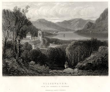 click to enlarge click to enlargeGA1304.jpg printed, bottom left, right, centre "G. W. Pettit, Delt. / Engd. by W. Banks, Edinr. / ULLSEWATER. / FROM THE ENTRANCE TO GRISEDALE. / PUBLISHED BY J. GARNETT, WINDERMERE." item:- Armitt Library : ALMA335.4 Image © see bottom of page |
|||||||||||||||||||||||||
|
|
||||||||||||||||||||||||||
| evidence:- | old map:- Garnett 1850s-60s H placename:- Ulles Water |
|||||||||||||||||||||||||
| source data:- | Map of the English Lakes, in Cumberland, Westmorland and
Lancashire, scale about 3.5 miles to 1 inch, published by John
Garnett, Windermere, Westmorland, 1850s-60s. GAR2NY42.jpg "ULLES WATER" outline with shore form lines, lake or tarn  GAR2NY31.jpg item:- JandMN : 82.1 Image © see bottom of page |
|||||||||||||||||||||||||
|
|
||||||||||||||||||||||||||
| evidence:- | old print:- Nelson 1853 (edn 1880s) placename:- Ulleswater |
|||||||||||||||||||||||||
| source data:- | Print, uncoloured, Ulleswater, Westmorland/Cumberland, published by Thomas Nelson
and Sons, London, 1853 edn 1880s?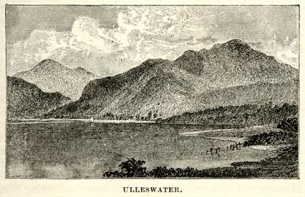 click to enlarge click to enlargeNS0320.jpg On p.51 of Views of the English Lakes, and Tourists Guide to the English Lakes. printed at bottom:- "ULLESWATER." item:- JandMN : 474.21 Image © see bottom of page |
|||||||||||||||||||||||||
|
|
||||||||||||||||||||||||||
| evidence:- | old print:- Nelson 1853 (edn 1880s) placename:- Ullswater item:- steamer |
|||||||||||||||||||||||||
| source data:- | Print, chromolithograph, Ullswater, Westmorland, published by Thomas Nelson and Sons,
London, 1880s?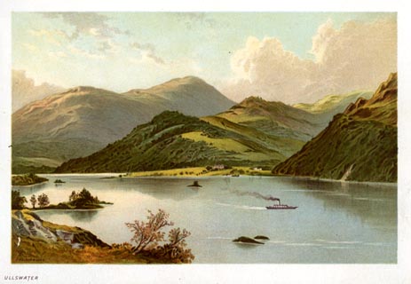 click to enlarge click to enlargeNS0335.jpg At the end of Views of the English Lakes, and Tourists Guide to the English Lakes. printed at bottom:- "ULLSWATER" item:- JandMN : 474.36 Image © see bottom of page |
|||||||||||||||||||||||||
|
|
||||||||||||||||||||||||||
| evidence:- | old print:- Pyne 1853 placename:- Ulleswater |
|||||||||||||||||||||||||
| source data:- | Print, tinted lithograph, Ulleswater, Westmorland, by James Baker Pyne, engraved by
W Gauci, published by Thomas Agnew and Sons, Manchester, Lancashire, 1853.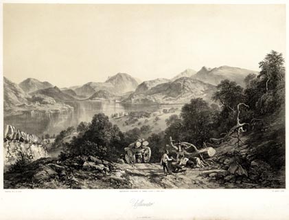 click to enlarge click to enlargePYN218.jpg "PAINTED BY J. B. PYNE. / W. GAUCI LITH. / MANCHESTER, PUBLISHED BY THOMAS AGNEW & SONS, 1853. / Ulleswater / M & N HANHART IMPT." item:- Armitt Library : A6678.19 Image © see bottom of page |
|||||||||||||||||||||||||
|
|
||||||||||||||||||||||||||
| evidence:- | old print:- Pyne 1853 placename:- Ulleswater |
|||||||||||||||||||||||||
| source data:- | Print, coloured lithograph, Ulleswater, Westmorland, by James Baker Pyne, engraved
by W Gauci, published by Thomas Agnew and Sons, Manchester, Lancashire, 1853.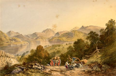 click to enlarge click to enlargePYN418.jpg item:- Armitt Library : A6677.19 Image © see bottom of page |
|||||||||||||||||||||||||
|
|
||||||||||||||||||||||||||
| evidence:- | old text:- Martineau 1855 item:- boat |
|||||||||||||||||||||||||
| source data:- | Guide book, A Complete Guide to the English Lakes, by Harriet
Martineau, published by John Garnett, Windermere, Westmorland,
and by Whittaker and Co, London, 1855; published 1855-76. goto source Page 37:- "..." "If the weather is calm and fine, he has a boat, to which he must walk across the meadows. As soon as he is afloat, the beauties of Ullswater open upon him,- the great Place Fell occupying the whole space to the right; and Stybarrow Crag, precipitous and wooded, shoots up on the left-hand bank. The road winds below it, under trees, passing good houses, and the paths to Helvellyn, and to the lead works, and to" goto sourcePage 38:- "Glencoin,- all recesses full of beauty. ..." "Ullswater has two bends, and is shaped like a relaxed Z. At the first bend, the boat draws to shore, below Lyulph's Tower, ... The park which surrounds it, and stretches down to the lake, is studded with ancient trees; and the sides of its watercourses, and the depths of its ravines, are luxuriantly wooded. Vast hills, with climbing tracks, rise behind, on which the herds of deer are occasionally seen, like brown shadows from the clouds. ..." |
|||||||||||||||||||||||||
|
|
||||||||||||||||||||||||||
| evidence:- | outline view, old text:- Martineau 1855 |
|||||||||||||||||||||||||
| source data:- | Plate, opposite p.38 :- goto source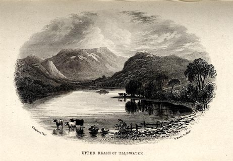 click to enlarge click to enlargeMNU106.jpg Print, engraving, Upper Reach of Ullswater, drawn by L Aspland, engraved by W Banks, Edinburgh, published by John Garnett, Windermere, Westmorland, and by Whittaker and Co, London, 1855. "L Aspland Delt. / W Banks Sc Edinr. / UPPER REACH OF ULLSWATER." item:- Armitt Library : A1159.6 Image © see bottom of page |
|||||||||||||||||||||||||
|
|
||||||||||||||||||||||||||
| evidence:- | old text:- Martineau 1855 |
|||||||||||||||||||||||||
| source data:- | Guide book, A Complete Guide to the English Lakes, by Harriet
Martineau, published by John Garnett, Windermere, Westmorland,
and by Whittaker and Co, London, 1855; published 1855-76. goto source Page 40:- "..." "He returns the way he came, by boat, to the inn, and, after dinner up Kirkstone Pass. He will hear and see enough to make him wish to come again, and stay awhile on Ullswater. He would like to walk along Place Fell, above the margin of the lake, where no carriage road is or can be made; and, once there, he would certainly climb the mountain. He would like to enter the bridle road, from the foot of the lake, which leads to Grisedale tarn, and comes out above Grasmere. He would like to visit Angle Tarn, on the southern end of Place Fell; and, yet more, Hays Water, ... Our traveller must, however, come again to see it; for there is no time to diverge to it to-day." |
|||||||||||||||||||||||||
|
|
||||||||||||||||||||||||||
| evidence:- | old text:- Martineau 1855 item:- depth, Ullswater |
|||||||||||||||||||||||||
| source data:- | Guide book, A Complete Guide to the English Lakes, by Harriet
Martineau, published by John Garnett, Windermere, Westmorland,
and by Whittaker and Co, London, 1855; published 1855-76. goto source Page 180:- "A TABLE OF THE LENGTH, BREADTH, AND DEPTH OF THE LAKES." "No. : Names of Lakes. : Counties : Length in Miles. : Extreme breadth in Miles : Extreme depth in Feet : Height above the Sea" "9 : Ullswater : Cumberland : 9 : 1 : 210 : 380" |
|||||||||||||||||||||||||
|
|
||||||||||||||||||||||||||
| evidence:- | old print:- Payn 1867 placename:- Ulls Water |
|||||||||||||||||||||||||
| source data:- | Print, uncoloured engraving, Ulls Water, Westmorland, by W J Linton, published by
J Garnett, Windermere, Westmorland, 1867.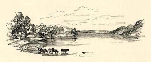 click to enlarge click to enlargePN0348.jpg On p.92 of The Lakes in Sunshine, text by James Payn. item:- Fell and Rock Climbing Club : 184.48 Image © see bottom of page |
|||||||||||||||||||||||||
|
|
||||||||||||||||||||||||||
| evidence:- | old photograph:- Payn 1867 placename:- Ullswater item:- rowing boat; boat |
|||||||||||||||||||||||||
| source data:- | Photograph, sepia, Head of Ullswater, looking North, Patterdale, Westmorland, by Garnett
and Sproat, published by J Garnett, Windermere, Westmorland, 1867.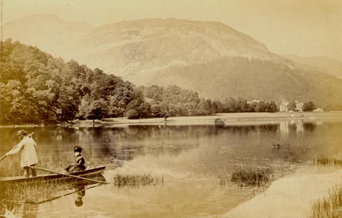 click to enlarge click to enlargePN0350.jpg Tipped in opposite p.96 of The Lakes in Sunshine, text by James Payn. printed at bottom:- "HEAD OF ULLSWATER, LOOKING NORTH" item:- Fell and Rock Climbing Club : 184.50 Image © see bottom of page |
|||||||||||||||||||||||||
|
|
||||||||||||||||||||||||||
| evidence:- | old print:- Payn 1867 placename:- Ulls Water |
|||||||||||||||||||||||||
| source data:- | Print, uncoloured engraving, Ulls Water, from Gowbarrow Park, Matterdale, Cumberland,
by T L Aspland, engraved by J Cooper, published by J Garnett, Windermere, Westmorland,
1867.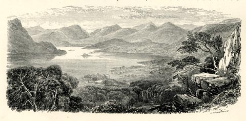 click to enlarge click to enlargePN0351.jpg On p.97 of The Lakes in Sunshine, text by James Payn. printed at lower right:- "J. COOPER Sc" item:- Fell and Rock Climbing Club : 184.51 Image © see bottom of page |
|||||||||||||||||||||||||
|
|
||||||||||||||||||||||||||
| evidence:- | old map:- Jenkinson 1875 map1 |
|||||||||||||||||||||||||
| source data:- | Map, Ullswater Section, Westmorland and Cumberland, ?colour
lithograph, scale about 1 mile to 1 inch, by Stanford's
Geographical Establishment, published by Edward Stanford, 55
Charing Cross, London, 1875.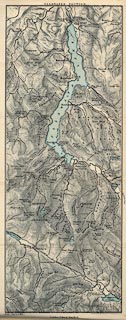 click to enlarge click to enlargeJK10.jpg item:- JandMN : 28.12 Image © see bottom of page |
|||||||||||||||||||||||||
|
|
||||||||||||||||||||||||||
| evidence:- | old print:- Walton 1876 placename:- Ulleswater |
|||||||||||||||||||||||||
| source data:- | Print, colour lithograph, Ulleswater, from the Matterdale Road, Patterdale? Westmorland,
from a painting by Elijah Walton, published by W M Thompson, 20 Cockspur Street, Pall
Mall, and Burlington Gallery, Piccadilly, London, 1876.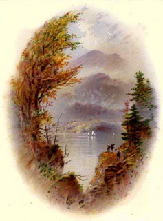 click to enlarge click to enlargeWLT302.jpg Plate 2 in English Lake Scenery, with a description by T G Bonney. item:- JandMN : 469.2 Image © see bottom of page |
|||||||||||||||||||||||||
|
|
||||||||||||||||||||||||||
| evidence:- | old print:- Walton 1876 placename:- Ulleswater |
|||||||||||||||||||||||||
| source data:- | Print, colour lithograph, Ulleswater, Looking towards High Street, Westmorland, from
a painting by Elijah Walton, published by W M Thompson, 20 Cockspur Street, Pall Mall,
and Burlington Gallery, Piccadilly, London, 1876.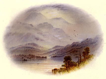 click to enlarge click to enlargeWLT322.jpg Plate 22 in English Lake Scenery, with a description by T G Bonney. item:- JandMN : 469.22 Image © see bottom of page |
|||||||||||||||||||||||||
|
|
||||||||||||||||||||||||||
| evidence:- | old photograph:- Bell 1880s-1940s item:- boat house; rowing boat; boat |
|||||||||||||||||||||||||
| source data:- | Photograph, black and white, boat landing, Ullswater, Patterdale, Westmorland, by
Herbert Bell, photographer, Ambleside, Westmorland, 1890s.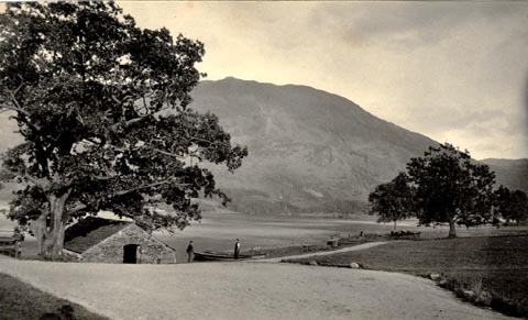 click to enlarge click to enlargeHB0769.jpg The boat houose could be the one in front of the Inn on the Lake? Place Fell behind. item:- Armitt Library : ALPS432 Image © see bottom of page |
|||||||||||||||||||||||||
|
|
||||||||||||||||||||||||||
| evidence:- | old photograph:- Bell 1880s-1940s item:- rowing boat; boat |
|||||||||||||||||||||||||
| source data:- | Photograph, black and white, Ullswater, near Stybarrow, Patterdale, Westmorland, by
Herbert Bell, photographer, Ambleside, Westmorland, 1890s.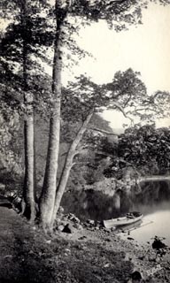 click to enlarge click to enlargeHB0771.jpg internegative at lower right:- "H. Bell" item:- Armitt Library : ALPS434 Image © see bottom of page |
|||||||||||||||||||||||||
|
|
||||||||||||||||||||||||||
| evidence:- | old photograph:- Bell 1880s-1940s |
|||||||||||||||||||||||||
| source data:- | Photograph, black and white, Ullswater looking at Purse Point? Patterdale, Westmorland,
by Herbert Bell, photographer, Ambleside, Westmorland, 1890s.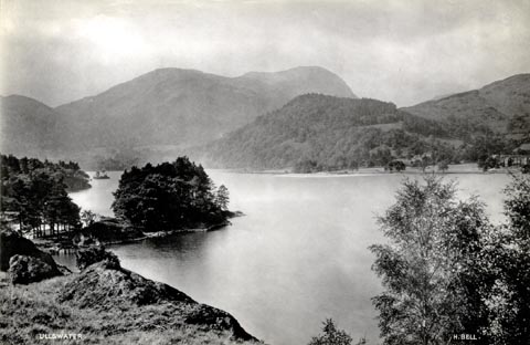 click to enlarge click to enlargeHB0902.jpg internegative (?) at lower left, right:- "ULLSWATER / H. BELL." item:- Armitt Library : ALPS575 Image © see bottom of page |
|||||||||||||||||||||||||
|
|
||||||||||||||||||||||||||
| evidence:- | old photograph:- Bell 1880s-1940s |
|||||||||||||||||||||||||
| source data:- | Photograph, black and white, Keldas by Ullswater, looking from above Blowick Bay?
towards Patterdale Hall, Patterdale, Westmorland, by Herbert Bell, photographer, Ambleside,
Westmorland, 1890s.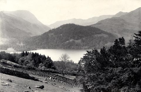 click to enlarge click to enlargeHB0904.jpg stamped at reverse:- "HERBERT BELL / Photographer / AMBLESIDE" item:- Armitt Library : ALPS578 Image © see bottom of page |
|||||||||||||||||||||||||
|
|
||||||||||||||||||||||||||
| evidence:- | old photograph:- Bell 1880s-1940s |
|||||||||||||||||||||||||
| source data:- | Photograph, black and white, Ullswater, Westmorland, by Herbert Bell, photographer,
Ambleside, Westmorland, 1890s.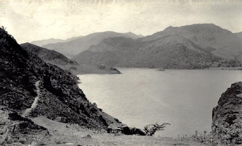 click to enlarge click to enlargeHB0768.jpg item:- Armitt Library : ALPS431 Image © see bottom of page |
|||||||||||||||||||||||||
|
|
||||||||||||||||||||||||||
| evidence:- | old photograph:- Bell 1880s-1940s |
|||||||||||||||||||||||||
| source data:- | Photograph, black and white, the head of Ullswater, Patterdale, Westmorland, by Herbert
Bell, photographer, Ambleside, Westmorland, 1890s.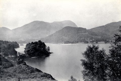 click to enlarge click to enlargeHB0766.jpg stamped at reverse:- "HERBERT BELL / Photographer / AMBLESIDE" item:- Armitt Library : ALPS429 Image © see bottom of page |
|||||||||||||||||||||||||
|
|
||||||||||||||||||||||||||
| evidence:- | old photograph:- Bell 1880s-1940s |
|||||||||||||||||||||||||
| source data:- | Photograph, black and white, Ullswater from Westside in Glenridding, Patterdale, Westmorland,
by Herbert Bell, photographer, Ambleside, Westmorland, 1890s.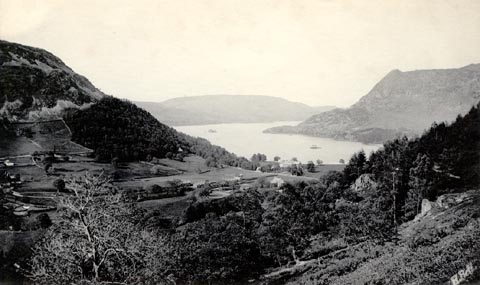 click to enlarge click to enlargeHB0762.jpg internegative at lower right:- "H. Bell" item:- Armitt Library : ALPS425 Image © see bottom of page |
|||||||||||||||||||||||||
|
|
||||||||||||||||||||||||||
| evidence:- | old photograph:- Bell 1880s-1940s |
|||||||||||||||||||||||||
| source data:- | Photograph, black and white, Ullswater from Silver Crag, Patterdale, Westmorland,
by Herbert Bell, photographer, Ambleside, Westmorland, 1890s.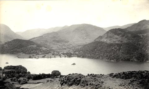 click to enlarge click to enlargeHB0761.jpg stamped at reverse:- "HERBERT BELL / Photographer / AMBLESIDE" item:- Armitt Library : ALPS424 Image © see bottom of page |
|||||||||||||||||||||||||
|
|
||||||||||||||||||||||||||
| evidence:- | old photograph:- Bell 1880s-1940s |
|||||||||||||||||||||||||
| source data:- | Photograph, black and white, Ullswater from Gowbarrow Park, Patterdale, Westmorland,
by Herbert Bell, photographer, Ambleside, Westmorland, 1890s.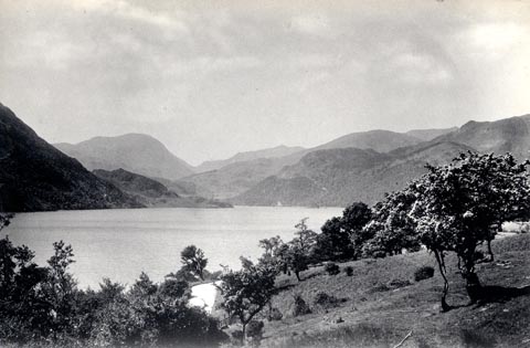 click to enlarge click to enlargeHB0760.jpg stamped at reverse:- "HERBERT BELL / Photographer / AMBLESIDE" item:- Armitt Library : ALPS423 Image © see bottom of page |
|||||||||||||||||||||||||
|
|
||||||||||||||||||||||||||
| evidence:- | old photograph:- Bell 1880s-1940s |
|||||||||||||||||||||||||
| source data:- | Photograph, black and white, Ullswater from Glencoyne Park, Patterdale, Westmorland,
by Herbert Bell, photographer, Ambleside, Westmorland, 1890s.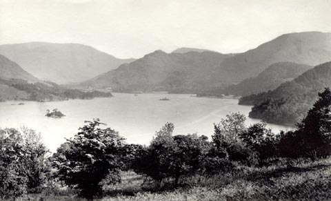 click to enlarge click to enlargeHB0759.jpg item:- Armitt Library : ALPS422 Image © see bottom of page |
|||||||||||||||||||||||||
|
|
||||||||||||||||||||||||||
| evidence:- | old photograph:- Bell 1880s-1940s |
|||||||||||||||||||||||||
| source data:- | Photograph, black and white, Ullswater looking towards Grisedale, Patterdale, Westmorland,
by Herbert Bell, photographer, Ambleside, Westmorland, 1890s.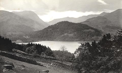 click to enlarge click to enlargeHB0757.jpg internegative at lower left:- "H. Bell" item:- Armitt Library : ALPS420 Image © see bottom of page |
|||||||||||||||||||||||||
|
|
||||||||||||||||||||||||||
| evidence:- | old photograph:- Bell 1880s-1940s |
|||||||||||||||||||||||||
| source data:- | Photograph, sepia, Ullswater and Glenridding, Patterdale, Westmorland, by Herbert
Bell, photographer, Ambleside, Westmorland, 1890s.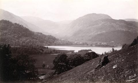 click to enlarge click to enlargeHB0755.jpg internegative at lower right:- "H. Bell" item:- Armitt Library : ALPS418 Image © see bottom of page |
|||||||||||||||||||||||||
|
|
||||||||||||||||||||||||||
| evidence:- | old photograph:- Bell 1880s-1940s |
|||||||||||||||||||||||||
| source data:- | Photograph, b/w, Ullswater from Gowbarrow Park, Matterdale, Cumberland, by Herbert
Bell, Ambleside, Westmorland, 1890s?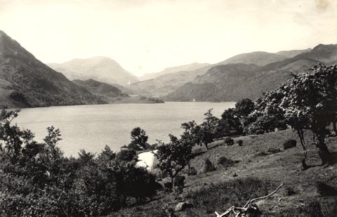 click to enlarge click to enlargeHB0277.jpg item:- Armitt Library : ALPS634 Image © see bottom of page |
|||||||||||||||||||||||||
|
|
||||||||||||||||||||||||||
| evidence:- | old photograph:- Bell 1880s-1940s |
|||||||||||||||||||||||||
| source data:- | Photograph, b/w, Ullswater, Westmorland and Cumberland, by Herbert Bell, Ambleside,
Westmorland, 1890s?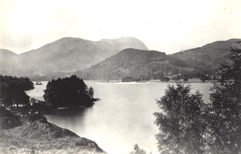 click to enlarge click to enlargeHB0310.jpg stamped at reverse:- "HERBERT BELL / Photographer / AMBLESIDE" item:- Armitt Library : ALPS669 Image © see bottom of page |
|||||||||||||||||||||||||
|
|
||||||||||||||||||||||||||
| evidence:- | old print:- Bemrose 1881 placename:- Ullswater |
|||||||||||||||||||||||||
| source data:- | Print, uncoloured, Ullswater, from the Matterdale Road, Cumberland, published by Bemrose
and Sons, 23 Old Bailey, London and Derby, by A B Moss, Carlisle, Cumberland, and
by T Wilson, Kendal, Westmorland, about 1881.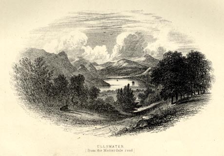 click to enlarge click to enlargeBEM123.jpg Tipped in opposite p.82 of a Handy Guide to the English Lakes and Shap Spa. printed at bottom:- "ULLSWATER / (From the Matterdale road)" item:- JandMN : 455.25 Image © see bottom of page |
|||||||||||||||||||||||||
|
|
||||||||||||||||||||||||||
| evidence:- | old map:- Mill and Heawood 1895 placename:- Ullswater |
|||||||||||||||||||||||||
| source data:- | Map, Ullswater and Haweswater, scale 2 inches to 1 mile, with
soundings by Hugh Robert Mill and Edward Heawood, by
Bartholomew, Edinburgh, Scotland, published by George Philip and
Son, 32 Fleet Street, London, etc, 1895.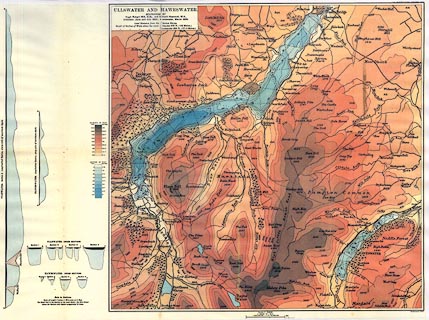 click to enlarge click to enlargeMIL8.jpg - with soundings and sections item:- Kendal Library : 7.7 Image © see bottom of page |
|||||||||||||||||||||||||
|
|
||||||||||||||||||||||||||
| evidence:- | old text:- Gents Mag item:- night fishing; fishing, night; trout |
|||||||||||||||||||||||||
| source data:- | Magazine, The Gentleman's Magazine or Monthly Intelligencer or
Historical Chronicle, published by Edward Cave under the
pseudonym Sylvanus Urban, and by other publishers, London,
monthly from 1731 to 1922. goto source Gentleman's Magazine 1900 part 2 p.359 "..." "The spending of a night by the waterside few people envy the angler, but in reality no one could wish for a finer experience than all night on Ullswater. Starting from Howtown, paddle slowly out into the middle of the lake and wait for the fish to begin biting, for you must try your luck at night-fishing, otherwsie your friends will believe you are thirsting for notoriety. Trout come on the feed" |
|||||||||||||||||||||||||
|
|
||||||||||||||||||||||||||
| evidence:- | old text:- Gents Mag 1900 |
|||||||||||||||||||||||||
| source data:- | goto source Gentleman's Magazine 1900 part 2 p.360 "about midnight and continue gorging, with few lulls, till daybreak. It is not necessary to be expert in fishing, and many, who do not think they possess enough patience for the sport, will be surprised how interesting they find such a night on the water. ..." |
|||||||||||||||||||||||||
|
|
||||||||||||||||||||||||||
| evidence:- | old map:- Pearson 1900s map (Ull) placename:- Ullswater |
|||||||||||||||||||||||||
| source data:- | Map, lithograph, Round Ullswater, Westmorland and Cumberland,
published by C Arthur Pearson, Henrietta Street, London, 1900s.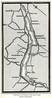 click to enlarge click to enlargePSN1M4.jpg On p.xxxv of Pearson's Gossipy Guide to the English Lakes and Neighbouring Districts. printed at bottom:- "By permission of the Controller of H.M. Stationery Office. / ROUND ULLSWATER." item:- Armitt Library : A1188.6 Image © see bottom of page |
|||||||||||||||||||||||||
|
|
||||||||||||||||||||||||||
| evidence:- | old photograph:- Ullswater Steamers 1900s (edn 1903) placename:- Ullswater |
|||||||||||||||||||||||||
| source data:- | Guide book, with photographs and advertisements, Penrith Ullswater and District, published
in a guide book by the Ullswater Steam Navigation Co, Penrith, Cumberland, 1903.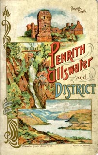 click to enlarge click to enlargeUN1C.jpg item:- JandMN : 1023 Image © see bottom of page |
|||||||||||||||||||||||||
|
|
||||||||||||||||||||||||||
| evidence:- | old photograph:- Ullswater Steamers 1900s (edn 1903) placename:- Ullswater |
|||||||||||||||||||||||||
| source data:- | Photograph, bw halftone, Ullswater from Place Fell, Patterdale, Westmorland, published
in a guide book by the Ullswater Steam Navigation Co, Penrith, Cumberland, 1903.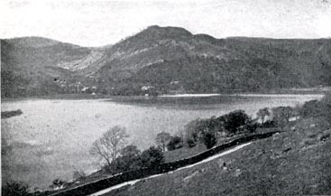 click to enlarge click to enlargeUN103.jpg printed, bottom "ULLSWATER FROM PLACE FELL" item:- JandMN : 1023.3 Image © see bottom of page |
|||||||||||||||||||||||||
|
|
||||||||||||||||||||||||||
| evidence:- | old photograph:- Ullswater Steamers 1900s (edn 1903) placename:- Ullswater item:- |
|||||||||||||||||||||||||
| source data:- | Photograph, bw halftone, yachts and a steam launch, Ullswater and Dunmallet ie Dunmallard
Hill, Dacre, Cumberland, published in a guide book by the Ullswater Steam Navigation
Co, Penrith, Cumberland, 1903.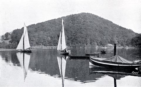 click to enlarge click to enlargeUN119.jpg printed, bottom "ULLSWATER AND DUNMALLET" item:- JandMN : 1023.19 Image © see bottom of page |
|||||||||||||||||||||||||
|
|
||||||||||||||||||||||||||
| evidence:- | old photograph:- Ullswater Steamers 1900s (edn 1903) placename:- Ullswater |
|||||||||||||||||||||||||
| source data:- | Photograph, bw halftone, Evening Shades on Ullswater, Westmorland and Cumberland,
published in a guide book by the Ullswater Steam Navigation Co, Penrith, Cumberland,
1903.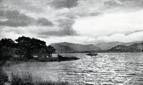 click to enlarge click to enlargeUN122.jpg printed, bottom "EVENING SHADES ON ULLSWATER" item:- JandMN : 1023.22 Image © see bottom of page |
|||||||||||||||||||||||||
|
|
||||||||||||||||||||||||||
| evidence:- | old photograph:- Ullswater Steamers 1900s (edn 1903) placename:- Ullswater |
|||||||||||||||||||||||||
| source data:- | Photograph, bw halftone, Head of Ullswater from Bleaze End, Westmorland and Cumberland,
published in a guide book by the Ullswater Steam Navigation Co, Penrith, Cumberland,
1903.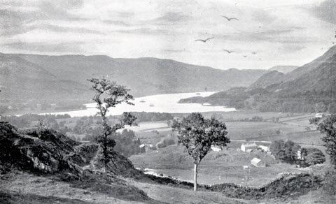 click to enlarge click to enlargeUN124.jpg printed, bottom "HEAD OF ULLSWATER FROM BLEAZE END" item:- JandMN : 1023.24 Image © see bottom of page |
|||||||||||||||||||||||||
|
|
||||||||||||||||||||||||||
| evidence:- | old print:- Bradley 1901 placename:- Ullswater |
|||||||||||||||||||||||||
| source data:- | Print, uncoloured lithograph, Ullswater, from near Gowbarrow, Patterdale, Westmorland,
by Joseph Pennell, published by Macmillan and Co, London, 1901.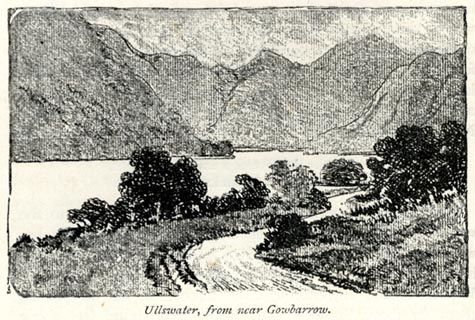 click to enlarge click to enlargeBRL108.jpg On page 38 of Highways and Byways in the Lake District, by A G Bradley. printed at bottom:- "Ullswater, from near Gowbarrow." item:- JandMN : 464.8 Image © see bottom of page |
|||||||||||||||||||||||||
|
|
||||||||||||||||||||||||||
| evidence:- | old print:- Bradley 1901 placename:- Ullswater |
|||||||||||||||||||||||||
| source data:- | Print, uncoloured lithograph, Head of Ullswater, Patterdale, Westmorland, by Joseph
Pennell, published by Macmillan and Co, London, 1901.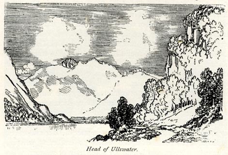 click to enlarge click to enlargeBRL109.jpg On page 40 of Highways and Byways in the Lake District, by A G Bradley. printed at bottom:- "Head of Ullswater." item:- JandMN : 464.9 Image © see bottom of page |
|||||||||||||||||||||||||
|
|
||||||||||||||||||||||||||
| evidence:- | old print:- Brabant 1902 placename:- Ullswater |
|||||||||||||||||||||||||
| source data:- | Print, uncoloured lithograph, Ullswater, from Gowbarrow Park, Westmorland, by Edmund
H New, published by Methuen and Co, 36 Essex Street, Strand, London, 1902.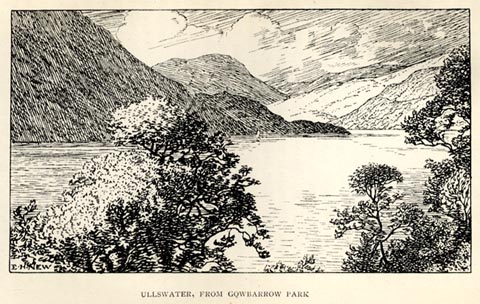 click to enlarge click to enlargeBBT108.jpg Tipped in opposite p.180 of The English Lakes, by F G Brabant. printed at bottom left:- "E. H. NEW" printed at bottom:- "ULLSWATER, FROM GOWBARROW PARK" item:- JandMN : 502.14 Image © see bottom of page |
|||||||||||||||||||||||||
|
|
||||||||||||||||||||||||||
| evidence:- | old print:- Heaton Cooper 1905 (edn 1908) placename:- Ullswater item:- deer |
|||||||||||||||||||||||||
| source data:- | Print, colour halftone, Ullswater, from Gowbarrow Park, a sultry June morn, Patterdale,
Westmorland, from a watercolour painting by Alfred Heaton Cooper, published by Adam
and Charles Black, London, 2nd edn 1908.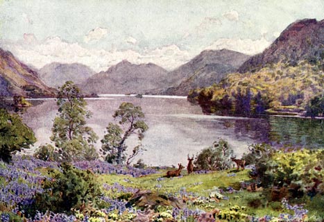 click to enlarge click to enlargeHC0161.jpg Opposite p.186 of The English Lakes, painted by Alfred Heaton Cooper, described by William T Palmer. printed at tissue opposite the print:- "ULLSWATER, FROM GOWBARROW PARK / A sultry June morn" printed at signed lower right:- "[A HEATON COOPER]" item:- JandMN : 468.61 Image © see bottom of page |
|||||||||||||||||||||||||
|
|
||||||||||||||||||||||||||
| evidence:- | old print:- Heaton Cooper 1905 (edn 1908) placename:- Ullswater |
|||||||||||||||||||||||||
| source data:- | Print, colour halftone, Ullswater, Silver Bay, Patterdale, Westmorland, from a watercolour
painting by Alfred Heaton Cooper, published by Adam and Charles Black, London, 2nd
edn 1908.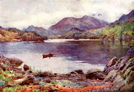 click to enlarge click to enlargeHC0162.jpg Opposite p.188 of The English Lakes, painted by Alfred Heaton Cooper, described by William T Palmer. printed at tissue opposite the print:- "ULLSWATER: SILVER BAY" printed at signed lower right:- "[A HEATON COOPER]" item:- JandMN : 468.62 Image © see bottom of page |
|||||||||||||||||||||||||
|
|
||||||||||||||||||||||||||
| evidence:- | old print:- Heaton Cooper 1905 (edn 1908) placename:- Ullswater item:- landing stage |
|||||||||||||||||||||||||
| source data:- | Print, colour halftone, Ullswater, the Silver Strand, afterglow, Patterdale, Westmorland,
from a watercolour painting by Alfred Heaton Cooper, published by Adam and Charles
Black, London, 2nd edn 1908.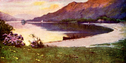 click to enlarge click to enlargeHC0163.jpg Perhaps Silver Bay? Opposite p.190 of The English Lakes, painted by Alfred Heaton Cooper, described by William T Palmer. printed at tissue opposite the print:- "ULLSWATER: THE SILVER STRAND / Afterglow" printed at signed lower right:- "[A HEATON COOPER]" item:- JandMN : 468.63 Image © see bottom of page |
|||||||||||||||||||||||||
|
|
||||||||||||||||||||||||||
| evidence:- | old print:- Heaton Cooper 1905 (edn 1908) placename:- Ullswater item:- landing stage; fishing |
|||||||||||||||||||||||||
| source data:- | Print, colour halftone, Hazy Twilight, Head of Ullswater, Patterdale, Westmorland,
from a watercolour painting by Alfred Heaton Cooper, published by Adam and Charles
Black, London, 2nd edn 1908.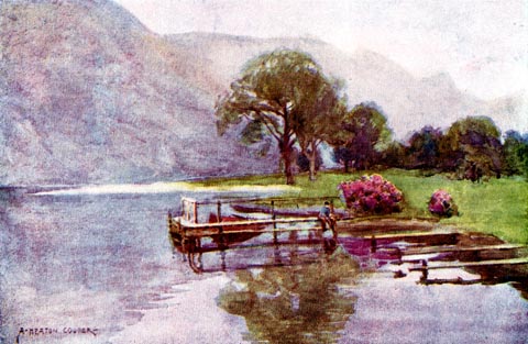 click to enlarge click to enlargeHC0164.jpg Opposite p.190 of The English Lakes, painted by Alfred Heaton Cooper, described by William T Palmer. printed at tissue opposite the print:- "HAZY TWILIGHT, HEAD OF ULLSWATER" printed at signed lower left:- "A HEATON COOPER" item:- JandMN : 468.64 Image © see bottom of page |
|||||||||||||||||||||||||
|
|
||||||||||||||||||||||||||
| evidence:- | text:- Mason 1907 (edn 1930) |
|||||||||||||||||||||||||
| source data:- | Text book, The Ambleside Geography Books bk.III, The Counties of
England, by Charlotte M Mason, published by Kegan Paul, Trench,
Trubner and Co, Broadway House, 68-74 Carter Lane, and the
Parents' Educational Union Office, 26 Victoria Street, London,
edn 1930. MSN1P021.txt Page 21:- "..." "Beautiful Derwent Water! - the fairest of all the lakes, many people think - with its green shores and" MSN1P022.txt Page 22:- "fringing trees, its islets and its mountain background; but perhaps Ullswater, on the other side of Helvellyn, has a wilder beauty." |
|||||||||||||||||||||||||
|
|
||||||||||||||||||||||||||
| evidence:- | old map:- Postlethwaite 1877 (3rd edn 1913) placename:- Ullswater |
|||||||||||||||||||||||||
| source data:- | Map, uncoloured engraving, Map of the Lake District Mining Field, Westmorland, Cumberland,
Lancashire, scale about 5 miles to 1 inch, by John Postlethwaite, published by W H
Moss and Sons, 13 Lowther Street, Whitehaven, Cumberland, 1877 edn 1913. PST2NY42.jpg 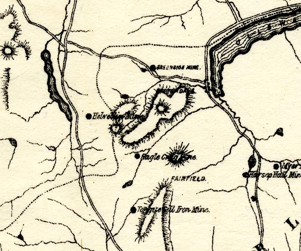 PST2NY31.jpg "ULLSWATER" lake, county boundary along N shore item:- JandMN : 162.2 Image © see bottom of page |
|||||||||||||||||||||||||
|
|
||||||||||||||||||||||||||
| evidence:- | old print:- Reynolds 1915 placename:- Ullswater ??? |
|||||||||||||||||||||||||
| source data:- | Print, colour halftone, Ullswater from Gowbarrow Park, Westmorland, from a painting
by Alfred Heaton Cooper, published by Adam and Charles Black, London, 1915.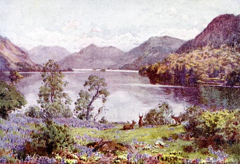 click to enlarge click to enlargeREY609.jpg "A HEATON COOPER" "ULLSWATER FROM GOWBARROW PARK." item:- JandMN : 1071.9 Image © see bottom of page |
|||||||||||||||||||||||||
|
|
||||||||||||||||||||||||||
| evidence:- | old photograph:- Marr 1916 placename:- Ullswater |
|||||||||||||||||||||||||
| source data:- | Photograph, halftone print, Looking down Ullswater, Westmorland and Cumberland, 1916.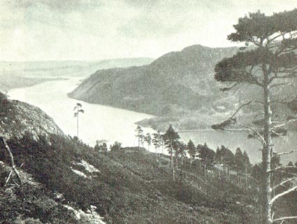 click to enlarge click to enlargeMA1222.jpg item:- JandMN : 173.30 Image © see bottom of page |
|||||||||||||||||||||||||
|
|
||||||||||||||||||||||||||
| evidence:- | descriptive text:- Burrow 1920s |
|||||||||||||||||||||||||
| source data:- | Road book, On the Road, Dunlop Pictorial Road Plans, volume V,
strip maps with parts in Westmorland, Cumberland etc, irregular
scale about 1.5 miles to 1 inch, by E J Burrow and Co,
Cheltenham, Gloucestershire, 1920s.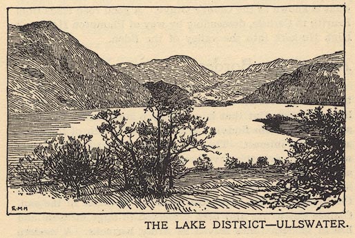 EJB3E2.jpg item:- private collection : 17 Image © see bottom of page |
|||||||||||||||||||||||||
|
|
||||||||||||||||||||||||||
| evidence:- | old print:- placename:- Ullswater |
|||||||||||||||||||||||||
| source data:- | Print, uncoloured engraving, Ullswater, Matterdale, Cumberland, by J Sergeant, engraved
by J Gellatly, published by J Menzies, 61 Prines Street, Edinburgh, 1880s-90s?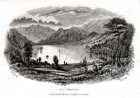 click to enlarge click to enlargePR0502.jpg printed at bottom left, right, centre:- "J. Sergeant / J. Gellaty / ULLSWATER / Published by J. Menzies, 61 Princes Str. Edinr." item:- Dove Cottage : 2008.107.451 Image © see bottom of page |
|||||||||||||||||||||||||
|
|
||||||||||||||||||||||||||
| evidence:- | old print:- placename:- Ullswater |
|||||||||||||||||||||||||
| source data:- | Print, coloured engraving, Ullswater, after A F Lyon, published 1880.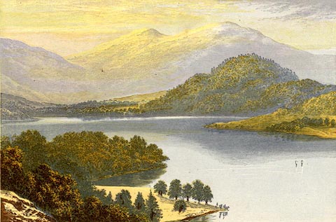 click to enlarge click to enlargePR0522.jpg printed at bottom:- "ULLSWATER" item:- Dove Cottage : 2008.107.471 Image © see bottom of page |
|||||||||||||||||||||||||
|
|
||||||||||||||||||||||||||
| evidence:- | old print:- Prior 1865 placename:- Ulls Water |
|||||||||||||||||||||||||
| source data:- | Print, uncoloured engraving, Ulls Water, Matterdale etc, Westmorland and Cumberland,
published by John Garnett, Windermere, Westmorland, and by Simpkin, Marshall and Co,
London, 1865.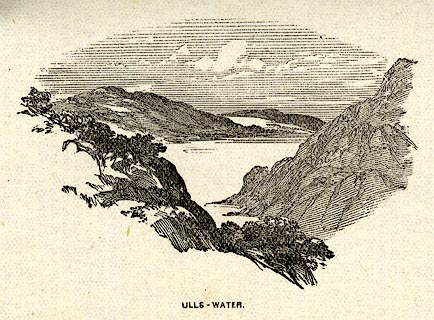 click to enlarge click to enlargePI0110.jpg Included on page 79 of the guide book, Ascents and Passes in the Lake District of England, by Herman Prior. printed at bottom:- "ULLS-WATER." item:- JandMN : 235.12 Image © see bottom of page |
|||||||||||||||||||||||||
|
|
||||||||||||||||||||||||||
| evidence:- | old print:- Garnett 1850s-60s F placename:- Ullswater item:- fishing |
|||||||||||||||||||||||||
| source data:- | Print, uncoloured engraving, Ullswater, from entrance to Grisdale, engraved by William
Banks and Son, Edinburgh, published by John Garnett, Windermere, Westmorland, 1850s-60s?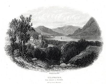 click to enlarge click to enlargePR0550.jpg Included in Views of the English Lakes. printed at bottom:- "W. Banks &Sons, Edinr. / ULLSWATER, / from entrance to Grisedale. / Pubd. by J. Garnett, Windermere" item:- Dove Cottage : 2008.107.499 Image © see bottom of page |
|||||||||||||||||||||||||
|
|
||||||||||||||||||||||||||
| evidence:- | old print:- Garnett 1850s-60s F |
|||||||||||||||||||||||||
| source data:- | Print, uncoloured engraving, Ullswater, from entrance to Grisdale, engraved by William
Banks and Sons, Edinburgh, published by John Garnett, Windermere, Westmorland, 1850s-60s?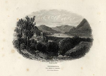 click to enlarge click to enlargeGAR709.jpg Included in Views of the English Lakes. printed at bottom:- "W. Banks &Sons, Edinr. / ULLSWATER, / from entrance to Grisedale. / Pubd. by J. Garnett, Windermere" item:- JandMN : 165.9 Image © see bottom of page |
|||||||||||||||||||||||||
|
|
||||||||||||||||||||||||||
| evidence:- | old print:- placename:- Ulleswater |
|||||||||||||||||||||||||
| source data:- | Print, uncoloured engraving, Ulleswater, Patterdale etc, Westmorland, by ?B Foster,
engraved by E Evans, 1850s-60s?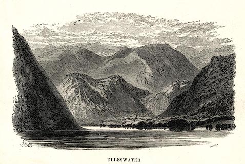 click to enlarge click to enlargePR0493.jpg View towards Patterdale. printed at bottom left, right, centre:- "[B] Foster / E. EVANS SC. / ULLESWATER" item:- Dove Cottage : 2008.107.442 Image © see bottom of page |
|||||||||||||||||||||||||
|
|
||||||||||||||||||||||||||
| evidence:- | old print:- Harwood 1842 |
|||||||||||||||||||||||||
| source data:- | Print, uncoloured engraving, Ullswater, Cumberland, engraved and published by John
and Frederick Harwood, 26 Fenchurch Street, London, 1842.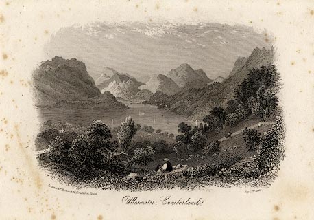 click to enlarge click to enlargeHRW208.jpg printed at bottom left, right, centre:- "London, J &F. Harwood, 26, Fenchurch Street. / Septr. 15th. 1842. / Ullswater, Cumberland." item:- JandMN : 166.8 Image © see bottom of page |
|||||||||||||||||||||||||
|
|
||||||||||||||||||||||||||
| evidence:- | old print:- placename:- Ullswater |
|||||||||||||||||||||||||
| source data:- | Print, uncoloured engraving, Ullswater, Patterdale, Westmorland, published about 1815?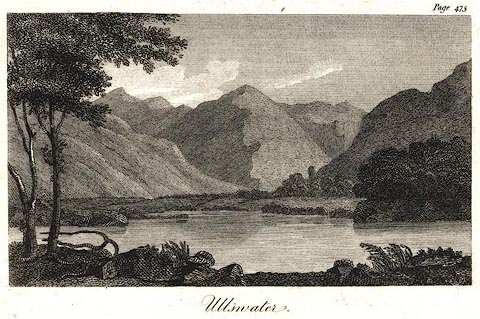 click to enlarge click to enlargePR0585.jpg The Patterdale end. Page 475 from? printed at bottom:- "Ullswater." item:- Dove Cottage : 2008.107.533 Image © see bottom of page |
|||||||||||||||||||||||||
|
|
||||||||||||||||||||||||||
| evidence:- | old print:- Housman 1800 placename:- Ullswater |
|||||||||||||||||||||||||
| source data:- | Print, uncoloured engraving, Ullswater Looking into Patterdale,drawn by IW, engraved
by R Scott, published by F Jollie, Carlisle, Cumberland, 1800.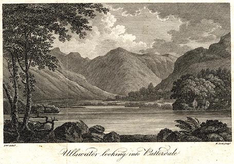 click to enlarge click to enlargePR0529.jpg Included in A Descriptive Tour, and Guide to the Lakes, Caves and Mountains, by John Housman. printed at bottom left, right, centre:- "I.W. delint. / R. Scott sculpt. / Ullswater looking into Patterdale" item:- Dove Cottage : 2008.107.478 Image © see bottom of page |
|||||||||||||||||||||||||
|
|
||||||||||||||||||||||||||
| evidence:- | old print:- Housman 1800 placename:- Ullswater |
|||||||||||||||||||||||||
| source data:- | Print, uncoloured engraving, Ullswater Looking into Patterdale,drawn by IW, engraved
by R Scott, published by F Jollie, Carlisle, Cumberland, 1800.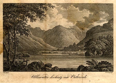 click to enlarge click to enlargePR0476.jpg Taken from a guide book, A Descriptive Tour, and Guide to the Lakes, Caves and Mountains, by John Housman, 1800, 5th edn 1812. printed at bottom left, right, centre:- "I.W. delint. / R. Scott sculpt. / Ullswater looking into Patterdale" item:- JandMN : 233.3 Image © see bottom of page |
|||||||||||||||||||||||||
|
|
||||||||||||||||||||||||||
| evidence:- | old print:- placename:- Ulleswater |
|||||||||||||||||||||||||
| source data:- | Print, uncoloured engraving, Ulleswater, Matterdale, Cumberland, early 19th century?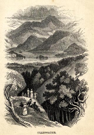 click to enlarge click to enlargePR0665.jpg printed at bottom:- "ULLESWATER." item:- Dove Cottage : 2008.107.606 Image © see bottom of page |
|||||||||||||||||||||||||
|
|
||||||||||||||||||||||||||
| evidence:- | old print:- placename:- Ulswater |
|||||||||||||||||||||||||
| source data:- | Print, uncoloured aquatint, Ulswater, painted by J Rathbone, engraved by J Hassell,
published by William Richardson, Castle Street, Leicester Square, London, 1794.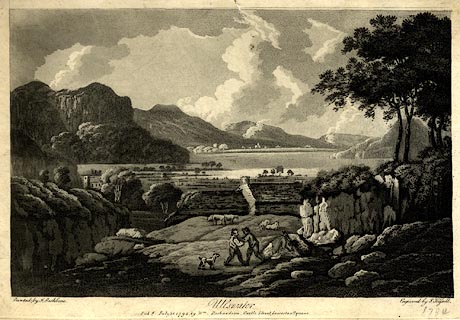 click to enlarge click to enlargePR0776.jpg printed at bottom left, right, centre:- "Pinted by J. Rathbone. / Engraved by J. Hassell. / Ulswater. / Pubd. July 28. 1794. by Wm Richardson, Castle Street Leicester Square." item:- private collection : 205 Image © see bottom of page |
|||||||||||||||||||||||||
|
|
||||||||||||||||||||||||||
| evidence:- | old print:- placename:- Ullswater |
|||||||||||||||||||||||||
| source data:- | Print, uncoloured engraving, Ullswater, Matterdale etc, Cumberland, engraved by Neele,
Strand, London, published 1790s-1800s?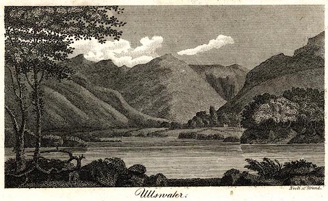 click to enlarge click to enlargePR0503.jpg printed at bottom right, centre:- "Neele sc. Strand. / Ullswater" item:- Dove Cottage : 2008.107.452 Image © see bottom of page |
|||||||||||||||||||||||||
|
|
||||||||||||||||||||||||||
| evidence:- | old print:- Newte 1788 placename:- Uls Water |
|||||||||||||||||||||||||
| source data:- | Print, engraving, Uls, Water, A Lake in Cumberland, ie Ullswater, Matterdale, Cumbria,
painted by G Barret, engraved by Heath, published by G G J and J Robinson, Paternoster
Row, London, 1788.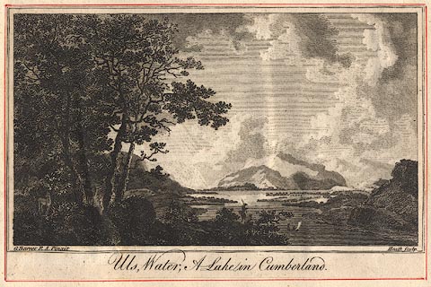 click to enlarge click to enlargeBNF11.jpg Plate 1 from A Tour in England and Scotland, by Thomas Newte. item:- Dove Cottage : Lowther.24 Image © see bottom of page |
|||||||||||||||||||||||||
|
|
||||||||||||||||||||||||||
| evidence:- | old print:- Pearson 1900s placename:- Ullswater item:- yacht; boat; sailing boat |
|||||||||||||||||||||||||
| source data:- | Print, halftone photograph, Head of Ullswater, Patterdale in the Distance, Patterdale,
Westmorland, published by C Arthur Pearson, Henrietta Street, London, 1900s.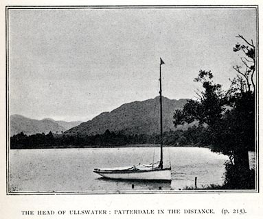 click to enlarge click to enlargePS1E74.jpg On p.213 of Pearson's Gossipy Guide to the English Lakes and Neighbouring Districts. printed at bottom:- "THE HEAD OF ULLLSWATER: PATTERDALE IN THE DISTANCE. (p.215)." item:- Armitt Library : A1188.81 Image © see bottom of page |
|||||||||||||||||||||||||
|
|
||||||||||||||||||||||||||
| evidence:- | old print:- Payn 1860s-70s placename:- Ullswater item:- boat |
|||||||||||||||||||||||||
| source data:- | Print, colour printed, Head of Ullswater, Patterdale, Westmorland, published by John
Garnett, Windermere, Westmorland, and by Simpkin, Marshall and Co, London, 1860s-70s?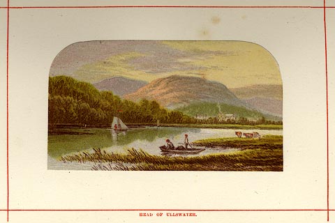 click to enlarge click to enlargePN0110.jpg Tipped in opposite p.40 of England's Lakeland, a Tour Therein, by James Payn. printed at bottom:- "HEAD OF ULLSWATER." item:- Armitt Library : A1183.10 Image © see bottom of page |
|||||||||||||||||||||||||
|
|
||||||||||||||||||||||||||
| evidence:- | old print:- Nelson 1859 placename:- Ulleswater |
|||||||||||||||||||||||||
| source data:- | Print, engraving, Ulleswater from Birk Fell, drawn by Keeley Halswelle, Edinburgh,
published by T Nelson and Sons, Paternoster Row, London, and Edinburgh and New York,
United States, 1859.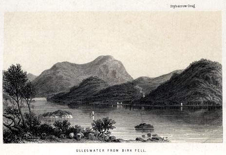 click to enlarge click to enlargeNS0112.jpg Tipped in oppposite p.280 of a guide book, The English Lakes. printed at bottom:- "ULLESWATER FROM BIRK FELL." item:- JandMN : 336.11 Image © see bottom of page |
|||||||||||||||||||||||||
|
|
||||||||||||||||||||||||||
| evidence:- | outline view:- Tattersall 1836 (version 1869) placename:- Ullswater |
|||||||||||||||||||||||||
| source data:- | Print, hand coloured, Upper Reach, Ullswater, Westmorland, drawn by George Tattersall,
1836, engraved by W F Topham, published by T J Allman, 463 Oxford Street, London,
1869.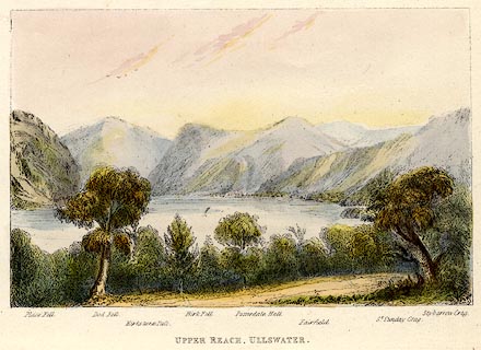 click to enlarge click to enlargeTAT218.jpg Included in The Lakes of England, by W F Topham. printed at bottom:- "UPPER REACH, ULLSWATER." printed at bottom:- "Place Fell. / Dod Fell. / Kirkstone Pass. / Birk Fell. / Patterdale Hall. / Fairfield. / St. Sunday Crag. / Stybarrow Crag." item:- Armitt Library : A1067.18 Image © see bottom of page |
|||||||||||||||||||||||||
|
|
||||||||||||||||||||||||||
| evidence:- | outline view:- Tattersall 1836 placename:- Ullswater |
|||||||||||||||||||||||||
| source data:- | Print, engraving, Upper Reach, Ullswater, Westmorland, drawn by George Tattersall,
engraved by W F Topham, published by Sherwood and Co, Paternoster Row, London, about
1836.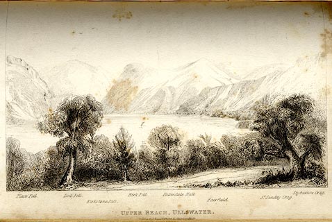 click to enlarge click to enlargeTAT142.jpg The print is captioned with mountain names and acts as an outline view. Tipped in opposite p.118 of The Lakes of England, by George Tattersall. printed at bottom:- "UPPER REACH, ULLSWATER. / [London Pubd. ...]" printed at bottom left to right:- "Place Fell. / Dod Fell. / Kirkstone Pass. / Birk Fell. / Patterdale Hall. / Fairfield. / St. Sunday Crag. / Stybarrow Crag." item:- Armitt Library : A1204.43 Image © see bottom of page |
|||||||||||||||||||||||||
|
|
||||||||||||||||||||||||||
| evidence:- | outline view:- Tattersall 1836 placename:- Ullswater |
|||||||||||||||||||||||||
| source data:- | Print, engraving, Second Reach, Ullswater, from Place Fell, Westmorland, drawn by
George Tattersall, engraved by W F Topham, published by Sherwood and Co, Paternoster
Row, London, about 1836.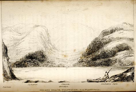 click to enlarge click to enlargeTAT141.jpg The print is captioned with mountain names and acts as an outline view. Tipped in opposite p.117 of The Lakes of England, by George Tattersall. printed at bottom:- "SECOND REACH, ULLSWATER; from PLACE FELL. / [London Pubd. ...]" printed at bottom left to right:- "Fairfield. / Stybarrow. / Helvellyn. / Glencoin. / Gowbarrow Parks." item:- Armitt Library : A1204.42 Image © see bottom of page |
|||||||||||||||||||||||||
|
|
||||||||||||||||||||||||||
| evidence:- | outline view:- Tattersall 1836 placename:- Ullswater |
|||||||||||||||||||||||||
| source data:- | Print, engraving, Lower Reach, Ullswater, from Pooley Bridge, Cumberland, drawn by
George Tattersall, engraved by W F Topham, published by Sherwood and Co, Paternoster
Row, London, about 1836.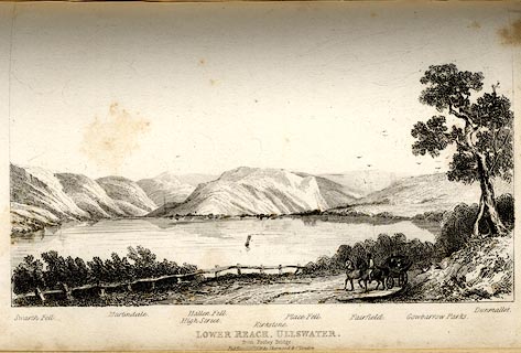 click to enlarge click to enlargeTAT140.jpg The print is captioned with mountain names and acts as an outline view. Tipped in opposite p.114 of The Lakes of England, by George Tattersall. printed at bottom:- "LOWER REACH, ULLSWATER, / from Pooley Bridge. / [London Pubd. ...]" printed at bottom left to right:- "Swarth Fell. / Martindale. / High Street. / Hallen Fell. / Kirkstone. / Place Fell. / Fairfield. / Gowbarrow Parks. / Dunmallet." item:- Armitt Library : A1204.41 Image © see bottom of page |
|||||||||||||||||||||||||
|
|
||||||||||||||||||||||||||
| evidence:- | old print:- Green 1819 placename:- Ulls Water item:- sailing boat; boat |
|||||||||||||||||||||||||
| source data:- | Print, aquatint, Ulls Water from House Holm, Patterdale, Westmorland, by William Green,
1819, published by R Lough and Co, Chronicle Office, Finkle Street, Kendal, and others,
1820.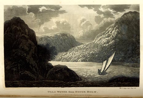 click to enlarge click to enlargeGN0109.jpg Tipped in opposite vol.1 p.341 of The Tourist's New Guide, by William Green. printed at bottom right, centre:- "Vol.I, page 341, line 22. / ULLS WATER from HOUSE HOLM. / Published at Ambleside, Augt. 1. 1819., by Wm. Green." item:- Armitt Library : A1141.10 Image © see bottom of page |
|||||||||||||||||||||||||
|
|
||||||||||||||||||||||||||
| evidence:- | old print:- Green 1819 placename:- Ulls Water |
|||||||||||||||||||||||||
| source data:- | Print, aquatint, Ulls Water, Westmorland and Cumberland, by William Green, 1819, published
by R Lough and Co, Chronicle Office, Finkle Street, Kendal, and others, 1820.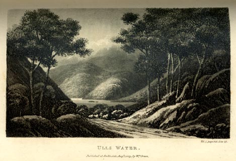 click to enlarge click to enlargeGN0108.jpg Tipped in opposite vol.1 p.328 of The Tourist's New Guide, by William Green. printed at bottom right, centre:- "Vol.I, page 328, line 27. / ULLS WATER. / Published at Ambleside, Augt. 1. 1819., by Wm. Green." item:- Armitt Library : A1141.9 Image © see bottom of page |
|||||||||||||||||||||||||
|
|
||||||||||||||||||||||||||
| evidence:- | old painting:- item:- sheep |
|||||||||||||||||||||||||
| source data:- | Painting, watercolour, Ullswater, Westmorland and Cumberland, by William Henry Nutter,
1864.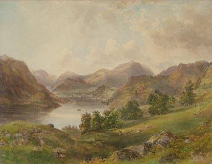 click to enlarge click to enlargePR0864.jpg View of Ullswater with sheep grazing in fields which slope down to the water's edge. Passing clouds cast their shadows on the landscape below. Distant fells lie beyond the lake. signed &dated at bottom right:- "W H Nutter 1864" item:- Tullie House Museum : 1915.16.2 Image © Tullie House Museum |
|||||||||||||||||||||||||
|
|
||||||||||||||||||||||||||
| evidence:- | old print:- Sylvan 1847 placename:- Ulleswater |
|||||||||||||||||||||||||
| source data:- | Print, engraving, Ulleswater from Gowbarrow Park, Westmorland, engraved by T Gilks,
published by John Johnstone, Paternoster Row, London, et al, 1847.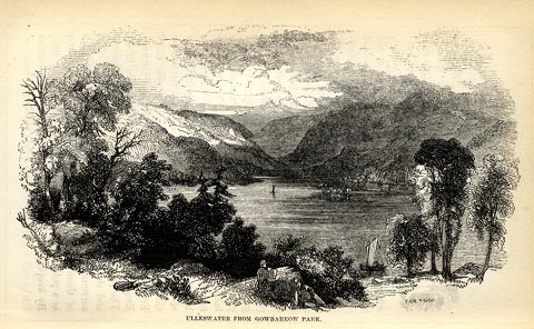 click to enlarge click to enlargeSYL161.jpg On p.232 of Sylvan's Pictorial Guide to the English Lakes. printed at bottom right, centre:- "[T GILKS Sc] / ULLESWATER FROM GOWBARROW PARK." item:- Armitt Library : A1201.61 Image © see bottom of page |
|||||||||||||||||||||||||
|
|
||||||||||||||||||||||||||
| evidence:- | old painting:- |
|||||||||||||||||||||||||
| source data:- | Painting, watercolour, Ullswater from Gowbarrow Park, Cumberland and Westmorland,
attributed to Samuel Bough, 1840s.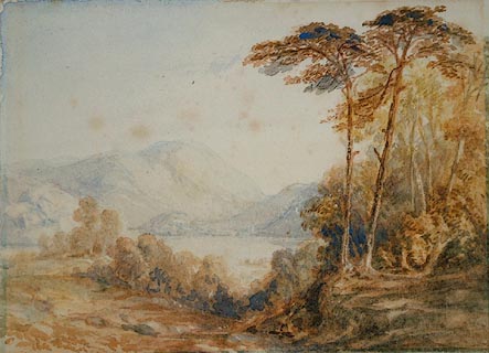 click to enlarge click to enlargePR0919.jpg Lofty autumnal trees to right of composition overlook Ullswater and distant fells. item:- Tullie House Museum : 1935.91.2.1 Image © Tullie House Museum |
|||||||||||||||||||||||||
|
|
||||||||||||||||||||||||||
| evidence:- | old postcard:- placename:- Ullswater |
|||||||||||||||||||||||||
| source data:- | Postcard, colour photograph, head of Ullswater, Patterdale, Westmorland, published
by Sanderson and Dixon, Ambleside, Westmorland, about 1959.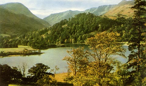 click to enlarge click to enlargePH0114.jpg printed at bottom:- "HEAD OF ULLSWATER AND ST. SUNDAY CRAG" item:- JandMN : 976.6 Image © see bottom of page |
|||||||||||||||||||||||||
|
|
||||||||||||||||||||||||||
| evidence:- | outline view:- Ullswater Steamers 1900s placename:- Ullswater |
|||||||||||||||||||||||||
| source data:- | Print, lithograph outline view, South Shore, Pooley Bridge to Patterdale, and North
Shore, Patterdale to Pooley Bridge, of Ullswater, Westmorland and Cumberland, drawn
by John Thompson, Penrith, published by the Ullswater Steam Navigation Co, 2nd edn
1900s? click to enlarge click to enlargeUL0101.jpg Tipped in opposite p.46 of the Souvenir and Guide to Ullswater. Places are identified by numbers keyed to a caption:- South Shore - 1 Eusemere, 2 Barton Fell, 3 Swarth Fell, 4 Sharrow Bay, 5 Brock Crag, 6 Lodepot, 7 Raven Crag, 8 Howtown, 9 Fusedale, 10 Stile End, 11 Beda, 12 Comb, 13 Hallin Fell, 14 Kailpot Crag, 15 High Street Range, 16 Sandwick, 17 Scale Force, 18 Birk Fell, 19 Silver Point, 20 Place Fell, 21 Raven Crag above Hartsop, 22 Dodd, 23 Dollywaggon Pike, 24 Bleaze End, 25 Borrowdale-in-Hartsop, 26 St Sunday Crag, 27 Landing Stage, 28 Ullswater Hotel, 29 Moorside, 30 Greenside, 31 Stybarrow. North Shore - 1 Stybarrow, 2 Glencoin, 3 Gowbarrrow Fells, 4 Park Brow, 5 Lyulph's Tower and Aira Force, 6 Gowbarrow Hall, 7 Hallsteads, 8 Old Church, 9 Knotts, 10 Priest Crag, 11 Beauthorn, 12 Watermillock, 13 Mell Fell, 14 Rampsbeck, 15 Brackenrigg, 16 Soulby Fell, 17 Waterfoot, 18 Dunmallet, and Steamer Pier. printed at bottom left:- "DRAWN BY JOHN THOMPSON, PENRITH." item:- JandMN : 383.1 Image © see bottom of page |
|||||||||||||||||||||||||
|
|
||||||||||||||||||||||||||
| evidence:- | old print:- Gresham Publishing 1900s placename:- Ullswater |
|||||||||||||||||||||||||
| source data:- | Print, colour halftone, Ullswater, and Stybarrow Crag, Patterdale, Westmorland, by
Ernest W Haslehurst, published by The Gresham Publishing Co, 66 Chandos Street, London,
1900s?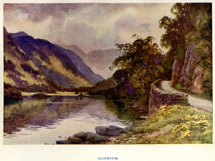 click to enlarge click to enlargePR1565.jpg Tipped in opposite p.32 of The English Lakes section of a volume of Our Beautiful Homeland. printed at bottom:- "ULLSWATER" printed at lower right:- "E. W. HASLEHURST" item:- JandMN : 381.7 Image © see bottom of page |
|||||||||||||||||||||||||
|
|
||||||||||||||||||||||||||
| evidence:- | old print:- Harwood 1895 placename:- Ullswater |
|||||||||||||||||||||||||
| source data:- | Print, halftone photograph, Ullswater, about Glenridding, Patterdale, Westmorland,
by Meisenbach, published by Henry Blacklock and Co, Albert Square, Manchester, 1895.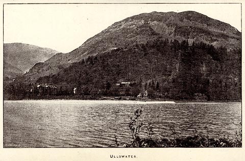 click to enlarge click to enlargeHRW301.jpg Tipped in opposite p.26 of the History and Description of the Thirlmere Water Scheme, by Sir John James Harwood. printed at bottom:- "ULLSWATER." printed at lower left:- "Meisenbach" item:- Armitt Library : A660.2 Image © see bottom of page |
|||||||||||||||||||||||||
|
|
||||||||||||||||||||||||||
| evidence:- | old drawing:- placename:- Ullswater |
|||||||||||||||||||||||||
| source data:- | Drawing, probably in the Lakes Series, Ullswater, Evening Light, Westmorland and Cumberland,
by Thomas Bushby, 1884-89.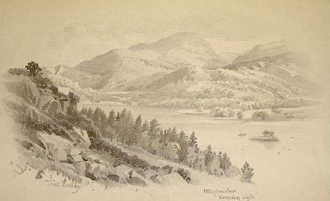 click to enlarge click to enlargePR0998.jpg View of Ullswater from an elevated perspective; the near shore is hidden by a wooded hillside. A rowing boat approaches the island in the middle of the lake. Woodland and fells rise beyond the far shore. Probably designed for Hudson Scott and Sons, box mfrs. signed at bottom left:- "Thos. Bushby" inscribed at bottom right:- "Ullswater 'Evening Light'" item:- Tullie House Museum : 1968.11.21 Image © Tullie House Museum |
|||||||||||||||||||||||||
|
|
||||||||||||||||||||||||||
| evidence:- | old painting:- placename:- Ullswater |
|||||||||||||||||||||||||
| source data:- | Painting, watercolour, Styebarrow Crag, by Ullswater, Patterdale, Westmorland, 1880s-90s.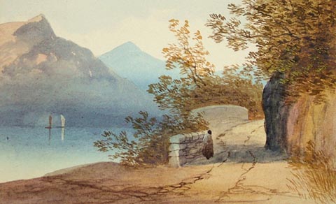 click to enlarge click to enlargePR1041.jpg To right of composition a road runs along the side of the lake with trees overhanging it from the crag. A solitary figure stands beside the wall by which it is flanked, gazing out at the water upon which may be seen the sails of two boats. Barren fells rise beyond. inscribed at bottom left on mount:- "Styebarrow Crag. Ullswater." item:- Tullie House Museum : 1970.33.26 Image © Tullie House Museum |
|||||||||||||||||||||||||
|
|
||||||||||||||||||||||||||
| evidence:- | old print:- Ritter 1849 placename:- Ulleswater |
|||||||||||||||||||||||||
| source data:- | Print, uncoloured engraving, Ulleswater, Westmorland and Cumberland, published by
the Religious Tract Society, The Depository, 56 Paternoster Row, and 65 St Paul's
Churchyard, London, 1849?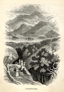 click to enlarge click to enlargeRT0106.jpg Notice an artist sketching. Tipped opposite p.194 of Loitering among the Lakes of Cumberland and Westmoreland, by Paul Ritter? printed at bottom:- "ULLESWATER." item:- Fell and Rock Climbing Club : 2.7 Image © see bottom of page |
|||||||||||||||||||||||||
|
|
||||||||||||||||||||||||||
| evidence:- | old painting:- |
|||||||||||||||||||||||||
| source data:- | Painting, watercolour, Ullswater from Glencoyne, Patterdale, Westmorland, attributed
to Samuel Bough, about 1840.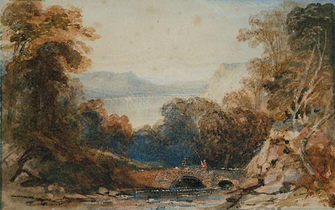 click to enlarge click to enlargePR0920.jpg Two fishermen stand on a stone bridge spanning a wooded glen through which a stream flows. In the background lies Ullswater with distant fells beyond. item:- Tullie House Museum : 1935.91.2.2 Image © Tullie House Museum |
|||||||||||||||||||||||||
|
|
||||||||||||||||||||||||||
| evidence:- | old painting:- |
|||||||||||||||||||||||||
| source data:- | Painting, watercolour, Ullswater from Stybarrow Crag, Patterdale, Westmorland, attributed
to Samuel Bough, about 1840.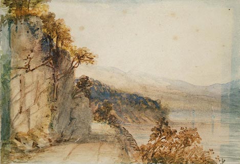 click to enlarge click to enlargePR0921.jpg To left of composition lies a rocky crag surmounted by autumnal bushes. A path leads past it, to right of which stands a low drystone wall. Ullswater lies to right of this. item:- Tullie House Museum : 1935.91.2.3 Image © Tullie House Museum |
|||||||||||||||||||||||||
|
|
||||||||||||||||||||||||||
| evidence:- | old painting:- |
|||||||||||||||||||||||||
| source data:- | Painting, watercolour, Ullswater from Martindale Forest, Westmorland, attributed to
Samuel Bough, 1840s.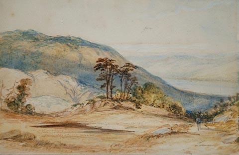 click to enlarge click to enlargePR0922.jpg A lone horseman descends from open heathland towards Ullswater below. item:- Tullie House Museum : 1935.91.2.4 Image © Tullie House Museum |
|||||||||||||||||||||||||
|
|
||||||||||||||||||||||||||
| evidence:- | old print:- placename:- Ullswater |
|||||||||||||||||||||||||
| source data:- | Print, uncoloured etching, Ullswater, Westmorland? by Duckworth? 1900s-30s?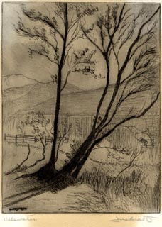 click to enlarge click to enlargePR1905.jpg "Ullswater / Du[ckworth]" "[ ]" item:- Armitt Library : ALMA368 Image © see bottom of page |
|||||||||||||||||||||||||
|
|
||||||||||||||||||||||||||
| evidence:- | old print:- placename:- Ullswater |
|||||||||||||||||||||||||
| source data:- | Print, uncoloured lithograph, Ullswater, Westmorland and Cumberland, drawn by F N?
published by G Hullmandel, 1821.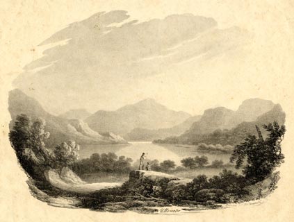 click to enlarge click to enlargePR1895.jpg "[F]N 1821 / printed by G Hullmandel / Ullswater" item:- Armitt Library : ALMA369 Image © see bottom of page |
|||||||||||||||||||||||||
|
|
||||||||||||||||||||||||||
| evidence:- | old print:- MacBride 1922 placename:- Ullswater |
|||||||||||||||||||||||||
| source data:- | Print, colour, Ullswater; Mountain Gloom, by Alfred Heaton Cooper, published by Adam
and Charles Black, 4-6 Soho Square, London, 2nd edn 1928. click to enlarge click to enlargeMB0124.jpg Tipped in opposite p.165 in Wild Lakeland by MacKenzie MacBride. printed at bottom:- "ULLSWATER: MOUNTAIN GLOOM" signed at lower right:- "A. HEATON COOPER" item:- JandMN : 195.26 Image © see bottom of page |
|||||||||||||||||||||||||
|
|
||||||||||||||||||||||||||
| evidence:- | old print:- placename:- Ulleswater |
|||||||||||||||||||||||||
| source data:- | Print, uncoloured engraving, Ulleswater, Westmorland and Cumberland, engraved by Whymper,
published 1920s-30s? click to enlarge click to enlargePR0318.jpg On page 234 of Picturesque Europe, The Lake Country. printed at lower right:- "WHYMPER. SC" printed at bottom:- "ULLESWATER." item:- Dove Cottage : 2008.107.318 Image © see bottom of page |
|||||||||||||||||||||||||
|
|
||||||||||||||||||||||||||
| evidence:- | old print:- placename:- Ullswater |
|||||||||||||||||||||||||
| source data:- | Print, chromolithograph, Ullswater, Westmorland, published by T Nelson and Sons, London,
1900s? click to enlarge click to enlargePR0171.jpg From a set of prints, The Scenery of the English Lakes printed at lower left:- "T. NELSON &SONS" printed at bottom left:- "ULLSWATER" item:- Dove Cottage : 2008.107.171 Image © see bottom of page |
|||||||||||||||||||||||||
|
|
||||||||||||||||||||||||||
| evidence:- | old photograph:- Bogg 1898 placename:- Ulleswater |
|||||||||||||||||||||||||
| source data:- | Photograph, halftone print, A Rush Grown Bay, Ulleswater, Cumberland? by Edmund Bogg,
published by Edmund Bogg, 3 Woodhouse Lane, and James Miles, Guildford Street, Leeds,
Yorkshire, 1898.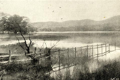 click to enlarge click to enlargeBGG140.jpg Included on p.140 of Lakeland and Ribblesdale, by Edmund Bogg. item:- JandMN : 231.40 Image © see bottom of page |
|||||||||||||||||||||||||
|
|
||||||||||||||||||||||||||
| evidence:- | old print:- placename:- Ullswater |
|||||||||||||||||||||||||
| source data:- | Print, uncoloured engraving, Ullswater, Westmorland, published late 19th century?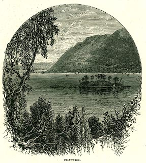 click to enlarge click to enlargePR0331.jpg On page 152 of The English Lakes. printed at bottom:- "ULLSWATER." item:- Dove Cottage : 2008.107.331 Image © see bottom of page |
|||||||||||||||||||||||||
|
|
||||||||||||||||||||||||||
| evidence:- | old print:- Rowbotham 1875 |
|||||||||||||||||||||||||
| source data:- | Print, colour lithograph? Ullswater, Westmorland and Cumberland, by T L Rowbotham,
published by Marcus Ward and Co, London? 1875?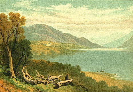 click to enlarge click to enlargePR0129.jpg Included in the set of prints, Views in the English Lake District. printed at lower left, right:- "T L Rowbotham / MARCUS WARD &CO" item:- Dove Cottage : 2008.107.129 Image © see bottom of page |
|||||||||||||||||||||||||
|
|
||||||||||||||||||||||||||
| evidence:- | outline view:- Jenkinson 1875 placename:- Ullswater |
|||||||||||||||||||||||||
| source data:- | Print, lithograph, outline view, Panoramic Sketches from Helvellyn, Westmorland, by
Edwin A Pettitt, London, published by Edward Stanford, 55 Charing Cross, London, 1875. click to enlarge click to enlargeJk01E1.jpg "... Ullswater ..." item:- JandMN : 28.5 Image © see bottom of page |
|||||||||||||||||||||||||
|
|
||||||||||||||||||||||||||
| evidence:- | old print:- placename:- Ulleswater |
|||||||||||||||||||||||||
| source data:- | Print, engraving with lithograph colour? Ulleswater from Birk Fell, Westmorland, 1860s-70s?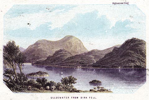 click to enlarge click to enlargePR0382.jpg Stybarrow Crag is captioned at the top of the image. printed at bottom:- "ULLESWATER FROM BIRK FELL." item:- Dove Cottage : 2008.107.382 Image © see bottom of page |
|||||||||||||||||||||||||
|
|
||||||||||||||||||||||||||
| evidence:- | old print:- |
|||||||||||||||||||||||||
| source data:- | Print, uncoloured engraving, Stybarrow Crag and Helvellyn, from Gowbarrow Park, Westmorland,
engraved by G Dalziel, published late 19th century?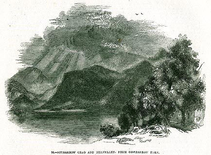 click to enlarge click to enlargePR0347.jpg On page 252 of The Land We Live In. printed at lower right:- "G. DALZIEL. SC" printed at bottom:- "10.- STYBARROW CRAG AND HELVELLYN, FROM GOWBARROW PARK." item:- Dove Cottage : 2008.107.347 Image © see bottom of page |
|||||||||||||||||||||||||
|
|
||||||||||||||||||||||||||
| evidence:- | old print:- placename:- Ulleswater |
|||||||||||||||||||||||||
| source data:- | Print, uncoloured engraving, Ulleswater, Westmorland and Cumberland, drawn by W Harvey
after T H Hair, engraved by T A Prior, published 1848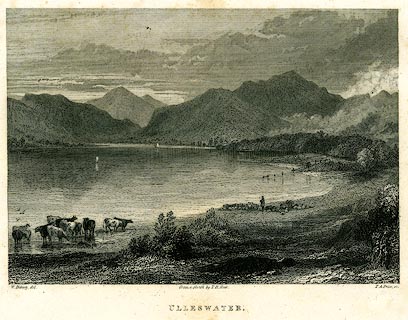 click to enlarge click to enlargePR0225.jpg printed at bottom left, right, centre:- "W. Harvey, del. / T. A. Prior, sc. / From a sketch by T. H. Hair. / ULLESWATER." item:- Dove Cottage : 2008.107.225 Image © see bottom of page |
|||||||||||||||||||||||||
|
|
||||||||||||||||||||||||||
| evidence:- | old print:- placename:- Ullswater |
|||||||||||||||||||||||||
| source data:- | Print, uncoloured engraving, Ullswater from Pooley Bridge, Cumberland, drawn by W
Westall, published by Ackermann and Co, 96 Strand, London, 1834.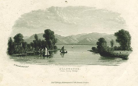 click to enlarge click to enlargePR0159.jpg printed at bottom left, centre:- "W. Westall, ARA. Delt. / ULLSWATER, / from Pooley Bridge. / Pubd. 1834, by Ackermann &Co. 96, Strand, London." item:- Dove Cottage : 2008.107.159 Image © see bottom of page |
|||||||||||||||||||||||||
|
|
||||||||||||||||||||||||||
| evidence:- | old print:- placename:- Ullswater |
|||||||||||||||||||||||||
| source data:- | Print, uncoloured engraving, Ullswater from the Matterdale Road, Cumberland, painted
by Thomas C Hofland, engraved by J W Cooke, published by C Tilt, Fleet Street, London,
et al, 1833.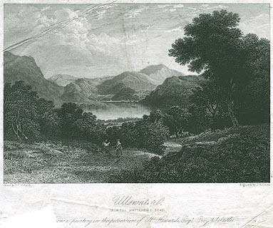 click to enlarge click to enlargePR0302.jpg Included in part 2 of Views of the Lakes in the North of England, by John Robinson. printed at bottom left, right, centre:- "Drawn by T. C. Hofland. / Engraved by J. W. Cooke. / Ullswater, / FROM THE MATTERDALE ROAD. / [F]rom a painting in the possession of H. Howard, Esqr. Greystoke Castle." item:- Dove Cottage : 2008.107.302 Image © see bottom of page |
|||||||||||||||||||||||||
|
|
||||||||||||||||||||||||||
| evidence:- | old print:- Fielding and Walton 1821 (plate 45) placename:- Ullswater |
|||||||||||||||||||||||||
| source data:- | Print, hand coloured aquatint, Patterdale Church, Ullswater Head, Westmorland, drawn
by John Walton, published by R Ackermann, 101 Strand, London, 1821.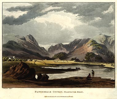 click to enlarge click to enlargePR0451.jpg Plate 45 in A Picturesque Tour of the English Lakes. printed at bottom left, centre:- "J. Walton delt. / PATTERDALE CHURCH, ULLSWATER HEAD. / Published March 1, 1821, at R. Ackermann's, 101 Strand." item:- private collection : 115 Image © see bottom of page |
|||||||||||||||||||||||||
|
|
||||||||||||||||||||||||||
| evidence:- | old print:- placename:- Ulleswater |
|||||||||||||||||||||||||
| source data:- | Print, uncoloured engraving, Ulleswater, Westmoreland, drawn by Craig, engraved by
Hay, published by R N Rose, 45 Holborn Hill, London, 1820.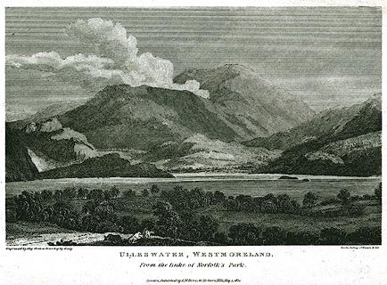 click to enlarge click to enlargePR0362.jpg Included in the Gallery of Nature and Art. printed at bottom left, right, centre:- "Engraved by Hay from a Drawing by Craig / for the Gallery of Nature &Art / ULLESWATER, WESTMORELAND. / From the Duke of Norfolk's Park. / London, Published by R. N. Rose, 45 Holborn Hill, May 1, 1820." item:- Dove Cottage : 2008.107.362 Image © see bottom of page |
|||||||||||||||||||||||||
|
|
||||||||||||||||||||||||||
| evidence:- | old print:- |
|||||||||||||||||||||||||
| source data:- | Print, uncoloured engraving, Patterdale, drawn by J M W Turner, engraved by J Heath,
published by J Mawman, Poultry, London, 1805.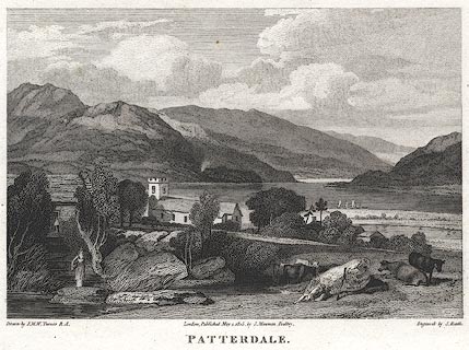 click to enlarge click to enlargePR0376.jpg St Patrick's Church in the midground. printed at bottom left, right, centre:- "Drawn by J. M. W. Turner R.A. / Engrav'd by J. Heath. / London, Published May 1. 1805, by J. Mawman, Poultry. / PATTERDALE." item:- Dove Cottage : 2008.107.376 Image © see bottom of page |
|||||||||||||||||||||||||
|
|
||||||||||||||||||||||||||
| evidence:- | old print:- placename:- Ulls Water |
|||||||||||||||||||||||||
| source data:- | Print, uncoloured aquatint, Ulls Water, from Martindale, Westmorland and Cumberland,
drawn, engraved and published by William Green, Ambleside, Westmorland, 1804.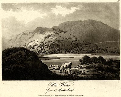 click to enlarge click to enlargePR0455.jpg printed at bottom:- "Ulls Water, from Martindale. / Drawn and Engraved by Wm. Green, and Published at Ambleside, June 24, 1804." item:- private collection : 119 Image © see bottom of page |
|||||||||||||||||||||||||
|
|
||||||||||||||||||||||||||
| evidence:- | old print:- placename:- Ullswater |
|||||||||||||||||||||||||
| source data:- | Print, aquatint, Ullswater and Gowbray Park, Cumberland, drawn by Becker, published
by R Cruttwell, Bath, Somerset, 1802.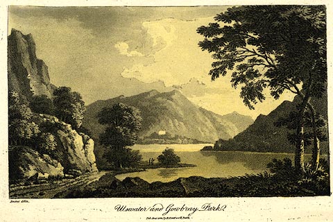 click to enlarge click to enlargePR0439.jpg A companion print has the publisher as Crutterell. printed at bottom left, centre:- "Becker del. / Ullswater and Gowbray Park. / Pub. Jan. 1 1802, by R. Cruttwell, Bath." item:- private collection : 103 Image © see bottom of page |
|||||||||||||||||||||||||
|
|
||||||||||||||||||||||||||
| evidence:- | old print:- placename:- Ulls Water |
|||||||||||||||||||||||||
| source data:- | Print, uncoloured engraving, Ullswater, Cumberland and Westmorland, published early
19th century?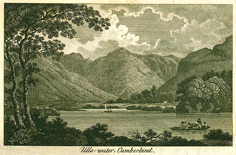 click to enlarge click to enlargePR0301.jpg Notice the cattle in the boat. printed at bottom:- "Ulls-water, Cumberland." item:- Dove Cottage : 2008.107.301 Image © see bottom of page |
|||||||||||||||||||||||||
|
|
||||||||||||||||||||||||||
| evidence:- | old print:- Middiman 1784-92 (pl.6) placename:- Ulleswater |
|||||||||||||||||||||||||
| source data:- | Print, engraving, Winandermere Lake, Windermere, Cumbria once Westmorland, painted
by G Barrett, engraved by Samuel Middiman, 1784, published by Samuel Middiman, 3 Grafton
Street, Tottenham Court Road, London, 1784-92.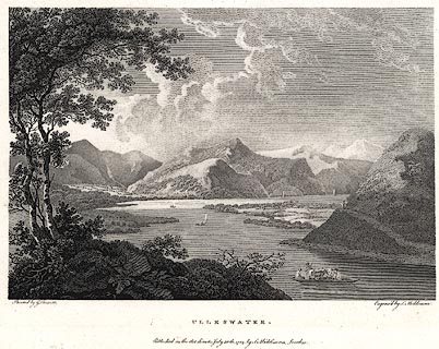 click to enlarge click to enlargePR0412.jpg Plate 6 from Select Views in Great Britain. printed at bottom left, right, centre:- "Painted by G. Barrett / Engrav'd by S. Middiman. / ULLESWATER. / Published as the Act directs, July 30th. 1784, by S. Middiman, London." item:- Dove Cottage : 2008.107.405 Image © see bottom of page |
|||||||||||||||||||||||||
|
|
||||||||||||||||||||||||||
 BLM23.jpg The Ullswater valley from:- (taken 23.12.2005) 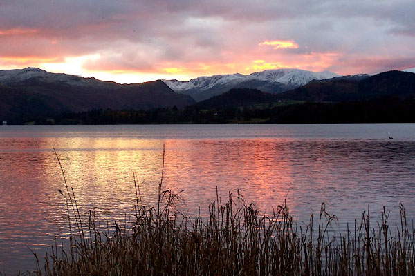 BLK52.jpg Sunset and dusk. (taken 28.11.2005) 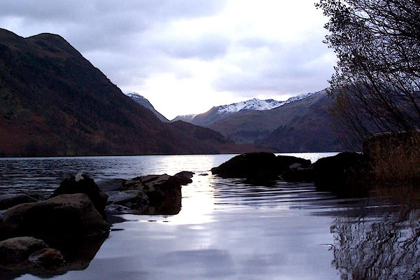 BLK53.jpg Sunset and dusk. (taken 28.11.2005)  Click to enlarge BLN47.jpg From Pooley Bridge Pier. (taken 4.1.2006)  CED61.jpg From Spying How. (taken 20.10.2015) 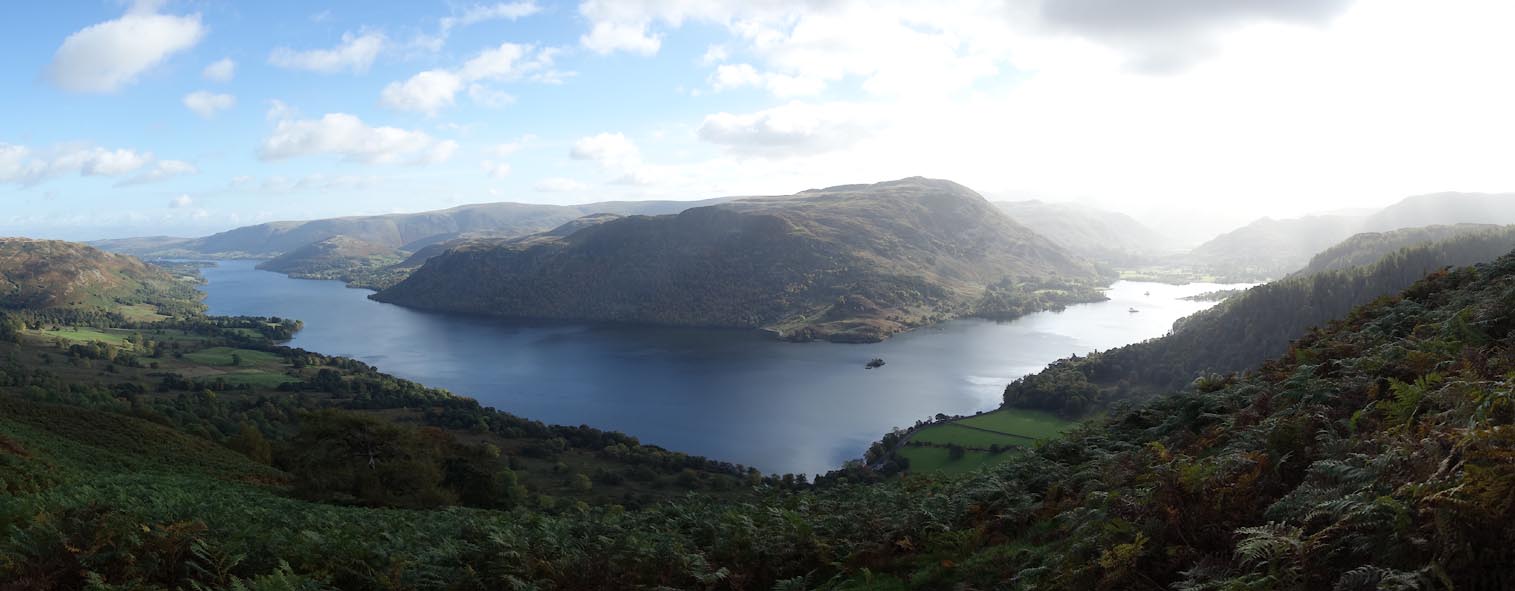 Click to enlarge CED62.jpg From Spying How. (taken 20.10.2015)  Click to enlarge BMY19.jpg Panorama from Silver Point, Patterdale to Matterdale. (taken 2.11.2006)  BLN96.jpg (taken 7.1.2006) 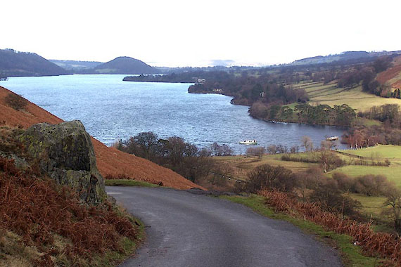 BLO88.jpg Howtown Wyke from The Rake. (taken 25.1.2006) 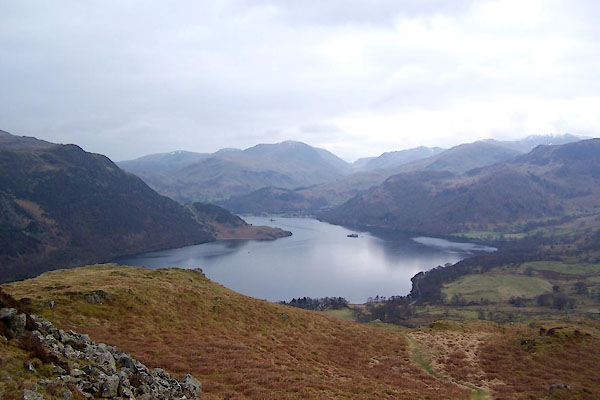 BUD17.jpg From Gowbarrow Park. (taken 28.2.2011) 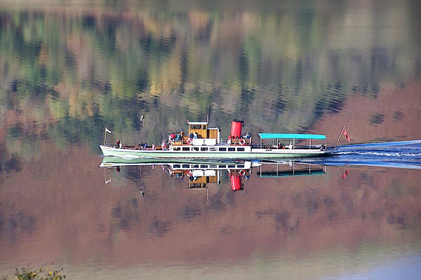 BMY21.jpg Lady of the Lake. (taken 2.11.2006) 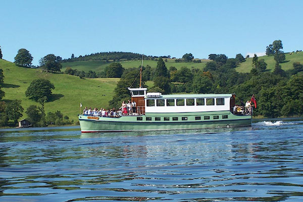 BNZ66.jpg (taken 24.8.2007) 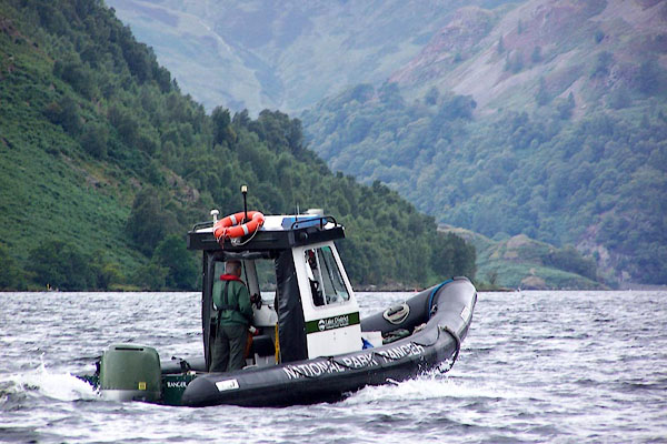 BOA32.jpg National Park Ranger. (taken 25.8.2007) 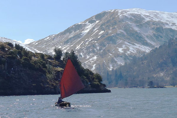 BYB06.jpg Sailing. (taken 3.4.2013) 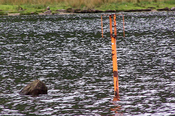 BOA38.jpg Danger mark, and the dangerous rock. (taken 25.8.2007) 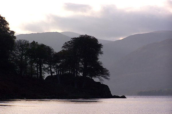 BMY33.jpg A headland. (taken 2.11.2006) 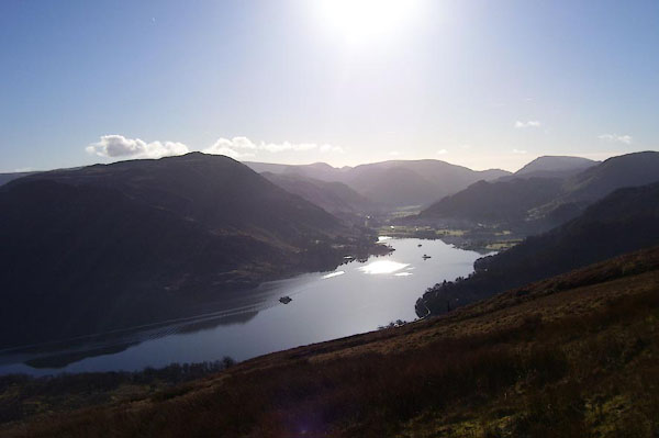 BND98.jpg From Swineside Knott. (taken 5.2.2007) 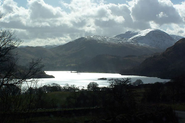 BJI94.jpg From near Aira Force. (taken 11.3.2005) 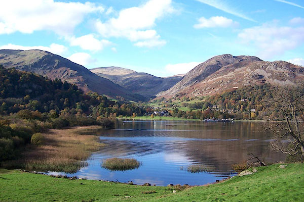 BMY09.jpg At Glenridding (taken 2.11.2006) |
||||||||||||||||||||||||||
|
|
||||||||||||||||||||||||||
| see:- | viewpoint, Dunmallard Hill Thomas West 1 viewpoint, Stybarrow Crag Thomas West 2 viewpoint, Patterdale Hotel Thomas West 3 viewpoint, Watermillock Thomas West viewpoint, Cross How Crag Peter Crosthwaite 1 viewpoint, Lyulph's Tower Peter Crosthwaite 2 viewpoint, Ridding Brow Peter Crosthwaite 3 |
|||||||||||||||||||||||||
|
|
||||||||||||||||||||||||||
Lakes Guides menu.