 Old Cumbria Gazetteer
 |
 |
|
| included in:- |
 Ullswater Ullswater |
|
| viewpoint, Ridding Brow | ||
| locality:- | Ridding Brow | |
| civil parish:- | Barton (formerly Westmorland) | |
| county:- | Cumbria | |
| locality type:- | viewpoint | |
| 1Km square:- | NY4823 | |
| 10Km square:- | NY42 | |
|
|
||
| evidence:- | old map:- Crosthwaite 1783-94 (Ull) placename:- station, Ullswater, Crosthwaite 3 |
|
| source data:- | Map, uncoloured engraving, Accurate Map of the Beautiful Lake of
Ullswater, scale about 3 inches to 1 mile, by Peter Crosthwaite,
Keswick, Cumberland, 1783, version published 1800.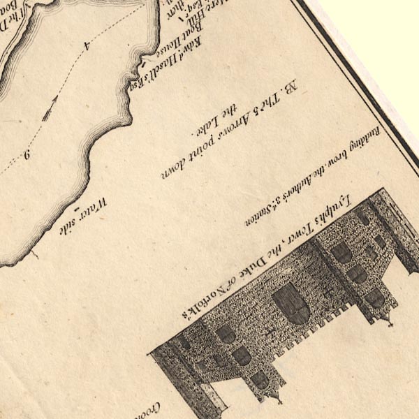 CT5NY42R.jpg "Rudding brow, the Author's 3d. Station" Just outside the map border at the south. item:- Armitt Library : 1959.191.7 Image © see bottom of page |
|
|
|
||
| indexing | ||
| person:- | map maker : Crosthwaite, Peter |
|
| place:- | Ullswater | |
| date:- | 1783 |
|
| period:- | 18th century, late | |
| period:- | 1780s | |
| item:- | map; Accurate Map of the Beautiful Lake of Ulls-water |
|
|
|
||
Lakes Guides menu.