 Old Cumbria Gazetteer
 |
 |
|
| included in:- |
 Ullswater Ullswater |
|
| viewpoint, Dunmallard Hill | ||
| site name:- | Dunmallard Hill | |
| civil parish:- | Dacre (formerly Cumberland) | |
| county:- | Cumbria | |
| locality type:- | viewpoint | |
| 1Km square:- | NY4624 | |
| 10Km square:- | NY42 | |
|
|
||
| evidence:- | descriptive text:- West 1778 (11th edn 1821) |
|
| source data:- | Guide book, A Guide to the Lakes, by Thomas West, published by
William Pennington, Kendal, Cumbria once Westmorland, and in
London, 1778 to 1821. goto source Page 153:- "[Mr Gray] 'gained the summit [of Dunmallet]. From hence, saw the lake opening directly at my feet, majestic in calmness, clear and smooth as a blue mirror, with winding shores, and low points of land, covered with green inclosures, white farm houses looking out among the trees, and cattle feeding. The water is almost everywhere bordered with cultivated lands, gently sloping upwards, from a mile to a quarter of a mile in breadth, till they reach the feet of the mountains, which rise very rude and awful, with their broken tops, on each hand. Directly in front, at better than three miles distance, Place-fell, one of the bravest among them, pushes its bold breast into the midst of the lake, and forces it to alter its course, forming first a large bay to the left, and then bending to the right. ...'" goto sourceAddendum; Mr Gray's Journal, 1769 Page 201:- "Oct. 1. A grey autumnal day, the air perfectly calm, and mild, went to see Ulls-water, ... Approached Dunmallet, a fine pointed hill, covered with wood, ... with some toil gained the summit. From hence saw the lake open directly at my feet, majestic in its calmness, clear and smooth as a blue mirror, with winding shores and low points of land covered with green inclosures, white farm houses looking out among the trees, and cattle feeding.- The water is almost everywhere bordered with cultivated lands, gently sloping upwards from a mile to a quarter of a mile in breadth, till they reach the feet of the mountains which rise very rude and awful with their broken tops on each hand. Directly in front, at better than three miles distance, Place-fell, one of the bravest among them, pushes its bold broad breast into the midst of the lake, and forces it to alter its course, forming first a large bay to the left, and then bending to the right. ..." |
|
|
|
||
| evidence:- | old map:- Crosthwaite 1783-94 (Ull) placename:- Dunmallet placename:- station, Ullswater, West 1 |
|
| source data:- | Map, uncoloured engraving, Accurate Map of the Beautiful Lake of
Ullswater, scale about 3 inches to 1 mile, by Peter Crosthwaite,
Keswick, Cumberland, 1783, version published 1800.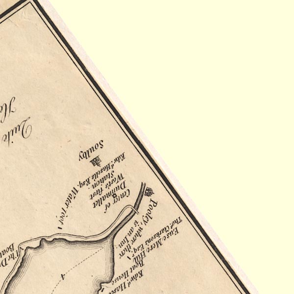 CT5NY42S.jpg "Centre of Dunmallet / West's first Station / Edwd. Hasell's Esq." item:- Armitt Library : 1959.191.7 Image © see bottom of page |
|
|
|
||
| indexing | ||
| person:- | author : West, Thomas |
|
| place:- | Ullswater | |
| date:- | 1778 |
|
| period:- | 18th century, late | |
| period:- | 1780s | |
| item:- | guide book; Guide to the Lakes |
|
|
|
||
Lakes Guides menu.