Old Cumbria Gazetteer
 |
 |
|
||
| Derwent, River | ||||
| runs into:- |  Irish Sea Irish Sea |
|||
|
|
||||
| civil parish:- | Workington (formerly Cumberland) | |||
| civil parish:- | Cockermouth (formerly Cumberland) | |||
| civil parish:- | Broughton (formerly Cumberland) | |||
| civil parish:- | Brigham (formerly Cumberland) | |||
| civil parish:- | Setmurthy (formerly Cumberland) | |||
| civil parish:- | Blindcrake (formerly Cumberland) | |||
| civil parish:- | Above Derwent (formerly Cumberland) | |||
| civil parish:- | Underskiddaw (formerly Cumberland) | |||
| civil parish:- | Borrowdale (formerly Cumberland) | |||
| county:- | Cumbria | |||
| locality type:- | river | |||
| 1Km square:- | NY2515 (etc) | |||
| 10Km square:- | NY21 | |||
| 10Km square:- | NY03 | |||
| 10Km square:- | NY13 | |||
| 10Km square:- | NY22 | |||
|
|
||||
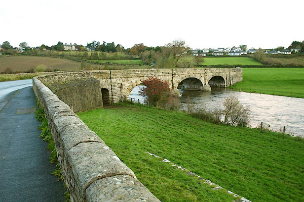
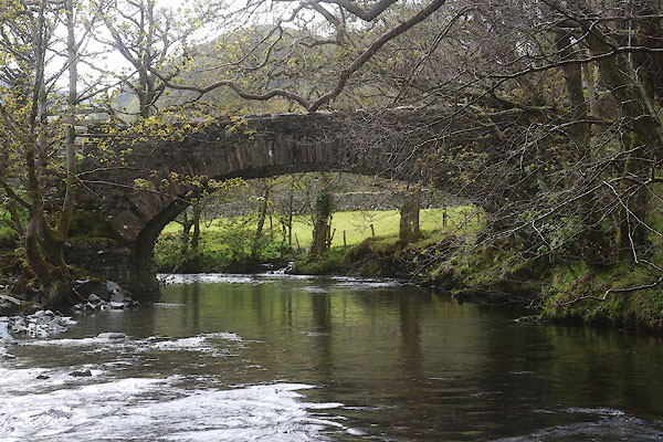
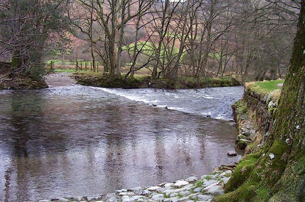
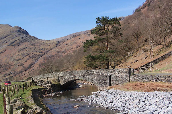
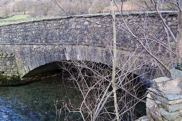
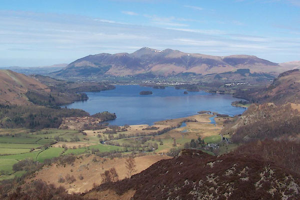
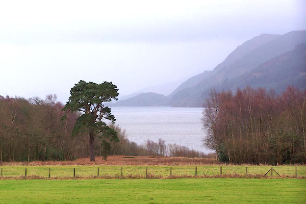
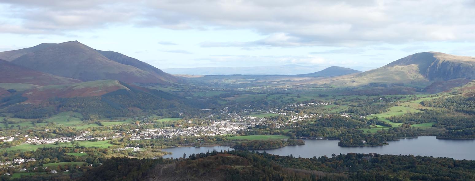
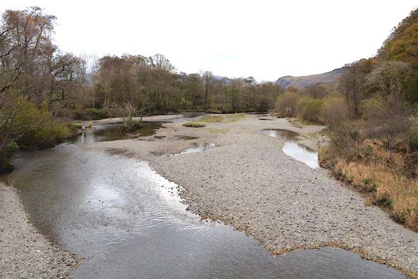
 BPT31.jpg At Broughton High Bridge. (taken 22.10.2008) 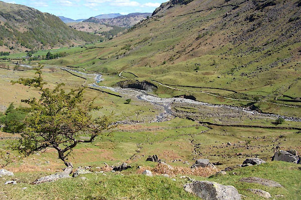 BQO04.jpg Above Seathwaite. (taken 12.5.2009) |
||||
|
|
||||
| evidence:- | old map:- OS County Series (Cmd 46 14) placename:- Derwent, River |
|||
| source data:- | Maps, County Series maps of Great Britain, scales 6 and 25
inches to 1 mile, published by the Ordnance Survey, Southampton,
Hampshire, from about 1863 to 1948. OS County Series (Cmd 46 15) OS County Series (Cmd 53 8) OS County Series (Cmd 54 3) OS County Series (Cmd 54 4) OS County Series (Cmd 64 1) |
|||
| source data:- | Maps, County Series maps of Great Britain, scales 6 and 25
inches to 1 mile, published by the Ordnance Survey, Southampton,
Hampshire, from about 1863 to 1948. "Ordinary Spring Tides flow to this point" about NY00492905 |
|||
|
|
||||
| evidence:- | old map:- Paris 1240s placename:- Dorevente |
|||
| source data:- | Maps, 4 manuscripts, of Great Britain by Matthew Paris, St
Albans, drawn in the mid 13th century. |
|||
|
|
||||
| evidence:- | old map:- Gough 1350s-60s |
|||
| source data:- | Map, colour photozincograph copy, reduced size facsimile, Gough
Map of Britain, scale about 28.5 miles to 1 inch, published by
the Ordnance Survey, Southampton, Hampshire, 1875. click to enlarge click to enlargeGgh1Cm.jpg Running into the sea by Workington. item:- JandMN : 33 Image © see bottom of page |
|||
|
|
||||
| evidence:- | old map:- Gough 1350s-60s |
|||
| source data:- | Map, lithograph facsimile, Gough Map of Britain, 20 miles to 1
inch? published by the Ordnance Survey, Southampton, Hampshire,
1935. click to enlarge click to enlargeGgh2Cm.jpg Running into the sea by Workington. item:- JandMN : 34 Image © see bottom of page |
|||
|
|
||||
| evidence:- | old map:- Lloyd 1573 placename:- Derwent Fl. |
|||
| source data:- | Map, hand coloured copper plate engraving, Angliae Regni,
Kingdom of England, with Wales, scale about 24 miles to 1 inch, authored by Humphrey
Lloyd, Denbigh, Clwyd, drawn and engraved
by Abraham Ortelius, Netherlands, 1573. click to enlarge click to enlargeLld1Cm.jpg "Derwent fl." item:- Hampshire Museums : FA1998.69 Image © see bottom of page |
|||
|
|
||||
| evidence:- | old map:- Saxton 1579 placename:- Darwen Flu. |
|||
| source data:- | Map, hand coloured engraving, Westmorlandiae et Cumberlandiae Comitatus ie Westmorland
and Cumberland, scale about 5 miles to 1 inch, by Christopher Saxton, London, engraved
by Augustinus Ryther, 1576, published 1579-1645.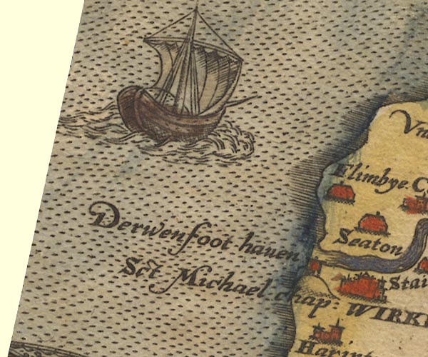 Sax9NX93.jpg 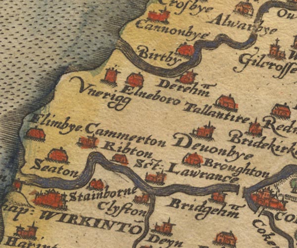 Sax9NY03.jpg  Sax9NY13.jpg 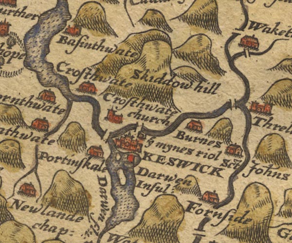 Sax9NY22.jpg "Darwen flu:" 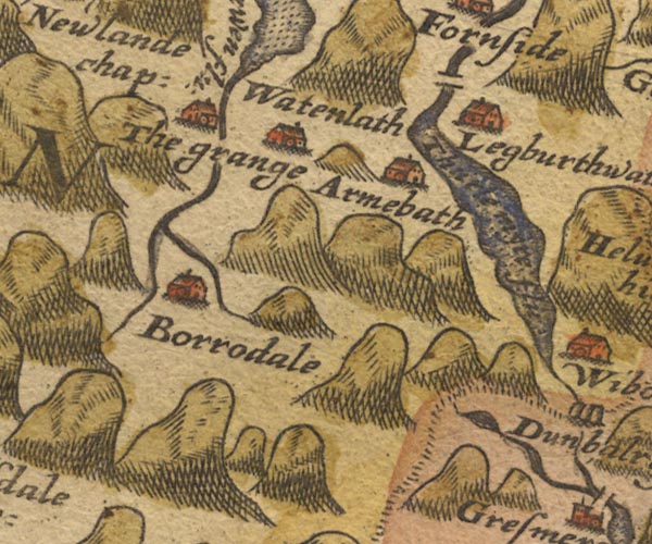 Sax9NY21.jpg item:- private collection : 2 Image © see bottom of page |
|||
|
|
||||
| evidence:- | old map:- Mercator 1595 (edn?) placename:- Darwen flu. |
|||
| source data:- | Map, hand coloured engraving, Northumbria, Cumberlandia, et
Dunelmensis Episcopatus, ie Northumberland, Cumberland and
Durham etc, scale about 6.5 miles to 1 inch, by Gerard Mercator,
Duisberg, Germany, about 1595. MER8CumB.jpg "Darwen flu." double line with stream lines; river, running into the sea 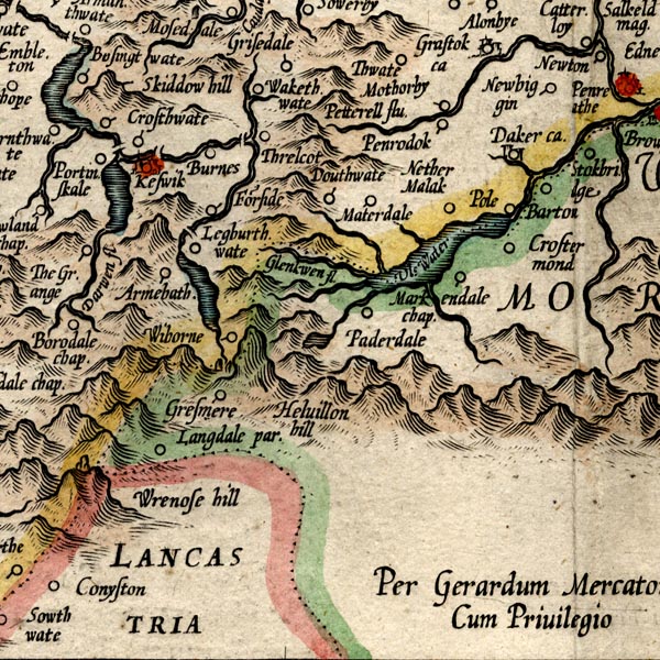 MER8CumF.jpg "Darwen flu." double line with stream lines; river, running into Derwent Water, etc item:- JandMN : 169 Image © see bottom of page |
|||
|
|
||||
| evidence:- | old map:- Keer 1605 |
|||
| source data:- | Map, hand coloured engraving, Westmorland and Cumberland, scale
about 16 miles to 1 inch, probably by Pieter van den Keere, or
Peter Keer, about 1605 edition perhaps 1676. click to enlarge click to enlargeKER8.jpg "" double wiggly line, tapering to single; river item:- Dove Cottage : 2007.38.110 Image © see bottom of page |
|||
|
|
||||
| evidence:- | old map:- Speed 1611 (Cum/EW) |
|||
| source data:- | Map, hand coloured engraving, Kingdome of Great Britaine and
Ireland, scale about 36 miles to 1 inch, by John Speed, about
1610-11, published by Thomas Bassett, Fleet Street and Richard
Chiswell, St Paul's Churchyard, London, 1676? click to enlarge click to enlargeSPD6Cm.jpg tapering wiggly line item:- private collection : 85 Image © see bottom of page |
|||
|
|
||||
| evidence:- | old map:- Speed 1611 (Cmd) placename:- Darwen flu. placename:- Darwent flu. |
|||
| source data:- | Map, hand coloured engraving, Cumberland and the Ancient Citie
Carlile Described, scale about 4 miles to 1 inch, by John Speed,
1610, published by J Sudbury and George Humble, Popes Head
Alley, London, 1611-12.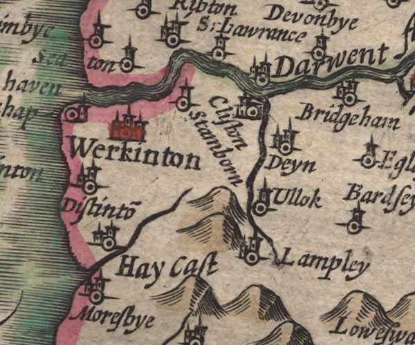 SP11NY02.jpg "Darwent flu" double line with stream lines, runs into the sea 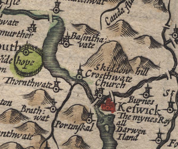 SP11NY22.jpg between Derwent Water and Bassenthwaite Lake 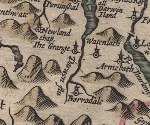 SP11NY21.jpg "Darwen flu" double line, runs into Derwent Water item:- private collection : 16 Image © see bottom of page |
|||
|
|
||||
| evidence:- | poem:- Drayton 1612/1622 text placename:- Darwent |
|||
| source data:- | Poem, Poly Olbion, by Michael Drayton, published by published by
John Marriott, John Grismand and Thomas Dewe, and others?
London, part 1 1612, part 2 1622. goto source page 165:- "... Where Darwent her cleere Fount from Borowdale that brings, Doth quickly cast her selfe into an ample Lake, ..." "... this River [Derwent] proud the while. Keepes on her Course to Sea, and in her way doth win Cleere Coker her compeere, ... ... ... Darwent therewithall, Runnes on her watry Race, and for her greater fame, Of Neptune doth obtaine a Haven of her name, ..." goto sourcepage 166:- "... Cleere Darwent dancing on, I [Skiddaw] looke at from above, As some enamoured Youth, being deeply struck in love, His Mistris doth behold, and every beautie notes; Who as shee to her fall, through Fells and Vallies flotes, Oft lifts her limber selfe above her Banks to view, How my brave by clift top, doth still her Course pursue." |
|||
|
|
||||
| evidence:- | probably table of distances:- Simons 1635 |
|||
| source data:- | Table of distances, uncoloured engraving, Cumberland, with a
thumbnail map, scale about 41 miles to 1 inch, by Mathew Simons,
published in A Direction for the English Traviller, 1635.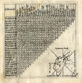 click to enlarge click to enlargeSIM4.jpg on thumbnail map item:- private collection : 50.11 Image © see bottom of page |
|||
|
|
||||
| evidence:- | old map:- Jenner 1643 |
|||
| source data:- | Tables of distances with a maps, Westmerland, scale about 16
miles to 1 inch, and Cumberland, scale about 21 miles to 1 inch,
published by Thomas Jenner, London, 1643; published 1643-80. JEN4Sq.jpg wiggly line |
|||
|
|
||||
| evidence:- | old map:- Jansson 1646 |
|||
| source data:- | Map, hand coloured engraving, Cumbria and Westmoria, ie
Cumberland and Westmorland, scale about 3.5 miles to 1 inch, by
John Jansson, Amsterdam, Netherlands, 1646.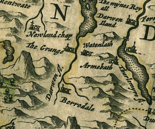 JAN3NY21.jpg "Darwen fl." 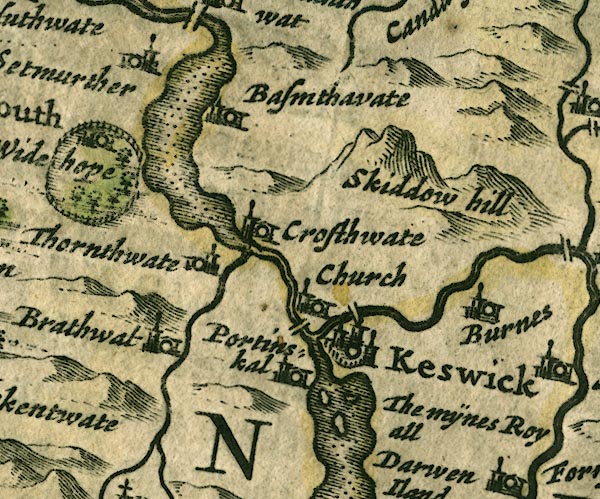 JAN3NY22.jpg 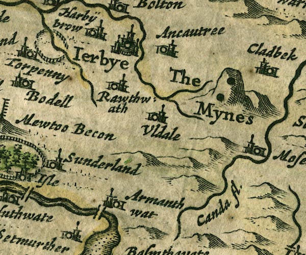 JAN3NY23.jpg 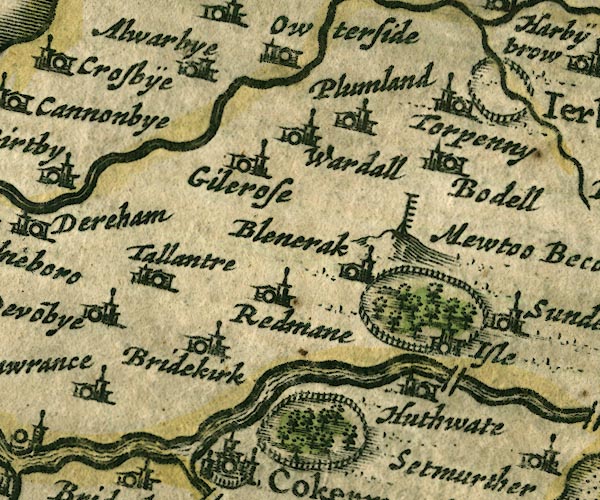 JAN3NY13.jpg 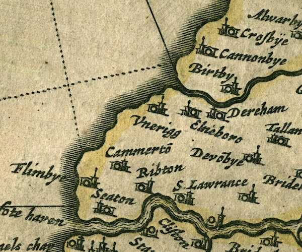 JAN3NY03.jpg Double line with stream lines, tapering to a single line. item:- JandMN : 88 Image © see bottom of page |
|||
|
|
||||
| evidence:- | old map:- Ogilby 1675 (plate 96) placename:- Darwen Fluvius placename:- Derwen Fluvius |
|||
| source data:- | Road strip map, hand coloured engraving, the Road from Kendal to
Cockermouth, and the Road from Egremond to Carlisle, scale about
1 inch to 1 mile, by John Ogilby, London, 1675.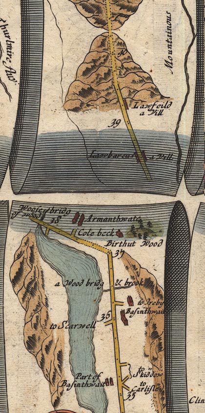 OG96m035.jpg In mile 38, Cumberland. River running out of the lake and crossed by the road over:- "Woose bridg of wood" item:- JandMN : 22 Image © see bottom of page |
|||
| source data:- | Road strip map, hand coloured engraving, the Road from Kendal to
Cockermouth, and the Road from Egremond to Carlisle, scale about
1 inch to 1 mile, by John Ogilby, London, 1675.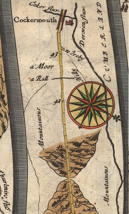 OG96m040.jpg In miles 35 to 43, Cumberland. River on the right of the road for 5 miles:- "Derwen fluv:" item:- JandMN : 22 Image © see bottom of page |
|||
| source data:- | Road strip map, hand coloured engraving, the Road from Kendal to
Cockermouth, and the Road from Egremond to Carlisle, scale about
1 inch to 1 mile, by John Ogilby, London, 1675.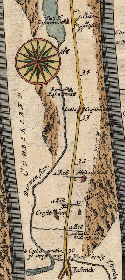 OG96m030.jpg In miles 30 to 34, Cumberland. "Darwen fluv:" alongside off to the left of the road, from Keswick to Bassenthwaite lake. 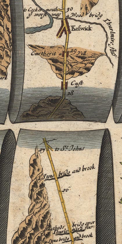 OG96m025.jpg In mile 29, Cumberland. Flowing from Derwent Water on the left of the road. item:- JandMN : 22 Image © see bottom of page |
|||
| source data:- | Road strip map, hand coloured engraving, the Road from Kendal to
Cockermouth, and the Road from Egremond to Carlisle, scale about
1 inch to 1 mile, by John Ogilby, London, 1675.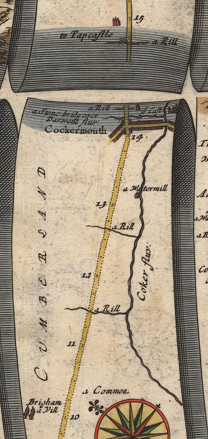 OG96Bm10.jpg In mile 14, Cumberland. River crossed by:- "a Stone bridg over Darwent fluv:" no bridge drawn. item:- JandMN : 22 Image © see bottom of page |
|||
|
|
||||
| evidence:- | old map:- Sanson 1679 placename:- Darwen flu. |
|||
| source data:- | Map, hand coloured engraving, Ancien Royaume de Northumberland
aujourdhuy Provinces de Nort, ie the Ancient Kingdom of
Northumberland or the Northern Provinces, scale about 9.5 miles
to 1 inch, by Nicholas Sanson, Paris, France, 1679. click to enlarge click to enlargeSAN2Cm.jpg "Darwen flu." tapering wiggly line; river item:- Dove Cottage : 2007.38.15 Image © see bottom of page |
|||
|
|
||||
| evidence:- | old map:- Seller 1694 (Cmd) |
|||
| source data:- | Map, uncoloured engraving, Cumberland, scale about 12 miles to 1
inch, by John Seller, 1694. click to enlarge click to enlargeSEL9.jpg tapering wiggly line; river item:- Dove Cottage : 2007.38.89 Image © see bottom of page |
|||
|
|
||||
| evidence:- | old map:- Morden 1695 (EW) |
|||
| source data:- | Map, hand coloured engraving, England, including Wales, scale
about 27 miles to 1 inch, by Robert Morden, published by Abel
Swale Awnsham and John Churchil, London, about 1695. click to enlarge click to enlargeMRD3Cm.jpg tapering wiggly line item:- JandMN : 339 Image © see bottom of page |
|||
|
|
||||
| evidence:- | old map:- Morden 1695 (Cmd) placename:- Derwent River placename:- Darwent River |
|||
| source data:- | Map, uncoloured engraving, Cumberland, scale about 4 miles to 1
inch, by Robert Morden, 1695, published by Abel Swale, the
Unicorn, St Paul's Churchyard, Awnsham, and John Churchill, the
Black Swan, Paternoster Row, London, 1695-1715. MD12NY03.jpg "Derwent R."  MD12NY13.jpg 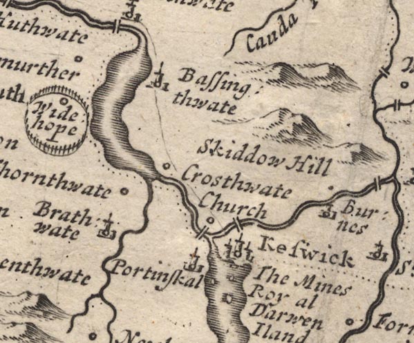 MD12NY22.jpg 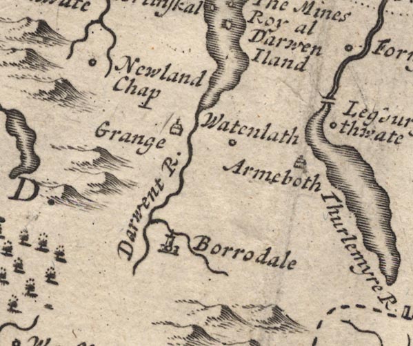 MD12NY21.jpg "Darwent R." item:- JandMN : 90 Image © see bottom of page |
|||
|
|
||||
| evidence:- | old map:- Morden 1695 (Wmd) placename:- Darwent River |
|||
| source data:- | Map, hand coloured engraving, Westmorland, scale about 2.5 miles to 1 inch, by Robert
Morden, published by Abel Swale, the Unicorn, St Paul's Churchyard, Awnsham, and John
Churchill, the Black Swan, Paternoster Row, London, 1695.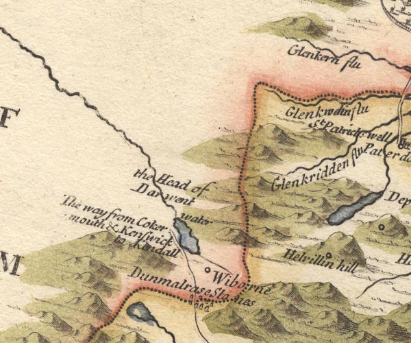 MD10NY31.jpg "the Head of Darwent water" item:- JandMN : 24 Image © see bottom of page |
|||
|
|
||||
| evidence:- | old map:- Bowen 1720 (plate 261) placename:- Derwen Flu. placename:- Darwent Flu. |
|||
| source data:- | Road strip map, uncoloured engraving, pl.261, the end of the
road from Kendal to Cockermouth and the road from Egremont to
Carlisle, scale about 2 miles to 1 inch, published by Emanuel
Bowen, St Katherines, London, 1720. B261m10.jpg At mile 14+. item:- Dove Cottage : Lowther.36 Image © see bottom of page |
|||
|
|
||||
| evidence:- | perhaps old map:- Stukeley 1723 |
|||
| source data:- | Road map, uncoloured engraving, the Antonine Itineraries through
Britain, scale about 55 miles to 1 inch, plotted by William
Stukeley, 1723, published London, 1724.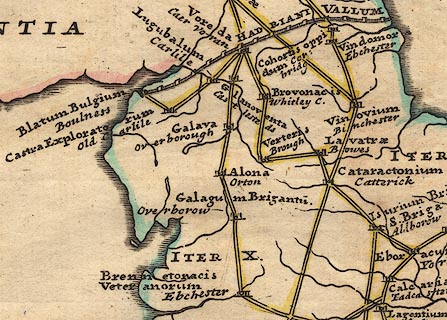 click to enlarge click to enlargeStu1Cm.jpg item:- Hampshire Museums : FA2001.171 Image © see bottom of page |
|||
|
|
||||
| evidence:- | descriptive text:- Defoe 1724-26 placename:- item:- salmon |
|||
| source data:- | Tour through England and Wales, by Daniel Defoe, published in
parts, London, 1724-26. "This Derwent is famous for its springing out of those hills, call'd Derwent Fells, ..." "..." "Cockermouth stands upon the River Derwent, about twelve miles from the sea, but more by the windings of the river, yet vessels of good burthen may come up to it." "..." "The River Derwent is noted for very good salmon, and for a very great quantity, and trout. Hence, that is, from Workington at the mouth of this river, and from Carlisle, notwithstanding the great distance, they at this time carry salmon (fresh as they take it) quite to London. This is perform'd with horses, which, changing often, go night and day without intermission, and, as they say, very much out-go the post; so that the fish come very sweet and good to London, where the extraordinary price they yield, being often sold at two shillings and sixpence to four shillings per pound, pay very well for the carriage." |
|||
|
|
||||
| evidence:- | old map:- Badeslade 1742 placename:- Derwent River |
|||
| source data:- | Map, uncoloured engraving, A Map of Cumberland North from
London, scale about 11 miles to 1 inch, with descriptive text,
by Thomas Badeslade, London, engraved and published by William
Henry Toms, Union Court, Holborn, London, 1742. click to enlarge click to enlargeBD10.jpg "Derwent R." tapering wiggly line item:- JandMN : 115 Image © see bottom of page |
|||
|
|
||||
| evidence:- | old text:- Gents Mag placename:- Darwent, River item:- canal, Workington to Cockermouth |
|||
| source data:- | Magazine, The Gentleman's Magazine or Monthly Intelligencer or
Historical Chronicle, published by Edward Cave under the
pseudonym Sylvanus Urban, and by other publishers, London,
monthly from 1731 to 1922. goto source Gentleman's Magazine 1748 p.4 "... The river Darwent is the second for magnitude in Cumberland; it might be made navigable to Cockermouth, by cutting thro' some grounds, and erecting locks; for it admits ships of tolerable burthen for coasters to Workington." |
|||
|
|
||||
| evidence:- | old map:- Simpson 1746 map (Wmd) |
|||
| source data:- | Map, uncoloured engraving, Westmorland, scale about 8 miles to 1
inch, printed by R Walker, Fleet Lane, London, 1746. SMP2NYG.jpg Wiggly line, out of Derwent Water, north east then north.  SMP2NYF.jpg Wiggly line; into Derwent Water. item:- Dove Cottage : 2007.38.59 Image © see bottom of page |
|||
|
|
||||
| evidence:- | descriptive text:- Simpson 1746 placename:- Derwent, River |
|||
| source data:- | Atlas, three volumes of maps and descriptive text published as
'The Agreeable Historian, or the Compleat English Traveller
...', by Samuel Simpson, 1746. goto source "... The Derwent runs thro' the Middle of the County, passes by Cockermouth, and discharges itself into the Irish Sea near Workington." goto source"..." "The River Derwent, which rising in Borrodale, a Vale surrounded with crooked Hills, runs among the Mountains, call'd Derwent Fells, which having pass'd, it spreads itself into a spacious Lake, ..." |
|||
|
|
||||
| evidence:- | old map:- Gents Mag 1751 placename:- Darwent River |
|||
| source data:- | Map, uncoloured engraving, Map of the Black Lead Mines in
Cumberland, and area, scale about 2 miles to 1 inch, by George
Smith, published in the Gentleman's Magazine, 1751. GM1305.jpg 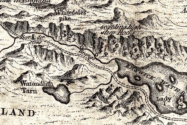 GM1310.jpg 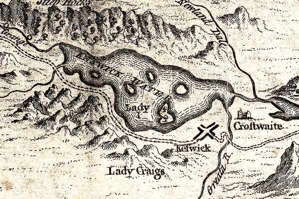 GM1311.jpg 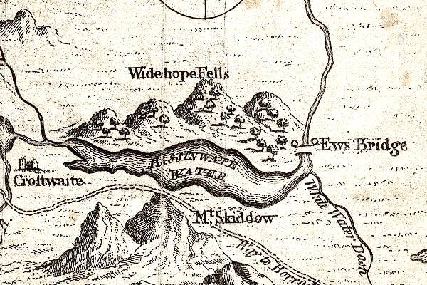 GM1312.jpg  GM1308.jpg 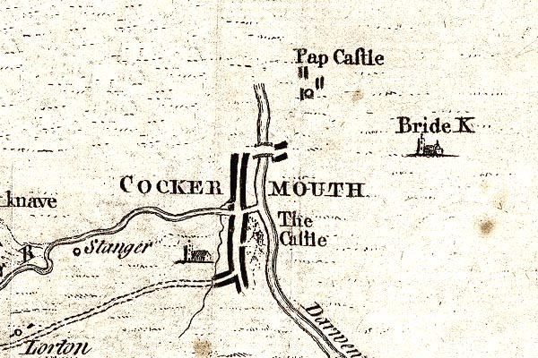 GM1304.jpg "Darwent R." tapering wiggly line; river item:- JandMN : 114 Image © see bottom of page |
|||
|
|
||||
| evidence:- | old map:- Bowen and Kitchin 1760 |
|||
| source data:- | Map, hand coloured engraving, A New Map of the Counties of
Cumberland and Westmoreland Divided into their Respective Wards,
scale about 4 miles to 1 inch, by Emanuel Bowen and Thomas
Kitchin et al, published by T Bowles, Robert Sayer, and John
Bowles, London, 1760. BO18NX92.jpg river mouth into the sea  BO18NY02.jpg  BO18NY12.jpg wiggly line, into and out of Bassenthwaite Lake  BO18NY11.jpg wiggly line, into Derwent Water  BO18NY10.jpg item:- Armitt Library : 2008.14.10 Image © see bottom of page |
|||
|
|
||||
| evidence:- | old map:- Donald 1774 (Cmd) |
|||
| source data:- | Map, hand coloured engraving, 3x2 sheets, The County of Cumberland, scale about 1
inch to 1 mile, by Thomas Donald, engraved and published by Joseph Hodskinson, 29
Arundel Street, Strand, London, 1774. D4NY03SW.jpg  D4NY03SE.jpg "Derwent River"  D4NY13SW.jpg 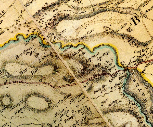 D4NY13SE.jpg 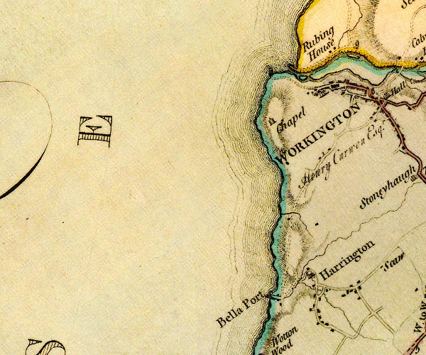 D4NX92NE.jpg  D4NY02NW.jpg  D4NY22NW.jpg "Derwent River"  D4NY22SE.jpg  D4NY21NW.jpg  D4NY21NE.jpg single or double wiggly line; a river in and from Derwent Water; into the sea item:- Carlisle Library : Map 2 Images © Carlisle Library |
|||
|
|
||||
| evidence:- | old map:- Donald 1774 (Cmd) placename:- Derwent River |
|||
| source data:- | Map, hand coloured engraving, 3x2 sheets, The County of Cumberland, scale about 1
inch to 1 mile, by Thomas Donald, engraved and published by Joseph Hodskinson, 29
Arundel Street, Strand, London, 1774. D41231F.jpg  D41130Z.jpg  D41230E.jpg "DERWENT RIVER"  D41230J.jpg  D41130T.jpg river item:- Carlisle Library : Map 2 Images © Carlisle Library |
|||
|
|
||||
| evidence:- | descriptive text:- West 1778 (11th edn 1821) |
|||
| source data:- | Guide book, A Guide to the Lakes, by Thomas West, published by
William Pennington, Kendal, Cumbria once Westmorland, and in
London, 1778 to 1821. goto source Page 96:- "... This river brings no mixture of mud from the mountains of naked rock, and runs in a channel of slate and granite, as clear as crystal. ..." goto sourcePage 97:- "... Here [Borrowdale] the Derwent, rapid as the Rhone, rolls his crystal streams through all the labyrinth of embattled obstacles. ..." "..." goto sourcePage 106:- "[from Latrigg] ... Below you, rolls the Greta, and, in its course, visits the town before it joins the Derwent, where it issues from the lake, and then their united streams are seen meandering through the vale till they meet the floods of Bassenthwaite, under the verdant skirts of Wythop brows." "..." goto sourcePage 107:- "The prospect to the south ... full into the rocky jaws of Borrowdale, through which the Derwent is seen pouring his crystal stream, and, after winding through some verdant meadows, which skirt the rocky coast, joining the lake at Lowdore. ..." |
|||
|
|
||||
| evidence:- | old map:- Crosthwaite 1783-94 (Bas) placename:- Derwent River |
|||
| source data:- | Map, uncoloured engraving, An Accurate Map of Broadwater or
Bassenthwaite Lake, scale about 3 inches to 1 mile, by Peter
Crosthwaite, Keswick, Cumberland, 1783, version published 1800.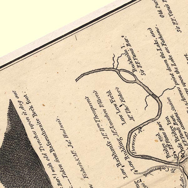 CT6NY13W.jpg "Derwent R." 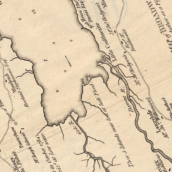 CT6NY22I.jpg "Derwent R." item:- Armitt Library : 1959.191.4 Image © see bottom of page |
|||
|
|
||||
| evidence:- | old map:- Crosthwaite 1783-94 (Der) placename:- Grange River |
|||
| source data:- | Map, uncoloured engraving, An Accurate Map of the Matchless Lake
of Derwent, ie Derwent Water, scale about 3 inches to 1 mile, by
Peter Crosthwaite, Keswick, Cumberland, 1783, version published
1800.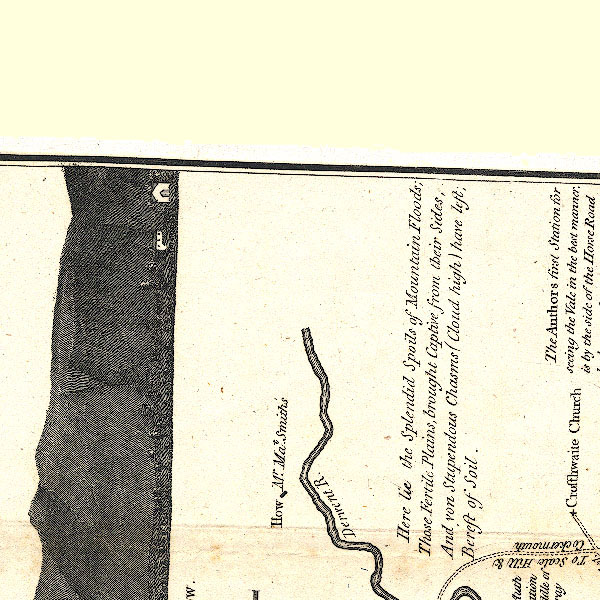 CT2NY22L.jpg "Derwent R." 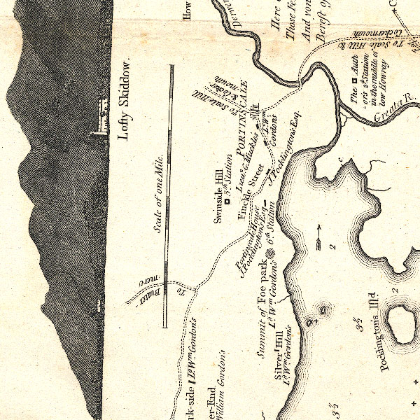 CT2NY22K.jpg 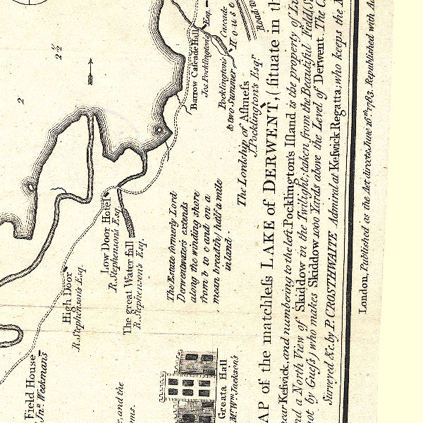 CT2NY21T.jpg 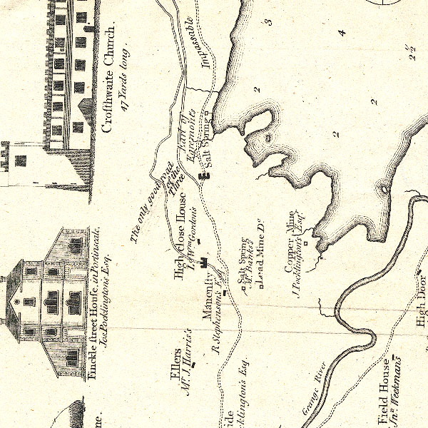 CT2NY21N.jpg "Grange River" 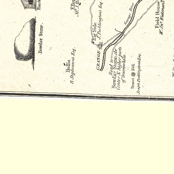 CT2NY21M.jpg item:- Armitt Library : 1959.191.3 Image © see bottom of page |
|||
|
|
||||
| evidence:- | old map:- West 1784 map placename:- Derwent River |
|||
| source data:- | Map, hand coloured engraving, A Map of the Lakes in Cumberland,
Westmorland and Lancashire, scale about 3.5 miles to 1 inch,
engraved by Paas, 53 Holborn, London, about 1784.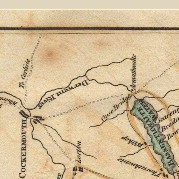 Ws02NY13.jpg item:- Armitt Library : A1221.1 Image © see bottom of page |
|||
|
|
||||
| evidence:- | old text:- Gilpin 1786 placename:- Derwent, River |
|||
| source data:- | Book, Observations, Relative Chiefly to Picturesque Beauty, Made
in the Year 1772, on Several Parts of England, Particularly the
Mountains, and Lakes of Cumberland Westmoreland, by Rev William
Gilpin, 1772-74; published 1786-1808. goto source vol.1 p.192 "..." "These two rivers, the Lodoar, and the Derwent, furnish the chief supplies of Derwentwater. But those of the latter are much ampler. The Lodoar accordingly is lost in the lake: while the Derwent, first giving it's name to it, retains it's own to the sea." |
|||
|
|
||||
| evidence:- | old map:- Clarke 1787 map (Keswick to Broadwater) placename:- Derwent, River |
|||
| source data:- | Map, uncoloured engraving, A Map of the Roads etc between
Keswick, and Broadwater, ie Bassenthwaite Lake, Cumberland,
scale about 9 miles to 1 inch, drawn and published by James
Clarke, Penrith and London, 1789.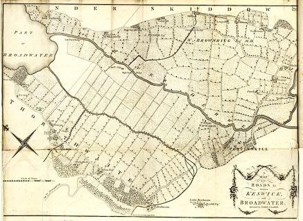 click to enlarge click to enlargeCL20.jpg running into Bassenthwaite Lake "RIVER DERWENT" item:- Armitt Library : A6615.7 Image © see bottom of page |
|||
|
|
||||
| evidence:- | old map:- Clarke 1787 map (Der) placename:- Grainge Beck placename:- Eea Foot |
|||
| source data:- | Map, uncoloured engraving, Map of Derwentwater and its Environs,
scale about 13 ins to 1 mile, by James Clarke, engraved by S J
Neele, published by James Clarke, Penrith, Cumberland and in
London etc, 1787.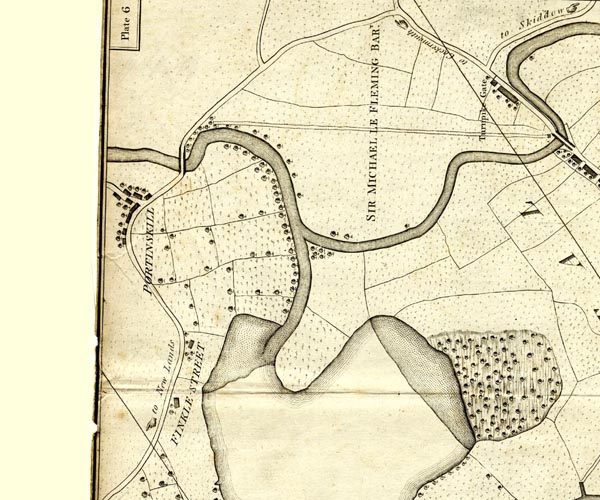 CL152523.jpg running from Derwent Water 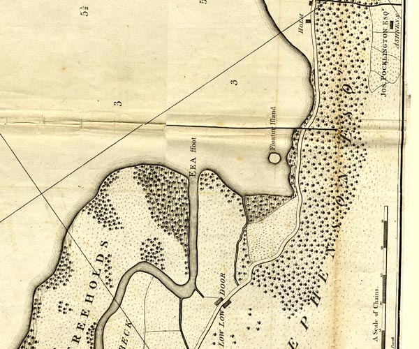 CL152619.jpg "EEA ffoot" running into Derwent Water 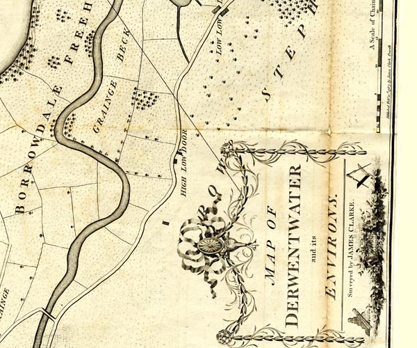 CL152618.jpg "GRAINGE BECK" item:- private collection : 169 Image © see bottom of page |
|||
|
|
||||
| evidence:- | old map:- Clarke 1787 map (Bassenthwaite Lake) placename:- Derwent, River |
|||
| source data:- | Map, A Map of Broadwater and its Environs, ie Bassenthwaite
Lake, scale about 6.5 ins to 1 mile, by James Clarke, engraved
by Neele, 352 Strand, published by James Clarke, Penrith,
Cumberland and in London etc, 1787.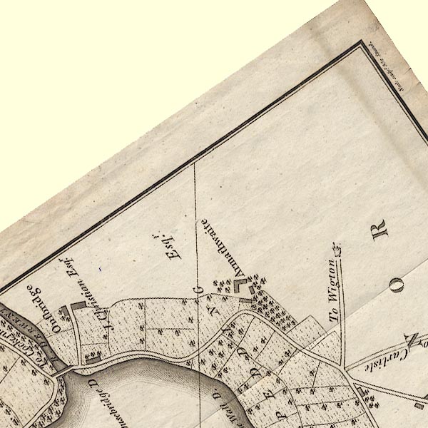 CL8NY23B.jpg "R. DERWENT" 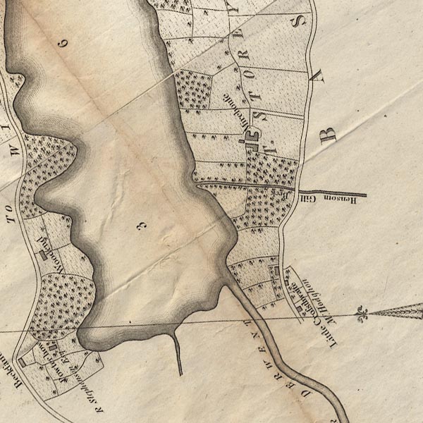 CL8NY22I.jpg "RIVER DERWENT" item:- private collection : 10.8 Image © see bottom of page |
|||
|
|
||||
| evidence:- | old text:- Camden 1789 placename:- Derwent, River |
|||
| source data:- | Book, Britannia, or A Chorographical Description of the Flourishing Kingdoms of England,
Scotland, and Ireland, by William Camden, 1586, translated from the 1607 Latin edition
by Richard Gough, published London, 1789. goto source Page 170:- "..." "Behind this [Hayes Castle] the river Derwent hides itself in the sea. It rises in Borrodale, a valley surrounded with crooked hills, winds among the hills called Derwentfels, in which at Newlands and elsewhere were rich veins of copper with some little gold and silver, ... The Derwent running among these hills spreads itself in a spacious lake, or as Bede calls it a very large pool, ... On the edges of this lake in very rich land, surrounded by dewy hills, and defended from the north winds by Skiddaw a very high mountain, lies Keswicke, ..." "..." "From hence the Derwent sometimes in a narrow, sometimes in a broad channel proceeds with rapidity to the north to meet the Cokar. These two rivers at their confluence almost surround Cokarmouth, ..." "... The Derwent, afterwards in one united" goto sourcePage 171:- "stream, throws itself into the ocean at Wirkinton, famous for a salmon fishery. ..." |
|||
|
|
||||
| evidence:- | old print:- Farington 1789 |
|||
| source data:- | Print, uncoloured engraving, The Grange, in Borrowdale, Cumberland, drawn by Joseph
Farington, engraved by W Byrne and T Medland, published by William Byrne, 79 Titchfield
Street, London, 1784.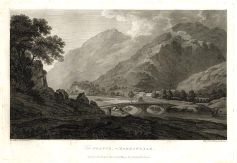 click to enlarge click to enlargeFA0302.jpg printed, bottom left, right, centre "Drawn by Josh. Farington / Engraved by W. Byrne &T. Medland / The GRANGE, in BORROWDALE. / Published as the Act directs, 1 Decr. 1784, by W. Byrne, No.79, Titchfield Str. London." item:- Armitt Library : A6668.2 Image © see bottom of page |
|||
|
|
||||
| evidence:- | old map:- Aikin 1790 (Cmd) placename:- Derwent River |
|||
| source data:- | Map, uncoloured engraving, Cumberland, by John Aikin, London,
1790. click to enlarge click to enlargeAIK3.jpg "Derwent R." river item:- JandMN : 145 Image © see bottom of page |
|||
|
|
||||
| evidence:- | old drawing:- Green 1790s-1820s placename:- Derwent, River |
|||
| source data:- | Drawing, pencil, View on the Derwent river near Isel, Blindcrake and Setmurthy, Cumberland,
by William Green, Ambleside, Westmorland, 1800.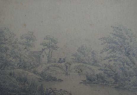 click to enlarge click to enlargePR1727.jpg ms at bottom left:- "View of the Derwent river near Isel." courtesy of Abbot Hall Art Gallery, Kendal item:- Abbot Hall : AH741.69 Image © see bottom of page |
|||
|
|
||||
| evidence:- | old map:- Bailey 1797 placename:- Derwen River |
|||
| source data:- | Map, soil etc, uncoloured engraving, Cumberland, scale about 21
miles to 1 inch, by J Bailey, engraved by Neele, Strand,
published by Messrs Robinson, Paternoster Row and G Nicol, Pall
Mall, London, 1797. click to enlarge click to enlargeBY04.jpg "Derwen R." river item:- Armitt Library : A680.2 Image © see bottom of page |
|||
|
|
||||
| evidence:- | road book:- Cary 1798 (2nd edn 1802) placename:- Derwent, River |
|||
| source data:- | Road book, itineraries, Cary's New Itinerary, by John Cary, 181
Strand, London, 2nd edn 1802. goto source click to enlarge click to enlargeC38557.jpg page 557-558 "Cross the Derwent River" item:- JandMN : 228.2 Image © see bottom of page |
|||
|
|
||||
| evidence:- | old map:- Skrine 1801 placename:- Derwent River |
|||
| source data:- | Map, uncoloured engraving, rivers in Cumberland, Westmorland,
Lancashire and Cheshire, scale about 23 miles to 1 inch, by
Henry Skrine, published by P Elmsly, London, 1801. click to enlarge click to enlargeM076.jpg "Derwent R." river item:- JandMN : 421 Image © see bottom of page |
|||
|
|
||||
| evidence:- | old map:- Cooke 1802 |
|||
| source data:- | Map, Cumberland, scale about 15.5 miles to 1 inch, by George
Cooke, 1802, bound in Gray's New Book of Roads, 1824, published
by Sherwood, Jones and Co, Paternoster Road, London, 1824. click to enlarge click to enlargeGRA1Cd.jpg tapering wiggly line; river item:- Hampshire Museums : FA2000.62.2 Image © see bottom of page |
|||
|
|
||||
| evidence:- | old map:- Cooke 1802 placename:- Derwent River |
|||
| source data:- | Map, The Lakes, Westmorland and Cumberland, scale about 8.5
miles to 1 inch, engravedby Neele and Son, published by
Sherwood, Jones and Co, Paternoster Road, London, 1824. click to enlarge click to enlargeGRA1Lk.jpg "Derwent R." tapering wiggly line; river item:- Hampshire Museums : FA2000.62.5 Image © see bottom of page |
|||
|
|
||||
| evidence:- | old map:- Laurie and Whittle 1806 placename:- Derwent River |
|||
| source data:- | Road map, Completion of the Roads to the Lakes, scale about 10
miles to 1 inch, by Nathaniel Coltman? 1806, published by Robert
H Laurie, 53 Fleet Street, London, 1834. click to enlarge click to enlargeLw18.jpg "Derwent R." distance from London item:- private collection : 18.18 Image © see bottom of page |
|||
|
|
||||
| evidence:- | old map:- Cooper 1808 placename:- Derwent River |
|||
| source data:- | Map, uncoloured engraving, Cumberland, scale about 10.5 miles to
1 inch, drawn and engraved by Cooper, published by R Phillips,
Bridge Street, Blackfriars, London, 1808. click to enlarge click to enlargeCOP3.jpg "Derwent R" tapering wiggly line; river, ward boundary item:- JandMN : 86 Image © see bottom of page |
|||
|
|
||||
| evidence:- | old print:- Green 1810 (plate 43) |
|||
| source data:- | Print, soft ground etching, Folly Bridge in Borrowdale, Cumberland, by William Green,
Ambleside, Westmorland, 1810.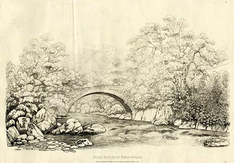 click to enlarge click to enlargeGN1243.jpg Plate 43 in Sixty Studies from Nature, 1810. printed at top right:- "43" printed at bottom:- "FOLLY BRIDGE IN BORROWDALE. / Drawn and Engraved by William Green, and Published at Ambleside, June 24, 1810." watermark:- "J WHATMAN / 1813" item:- Armitt Library : A6641.43 Image © see bottom of page |
|||
|
|
||||
| evidence:- | old print:- Wilkinson 1810 (plate 33) placename:- Grange River item:- fishing |
|||
| source data:- | Print, uncoloured soft ground etching, View on the Grange River, Borrowdale, looking
towards Derwent Water, Cumberland, by Joseph Wilkinson, engraved by William Frederick
Wells, published by R Ackermann, Repository of Arts, 101 Strand, London, 1810.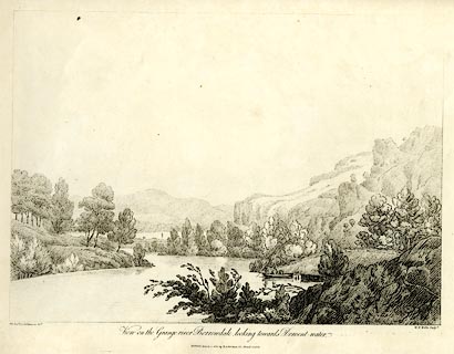 click to enlarge click to enlargeWKN133.jpg Plate 33 in Select Views in Cumberland, Westmoreland, and Lancashire. printed at bottom left, right, centre:- "The Revd. Jos: Wilkinson delt. / W. F. Wells Sculpt. / View on the Grange-river Borrowdale, looking towards Derwent-water. / Publish'd March 1. 1810. by R. Ackerman. 101. Strand. London." item:- Fell and Rock Climbing Club : MN4.33 Image © see bottom of page |
|||
|
|
||||
| evidence:- | old print:- Wilkinson 1810 (plate 34) placename:- Grange River |
|||
| source data:- | Print, uncoloured soft ground etching, View on the Grange River, Borrowdale, Cumberland,
by Joseph Wilkinson, engraved by William Frederick Wells, published by R Ackermann,
Repository of Arts, 101 Strand, London, 1810.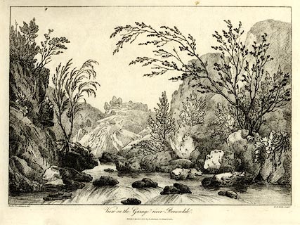 click to enlarge click to enlargeWKN134.jpg Plate 34 in Select Views in Cumberland, Westmoreland, and Lancashire. printed at bottom left, right, centre:- "The Revd. Jos. Wilkinson delt. / W. F. Wells Sculpt. / View on the Grange-river Borrowdale. / Publish'd March 1. 1810. by R. Ackerman. 101. Strand. London." item:- Fell and Rock Climbing Club : MN4.34 Image © see bottom of page |
|||
|
|
||||
| evidence:- | old text:- Green 1814 |
|||
| source data:- | Set of prints, soft ground etchings, Sixty Small Prints, with
text, A Description of a Series of Sixty Small Prints, by
William Green, Ambleside, Westmorland, 1814. goto source page 20:- "..." "The source of the stream passing under this bridge [Longthwaite Bridge] is in Sprinkling Tarn, which descending the mountain Sprinkling, unites itself with Sty Head Tarn, and having reached the valley, winds between the village of Seathwaite and the black lead mines to Langthwaite Bridge, which is a quarter of a mile from Rosthwaite." |
|||
|
|
||||
| evidence:- | old map:- Otley 1818 placename:- Derwent River |
|||
| source data:- | Map, uncoloured engraving, The District of the Lakes,
Cumberland, Westmorland, and Lancashire, scale about 4 miles to
1 inch, by Jonathan Otley, 1818, engraved by J and G Menzies,
Edinburgh, Scotland, published by Jonathan Otley, Keswick,
Cumberland, et al, 1833. OT02NY02.jpg "Derwent R." item:- JandMN : 48.1 Image © see bottom of page |
|||
|
|
||||
| evidence:- | old map:- Hall 1820 (Cmd) placename:- Derwent River |
|||
| source data:- | Map, hand coloured engraving, Cumberland, scale about 21 miles
to 1 inch, engraved by Sidney Hall, published by S Leigh, 18
Strand, London, 1820-31. click to enlarge click to enlargeHA14.jpg "Derwent R." tapering wiggly line; river item:- JandMN : 91 Image © see bottom of page |
|||
|
|
||||
| evidence:- | descriptive text:- Otley 1823 (5th edn 1834) |
|||
| source data:- | Guide book, A Concise Description of the English Lakes, the
mountains in their vicinity, and the roads by which they may be
visited, with remarks on the mineralogy and geology of the
district, by Jonathan Otley, published by the author, Keswick,
Cumberland now Cumbria, by J Richardson, London, and by Arthur
Foster, Kirkby Lonsdale, Cumbria, 1823; published 1823-49,
latterly as the Descriptive Guide to the English Lakes. goto source Page 39:- "..." "The Derwent has its rise in Borrowdale; its" goto sourcePage 40:- "branches are known by different names till it reaches the lake, from whence it is called the Derwent till it enters the sea." goto sourcePage 40:- "... passing Keswick, it [River Greta] joins the Derwent, shortly after that river leaves the lake. In heavy rains the Greta sometimes rises so suddenly that it inverts the stream of the Derwent, so that the lake is for a short time literally filled from all quarters. ..." goto sourcePage 88:- "... becks receive a name from some dale, hamlet or remarkable place which they pass, and in their course the appellation is frequently changed; for instance, a stream running north from Bowfell, and receiving several augmentations in its progress down Borrowdale is called Langstreth beck; then Stonethwaite beck, Rosthwaite beck, and Grange beck till it enters Derwent lake, thence it has the name of Derwent, to Workington, where it falls into the sea." |
|||
|
|
||||
| evidence:- | old map:- Perrot 1823 |
|||
| source data:- | Map, hand coloured engraving, Cumberland and Westmoreland ie
Westmorland, scale about 38 miles to 1 inch, by Aristide Michel
Perrot, engraved by Migneret, 1823, published by Etienne Ledoux,
9 Rue Guenegaud, Paris, France, 1824-48. click to enlarge click to enlargePER2.jpg tapering wiggly line item:- Dove Cottage : 2007.38.45 Image © see bottom of page |
|||
|
|
||||
| evidence:- | descriptive text:- Ford 1839 (3rd edn 1843) placename:- Derwent |
|||
| source data:- | Guide book, A Description of Scenery in the Lake District, by
Rev William Ford, published by Charles Thurnam, Carlisle, by W
Edwards, 12 Ave Maria Lane, Charles Tilt, Fleet Street, William
Smith, 113 Fleet Street, London, by Currie and Bowman,
Newcastle, by Bancks and Co, Manchester, by Oliver and Boyd,
Edinburgh, and by Sinclair, Dumfries, 1839. goto source Page 67:- "... Randerson's Band Rocks; beneath meanders the Derwent, enriching with welcome fertility, the fields and meadows through which are scattered the dwellings of Borrowdale. ..." |
|||
|
|
||||
| evidence:- | old map:- Ford 1839 map placename:- Derwent, River |
|||
| source data:- | Map, uncoloured engraving, Map of the Lake District of
Cumberland, Westmoreland and Lancashire, scale about 3.5 miles
to 1 inch, published by Charles Thurnam, Carlisle, and by R
Groombridge, 5 Paternoster Row, London, 3rd edn 1843. FD02NY13.jpg "R. Derwent" item:- JandMN : 100.1 Image © see bottom of page |
|||
|
|
||||
| evidence:- | old map:- Garnett 1850s-60s H placename:- Derwent, River |
|||
| source data:- | Map of the English Lakes, in Cumberland, Westmorland and
Lancashire, scale about 3.5 miles to 1 inch, published by John
Garnett, Windermere, Westmorland, 1850s-60s. GAR2NY03.jpg "Derwent R." double wiggly line ... and wiggly line, river  GAR2NY13.jpg "Derwent R."  GAR2NY02.jpg  GAR2NY22.jpg "Derwent R."  GAR2NY21.jpg "Derwent R." item:- JandMN : 82.1 Image © see bottom of page |
|||
|
|
||||
| evidence:- | old print:- Pyne 1853 placename:- Derwent, River |
|||
| source data:- | Print, tinted lithograph, The Derwent River and Borrowdale, Cumberland, by James Baker
Pyne, engraved by W Gauci, published by Thomas Agnew and Sons, Manchester, Lancashire,
1853.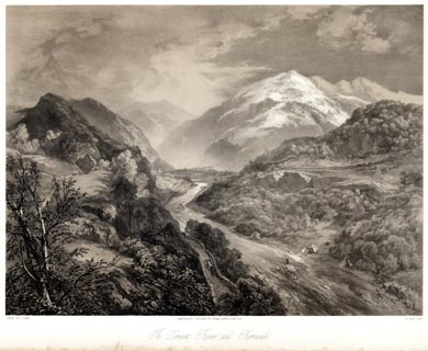 click to enlarge click to enlargePYN224.jpg "PAINTED BY J. B. PYNE. / W. GAUCI LITH. / MANCHESTER, PUBLISHED BY THOMAS AGNEW & SONS, 1853. / The Derwent River and Borrowdale / [ ]" item:- Armitt Library : A6678.25 Image © see bottom of page |
|||
|
|
||||
| evidence:- | old print:- Pyne 1853 placename:- Derwent, River |
|||
| source data:- | Print, coloured lithograph, The Derwent River and Borrowdale, Cumberland, by James
Baker Pyne, engraved by W Gauci, published by Thomas Agnew and Sons, Manchester, Lancashire,
1853.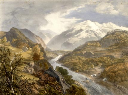 click to enlarge click to enlargePYN424.jpg item:- Armitt Library : A6677.25 Image © see bottom of page |
|||
|
|
||||
| evidence:- | old text:- Martineau 1855 |
|||
| source data:- | Guide book, A Complete Guide to the English Lakes, by Harriet
Martineau, published by John Garnett, Windermere, Westmorland,
and by Whittaker and Co, London, 1855; published 1855-76. goto source Page 80:- "..." "Rosthwaite is beautifully situated near the centre of the dale, and at the confluence of the two mountain brooks which form the Derwent. This river flows through the lakes of Derwent Water and Bassenthwaite, passes Cockermouth, and falls into the sea at Workington. ..." "..." goto sourcePage 89:- "... Ouse Bridge, beneath which the [Bassentwhaite] lake discharges itself in the form of the much enlarged river Derwent, which flows away towards Cockermouth. ..." |
|||
|
|
||||
| evidence:- | old photograph:- Bell 1880s-1940s |
|||
| source data:- | Photograph, sepia, the River Derwent, Borrowdale, Cumberland, by Herbert Bell, Ambleside,
Westmorland, 1890s.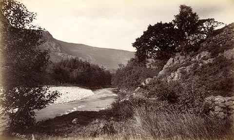 click to enlarge click to enlargeHB0382.jpg internegative at lower left:- "H. Bell" item:- Armitt Library : ALPS36 Image © see bottom of page |
|||
|
|
||||
| evidence:- | old photograph:- Bell 1880s-1940s |
|||
| source data:- | Photograph, black and white, Eagle Crag, from beside Stonethwaite Beck, Borrowdale,
Cumberland, by Herbert Bell, Ambleside, Westmorland, 1890s.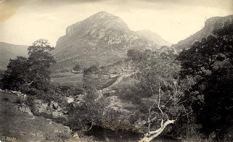 click to enlarge click to enlargeHB0383.jpg internegative at lower left:- "H. Bell" item:- Armitt Library : ALPS37 Image © see bottom of page |
|||
|
|
||||
| evidence:- | old print:- Brabant 1902 |
|||
| source data:- | Print, uncoloured lithograph, Borrowdale, In the Jaws, Cumberland, by Edmund H New,
published by Methuen and Co, 36 Essex Street, Strand, London, 1902.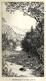 click to enlarge click to enlargeBBT111.jpg Tipped in opposite p.272 of The English Lakes, by F G Brabant. printed at bottom left:- "E. H. N" printed at bottom:- "BORROWDALE ("IN THE JAWS")" item:- JandMN : 502.19 Image © see bottom of page |
|||
|
|
||||
| evidence:- | old map:- Postlethwaite 1877 (3rd edn 1913) placename:- Derwent, River |
|||
| source data:- | Map, uncoloured engraving, Map of the Lake District Mining Field, Westmorland, Cumberland,
Lancashire, scale about 5 miles to 1 inch, by John Postlethwaite, published by W H
Moss and Sons, 13 Lowther Street, Whitehaven, Cumberland, 1877 edn 1913. PST2NY03.jpg "River Derwent" wiggly line 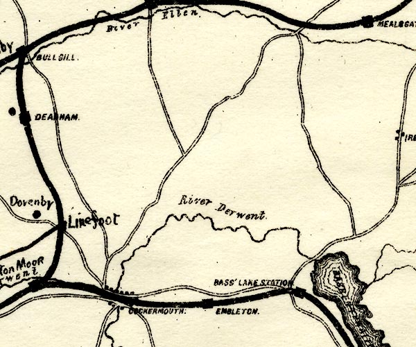 PST2NY13.jpg "River Derwent" wiggly line, running out of Bassenthwaite Lake item:- JandMN : 162.2 Image © see bottom of page |
|||
|
|
||||
| evidence:- | old text:- Admiralty 1933 placename:- Derwent, River |
|||
| source data:- | goto source Page 395:- "..." "River Derwent. - The Derwent rises among the mountains at the head of Borrowdale, 1 1/4 miles north-eastward of Scafell Pikes, 3,210 feet (978m4) high. It joins Derwentwater 7 1/2 miles from its source, issues from the northern end of that lake near Keswick, and is there joined by the Greta; it then winds through a marshy plain, at the south-western foot of Skiddaw, for 3 miles, and enters Lake Bassenthwaite, which is 3 1/2 miles long; from thence it flows on by Cockermouth, Great Broughton, and Camerton, to Workington, where, at half a mile below the bridge, it falls into the sea; its total length, including 2 3/4 miles through Derwentwater, being 36 miles; its outlet forms Workington harbour." |
|||
|
|
||||
| evidence:- | text:- Rivet and Smith 1979 placename:- Derventio placename:- Dorvantium |
|||
| source data:- | The River Derwent, Cumberland. |
|||
|
|
||||
| evidence:- | old print:- Robertson 1911 |
|||
| source data:- | Print, lithograph? The Derwent, seen from John Wordsworth's Terrace, Cockermouth,
from a watercolour by Arthur Tucker, published by Chatto and Windus, London, 1911. click to enlarge click to enlargeRSN109.jpg Tipped in opposite p.28 of Wordsworthshire by Eric Robertson. Derwent Bridge in the middle ground. printed at bottom:- "THE DERWENT, SEEN FROM JOHN WORDSWORTH'S TERRACE, COCKERMOUTH" signed at painting lower left:- "Arthur Tucker" item:- JandMN : 197.9 Image © see bottom of page |
|||
|
|
||||
| evidence:- | old print:- |
|||
| source data:- | Print, coloured halftone, The River Running into Derwentwater, from a painting by
Benjamin William Leader, early 20th century. click to enlarge click to enlargePR0562.jpg printed at bottom:- "THE RIVER RUNNING INTO DERWENTWATER / B. W. Leader R.A. / By permission of Southport Corporation" item:- Dove Cottage : 2008.107.510 Image © see bottom of page |
|||
|
|
||||
| evidence:- | old print:- |
|||
| source data:- | Print, chromolithograph, View in Borrowdale, Cumberland, published by T Nelson and
Sons, London, 1900s?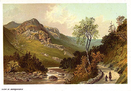 click to enlarge click to enlargePR0168.jpg From a set of prints, The Scenery of the English Lakes printed at lower left:- "T. NELSON &SONS" printed at bottom left:- "VIEW IN BORROWDALE" item:- Dove Cottage : 2008.107.168 Image © see bottom of page |
|||
|
|
||||
| evidence:- | old photograph:- Bogg 1898 |
|||
| source data:- | Photograph, halftone print, Grange, Borrowdale, Cumberland, by Edmund Bogg, published
by Edmund Bogg, 3 Woodhouse Lane, and James Miles, Guildford Street, Leeds, Yorkshire,
1898.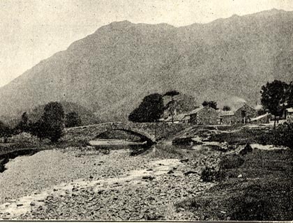 click to enlarge click to enlargeBGG170.jpg Included on p.187 of Lakeland and Ribblesdale, by Edmund Bogg. item:- JandMN : 231.70 Image © see bottom of page |
|||
|
|
||||
| evidence:- | old print:- |
|||
| source data:- | Print, uncoloured engraving, Borrowdale, Cumberland, by W H J Bool, published late
19th century?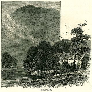 click to enlarge click to enlargePR0330.jpg On page 151 of The English Lakes. printed at lower left:- "[WHJBool]" printed at bottom:- "BORROWDALE." item:- Dove Cottage : 2008.107.330 Image © see bottom of page |
|||
|
|
||||
| evidence:- | old print:- Rowbotham 1875 |
|||
| source data:- | Print, colour lithograph? Keswick, Cumberland, by T L Rowbotham, published by Marcus
Ward and Co, London? 1875?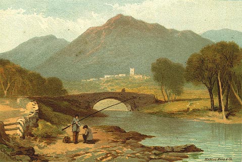 click to enlarge click to enlargePR0126.jpg Included in the set of prints, Views in the English Lake District. printed at lower left, right:- "[T] L Rowbotham / MARCUS WARD &CO" item:- Dove Cottage : 2008.107.126 Image © see bottom of page |
|||
|
|
||||
| evidence:- | old print:- Martineau 1855 |
|||
| source data:- | Print, engraving, Borrowdale near the Bowder Stone, drawn by L Aspland, engraved by
W Banks, Edinburgh, published by John Garnett, Windermere, Westmorland, and by Whittaker
and Co, London, 1855.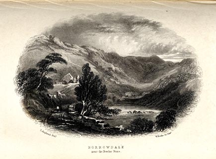 click to enlarge click to enlargeMNU118.jpg Tipped in opposite p.152 in A Complete Guide to the English Lakes, by Harriet Martineau. printed at bottom left, right, centre:- "L Aspland Delt. / W Banks Sc Edinr. / BORROWDALE / near the Bowder Stone." item:- Armitt Library : A1159.18 Image © see bottom of page |
|||
|
|
||||
| evidence:- | old print:- item:- fishing |
|||
| source data:- | Print, hand coloured engraving, Eagle Crag at the Head of Borrowdale, Westmoreland,
should be Cumberland, drawn by Ramsay Richard Reinagle, engraved by John Pye, published
1850s?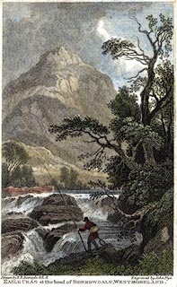 click to enlarge click to enlargePR0578.jpg A fisherman in the foreground. printed at bottom left, right, centre:- "Drawn by R. R. Reinagle A.R.A. / Engraved by John Pye / EAGLE CRAG at the head of BORROWDALE, WESTMORELAND." item:- Dove Cottage : 2008.107.526 Image © see bottom of page |
|||
|
|
||||
| evidence:- | old print:- |
|||
| source data:- | Print, uncoloured engraving, Borrowdale from near the Bowder Stone, Cumberland, drawn
by T Aspland, engraved by W Banks, Edinburgh, published by J Garnett, Windermere,
Westmorland, 1850s-60s?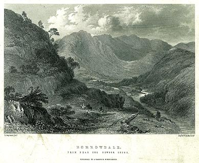 click to enlarge click to enlargePR0224.jpg printed at bottom left, right, centre:- "T. Aspland. Delt. / Engd. by W. Banks, Edinr. / BORROWDALE. / FROM NEAR THE BOWDER STONE. / PUBLISHED BY J. GARNETT, WINDERMERE." item:- Dove Cottage : 2008.107.224 Image © see bottom of page |
|||
|
|
||||
| evidence:- | old print:- Rose 1832-35 (vol.3 no.32) |
|||
| source data:- | Print, uncoloured engraving, Eagle Crag from Rosthwaite, Borrowdale, Cumberland, drawn
by Thomas Allom, engraved by J Sands, published by Fisher, Son and Co, London, 1832-35.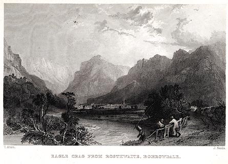 click to enlarge click to enlargePR0043.jpg vol.3 pl.32 in the set of prints, Westmorland, Cumberland, Durham and Northumberland Illustrated. printed at bottom left, right, centre:- "T. Allom. / J. Sands. / EAGLE CRAG FROM ROSTHWAITE, BORROWDALE." item:- Dove Cottage : 2008.107.43 Image © see bottom of page |
|||
|
|
||||
| evidence:- | old print:- Rose 1832-35 (vol.3 no.7) |
|||
| source data:- | Print, uncoloured engraving, Borrowdale, Cumberland, drawn by Thomas Allom, engraved
by A le Petit, published by Fisher, Son and Co, London, 1832-35.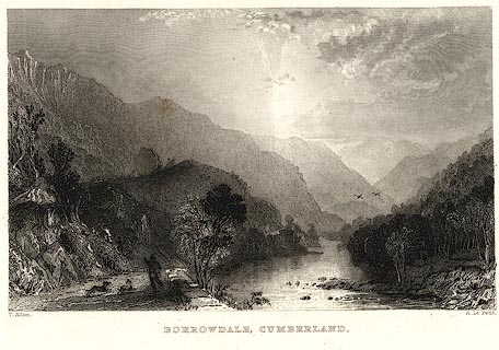 click to enlarge click to enlargePR0034.jpg vol.3 pl.7 in the set of prints, Westmorland, Cumberland, Durham and Northumberland Illustrated. printed at bottom left, right, centre:- "T. Allom. / A. Le Petit. / BORROWDALE, CUMBERLAND." item:- Dove Cottage : 2008.107.34 Image © see bottom of page |
|||
|
|
||||
| evidence:- | old print:- Rose 1832-35 (vol.1 no.71) |
|||
| source data:- | Print, uncoloured engraving, Castle Crag, Borrowdale, from the Village of Grange,
Cumberland, drawn by Thomas Allom, engraved by J C Bentley, published by Fisher, Son
and Co, London, 1832-35.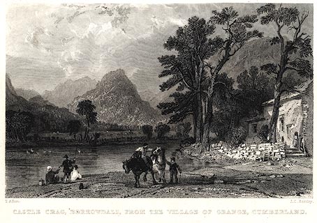 click to enlarge click to enlargePR0026.jpg vol.1 pl.71 in the set of prints, Westmorland, Cumberland, Durham and Northumberland Illustrated. printed at bottom left, right, centre:- "T. Allom. / J. C. Bentley. / CASTLE CRAG, BORROWDALE, FROM THE VILLAGE OF GRANGE, CUMBERLAND." item:- Dove Cottage : 2008.107.26 Image © see bottom of page |
|||
|
|
||||
| evidence:- | old print:- Rose 1832-35 (vol.1 no.51) |
|||
| source data:- | Print, uncoloured engraving, Wood Hall, near Cockermouth, Cumberland, drawn by Thomas
Allom, engraved by W le Petit, published by Fisher, Son and Co, London, 1832-35.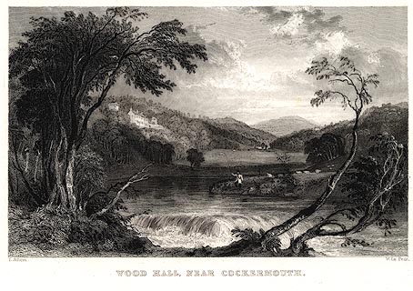 click to enlarge click to enlargePR0019.jpg vol.1 pl.51 in the set of prints, Westmorland, Cumberland, Durham and Northumberland Illustrated. printed at bottom left, right, centre:- "T. Allom. / W Le Petit. / WOOD HALL, NEAR COCKERMOUTH." item:- Dove Cottage : 2008.107.19 Image © see bottom of page |
|||
|
|
||||
| evidence:- | old print:- Britton and Brayley 1802 |
|||
| source data:- | Print, uncoloured engraving, Burrowdale, from Bowdar Stone, Cumberland, drawn by A
Wilson, engraved by Hay, published by Vernor and Hood, Poultry, London, 1800s.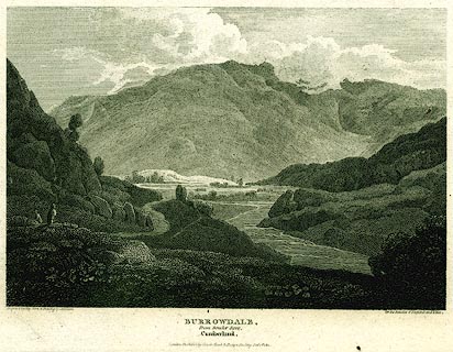 click to enlarge click to enlargePR0140.jpg Included in the Beauties of England and Wales, by John Britton and Edward W Brayley. printed at bottom left, right, centre:- "Engrav'd by Hay from a Drawing by A. Wilson / for the Beauties of England and Wales. / BURROWDALE, / From Bowdar Stone, / Cumberland. / [London. Publish'd by Vernor &Hood. Poultry, ]" item:- Dove Cottage : 2008.107.140 Image © see bottom of page |
|||
|
|
||||
| evidence:- | old print with text:- Farington 1789 (plate 2) |
|||
| source data:- | Print, engraving, The Grange in Borrowdale, painted by Joseph Farington, engraved
by W Byrne and T Medland, published by W Byrne, 79 Titchfield Street, London, 1784.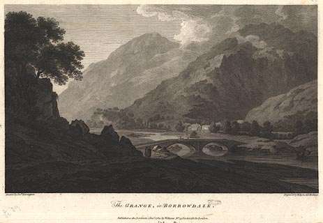 click to enlarge click to enlargeBMZ90.jpg Grange Bridge over the River Derwent, Grange village and Low Scawdel and High Scawdel in the background? Plate 2 from Views of the Lakes, &c, in Cumberland and Westmorland, published 1789; with descriptive text:- "THE GRANGE IN BORROWDALE. ... Except in a very dry Season, the Derwent affords a Passage to Boats from the Lake up to the Bridge; the extreme Transparency of its Water never escapes the Observation of the Traveller." item:- Dove Cottage : Lowther.54 Image © see bottom of page |
|||
|
|
||||
| evidence:- | old print:- Middiman 1784-92 (pl.2) |
|||
| source data:- | Print, uncoloured engraving, Keswick Lake, Cumberland, drawn by J Smith, engraved
and published by Samuel Middiman, London, 1784.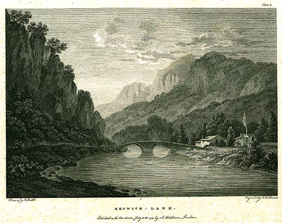 click to enlarge click to enlargePR0193.jpg The view is of Grange Bridge, Borrowdale, on the River Derwent, not the lake; and is not a true picture of the double bridge? Plate 2 in a set of prints, part 1, Select Views in Great Britain. printed at bottom left, right, centre:- "Drawn by J. Smith. / Engrav'd by S. Middiman. / KESWICK - LAKE. / Published as the Act directs, July 30th. 1784, by S. Middiman, London." printed at top right:- "Plate 2." item:- Dove Cottage : 2008.107.193 Image © see bottom of page |
|||
|
|
||||
| evidence:- | old print:- Goodwin 1887 (edn 1890) |
|||
| source data:- | Print, etching? Cockermouth Castle, Cumberland, by Harry Goodwin, published by Swan
Sonnenschein and Co, Paternoster Square, London, 1890.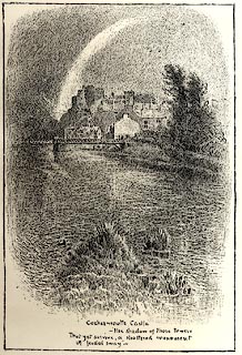 click to enlarge click to enlargePR1572.jpg Tipped in opposite p.2 of Through the Wordsworth Country, by William Knight. printed at lower centre:- "Cockermouth Castle / -the shadow of those towers / That yet survive, a shattered monument / O feudal sway -" item:- JandMN : 382.2 Image © see bottom of page |
|||
|
|
||||
| evidence:- | old painting:- item:- sheep |
|||
| source data:- | Painting, oil painting, Workington Bridge, over the River Derwent, Workington, Cumberland,
by Samuel Bough, 1842.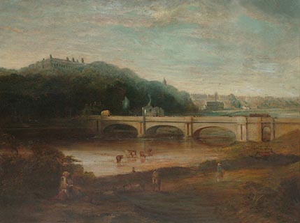 click to enlarge click to enlargePR0924.jpg A family group is seated in the foreground. Beside a wide river a small flock of sheep is being driven; cattle loiter in the shallows. Beyond the bridge rises a wooded hillside upon which stands Workington Hall; to right of composition lies a distant view of Workington. signed &dated at bottom left:- "Sam Bough 1842" item:- Tullie House Museum : 1936.4.3 Image © Tullie House Museum |
|||
|
|
||||
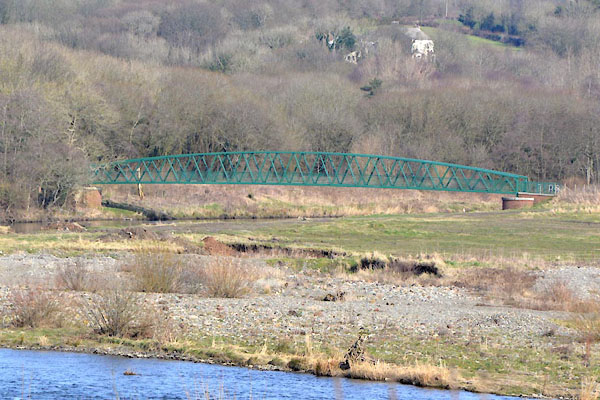
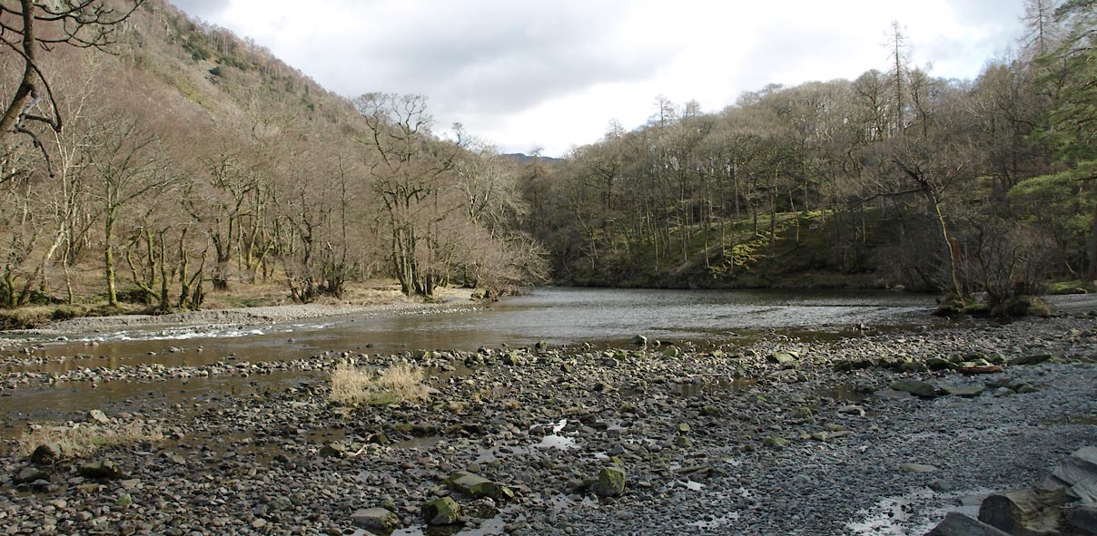
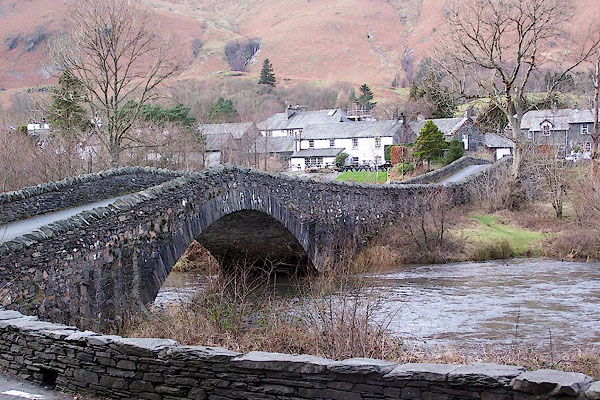
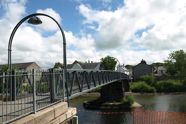
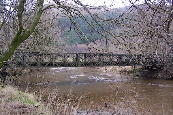
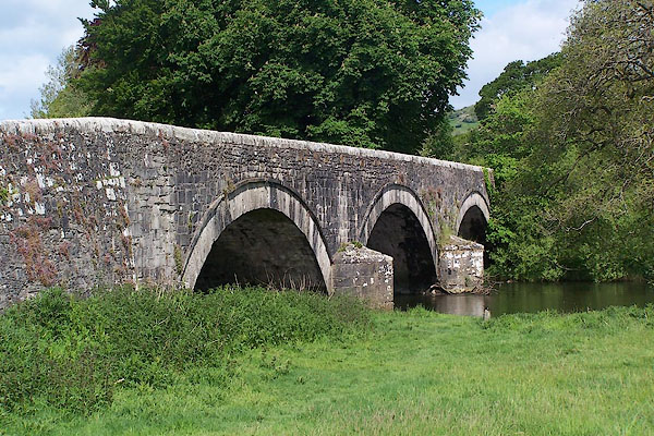
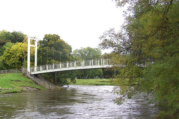
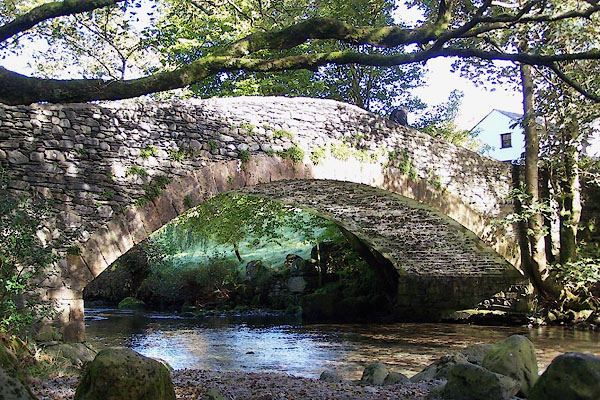
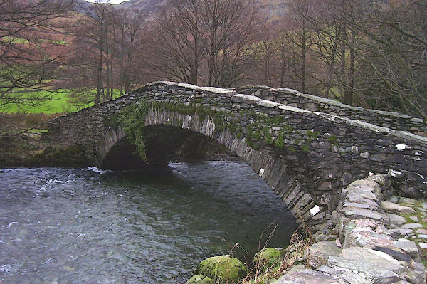
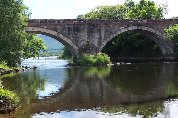
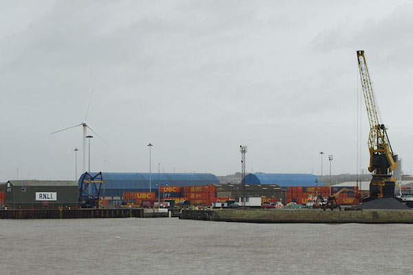
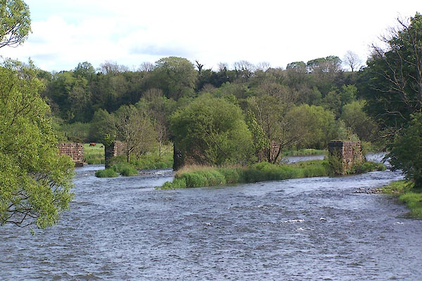
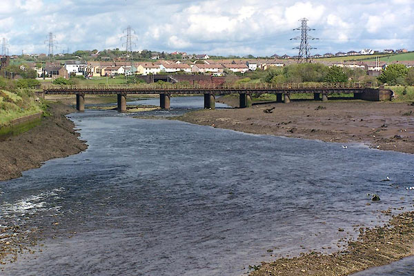
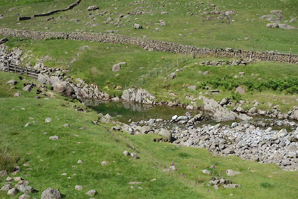
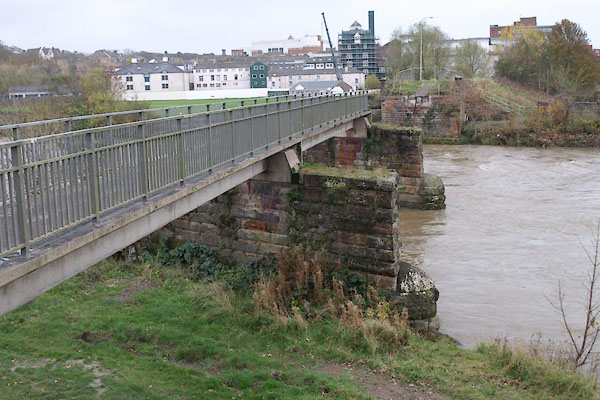
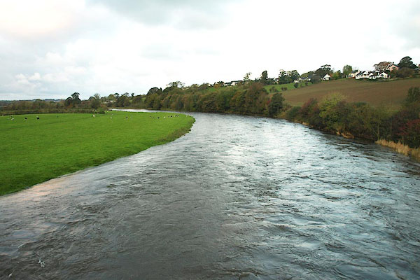
 CGV59.jpg At Grange Bridge, (taken 3.11.2017) 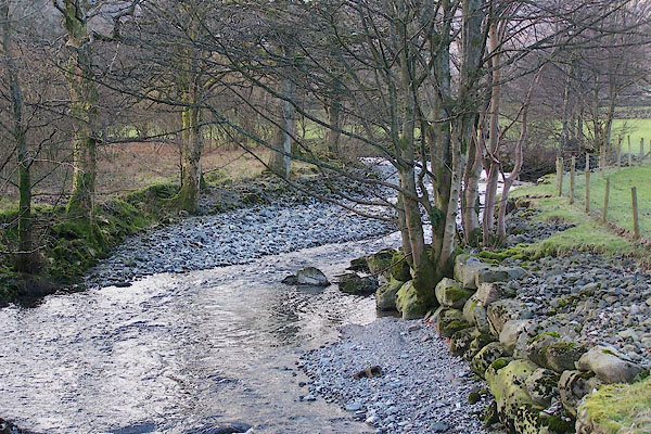 BNG33.jpg At Strands Bridge. (taken 26.2.2007) 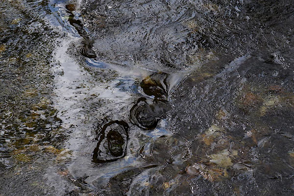 CCZ90.jpg Below Strands Bridge. (taken 13.5.2015) 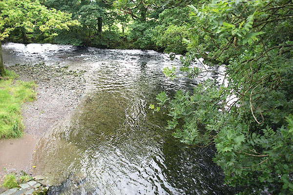 BPQ39.jpg At Folly Bridge. (taken 26.2.2007) 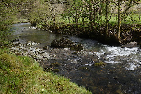 CCZ88.jpg At Folly Bridge. (taken 13.5.2015) 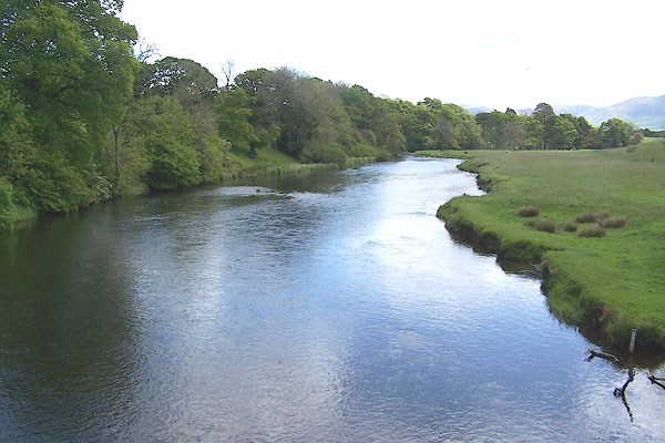 BNR60.jpg At Isel Bridge. (taken 25.5.2007) 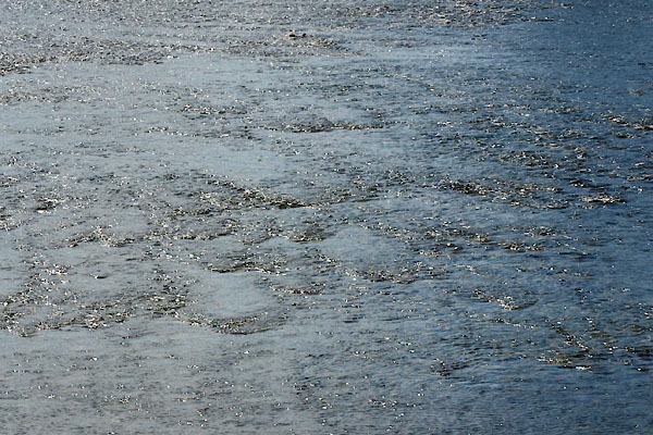 BYP53.jpg Ripples in shallow water, (taken 21.6.2013) 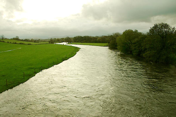 BPT30.jpg At Broughton High Bridge. (taken 22.10.2008) 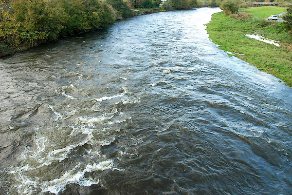 BPT60.jpg At Workington Bridge. (taken 22.10.2008) 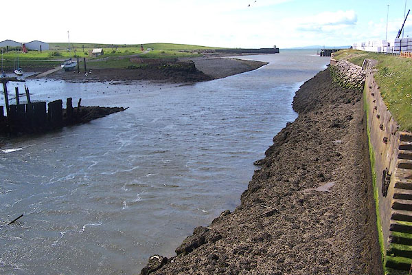 BNQ96.jpg Into the sea at the Port of Workington, (taken 14.5.2007) |
||||
|
|
||||
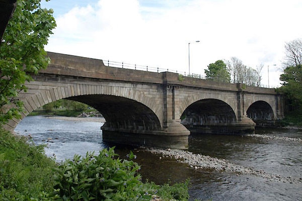
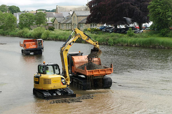 BYP08.jpg Dredging work above Derwent Bridge, Cockermouth, following the floods, November 2009. (taken 21.6.2013) 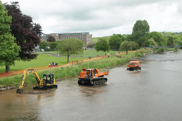 BYP09.jpg Dredging work above Derwent Bridge, Cockermouth, following the floods, November 2009. (taken 21.6.2013) |
||||
|
|
||||
| places:- |
|
|||
|
||||
|
||||
|
||||
|
||||
|
||||
|
||||
|
||||
|
||||
|
||||
|
||||
|
||||
|
||||
|
||||
|
||||
|
||||
|
||||
|
||||
|
||||
|
||||
|
||||
|
||||
|
||||
|
||||
|
||||
|
||||
|
||||
|
||||
|
||||
|
||||
|
||||
|
||||
|
||||
|
||||
|
||||
|
||||
|
||||
|
||||
|
||||
|
||||
|
||||
|
||||
|
||||
|
||||
|
||||
|
||||
|
||||
|
||||
|
||||
|
||||
|
||||
|
||||
|
||||
|
||||
|
||||
|
||||
|
||||
|
||||
|
||||
|
||||
|
||||
|
||||
|
||||
Lakes Guides menu.