 Old Cumbria Gazetteer
 |
 |
|
| New Bridge, Borrowdale | ||
| New Bridge | ||
| site name:- | Derwent, River | |
| locality:- | Rosthwaite | |
| civil parish:- | Borrowdale (formerly Cumberland) | |
| county:- | Cumbria | |
| locality type:- | bridge | |
| coordinates:- | NY25191510 | |
| 1Km square:- | NY2515 | |
| 10Km square:- | NY21 | |
| SummaryText:- | transport &road | |
|
|
||
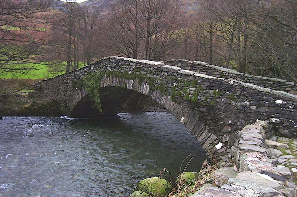 BOK87.jpg (taken 19.1.2008) 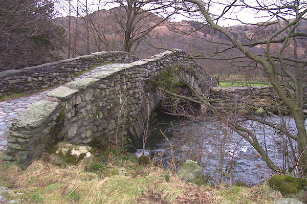 BOK86.jpg (taken 19.1.2008) |
||
|
|
||
| evidence:- | old map:- OS County Series (Cmd 70 9) placename:- New Bridge placename:- Bridge, New |
|
| source data:- | Maps, County Series maps of Great Britain, scales 6 and 25
inches to 1 mile, published by the Ordnance Survey, Southampton,
Hampshire, from about 1863 to 1948. |
|
|
|
||
| evidence:- | probably old map:- Donald 1774 (Cmd) |
|
| source data:- | Map, hand coloured engraving, 3x2 sheets, The County of Cumberland, scale about 1
inch to 1 mile, by Thomas Donald, engraved and published by Joseph Hodskinson, 29
Arundel Street, Strand, London, 1774.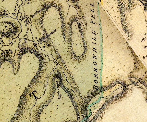 D4NY21SE.jpg double line across a river; a bridge over the Derwent item:- Carlisle Library : Map 2 Image © Carlisle Library |
|
|
|
||
| evidence:- | old print:- Green 1804 (plate 27) placename:- New Bridge |
|
| source data:- | Print, uncoloured aquatint, New Bridge in Borrowdale, Rosthwaite, Borrowdale, Cumberland,
by William Green, Ambleside, Westmorland, 1804.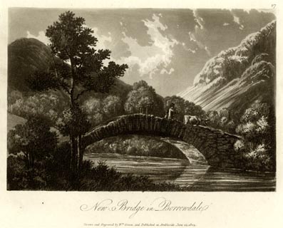 click to enlarge click to enlargeGN1627.jpg Plate 27 from a series. printed at bottom:- "New Bridge in Borrowdale. / Drawn and Engraved by Wm. Green, and Published at Ambleside, June 24, 1804." printed at top right:- "27" item:- Armitt Library : 2014.176 Image © see bottom of page |
|
|
|
||
 Lakes Guides menu.