item:- Armitt Library : A6615.7
image:- © see bottom of page
 CL20.jpg
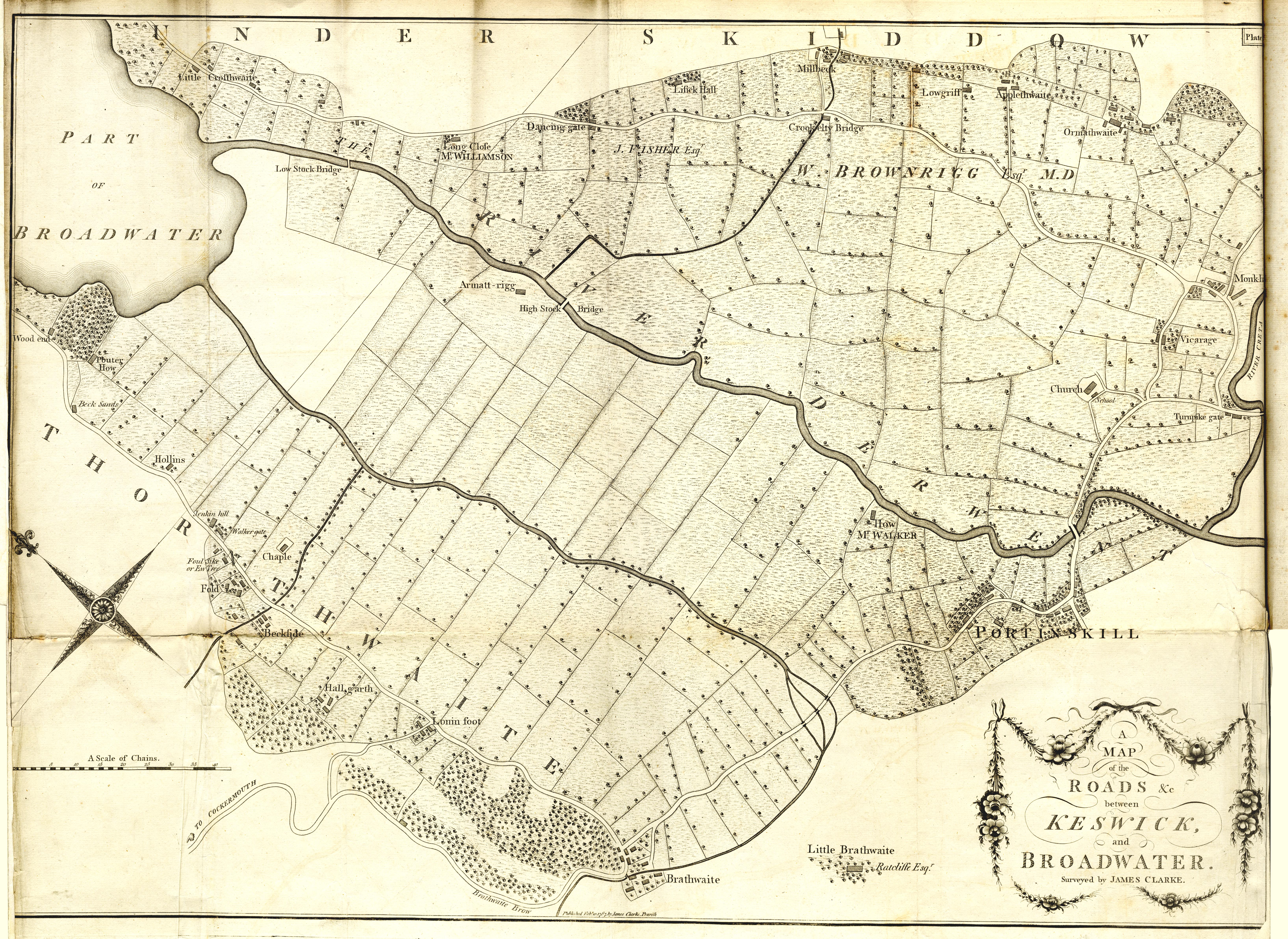
Map, uncoloured engraving, A Map of the Roads etc between
Keswick, and Broadwater, ie Bassenthwaite Lake, Cumberland,
scale about 9 miles to 1 inch, drawn and published by James
Clarke, Penrith and London, 1789.
 Lakes Guides menu.