Old Cumbria Gazetteer
 |
 |
|
||
| Lune, River | ||||
| runs into:- |  Irish Sea Irish Sea |
|||
|
|
||||
| civil parish:- | Ravenstonedale (formerly Westmorland) | |||
| civil parish:- | Orton S (formerly Westmorland) | |||
| civil parish:- | Tebay (formerly Westmorland) | |||
| civil parish:- | Grayrigg (formerly Westmorland) | |||
| civil parish:- | Sedbergh (formerly Yorkshire) | |||
| civil parish:- | Firbank (formerly Westmorland) | |||
| civil parish:- | Killington (formerly Westmorland) | |||
| civil parish:- | Middleton (formerly Westmorland) | |||
| civil parish:- | Mansergh (formerly Westmorland) | |||
| civil parish:- | Barbon (formerly Westmorland) | |||
| civil parish:- | Casterton (formerly Westmorland) | |||
| civil parish:- | Kirkby Lonsdale (formerly Westmorland) | |||
| county:- | Cumbria | |||
| locality type:- | river | |||
| 1Km square:- | NY6205 (etc) | |||
| 10Km square:- | NY60 | |||
| 10Km square:- | SD69 | |||
| 10Km square:- | SD68 | |||
| county:- | Lancashire | |||
| locality type:- | river | |||
| 10Km square:- | SD68 | |||
|
|
||||
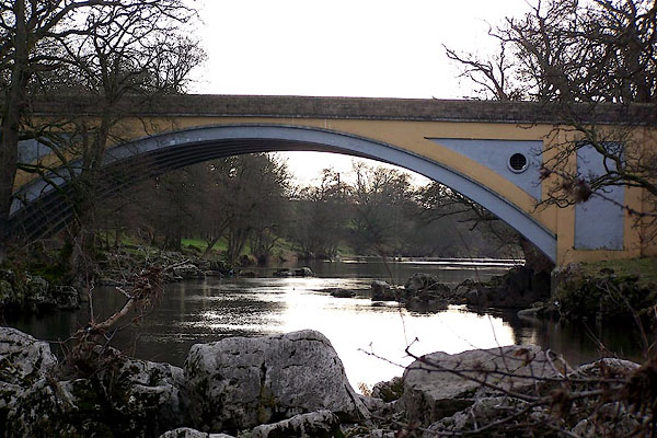
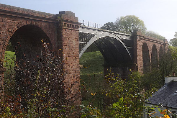
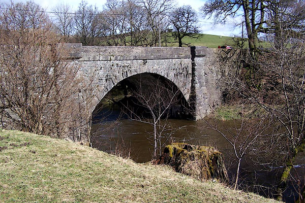
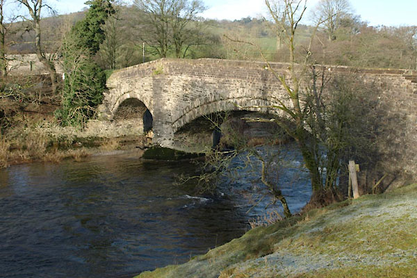
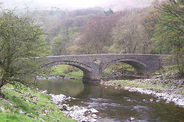
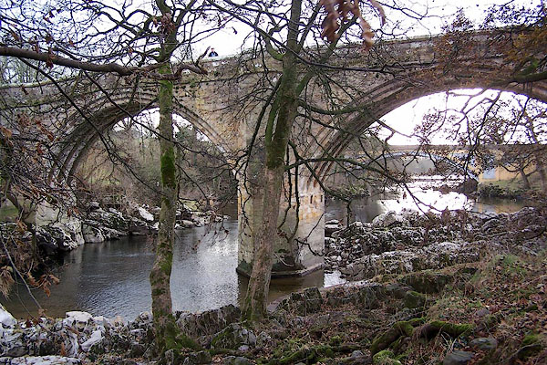
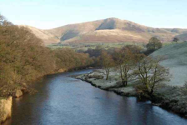 BVU53.jpg At Lincoln's Inn Bridge:- (taken 13.1.2012) 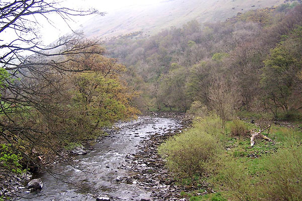 BNP36.jpg At Salterwath Bridge, Tebay. (taken 18.4.2007) |
||||
|
|
||||
| evidence:- | old map:- OS County Series (Wmd 28 12) placename:- Lune, River |
|||
| source data:- | Maps, County Series maps of Great Britain, scales 6 and 25
inches to 1 mile, published by the Ordnance Survey, Southampton,
Hampshire, from about 1863 to 1948. OS County Series (Wmd 29 5) OS County Series (Wmd 29 6) OS County Series (Wmd 29 7) OS County Series (Wmd 34 4) OS County Series (Wmd 34 8) OS County Series (Wmd 40 1) OS County Series (Wmd 40 13) OS County Series (Wmd 43 4) OS County Series (Wmd 43 8) OS County Series (Wmd 43 16) OS County Series (Wmd 47 4) OS County Series (Wmd 47 8) |
|||
|
|
||||
| evidence:- | old map:- Gough 1350s-60s placename:- Lon |
|||
| source data:- | Map, colour photozincograph copy, reduced size facsimile, Gough
Map of Britain, scale about 28.5 miles to 1 inch, published by
the Ordnance Survey, Southampton, Hampshire, 1875. click to enlarge click to enlargeGgh1Cm.jpg "lon" Flowing from east of Kirkby Lonsdale to the sea. item:- JandMN : 33 Image © see bottom of page |
|||
|
|
||||
| evidence:- | old map:- Gough 1350s-60s placename:- Lon |
|||
| source data:- | Map, lithograph facsimile, Gough Map of Britain, 20 miles to 1
inch? published by the Ordnance Survey, Southampton, Hampshire,
1935. click to enlarge click to enlargeGgh2Cm.jpg "lon" Flowing from east of Kirkby Lonsdale to the sea. item:- JandMN : 34 Image © see bottom of page |
|||
|
|
||||
| evidence:- | old map:- Ptolemy 1540 |
|||
| source data:- | Map, copy, uncoloured lithograph? Anglia II Nova Tabula, New Map
of England, scale about 50 miles to 1 inch, data in the
Geographia by Claudius Ptolemy, engraved by Sebastian Munster,
Basle, Switzerland, 1540. click to enlarge click to enlargePTY4Cm.jpg tapering wiggly double line; river item:- private collection : 131 Image © see bottom of page |
|||
|
|
||||
| evidence:- | old map:- Lloyd 1573 placename:- Lan Flu. |
|||
| source data:- | Map, hand coloured copper plate engraving, Angliae Regni,
Kingdom of England, with Wales, scale about 24 miles to 1 inch, authored by Humphrey
Lloyd, Denbigh, Clwyd, drawn and engraved
by Abraham Ortelius, Netherlands, 1573. click to enlarge click to enlargeLld1Cm.jpg "Lan flu." item:- Hampshire Museums : FA1998.69 Image © see bottom of page |
|||
|
|
||||
| evidence:- | old map:- Saxton 1579 placename:- Lune Flu. |
|||
| source data:- | Map, hand coloured engraving, Westmorlandiae et Cumberlandiae Comitatus ie Westmorland
and Cumberland, scale about 5 miles to 1 inch, by Christopher Saxton, London, engraved
by Augustinus Ryther, 1576, published 1579-1645. Sax9NY60.jpg 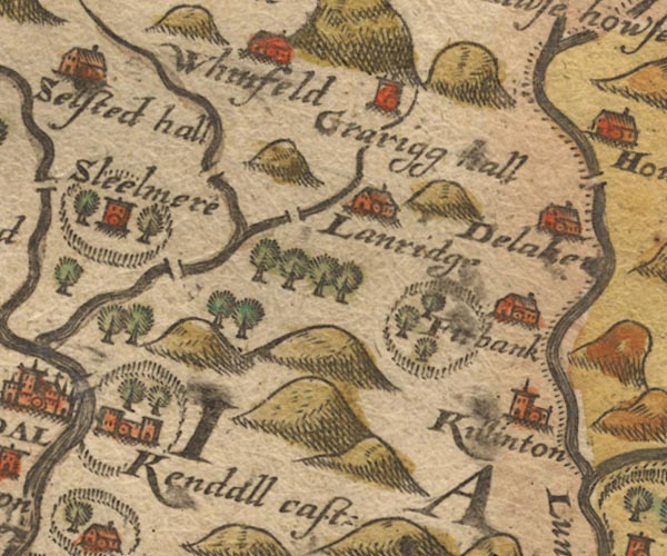 Sax9SD59.jpg 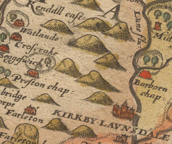 Sax9SD58.jpg "Lune flu:" 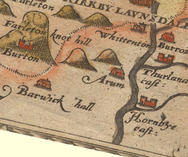 Sax9SD57.jpg item:- private collection : 2 Image © see bottom of page |
|||
|
|
||||
| evidence:- | old map:- Mercator 1595 (edn?) placename:- Lune flu. |
|||
| source data:- | Map, hand coloured engraving, Westmorlandia, Lancastria, Cestria
etc, ie Westmorland, Lancashire, Cheshire etc, scale about 10.5
miles to 1 inch, by Gerard Mercator, Duisberg, Germany, 1595,
edition 1613-16. MER5WmdA.jpg "Lune flu." double line with stream lines; river, running into Lancashire, county boundary with Yorkshire item:- Armitt Library : 2008.14.3 Image © see bottom of page |
|||
|
|
||||
| evidence:- | old map:- Keer 1605 |
|||
| source data:- | Map, hand coloured engraving, Westmorland and Cumberland, scale
about 16 miles to 1 inch, probably by Pieter van den Keere, or
Peter Keer, about 1605 edition perhaps 1676. click to enlarge click to enlargeKER8.jpg "" double wiggly line, tapering to single; river item:- Dove Cottage : 2007.38.110 Image © see bottom of page |
|||
|
|
||||
| evidence:- | old map:- Speed 1611 (Cum/EW) |
|||
| source data:- | Map, hand coloured engraving, Kingdome of Great Britaine and
Ireland, scale about 36 miles to 1 inch, by John Speed, about
1610-11, published by Thomas Bassett, Fleet Street and Richard
Chiswell, St Paul's Churchyard, London, 1676? click to enlarge click to enlargeSPD6Cm.jpg tapering wiggly line, to the coast below Lancaster item:- private collection : 85 Image © see bottom of page |
|||
|
|
||||
| evidence:- | old map:- Speed 1611 (Wmd) placename:- Lune flud |
|||
| source data:- | Map, hand coloured engraving, The Countie Westmorland and
Kendale the Cheif Towne, scale about 2.5 miles to 1 inch, by
John Speed, 1610, published by George Humble, Popes Head Alley,
London, 1611-12.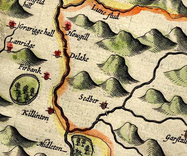 SP14SD69.jpg double line; county boundary 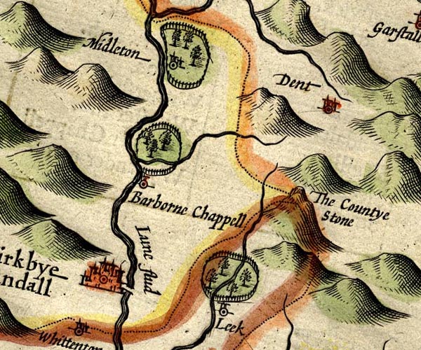 SP14SD68.jpg "Lune flud" double line with stream lines item:- Armitt Library : 2008.14.5 Image © see bottom of page |
|||
|
|
||||
| evidence:- | poem:- Drayton 1612/1622 text placename:- Lon item:- weather signs |
|||
| source data:- | Poem, Poly Olbion, by Michael Drayton, published by published by
John Marriott, John Grismand and Thomas Dewe, and others?
London, part 1 1612, part 2 1622. goto source page 133:- "..." "... Christall Lon, The Flood that names the Towne, from whence the Shire begun, Her title first to take, ... ... the long-wandring Lon, ... As shee comes ambling on from Westmerland, where first Arising from her head, amongst the Mountaines nurst, By many a pretty spring, that howerly getting strength, Ariving in her Course in Lancashire at length, To Lonsdale showes her selfe, ... ... That shee with greater state may come to Lancaster, Of her which takes the name, which likewise to the Shire, The Soveraigne title lends, ..." "... ..." goto sourcepage 162:- "... The source of long liv'd Lun, I long-liv'd doe her call; For of the British Floods, scarce one amongst them all, Such state as to her selfe, the Destinies assigne, By christning in her Course a Countie Palatine, For Luncaster so nam'd; the Fort upon the Lun, And Lancashire the name from Lancaster begun: Yet though she be a Flood, such glory that doth gaine, In that the British Crowne doth to her state pertaine, Yet Westmerland alone, not onely boasts her birth, But for her greater good the kind Westerian earth, Cleere Burbeck her bequeaths, and Barrow to attend Her grace, till shee her name to Lancaster doe lend." |
|||
|
|
||||
| evidence:- | old map:- Drayton 1612/1622 placename:- Lun, Springe of placename:- Springe of Lun |
|||
| source data:- | Map, hand coloured engraving, Cumberlande and Westmorlande, by
Michael Drayton, probably engraved by William Hole, scale about
4 or 5 miles to 1 inch, published by John Mariott, John
Grismand, and Thomas Dewe, London, 1622.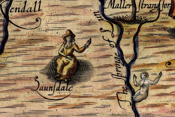 DRY524.jpg "The springe of Lun" River, naiad. item:- JandMN : 168 Image © see bottom of page |
|||
|
|
||||
| evidence:- | table of distances:- Simons 1635 |
|||
| source data:- | Table of distances, uncoloured engraving, Westmerland ie
Westmorland, with a thumbnail map, scale about 42 miles to 1
inch, by Mathew Simons, published in A Direction for the English
Traviller, 1635.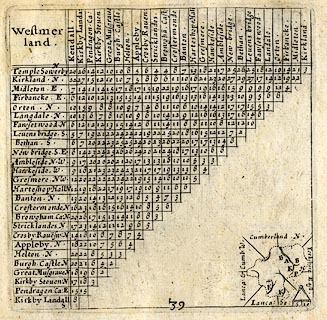 click to enlarge click to enlargeSIM3.jpg on thumbnail map item:- private collection : 50.39 Image © see bottom of page |
|||
|
|
||||
| evidence:- | old map:- Jenner 1643 |
|||
| source data:- | Table of distances, with map, hand coloured engraving,
Westmerland ie Westmorland, scale about 16 miles to 1 inch,
engraved by Jacob van Langeren, published by Thomas Jenner,
Cornhill, London, 1643.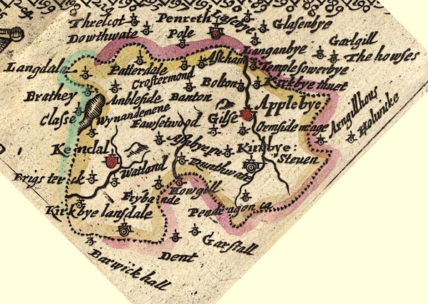 JEN3Sq.jpg wiggly line item:- private collection : 52.Wmd Image © see bottom of page |
|||
|
|
||||
| evidence:- | old map:- Jansson 1646 |
|||
| source data:- | Map, hand coloured engraving, Cumbria and Westmoria, ie
Cumberland and Westmorland, scale about 3.5 miles to 1 inch, by
John Jansson, Amsterdam, Netherlands, 1646. JAN3NY60.jpg  JAN3SD69.jpg  JAN3SD68.jpg "Lune fl."  JAN3SD67.jpg Double wiggly line tapering to single. item:- JandMN : 88 Image © see bottom of page |
|||
|
|
||||
| evidence:- | old map:- Ogilby 1675 (plate 38) placename:- Lune Flu. |
|||
| source data:- | Road strip map, hand coloured engraving, continuation of the
Road from London to Carlisle, scale about 1 inch to 1 mile, by
John Ogilby, London, 1675.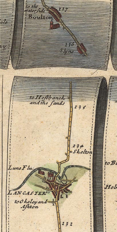 OG38m232.jpg In mile 233, Lancashire. "Lune Flu:" crossed by the road. item:- JandMN : 21 Image © see bottom of page |
|||
|
|
||||
| evidence:- | old map:- Sanson 1679 placename:- Lune fl. |
|||
| source data:- | Map, hand coloured engraving, Ancien Royaume de Northumberland
aujourdhuy Provinces de Nort, ie the Ancient Kingdom of
Northumberland or the Northern Provinces, scale about 9.5 miles
to 1 inch, by Nicholas Sanson, Paris, France, 1679. click to enlarge click to enlargeSAN2Cm.jpg "Lune fl." tapering wiggly line; river item:- Dove Cottage : 2007.38.15 Image © see bottom of page |
|||
|
|
||||
| evidence:- | old map:- Seller 1694 (Wmd) placename:- Lone fl. |
|||
| source data:- | Map, hand coloured engraving, Westmorland, scale about 8 miles
to 1 inch, by John Seller, 1694. click to enlarge click to enlargeSEL7.jpg "Lone fl" tapering wiggly line; river item:- Dove Cottage : 2007.38.87 Image © see bottom of page |
|||
|
|
||||
| evidence:- | old map:- Morden 1695 (EW) |
|||
| source data:- | Map, hand coloured engraving, England, including Wales, scale
about 27 miles to 1 inch, by Robert Morden, published by Abel
Swale Awnsham and John Churchil, London, about 1695. click to enlarge click to enlargeMRD3Cm.jpg tapering wiggly line item:- JandMN : 339 Image © see bottom of page |
|||
|
|
||||
| evidence:- | old map:- Morden 1695 (Wmd) placename:- Lune Flu. placename:- Lone Flu. |
|||
| source data:- | Map, hand coloured engraving, Westmorland, scale about 2.5 miles to 1 inch, by Robert
Morden, published by Abel Swale, the Unicorn, St Paul's Churchyard, Awnsham, and John
Churchill, the Black Swan, Paternoster Row, London, 1695.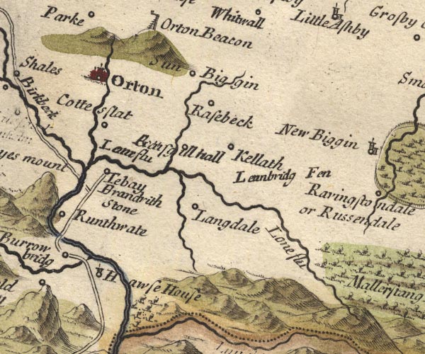 MD10NY60.jpg "Lone flu / Lone flu"  MD10SD69.jpg "Lone Flu" With the county boundary drawn alongside.  MD10SD68.jpg "Lune Flu" 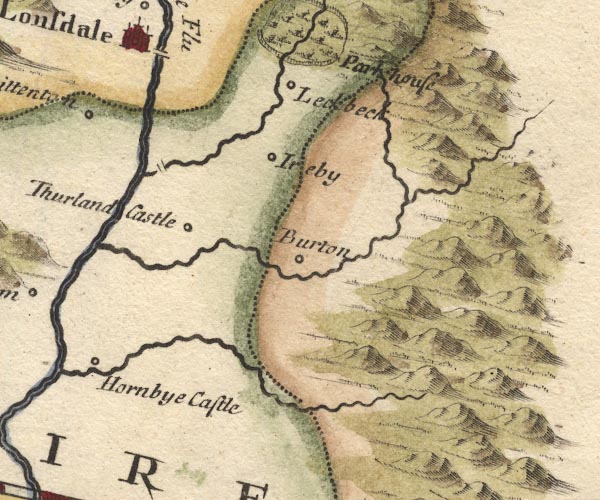 MD10SD67.jpg item:- JandMN : 24 Image © see bottom of page |
|||
|
|
||||
| evidence:- | descriptive text:- Fiennes 1698 placename:- item:- salmon; salmon wier |
|||
| source data:- | Travel book, manuscript record of Journeys through England
including parts of the Lake District, by Celia Fiennes, 1698. "... on the Castle tower walking quite round by the battlements I saw the whole town and river at a view, which runs almost quite round and returns againe by the town, ..." "... in the river there are a great many wires or falls of water made for salmon fishing, where they hang their nets and catch great quantety's of fish, which is neare the bridge; ..." |
|||
|
|
||||
| evidence:- | old map:- Stukeley 1723 |
|||
| source data:- | Road map, uncoloured engraving, the Antonine Itineraries through
Britain, scale about 55 miles to 1 inch, plotted by William
Stukeley, 1723, published London, 1724. click to enlarge click to enlargeStu1Cm.jpg item:- Hampshire Museums : FA2001.171 Image © see bottom of page |
|||
|
|
||||
| evidence:- | descriptive text:- Defoe 1724-26 placename:- Lone, River placename:- Lune, River |
|||
| source data:- | Tour through England and Wales, by Daniel Defoe, published in
parts, London, 1724-26. "... Lancaster is the next, the county town, and situate near the mouth of the River Lone or Lune." "..." "... Kirby Launsdale, or Lunedale, because it stands on the River Lune, which is the boundary of the county, and leaves the hills of Mallerstang Forest, which are, in many places, unpassable." |
|||
|
|
||||
| evidence:- | old map:- Badeslade 1742 placename:- Lone, River placename:- Lune, River |
|||
| source data:- | Maps, Westmorland North from London, scale about 10 miles to 1
inch, and Cumberland North from London, scale about 11 miles to
1 inch, with descriptive text, by Thomas Badeslade, London,
engraved and published by William Henry Toms, Union Court,
Holborn, London, 1742; published 1742-49. "... the Lone or Lune after having received the River Burrow is the Boundary [of Westmorland] to Yorkshire, then passes by Kirby Lonsdale into Lancashire." |
|||
|
|
||||
| evidence:- | old map:- Badeslade 1742 placename:- Lone River |
|||
| source data:- | Map, uncoloured engraving, A Map of Westmorland North from
London, scale about 10 miles to 1 inch, with descriptive text,
by Thomas Badeslade, London, engraved and published by William
Henry Toms, Union Court, Holborn, London, 1742. click to enlarge click to enlargeBD12.jpg "Lone R" tapering wiggly line; county boundary item:- Dove Cottage : 2007.38.62 Image © see bottom of page |
|||
|
|
||||
| evidence:- | descriptive text:- Simpson 1746 placename:- Lone, River placename:- Lune, River |
|||
| source data:- | Atlas, three volumes of maps and descriptive text published as
'The Agreeable Historian, or the Compleat English Traveller
...', by Samuel Simpson, 1746. goto source Page 1020:- "..." "... The greatest River in the South Parts [of Westmoreland], is the Lone or Lune, which rising near Mallerstrand Forest, not far from Rissendale, gives Name to the Track called Lonsdale, i.e. a vale upon the Lone. After receiving some Rivulets, and the two Rivers Birkbeck and Burrow, near Orton. it grows a large Stream, and waters the middle Part of the County, and near half the Borders towards Yorkshire, and then passes into Lancashire. ..." goto sourcePage 1024:- "..." "Kirkby Lonsdale, ... with a good Stone Bridge over the River Lone." |
|||
|
|
||||
| evidence:- | old map:- Simpson 1746 map (Wmd) |
|||
| source data:- | Map, uncoloured engraving, Westmorland, scale about 8 miles to 1
inch, printed by R Walker, Fleet Lane, London, 1746. SMP2NYK.jpg Wiggly line.  SMP2NYQ.jpg "Lone R." Wiggly line. 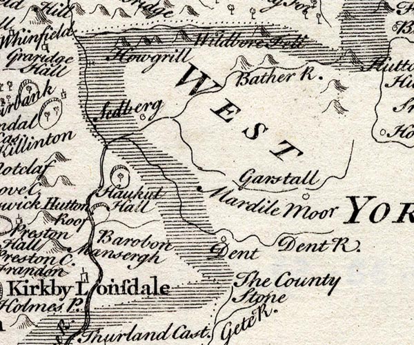 SMP2SDU.jpg Wiggly line; partly county boundary with Yorkshire. 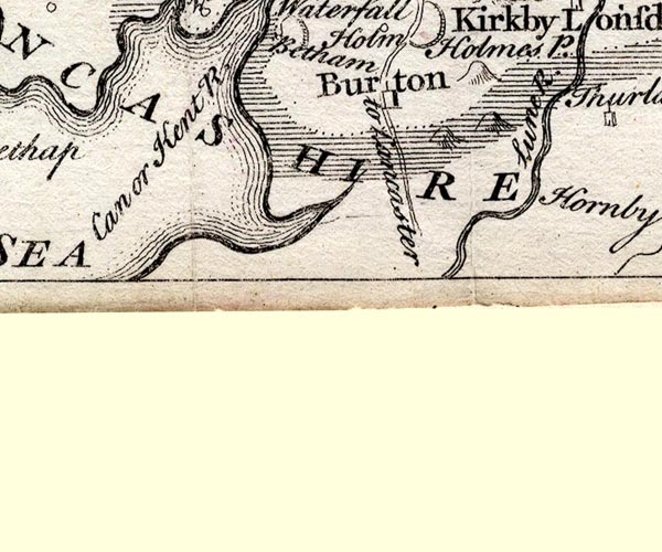 SMP2SDN.jpg "Lune R." Double line with stream lines. item:- Dove Cottage : 2007.38.59 Image © see bottom of page |
|||
|
|
||||
| evidence:- | old map:- Bickham 1753-54 (Wmd) placename:- Lone River |
|||
| source data:- | Map, uncoloured engraving, perspective view, A Map of
Westmorland, North from London, by George Bickham, James Street,
Bunhill Fields, London, 1753.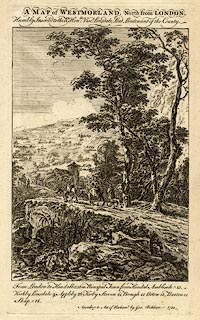 click to enlarge click to enlargeBCK3.jpg "Lone R" view (sort of) item:- Armitt Library : 2008.14.71 Image © see bottom of page |
|||
|
|
||||
| evidence:- | old map:- Bowen and Kitchin 1760 placename:- Lone River placename:- Lune River |
|||
| source data:- | Map, hand coloured engraving, A New Map of the Counties of
Cumberland and Westmoreland Divided into their Respective Wards,
scale about 4 miles to 1 inch, by Emanuel Bowen and Thomas
Kitchin et al, published by T Bowles, Robert Sayer, and John
Bowles, London, 1760.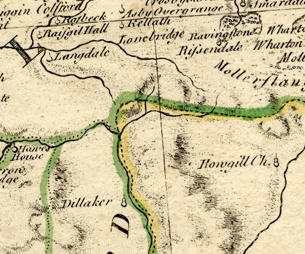 BO18NY60.jpg wiggly line, county boundary Westmorland Yorkshire 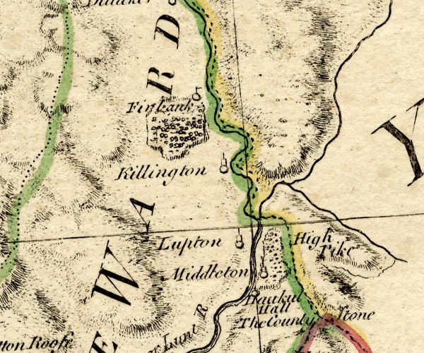 BO18SD69.jpg wiggly line then double line with stream lines, county boundary Westmorland Yorkshire 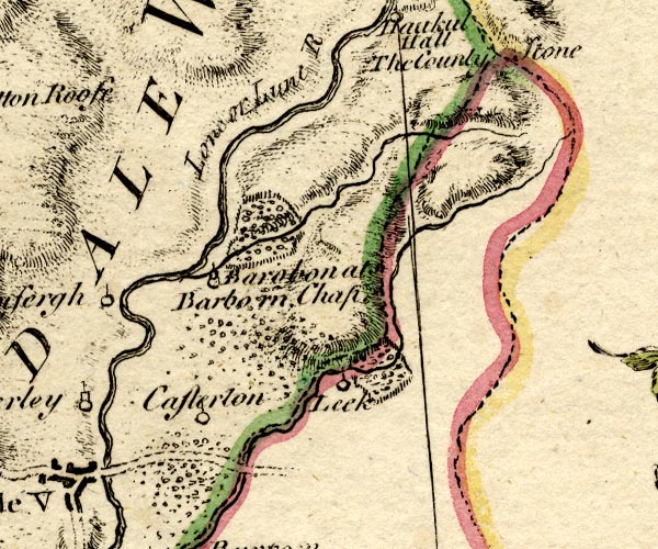 BO18SD68.jpg "Lone or Lune R." double line with stream lines item:- Armitt Library : 2008.14.10 Image © see bottom of page |
|||
|
|
||||
| evidence:- | old map:- Jefferys 1770 (Wmd) placename:- Lune River |
|||
| source data:- | Map, 4 sheets, The County of Westmoreland, scale 1 inch to 1
mile, surveyed 1768, and engraved and published by Thomas
Jefferys, London, 1770. J5NY60NE.jpg 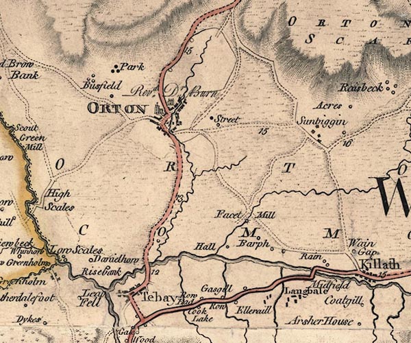 J5NY60NW.jpg 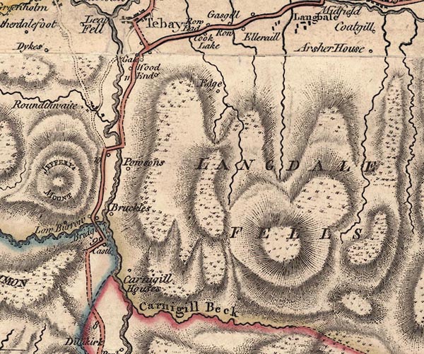 J5NY60SW.jpg  J5SD69NW.jpg "Lune River"  J5SD69SW.jpg 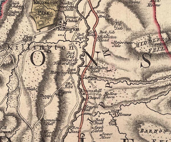 J5SD68NW.jpg 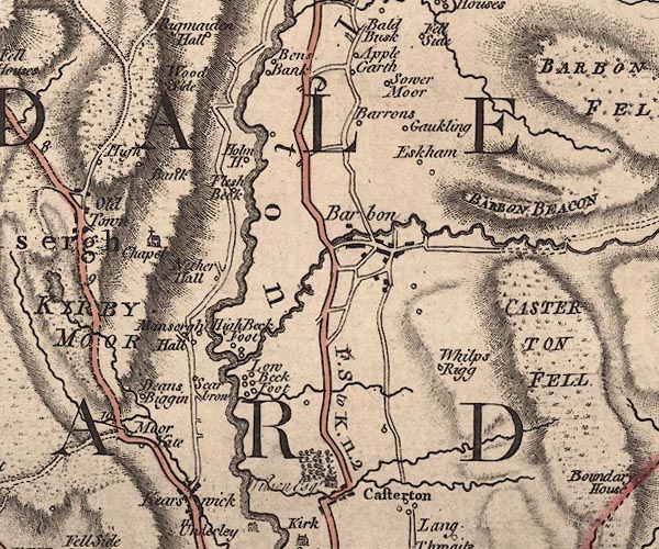 J5SD68SW.jpg 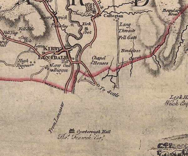 J5SD67NW.jpg single or double wiggly line; river item:- National Library of Scotland : EME.s.47 Images © National Library of Scotland |
|||
|
|
||||
| evidence:- | old text:- Pennant 1773 placename:- Lune, River |
|||
| source data:- | Book, A Tour from Downing to Alston Moor, 1773, by Thomas
Pennant, published by Edward Harding, 98 Pall Mall, London, 1801. goto source Pennant's Tour 1773, page 117 "..." "... reached the Lune, a river which rises under Green Belt Fell, and, after running for a considerable track almost due west, suddenly turns to the south, and preserves that course till it enters Lancashire, a little below this, from whence it tends south-west till it falls into the sea below Lancaster. ..." "..." goto sourcePennant's Tour 1773, page 122 "... Not far from Orton, I passed by the Lune, near the spot where it begins its southward direction; kept to the east along a turnpike-road in a narrow vale watered by the Lune, here a small stream, which I lost again to the south, where it takes its" goto sourcePennant's Tour 1773, page 123 "rise at no great distance in Greenbelt-fell; ..." |
|||
|
|
||||
| evidence:- | old map:- Pennant 1777 placename:- Lune River placename:- Lone River |
|||
| source data:- | Map, hand coloured engraving, A Map of Scotland, Hebrides and
Part of England, drawn for Thomas Pennant, engraved by J Bayly,
published by Benjamin White, London, 1777.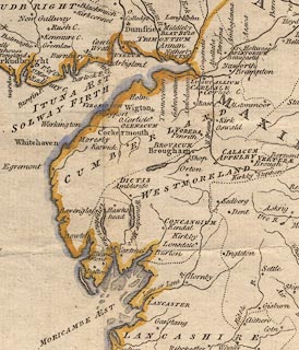 click to enlarge click to enlargePEN1Cm.jpg "Lune or Lone R." river item:- private collection : 66 Image © see bottom of page |
|||
|
|
||||
| evidence:- | descriptive text:- West 1778 (11th edn 1821) placename:- Loyn, River placename:- Lon, River |
|||
| source data:- | Guide book, A Guide to the Lakes, by Thomas West, published by
William Pennington, Kendal, Cumbria once Westmorland, and in
London, 1778 to 1821. goto source Page 6:- "... [station, Hornby Road] is on the south side of the great, or Queen's road, a little higher than where Mr. Gray stood; for there the vale is in full display, including a long reach of the river and the wheel of Lune, forming a high crowned isthmus, fringed with tall trees, that in time past was the solitary site of a hermit [1]. ..." "[1] Hugh, to whom William de Lancastre, sixth baron of Kendal, gave a certain place called Askeleros and Croc, to look to his fishing in the river Loyn [or Lune.] - Burn's Westmorland, p.31" "..." goto sourcePage 14:- "... The station [roman fort, Lancaster] was called Longovicum, and in process of time the inhabitants were called Longovices, i.e. a people living upon the Lon or Lune." "..." goto sourcePage 25:- "'... [Mr. Gray's view from his station, Hornby Road] on each hand of the middle distance rise two sloping hills, the left clothed with thick wood, the right with variegated rock" goto sourcePage 26:- "and herbage. Between them, is the richest of valleys, the Lune serpentizes for many a mile, and comes forth ample and clear thro' a well wooded and richly pastured foreground. ...'" goto sourceAddendum; Mr Gray's Journal, 1769 Page 217:- "... Here [Lancaster] is a good bridge of four arches over the Lune, that runs, when the tide is out, in two steams, divided by a bed of gravel, which is not covered but in spring tides; below the town it widens to near the breadth of the Thames at London, and meets the sea at five or six miles distance to south-west." goto sourcePage 218:- "..." "Oct. 12. I set out for Settle by a fine turnpike-road, ... on the left the river Lune winding in a deep valley, its hanging banks clothed with fine woods, through which you catch long reaches of the water as the road winds about at a considerable height above it. ... In the most picturesque part of the way, I passed the part belonging to the Hon. Mr. Clifford, a catholic. The grounds between him and the river, are indeed charming [1]; ..." "[1] This scene opens just three miles from Lancaster, on what is called the Queen's road. ... in the richest of valleys, the Lune serpentizes for many a mile, and comes forth ample and clear, through a well wooded and richly pastured fore-ground. ..." goto sourceTour to the Caves in the West Riding of Yorkshire, late 18th century Page 240:- "..." "... [at] Underley. The prospect was of the most amusing kind. At the foot of the steep bank on which we walked, being about forty or fifty yards perpendicular, glided the large pellucid river Lune, amongst the rocks and pebbles, which amused the ear, whilst the eye was entertained itself with a vast variety of agreeable objects. A transparent sheet of still water, about half a mile in length, lay stretched out before us; at the high end of it was a grotesque range of impending rocks of red stone, about thirty yards in perpendicular height, which had an excellent effect in the scene, both by their colour and situation. We were told," goto sourcePage 241:- "that in winter the precipice was in some parts so glazed over with ice, from the water trickling down the surface, as to make it appear like a sheet of alabaster. From other parts of the impending rocks hung great and enormous icicles, which made it appear like a huge organ." "..." "After breakfast, we walked by the side of the river to the bridge. The channel is deep, the stream rapid, among rocks, the banks on each side covered with trees of various foliage, which serve both as a defence and ornament. The bridge is the most lofty, strong, ancient, and striking to the eye of a stranger, of any I have yet seen. ..." goto sourcePage 242:- "..." "From the top of the bridge the prospect down the river is delightful: the sides of the deep channel covered with trees, are nearly parallel for half a mile, and the water one continued surface, save here and there where a pointed rock lift up its head above the stream. We walked down by the side of the river about a mile, and as we proceeded were continually presented with new prospects; while the soft murmurs of the river afforded a variety of different notes. ..." goto sourcePage 244:- "If the traveller is distressed for time, and has no inclination to take a second view of the river Lune and its environs, he may order his horse to be sent to Cowan-bridge, and walk through the park of Borough-hall, where he may be entertained with a variety of other prospects." |
|||
|
|
||||
| evidence:- | old map:- West 1784 map |
|||
| source data:- | Map, hand coloured engraving, A Map of the Lakes in Cumberland,
Westmorland and Lancashire, scale about 3.5 miles to 1 inch,
engraved by Paas, 53 Holborn, London, about 1784.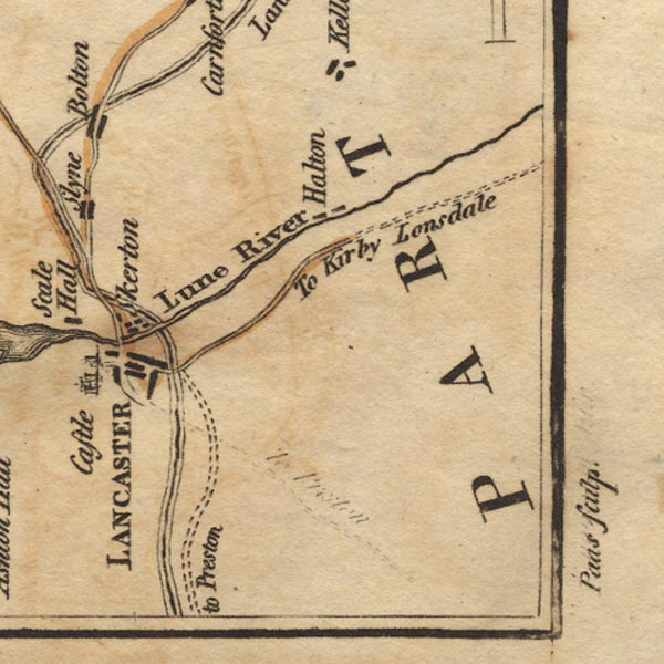 Ws02SD55.jpg item:- Armitt Library : A1221.1 Image © see bottom of page |
|||
|
|
||||
| evidence:- | old text:- Camden 1789 placename:- Lone, River placename:- Lune, River item:- salmon |
|||
| source data:- | Book, Britannia, or A Chorographical Description of the Flourishing Kingdoms of England,
Scotland, and Ireland, by William Camden, 1586, translated from the 1607 Latin edition
by Richard Gough, published London, 1789. goto source Page 131:- "... ..." "This river Lone or Lune rising in Westmoreland hills runs southward between craggy banks and an unequal channel, inriching those who live on it in the summer months with a fine salmon fishery; which fish delighting in clear streams and sandy flats come in shoals to this and other rivers on this coast. As soon as it visits Lancashire the little river Lac unites its waters with it from the east, where now is Over Burrow, a mean country village, ..." "From this Burgh the river Lone passes by Thurland, a castle of the Tunstalls, ..." "The Lone proceeding a few miles further, sees on its south bank the chief town of the county, called more properly by the natives Loncaster, as also by the Scots, who gave it the name of Loncastell from the river Lone. Both the name and the river running by it prove it to be LONGOVICUM, ..." "While I was looking round from this hill [in Lancaster] for the mouth of the Lone which empties itself not much below, Forness, the other part of this county, almost torn off by the sea, presented itself to my view. ..." |
|||
|
|
||||
| evidence:- | old text:- Camden 1789 (Gough Additions) placename:- Lune, River |
|||
| source data:- | Book, Britannia, or A Chorographical Description of the Flourishing Kingdoms of England,
Scotland, and Ireland, by William Camden, 1586, translated from the 1607 Latin edition
by Richard Gough, published London, 1789. goto source Page 155:- "..." "The river Lune rising a little above Ravenstondale, or Rissendale, runs by Lang gill, ... After receiving the Birckbeck it runs down by a field called Gallaber, where stands Brandreth stone, ..." |
|||
|
|
||||
| evidence:- | old map:- Cary 1789 (edn 1805) |
|||
| source data:- | Map, uncoloured engraving, Westmoreland, scale about 2.5 miles
to 1 inch, by John Cary, London, 1789; edition 1805.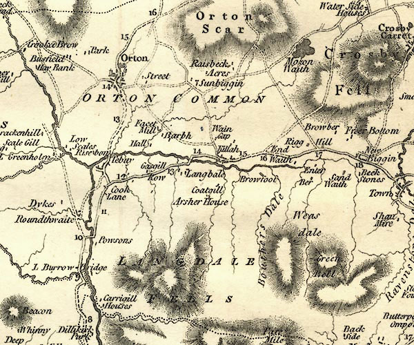 CY24NY60.jpg 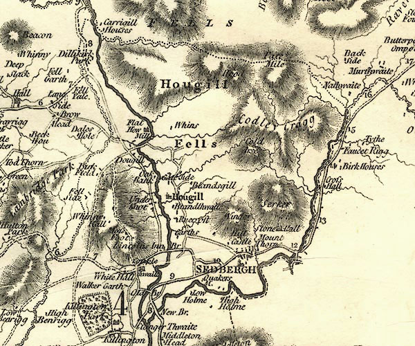 CY24SD69.jpg 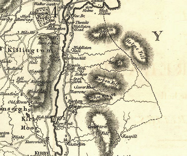 CY24SD68.jpg 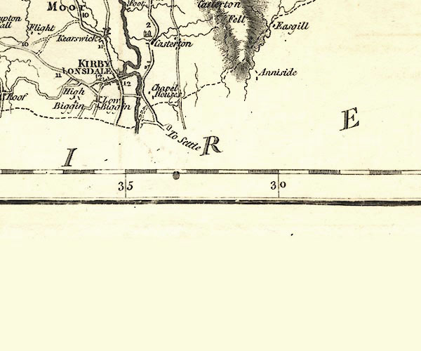 CY24SD67.jpg river item:- JandMN : 129 Image © see bottom of page |
|||
|
|
||||
| evidence:- | old map:- Aikin 1790 (Wmd) placename:- Lune River |
|||
| source data:- | Map, uncoloured engraving, Westmoreland ie Westmorland, scale
about 8.5 miles to 1 inch, by John Aikin, London, 1790.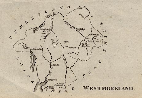 click to enlarge click to enlargeAIK2.jpg "Lune R." river item:- JandMN : 51 Image © see bottom of page |
|||
|
|
||||
| evidence:- | old map:- Bailey 1797 placename:- Lune River |
|||
| source data:- | Map, soil etc, uncoloured engraving, Westmoreland, scale about
12 miles to 1 inch, by J Bailey, engraved by Neele, Strand,
published by Messrs Robinson, Paternoster Row and G Nicol, Pall
Mall, London, 1797.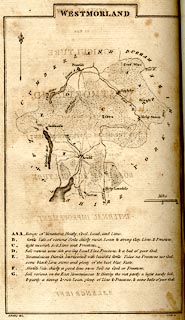 click to enlarge click to enlargeBY05.jpg "Lune R." river item:- Armitt Library : A680.3 Image © see bottom of page |
|||
|
|
||||
| evidence:- | road book:- Cary 1798 (2nd edn 1802) placename:- Loyne, River placename:- Lune, River |
|||
| source data:- | Road book, itineraries, Cary's New Itinerary, by John Cary, 181
Strand, London, 2nd edn 1802. goto source click to enlarge click to enlargeC38267.jpg page 267-268 "Cross the Loyne River." goto source click to enlarge click to enlargeC38315.jpg page 315-316 "Cross the Lune or Loyne River." twice goto source click to enlarge click to enlargeC38333.jpg page 333-334 "Cross the Loyne River" item:- JandMN : 228.1 Image © see bottom of page |
|||
|
|
||||
| evidence:- | old map:- Skrine 1801 placename:- Lune River |
|||
| source data:- | Map, uncoloured engraving, rivers in Cumberland, Westmorland,
Lancashire and Cheshire, scale about 23 miles to 1 inch, by
Henry Skrine, published by P Elmsly, London, 1801. click to enlarge click to enlargeM076.jpg "Lune R." river item:- JandMN : 421 Image © see bottom of page |
|||
|
|
||||
| evidence:- | old map:- Cooke 1802 placename:- Lune River |
|||
| source data:- | Map, Westmoreland ie Westmorland, scale about 12 miles to 1
inch, by George Cooke, 1802, published by Sherwood, Jones and
Co, Paternoster Road, London, 1824. click to enlarge click to enlargeGRA1Wd.jpg "Lune R." tapering wiggly line; river; county boundary item:- Hampshire Museums : FA2000.62.4 Image © see bottom of page |
|||
|
|
||||
| evidence:- | old map:- Laurie and Whittle 1806 placename:- Loyne River |
|||
| source data:- | Road map, Continuation of the Roads to Glasgow and Edinburgh,
scale about 10 miles to 1 inch, by Nathaniel Coltman? 1806,
published by Robert H Laurie, 53 Fleet Street, London, 1834. click to enlarge click to enlargeLw21.jpg "Loyne R." river; on county boundary item:- private collection : 18.21 Image © see bottom of page |
|||
|
|
||||
| evidence:- | old text:- Capper 1808 placename:- Lune, River |
|||
| source data:- | Gazetteer, A Topographical Dictionary of the United Kingdom,
compiled by Benjamin Pitts Capper, published by Richard
Phillips, Bridge Street, Blackfriars, London, 1808; published
1808-29. goto source "[Kirkby Lonsdale] ... river Lune, and along its banks are many pleasant walks and arbours commanding a very picturesque view. The river abounds with excellent salmon and trout. ..." |
|||
|
|
||||
| evidence:- | old map:- Cooper 1808 placename:- Lune River placename:- Loyne River |
|||
| source data:- | Map, hand coloured engraving, Westmoreland ie Westmorland, scale
about 9 miles to 1 inch, by H Cooper, 1808, published by R
Phillips, Bridge Street, Blackfriars, London, 1808. click to enlarge click to enlargeCOP4.jpg "Lune or Loyne R. / Loyne R." tapering wiggly line; river; county boundary item:- Dove Cottage : 2007.38.53 Image © see bottom of page |
|||
|
|
||||
| evidence:- | old map:- Wallis 1810 (Wmd) placename:- Lune River |
|||
| source data:- | Road map, Westmoreland, scale about 19 miles to 1 inch, by James
Wallis, 77 Berwick Street, Soho, 1810, published by W Lewis,
Finch Lane, London, 1835? click to enlarge click to enlargeWAL5.jpg "Lune R." river; county boundary item:- JandMN : 63 Image © see bottom of page |
|||
|
|
||||
| evidence:- | descriptive text:- Wallis 1810 placename:- Lune placename:- Lon |
|||
| source data:- | Map, Westmoreland, scale about 19 miles to 1 inch, and
Cumberland, scale about 16 miles to 1 inch, by James Wallis, 77
Berwick Street, Soho, London, 1810; published 1810-36. "PRINCIPAL RIVERS." "This county is well watered by the rivers, Eden, Loder, Ken, and Lune, or Lon. ..." "... The Lune, or Lon, rises near Kirby Lonsdale, and running S.W. after being augmented by several streams, passes into Lancashire, and running by the town of Lancaster, falls into the Irish sea about four miles below that town." |
|||
|
|
||||
| evidence:- | old text:- Wordsworth 1810 |
|||
| source data:- | Guide book, A Description of the Scenery of the Lakes, later A
Guide through the District of The Lakes, by William Wordsworth,
1810-35. goto source page iii "... Near Kirkby Lonsdale observe the view from the bridge over the Lune, and descend to the channel of the river, and by no means omit looking at the Vale of Lune from the Church-yard." |
|||
|
|
||||
| evidence:- | old map:- Otley 1818 placename:- Lune, River |
|||
| source data:- | Map, uncoloured engraving, The District of the Lakes,
Cumberland, Westmorland, and Lancashire, scale about 4 miles to
1 inch, by Jonathan Otley, 1818, engraved by J and G Menzies,
Edinburgh, Scotland, published by Jonathan Otley, Keswick,
Cumberland, et al, 1833. OT02SD56.jpg "River Lune" item:- JandMN : 48.1 Image © see bottom of page |
|||
|
|
||||
| evidence:- | old map:- Hall 1820 (Wmd) placename:- Lune River |
|||
| source data:- | Map, hand coloured engraving, Westmoreland ie Westmorland, scale
about 14.5 miles to 1 inch, by Sidney Hall, London, 1820,
published by Samuel Leigh, 18 Strand, London, 1820-31. click to enlarge click to enlargeHA18.jpg "Lune R." tapering wiggly line; river; county boundary item:- Armitt Library : 2008.14.58 Image © see bottom of page |
|||
|
|
||||
| evidence:- | descriptive text:- Otley 1823 (8th edn 1849) |
|||
| source data:- | Guide book, A Concise Description of the English Lakes, the
mountains in their vicinity, and the roads by which they may be
visited, with remarks on the mineralogy and geology of the
district, by Jonathan Otley, published by the author, Keswick,
Cumberland now Cumbria, by J Richardson, London, and by Arthur
Foster, Kirkby Lonsdale, Cumbria, 1823; published 1823-49,
latterly as the Descriptive Guide to the English Lakes. goto source Page 180:- "..." "[at Devil's Bridge, Kirkby Lonsdale] In heavy floods, the river rises a height of 15 feet or more. In ordinary seasons the battlements are about 52 feet above the level of the water. The views of the river from the centre are singularly beautiful; it here flows through a rocky channel, narrow, but of a profound depth; and the banks on either side are adorned with fine trees. ..." |
|||
|
|
||||
| evidence:- | descriptive text:- Otley 1823 (5th edn 1834) item:- geology |
|||
| source data:- | Guide book, A Concise Description of the English Lakes, the
mountains in their vicinity, and the roads by which they may be
visited, with remarks on the mineralogy and geology of the
district, by Jonathan Otley, published by the author, Keswick,
Cumberland now Cumbria, by J Richardson, London, and by Arthur
Foster, Kirkby Lonsdale, Cumbria, 1823; published 1823-49,
latterly as the Descriptive Guide to the English Lakes. goto source Page 41:- "[... the Lune - which at] Kirkby Lonsdale is a fine river, and crossed by a lofty antique bridge; it is navigable at Lancaster, a little below which place it falls into the sea." "..." goto sourcePage 158:- "... Towards the south-east succeeds [from the 3rd division of rocks] a series of rocks of the same dark-blue colour, and principally of a slaty structure: but accompanied in places with a rock, which breaks alike in all directions. This last has supplied a great portion of the rounded" goto sourcePage 159:- "stones found in the beds of the rivers Kent and Lune; thus furnishing materials for paving the streets, and repairing the roads in the vicinity." goto sourcePage 160:- "..." "A conglomerate, composed of rounded stones of various sizes, from the smallest gravel, to the weight of several pounds, held together by a ferruginous, calcareous cement, ..." goto sourcePage 161:- "A large mass of similar composition appears in the bed and on the banks of the river Lune at Kirkby Lonsdale. Its dip indicates that it should pass under the limestone which appears at a little distance; but, in that case, how it came to contains nodules of limestone I am at a loss to understand. ... wherever the subjacent rock can be seen, it is always deeply coloured by the iron of the conglomerate." |
|||
|
|
||||
| evidence:- | old map:- Perrot 1823 |
|||
| source data:- | Map, hand coloured engraving, Cumberland and Westmoreland ie
Westmorland, scale about 38 miles to 1 inch, by Aristide Michel
Perrot, engraved by Migneret, 1823, published by Etienne Ledoux,
9 Rue Guenegaud, Paris, France, 1824-48. click to enlarge click to enlargePER2.jpg tapering wiggly line item:- Dove Cottage : 2007.38.45 Image © see bottom of page |
|||
|
|
||||
| evidence:- | old map:- Ford 1839 map placename:- Lune River |
|||
| source data:- | Map, uncoloured engraving, Map of the Lake District of
Cumberland, Westmoreland and Lancashire, scale about 3.5 miles
to 1 inch, published by Charles Thurnam, Carlisle, and by R
Groombridge, 5 Paternoster Row, London, 3rd edn 1843. FD02SD57.jpg "Lune R." item:- JandMN : 100.1 Image © see bottom of page |
|||
|
|
||||
| evidence:- | old map:- Garnett 1850s-60s H placename:- Lune, River |
|||
| source data:- | Map of the English Lakes, in Cumberland, Westmorland and
Lancashire, scale about 3.5 miles to 1 inch, published by John
Garnett, Windermere, Westmorland, 1850s-60s. GAR2NY60.jpg "R. Lune" wiggly line, river 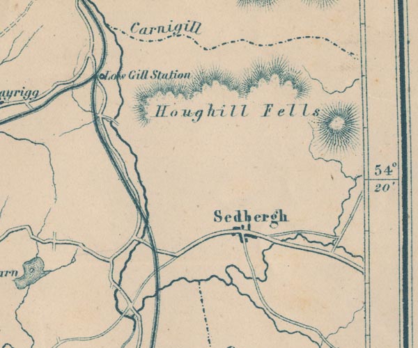 GAR2SD69.jpg 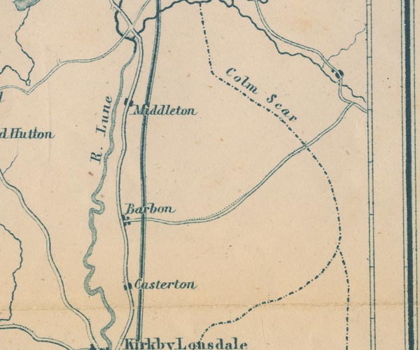 GAR2SD68.jpg "R. Lune" 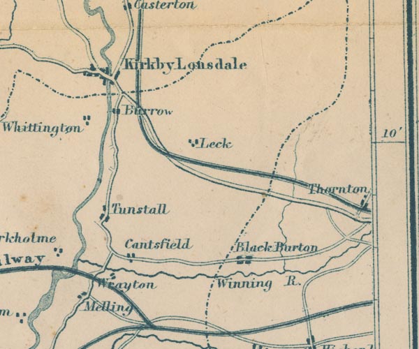 GAR2SD67.jpg double wiggly line 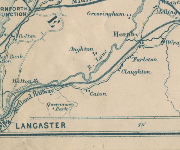 GAR2SD56.jpg "R. Lune"  GAR2SD46.jpg item:- JandMN : 82.1 Image © see bottom of page |
|||
|
|
||||
| evidence:- | old map:- Postlethwaite 1877 (3rd edn 1913) placename:- Clough, River |
|||
| source data:- | Map, uncoloured engraving, Map of the Lake District Mining Field, Westmorland, Cumberland,
Lancashire, scale about 5 miles to 1 inch, by John Postlethwaite, published by W H
Moss and Sons, 13 Lowther Street, Whitehaven, Cumberland, 1877 edn 1913.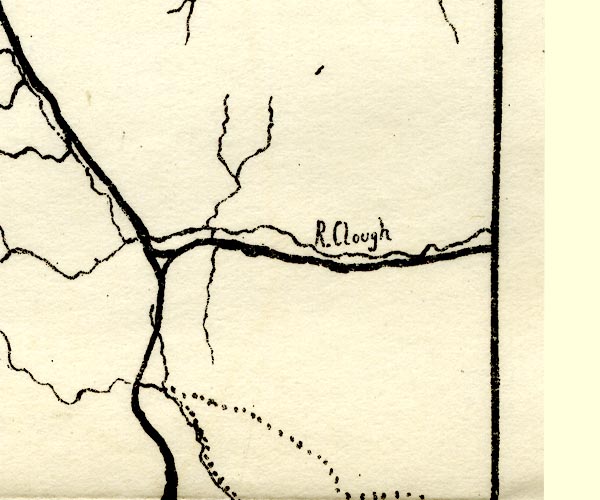 PST2NY60.jpg "R. Clough" wiggly line item:- JandMN : 162.2 Image © see bottom of page |
|||
|
|
||||
| evidence:- | old map:- Postlethwaite 1877 (3rd edn 1913) placename:- Lune, River |
|||
| source data:- | Map, uncoloured engraving, Map of the Lake District Mining Field, Westmorland, Cumberland,
Lancashire, scale about 5 miles to 1 inch, by John Postlethwaite, published by W H
Moss and Sons, 13 Lowther Street, Whitehaven, Cumberland, 1877 edn 1913.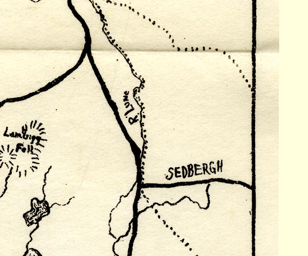 PST2SD69.jpg "R. Lune" wiggly line, county boundary 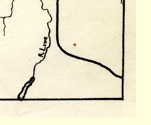 PST2SD67.jpg "R. Lune." wiggly line, running into an estuary item:- JandMN : 162.2 Image © see bottom of page |
|||
|
|
||||
| evidence:- | old map:- LMS 1920s maps |
|||
| source data:- | Railway map, lithograph, 23 pages of strip maps, The Journey in
Brief, the Route London to Carlisle, published by the London
Midland and Scottish Railway, LMS, 1920s.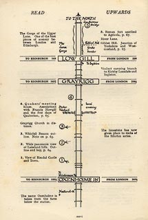 click to enlarge click to enlargeLS3p26.jpg "The Gorge of the Upper Lune. One of the best pieces of scenery between London and Edinburgh." item:- JandMN : 95.2 Image © see bottom of page |
|||
|
|
||||
| evidence:- | old text:- Admiralty 1933 placename:- Lune, River |
|||
| source data:- | goto source Page 371:- "..." "RIVER LUNE. - The River Lune rises near Ravenstonedale in Westmorland, and flows in a southerly and south-westerly direction, passing about 2 miles westward of Sedbergh and on to Kirkby Lonsdale and Lancaster, 28 and 45 miles, respectively, from its source. Its chief tributaries are the Rawthey, near Sedbergh, the Greta, and the Wenning, all from the eastward. Below Lancaster, the river expands into a winding estuary which flows past Glasson dock, 5 miles below Lancaster on the left bank, and into Morecambe bay, 2 miles lower down, between a point situated northward of Cockersand abbey and Sunderland point." "..." |
|||
|
|
||||
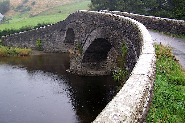
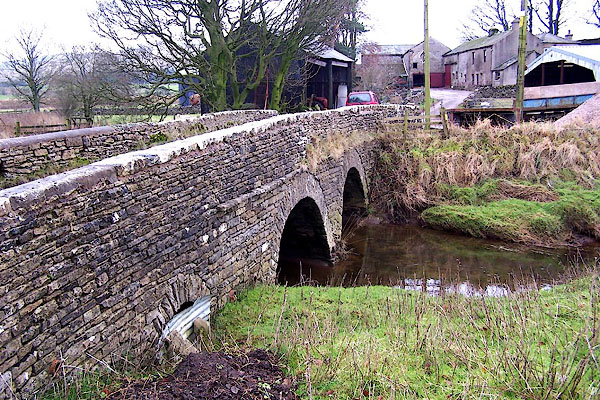
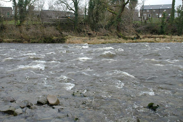
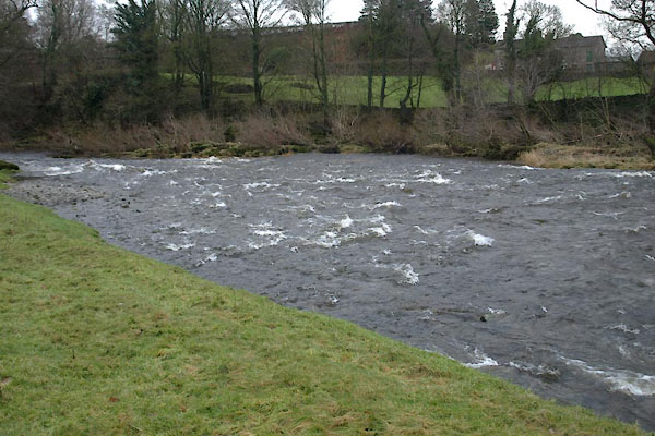
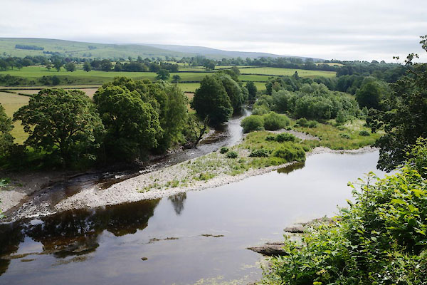
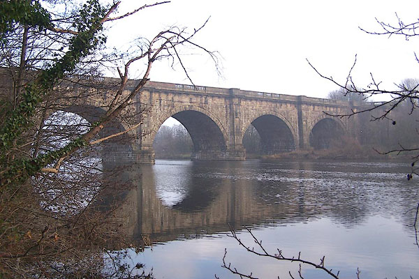
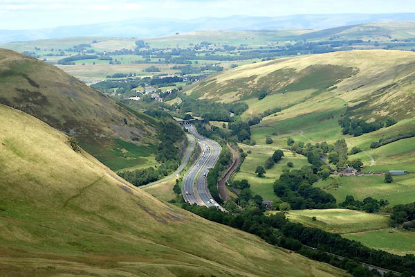
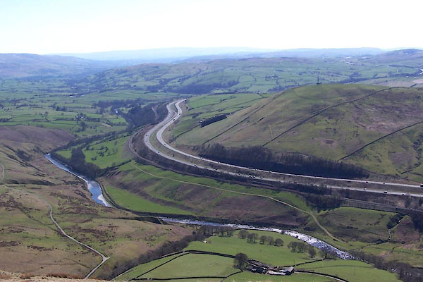
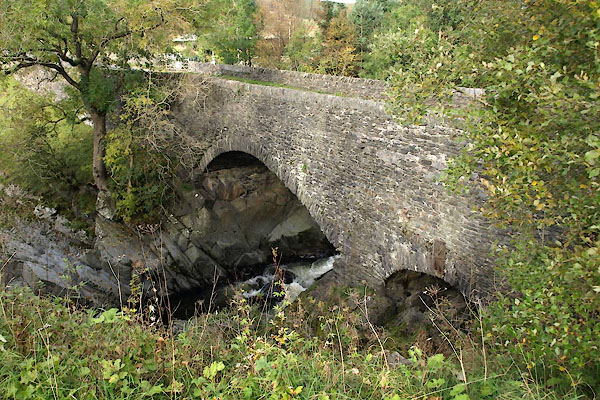
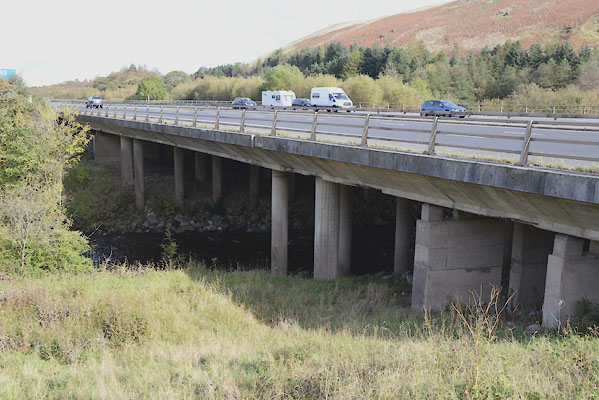
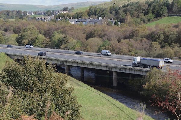
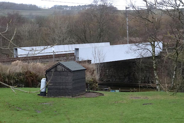
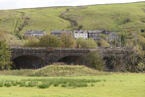
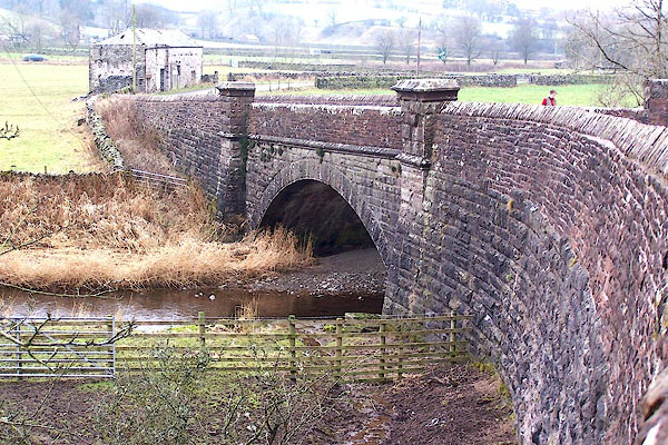
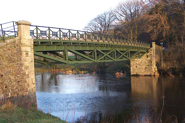
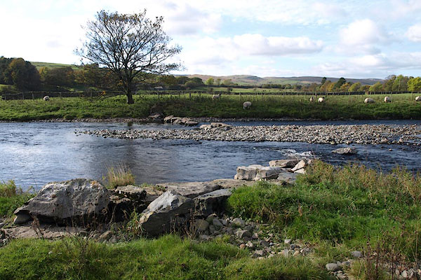
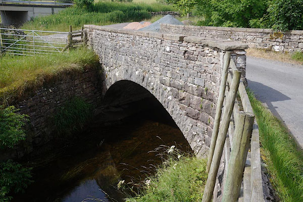
 CBB21.jpg At Wath Bridge, (taken 11.7.2014)  BRS93.jpg At the 'stepping stones', Tebay. (taken 16.10.2009)  CGQ67.jpg At railway bridge, (taken 6.10.2017) 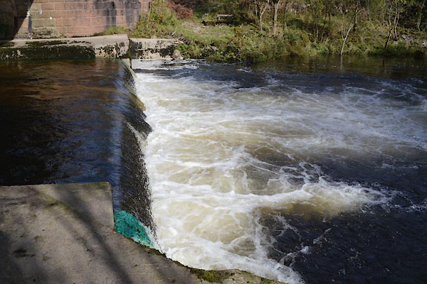 CGQ68.jpg At railway bridge, (taken 6.10.2017) 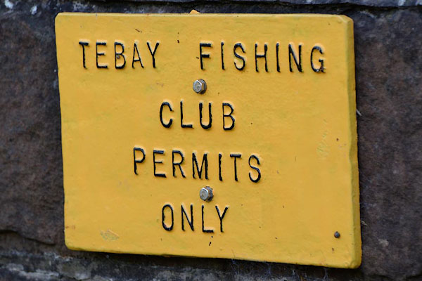 CGQ69.jpg Tebay Fishing Club notice, (taken 6.10.2017) 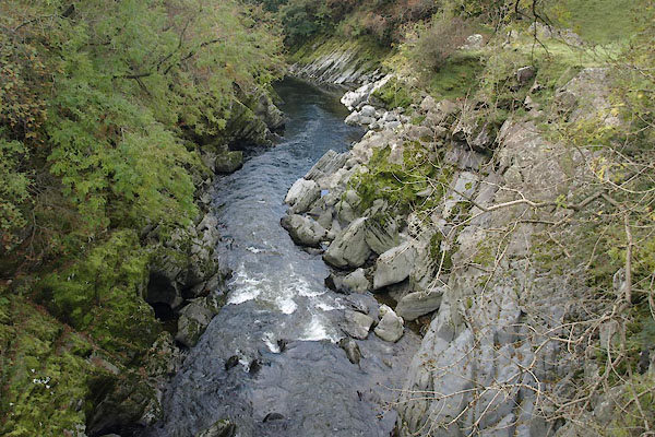 BTR45.jpg at Lune's Bridge, Tebay. (taken 9.12.2005) 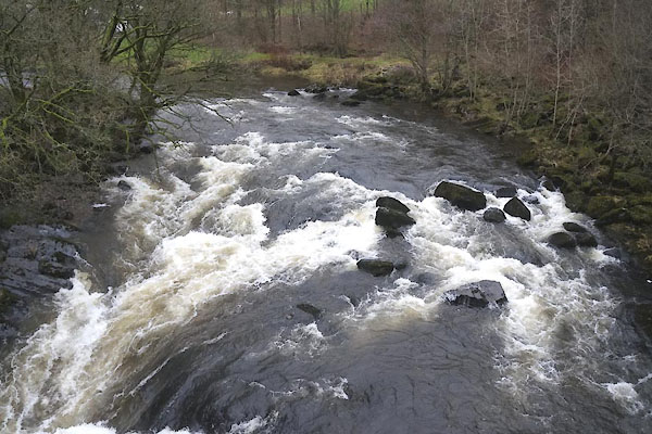 CEK89.jpg at Lune's Bridge, Tebay. (taken 4.12.2015)  CGQ63.jpg at a motorway bridge, (taken 5.10.2017)  CEK90.jpg at Lune's Bridge, Tebay. (taken 4.12.2015)  CEK91.jpg at Lune's Bridge, Tebay. (taken 4.12.2015)  BZE13.jpg In the Lune Gap. (taken 25.8.2013)  BLL29.jpg River bed at Lune's Bridge, Tebay. (taken 9.12.2005) 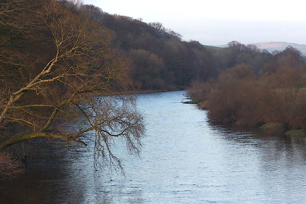 BNB57.jpg View N from Rigmaden Bridge, Mansergh. (taken 1.12.2006) |
||||
|
|
||||
| places:- |
|
|||
|
||||
|
||||
|
||||
|
||||
|
||||
|
||||
|
||||
|
||||
|
||||
|
||||
|
||||
|
||||
|
||||
|
||||
|
||||
|
||||
|
||||
|
||||
|
||||
|
||||
|
||||
|
||||
|
||||
|
||||
|
||||
|
||||
|
||||
|
||||
|
||||
|
||||
|
||||
|
||||
|
||||
|
||||
|
||||
|
||||
|
||||
|
||||
|
||||
|
||||
|
||||
|
||||
|
||||
|
||||
|
||||
|
||||
|
||||
|
||||
|
||||
|
||||
|
||||
|
||||
|
||||
|
||||
|
||||
|
||||
|
||||
|
||||
|
||||
|
||||
|
||||
|
||||
|
||||
|
||||
|
||||
|
||||
Lakes Guides menu.