 Old Cumbria Gazetteer
 |
 |
|
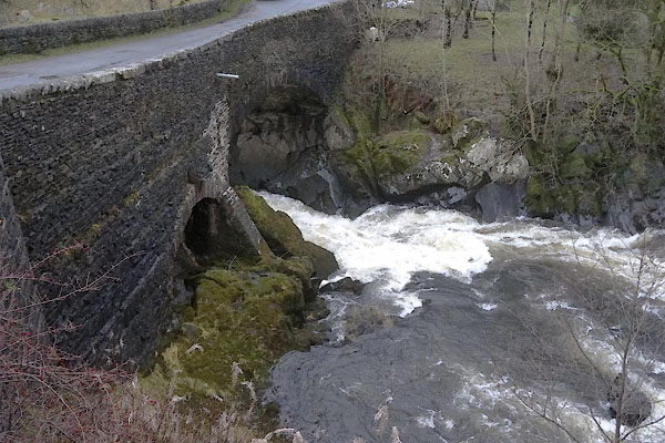
| Lune's Bridge, Tebay | ||
| Lune's Bridge | ||
| site name:- | Lune, River | |
| locality:- | Tebay | |
| civil parish:- | Tebay (formerly Westmorland) | |
| county:- | Cumbria | |
| locality type:- | bridge | |
| coordinates:- | NY61300286 | |
| 1Km square:- | NY6102 | |
| 10Km square:- | NY60 | |
|
|
||
 BTR43.jpg (taken 16.10.2010) 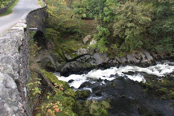 BTR44.jpg (taken 16.10.2010) |
||
|
|
||
| evidence:- | old map:- OS County Series (Wmd 28 12) placename:- Lune's Bridge |
|
| source data:- | Maps, County Series maps of Great Britain, scales 6 and 25
inches to 1 mile, published by the Ordnance Survey, Southampton,
Hampshire, from about 1863 to 1948. |
|
|
|
||
| evidence:- | probably old map:- Morden 1695 (Wmd) |
|
| source data:- | Map, hand coloured engraving, Westmorland, scale about 2.5 miles to 1 inch, by Robert
Morden, published by Abel Swale, the Unicorn, St Paul's Churchyard, Awnsham, and John
Churchill, the Black Swan, Paternoster Row, London, 1695.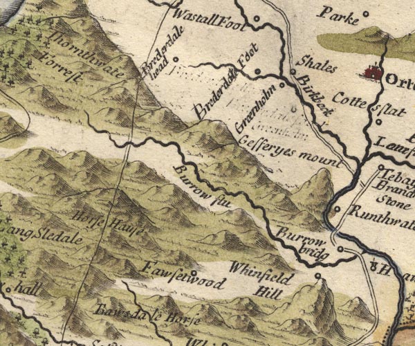 MD10NY50.jpg Road across Lune. item:- JandMN : 24 Image © see bottom of page |
|
|
|
||
| evidence:- | old map:- Bowen and Kitchin 1760 |
|
| source data:- | Map, hand coloured engraving, A New Map of the Counties of
Cumberland and Westmoreland Divided into their Respective Wards,
scale about 4 miles to 1 inch, by Emanuel Bowen and Thomas
Kitchin et al, published by T Bowles, Robert Sayer, and John
Bowles, London, 1760.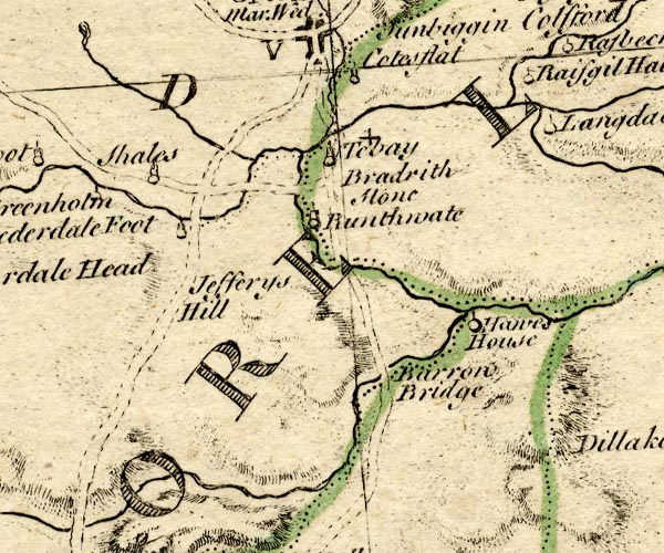 BO18NY50.jpg road across the Lune item:- Armitt Library : 2008.14.10 Image © see bottom of page |
|
|
|
||
| evidence:- | old map:- Jefferys 1770 (Wmd) |
|
| source data:- | Map, 4 sheets, The County of Westmoreland, scale 1 inch to 1
mile, surveyed 1768, and engraved and published by Thomas
Jefferys, London, 1770.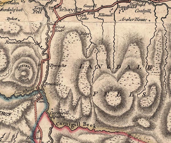 J5NY60SW.jpg double line, road, across a stream; bridge item:- National Library of Scotland : EME.s.47 Image © National Library of Scotland |
|
|
|
||
| evidence:- | old map:- Cary 1789 (edn 1805) |
|
| source data:- | Map, uncoloured engraving, Westmoreland, scale about 2.5 miles
to 1 inch, by John Cary, London, 1789; edition 1805.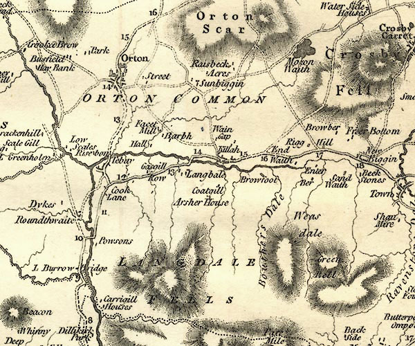 CY24NY60.jpg road across a stream; bridge over the Lune item:- JandMN : 129 Image © see bottom of page |
|
|
|
||
| evidence:- | old map:- Cooper 1808 |
|
| source data:- | Map, hand coloured engraving, Westmoreland ie Westmorland, scale
about 9 miles to 1 inch, by H Cooper, 1808, published by R
Phillips, Bridge Street, Blackfriars, London, 1808. click to enlarge click to enlargeCOP4.jpg road across stream; bridge? item:- Dove Cottage : 2007.38.53 Image © see bottom of page |
|
|
|
||
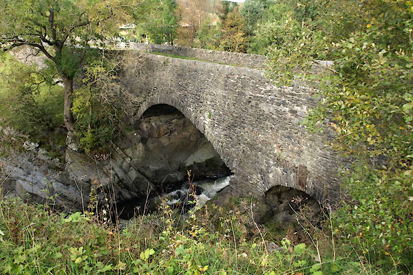
| evidence:- | database:- Listed Buildings 2010 placename:- Lunes Bridge |
|
| source data:- | courtesy of English Heritage "LUNES BRIDGE / / / TEBAY / EDEN / CUMBRIA / II / 74204 / NY6129902858" |
|
| source data:- | courtesy of English Heritage "Bridge. Early/mid C19. Roughly coursed limestone rubble. Elliptical main arch with rough voussoirs, segmental smaller flood arch to east end. Parapets with vertically set stones. Iron tie to crown of flood arch. Dramatic situation crossing rock filled river." |
|
|
|
||
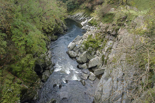 BTR45.jpg View of river. (taken 9.12.2005) 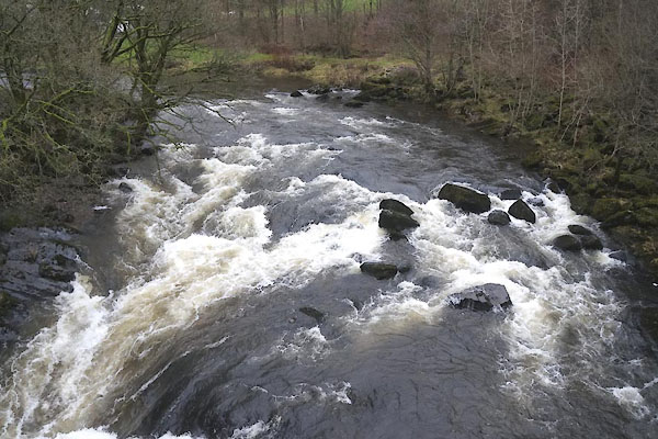 CEK89.jpg View of river. (taken 4.12.2015) 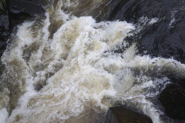 CEK90.jpg View of river. (taken 4.12.2015) 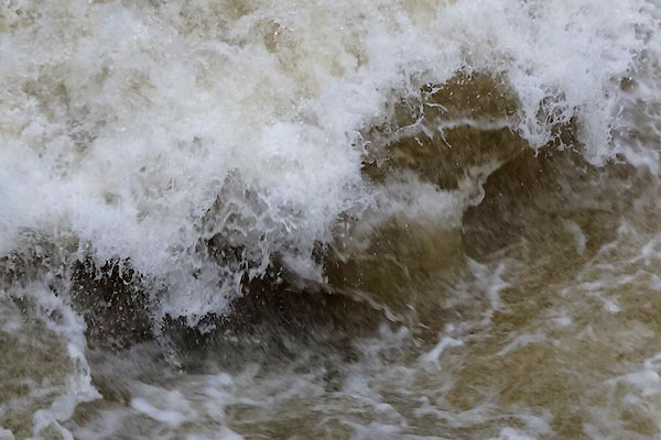 CEK91.jpg View of river. (taken 4.12.2015) 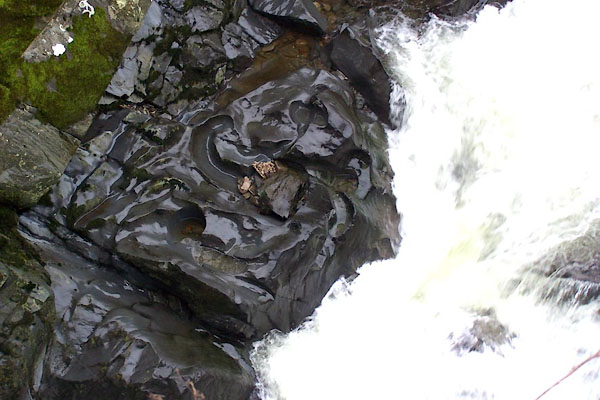 BLL29.jpg View of river. River bed at Lune's Bridge, Tebay. (taken 9.12.2005) |
||
|
|
||
 CEK88.jpg (taken 4.12.2015) |
||
|
|
||
 Lakes Guides menu.