 Old Cumbria Gazetteer
 |
 |
|
| Killington New Bridge, Killington | ||
| Killington New Bridge | ||
| site name:- | Lune, River | |
| civil parish:- | Killington (formerly Westmorland) | |
| civil parish:- | Sedbergh (formerly Yorkshire) | |
| county:- | Cumbria | |
| locality type:- | bridge | |
| locality type:- | boundary feature | |
| locality type:- | parish boundary feature | |
| locality type:- | county boundary feature | |
| coordinates:- | SD62249080 | |
| 1Km square:- | SD6290 | |
| 10Km square:- | SD69 | |
|
|
||
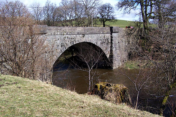 BLT32.jpg (taken 31.3.2006) |
||
|
|
||
| evidence:- | old map:- OS County Series (Wmd 39 12) placename:- Killington New Bridge |
|
| source data:- | Maps, County Series maps of Great Britain, scales 6 and 25
inches to 1 mile, published by the Ordnance Survey, Southampton,
Hampshire, from about 1863 to 1948. OS County Series (Yrk 63 2) |
|
|
|
||
| evidence:- | database:- Listed Buildings 2010 placename:- Killington New Bridge |
|
| source data:- | courtesy of English Heritage "KILLINGTON NEW BRIDGE (THAT PART IN KILLINGTON C.P.) / / A683 / KILLINGTON / SOUTH LAKELAND / CUMBRIA / II / 75678 / SD6223990807" |
|
| source data:- | courtesy of English Heritage "Bridge, mid to late C19. Dressed stone with rock-faced stone dressings. Segmental arch with rock-faced voussoirs and flanking battered piers. Rainwater spout to each side. Plain parapet, projecting over piers." |
|
|
|
||
 Lakes Guides menu.