Old Cumbria Gazetteer
 |
 |
|
||
| Eamont, River | ||||
| runs into:- |  Eden, River Eden, River |
|||
|
|
||||
| civil parish:- | Barton (formerly Westmorland) | |||
| civil parish:- | Dacre (formerly Cumberland) | |||
| civil parish:- | Sockbridge and Tirril (formerly Westmorland) | |||
| civil parish:- | Brougham (formerly Westmorland) | |||
| civil parish:- | Penrith (formerly Cumberland) | |||
| civil parish:- | Yanwath and Eamont Bridge (formerly Westmorland) | |||
| civil parish:- | Langwathby (formerly Cumberland) | |||
| civil parish:- | Brougham (formerly Westmorland) | |||
| county:- | Cumbria | |||
| locality type:- | river | |||
| locality type:- | boundary | |||
| locality type:- | county boundary | |||
| 1Km square:- | NY4624 (etc) | |||
| coordinates:- | NY58622915 (falls into Eden) | |||
| 10Km square:- | NY42 | |||
| 10Km square:- | NY52 | |||
| 10Km square:- | NY53 | |||
|
|
||||
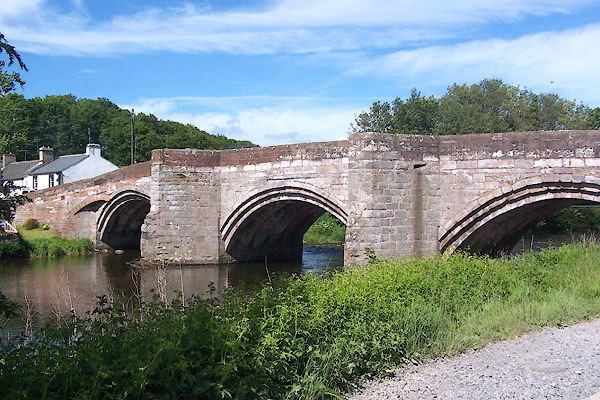
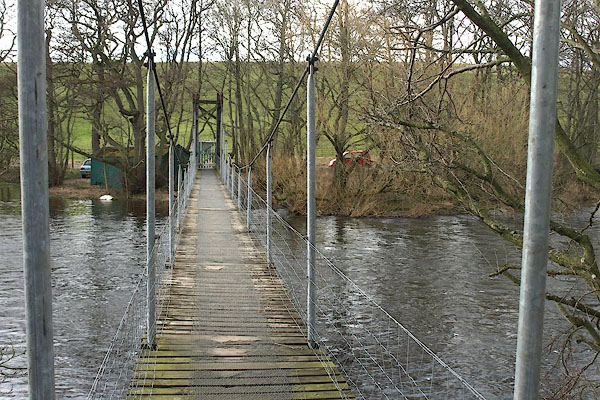
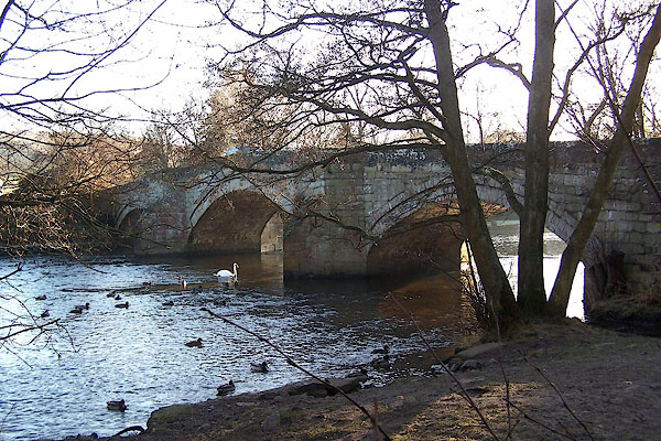
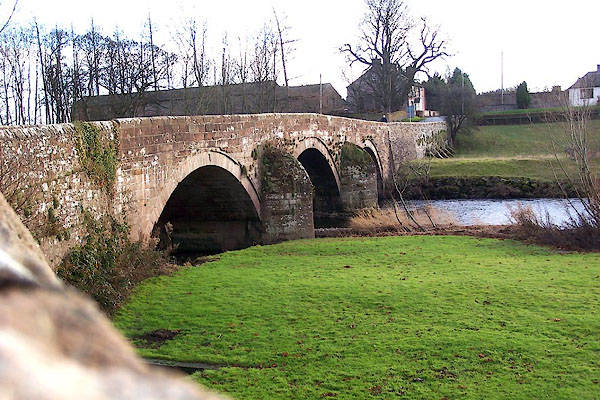
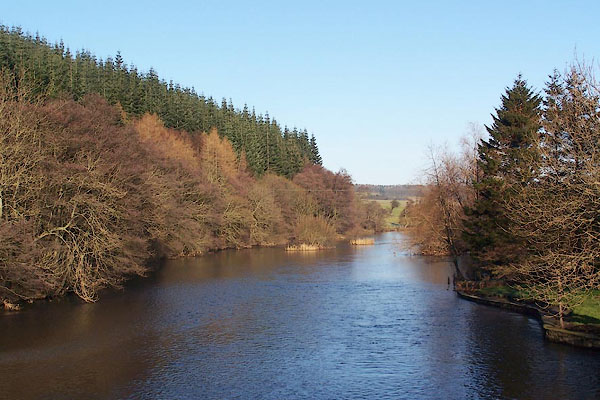 BLN40.jpg Looking downstream from Pooley Bridge. (taken 4.1.2006) 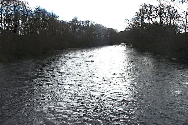 BOV05.jpg Upstream from Pooley Mill footbridge. (taken 17.3.2008) |
||||
|
|
||||
| evidence:- | old map:- OS County Series (Wmd 3 15) placename:- Eamont, River |
|||
| source data:- | Maps, County Series maps of Great Britain, scales 6 and 25
inches to 1 mile, published by the Ordnance Survey, Southampton,
Hampshire, from about 1863 to 1948. OS County Series (Cmd 58 11) OS County Series (Cmd 59 2) OS County Series (Cmd 59 5) |
|||
|
|
||||
| evidence:- | old map:- Gough 1350s-60s |
|||
| source data:- | Map, colour photozincograph copy, reduced size facsimile, Gough
Map of Britain, scale about 28.5 miles to 1 inch, published by
the Ordnance Survey, Southampton, Hampshire, 1875. click to enlarge click to enlargeGgh1Cm.jpg Tributary to the Eden; by Penrith; not labelled. item:- JandMN : 33 Image © see bottom of page |
|||
|
|
||||
| evidence:- | old map:- Gough 1350s-60s |
|||
| source data:- | Map, lithograph facsimile, Gough Map of Britain, 20 miles to 1
inch? published by the Ordnance Survey, Southampton, Hampshire,
1935. click to enlarge click to enlargeGgh2Cm.jpg Tributary to the Eden; by Penrith; not labelled. item:- JandMN : 34 Image © see bottom of page |
|||
|
|
||||
| evidence:- | probably old map:- Lloyd 1573 |
|||
| source data:- | Map, hand coloured copper plate engraving, Angliae Regni,
Kingdom of England, with Wales, scale about 24 miles to 1 inch, authored by Humphrey
Lloyd, Denbigh, Clwyd, drawn and engraved
by Abraham Ortelius, Netherlands, 1573. click to enlarge click to enlargeLld1Cm.jpg item:- Hampshire Museums : FA1998.69 Image © see bottom of page |
|||
|
|
||||
| evidence:- | old map:- Saxton 1579 |
|||
| source data:- | Map, hand coloured engraving, Westmorlandiae et Cumberlandiae Comitatus ie Westmorland
and Cumberland, scale about 5 miles to 1 inch, by Christopher Saxton, London, engraved
by Augustinus Ryther, 1576, published 1579-1645. Sax9NY53.jpg County boundary. item:- private collection : 2 Image © see bottom of page |
|||
|
|
||||
| evidence:- | old map:- Mercator 1595 (edn?) placename:- |
|||
| source data:- | Map, hand coloured engraving, Northumbria, Cumberlandia, et
Dunelmensis Episcopatus, ie Northumberland, Cumberland and
Durham etc, scale about 6.5 miles to 1 inch, by Gerard Mercator,
Duisberg, Germany, about 1595. MER8CumD.jpg 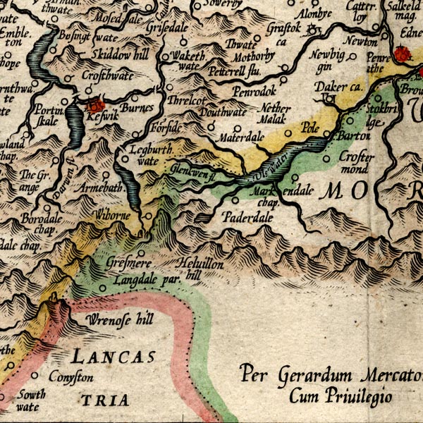 MER8CumF.jpg double line with stream lines; river, county boundary with Westmorland item:- JandMN : 169 Image © see bottom of page |
|||
|
|
||||
| evidence:- | old map:- Mercator 1595 (edn?) placename:- |
|||
| source data:- | Map, hand coloured engraving, Westmorlandia, Lancastria, Cestria
etc, ie Westmorland, Lancashire, Cheshire etc, scale about 10.5
miles to 1 inch, by Gerard Mercator, Duisberg, Germany, 1595,
edition 1613-16. MER5WmdA.jpg "" double line with stream lines; river, running into the Eden, county boundary with Cumberland item:- Armitt Library : 2008.14.3 Image © see bottom of page |
|||
|
|
||||
| evidence:- | old map:- Keer 1605 |
|||
| source data:- | Map, hand coloured engraving, Westmorland and Cumberland, scale
about 16 miles to 1 inch, probably by Pieter van den Keere, or
Peter Keer, about 1605 edition perhaps 1676. click to enlarge click to enlargeKER8.jpg "" double wiggly line, tapering to single; river; county boundary item:- Dove Cottage : 2007.38.110 Image © see bottom of page |
|||
|
|
||||
| evidence:- | old map:- Speed 1611 (Cum/EW) |
|||
| source data:- | Map, hand coloured engraving, Kingdome of Great Britaine and
Ireland, scale about 36 miles to 1 inch, by John Speed, about
1610-11, published by Thomas Bassett, Fleet Street and Richard
Chiswell, St Paul's Churchyard, London, 1676? click to enlarge click to enlargeSPD6Cm.jpg tapering wiggly line, twice! once misplaced item:- private collection : 85 Image © see bottom of page |
|||
|
|
||||
| evidence:- | old map:- Speed 1611 (Cmd) |
|||
| source data:- | Map, hand coloured engraving, Cumberland and the Ancient Citie
Carlile Described, scale about 4 miles to 1 inch, by John Speed,
1610, published by J Sudbury and George Humble, Popes Head
Alley, London, 1611-12.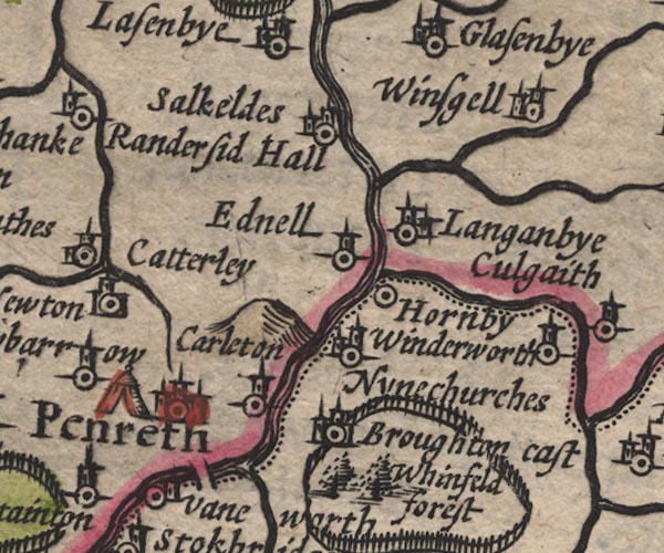 SP11NY53.jpg double line with stream lines, runs into the Eden; county boundary 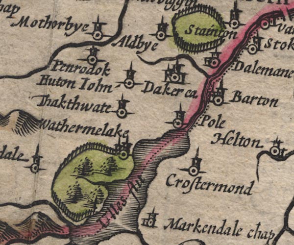 SP11NY42.jpg double line; county boundary item:- private collection : 16 Image © see bottom of page |
|||
|
|
||||
| evidence:- | old map:- Speed 1611 (Wmd) placename:- Eimot flu. |
|||
| source data:- | Map, hand coloured engraving, The Countie Westmorland and
Kendale the Cheif Towne, scale about 2.5 miles to 1 inch, by
John Speed, 1610, published by George Humble, Popes Head Alley,
London, 1611-12.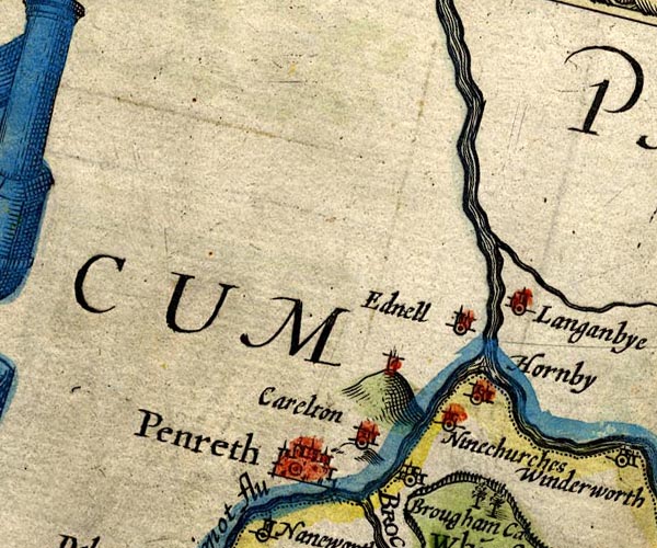 SP14NY53.jpg running into the Eden 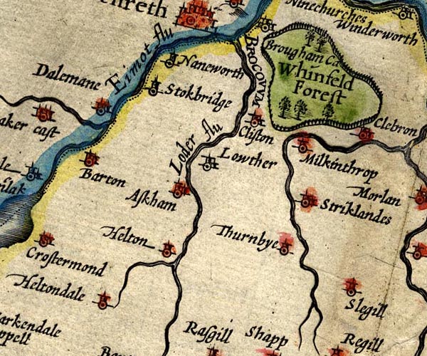 SP14NY52.jpg "Eimot flu" double line with stream lines; county boundary item:- Armitt Library : 2008.14.5 Image © see bottom of page |
|||
|
|
||||
| evidence:- | poem:- Drayton 1612/1622 text placename:- Eymot |
|||
| source data:- | Poem, Poly Olbion, by Michael Drayton, published by published by
John Marriott, John Grismand and Thomas Dewe, and others?
London, part 1 1612, part 2 1622. goto source page 163:- "... ... and happily to fill, Her [Eden's] more abundant Banks, from Ulls, a mightie Mere On Cumberlands confines, comes Eymot neat and cleere, ..." |
|||
|
|
||||
| evidence:- | old map:- Drayton 1612/1622 placename:- Eymot Fl. |
|||
| source data:- | Map, hand coloured engraving, Cumberlande and Westmorlande, by
Michael Drayton, probably engraved by William Hole, scale about
4 or 5 miles to 1 inch, published by John Mariott, John
Grismand, and Thomas Dewe, London, 1622.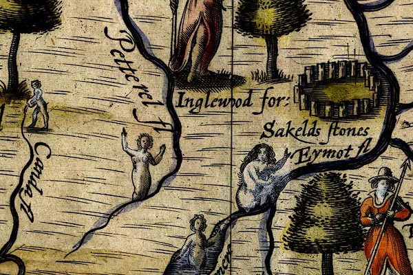 DRY510.jpg "Eymot fl" River, naiad. item:- JandMN : 168 Image © see bottom of page |
|||
|
|
||||
| evidence:- | probably table of distances:- Simons 1635 |
|||
| source data:- | Table of distances, uncoloured engraving, Westmerland ie
Westmorland, with a thumbnail map, scale about 42 miles to 1
inch, by Mathew Simons, published in A Direction for the English
Traviller, 1635.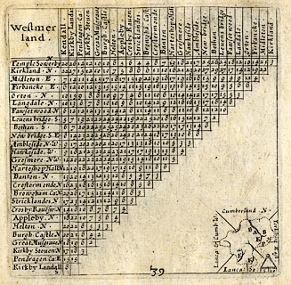 click to enlarge click to enlargeSIM3.jpg on thumbnail map item:- private collection : 50.39 Image © see bottom of page |
|||
|
|
||||
| evidence:- | old map:- Jansson 1646 |
|||
| source data:- | Map, hand coloured engraving, Cumbria and Westmoria, ie
Cumberland and Westmorland, scale about 3.5 miles to 1 inch, by
John Jansson, Amsterdam, Netherlands, 1646. JAN3NY42.jpg  JAN3NY52.jpg 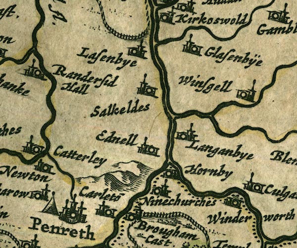 JAN3NY53.jpg Double wiggly line, tapering to single; county boundary. item:- JandMN : 88 Image © see bottom of page |
|||
|
|
||||
| evidence:- | old map:- Ogilby 1675 (plate 38) placename:- Eden Flu. |
|||
| source data:- | Road strip map, hand coloured engraving, continuation of the
Road from London to Carlisle, scale about 1 inch to 1 mile, by
John Ogilby, London, 1675.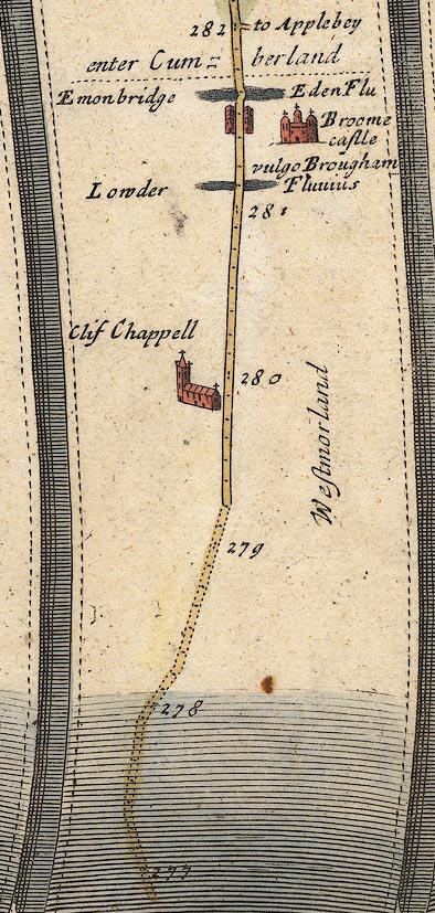 OG38m277.jpg In mile 281, Westmorland. "Eden Flu" crossed by the road over a low arch at:- "Emonbridge" The county boundary is here:- "enter Cumberland" just across the river. item:- JandMN : 21 Image © see bottom of page |
|||
|
|
||||
| evidence:- | old map:- Sanson 1679 placename:- Wlles fl. |
|||
| source data:- | Map, hand coloured engraving, Ancien Royaume de Northumberland
aujourdhuy Provinces de Nort, ie the Ancient Kingdom of
Northumberland or the Northern Provinces, scale about 9.5 miles
to 1 inch, by Nicholas Sanson, Paris, France, 1679. click to enlarge click to enlargeSAN2Cm.jpg "Wlles fl." tapering wiggly line; river, double line item:- Dove Cottage : 2007.38.15 Image © see bottom of page |
|||
|
|
||||
| evidence:- | old map:- Seller 1694 (Wmd) |
|||
| source data:- | Map, hand coloured engraving, Westmorland, scale about 8 miles
to 1 inch, by John Seller, 1694. click to enlarge click to enlargeSEL7.jpg tapering wiggly line; river; county boundary item:- Dove Cottage : 2007.38.87 Image © see bottom of page |
|||
|
|
||||
| evidence:- | old map:- Seller 1694 (Cmd) |
|||
| source data:- | Map, uncoloured engraving, Cumberland, scale about 12 miles to 1
inch, by John Seller, 1694. click to enlarge click to enlargeSEL9.jpg tapering wiggly line; river; county boundary item:- Dove Cottage : 2007.38.89 Image © see bottom of page |
|||
|
|
||||
| evidence:- | old map:- Morden 1695 (Cmd) placename:- Eimo River |
|||
| source data:- | Map, uncoloured engraving, Cumberland, scale about 4 miles to 1
inch, by Robert Morden, 1695, published by Abel Swale, the
Unicorn, St Paul's Churchyard, Awnsham, and John Churchill, the
Black Swan, Paternoster Row, London, 1695-1715. MD12NY42.jpg "[Eimo] R." item:- JandMN : 90 Image © see bottom of page |
|||
|
|
||||
| evidence:- | old map:- Morden 1695 (Wmd) placename:- Emie Flu. |
|||
| source data:- | Map, hand coloured engraving, Westmorland, scale about 2.5 miles to 1 inch, by Robert
Morden, published by Abel Swale, the Unicorn, St Paul's Churchyard, Awnsham, and John
Churchill, the Black Swan, Paternoster Row, London, 1695. MD10NY53.jpg 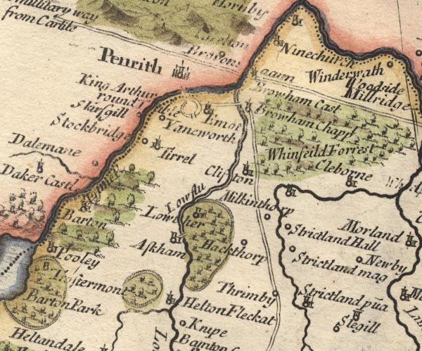 MD10NY52.jpg "Em[ie fl]" With the county boundary drawn alongside. item:- JandMN : 24 Image © see bottom of page |
|||
|
|
||||
| evidence:- | descriptive text:- Fiennes 1698 placename:- Emount |
|||
| source data:- | Travel book, manuscript record of Journeys through England
including parts of the Lake District, by Celia Fiennes, 1698. "Here [Penrith] are two rivers one called the Emount which parts Cumberland and Westmorland which bridge I should have passed over had I come the direct roade from Kendall to Peroth, but strikeing off to Ambleside to Wiandermer I came another end of the town; in this river are greate falls of waters call'd cataracts by reason of the rock and shelves in it which makes a great noise, which is heard more against foul weather into the town tho' the bridge be halfe a mile out of the town; ..." "..." "I walked round the walls [of Carlisle] and saw the river, which twists and turns it self round the grounds, called the Emount which at 3 or 4 miles off is flow'd by the sea; ..." "..." "From HENCE I tooke a Guide the next day and so went for Scotland and rode 3 or 4 mile by the side of this River Emount which is full of very good fish; I rode somtymes on a high ridge over a hill sometymes on the sands, it turning and winding about, that I went almost all the way by it and saw them with boates fishing for salmon and troute which made my journey very pleasant; ..." |
|||
|
|
||||
| evidence:- | old map:- Bowen 1720 (plate 94) placename:- Eden Flu. |
|||
| source data:- | Strip maps, uncoloured engravings, road maps, The Road from
London to Carlisle, scale about 2 miles to 1 inch, with sections
in Lancashire and Westmorland, published by Emanuel Bowen, St
Katherines, London, 1720.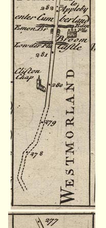 B094m277.jpg The placename on the map is wrong. At mile 281-282. item:- Dove Cottage : 2007.38.100 Image © see bottom of page |
|||
|
|
||||
| evidence:- | perhaps old map:- Stukeley 1723 |
|||
| source data:- | Road map, uncoloured engraving, the Antonine Itineraries through
Britain, scale about 55 miles to 1 inch, plotted by William
Stukeley, 1723, published London, 1724.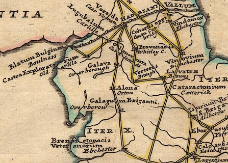 click to enlarge click to enlargeStu1Cm.jpg item:- Hampshire Museums : FA2001.171 Image © see bottom of page |
|||
|
|
||||
| evidence:- | old map:- Badeslade 1742 placename:- Eimot, River |
|||
| source data:- | Maps, Westmorland North from London, scale about 10 miles to 1
inch, and Cumberland North from London, scale about 11 miles to
1 inch, with descriptive text, by Thomas Badeslade, London,
engraved and published by William Henry Toms, Union Court,
Holborn, London, 1742; published 1742-49. "... The N.W. Boundary [of Westmorland] is the River Eimot, which receives the Loder, and at last unites with the Eden. ..." |
|||
|
|
||||
| evidence:- | old map:- Badeslade 1742 placename:- Eymot River |
|||
| source data:- | Map, uncoloured engraving, A Map of Cumberland North from
London, scale about 11 miles to 1 inch, with descriptive text,
by Thomas Badeslade, London, engraved and published by William
Henry Toms, Union Court, Holborn, London, 1742. click to enlarge click to enlargeBD10.jpg "Eymot R" tapering wiggly line; county boundary item:- JandMN : 115 Image © see bottom of page |
|||
|
|
||||
| evidence:- | old map:- Badeslade 1742 placename:- Eimot River |
|||
| source data:- | Map, uncoloured engraving, A Map of Westmorland North from
London, scale about 10 miles to 1 inch, with descriptive text,
by Thomas Badeslade, London, engraved and published by William
Henry Toms, Union Court, Holborn, London, 1742. click to enlarge click to enlargeBD12.jpg "Eimot R." tapering wiggly line; county boundary item:- Dove Cottage : 2007.38.62 Image © see bottom of page |
|||
|
|
||||
| evidence:- | descriptive text:- Simpson 1746 placename:- Eimont, River |
|||
| source data:- | Atlas, three volumes of maps and descriptive text published as
'The Agreeable Historian, or the Compleat English Traveller
...', by Samuel Simpson, 1746. goto source "..." "... the River Eimont, which has its Rise from the Lake call'd Ulles or Ulleswater." |
|||
|
|
||||
| evidence:- | old map:- Simpson 1746 map (Wmd) placename:- Eymot River |
|||
| source data:- | Map, uncoloured engraving, Westmorland, scale about 8 miles to 1
inch, printed by R Walker, Fleet Lane, London, 1746.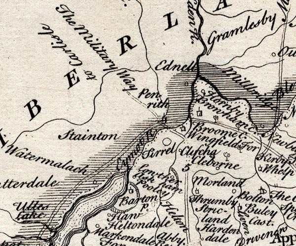 SMP2NYL.jpg "Eymot R." Wiggly line; the county boundary alongside. item:- Dove Cottage : 2007.38.59 Image © see bottom of page |
|||
|
|
||||
| evidence:- | old map:- Bickham 1753-54 (Wmd) placename:- Emor River |
|||
| source data:- | Map, uncoloured engraving, perspective view, A Map of
Westmorland, North from London, by George Bickham, James Street,
Bunhill Fields, London, 1753.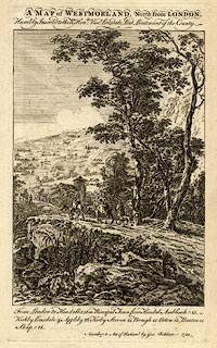 click to enlarge click to enlargeBCK3.jpg "Emor R" view (sort of) item:- Armitt Library : 2008.14.71 Image © see bottom of page |
|||
|
|
||||
| evidence:- | old map:- Bowen and Kitchin 1760 placename:- Eymot River |
|||
| source data:- | Map, hand coloured engraving, A New Map of the Counties of
Cumberland and Westmoreland Divided into their Respective Wards,
scale about 4 miles to 1 inch, by Emanuel Bowen and Thomas
Kitchin et al, published by T Bowles, Robert Sayer, and John
Bowles, London, 1760.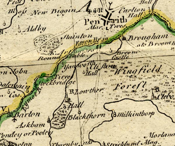 BO18NY42.jpg "Eymot R." wiggly line, county boundary Westmorland Cumberland item:- Armitt Library : 2008.14.10 Image © see bottom of page |
|||
|
|
||||
| evidence:- | old map:- Jefferys 1770 (Wmd) placename:- Emont River |
|||
| source data:- | Map, 4 sheets, The County of Westmoreland, scale 1 inch to 1
mile, surveyed 1768, and engraved and published by Thomas
Jefferys, London, 1770.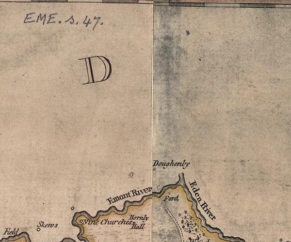 J5NY53SE.jpg "Emont River" 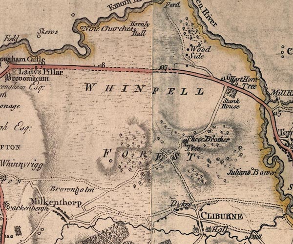 J5NY52NE.jpg 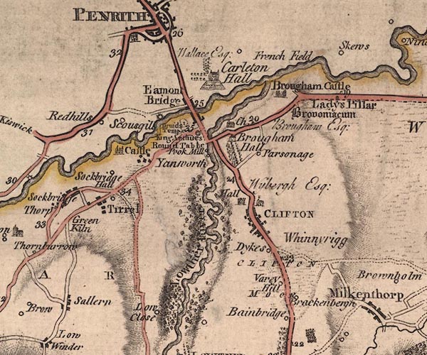 J5NY52NW.jpg 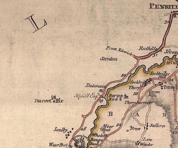 J5NY42NE.jpg 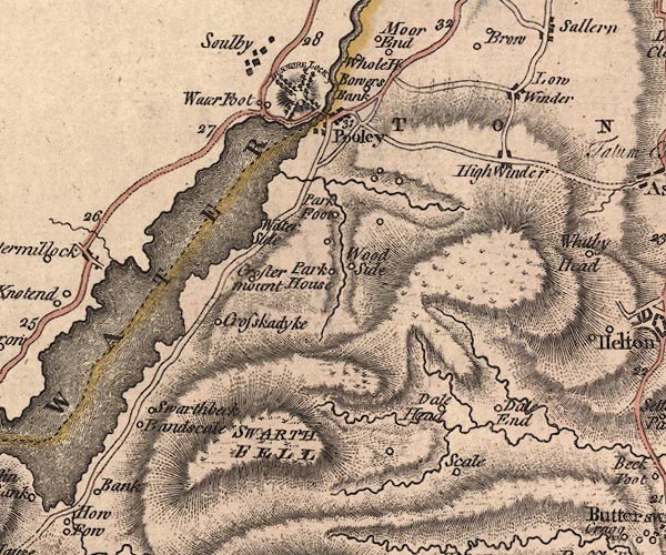 J5NY42SE.jpg single or double wiggly line; river; county boundary item:- National Library of Scotland : EME.s.47 Images © National Library of Scotland |
|||
|
|
||||
| evidence:- | old map:- Donald 1774 (Cmd) placename:- Eamont River |
|||
| source data:- | Map, hand coloured engraving, 3x2 sheets, The County of Cumberland, scale about 1
inch to 1 mile, by Thomas Donald, engraved and published by Joseph Hodskinson, 29
Arundel Street, Strand, London, 1774.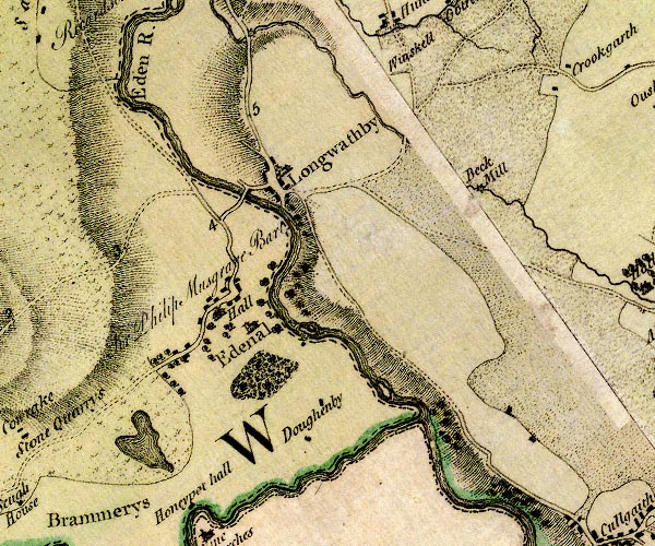 D4NY53SE.jpg 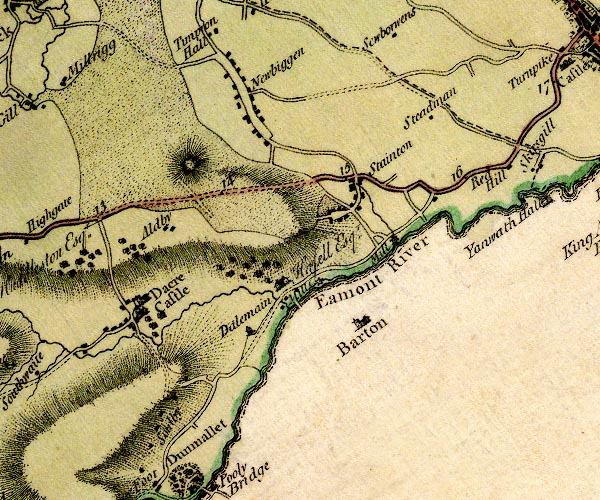 D4NY42NE.jpg "Eamont River" 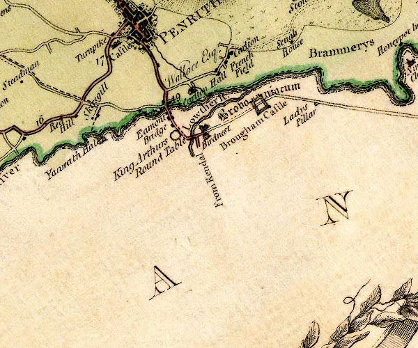 D4NY52NW.jpg 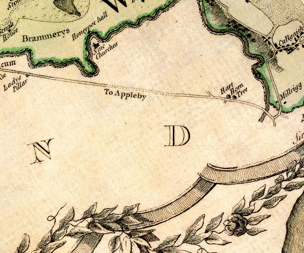 D4NY52NE.jpg 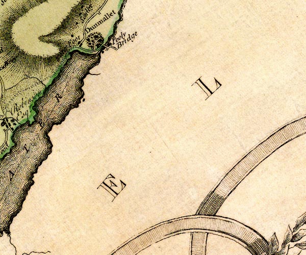 D4NY42SE.jpg single or double wiggly line; a river from Ullswater, and county boundary, into the Eden item:- Carlisle Library : Map 2 Images © Carlisle Library |
|||
|
|
||||
| evidence:- | descriptive text:- West 1778 (11th edn 1821) placename:- Emont, River |
|||
| source data:- | Guide book, A Guide to the Lakes, by Thomas West, published by
William Pennington, Kendal, Cumbria once Westmorland, and in
London, 1778 to 1821. goto source Page 151:- "..." "ULLS-WATER." "Those that do not choose to go as far as Penrith, may, near the eighth mile-post," goto sourcePage 152:- "..." "Mr. Gray's choice of visiting this lake [Ullswater], was from Penrith, up the vale of Emont. 'A grey autumnal day, ... through shady lanes, along the vale of Emont, which runs rapidly on near the way, rippling over the stones; ..." goto sourceAddendum; Mr Gray's Journal, 1769 Page 200:- "... crossed the Eden and the Eamont ... [to] Penrith ..." goto sourcePage 201:- "Oct. 1. A grey autumnal day, the air perfectly calm, and mild, went to see Ulls-water, five miles distant [from Penrith]; soon left the Keswick road, and turned to the left through shady lanes along the vale of Eamont, which runs rapidly on near the way, rippling over the stones: ... ... I descended Dunmallet again by the side avenue, ... and came to Barton-bridge over the Eamont; then walked through a path in the wood round the bottom of the hill, came forth where the Eamont issues out of the lake, ..." |
|||
|
|
||||
| evidence:- | descriptive text:- Lowther 1780s-90s placename:- Eimot, River placename:- Yeoman, River |
|||
| source data:- | Scrapbook, 4 volumes, of descriptive texts, maps, and prints of
views and coats of arms, for Westmorland and Cumberland,
assembled by a member of the Lowther Family, late 18th early
19th century. Text with a print, Brougham Castle, Brougham, Cumbria, engraved by Godfrey, 1774:- "BROUGHAM CASTLE, WESTMORELAND. ... is situated on the banks of the river Eimot, vulgarly pronounced Yeoman. Its remains shew it was once a strong, extensive, and beautiful edifice. The chief entrance is through a number of arches by the river-side." "'An Excursion to the Lakes.' [says] 'WE quited the high-road in order to pass by Brougham castle, a spacious ruin, situate on the banks of the river Yeoman. ..." |
|||
|
|
||||
| evidence:- | old map:- Crosthwaite 1783-94 (Ull) |
|||
| source data:- | Map, uncoloured engraving, Accurate Map of the Beautiful Lake of
Ullswater, scale about 3 inches to 1 mile, by Peter Crosthwaite,
Keswick, Cumberland, 1783, version published 1800.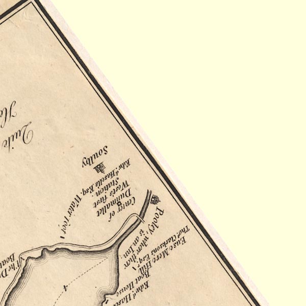 CT5NY42S.jpg item:- Armitt Library : 1959.191.7 Image © see bottom of page |
|||
|
|
||||
| evidence:- | old map:- West 1784 map placename:- Emmont River |
|||
| source data:- | Map, hand coloured engraving, A Map of the Lakes in Cumberland,
Westmorland and Lancashire, scale about 3.5 miles to 1 inch,
engraved by Paas, 53 Holborn, London, about 1784.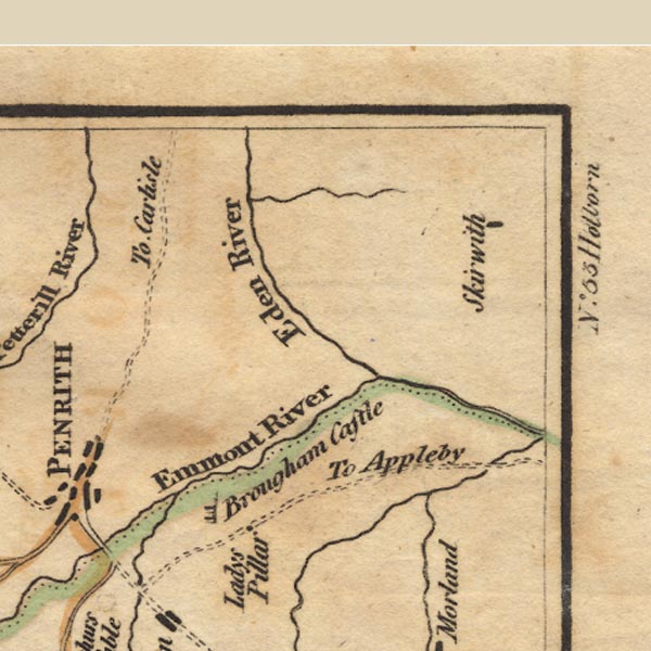 Ws02NY53.jpg 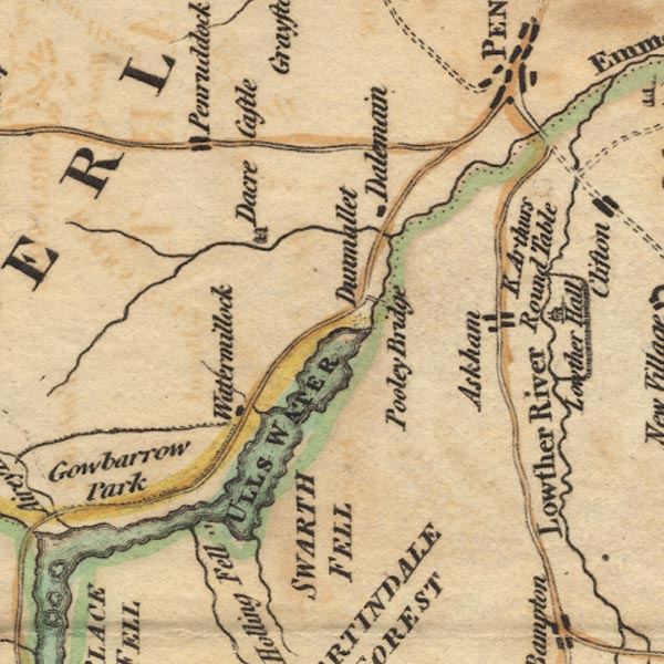 Ws02NY42.jpg County boundary. item:- Armitt Library : A1221.1 Image © see bottom of page |
|||
|
|
||||
| evidence:- | old map:- Clarke 1787 map (Ullswater) placename:- Emont River |
|||
| source data:- | Map, A Map of the Lake Ullswater and its Environs, scale about
6.5 ins to 1 mile, by James Clarke, engraved by S J Neele, 352
Strand, published by James Clarke, Penrith, Cumberland and in
London etc, 1787. CL4NY42S.jpg "Emont River" An island is drawn below Pooley Bridge. item:- private collection : 10.4 Image © see bottom of page |
|||
|
|
||||
| evidence:- | old map:- Clarke 1787 map (Penrith to Ullswater) placename:- Emont, River |
|||
| source data:- | Map, A Map of the Roads between Penrith and Ullswater, scale
about 10 ins to 1 mile, by James Clarke, engraved by S J Neele,
352 Strand, published by James Clarke, Penrith, Cumberland and
in London etc, 1787. click to enlarge click to enlargeCL03.jpg "RIVER EMONT" item:- private collection : 10.3 Image © see bottom of page |
|||
|
|
||||
| evidence:- | old text:- Camden 1789 placename:- Eymot, River |
|||
| source data:- | Book, Britannia, or A Chorographical Description of the Flourishing Kingdoms of England,
Scotland, and Ireland, by William Camden, 1586, translated from the 1607 Latin edition
by Richard Gough, published London, 1789. goto source Page 148:- "... Here [Brougham] the river Eymot rising out of a large lake, and for some time dividing this county [Westmorland] from Cumberland, receives the river Loder, ..." goto sourcePage 149:- "..." "The Eymot, after serving some time as a boundary between this county [Westmorland] and Cumberland ..." |
|||
|
|
||||
| evidence:- | old text:- Camden 1789 (Gough Additions) placename:- Emot, River |
|||
| source data:- | Book, Britannia, or A Chorographical Description of the Flourishing Kingdoms of England,
Scotland, and Ireland, by William Camden, 1586, translated from the 1607 Latin edition
by Richard Gough, published London, 1789. goto source Page 162:- "..." "Emot may be called the Ticinus of the two counties of Westmoreland and Cumberland falling in a clear and rapid stream out of Ulleswater as the Tesin from Lago Maggiore. Upon its banks king Athelstan A.D. 926, concluded a treaty of peace and union with Constantine king of the Scots, Huval (Howel), king of the Western Britans or Stratcluid Welsh, and others who found themselves unable to make head against him. They met, according to Simeon Dunelm. and Hoveden iv. Id. Jul. in a place called Eamotun, and entered into a league confirmed by oath. Bishop Gibson has taken much pains to prove the above monuments, particularly Mayborough, memorials of this event, whereas they are plainly British and Druidical. ..." |
|||
|
|
||||
| evidence:- | old text:- Camden 1789 (Gough Additions) placename:- Emot |
|||
| source data:- | Book, Britannia, or A Chorographical Description of the Flourishing Kingdoms of England,
Scotland, and Ireland, by William Camden, 1586, translated from the 1607 Latin edition
by Richard Gough, published London, 1789. goto source Page 179:- "..." "... a water called Emot that divideth on the south side the one part Cumbreland from Westmorland ..." |
|||
|
|
||||
| evidence:- | old map:- Cary 1789 (edn 1805) placename:- Emont River |
|||
| source data:- | Map, uncoloured engraving, Westmoreland, scale about 2.5 miles
to 1 inch, by John Cary, London, 1789; edition 1805. CY24NY42.jpg river, out of Ullswater; county boundary  CY24NY52.jpg "Emont River" river; county boundary item:- JandMN : 129 Image © see bottom of page |
|||
|
|
||||
| evidence:- | old map:- Aikin 1790 (Wmd) placename:- Eymot River |
|||
| source data:- | Map, uncoloured engraving, Westmoreland ie Westmorland, scale
about 8.5 miles to 1 inch, by John Aikin, London, 1790. click to enlarge click to enlargeAIK2.jpg "Eymot R." river; on county boundary item:- JandMN : 51 Image © see bottom of page |
|||
|
|
||||
| evidence:- | old map:- Aikin 1790 (Cmd) placename:- Eymot River |
|||
| source data:- | Map, uncoloured engraving, Cumberland, by John Aikin, London,
1790.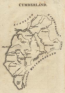 click to enlarge click to enlargeAIK3.jpg "Eymot R." river; on county boundary item:- JandMN : 145 Image © see bottom of page |
|||
|
|
||||
| evidence:- | old text:- Gents Mag placename:- Eimot placename:- Ea muth item:- placename, Eamont |
|||
| source data:- | Magazine, The Gentleman's Magazine or Monthly Intelligencer or
Historical Chronicle, published by Edward Cave under the
pseudonym Sylvanus Urban, and by other publishers, London,
monthly from 1731 to 1922. goto source Gentleman's Magazine 1791 p.1080 "..." "Eamont (or Eimot) is a slight corruption of the Saxon Ea-muth, i.e. the water's mouth, meaning Ulleswater, whence this river flows. A Saxon name for a river is so uncommon a circumstance, that I should be glad to know whether its irruption might not have taken place subsequently to the settlement of that people." "... ..." "Yours, &c." "DEIRENSIS." |
|||
|
|
||||
| evidence:- | old map:- Bailey 1797 placename:- Emont River |
|||
| source data:- | Map, soil etc, uncoloured engraving, Westmoreland, scale about
12 miles to 1 inch, by J Bailey, engraved by Neele, Strand,
published by Messrs Robinson, Paternoster Row and G Nicol, Pall
Mall, London, 1797.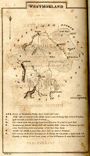 click to enlarge click to enlargeBY05.jpg "Emont R." river; on county boundary item:- Armitt Library : A680.3 Image © see bottom of page |
|||
|
|
||||
| evidence:- | road book:- Cary 1798 (2nd edn 1802) placename:- Emont, River |
|||
| source data:- | Road book, itineraries, Cary's New Itinerary, by John Cary, 181
Strand, London, 2nd edn 1802. goto source click to enlarge click to enlargeC38267.jpg page 267-268 "Cross the River Emont." goto source click to enlarge click to enlargeC38281.jpg page 281-282 "Cross the Emont River" item:- JandMN : 228.1 Image © see bottom of page |
|||
|
|
||||
| evidence:- | descriptive text:- Baker 1802 placename:- Emmont, River |
|||
| source data:- | Perspective road map with sections in Lancashire, Westmorland,
and Cumberland, by J Baker, London 1802. pp.25-26:- "... At Lowther Bridge the rivers Emmont and Lowther form a junction. ..." "... The river Emmont on one side winds amicably along the edge of the town [Penrith], ..." |
|||
|
|
||||
| evidence:- | old map:- Cooke 1802 placename:- Eamont River |
|||
| source data:- | Map, Westmoreland ie Westmorland, scale about 12 miles to 1
inch, by George Cooke, 1802, published by Sherwood, Jones and
Co, Paternoster Road, London, 1824. click to enlarge click to enlargeGRA1Wd.jpg "Eamont R" tapering wiggly line; river; county boundary item:- Hampshire Museums : FA2000.62.4 Image © see bottom of page |
|||
|
|
||||
| evidence:- | old map:- Cooke 1802 placename:- Emont River |
|||
| source data:- | Map, Cumberland, scale about 15.5 miles to 1 inch, by George
Cooke, 1802, bound in Gray's New Book of Roads, 1824, published
by Sherwood, Jones and Co, Paternoster Road, London, 1824. click to enlarge click to enlargeGRA1Cd.jpg "Emont R." tapering wiggly line; river; county boundary item:- Hampshire Museums : FA2000.62.2 Image © see bottom of page |
|||
|
|
||||
| evidence:- | old map:- Laurie and Whittle 1806 placename:- Emont River |
|||
| source data:- | Road map, Completion of the Roads to the Lakes, scale about 10
miles to 1 inch, by Nathaniel Coltman? 1806, published by Robert
H Laurie, 53 Fleet Street, London, 1834. click to enlarge click to enlargeLw18.jpg "Emont Riv." river; on county boundary item:- private collection : 18.18 Image © see bottom of page |
|||
|
|
||||
| evidence:- | old map:- Cooper 1808 placename:- Emont River |
|||
| source data:- | Map, uncoloured engraving, Cumberland, scale about 10.5 miles to
1 inch, drawn and engraved by Cooper, published by R Phillips,
Bridge Street, Blackfriars, London, 1808. click to enlarge click to enlargeCOP3.jpg "Emont R." tapering wiggly line; river item:- JandMN : 86 Image © see bottom of page |
|||
|
|
||||
| evidence:- | old map:- Cooper 1808 |
|||
| source data:- | Map, hand coloured engraving, Westmoreland ie Westmorland, scale
about 9 miles to 1 inch, by H Cooper, 1808, published by R
Phillips, Bridge Street, Blackfriars, London, 1808. click to enlarge click to enlargeCOP4.jpg tapering wiggly line; river; county boundary item:- Dove Cottage : 2007.38.53 Image © see bottom of page |
|||
|
|
||||
| evidence:- | old map:- Wallis 1810 (Wmd/Cmd) placename:- Emont River |
|||
| source data:- | Road map, Westmoreland, scale about 19 miles to 1 inch, by James
Wallis, 77 Berwick Street, Soho, 1810, published by W Lewis,
Finch Lane, London, 1835? click to enlarge click to enlargeWAL5.jpg "Emont R." river; county boundary item:- JandMN : 63 Image © see bottom of page |
|||
|
|
||||
| evidence:- | old map:- Wallis 1810 (Wmd/Cmd) placename:- Emont River |
|||
| source data:- | Road map, hand coloured engraving, Cumberland, scale about 16
miles to 1 inch, by James Wallis, 77 Berwick Stree, Soho,
London, 1810. click to enlarge click to enlargeWL13.jpg "Emont R." river; county boundary item:- Dove Cottage : 2009.81.10 Image © see bottom of page |
|||
|
|
||||
| evidence:- | descriptive text:- Wallis 1810 placename:- Eimot |
|||
| source data:- | Map, Westmoreland, scale about 19 miles to 1 inch, and
Cumberland, scale about 16 miles to 1 inch, by James Wallis, 77
Berwick Street, Soho, London, 1810; published 1810-36. "PRINCIPAL RIVERS." "This county is well watered by the rivers, Eden, Loder, Ken, and Lune, or Lon. ..." "The Loder, rising at a lake called Broadwater, runs N.W., and falls into a small river called the Eimot, near the borders of this county." |
|||
|
|
||||
| evidence:- | old map:- Otley 1818 placename:- Eamont River |
|||
| source data:- | Map, uncoloured engraving, The District of the Lakes,
Cumberland, Westmorland, and Lancashire, scale about 4 miles to
1 inch, by Jonathan Otley, 1818, engraved by J and G Menzies,
Edinburgh, Scotland, published by Jonathan Otley, Keswick,
Cumberland, et al, 1833. OT02NY52.jpg "Eamont R." item:- JandMN : 48.1 Image © see bottom of page |
|||
|
|
||||
| evidence:- | old map:- Hall 1820 (Wmd) |
|||
| source data:- | Map, hand coloured engraving, Westmoreland ie Westmorland, scale
about 14.5 miles to 1 inch, by Sidney Hall, London, 1820,
published by Samuel Leigh, 18 Strand, London, 1820-31. click to enlarge click to enlargeHA18.jpg tapering wiggly line; river; county boundary item:- Armitt Library : 2008.14.58 Image © see bottom of page |
|||
|
|
||||
| evidence:- | old map:- Hall 1820 (Cmd) |
|||
| source data:- | Map, hand coloured engraving, Cumberland, scale about 21 miles
to 1 inch, engraved by Sidney Hall, published by S Leigh, 18
Strand, London, 1820-31. click to enlarge click to enlargeHA14.jpg tapering wiggly line; river; county boundary item:- JandMN : 91 Image © see bottom of page |
|||
|
|
||||
| evidence:- | descriptive text:- Otley 1823 (5th edn 1834) item:- eel |
|||
| source data:- | Guide book, A Concise Description of the English Lakes, the
mountains in their vicinity, and the roads by which they may be
visited, with remarks on the mineralogy and geology of the
district, by Jonathan Otley, published by the author, Keswick,
Cumberland now Cumbria, by J Richardson, London, and by Arthur
Foster, Kirkby Lonsdale, Cumbria, 1823; published 1823-49,
latterly as the Descriptive Guide to the English Lakes. goto source Page 8:- "... great quantities of eels are taken in the river Eamont, below Pooley Bridge, as they migrate from the lake [Ullswater] in autumn." goto sourcePage 40:- "... The several becks of Patterdale unite in Ullswater, the river issuing from thence is called the Eamont; it receives the Lowther, ... near Brougham Castle; and is afterwards absorbed in the Eden, ..." |
|||
|
|
||||
| evidence:- | old map:- Perrot 1823 |
|||
| source data:- | Map, hand coloured engraving, Cumberland and Westmoreland ie
Westmorland, scale about 38 miles to 1 inch, by Aristide Michel
Perrot, engraved by Migneret, 1823, published by Etienne Ledoux,
9 Rue Guenegaud, Paris, France, 1824-48. click to enlarge click to enlargePER2.jpg tapering wiggly line, county boundary? item:- Dove Cottage : 2007.38.45 Image © see bottom of page |
|||
|
|
||||
| evidence:- | old map:- Ford 1839 map placename:- Eamont River |
|||
| source data:- | Map, uncoloured engraving, Map of the Lake District of
Cumberland, Westmoreland and Lancashire, scale about 3.5 miles
to 1 inch, published by Charles Thurnam, Carlisle, and by R
Groombridge, 5 Paternoster Row, London, 3rd edn 1843.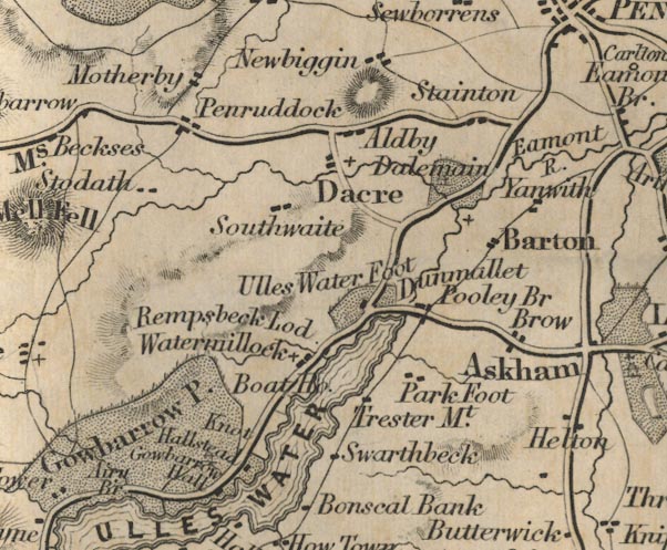 FD02NY42.jpg "Eamont R." item:- JandMN : 100.1 Image © see bottom of page |
|||
|
|
||||
| evidence:- | old map:- Garnett 1850s-60s H placename:- Eamont, River |
|||
| source data:- | Map of the English Lakes, in Cumberland, Westmorland and
Lancashire, scale about 3.5 miles to 1 inch, published by John
Garnett, Windermere, Westmorland, 1850s-60s.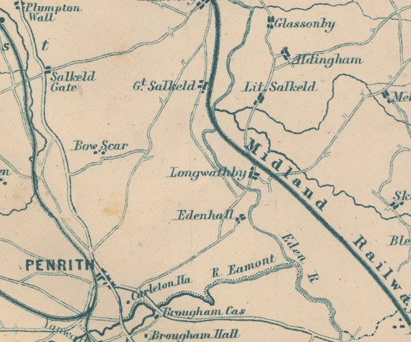 GAR2NY53.jpg "R. Eamont" double wiggly line, and dotted line, the county boundary 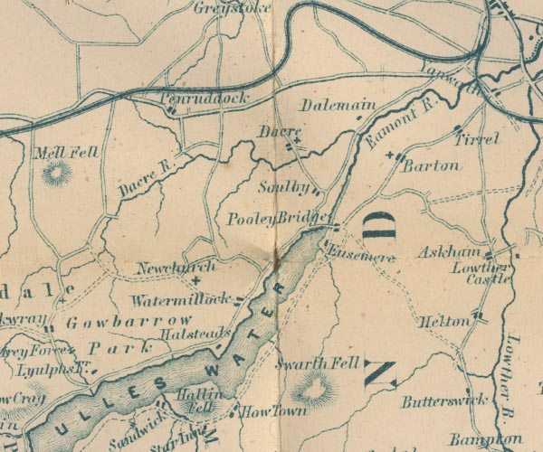 GAR2NY42.jpg "Eamont R." item:- JandMN : 82.1 Image © see bottom of page |
|||
|
|
||||
| evidence:- | old photograph:- Bell 1880s-1940s |
|||
| source data:- | Photograph, b/w, Eamont Bridge and the River Eamont, Yanwath and Eamont Bridge, Westmorland,
by Herbert Bell, Ambleside, Westmorland, 1890s?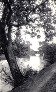 click to enlarge click to enlargeHB0293.jpg item:- Armitt Library : ALPS652 Image © see bottom of page |
|||
|
|
||||
| evidence:- | old photograph:- Bell 1880s-1940s placename:- Eamont, River |
|||
| source data:- | Photograph, Yanwath Hall and River Eamont, Yanwath and Eamont Bridge, Westmorland,
by Herbert Bell, photographer, Ambleside, Westmorland, 1896.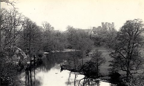 click to enlarge click to enlargeHB0071.jpg Vol.1 no.71 in an album, Examples of Early Domestic and Military Architecture in Westmorland, assembled 1910. ms at bottom:- "71. Yanwath Hall and River Eamont. Barton. W." item:- Armitt Library : 1958.3165.71 Image © see bottom of page |
|||
|
|
||||
| evidence:- | old map:- Postlethwaite 1877 (3rd edn 1913) placename:- Eamont, River |
|||
| source data:- | Map, uncoloured engraving, Map of the Lake District Mining Field, Westmorland, Cumberland,
Lancashire, scale about 5 miles to 1 inch, by John Postlethwaite, published by W H
Moss and Sons, 13 Lowther Street, Whitehaven, Cumberland, 1877 edn 1913. PST2NY53.jpg "R. Eamont" wiggly line, running into the Eden; county boundary  PST2NY42.jpg "R. Eamont" running out of Ullswater, county boundary item:- JandMN : 162.2 Image © see bottom of page |
|||
|
|
||||
| evidence:- | old map:- LMS 1920s maps |
|||
| source data:- | Railway map, lithograph, 23 pages of strip maps, The Journey in
Brief, the Route London to Carlisle, published by the London
Midland and Scottish Railway, LMS, 1920s. click to enlarge click to enlargeLS3p28.jpg item:- JandMN : 95.2 Image © see bottom of page |
|||
|
|
||||
| evidence:- | old photograph:- Bogg 1898 item:- cattle |
|||
| source data:- | Photograph, halftone print, A Bend of the Eamont, perhaps near the Giant's Caves?
Cumberland, by Edmund Bogg, published by Edmund Bogg, 3 Woodhouse Lane, and James
Miles, Guildford Street, Leeds, Yorkshire, 1898.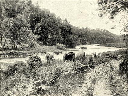 click to enlarge click to enlargeBGG125.jpg Included on p.70 of Lakeland and Ribblesdale, by Edmund Bogg. item:- JandMN : 231.25 Image © see bottom of page |
|||
|
|
||||
| evidence:- | old painting:- |
|||
| source data:- | Painting, watercolour, View Looking to the Bridge on the River Going to Ullswater,
Pooley Bridge, Barton, Westmorland, by Paul Sandby, 1760s-70s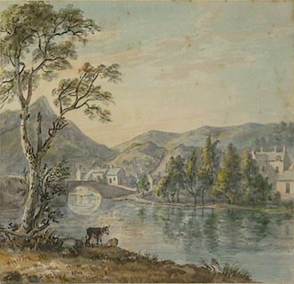 click to enlarge click to enlargePR0812.jpg Summertime; view of a wide gently flowing river from the nearside bank with two cattle at the water's edge beside a blasted oak tree which frames composition to left. Beyond, the river is panned by a stone bridge, a small village speading along the riverbank, partially screened by a stand of trees. Barren fells rise beyond. inscribed at on mount:- "P. Sandby View looking to the Bridge on the river going out of Ullswater" item:- Tullie House Museum : 1905.10A.3 Image © Tullie House Museum |
|||
|
|
||||
| evidence:- | old print:- |
|||
| source data:- | Print, uncoloured engraving, Brougham Castle, Westmorland, published late 19th century?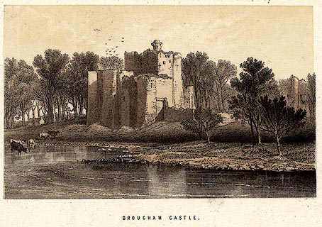 click to enlarge click to enlargePR0237.jpg printed at bottom:- "BROUGHAM CASTLE." item:- Dove Cottage : 2008.107.237 Image © see bottom of page |
|||
|
|
||||
| evidence:- | old print:- Rose 1832-35 (vol.2 no.51) |
|||
| source data:- | Print, uncoloured engraving, Eamont Bridge, from the Westmorland Side, drawn by Thomas
Allom, engraved by W Taylor, published by Fisher, Son and Co, London, 1832-35.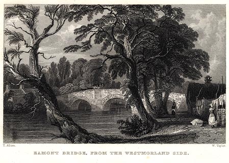 click to enlarge click to enlargePR0030.jpg vol.2 pl.51 in the set of prints, Westmorland, Cumberland, Durham and Northumberland Illustrated. printed at bottom left, right, centre:- "T. Allom. / W. Taylor. / EAMONT BRIDGE, FROM THE WESTMORLAND SIDE." item:- Dove Cottage : 2008.107.30 Image © see bottom of page |
|||
|
|
||||
| evidence:- | old print:- Rose 1832-35 |
|||
| source data:- | Print, engraving, Brougham Castle, Westmorland, by Thomas Allom, engraved by S Lacey,
1833.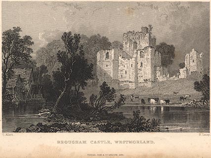 click to enlarge click to enlargeR220.jpg "Brougham Castle, Westmorland" item:- JandMN : 96.11 Image © see bottom of page |
|||
|
|
||||
| evidence:- | old print:- |
|||
| source data:- | Print, uncoloured engraving, Brougham Castle, Westmorland, published early 19th century?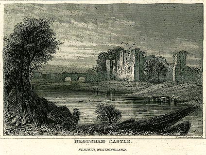 click to enlarge click to enlargePR0238.jpg printed at bottom:- "BROUGHAM CASTLE. / PENRITH, WESTMORELAND." item:- Dove Cottage : 2008.107.238 Image © see bottom of page |
|||
|
|
||||
| evidence:- | old print:- |
|||
| source data:- | Print, uncoloured engraving, Brougham Castle, Westmorland, published by J and J Cundee,
Ivy Lane, Paternoster Row, London, 1819.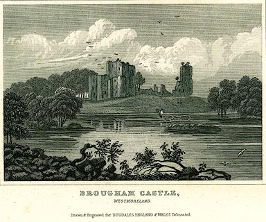 click to enlarge click to enlargePR0190.jpg Included in vol.4 of The New British Traveller, or Modern Panorama of England and Wales, by James Dugdale. printed at bottom:- "BROUGHAM CASTLE, / WESTMORELAND. / Drawn & Engraved for DUGDALES ENGLAND &WALES Delineated." item:- Dove Cottage : 2008.107.190 Image © see bottom of page |
|||
|
|
||||
| evidence:- | old print:- |
|||
| source data:- | Print, uncoloured engraving, Skirsgill, Cumberland, early 19th century?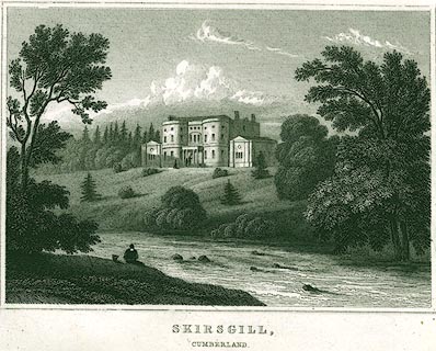 click to enlarge click to enlargePR0300.jpg printed at bottom:- "SKIRSGILL, / CUMBERLAND." item:- Dove Cottage : 2008.107.300 Image © see bottom of page |
|||
|
|
||||
| places:- |
|
|||
|
||||
|
||||
|
||||
|
||||
|
||||
|
||||
|
||||
|
||||
|
||||
|
||||
|
||||
|
||||
|
||||
|
||||
|
||||
|
||||
|
||||
Lakes Guides menu.