 Old Cumbria Gazetteer
 |
 |
|
| Ud Ford, Langwathby | ||
| Ud Ford | ||
| site name:- | Eamont, River | |
| civil parish:- | Langwathby (formerly Cumberland) | |
| civil parish:- | Brougham (formerly Westmorland) | |
| county:- | Cumbria | |
| locality type:- | ford | |
| coordinates:- | NY57723048 | |
| 1Km square:- | NY5730 | |
| 10Km square:- | NY53 | |
|
|
||
| evidence:- | old map:- OS County Series (Cmd 59 3) placename:- Ud Ford |
|
| source data:- | Maps, County Series maps of Great Britain, scales 6 and 25
inches to 1 mile, published by the Ordnance Survey, Southampton,
Hampshire, from about 1863 to 1948. |
|
|
|
||
| evidence:- | old map:- OS County Series (Wmd 4 6) placename:- Ud Ford |
|
| source data:- | Maps, County Series maps of Great Britain, scales 6 and 25
inches to 1 mile, published by the Ordnance Survey, Southampton,
Hampshire, from about 1863 to 1948. |
|
|
|
||
| evidence:- | old map:- Jefferys 1770 (Wmd) |
|
| source data:- | Map, 4 sheets, The County of Westmoreland, scale 1 inch to 1
mile, surveyed 1768, and engraved and published by Thomas
Jefferys, London, 1770.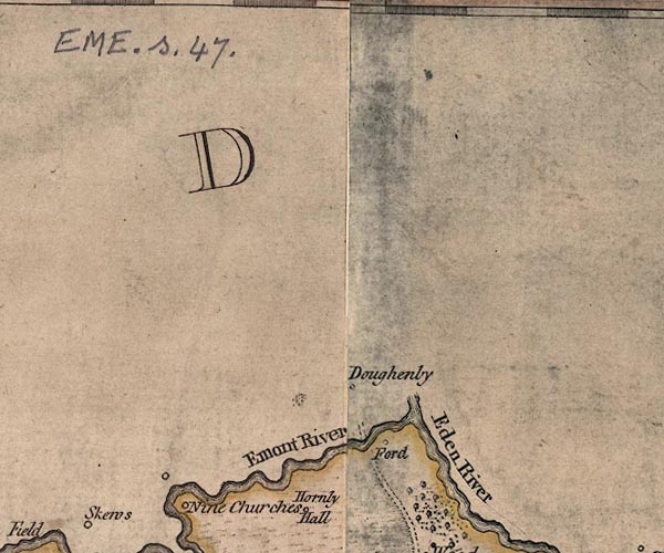 J5NY53SE.jpg road crossing river; ford item:- National Library of Scotland : EME.s.47 Image © National Library of Scotland |
|
|
|
||
 Lakes Guides menu.