Eamont Bridge, Eamont Bridge | ||
Eamont Bridge | ||
site name:- | Eamont, River | |
locality:- | Eamont Bridge | |
civil parish:- | Yanwath and Eamont Bridge (formerly Westmorland) | |
civil parish:- | Penrith (formerly Cumberland) | |
county:- | Cumbria | |
locality type:- | bridge | |
locality type:- | boundary feature | |
locality type:- | county boundary feature | |
coordinates:- | NY52222874 | |
1Km square:- | NY5228 | |
10Km square:- | NY52 | |
|
||
BMF48.jpg (taken 2.6.2006) BMF49.jpg (taken 2.6.2006) |
||
|
||
evidence:- | old map:- OS County Series (Wmd 3 12) placename:- Eamont Bridge |
|
source data:- | Maps, County Series maps of Great Britain, scales 6 and 25
inches to 1 mile, published by the Ordnance Survey, Southampton,
Hampshire, from about 1863 to 1948. OS County Series (Cmd 59 5) |
|
|
||
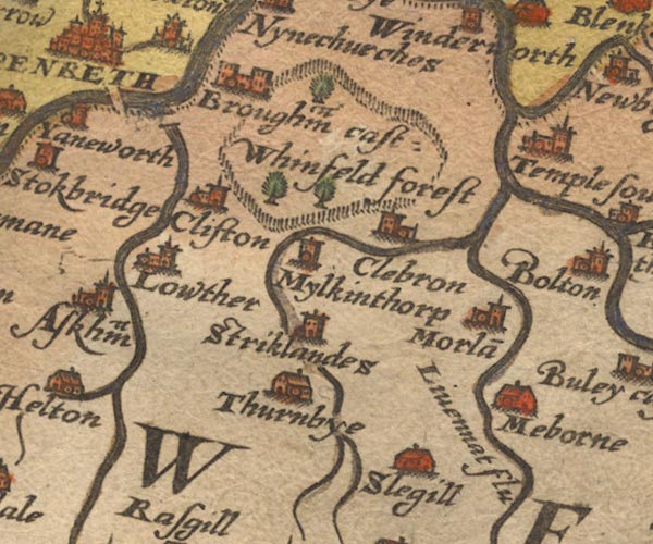
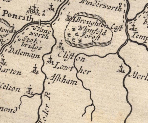
evidence:- | old map:- Saxton 1579 |
|
source data:- | Map, hand coloured engraving, Westmorlandiae et Cumberlandiae Comitatus ie Westmorland
and Cumberland, scale about 5 miles to 1 inch, by Christopher Saxton, London, engraved
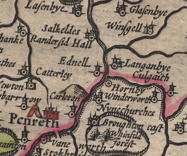
by Augustinus Ryther, 1576, published 1579-1645. Sax9NY52.jpg Over the Eamont S of Penrith. item:- private collection : 2 Image © see bottom of page |
|
|
||
evidence:- | old map:- Speed 1611 (Cmd) |
|
source data:- | Map, hand coloured engraving, Cumberland and the Ancient Citie
Carlile Described, scale about 4 miles to 1 inch, by John Speed,
1610, published by J Sudbury and George Humble, Popes Head
Alley, London, 1611-12. SP11NY53.jpg double line across the Eamont, S of Penrith item:- private collection : 16 Image © see bottom of page |
|
|
||
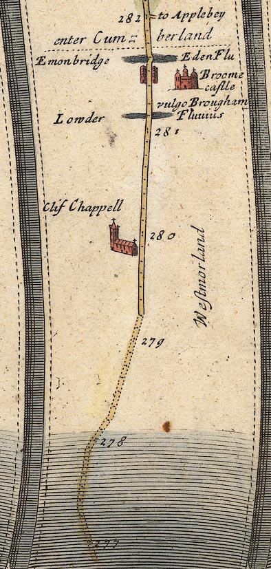
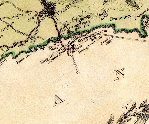
evidence:- | old map:- Ogilby 1675 (plate 38) placename:- Emonbridge |
|
source data:- | Road strip map, hand coloured engraving, continuation of the
Road from London to Carlisle, scale about 1 inch to 1 mile, by
John Ogilby, London, 1675. OG38m277.jpg In mile 281, Westmorland. Road crosses over the river at:- "Emonbridge" with a drawing of a low arch over the:- "Eden Flu" item:- JandMN : 21 Image © see bottom of page |
|
|
||
evidence:- | old map:- Sanson 1679 |
|
source data:- | Map, hand coloured engraving, Ancien Royaume de Northumberland
aujourdhuy Provinces de Nort, ie the Ancient Kingdom of
Northumberland or the Northern Provinces, scale about 9.5 miles
to 1 inch, by Nicholas Sanson, Paris, France, 1679. click to enlarge SAN2Cm.jpg double line over a stream; bridge, across county boundary item:- Dove Cottage : 2007.38.15 Image © see bottom of page |
|
|
||
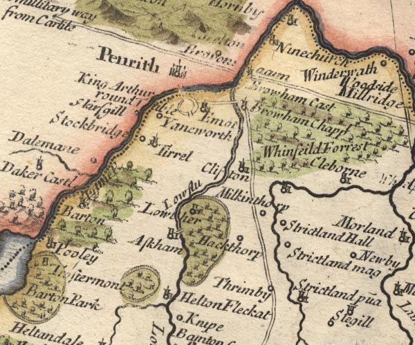
evidence:- | old map:- Morden 1695 (Cmd) |
|
source data:- | Map, uncoloured engraving, Cumberland, scale about 4 miles to 1
inch, by Robert Morden, 1695, published by Abel Swale, the
Unicorn, St Paul's Churchyard, Awnsham, and John Churchill, the
Black Swan, Paternoster Row, London, 1695-1715. MD12NY52.jpg Double line over a stream. item:- JandMN : 90 Image © see bottom of page |
|
|
||
evidence:- | old map:- Morden 1695 (Wmd) |
|
source data:- | Map, hand coloured engraving, Westmorland, scale about 2.5 miles to 1 inch, by Robert
Morden, published by Abel Swale, the Unicorn, St Paul's Churchyard, Awnsham, and John
Churchill, the Black Swan, Paternoster Row, London, 1695. MD10NY52.jpg Double line over a stream. item:- JandMN : 24 Image © see bottom of page |
|
|
||
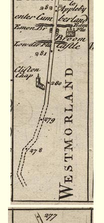
evidence:- | old map:- Bowen 1720 (plate 94) placename:- Emon Bridge |
|
source data:- | Strip maps, uncoloured engravings, road maps, The Road from
London to Carlisle, scale about 2 miles to 1 inch, with sections
in Lancashire and Westmorland, published by Emanuel Bowen, St
Katherines, London, 1720. B094m277.jpg At mile 281-282. item:- Dove Cottage : 2007.38.100 Image © see bottom of page |
|
|
||
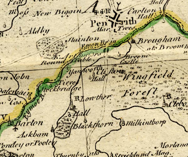
evidence:- | old map:- Bowen and Kitchin 1760 placename:- Emon Bridge |
|
source data:- | Map, hand coloured engraving, A New Map of the Counties of
Cumberland and Westmoreland Divided into their Respective Wards,
scale about 4 miles to 1 inch, by Emanuel Bowen and Thomas
Kitchin et al, published by T Bowles, Robert Sayer, and John
Bowles, London, 1760. BO18NY42.jpg "Emon Br in" labelled by road across the Eamont item:- Armitt Library : 2008.14.10 Image © see bottom of page |
|
|
||
evidence:- | old map:- Jefferys 1770 (Wmd) placename:- Eamont Bridge |
|
source data:- | Map, 4 sheets, The County of Westmoreland, scale 1 inch to 1
mile, surveyed 1768, and engraved and published by Thomas
Jefferys, London, 1770. J5NY52NW.jpg "Eamont Bridge" double line, road, across a stream; bridge item:- National Library of Scotland : EME.s.47 Image © National Library of Scotland |
|
|
||
evidence:- | old text:- Pennant 1773 placename:- Eimont Bridge |
|
source data:- | Book, A Tour from Downing to Alston Moor, 1773, by Thomas
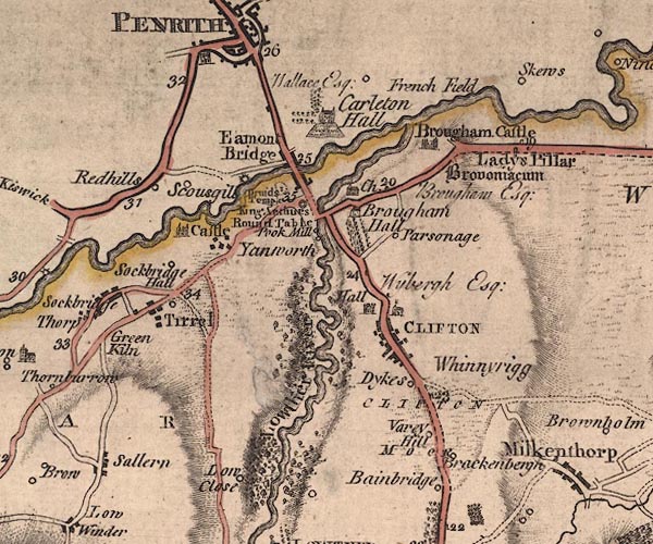
Pennant, published by Edward Harding, 98 Pall Mall, London, 1801. goto source Pennant's Tour 1773, page 158 "I crossed Eimont-bridge. In the reign of Henry VI. there was a general contribution towards the building, or, perhaps, rebuilding of this bridge. The piety of the country was made an instrument of so good a work; an indulgence of forty days was bestowed upon every well-disposed person who flung his mite to forward the design. I then entered the County of" "CUMBERLAND." |
|
|
||
evidence:- | old map:- Donald 1774 (Cmd) |
|
source data:- | Map, hand coloured engraving, 3x2 sheets, The County of Cumberland, scale about 1
inch to 1 mile, by Thomas Donald, engraved and published by Joseph Hodskinson, 29
Arundel Street, Strand, London, 1774. D4NY52NW.jpg double line across a river; a bridge item:- Carlisle Library : Map 2 Image © Carlisle Library |
|
|
||
evidence:- | old text:- Clarke 1787 placename:- Emont Bridge |
|
source data:- | Guide book, A Survey of the Lakes of Cumberland, Westmorland,
and Lancashire, written and published by James Clarke, Penrith,
Cumberland, and in London etc, 1787; published 1787-93. goto source Page 11:- "..." "Emont Bridge divides Cumberland from Westmorland, and is a plain but substantial building. From the middle arch is a beautiful view either up or down the river, and perhaps few places are better disposed in point of picturesque beauty, though none have been less noticed." |
|
|
||
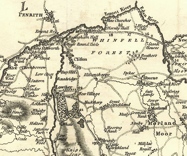
evidence:- | old map:- Cary 1789 (edn 1805) |
|
source data:- | Map, uncoloured engraving, Westmoreland, scale about 2.5 miles
to 1 inch, by John Cary, London, 1789; edition 1805. CY24NY52.jpg road across a stream; bridge item:- JandMN : 129 Image © see bottom of page |
|
|
||
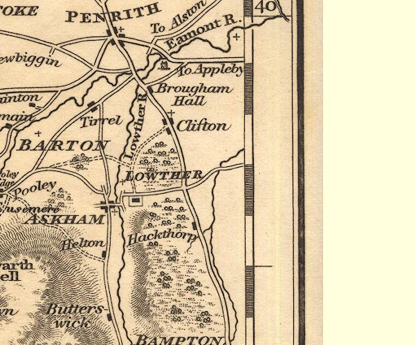
evidence:- | old map:- Cooper 1808 |
|
source data:- | Map, hand coloured engraving, Westmoreland ie Westmorland, scale
about 9 miles to 1 inch, by H Cooper, 1808, published by R
Phillips, Bridge Street, Blackfriars, London, 1808. click to enlarge COP4.jpg road across stream; bridge? item:- Dove Cottage : 2007.38.53 Image © see bottom of page |
|
|
||
evidence:- | old map:- Otley 1818 |
|
source data:- | Map, uncoloured engraving, The District of the Lakes,
Cumberland, Westmorland, and Lancashire, scale about 4 miles to
1 inch, by Jonathan Otley, 1818, engraved by J and G Menzies,
Edinburgh, Scotland, published by Jonathan Otley, Keswick,
Cumberland, et al, 1833. OT02NY52.jpg Implied by a road across the stream. item:- JandMN : 48.1 Image © see bottom of page |
|
|
||
evidence:- | descriptive text:- Ford 1839 (3rd edn 1843) |
|
source data:- | Guide book, A Description of Scenery in the Lake District, by
Rev William Ford, published by Charles Thurnam, Carlisle, by W
Edwards, 12 Ave Maria Lane, Charles Tilt, Fleet Street, William
Smith, 113 Fleet Street, London, by Currie and Bowman,
Newcastle, by Bancks and Co, Manchester, by Oliver and Boyd,
Edinburgh, and by Sinclair, Dumfries, 1839. goto source Page 133:- "..." "A pleasant road [from penrith] leads to Eamont Bridge, so picturesque an object that it ought to be transferred to the sketch-book of every artist. ..." |
|
|
||
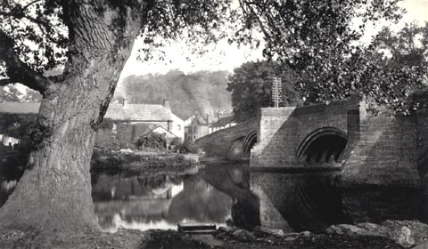
evidence:- | old photograph:- Bell 1880s-1940s |
|
source data:- | Photograph, b/w, Eamont Bridge, Yanwath and Eamont Bridge, Westmorland, by Herbert
Bell, Ambleside, Westmorland, 1890s? click to enlarge HB0292.jpg item:- Armitt Library : ALPS651 Image © see bottom of page |
|
|
||
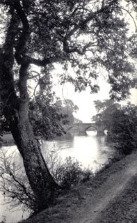
evidence:- | old photograph:- Bell 1880s-1940s |
|
source data:- | Photograph, b/w, Eamont Bridge and the River Eamont, Yanwath and Eamont Bridge, Westmorland,
by Herbert Bell, Ambleside, Westmorland, 1890s? click to enlarge HB0293.jpg item:- Armitt Library : ALPS652 Image © see bottom of page |
|
|
||
evidence:- | old map:- Bell 1892 placename:- Eamont Bridge |
|
source data:- | Map, colour lithograph, Road Map of Cumberland, by George Joseph
Bell, scale about 2.5 miles to 1 inch, printed by Charles
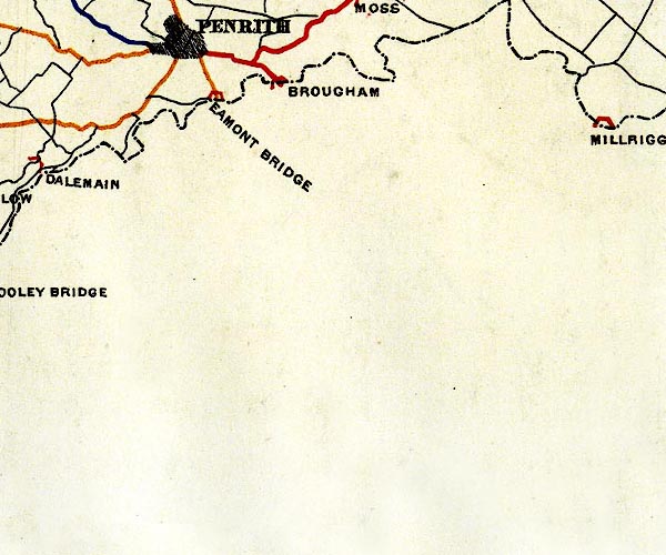
Thurnam and Sons, Carlisle, Cumberland, 1892. BEL9NY52.jpg "EAMONT BRIDGE" bridge symbol; on county boundary Road map of Cumberland showing County Bridges item:- Carlisle Library : Map 38 Image © Carlisle Library |
|
|
||
evidence:- | old photograph:- Ullswater Steamers 1900s (edn 1903) placename:- Eamont Bridge |
|
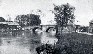
source data:- | Photograph, bw halftone, Eamont Bridge, Penrith, Cumberland, published in a guide
book by the Ullswater Steam Navigation Co, Penrith, Cumberland, 1903. click to enlarge UN101.jpg printed, bottom "EAMONT BRIDGE, PENRITH" item:- JandMN : 1023.1 Image © see bottom of page |
|
|
||
evidence:- | old print:- Bradley 1901 placename:- Eamont Bridge |
|
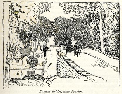
source data:- | Print, uncoloured lithograph, Eamont Bridge, near Penrith, Yanwath and Eamont Bridge,
Westmorland, by Joseph Pennell, published by Macmillan and Co, London, 1901. click to enlarge BRL105.jpg On page 33 of Highways and Byways in the Lake District, by A G Bradley. printed at lower left:- "AG" printed at bottom:- "Eamont Bridge, near Penrith." item:- JandMN : 464.5 Image © see bottom of page |
|
|
||
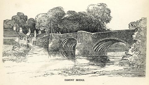
evidence:- | old text:- Harper 1907 placename:- Eamont Bridge |
|
source data:- | HP01p128.txt Page 128:- "..." "The road over Eamont Bridge is very steep and narrow and the ascent beyond it steeper still; so that the stranger, observing the fury with which the drivers of the excursion wagonettes and motor chars-a-bancs take the ascents and descents on their wild way to and from Penrith and Ullswater, confidently expects an accident "while he waits." But whether it be skill, or luck, the accidents do not happen, and expectant strangers, to have their expectations realised, would have to wait on the spot until the moss grew on them." "According to the writers of guide-books, there may be found, carved on the parapet of the bridge, the hospitable phrase, "Welcome into Cumberland." You, in fact, in crossing it leave Westmoreland for Cumberland, and, having read so much of this kindly sentiment, you seek diligently for the inscription. Alas! in vain. There is not, nor was there ever, anything of the kind. Instead, what meets your eye is an inn whose sign, "The Welcome into Cumberland," ..." HP01p129.txt Page 129:- click to enlarge HP0118.jpg "EAMONT BRIDGE." item:- JandMN : 1055.19 Image © see bottom of page |
|
|
||
evidence:- | database:- Listed Buildings 2010 placename:- Eamont Bridge |
|
source data:- | courtesy of English Heritage "EAMONT BRIDGE / / A6 / PENRITH / EDEN / CUMBRIA / I / 72755 / NY5221928752" |
|
source data:- | courtesy of English Heritage "EAMONT BRIDGE / / / YANWATH AND EAMONT BRIDGE / EDEN / CUMBRIA / I / 74380 / NY5222128745" |
|
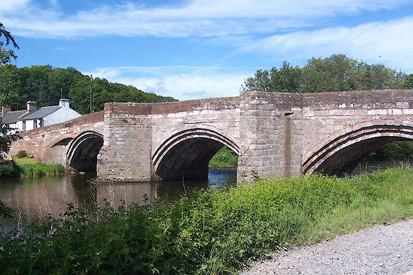
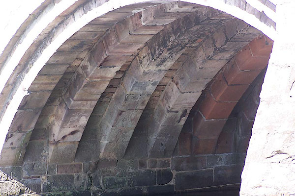
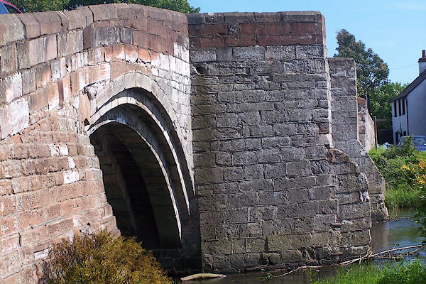
source data:- | courtesy of English Heritage "Road bridge over the River Eamont crossing the old county boundary between Cumberland and Westmorland. Probably C15 widened 1875. Dressed grey sandstone with alterations of dressed red sandstone. Narrow slightly humped-back bridge of 3 segmental arches, the soffits originally supported by 4 ribs but with widening now 6; recessed voussoirs, supported on 2 splayed cutwaters continued up to form pedestrian refuges with solid parapets. When widened on the down stream side care was taken to use much of the old stonework. Parapet partly rebuilt in red sandstone. One of the oldest bridges still in daily use in the county. RCHM, Westmorland, 1936 p.250, which says it was rebuilt in C16, but there is no evidence of this and the bridge with its later alterations appears to be as constructed. This bridge lies partly in Yanwath and Eamont Bridge C.P. Bibliography 3728 Inventory Of Westmorland (Royal Commission on the Historical Monuments of England), 1936, Page(s) 250." |
|
|
||
evidence:- | old print:- Rose 1832-35 (vol.2 no.51) placename:- Eamont Bridge |
|
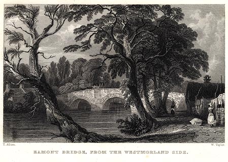
source data:- | Print, uncoloured engraving, Eamont Bridge, from the Westmorland Side, drawn by Thomas
Allom, engraved by W Taylor, published by Fisher, Son and Co, London, 1832-35. click to enlarge PR0030.jpg vol.2 pl.51 in the set of prints, Westmorland, Cumberland, Durham and Northumberland Illustrated. printed at bottom left, right, centre:- "T. Allom. / W. Taylor. / EAMONT BRIDGE, FROM THE WESTMORLAND SIDE." item:- Dove Cottage : 2008.107.30 Image © see bottom of page |
|
|
||
BMF50.jpg (taken 2.6.2006) |
||
|