 Garnett 1850s-60s NY11


|

|
|
|
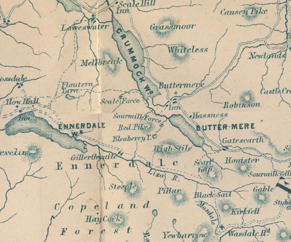
gazetteer links places may or may not be labelled on the map |
||

|
-- Black Sail Pass -- "Black Sail" |
|
|
|
-- Bleaberry Tarn -- "Bleaberry T." |
|
|
|
-- Buttermere -- "BUTTER-MERE" |
|
|
|
-- Buttermere -- "Buttermere" |
|
|
|
-- Copeland Forest -- "Copeland Forest" |
|
|
|
-- Crummock Water -- "CRUMMOCK WR." |
|
|
|
-- Ennerdale Water -- "ENNERDALE WR." |
|
|
|
-- Ennerdale -- "Ennerdale" |
|
|
|
-- Fish Hotel -- "Inn" |
|
|
|
-- Floutern Tarn -- "Floutern Tarn" |
|
|
|
-- Gatesgarth -- "Gatescarth" |
|
|
|
-- Gillerthwaite -- "Gillerthwaite" |
|
|
|
-- Grasmoor -- "Grassmoor" |
|
|
|
-- Hassness -- "Hassness" |
|
|
|
-- High Stile -- "High Stile" |
|
|
|
-- Kirk Fell -- "Kirkfell" |
|
|
|
-- Liza, River -- "Liza R." |
|
|
|
-- Mellbreak -- "Melbreak" |
|
|
|
-- Mosedale -- "Mosdale" |
|
|
|
-- Pillar -- "Pillar" |
|
|
|
-- Red Pike -- "Red Pike" |
|
|
|
-- Scale Force -- "Scale Force" |
|
|
|
-- Scarth Gap -- "Scarf Gap" |
|
|
|
-- Scoat Tarn |
|
|
|
-- Sour Milk Gill -- "Sourmilk Force" |
|
|
|
-- St James's Church |
|
|
|
-- Steeple -- "Steeple" |
|
|
|
-- Whiteless Pike -- "Whiteless" |
|
|
civil parishes The area roughly includes parts of parishes:- Lamplugh Nether Wasdale Ennerdale and Kinniside Buttermere Loweswater Above Derwent |
||
|
|
||
|
|
Lakes Guides menu. | |