 Old Cumbria Gazetteer
 |
 |
|
| Copeland Forest, Nether Wasdale | ||
| Copeland Forest | ||
| civil parish:- | Nether Wasdale (formerly Cumberland) | |
| county:- | Cumbria | |
| locality type:- | forest | |
| coordinates:- | NY15460738 (etc etc) | |
| 1Km square:- | NY1507 | |
| 10Km square:- | NY10 | |
|
|
||
| evidence:- | old map:- OS County Series (Cmd 73 15) placename:- Copeland Forest |
|
| source data:- | Maps, County Series maps of Great Britain, scales 6 and 25
inches to 1 mile, published by the Ordnance Survey, Southampton,
Hampshire, from about 1863 to 1948. |
|
|
|
||
| evidence:- | old map:- Saxton 1579 placename:- Copeland Forest |
|
| source data:- | Map, hand coloured engraving, Westmorlandiae et Cumberlandiae Comitatus ie Westmorland
and Cumberland, scale about 5 miles to 1 inch, by Christopher Saxton, London, engraved
by Augustinus Ryther, 1576, published 1579-1645.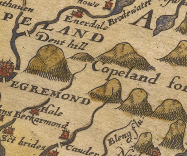 Sax9NY01.jpg "Copeland forest" No trees. item:- private collection : 2 Image © see bottom of page |
|
|
|
||
| evidence:- | old map:- Mercator 1595 (edn?) placename:- Copeland Forest |
|
| source data:- | Map, hand coloured engraving, Northumbria, Cumberlandia, et
Dunelmensis Episcopatus, ie Northumberland, Cumberland and
Durham etc, scale about 6.5 miles to 1 inch, by Gerard Mercator,
Duisberg, Germany, about 1595. MER8CumE.jpg "Copeland forest" trees, tinted green; forest item:- JandMN : 169 Image © see bottom of page |
|
|
|
||
| evidence:- | old map:- Speed 1611 (Cmd) placename:- Copeland Forest |
|
| source data:- | Map, hand coloured engraving, Cumberland and the Ancient Citie
Carlile Described, scale about 4 miles to 1 inch, by John Speed,
1610, published by J Sudbury and George Humble, Popes Head
Alley, London, 1611-12.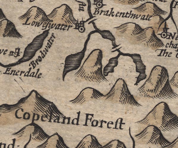 SP11NY11.jpg "Copeland Forest" area item:- private collection : 16 Image © see bottom of page |
|
|
|
||
| evidence:- | poem:- Drayton 1612/1622 text placename:- Copland placename:- Copper Land item:- Hoodwinke; Barley Breake; Tick; Prison Base; game; placename, Copeland; echoes; minerals; copper |
|
| source data:- | Poem, Poly Olbion, by Michael Drayton, published by published by
John Marriott, John Grismand and Thomas Dewe, and others?
London, part 1 1612, part 2 1622. goto source goto sourcepage 164:- "... ... Copland comming downe, a Forrest-Nymph, which sings Her owne praise, and those Floods, their Fountains that derive From her, which to extoll, the Forrest thus doth strive." "Yee Northerne Dryades all adorn'd with Mountaines steepe, Upon whose hoary heads cold Winter long doth keepe, Where often rising Hils, deepe Dales, and many make, Where many a pleasant Spring, and many a large-spread Lake, Their cleere beginnings keepe, and doe their names bestow Upon those humble Vales, through which they eas'ly flow; Whereas the Mountaine Nymphs, and those that doe frequent The Fountaines, Fields, and Groves, with wondrous meriment, By Moone-shine many a night, doe give each other chase, At Hood-winke, Barley-breake, at Tick, or Prison-base, With tricks and antique toyes, tha one another mocke, That skip from Crag to Crag, and leape from Rocke to Rocke, Then Copland, of this Tract a corner, I would know, What place can there be found in Britan, that doth show A Surface more austere, more sterne from every way, That who doth it behold, he cannot chuse but say, Th'aspect of these grim Hills, these darke and mistie Dales, From clouds scarce ever cleer'd, with the strongst Northern gales Tell in their mighty Roots, some Minerall there doth lye, The Islands generall want, whose plenty might supply. Wherefore as some suppose of Copper Mynes in me, I Copper-land was cald, but some will have to be From the old Britans brought, for Cop they use to call The tops of many Hils, which I am stor'd withall. Then Eskdale mine Ally, and Niterdale so nam'd, Of Floods from you that flow, as Borowdale most fam'd, With Wasdale walled in, with Hils on every side, Hows'ever ye extend within your wasts so wide, For th' surface of a soyle, a Copland, Copland cry. Till to your shouts the Hils with Ecchoes all reply." "Which Copland scarce had spoke, but quickly every hill, Upon her Verge that stands, the neighbouring Vallies fill; Helvillon from his height, it through the Mountaines threw, From whom as soone againe, the sound Dunbalrase drew, From wjhose stone-trophied head, it on to Wendrosse went, Which tow'rds the Sea againe, resounded it to Dent, That Brodwater therewith within her Banks astound, In sayling to the Sea, told it to Egremound, Whose Buildings, walks, and streets, with Ecchoes loud and long, Did mightily commend old Copland for her Song." |
|
|
|
||
| evidence:- | old map:- Drayton 1612/1622 placename:- Copland Forest |
|
| source data:- | Map, hand coloured engraving, Cumberlande and Westmorlande, by
Michael Drayton, probably engraved by William Hole, scale about
4 or 5 miles to 1 inch, published by John Mariott, John
Grismand, and Thomas Dewe, London, 1622.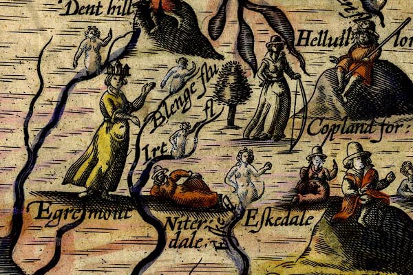 DRY519.jpg "Copland for:" Tree, huntress with a bow. item:- JandMN : 168 Image © see bottom of page |
|
|
|
||
| evidence:- | old map:- Jansson 1646 placename:- Copeland Forest |
|
| source data:- | Map, hand coloured engraving, Cumbria and Westmoria, ie
Cumberland and Westmorland, scale about 3.5 miles to 1 inch, by
John Jansson, Amsterdam, Netherlands, 1646.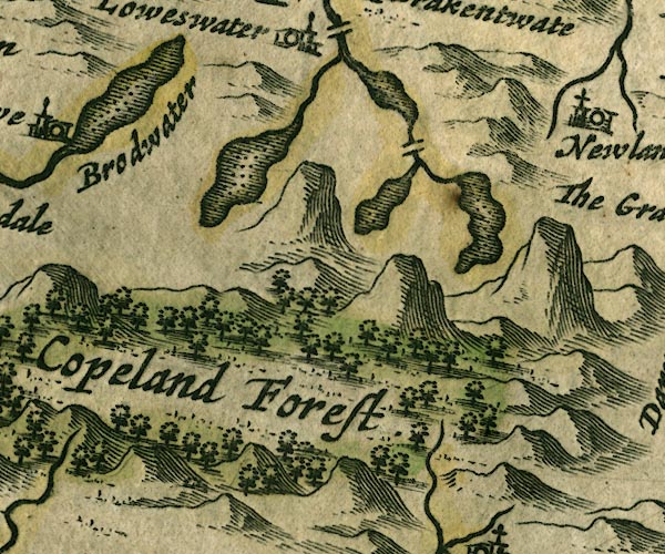 JAN3NY11.jpg "Copeland Forest" Large group of trees. item:- JandMN : 88 Image © see bottom of page |
|
|
|
||
| evidence:- | old map:- Seller 1694 (Cmd) placename:- Copland Forest |
|
| source data:- | Map, uncoloured engraving, Cumberland, scale about 12 miles to 1
inch, by John Seller, 1694. click to enlarge click to enlargeSEL9.jpg "Copland Forest" area item:- Dove Cottage : 2007.38.89 Image © see bottom of page |
|
|
|
||
| evidence:- | old map:- Morden 1695 (Cmd) placename:- Copeland Forest |
|
| source data:- | Map, uncoloured engraving, Cumberland, scale about 4 miles to 1
inch, by Robert Morden, 1695, published by Abel Swale, the
Unicorn, St Paul's Churchyard, Awnsham, and John Churchill, the
Black Swan, Paternoster Row, London, 1695-1715.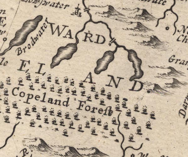 MD12NY11.jpg "Copeland Forest" Trees. item:- JandMN : 90 Image © see bottom of page |
|
|
|
||
| evidence:- | old map:- Badeslade 1742 placename:- Copland Forest |
|
| source data:- | Map, uncoloured engraving, A Map of Cumberland North from
London, scale about 11 miles to 1 inch, with descriptive text,
by Thomas Badeslade, London, engraved and published by William
Henry Toms, Union Court, Holborn, London, 1742. click to enlarge click to enlargeBD10.jpg "Copland for" trees item:- JandMN : 115 Image © see bottom of page |
|
|
|
||
| evidence:- | old map:- Bowen and Kitchin 1760 placename:- Copland Forest |
|
| source data:- | Map, hand coloured engraving, A New Map of the Counties of
Cumberland and Westmoreland Divided into their Respective Wards,
scale about 4 miles to 1 inch, by Emanuel Bowen and Thomas
Kitchin et al, published by T Bowles, Robert Sayer, and John
Bowles, London, 1760.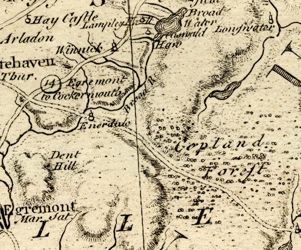 BO18NY01.jpg "Copland Forest" trees 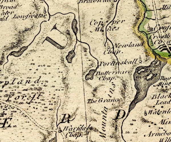 BO18NY11.jpg item:- Armitt Library : 2008.14.10 Image © see bottom of page |
|
|
|
||
| evidence:- | old map:- Donald 1774 (Cmd) placename:- Copeland Forest |
|
| source data:- | Map, hand coloured engraving, 3x2 sheets, The County of Cumberland, scale about 1
inch to 1 mile, by Thomas Donald, engraved and published by Joseph Hodskinson, 29
Arundel Street, Strand, London, 1774. D4NY01SE.jpg 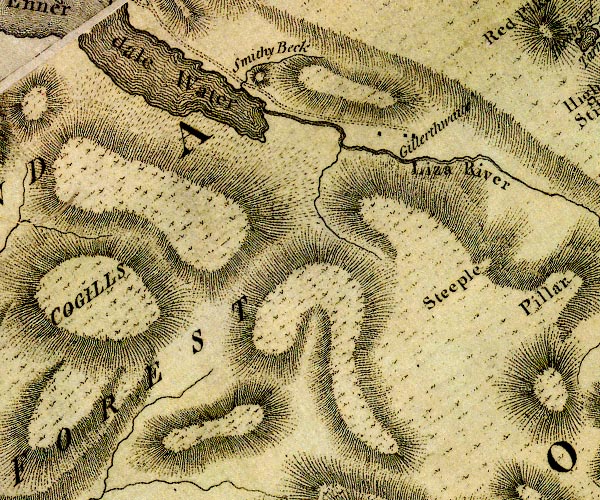 D4NY11SW.jpg "COPELAND FOREST" area item:- Carlisle Library : Map 2 Images © Carlisle Library |
|
|
|
||
| evidence:- | old map:- West 1784 map placename:- Copeland Forest |
|
| source data:- | Map, hand coloured engraving, A Map of the Lakes in Cumberland,
Westmorland and Lancashire, scale about 3.5 miles to 1 inch,
engraved by Paas, 53 Holborn, London, about 1784.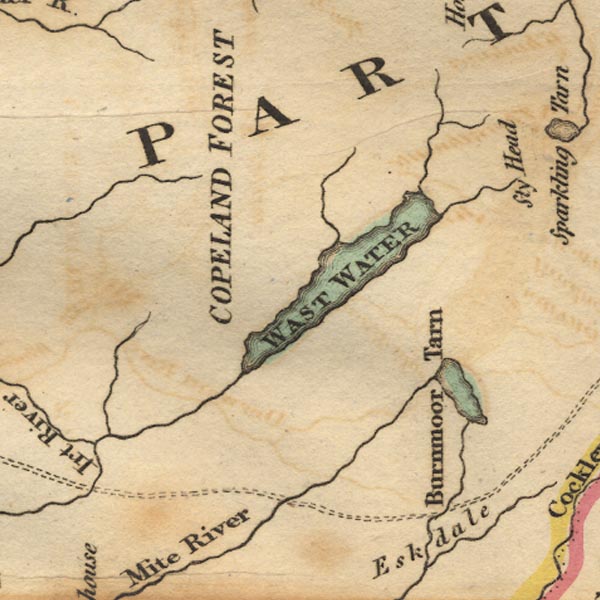 Ws02NY10.jpg "COPELAND FOREST" item:- Armitt Library : A1221.1 Image © see bottom of page |
|
|
|
||
| evidence:- | old map:- Ford 1839 map placename:- Copeland Forest |
|
| source data:- | Map, uncoloured engraving, Map of the Lake District of
Cumberland, Westmoreland and Lancashire, scale about 3.5 miles
to 1 inch, published by Charles Thurnam, Carlisle, and by R
Groombridge, 5 Paternoster Row, London, 3rd edn 1843. FD02NY01.jpg "Copeland Forest" Area. item:- JandMN : 100.1 Image © see bottom of page |
|
|
|
||
| evidence:- | old map:- Garnett 1850s-60s H placename:- Copeland Forest |
|
| source data:- | Map of the English Lakes, in Cumberland, Westmorland and
Lancashire, scale about 3.5 miles to 1 inch, published by John
Garnett, Windermere, Westmorland, 1850s-60s. GAR2NY11.jpg "Copeland Forest" area item:- JandMN : 82.1 Image © see bottom of page |
|
|
|
||
Lakes Guides menu.