 Old Cumbria Gazetteer
 |
 |
|
| Steeple, Ennerdale and Kinniside | ||
| Steeple | ||
| civil parish:- | Ennerdale and Kinniside (formerly Cumberland) | |
| county:- | Cumbria | |
| locality type:- | hill | |
| coordinates:- | NY15731167 | |
| 1Km square:- | NY1511 | |
| 10Km square:- | NY11 | |
| altitude:- | 2687 feet | |
| altitude:- | 819m | |
|
|
||
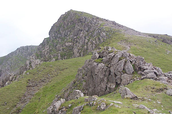 BTF01.jpg (taken 13.7.2010) 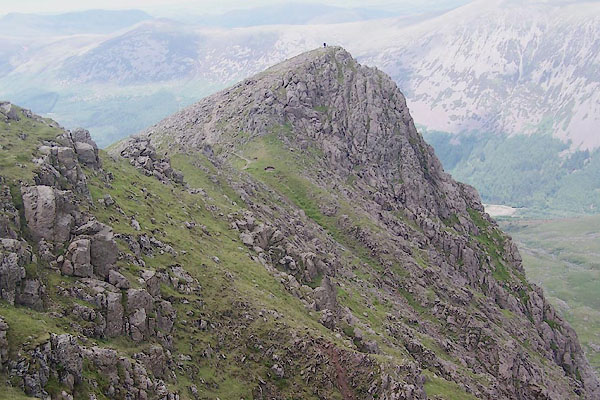 BTF03.jpg (taken 13.7.2010) |
||
|
|
||
| evidence:- | old map:- OS County Series (Cmd 74 2) placename:- Steeple |
|
| source data:- | Maps, County Series maps of Great Britain, scales 6 and 25
inches to 1 mile, published by the Ordnance Survey, Southampton,
Hampshire, from about 1863 to 1948. |
|
|
|
||
| evidence:- | old map:- Donald 1774 (Cmd) placename:- Steeple |
|
| source data:- | Map, hand coloured engraving, 3x2 sheets, The County of Cumberland, scale about 1
inch to 1 mile, by Thomas Donald, engraved and published by Joseph Hodskinson, 29
Arundel Street, Strand, London, 1774.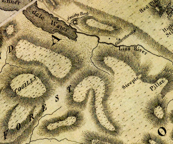 D4NY11SW.jpg "Steeple" hill hachuring; a hill or mountain item:- Carlisle Library : Map 2 Image © Carlisle Library |
|
|
|
||
| evidence:- | outline view:- Otley 1823 (4th edn 1830) placename:- Steeple |
|
| source data:- | Print, engraving, outline view, Mountains of Ennerdale as seen from Kirkland, published
by Jonathan Otley, Keswick, Cumberland et al, 1830.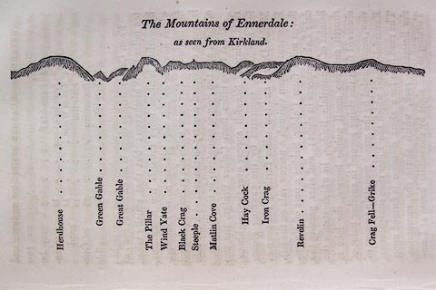 click to enlarge click to enlargeO75E09.jpg p.131 in A Concise Description of the English Lakes, by Jonathan Otley, 4th edition, 1830. "The Mountains of Ennerdale: / as seen from Kirkland." "Herdhouse / Green Gable / Great Gable / The Pillar / Wind Yate / Black Crag / Steeple / Matlin Cove / Hay Cock / Iron Crag / Revelin / Crag Fell - Grike" item:- Armitt Library : A1175.9 Image © see bottom of page |
|
|
|
||
| evidence:- | outline view:- Otley 1823 (8th edn 1849) placename:- Steeple |
|
| source data:- | Engraving, outline view of mountains, Ennerdale from a Field near Kirkland and Salter,
drawn by T Binns, engraved by O Jewitt, opposite p.20 of A Descriptive Guide of the
English Lakes, by Jonathan Otley, 8th edition, 1849.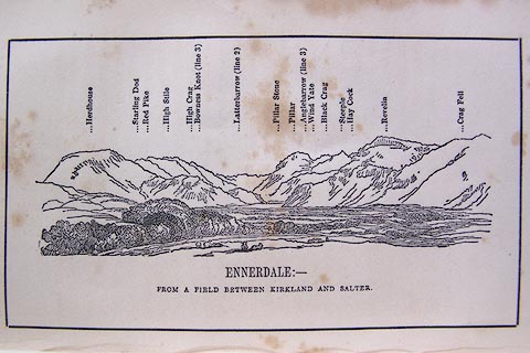 click to enlarge click to enlargeO80E11.jpg item:- Armitt Library : A1180.12 Image © see bottom of page |
|
|
|
||
| evidence:- | outline view:- Otley 1823 (8th edn 1849) placename:- Steeple |
|
| source data:- | Engraving, outline view of mountains, A Group of Mountains seen from Helvellyn, looking
towards the South West, drawn by T Binns, engraved by O Jewitt, opposite p.50 of A
Descriptive Guide of the English Lakes, by Jonathan Otley, 8th edition, 1849.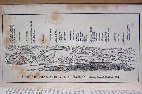 click to enlarge click to enlargeO80E17.jpg item:- Armitt Library : A1180.18 Image © see bottom of page |
|
|
|
||
| evidence:- | outline view:- Otley 1823 (5th edn 1834) |
|
| source data:- | Print, woodcut outline view, The Mountains of Ennerdale, by
Jonathan Otley, Keswick, Cumberland, 1830.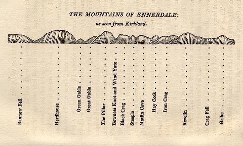 click to enlarge click to enlargeOT2E06.jpg Printed on p.27 of A Concise Description of the English Lakes, by Jonathan Otley, 5th edition, 1834. "THE MOUNTAINS OF ENNERDALE: as seen from Kirkland." "Bannow Fell / Herdhouse / Green Gable / Great Gable / The Pillar / Bowness Knot and Wind Yate / Black Crag / Steeple / Matlin Cove / Hay Cock / Iron Crag / Revelin / Crag Fell / Grike" item:- JandMN : 48.7 Image © see bottom of page |
|
|
|
||
| evidence:- | old map:- Garnett 1850s-60s H placename:- Steeple |
|
| source data:- | Map of the English Lakes, in Cumberland, Westmorland and
Lancashire, scale about 3.5 miles to 1 inch, published by John
Garnett, Windermere, Westmorland, 1850s-60s.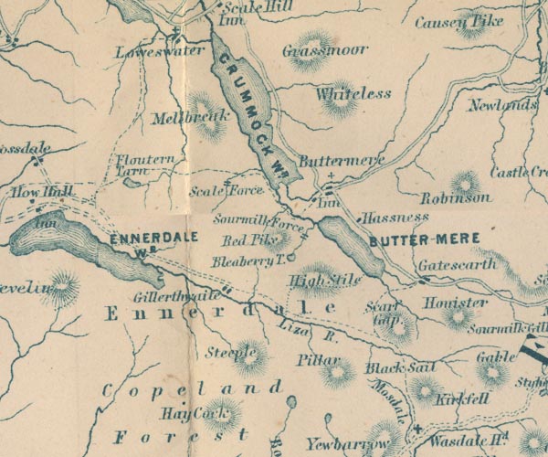 GAR2NY11.jpg "Steeple" hill hachuring item:- JandMN : 82.1 Image © see bottom of page |
|
|
|
||
| evidence:- | outline view:- Jenkinson 1875 placename:- Steeple |
|
| source data:- | Print, lithograph, outline view, Panoramic Sketches from Helvellyn, Westmorland, by
Edwin A Pettitt, London, published by Edward Stanford, 55 Charing Cross, London, 1875. click to enlarge click to enlargeJk01E1.jpg "... Steeple ..." item:- JandMN : 28.5 Image © see bottom of page |
|
|
|
||
| evidence:- | outline view:- Jenkinson 1875 placename:- Steeple |
|
| source data:- | Print, lithograph, outline view, Panoramic Sketches from Skiddaw, Cumberland, by Edwin
A Pettitt, London, published by Edward Stanford, 55 Charing Cross, London, 1875. click to enlarge click to enlargeJk01E2.jpg "... Stile End ..." item:- JandMN : 28.8 Image © see bottom of page |
|
|
|
||
| evidence:- | outline view:- Matthew 1866 placename:- Steeple |
|
| source data:- | Print, engraving, outline view, Ennerdale, Cumberland, published by J Richardson,
Highgate, Kendal, Westmorland, 1866.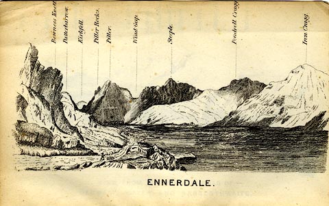 click to enlarge click to enlargeMW1E04.jpg Tipped in before p.1 of The English Lakes, Peaks and Passes, from Kendal to Keswick, by George King Matthew. printed at bottom:- "ENNERDALE" printed at caption to mountains:- "... Steeple. ..." item:- Armitt Library : A1168.4 Image © see bottom of page |
|
|
|
||
| evidence:- | outline view:- Tattersall 1836 (version 1869) placename:- Steeple Crag |
|
| source data:- | Print, hand coloured, Ennerdale Lake, from the North East, Cumberland, drawn by George
Tattersall, 1836, engraved by W F Topham, published by T J Allman, 463 Oxford Street,
London, 1869.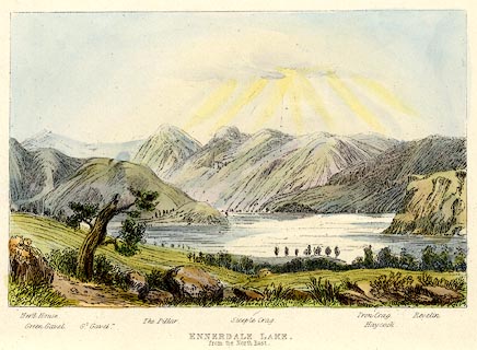 click to enlarge click to enlargeTAT215.jpg Included in The Lakes of England, by W F Topham. printed at bottom:- "ENNERDALE LAKE, / from the North East." printed at bottom:- "Herd House. / Green Gavel. / Gt. Gavel. / The Pillar. / Steeple Crag. / Iron Crag. / Haycock. / Revelin." item:- Armitt Library : A1067.15 Image © see bottom of page |
|
|
|
||
| evidence:- | outline view:- Tattersall 1836 placename:- Steeple Crag |
|
| source data:- | Print, engraving, Ennerdale Lake, from the North East, Cumberland, drawn by George
Tattersall, engraved by W F Topham, published by Sherwood and Co, Paternoster Row,
London, about 1836.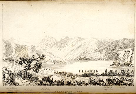 click to enlarge click to enlargeTAT133.jpg The print is captioned with mountain names and acts as an outline view. Tipped in opposite p.83 of The Lakes of England, by George Tattersall. printed at bottom:- "ENNERDALE LAKE, / from the North East." printed at bottom left to right:- "Herd House. / Green Gavel. / Gt. Gavel. / The Pillar. / Steeple Crag. / Iron Crag. / Haycock. / Revelin." item:- Armitt Library : A1204.34 Image © see bottom of page |
|
|
|
||
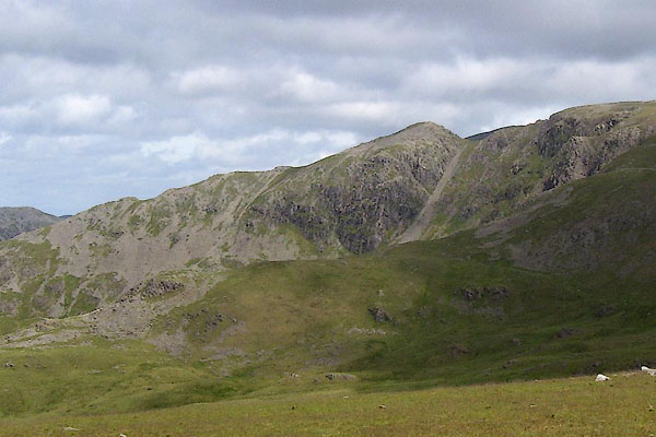 BPK36.jpg (taken 30.6.2008) 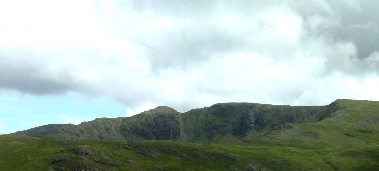 Click to enlarge BPK37.jpg (taken 30.6.2008) 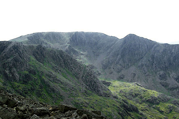 BQX28.jpg Black Crag, High Stile, and Steeple on the right. (taken 25.6.2009) |
||
|
|
||
 Lakes Guides menu.