 Old Cumbria Gazetteer
 |
 |
|
| Scarth Gap, Buttermere | ||
| Scarth Gap | ||
| Scarth Gap Pass | ||
| civil parish:- | Buttermere (formerly Cumberland) | |
| civil parish:- | Ennerdale and Kinniside (formerly Cumberland) | |
| county:- | Cumbria | |
| locality type:- | pass | |
| coordinates:- | NY189133 | |
| 1Km square:- | NY1813 | |
| 10Km square:- | NY11 | |
|
|
||
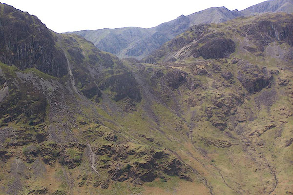 BQL65.jpg (taken 1.5.2009) 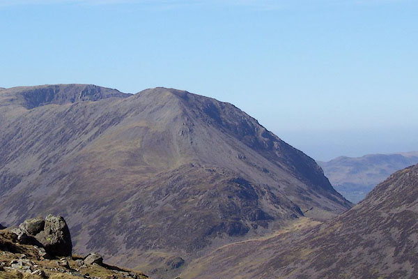 BNM82.jpg (taken 4.4.2007) |
||
|
|
||
| evidence:- | old map:- OS County Series (Cmd 69 15) placename:- Scarth Gap |
|
| source data:- | Maps, County Series maps of Great Britain, scales 6 and 25
inches to 1 mile, published by the Ordnance Survey, Southampton,
Hampshire, from about 1863 to 1948. |
|
|
|
||
| evidence:- | descriptive text:- Otley 1823 (5th edn 1834) placename:- Scarf Gap |
|
| source data:- | Guide book, A Concise Description of the English Lakes, the
mountains in their vicinity, and the roads by which they may be
visited, with remarks on the mineralogy and geology of the
district, by Jonathan Otley, published by the author, Keswick,
Cumberland now Cumbria, by J Richardson, London, and by Arthur
Foster, Kirkby Lonsdale, Cumbria, 1823; published 1823-49,
latterly as the Descriptive Guide to the English Lakes. goto source goto sourcePage 26:- "... Pedestrians, anxious to explore the inmost recesses of the mountains, may follow the lake [Ennerdale Water] to its head, and ... continue their route four of five miles along the narrow dale, ... and ... turn to the left, by the pass called Scarf Gap, to Buttermere; ..." "..." goto sourcePage 126:- "Opposite to the farm of Gatesgarth, which is two miles from the inn at Buttermere, a shepherd's path leads over the mountain, by a pass called Scarf-gap, ... The crags on the left of Scarf-gap are, from their form, called Hay-stacks; and to the right, three adjoining summits are called High-crag, High-stile, and Red-pike." |
|
|
|
||
| evidence:- | old map:- Garnett 1850s-60s H placename:- Scarf Gap |
|
| source data:- | Map of the English Lakes, in Cumberland, Westmorland and
Lancashire, scale about 3.5 miles to 1 inch, published by John
Garnett, Windermere, Westmorland, 1850s-60s.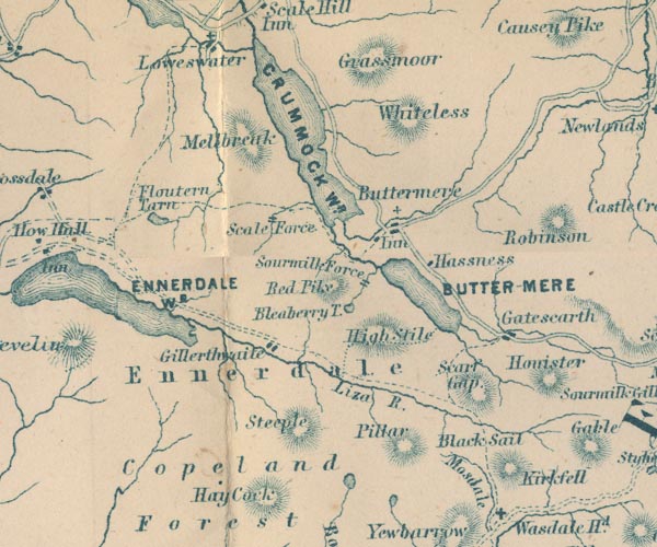 GAR2NY11.jpg "Scarf Gap" hill hachuring item:- JandMN : 82.1 Image © see bottom of page |
|
|
|
||
| evidence:- | old text:- Martineau 1855 placename:- Scarf Gap |
|
| source data:- | Guide book, A Complete Guide to the English Lakes, by Harriet
Martineau, published by John Garnett, Windermere, Westmorland,
and by Whittaker and Co, London, 1855; published 1855-76. goto source Page 161:- "The other exit from Wastdale Head is by the road to Scarf Gap, already referred to as having been found dangerous by inexperienced travellers. A rough foot-road leads through the valley of Mosedale, between Kirkfell and Yewbarrow, till it enters Gillerthwaite, at the head of Ennerdale. Kirkfell and the stream being kept on the right, the track passes between Kirkfell and the Pillar. Coming down into Gillerthwaite, the view is beautiful. Great Gable and Kirkfell close in the dale at its head; High Stile and Red Pike are in front, and Gillerthwaite is below, with its circular green level, dropped over with wood, its farmhouse and stream, and the lake at the other end. Behind, the wild valley of Mosedale winds away between Kirkfell and Yewbarrow, and discloses the great summits of Scawfell and Bowfell. The Pillar is 2,893 feet high, and inaccessible, from its craggy and precipitous character. The path leads along the Pass called Blacksail to a sheepfold on the little river Liza, which falls into Ennerdale Lake: at that fold the stream will be crossed, and an indistinct path will be seen crossing a hollow in the direction of Buttermere. That hollow is Scarf Gap; and the path leads out upon Gatesgarth, at the head of Buttermere. ..." goto sourcePage 162:- "... the walk from Wastdale to Gatesgarth is somewhat short of twelve miles. Most of it must be traversed on foot, though a horse may be led, to be occasionally mounted." |
|
|
|
||
| evidence:- | outline view:- Martineau 1855 placename:- Scarf Gap |
|
| source data:- | Print, engraving, outline view, Mountains seen from Lanthwaite Wood Crummock Water,
drawn by L Aspland, engraved by W Banks, Edinburgh, published by John Garnett, Windermere,
Westmorland, and by Whittaker and Co, London, 1855.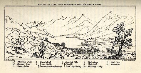 click to enlarge click to enlargeMNU113.jpg Opposite p.84 in A Complete Guide to the English Lakes, by Harriet Martineau. The view is captioned, numbers referring to mountains in the image:- "1 Whiteless Pike, 2 Honister Crag, 3 Green Gable, 4 Great End, 5 Great Gable / Rannerdale Knott (beneath), 6 Scawfell Pike, 7 Kirkfell / Scarf Gap (below), 8 High Crag, 9 High Stile, 10 Bleaberry Crag, 11 Red Pike, 12 Melbreak." "MOUNTAINS SEEN FROM LANTHWAITE WOOD CRUMMOCK WATER." "L Aspland Delt. / W Banks Sc Edinr." item:- Armitt Library : A1159.13 Image © see bottom of page |
|
|
|
||
| evidence:- | old print:- Prior 1865 placename:- Scarth Gap |
|
| source data:- | Print, uncoloured engraving, Buttermere, Honister Crag, Scarth Gap, and Haystacks,
Cumberland, published by John Garnett, Windermere, Westmorland, and by Simpkin, Marshall
and Co, London, 1865.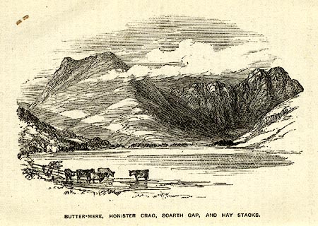 click to enlarge click to enlargePI0103.jpg Included on page 16 of the guide book, Ascents and Passes in the Lake District of England, by Herman Prior. printed at bottom:- "BUTTER-MERE, HONISTER CRAG, SCARTH GAP, AND HAYSTACKS." item:- JandMN : 235.5 Image © see bottom of page |
|
|
|
||
| evidence:- | outline view:- Black 1856 placename:- Scarf Gap |
|
| source data:- | Print, lithograph, Outline Views, Buttermere - Mountains as seen from the Knots near
the Hotel at Buttermere, and Mountains as seen at the Seat in Lanthwaite Wood, Scale
Hill, by J Flintoft, Keswick, Cumberland, engraved by R Mason, Edinburgh, Lothian,
about 1900. click to enlarge click to enlargeBC08E5.jpg "... Scarf Gap ..." item:- JandMN : 37.19 Image © see bottom of page |
|
|
|
||
| evidence:- | old print:- Sylvan 1847 placename:- Scarf Gap |
|
| source data:- | Print, engraving, Ennerdale Water from Scarf Gap, showing Scarth Gap, Buttermere,
Cumberland, published by John Johnstone, Paternoster Row, London, et al, 1847.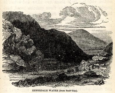 click to enlarge click to enlargeSYL155.jpg On p.211 of Sylvan's Pictorial Guide to the English Lakes. printed at bottom:- "ENNERDALE WATER (from Scarf Gap)." item:- Armitt Library : A1201.55 Image © see bottom of page |
|
|
|
||
| evidence:- | outline view:- Black 1841 (3rd edn 1846) placename:- Scarf Gap |
|
| source data:- | Print, engraving, outline view, Mountains as seen from The Knots near the Victoria
at Buttermere, and Mountains as seen at the Seat in Lanthwaite Wood, Scale Hill, by
J Flintoft, Keswick, Cumberland, engraved by R Mason, Edinburgh, Lothian, about 1846.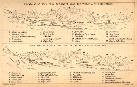 click to enlarge click to enlargeBC02E7.jpg "... Scarf Gap ..." item:- JandMN : 32.11 Image © see bottom of page |
|
|
|
||
 Click to enlarge BNM88.jpg (taken 4.4.2007) 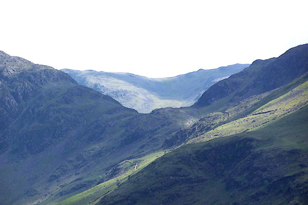 BJQ14.jpg From road to Newlands Hause. (taken 10.6.2005) 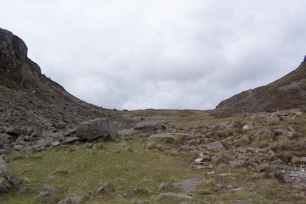 BWO37.jpg (taken 16.5.2012) 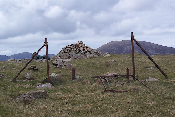 BWO38.jpg Cairn, (taken 16.5.2012) |
||
|
|
||
Lakes Guides menu.