 Old Cumbria Gazetteer
 |
 |
|
||||||||||||||||||||||||
| Ennerdale Water | ||||||||||||||||||||||||||
| runs into:- |  Ehen, River Ehen, River |
|||||||||||||||||||||||||
|
|
||||||||||||||||||||||||||
| locality:- | Ennerdale | |||||||||||||||||||||||||
| civil parish:- | Ennerdale and Kinniside (formerly Cumberland) | |||||||||||||||||||||||||
| county:- | Cumbria | |||||||||||||||||||||||||
| locality type:- | lake | |||||||||||||||||||||||||
| coordinates:- | NY10771490 (etc) | |||||||||||||||||||||||||
| 1Km square:- | NY1014 | |||||||||||||||||||||||||
| 10Km square:- | NY11 | |||||||||||||||||||||||||
| altitude:- | 367 feet | |||||||||||||||||||||||||
| altitude:- | 112m (Winter water level 112 metres above Newlyn datum 1972) | |||||||||||||||||||||||||
|
|
||||||||||||||||||||||||||
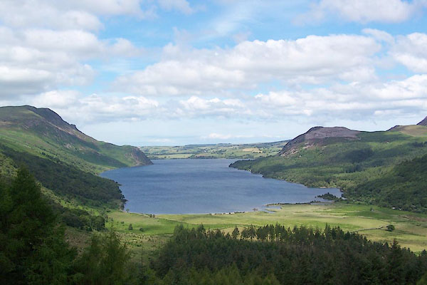 BTE90.jpg (taken 13.7.2010) 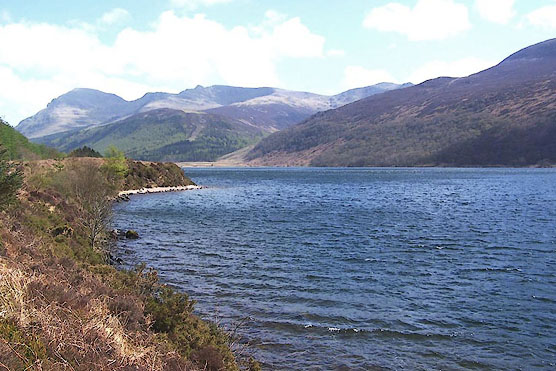 BMA16.jpg From Bowness. (taken 3.5.2006) |
||||||||||||||||||||||||||
|
|
||||||||||||||||||||||||||
| evidence:- | old map:- OS County Series (Cmd 68 11) placename:- Ennerdale Water |
|||||||||||||||||||||||||
| source data:- | Maps, County Series maps of Great Britain, scales 6 and 25
inches to 1 mile, published by the Ordnance Survey, Southampton,
Hampshire, from about 1863 to 1948. OS County Series (Cmd 68 12) |
|||||||||||||||||||||||||
|
|
||||||||||||||||||||||||||
| evidence:- | old map:- OS County Series (Cmd 68) |
|||||||||||||||||||||||||
| source data:- | Maps, County Series maps of Great Britain, scales 6 and 25
inches to 1 mile, published by the Ordnance Survey, Southampton,
Hampshire, from about 1863 to 1948. "Lowest point of bed of lake [ ] above O.S. datum" elsewhere:- "Sur. of Water 368 9" |
|||||||||||||||||||||||||
|
|
||||||||||||||||||||||||||
| evidence:- | old map:- Saxton 1579 placename:- Brodewater |
|||||||||||||||||||||||||
| source data:- | Map, hand coloured engraving, Westmorlandiae et Cumberlandiae Comitatus ie Westmorland
and Cumberland, scale about 5 miles to 1 inch, by Christopher Saxton, London, engraved
by Augustinus Ryther, 1576, published 1579-1645.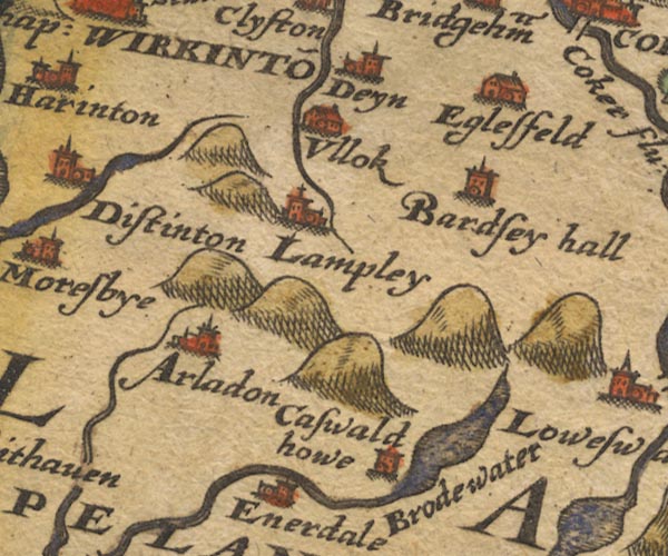 Sax9NY02.jpg "Brodewater" Lake. item:- private collection : 2 Image © see bottom of page |
|||||||||||||||||||||||||
|
|
||||||||||||||||||||||||||
| evidence:- | old map:- Mercator 1595 (edn?) placename:- |
|||||||||||||||||||||||||
| source data:- | Map, hand coloured engraving, Northumbria, Cumberlandia, et
Dunelmensis Episcopatus, ie Northumberland, Cumberland and
Durham etc, scale about 6.5 miles to 1 inch, by Gerard Mercator,
Duisberg, Germany, about 1595. MER8CumE.jpg "" outline, coast shaded, tinted blue; lake item:- JandMN : 169 Image © see bottom of page |
|||||||||||||||||||||||||
|
|
||||||||||||||||||||||||||
| evidence:- | old map:- Speed 1611 (Cmd) placename:- Brodwater |
|||||||||||||||||||||||||
| source data:- | Map, hand coloured engraving, Cumberland and the Ancient Citie
Carlile Described, scale about 4 miles to 1 inch, by John Speed,
1610, published by J Sudbury and George Humble, Popes Head
Alley, London, 1611-12.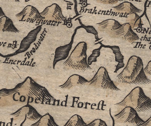 SP11NY11.jpg "Brodwater" outline, shaded item:- private collection : 16 Image © see bottom of page |
|||||||||||||||||||||||||
|
|
||||||||||||||||||||||||||
| evidence:- | poem:- Drayton 1612/1622 text placename:- Brodwater |
|||||||||||||||||||||||||
| source data:- | Poem, Poly Olbion, by Michael Drayton, published by published by
John Marriott, John Grismand and Thomas Dewe, and others?
London, part 1 1612, part 2 1622. goto source page 164:- "... Brodwater ..." |
|||||||||||||||||||||||||
|
|
||||||||||||||||||||||||||
| evidence:- | probably old map:- Drayton 1612/1622 placename:- |
|||||||||||||||||||||||||
| source data:- | Map, hand coloured engraving, Cumberlande and Westmorlande, by
Michael Drayton, probably engraved by William Hole, scale about
4 or 5 miles to 1 inch, published by John Mariott, John
Grismand, and Thomas Dewe, London, 1622.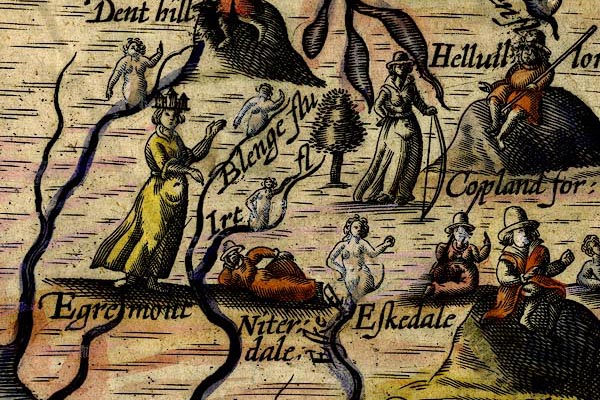 DRY519.jpg Lake. item:- JandMN : 168 Image © see bottom of page |
|||||||||||||||||||||||||
|
|
||||||||||||||||||||||||||
| evidence:- | old map:- Jansson 1646 placename:- Brodwater |
|||||||||||||||||||||||||
| source data:- | Map, hand coloured engraving, Cumbria and Westmoria, ie
Cumberland and Westmorland, scale about 3.5 miles to 1 inch, by
John Jansson, Amsterdam, Netherlands, 1646. JAN3NY11.jpg "Brodwater" Outline with shore shaded, dotted area. item:- JandMN : 88 Image © see bottom of page |
|||||||||||||||||||||||||
|
|
||||||||||||||||||||||||||
| evidence:- | old map:- Sanson 1679 |
|||||||||||||||||||||||||
| source data:- | Map, hand coloured engraving, Ancien Royaume de Northumberland
aujourdhuy Provinces de Nort, ie the Ancient Kingdom of
Northumberland or the Northern Provinces, scale about 9.5 miles
to 1 inch, by Nicholas Sanson, Paris, France, 1679. click to enlarge click to enlargeSAN2Cm.jpg outline, shore shaded; lake, part of 'Broadwater fl.' item:- Dove Cottage : 2007.38.15 Image © see bottom of page |
|||||||||||||||||||||||||
|
|
||||||||||||||||||||||||||
| evidence:- | old map:- Seller 1694 (Cmd) |
|||||||||||||||||||||||||
| source data:- | Map, uncoloured engraving, Cumberland, scale about 12 miles to 1
inch, by John Seller, 1694. click to enlarge click to enlargeSEL9.jpg outline with shaded shore; lake item:- Dove Cottage : 2007.38.89 Image © see bottom of page |
|||||||||||||||||||||||||
|
|
||||||||||||||||||||||||||
| evidence:- | old map:- Morden 1695 (Cmd) placename:- Brodwater |
|||||||||||||||||||||||||
| source data:- | Map, uncoloured engraving, Cumberland, scale about 4 miles to 1
inch, by Robert Morden, 1695, published by Abel Swale, the
Unicorn, St Paul's Churchyard, Awnsham, and John Churchill, the
Black Swan, Paternoster Row, London, 1695-1715. MD12NY01.jpg "Brodwater" Outline with shore shading. item:- JandMN : 90 Image © see bottom of page |
|||||||||||||||||||||||||
|
|
||||||||||||||||||||||||||
| evidence:- | old map:- Badeslade 1742 placename:- |
|||||||||||||||||||||||||
| source data:- | Map, uncoloured engraving, A Map of Cumberland North from
London, scale about 11 miles to 1 inch, with descriptive text,
by Thomas Badeslade, London, engraved and published by William
Henry Toms, Union Court, Holborn, London, 1742. click to enlarge click to enlargeBD10.jpg "" outline with form lines item:- JandMN : 115 Image © see bottom of page |
|||||||||||||||||||||||||
|
|
||||||||||||||||||||||||||
| evidence:- | old map:- Gents Mag 1751 placename:- Enerdale Water |
|||||||||||||||||||||||||
| source data:- | Map, uncoloured engraving, Map of the Black Lead Mines in
Cumberland, and area, scale about 2 miles to 1 inch, by George
Smith, published in the Gentleman's Magazine, 1751. GM1301.jpg "ENERDALE WATER" outline with form lines; lake item:- JandMN : 114 Image © see bottom of page |
|||||||||||||||||||||||||
|
|
||||||||||||||||||||||||||
| evidence:- | old map:- Bowen and Kitchin 1760 placename:- Broad Water |
|||||||||||||||||||||||||
| source data:- | Map, hand coloured engraving, A New Map of the Counties of
Cumberland and Westmoreland Divided into their Respective Wards,
scale about 4 miles to 1 inch, by Emanuel Bowen and Thomas
Kitchin et al, published by T Bowles, Robert Sayer, and John
Bowles, London, 1760. BO18NY02.jpg "Broad Water" outline with form lines item:- Armitt Library : 2008.14.10 Image © see bottom of page |
|||||||||||||||||||||||||
|
|
||||||||||||||||||||||||||
| evidence:- | old map:- Donald 1774 (Cmd) placename:- Ennerdale Water |
|||||||||||||||||||||||||
| source data:- | Map, hand coloured engraving, 3x2 sheets, The County of Cumberland, scale about 1
inch to 1 mile, by Thomas Donald, engraved and published by Joseph Hodskinson, 29
Arundel Street, Strand, London, 1774. D4NY01NE.jpg "Ennerdale Water"  D4NY11SW.jpg "ENNERDALE WATER" lake item:- Carlisle Library : Map 2 Images © Carlisle Library |
|||||||||||||||||||||||||
|
|
||||||||||||||||||||||||||
| evidence:- | descriptive text:- West 1778 (11th edn 1821) placename:- Ennerdale Broad Water |
|||||||||||||||||||||||||
| source data:- | Guide book, A Guide to the Lakes, by Thomas West, published by
William Pennington, Kendal, Cumbria once Westmorland, and in
London, 1778 to 1821. goto source Account of Ennerdale, late 18th century Page 295:- "Within these few years, several visitors of the lakes extend their tour, by taking in Whitehaven, and proceeding from thence, by Cleator and Kinnyside, to Ennerdale Bridge; at which place guides can be procured, to conduct them by the best rout to Ennerdale Broad-water; ..." "Certain it is, the approach to the lake of Ennerdale, to Lowes-water, and to Buttermere, is from no other quarter so magnificent and captivating. The lake of Ennerdale appears in view. To the left, a majestic wood, rising gradually up the side of Cold-fell from the opposite shore of the water, imparts the most graceful ornament to the entrance into a region perfectly different from the last. A short turn to the right lays the whole lake and valley open to the view, and Herd-house presents his tawny front, as regent of the scene. The furniture of the lake (if the expression may be allowed) is totally changed: on the traveller's side (the east) the farms are stretched out, and exhibit a verdure seldom exceeded in the most fertile parts of this kingdom; and in a compass of a few miles, the number of small tenements seem to say with Goldsmith," "'Here every rood maintains its man.'" "On the opposite shore of this little ocean (which is frequently seen vexed with little storms of short duration) the mountain towers with great dignity; neither terrible nor in-" goto sourcePage 296:- "[in]viting in its aspect, but suited to the serenity of the spot, which is calculated to inspire sentiments at once sublime and chearful." "The langauge of poetry never applied 'The clear mirror of the flood,' with a propriety greater than that with which, on many accounts, a description of this lake might adopt it: the extent of the water is particularly calculated with the height of the adjoining mountain, to produce the most astonishing reflection from its surface; and the situation of the neighbouring mountains occasions such frequent changes of atmosphere in the course of the summer's day (and at no other season, it is presumed, are these parts visited by strangers) that the tourist will hardly be disappointed of viewing the picture in all its great variety of light and shade." "The following lines are an impromptu, written by a gentleman in the year 1788, who has since distinguished himself by his ingenuity, and at present enjoys no inconsiderable rank as an artist; we might be justified in saying he now possesses a very honourable niche in the modern temple of pictorial fame - in Somerset-house." "Here let the youth who pants for honest fame, / By real genius led, whose classic taste / Delights to copy Nature, here employ / His pencil, and by boldest stretch of art, / Snatch all the transient colours of the lake, / That wildly on its surface mingling play." "And let the rapture that with speed pursues / The flying spectacle of light and shade / (And, instant, strikes the canvas with their tint) / Direct the eye, and guide the rapid hand, / Quick! as the chasing clouds and glancing light / Reflect their image on the glassy plain." goto sourcePage 297:- "Now leave the varying beauties of the scene, / And dash the scowling mountain's brows sublime. / Sweep down their rugged sides, august and steep, / With many a furrow-mark'd, and shelving ridge, / And paint the pebbled margin of the flood." "But seize! ah, seize on Pillar's lofty top, / That passing mist which half obscures its peak. / Its evanescent form no art depicts! / No fancy wing'd so quick to give it shape!- / It flies, alas! and mix'd with common air, / Brightens, and fades - insensibly - away!" "Describe the dread serenity that dwells / In all this region of romantic view, / Of awful silence - silence undisturb'd, / Save when, as gently mov'd by zephyrs bland, / The hedge-row mingles with its sweets a sigh; / Or the wing'd inmates of the wat'ry vale / Carol, responsive, to the general song / Of rising Nature. From her lap he throws / The richest offerings of the growing year; / And ev'ry tow'ring hill, and daisy'd bank, / Breathes choicest incense to th'Almighty Power, / Beneficent, whose works are only good." "Pictor." |
|||||||||||||||||||||||||
|
|
||||||||||||||||||||||||||
| evidence:- | old map:- West 1784 map placename:- Ennerdale Water |
|||||||||||||||||||||||||
| source data:- | Map, hand coloured engraving, A Map of the Lakes in Cumberland,
Westmorland and Lancashire, scale about 3.5 miles to 1 inch,
engraved by Paas, 53 Holborn, London, about 1784. Ws02NY01.jpg "ENNERDALE WATER" item:- Armitt Library : A1221.1 Image © see bottom of page |
|||||||||||||||||||||||||
|
|
||||||||||||||||||||||||||
| evidence:- | old map:- Aikin 1790 (Cmd) placename:- |
|||||||||||||||||||||||||
| source data:- | Map, uncoloured engraving, Cumberland, by John Aikin, London,
1790. click to enlarge click to enlargeAIK3.jpg "" outline with form lines; lake item:- JandMN : 145 Image © see bottom of page |
|||||||||||||||||||||||||
|
|
||||||||||||||||||||||||||
| evidence:- | old painting:- Green 1790s-1820s (1800) |
|||||||||||||||||||||||||
| source data:- | Painting, watercolour, Ennerdale Water, Cumberland, by William Green, Ambleside, Westmorland,
1800.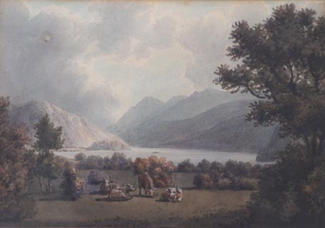 click to enlarge click to enlargePR1726.jpg courtesy of Abbot Hall Art Gallery, Kendal item:- Abbot Hall : AH572.67 Image © see bottom of page |
|||||||||||||||||||||||||
|
|
||||||||||||||||||||||||||
| evidence:- | old painting:- Green 1790s-1820s item:- sheep |
|||||||||||||||||||||||||
| source data:- | Painting, watercolour, Ennerdale Water, Ennerdale and Kinniside, Cumberland, by William
Green, Ambleside, Westmorland, 1800s-10s?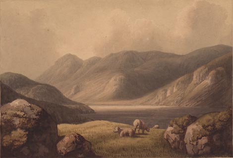 click to enlarge click to enlargePR1742.jpg item:- Dove Cottage : 1998.2.37 Image © see bottom of page |
|||||||||||||||||||||||||
|
|
||||||||||||||||||||||||||
| evidence:- | old map:- Housman 1800 map 3 placename:- Ennerdale Water |
|||||||||||||||||||||||||
| source data:- | Maps, hand coloured engraving, Lakes in Cumberland, 9 lakes on one sheet, engraved
by James Lowes, published by F Jollie, Carlisle, Cumberland, and C Law, Ave Maria
Lane, London, 1800. click to enlarge click to enlargeHM01Enn.jpg "ENNERDALE WATER" item:- Dove Cottage : 2007.38.96 Image © see bottom of page |
|||||||||||||||||||||||||
|
|
||||||||||||||||||||||||||
| evidence:- | old map:- Cooke 1802 placename:- Ennerdale Water |
|||||||||||||||||||||||||
| source data:- | Map, The Lakes, Westmorland and Cumberland, scale about 8.5
miles to 1 inch, engravedby Neele and Son, published by
Sherwood, Jones and Co, Paternoster Road, London, 1824. click to enlarge click to enlargeGRA1Lk.jpg "Ennerdale W." outline with form lines; lake or tarn item:- Hampshire Museums : FA2000.62.5 Image © see bottom of page |
|||||||||||||||||||||||||
|
|
||||||||||||||||||||||||||
| evidence:- | old map:- Cooke 1802 placename:- Ennerdale Water |
|||||||||||||||||||||||||
| source data:- | Map, Cumberland, scale about 15.5 miles to 1 inch, by George
Cooke, 1802, bound in Gray's New Book of Roads, 1824, published
by Sherwood, Jones and Co, Paternoster Road, London, 1824. click to enlarge click to enlargeGRA1Cd.jpg "Ennerdale Water" outline with form lines; lake or tarn item:- Hampshire Museums : FA2000.62.2 Image © see bottom of page |
|||||||||||||||||||||||||
|
|
||||||||||||||||||||||||||
| evidence:- | old print:- Green 1804 (plate 23) placename:- Ennerdale Water |
|||||||||||||||||||||||||
| source data:- | Print, uncoloured aquatint, Ennerdale Water, Ennerdale and Kinniside, Cumberland,
by William Green, Ambleside, Westmorland, 1804, printed after 1806.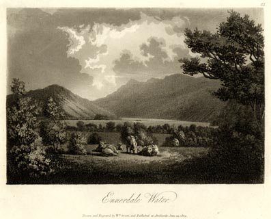 click to enlarge click to enlargeGN1623.jpg Plate 23 from a series. printed at bottom:- "Ennerdale Water. / Drawn and Engraved by Wm. Green, and Published at Ambleside, June 24, 1804." printed at top right:- "23" at :- "E [ ] / 1806" item:- Armitt Library : 2014.171 Image © see bottom of page |
|||||||||||||||||||||||||
|
|
||||||||||||||||||||||||||
| evidence:- | old map:- Laurie and Whittle 1806 placename:- Ennerdale Water |
|||||||||||||||||||||||||
| source data:- | Road map, Completion of the Roads to the Lakes, scale about 10
miles to 1 inch, by Nathaniel Coltman? 1806, published by Robert
H Laurie, 53 Fleet Street, London, 1834. click to enlarge click to enlargeLw18.jpg "Ennerdale Water" lake item:- private collection : 18.18 Image © see bottom of page |
|||||||||||||||||||||||||
|
|
||||||||||||||||||||||||||
| evidence:- | old map:- Cooper 1808 placename:- Ennerdale Water |
|||||||||||||||||||||||||
| source data:- | Map, uncoloured engraving, Cumberland, scale about 10.5 miles to
1 inch, drawn and engraved by Cooper, published by R Phillips,
Bridge Street, Blackfriars, London, 1808. click to enlarge click to enlargeCOP3.jpg "Ennerdale W." outline, shaded; lake item:- JandMN : 86 Image © see bottom of page |
|||||||||||||||||||||||||
|
|
||||||||||||||||||||||||||
| evidence:- | old text:- Green 1810 placename:- Ennerdale Water |
|||||||||||||||||||||||||
| source data:- | Set of prints, soft ground etchings, Sixty Studies from Nature,
by William Green, Ambleside, Westmorland, drawn 1808-10,
published 1810. goto source page 71:- "..." "The best views of the lake are about one mile east of the foot; this is inclosed ground, and the grouped and" goto sourcepage 72:- "single trees are picturesque, and associate well in composition with the distances: Bonus Knot, a mountain mass of rugged rock, is the side screen on the left, but this is contrasted by the western boundary, which, excepting at Anglingstone, is something smooth and uniform in its height all the way up the side of the lake: Among the mountains at the head of the water, are the Pillar and the Steeple." |
|||||||||||||||||||||||||
|
|
||||||||||||||||||||||||||
| evidence:- | old print:- Wilkinson 1810 (plate 40) placename:- Ennerdale Broad Water |
|||||||||||||||||||||||||
| source data:- | Print, uncoloured soft ground etching, Ennerdale Broad Water, Cumberland, by Joseph
Wilkinson, engraved by William Frederick Wells, published by R Ackermann, Repository
of Arts, 101 Strand, London, 1810.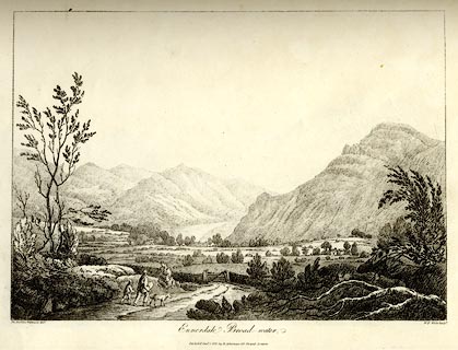 click to enlarge click to enlargeWKN140.jpg Plate 40 in Select Views in Cumberland, Westmoreland, and Lancashire. printed at bottom left, right, centre:- "The Revd. Jos: Wilkinson delt. / W. F. Wells Sculpt. / Ennerdale Broad-water / Publish'd Jany. 1. 1810. by R. Ackerman. 101. Strand. London." item:- Fell and Rock Climbing Club : MN4.40 Image © see bottom of page |
|||||||||||||||||||||||||
|
|
||||||||||||||||||||||||||
| evidence:- | old print:- Green 1814 (plate 42) placename:- Ennerdale Water |
|||||||||||||||||||||||||
| source data:- | Print, tinted soft ground etching, Ennerdale Water, Ennerdale and Kinniside, Cumberland,
by William Green, Ambleside, Westmorland, 1814.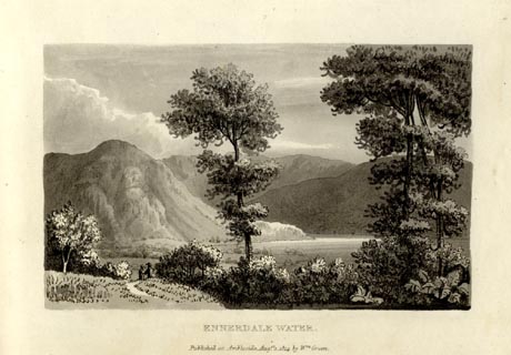 click to enlarge click to enlargeGN1042.jpg Plate 42 in Sixty Small Prints. printed at top right:- "42" printed at bottom:- "ENNERDALE WATER. / Published at Ambleside Augst. 1, 1814, by Wm. Green." item:- Armitt Library : A6653.42 Image © see bottom of page |
|||||||||||||||||||||||||
|
|
||||||||||||||||||||||||||
| evidence:- | old print:- Green 1814 (plate 42) placename:- Ennerdale Water |
|||||||||||||||||||||||||
| source data:- | Print, uncoloured soft ground etching, Ennerdale Water, Ennerdale and Kinniside, Cumberland,
by William Green, Ambleside, Westmorland, 1814.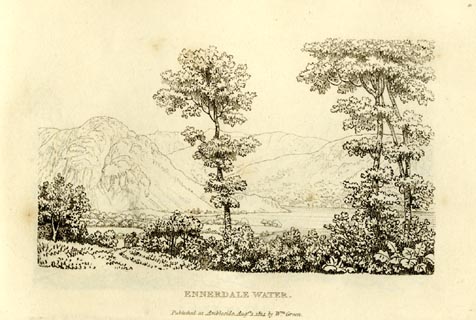 click to enlarge click to enlargeGN0942.jpg Plate 42 in Sixty Small Prints. printed at top right:- "42" printed at bottom:- "ENNERDALE WATER. / Published at Ambleside Augst. 1, 1814, by Wm. Green." item:- Armitt Library : A6656.42 Image © see bottom of page |
|||||||||||||||||||||||||
|
|
||||||||||||||||||||||||||
| evidence:- | old text:- Green 1814 placename:- Ennerdale Water |
|||||||||||||||||||||||||
| source data:- | Set of prints, soft ground etchings, Sixty Small Prints, with
text, A Description of a Series of Sixty Small Prints, by
William Green, Ambleside, Westmorland, 1814. goto source page 22:- "..." "ENNERDALE WATER." "Ennerdale Water may be visited by foot or horsemen from the Inn at Buttermere, by keeping the road down the" goto sourcepage 23:- "meadows, and passing Scale Force on the left, to a little lake called Fluttering Tarn, which must likewise be kept on the left. This road, though of considerable ascent, is not over the highest part of the mountain. After having gained the Tarn, the traveller will, from the north-east, presently see Ennerdale Water, which is by many thought to be an interesting lake. From the Inn at Scale Hill the carriage-road lies on the eastern side of Low's Water through Lampleugh; but the horse and foot-road is between Crummock Water and Low's Water; afterwards skirt Melbreak, which keep on the left for some time; then on the right turn up the side of the hill to Fluttering Tarn, before spoken of." "The best views of this lake are about one mile east of the foot; this is enclosed ground, and the grouped and single trees are picturesque, and associate well in composition with the distances; ... Bonus Knott, a mountain mass of rugged rock, is the side screen on the left; but this is contrasted by the western boundary, which, excepting at Angling Stone, is rather smooth and uniform in its height all the way to the head of the lake. Amongst the distant mountains are the Pillar and the Steeple." |
|||||||||||||||||||||||||
|
|
||||||||||||||||||||||||||
| evidence:- | old print:- Green 1815 placename:- Ennerdale Water item:- sheep |
|||||||||||||||||||||||||
| source data:- | Print, coloured aquatint, Ennerdale Water, Ennerdale and Kinniside, Cumberland, by
William Green, Ambleside, Westmorland, 1815.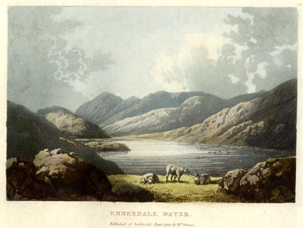 click to enlarge click to enlargeGN0551.jpg Plate 55 in Lake Scenery. printed at upper right:- "55" printed at bottom:- "ENNERDALE WATER. / Published at Ambleside, June 1, 1815, by Wm. Green." item:- Armitt Library : A6646.51 Image © see bottom of page |
|||||||||||||||||||||||||
|
|
||||||||||||||||||||||||||
| evidence:- | old map:- Otley 1818 |
|||||||||||||||||||||||||
| source data:- | Map, uncoloured engraving, The District of the Lakes,
Cumberland, Westmorland, and Lancashire, scale about 4 miles to
1 inch, by Jonathan Otley, 1818, engraved by J and G Menzies,
Edinburgh, Scotland, published by Jonathan Otley, Keswick,
Cumberland, et al, 1833. OT02NY01.jpg  OT02NY11.jpg item:- JandMN : 48.1 Image © see bottom of page |
|||||||||||||||||||||||||
|
|
||||||||||||||||||||||||||
| evidence:- | old map:- Hall 1820 (Cmd) placename:- Ennerdale Water |
|||||||||||||||||||||||||
| source data:- | Map, hand coloured engraving, Cumberland, scale about 21 miles
to 1 inch, engraved by Sidney Hall, published by S Leigh, 18
Strand, London, 1820-31. click to enlarge click to enlargeHA14.jpg "Ennerdale W[r.]" outline, shaded; lake item:- JandMN : 91 Image © see bottom of page |
|||||||||||||||||||||||||
|
|
||||||||||||||||||||||||||
| evidence:- | old print:- Fielding and Walton 1821 (plate 31) placename:- Ennerdale Water |
|||||||||||||||||||||||||
| source data:- | Print, coloured aquatint, Ennerdale Water, Ennerdale and Kinniside, Cumberland, drawn
by Theodore H A Fielding, published by R Ackermann, 101 Strand, London, 1821.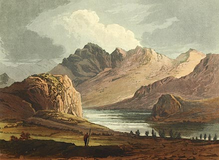 click to enlarge click to enlargeFW0131.jpg Bowness Knott and Angler's Crag are prominent. Tipped in opposite p.206 in A Picturesque Tour of the English Lakes. item:- Dove Cottage : 1993.R566.31 Image © see bottom of page |
|||||||||||||||||||||||||
|
|
||||||||||||||||||||||||||
| evidence:- | descriptive text:- Otley 1823 (5th edn 1834) placename:- Ennerdale Lake item:- trout; char; fishing |
|||||||||||||||||||||||||
| source data:- | Guide book, A Concise Description of the English Lakes, the
mountains in their vicinity, and the roads by which they may be
visited, with remarks on the mineralogy and geology of the
district, by Jonathan Otley, published by the author, Keswick,
Cumberland now Cumbria, by J Richardson, London, and by Arthur
Foster, Kirkby Lonsdale, Cumbria, 1823; published 1823-49,
latterly as the Descriptive Guide to the English Lakes. goto source Page 26:- "ENNERDALE LAKE" "Is about two miles and a half in length, and three quarters of a mile in breadth. It is more difficult to obtain a good view of this than of any other lake. The best general view may be had near How Hall; but, as the principal mountain scenery, with part of the lake, is seen to advantage from the road by which tourists generally pass from Wastwater to Lowes Water and Buttermere; few like to extend the journey two or three miles for any improvement that can be made to the view. Pedestrians, anxious to explore the inmost recesses of the mountains, may follow the lake to its head, and after passing the sequestered farm of Gillerthwaite, continue their route four of five miles along the narrow dale, by the transparent stream of the Lisa, which is fed by the crystal springs issuing from the side of the mountains; and either turn to the left, by the pass called Scarf Gap, to Buttermere; or to the right, over the Black Sail, to Wasdale head. This way a horse might be taken, but it would be found more troublesome than useful." "This lake is well stocked with trout: here is also an inferior kind of char, which enter the river in autumn to deposit their spawn; contrary to the habits of those in the lakes of Buttermere and Crummock. There are two small public houses at Ennerdale Bridge; but not calculated to afford much accommodation to travellers." |
|||||||||||||||||||||||||
|
|
||||||||||||||||||||||||||
| evidence:- | descriptive text:- Ford 1839 (3rd edn 1843) placename:- Ennerdale Water placename:- Lake of Ennerdale item:- depth, Ennerdale Water |
|||||||||||||||||||||||||
| source data:- | Guide book, A Description of Scenery in the Lake District, by
Rev William Ford, published by Charles Thurnam, Carlisle, by W
Edwards, 12 Ave Maria Lane, Charles Tilt, Fleet Street, William
Smith, 113 Fleet Street, London, by Currie and Bowman,
Newcastle, by Bancks and Co, Manchester, by Oliver and Boyd,
Edinburgh, and by Sinclair, Dumfries, 1839. goto source Page 79:- "..." "LAKE OF ENNERDALE." "This water is about two miles and a half long; near its foot is half a mile across, but towards the head it grows much narrower. It is well stocked with trout and an inferior kind of char. It is much secluded, difficult of access, and, consequently, rarely seen. The shores are bold and somewhat savage. The best scenery is between its foot and the side of the hill to the north, in descending from Floutern Tarn. Tourists generally rest satisfied with what may be seen in passing the lower end, on their progress to Buttermere, few liking to extend their journey into the dale. ..." goto sourcePage 177:- "A TABLE" "OF THE LENGTH, BREADTH, &c. OF THE LAKES," "COLLECTED FROM DIFFERENT AUTHORITIES."
|
|||||||||||||||||||||||||
|
|
||||||||||||||||||||||||||
| evidence:- | old map:- Ford 1839 map placename:- Ennerdale Water |
|||||||||||||||||||||||||
| source data:- | Map, uncoloured engraving, Map of the Lake District of
Cumberland, Westmoreland and Lancashire, scale about 3.5 miles
to 1 inch, published by Charles Thurnam, Carlisle, and by R
Groombridge, 5 Paternoster Row, London, 3rd edn 1843. FD02NY11.jpg "Ennerdale Wr." Outline with form lines. item:- JandMN : 100.1 Image © see bottom of page |
|||||||||||||||||||||||||
|
|
||||||||||||||||||||||||||
| evidence:- | old map:- Ford 1839 map placename:- Ennerdale Water |
|||||||||||||||||||||||||
| source data:- | Map, uncoloured engraving, Map of the Lake District of
Cumberland, Westmoreland and Lancashire, scale about 3.5 miles
to 1 inch, published by Charles Thurnam, Carlisle, and by R
Groombridge, 5 Paternoster Row, London, 3rd edn 1843. FD02NY01.jpg "Ennerdale Wr." Outline with form lines. item:- JandMN : 100.1 Image © see bottom of page |
|||||||||||||||||||||||||
|
|
||||||||||||||||||||||||||
| evidence:- | old map:- Ford 1839 map placename:- Ennerdale Water |
|||||||||||||||||||||||||
| source data:- | Map, uncoloured engraving, Map of the Lake District of
Cumberland, Westmoreland and Lancashire, scale about 3.5 miles
to 1 inch, published by Charles Thurnam, Carlisle, and by R
Groombridge, 5 Paternoster Row, London, 3rd edn 1843. FD02NY11.jpg "Ennerdale Wr." Outline with form lines. item:- JandMN : 100.1 Image © see bottom of page |
|||||||||||||||||||||||||
|
|
||||||||||||||||||||||||||
| evidence:- | old map:- Ford 1839 map placename:- Ennerdale Water |
|||||||||||||||||||||||||
| source data:- | Map, uncoloured engraving, Map of the Lake District of
Cumberland, Westmoreland and Lancashire, scale about 3.5 miles
to 1 inch, published by Charles Thurnam, Carlisle, and by R
Groombridge, 5 Paternoster Row, London, 3rd edn 1843. FD02NY01.jpg "Ennerdale Wr." Outline with form lines. item:- JandMN : 100.1 Image © see bottom of page |
|||||||||||||||||||||||||
|
|
||||||||||||||||||||||||||
| evidence:- | old drawing:- Aspland 1840s-60s |
|||||||||||||||||||||||||
| source data:- | Drawing, pencil, Ennerdale Water, Ennerdale, Cumberland, by Theophilus Lindsey Aspland,
1849.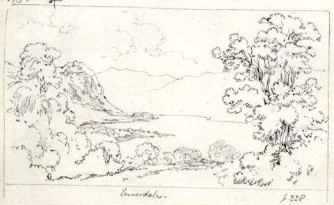 click to enlarge click to enlargeAS0185.jpg "Ennerdale / p 288" item:- Armitt Library : 1958.487.84 Image © see bottom of page |
|||||||||||||||||||||||||
|
|
||||||||||||||||||||||||||
| evidence:- | old map:- Wyld 1847 placename:- Ennerdale Water |
|||||||||||||||||||||||||
| source data:- | Map, uncoloured engraving, Loweswater, Crummock, Buttermere,
Ennerdale and Wastwaters, Cumberland, scale about 3.5 miles to 1
inch, by James Wyld, published by John Johnstone, Paternoster
Row, London, et al, 1847.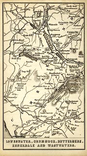 click to enlarge click to enlargeWLD3M3.jpg printed at bottom:- "LOWESWATER, CRUMMOCK, BUTTERMERE, / ENNERDALE AND WASTWATERS." item:- Armitt Library : A1201.66 Image © see bottom of page |
|||||||||||||||||||||||||
|
|
||||||||||||||||||||||||||
| evidence:- | old map:- Garnett 1850s-60s H placename:- Ennerdale Water |
|||||||||||||||||||||||||
| source data:- | Map of the English Lakes, in Cumberland, Westmorland and
Lancashire, scale about 3.5 miles to 1 inch, published by John
Garnett, Windermere, Westmorland, 1850s-60s. GAR2NY01.jpg outline with shore form lines, lake or tarn  GAR2NY11.jpg "ENNERDALE WR." item:- JandMN : 82.1 Image © see bottom of page |
|||||||||||||||||||||||||
|
|
||||||||||||||||||||||||||
| evidence:- | old print:- Pyne 1853 placename:- Ennerdale Lake |
|||||||||||||||||||||||||
| source data:- | Print, tinted lithograph, Ennerdale Lake, Cumberland, by James Baker Pyne, engraved
by W Gauci, published by Thomas Agnew and Sons, Manchester, Lancashire, 1853.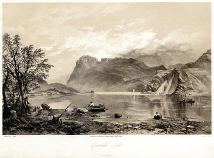 click to enlarge click to enlargePYN205.jpg "PAINTED BY J. B. PYNE. / W. GAUCI LITH. / MANCHESTER, PUBLISHED BY THOMAS AGNEW & SONS, 1853. / Ennerdale Lake / M & N HANHART IMPT." item:- Armitt Library : A6678.6 Image © see bottom of page |
|||||||||||||||||||||||||
|
|
||||||||||||||||||||||||||
| evidence:- | old print:- Pyne 1853 placename:- Ennerdale Lake |
|||||||||||||||||||||||||
| source data:- | Print, coloured lithograph, Ennerdale Lake, Cumberland, by James Baker Pyne, engraved
by W Gauci, published by Thomas Agnew and Sons, Manchester, Lancashire, 1853.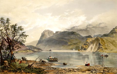 click to enlarge click to enlargePYN405.jpg item:- Armitt Library : A6677.6 Image © see bottom of page |
|||||||||||||||||||||||||
|
|
||||||||||||||||||||||||||
| evidence:- | old text:- Martineau 1855 item:- depth, Ennerdale Water |
|||||||||||||||||||||||||
| source data:- | Guide book, A Complete Guide to the English Lakes, by Harriet
Martineau, published by John Garnett, Windermere, Westmorland,
and by Whittaker and Co, London, 1855; published 1855-76. goto source Page 180:- "A TABLE OF THE LENGTH, BREADTH, AND DEPTH OF THE LAKES." "No. : Names of Lakes. : Counties : Length in Miles. : Extreme breadth in Miles : Extreme depth in Feet : Height above the Sea" "15 : Ennerdale : Cumberland : 2½ : ½: 80 : -" |
|||||||||||||||||||||||||
|
|
||||||||||||||||||||||||||
| evidence:- | old map:- Mill and Heawood 1895 placename:- Ennerdale Water |
|||||||||||||||||||||||||
| source data:- | Map, Buttermere, Crummock Water, and Ennerdale Water, scale 2
inches to 1 mile, with soundings by Hugh Robert Mill and Edward
Heawood, by Bartholomew, Edinburgh, Scotland, published by
George Philip and Son, 32 Fleet Street, London, etc, 1895.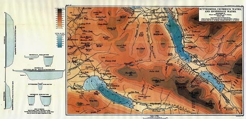 click to enlarge click to enlargeMIL5.jpg - with soundings and sections item:- Kendal Library : 7.4 Image © see bottom of page |
|||||||||||||||||||||||||
|
|
||||||||||||||||||||||||||
| evidence:- | old print:- Heaton Cooper 1905 (edn 1908) placename:- Ennerdale Lake |
|||||||||||||||||||||||||
| source data:- | Print, colour halftone, Ennerdale Lake at Sunset, Ennerdale and Kinniside, Cumberland,
from a watercolour painting by Alfred Heaton Cooper, published by Adam and Charles
Black, London, 2nd edn 1908.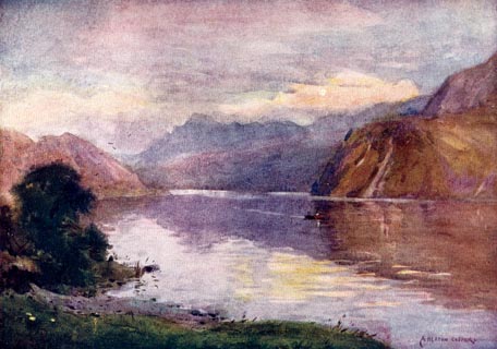 click to enlarge click to enlargeHC0137.jpg Opposite p.98 of The English Lakes, painted by Alfred Heaton Cooper, described by William T Palmer. printed at tissue opposite the print:- "ENNERDALE LAKE AT SUNSET" printed at signed lower right:- "A HEATON COOPER" item:- JandMN : 468.37 Image © see bottom of page |
|||||||||||||||||||||||||
|
|
||||||||||||||||||||||||||
| evidence:- | old map:- Postlethwaite 1877 (3rd edn 1913) |
|||||||||||||||||||||||||
| source data:- | Map, uncoloured engraving, Map of the Lake District Mining Field, Westmorland, Cumberland,
Lancashire, scale about 5 miles to 1 inch, by John Postlethwaite, published by W H
Moss and Sons, 13 Lowther Street, Whitehaven, Cumberland, 1877 edn 1913.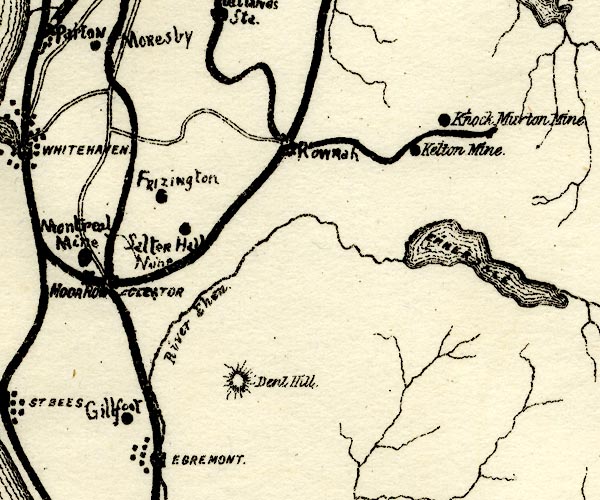 PST2NY01.jpg "ENNERDALE" lake item:- JandMN : 162.2 Image © see bottom of page |
|||||||||||||||||||||||||
|
|
||||||||||||||||||||||||||
| evidence:- | old print:- MacBride 1922 placename:- Ennerdale Lake |
|||||||||||||||||||||||||
| source data:- | Print, colour, Ennerdale Lake, by Alfred Heaton Cooper, published by Adam and Charles
Black, 4-6 Soho Square, London, 2nd edn 1928.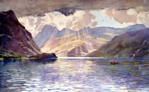 click to enlarge click to enlargeMB0102.jpg Tipped in opposite p.8 in Wild Lakeland by MacKenzie MacBride. printed at bottom:- "ENNERDALE LAKE" signed at lower right:- "A. HEATON COOPER" item:- JandMN : 195.4 Image © see bottom of page |
|||||||||||||||||||||||||
|
|
||||||||||||||||||||||||||
| evidence:- | old print:- |
|||||||||||||||||||||||||
| source data:- | Print, uncoloured engraving, Ennerdale, from Scarf Gap, Cumberland, engraved by Whymper,
published 1920s-30s?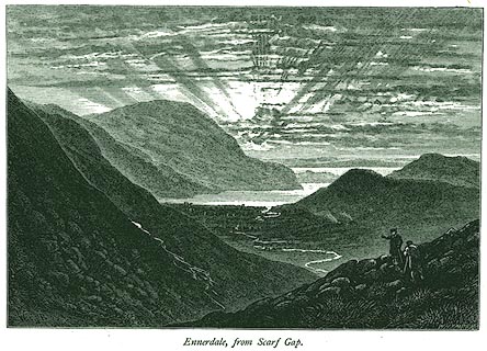 click to enlarge click to enlargePR0319.jpg On page 233 of Picturesque Europe, The Lake Country. printed at lower right:- "WHYMPER. SC" printed at bottom:- "Ennerdale, from Scarf Gap." item:- Dove Cottage : 2008.107.319 Image © see bottom of page |
|||||||||||||||||||||||||
|
|
||||||||||||||||||||||||||
| evidence:- | old print:- placename:- Ennerdale Water item:- sailing |
|||||||||||||||||||||||||
| source data:- | Print, uncoloured engraving, Ennerdale Water, Ennerdale and Kinniside, Cumberland,
drawn by R Shepherd, published 1860s?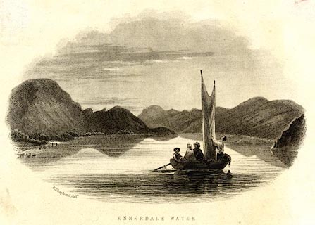 click to enlarge click to enlargePR0512.jpg printed at bottom left, centre:- "R. Shepherd delt. / ENNERDALE WATER" item:- Dove Cottage : 2008.107.461 Image © see bottom of page |
|||||||||||||||||||||||||
|
|
||||||||||||||||||||||||||
| evidence:- | old print:- placename:- Ennerdale Water |
|||||||||||||||||||||||||
| source data:- | Print, uncoloured engraving, Ennerdale Water, Cumberland, engraved by Orrin Smith
and H Harral, published late 19th century?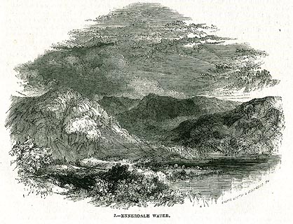 click to enlarge click to enlargePR0340.jpg On page 228 of The Land We Live In. printed at lower right:- "ORRIN SMITH &H HARRAL SC" printed at bottom:- "2.- ENNERDALE WATER." item:- Dove Cottage : 2008.107.340 Image © see bottom of page |
|||||||||||||||||||||||||
|
|
||||||||||||||||||||||||||
| evidence:- | old print:- Pyne 1853 placename:- Ennerdale Lake |
|||||||||||||||||||||||||
| source data:- | Drawn by James Barker Pyne, 1848-1853, lithographed by T Picken, 1859.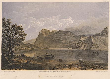 click to enlarge click to enlargePY16.jpg "Ennerdale Lake" item:- JandMN : 97.15 Image © see bottom of page |
|||||||||||||||||||||||||
|
|
||||||||||||||||||||||||||
| evidence:- | old print:- Linton 1852 placename:- Ennerdale Water item:- sailing boat; boat |
|||||||||||||||||||||||||
| source data:- | Print, engraving, Ennerdale Water, Ennerdale and Kinniside, Cumberland, drawn by R
Shepherd, engraved by W H Lizars, Edinburgh, published by Whittaker and Co, London,
and by R Gibson and Son and by Callander and Dixon, Whitehaven, Cumberland, 1852.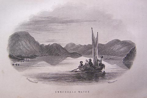 click to enlarge click to enlargeLN1E03.jpg Tipped in opposite p.18 of A Handbook of the Whitehaven and Furness Railway, by John Linton. printed at bottom left, right, centre:- "R. Shepherd delt. / W. H. Lizars sculpt. / ENNERDALE WATER" item:- Armitt Library : A1158.3 Image © see bottom of page |
|||||||||||||||||||||||||
|
|
||||||||||||||||||||||||||
| evidence:- | old print:- Garnett 1850s-60s F |
|||||||||||||||||||||||||
| source data:- | Print, uncoloured engraving, Ennerdale, Cumberland, drawn and engraved by William
Banks and Son, Edinburgh, published by John Garnett, Windermere, Westmorland, 1850s-60s?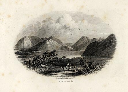 click to enlarge click to enlargeGAR711.jpg Included in Views of the English Lakes. printed at bottom:- "Drawn & Engd. by W. Banks &Son, Edinr. / ENNERDALE." item:- JandMN : 165.11 Image © see bottom of page |
|||||||||||||||||||||||||
|
|
||||||||||||||||||||||||||
| evidence:- | outline view:- Tattersall 1836 (version 1869) placename:- Ennerdale Lake |
|||||||||||||||||||||||||
| source data:- | Print, hand coloured, Ennerdale Lake, from the North East, Cumberland, drawn by George
Tattersall, 1836, engraved by W F Topham, published by T J Allman, 463 Oxford Street,
London, 1869.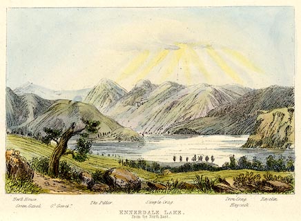 click to enlarge click to enlargeTAT215.jpg Included in The Lakes of England, by W F Topham. printed at bottom:- "ENNERDALE LAKE, / from the North East." printed at bottom:- "Herd House. / Green Gavel. / Gt. Gavel. / The Pillar. / Steeple Crag. / Iron Crag. / Haycock. / Revelin." item:- Armitt Library : A1067.15 Image © see bottom of page |
|||||||||||||||||||||||||
|
|
||||||||||||||||||||||||||
| evidence:- | outline view:- Tattersall 1836 placename:- Ennerdale Lake |
|||||||||||||||||||||||||
| source data:- | Print, engraving, Ennerdale Lake, from the North East, Cumberland, drawn by George
Tattersall, engraved by W F Topham, published by Sherwood and Co, Paternoster Row,
London, about 1836.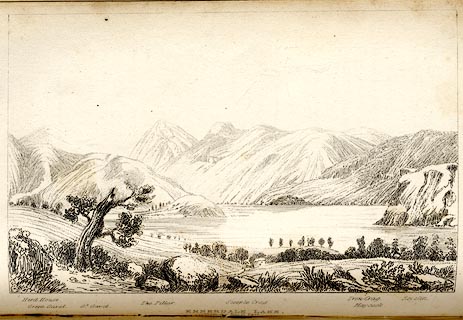 click to enlarge click to enlargeTAT133.jpg The print is captioned with mountain names and acts as an outline view. Tipped in opposite p.83 of The Lakes of England, by George Tattersall. printed at bottom:- "ENNERDALE LAKE, / from the North East." printed at bottom left to right:- "Herd House. / Green Gavel. / Gt. Gavel. / The Pillar. / Steeple Crag. / Iron Crag. / Haycock. / Revelin." item:- Armitt Library : A1204.34 Image © see bottom of page |
|||||||||||||||||||||||||
|
|
||||||||||||||||||||||||||
| evidence:- | old print:- Rose 1832-35 |
|||||||||||||||||||||||||
| source data:- | Print, engraving, Ennerdale Water from How Hall, Cumberland, by Thomas Allom, engraved
by J Sands, 1833.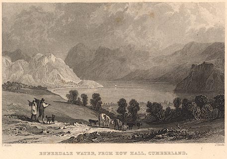 click to enlarge click to enlargeR203.jpg "Ennerdale Water from How Hall, Cumberland" item:- JandMN : 96.1 Image © see bottom of page |
|||||||||||||||||||||||||
|
|
||||||||||||||||||||||||||
| evidence:- | old print:- Green 1819 placename:- Ennerdale Water |
|||||||||||||||||||||||||
| source data:- | Print, aquatint, Ennerdale Water, Cumberland, by William Green, 1819, published by
R Lough and Co, Chronicle Office, Finkle Street, Kendal, and others, 1820.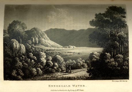 click to enlarge click to enlargeGN0126.jpg Tipped in opposite vol.2 p.228 of The Tourist's New Guide, by William Green. printed at bottom right, centre:- "Vol.2, page 228, line 14. / ENNERDALE WATER. / Published at Ambleside, Augt. 1. 1819, by Wm. Green." item:- Armitt Library : A1141.27 Image © see bottom of page |
|||||||||||||||||||||||||
|
|
||||||||||||||||||||||||||
| evidence:- | old print:- placename:- Ennerdale Water |
|||||||||||||||||||||||||
| source data:- | Print, uncoloured aquatint, Ennerdale Water, Cumberland, drawn, engraved and published
by William Green, Ambleside, Westmorland, 1804.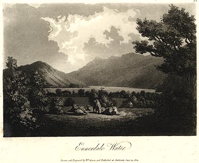 click to enlarge click to enlargePR0452.jpg Included in vol.2, plate 23 in the Tourist's New Guide, 1819. printed at bottom:- "Ennerdale Water. / Drawn and Engraved by Wm. Green, and Published at Ambleside, June 24, 1804." item:- private collection : 116 Image © see bottom of page |
|||||||||||||||||||||||||
|
|
||||||||||||||||||||||||||
| evidence:- | old print:- Rumney 1899 placename:- Ennerdale Lake |
|||||||||||||||||||||||||
| source data:- | Print, halftone photograph, Ennerdale Lake, Cumberland, published by George Philip
and Son, 32 Fleet Street, London, and Liverpool, 1899. click to enlarge click to enlargeRUM122.jpg On p.65 of the Cyclist's Guide to the English Lake District, by A W Rumney. printed at bottom:- "ENNERDALE LAKE." item:- JandMN : 147.23 Image © see bottom of page |
|||||||||||||||||||||||||
|
|
||||||||||||||||||||||||||
| evidence:- | perhaps old painting:- |
|||||||||||||||||||||||||
| source data:- | Painting, watercolour, Mountain and Lake Scene, Cumbria, by Frederick Clive Newcome,
1889.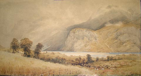 click to enlarge click to enlargePR0925.jpg Autumn; to left of composition lies a sloping cornfield flanked by a hedge beyond which the roof of a small building is visible in the midst a stand of tall trees. A narrow path winds downhill beside the cornfield towards the lakeside; three geese stand amidst clumps of heather beside the path to right of composition. Intervening landscape of woods and fields fills centre of composition. Barren fells rise above the lake, some of them cloaked in mist. Perhaps Angler's Crag on Ennerdale Water. signed &dated at bottom left:- "NEWCOME 89" item:- Tullie House Museum : 1936.4.4 Image © Tullie House Museum |
|||||||||||||||||||||||||
|
|
||||||||||||||||||||||||||
| evidence:- | old painting:- placename:- Ennerdale Lake |
|||||||||||||||||||||||||
| source data:- | Painting, oil painting, Ennerdale Lake, Cumberland, 1840s-50s.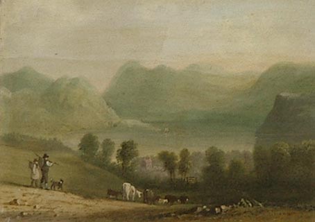 click to enlarge click to enlargePR1308.jpg Summertime; view from an elevated perspective across a lake to the fells which surround it. In foreground field a man and boy drive a small herd of cattle downhill towards a farm nestling amongst the trees which obscure the nearside shore of the lake. labelled at reverse:- "ENNERDALE LAKE. I THINK WAS PROPERTY OF HOW HALL PENRITH CUMBERLAND. PICTURE PAINTED FROM HOW HALL FOR MISS DICKINSON WHO BECAME MRS UNSWORTH MY GRANDMOTHER. I SHOULD LIKE THIS SMALL PICTURE TO GO BACK TO A PENRITH MUSEUM OR A SUITABLE MUSEUM. I BELIEVE THE LAKE IS NOW LOST IN A RESEVOIR. Kathleen M Wild 28.II.72" item:- Tullie House Museum : 1981.28 Image © Tullie House Museum |
|||||||||||||||||||||||||
|
|
||||||||||||||||||||||||||
| evidence:- | old drawing:- placename:- Ennerdale Water |
|||||||||||||||||||||||||
| source data:- | Drawing, Ennerdale Water, Cumberland, by William Havell, 1800s-10s.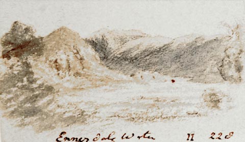 click to enlarge click to enlargePR1407.jpg View of Ennerdale Water surrounded by hills with trees framing the view. One of a set of twenty views of the lake district executed by the artist on one sheet of paper. at bottom:- "Ennerdale Water II 22d" item:- Tullie House Museum : 2009.89.51 Image © Tullie House Museum |
|||||||||||||||||||||||||
|
|
||||||||||||||||||||||||||
 Click to enlarge BWO07.jpg Looking up. (taken 16.5.2012) 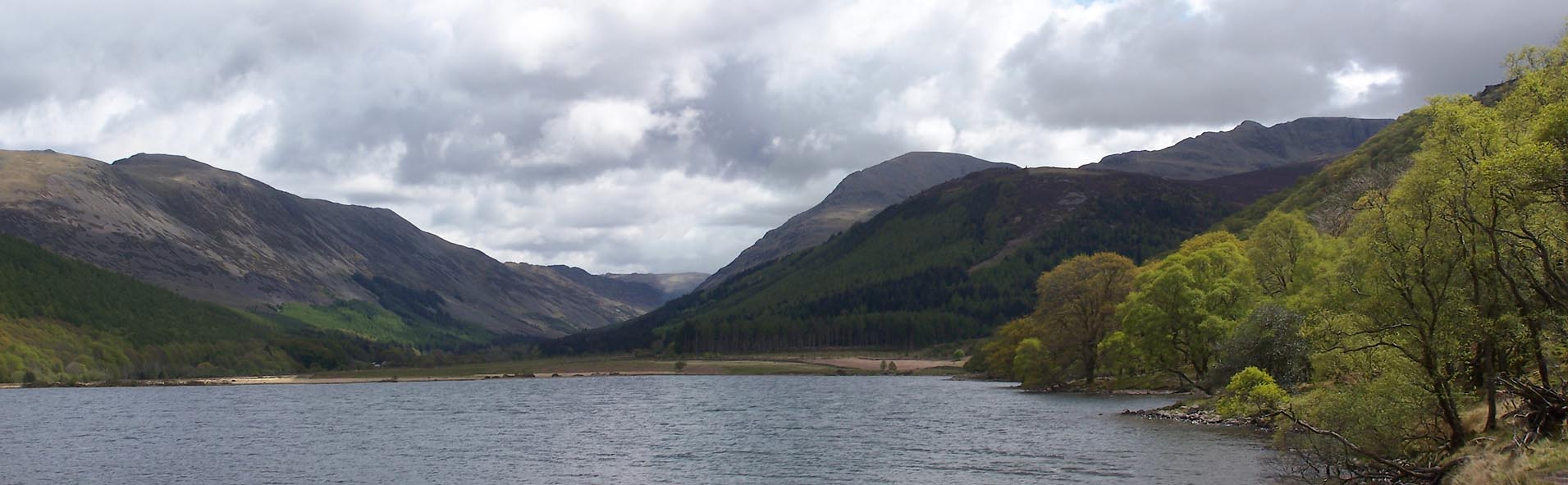 Click to enlarge BWO08.jpg Looking up. (taken 16.5.2012) 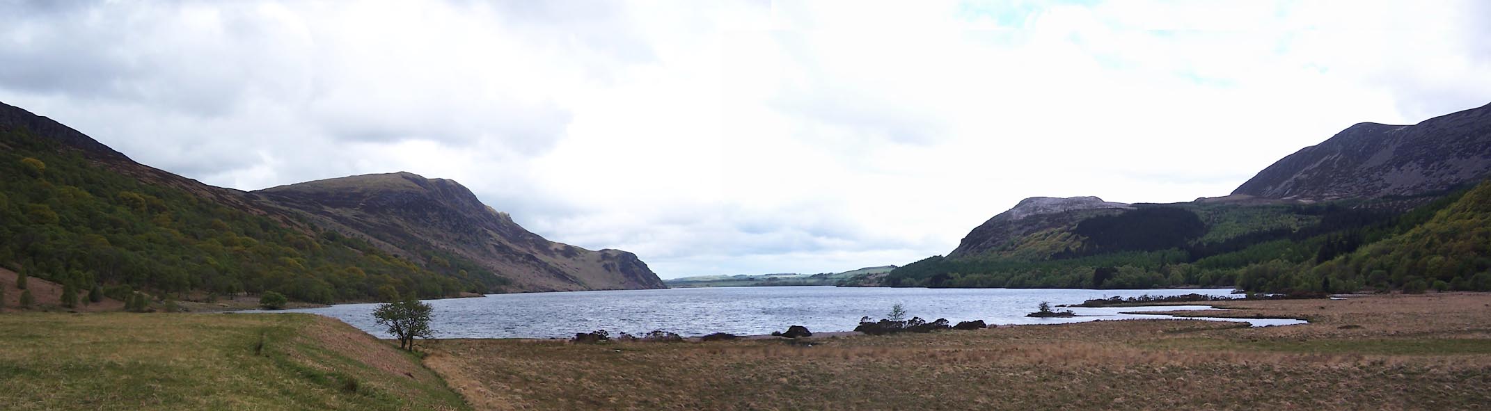 Click to enlarge BWO09.jpg Looking down. (taken 16.5.2012) 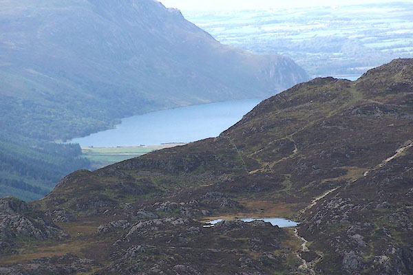 BMR56.jpg From between Grey Knotts and Brandreth. (taken 22.9.2006) 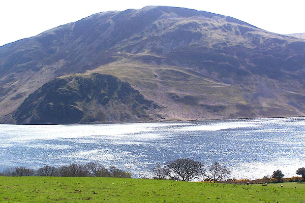 BMA12.jpg Angler's Crag and Crag Fell. (taken 3.5.2006) 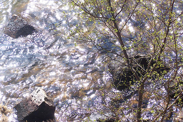 BMA17.jpg (taken 3.5.2006) 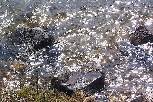 BMA18.jpg (taken 3.5.2006) 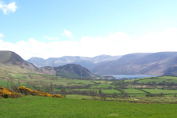 BMA04.jpg From Cauda Brow. (taken 3.5.2006) 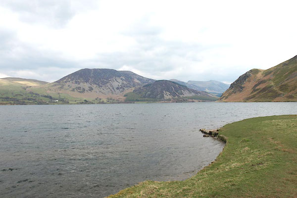 BPA33.jpg From the foot of the lake. (taken 16.4.2008) 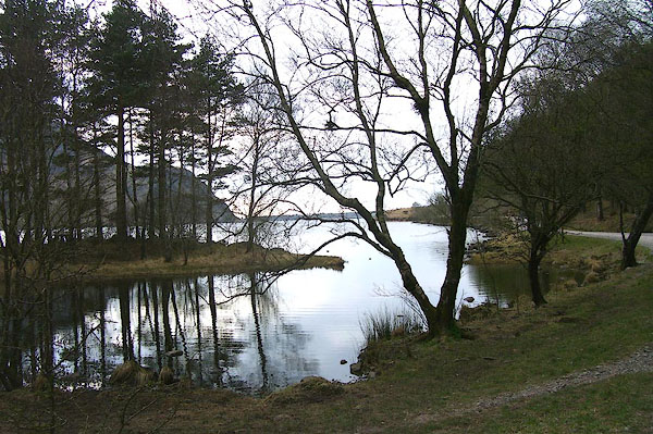 BPA58.jpg (taken 16.4.2008) 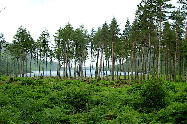 BPK29.jpg (taken 30.6.2008) 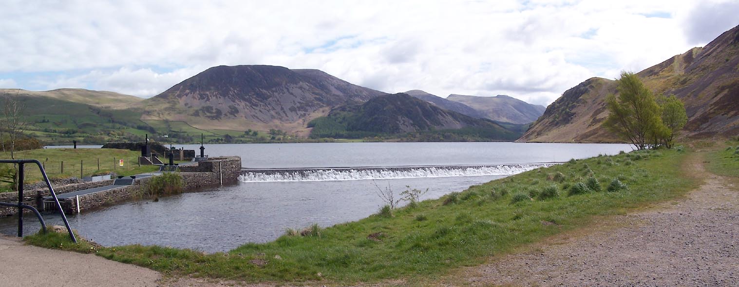 Click to enlarge BWO06.jpg Dam at the foot of the lake. (taken 16.5.2012) 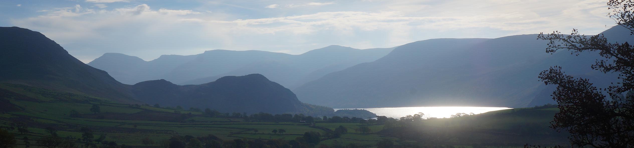 Click to enlarge CEE22.jpg (taken 27.10.2015) |
||||||||||||||||||||||||||
|
|
||||||||||||||||||||||||||
| notes:- |
Nancy Price, who allocated religious denominations to the lakes, said:- |
|||||||||||||||||||||||||
| "Ennerdale is certainly a Quaker lake. Before I ever saw her my fancy clother her in
gentle shades of grey, and now that I know her well I find I was not mistaken, her
fells and waters have the subtle colour of a wood pigeon's wing." |
||||||||||||||||||||||||||
| William Gilpin was not the end of fancy. |
||||||||||||||||||||||||||
| Baron 1925 |
||||||||||||||||||||||||||
|
|
||||||||||||||||||||||||||
| hearsay:- |
The freshwater shrimp, Mysis relicta, lives in the lake. |
|||||||||||||||||||||||||
|
|
||||||||||||||||||||||||||
Lakes Guides menu.