 Old Cumbria Gazetteer
 |
 |
|
||||||||||||||||||||||||||||||||||||||||||||||
| Hadrian's Wall | ||||||||||||||||||||||||||||||||||||||||||||||||
| civil parish:- | Bowness (formerly Cumberland) | |||||||||||||||||||||||||||||||||||||||||||||||
| civil parish:- | Burgh by Sands (formerly Cumberland) | |||||||||||||||||||||||||||||||||||||||||||||||
| civil parish:- | Beaumont (formerly Cumberland) | |||||||||||||||||||||||||||||||||||||||||||||||
| civil parish:- | Stanwix Rural (formerly Cumberland) | |||||||||||||||||||||||||||||||||||||||||||||||
| civil parish:- | Irthington (formerly Cumberland) | |||||||||||||||||||||||||||||||||||||||||||||||
| civil parish:- | Burtholme (formerly Cumberland) | |||||||||||||||||||||||||||||||||||||||||||||||
| civil parish:- | Waterhead (formerly Cumberland) | |||||||||||||||||||||||||||||||||||||||||||||||
| civil parish:- | Upper Denton (formerly Cumberland) | |||||||||||||||||||||||||||||||||||||||||||||||
| county:- | Cumbria | |||||||||||||||||||||||||||||||||||||||||||||||
| locality type:- | roman wall | |||||||||||||||||||||||||||||||||||||||||||||||
| 1Km square:- | NY6166 (etc) | |||||||||||||||||||||||||||||||||||||||||||||||
| 10Km square:- | NY26 | |||||||||||||||||||||||||||||||||||||||||||||||
| 10Km square:- | NY25 | |||||||||||||||||||||||||||||||||||||||||||||||
| 10Km square:- | NY35 | |||||||||||||||||||||||||||||||||||||||||||||||
| 10Km square:- | NY45 | |||||||||||||||||||||||||||||||||||||||||||||||
| 10Km square:- | NY46 | |||||||||||||||||||||||||||||||||||||||||||||||
| 10Km square:- | NY56 | |||||||||||||||||||||||||||||||||||||||||||||||
| 10Km square:- | NY66 | |||||||||||||||||||||||||||||||||||||||||||||||
| county:- | Northumberland | |||||||||||||||||||||||||||||||||||||||||||||||
|
|
||||||||||||||||||||||||||||||||||||||||||||||||
| evidence:- | old map:- OS County Series (Cmd 11 16) |
|||||||||||||||||||||||||||||||||||||||||||||||
| source data:- | Maps, County Series maps of Great Britain, scales 6 and 25
inches to 1 mile, published by the Ordnance Survey, Southampton,
Hampshire, from about 1863 to 1948. "ROMAN WALL (Site of)" "VALLUM (Site of)" |
|||||||||||||||||||||||||||||||||||||||||||||||
| source data:- | Maps, County Series maps of Great Britain, scales 6 and 25
inches to 1 mile, published by the Ordnance Survey, Southampton,
Hampshire, from about 1863 to 1948. "VALLUM" |
|||||||||||||||||||||||||||||||||||||||||||||||
| source data:- | Maps, County Series maps of Great Britain, scales 6 and 25
inches to 1 mile, published by the Ordnance Survey, Southampton,
Hampshire, from about 1863 to 1948. "ROMAN WALL (Site of)" |
|||||||||||||||||||||||||||||||||||||||||||||||
| source data:- | Maps, County Series maps of Great Britain, scales 6 and 25
inches to 1 mile, published by the Ordnance Survey, Southampton,
Hampshire, from about 1863 to 1948. "ROMAN WALL (Site of) / ..." "VALLUM (Site of)" |
|||||||||||||||||||||||||||||||||||||||||||||||
| source data:- | Maps, County Series maps of Great Britain, scales 6 and 25
inches to 1 mile, published by the Ordnance Survey, Southampton,
Hampshire, from about 1863 to 1948. "ROMAN WALL (Remains of)" |
|||||||||||||||||||||||||||||||||||||||||||||||
| source data:- | Maps, County Series maps of Great Britain, scales 6 and 25
inches to 1 mile, published by the Ordnance Survey, Southampton,
Hampshire, from about 1863 to 1948. "HADRIAN'S WALL (Course of)" "DITCH (Course of)" |
|||||||||||||||||||||||||||||||||||||||||||||||
| source data:- | Maps, County Series maps of Great Britain, scales 6 and 25
inches to 1 mile, published by the Ordnance Survey, Southampton,
Hampshire, from about 1863 to 1948. "HADRIAN'S WALL (Course of)" "HADRIAN'S WALL (Remains of)" "DITCH (Course of)" |
|||||||||||||||||||||||||||||||||||||||||||||||
| source data:- | Maps, County Series maps of Great Britain, scales 6 and 25
inches to 1 mile, published by the Ordnance Survey, Southampton,
Hampshire, from about 1863 to 1948. "ROMAN WALL (Site of)" |
|||||||||||||||||||||||||||||||||||||||||||||||
| source data:- | Maps, County Series maps of Great Britain, scales 6 and 25
inches to 1 mile, published by the Ordnance Survey, Southampton,
Hampshire, from about 1863 to 1948. "ROMAN WALL (Site of)" "VALLUM (Site of)" |
|||||||||||||||||||||||||||||||||||||||||||||||
| source data:- | Maps, County Series maps of Great Britain, scales 6 and 25
inches to 1 mile, published by the Ordnance Survey, Southampton,
Hampshire, from about 1863 to 1948. "ROMAN WALL (Site of)" |
|||||||||||||||||||||||||||||||||||||||||||||||
| source data:- | Maps, County Series maps of Great Britain, scales 6 and 25
inches to 1 mile, published by the Ordnance Survey, Southampton,
Hampshire, from about 1863 to 1948. "ROMAN WALL (Site of)" |
|||||||||||||||||||||||||||||||||||||||||||||||
| source data:- | Maps, County Series maps of Great Britain, scales 6 and 25
inches to 1 mile, published by the Ordnance Survey, Southampton,
Hampshire, from about 1863 to 1948. "ROMAN WALL (Site of)" "VALLUM (Site of)" |
|||||||||||||||||||||||||||||||||||||||||||||||
| source data:- | Maps, County Series maps of Great Britain, scales 6 and 25
inches to 1 mile, published by the Ordnance Survey, Southampton,
Hampshire, from about 1863 to 1948. "ROMAN WALL (Site of)" "VALLUM" |
|||||||||||||||||||||||||||||||||||||||||||||||
| source data:- | Maps, County Series maps of Great Britain, scales 6 and 25
inches to 1 mile, published by the Ordnance Survey, Southampton,
Hampshire, from about 1863 to 1948. "ROMAN WALL (Site of)" "VALLUM (Site of)" |
|||||||||||||||||||||||||||||||||||||||||||||||
| source data:- | Maps, County Series maps of Great Britain, scales 6 and 25
inches to 1 mile, published by the Ordnance Survey, Southampton,
Hampshire, from about 1863 to 1948. "VALLUM (Remains of)" |
|||||||||||||||||||||||||||||||||||||||||||||||
| source data:- | Maps, County Series maps of Great Britain, scales 6 and 25
inches to 1 mile, published by the Ordnance Survey, Southampton,
Hampshire, from about 1863 to 1948. "ROMAN WALL (Site of)" |
|||||||||||||||||||||||||||||||||||||||||||||||
|
|
||||||||||||||||||||||||||||||||||||||||||||||||
| evidence:- | old map:- Paris 1240s |
|||||||||||||||||||||||||||||||||||||||||||||||
| source data:- | Map, version B, northern England, Scotland and part of Wales, by Matthew Paris, 1240s.
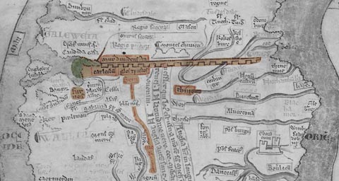 click to enlarge click to enlargePAR2Cm.jpg "Murus dividens An / glos et Pictos" Crenellated wall eastward from Carlisle. derived from copyright image, courtesy of Corpus Christi College item:- Corpus Christi, Cambridge : MS16.f4.5 Image © see bottom of page |
|||||||||||||||||||||||||||||||||||||||||||||||
|
|
||||||||||||||||||||||||||||||||||||||||||||||||
| evidence:- | old map:- Saxton 1579 placename:- Wall of the Pictes, The |
|||||||||||||||||||||||||||||||||||||||||||||||
| source data:- | Map, hand coloured engraving, Westmorlandiae et Cumberlandiae Comitatus ie Westmorland
and Cumberland, scale about 5 miles to 1 inch, by Christopher Saxton, London, engraved
by Augustinus Ryther, 1576, published 1579-1645. Sax9NY26.jpg West end of Hadrian's Wall; faint dashed line.  Sax9NY35.jpg  Sax9NY45.jpg 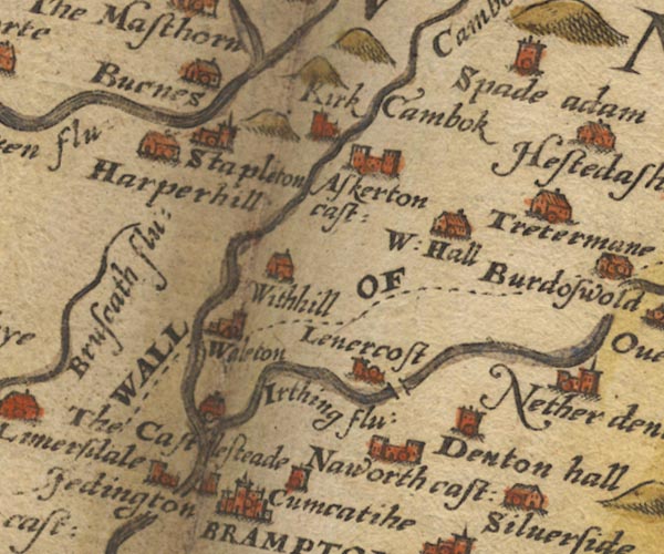 Sax9NY56.jpg "THE WALL OF ..." 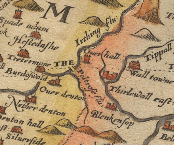 Sax9NY66.jpg 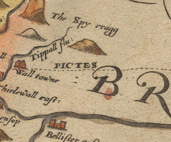 Sax9NY76.jpg "... THE PICTES" Faint dashed line; continues eastward. item:- private collection : 2 Image © see bottom of page |
|||||||||||||||||||||||||||||||||||||||||||||||
|
|
||||||||||||||||||||||||||||||||||||||||||||||||
| evidence:- | old map:- Mercator 1595 (edn?) placename:- Murus Picticus |
|||||||||||||||||||||||||||||||||||||||||||||||
| source data:- | Map, hand coloured engraving, Northumbria, Cumberlandia, et
Dunelmensis Episcopatus, ie Northumberland, Cumberland and
Durham etc, scale about 6.5 miles to 1 inch, by Gerard Mercator,
Duisberg, Germany, about 1595. MER8CumC.jpg "Murus Picticus"  MER8CumA.jpg dotted line and fence palings; wall; from Boulness to Carlysle, then NE into Northumberland item:- JandMN : 169 Image © see bottom of page |
|||||||||||||||||||||||||||||||||||||||||||||||
|
|
||||||||||||||||||||||||||||||||||||||||||||||||
| evidence:- | descriptive text:- Keer 1605 (edn 1620) |
|||||||||||||||||||||||||||||||||||||||||||||||
| source data:- | Map, Westmorlandia et Comberlandia, ie Westmorland and
Cumberland now Cumbria, scale about 16 miles to 1 inch, probably
by Pieter van den Keere, or Peter Keer, about 1605, published
about 1605 to 1676. goto source goto sourcesecond page:- "(6) Many memorable Antiquities remaine and have beene found in this County: for it being the Confines of the Romans Possessions, was continually secured by their Garrisons, where remaine at this day parts of that admirable wall built by Severus: also another Fortification from Werkinton to Elne Mouth, upon the Sea-shore towards Ireland, by Stiloco raised, when under Theodosius he suppres-" |
|||||||||||||||||||||||||||||||||||||||||||||||
|
|
||||||||||||||||||||||||||||||||||||||||||||||||
| evidence:- | old map:- Speed 1611 (Cum/EW) |
|||||||||||||||||||||||||||||||||||||||||||||||
| source data:- | Map, hand coloured engraving, Kingdome of Great Britaine and
Ireland, scale about 36 miles to 1 inch, by John Speed, about
1610-11, published by Thomas Bassett, Fleet Street and Richard
Chiswell, St Paul's Churchyard, London, 1676? click to enlarge click to enlargeSPD6Cm.jpg wall with towers, from near Carlisle eastward item:- private collection : 85 Image © see bottom of page |
|||||||||||||||||||||||||||||||||||||||||||||||
|
|
||||||||||||||||||||||||||||||||||||||||||||||||
| evidence:- | old map:- Speed 1611 (Cmd) |
|||||||||||||||||||||||||||||||||||||||||||||||
| source data:- | Map, hand coloured engraving, Cumberland and the Ancient Citie
Carlile Described, scale about 4 miles to 1 inch, by John Speed,
1610, published by J Sudbury and George Humble, Popes Head
Alley, London, 1611-12.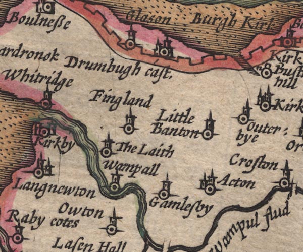 SP11NY25.jpg 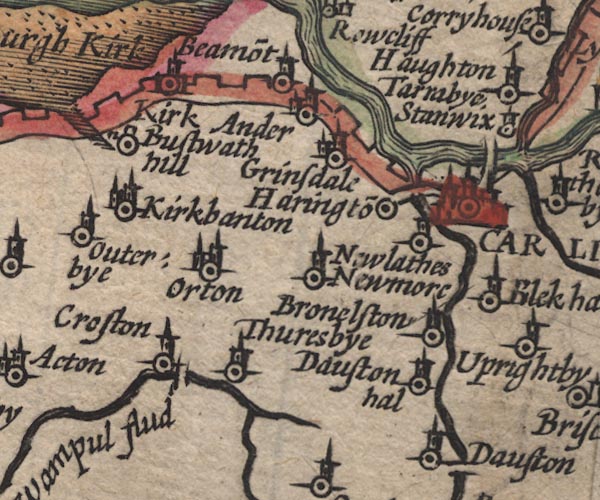 SP11NY35.jpg  SP11NY45.jpg  SP11NY46.jpg 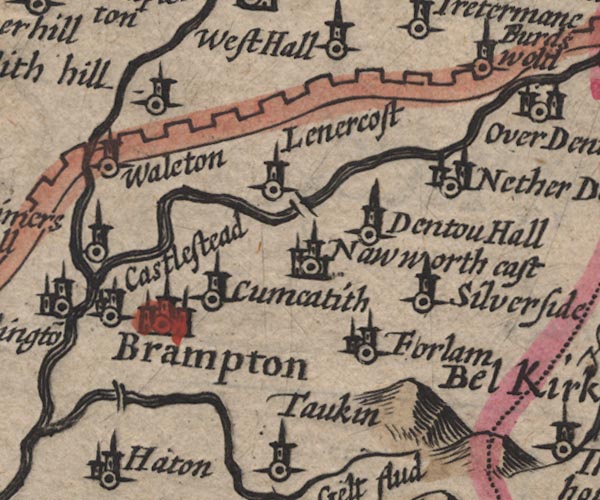 SP11NY56.jpg 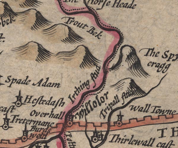 SP11NY67.jpg crenellated wall, from Bowness-on-Solway, through Carlisle, north and east into Northumberland item:- private collection : 16 Image © see bottom of page |
|||||||||||||||||||||||||||||||||||||||||||||||
|
|
||||||||||||||||||||||||||||||||||||||||||||||||
| evidence:- | poem:- Drayton 1612/1622 text placename:- Pictswall item:- speaking tube |
|||||||||||||||||||||||||||||||||||||||||||||||
| source data:- | Poem, Poly Olbion, by Michael Drayton, published by published by
John Marriott, John Grismand and Thomas Dewe, and others?
London, part 1 1612, part 2 1622. goto source in Northumberland, page 158:- "... ... ..." "But Pictswalll all this while, as though he had been lost, Not mention'd by the Muse, began to fret and fume, That every petty Brooke thus proudly should presume To talke; and he whom first the Romans did invent, And of their greatnesse yet, the longest-liv'd monument, Should this be over-trod; wherefore his wrong to wreake, In their proud presence thus, doth aged Pictswall speake." "Me thinks that Offa's ditch in Cambria should not dare To thinke himselfe my match, who with such cost and care The Romans did erect, and for my safeguard set Their Legions, from my spoyle the proling Pict to let, That often In-roads made, our earth from them to win, By Adrian beaten back, so he to keepe them in, To Sea from East to West, begun me first a wall Of eightie myles in length, twixt Tyne and Edens fall: Long making mee they were, and long did me maintaine. Nor yet that Trench which tracts the Westerne Wiltshire Plaine, Of Woden, Wansdyke cal'd, should parallel with me, Comparing our descents, which shall appeare to be Mere upstarts, baseley borne: for when I was in hand, The Saxon had not then set foot upon this land, Till my declining age, and after many a yeare, Of whose poore petty Kings, those the small labors were. That on Newmarket-Heath, made up as though but now, Who for the Devils worke the vulgar dare avow Tradition telling none, who truly it began, Where many a reverent Booke can tell you of my Man, And when I first decayd, Severus going on, What Adrian built of turfe, he builded new of stone, And after many a time, the Britans me repayr'd, To keepe me still in plight, nor cost they ever spar'd. Townes stood upon my length, where Garrisons were laid, Their limits to defend; and for my greater ay'd," goto sourcein Northumberland, page 159:- "With Turrets I was built, where Sentinels were plac'd, To watch upon the Pict; so me my Makers grac'd, With hollow Pipes of Brasse, along me still that went, By which they in one Fort still to another sent, By speaking in the same, to tell them what to doe, And so from Sea to Sea I could be whispered through; Upon my thicknesse, three march'd eas'ly breast to breast, Twelve foot was I in height, such glory I possest." "Old Pictswall with much pride thus finishing his plea, Had in his utmost course attain'd the Easterne Sea, Yet there was Hill nor Flood once heard to clap a hand; ... ... ..." goto sourcepage 167:- "... That mighty Roman Fort, which of the Picts we call But by them neere those times was stil'd Severus wall, Of that great Emperour nam'd, which first that worke began, Betwixt the Irish Sea, and German Ocean, Doth cut me [Eden] in his course neere Carlill, and doth end At Boulnesse, where my selfe I on the Ocean spend." |
|||||||||||||||||||||||||||||||||||||||||||||||
|
|
||||||||||||||||||||||||||||||||||||||||||||||||
| evidence:- | old map:- Jansson 1646 placename:- Picts Wall |
|||||||||||||||||||||||||||||||||||||||||||||||
| source data:- | Map, hand coloured engraving, Cumbria and Westmoria, ie
Cumberland and Westmorland, scale about 3.5 miles to 1 inch, by
John Jansson, Amsterdam, Netherlands, 1646. JAN3NY26.jpg  JAN3NY25.jpg "THE PICTS WAL."  JAN3NY35.jpg  JAN3NY45.jpg  JAN3NY46.jpg  JAN3NY56.jpg "THE PICTS WAL." 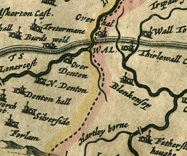 JAN3NY66.jpg Drawn as a squarely built wall; from Bowness on Solway, through Carlisle, then north and east into Northumberland. item:- JandMN : 88 Image © see bottom of page |
|||||||||||||||||||||||||||||||||||||||||||||||
|
|
||||||||||||||||||||||||||||||||||||||||||||||||
| evidence:- | old map:- Ogilby 1675 (plate 86) placename:- Picts Wall |
|||||||||||||||||||||||||||||||||||||||||||||||
| source data:- | Road strip map, uncoloured engraving, the Road from Tinmouth ...
to Carlisle, scale about 1 inch to 1 mile, by John Ogilby,
London, 1675.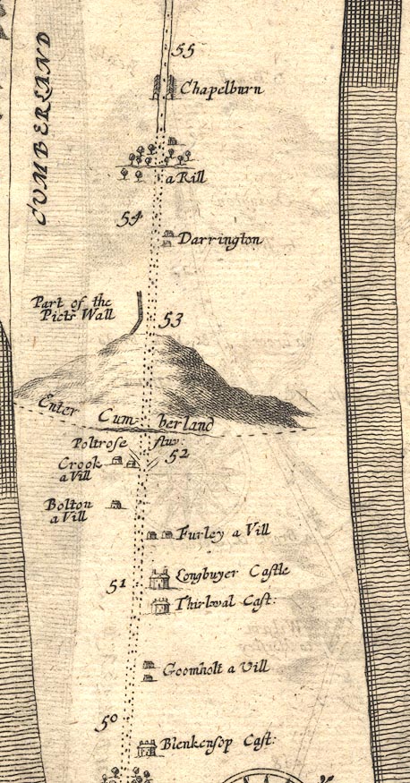 OG86m050.jpg In mile 53, Cumberland. "Part of the Picts Wall" wall alongside the left of the road. item:- JandMN : 73 Image © see bottom of page |
|||||||||||||||||||||||||||||||||||||||||||||||
|
|
||||||||||||||||||||||||||||||||||||||||||||||||
| evidence:- | old map:- Sanson 1679 |
|||||||||||||||||||||||||||||||||||||||||||||||
| source data:- | Map, hand coloured engraving, Ancien Royaume de Northumberland
aujourdhuy Provinces de Nort, ie the Ancient Kingdom of
Northumberland or the Northern Provinces, scale about 9.5 miles
to 1 inch, by Nicholas Sanson, Paris, France, 1679. click to enlarge click to enlargeSAN2Cm.jpg crenelated wall from Carlisle NE and E into Northumberland item:- Dove Cottage : 2007.38.15 Image © see bottom of page |
|||||||||||||||||||||||||||||||||||||||||||||||
|
|
||||||||||||||||||||||||||||||||||||||||||||||||
| evidence:- | old map:- Seller 1694 (Cmd) placename:- Picts Wall, The |
|||||||||||||||||||||||||||||||||||||||||||||||
| source data:- | Map, uncoloured engraving, Cumberland, scale about 12 miles to 1
inch, by John Seller, 1694. click to enlarge click to enlargeSEL9.jpg "The Picts Wall" wall drawn from Bowness-on-Solway through Carlisle, NE and E into Northumberland item:- Dove Cottage : 2007.38.89 Image © see bottom of page |
|||||||||||||||||||||||||||||||||||||||||||||||
|
|
||||||||||||||||||||||||||||||||||||||||||||||||
| evidence:- | old map:- Morden 1695 (Cmd) |
|||||||||||||||||||||||||||||||||||||||||||||||
| source data:- | Map, uncoloured engraving, Cumberland, scale about 4 miles to 1
inch, by Robert Morden, 1695, published by Abel Swale, the
Unicorn, St Paul's Churchyard, Awnsham, and John Churchill, the
Black Swan, Paternoster Row, London, 1695-1715. MD12NY26.jpg  MD12NY25.jpg 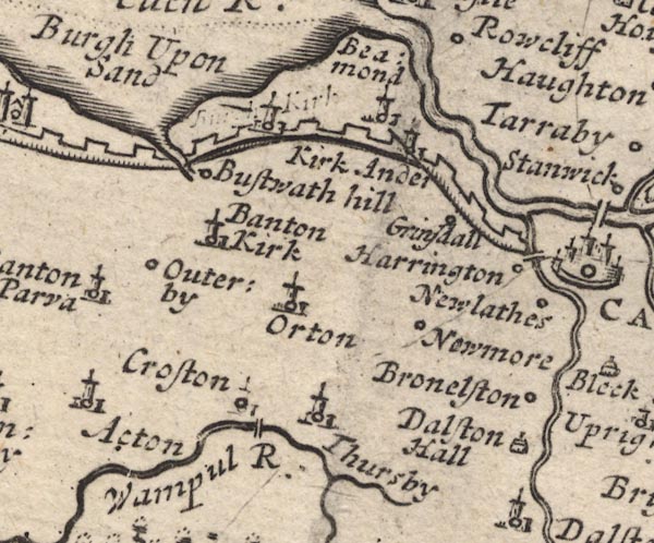 MD12NY35.jpg 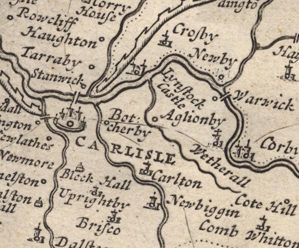 MD12NY45.jpg  MD12NY46.jpg  MD12NY56.jpg 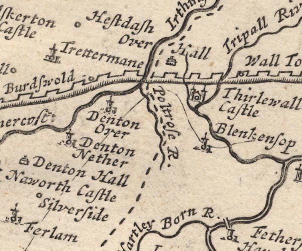 MD12NY66.jpg 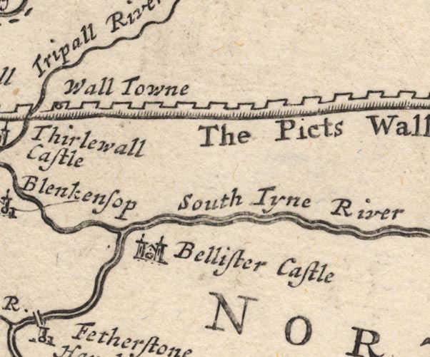 MD12NY76.jpg "The Picts Wall" Castelated wall. item:- JandMN : 90 Image © see bottom of page |
|||||||||||||||||||||||||||||||||||||||||||||||
|
|
||||||||||||||||||||||||||||||||||||||||||||||||
| evidence:- | old map, descriptive text:- Bowen 1720 (plate 162) placename:- Picts Wall item:- roman coin; coin; trumpet; figure; Mercury; Victory |
|||||||||||||||||||||||||||||||||||||||||||||||
| source data:- | Road book, Britannia Depicta Or Ogilby Improv'd, including road
strip maps with sections in Westmorland and Cumberland, scale
about 2 miles to 1 inch, derived from maps by Ogilby, 1675, also
a county map of Westmorland, scale about 8 miles to 1 inch, and
of Cumberland, scale about 16.5 miles to 1 inch, each with text,
by John Owen, published by Emanuel Bowen, London, 1720;
published 1720-64.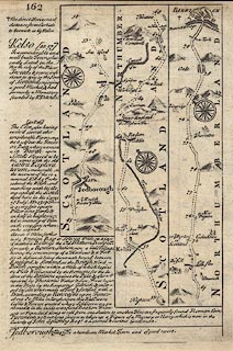 click to enlarge click to enlargeB162.jpg "Bolness ... formerly a Roman Station, ... within a Mile of which begins the Picts Wall, erected by the Romans for the defence of the Britains against the Picts, & afterwds. repaired by Theodosius Father & Son, Twas begun in this Place by the Emperour Adrian, & enlarged by Severus, made of Turf & fortified with a Ditch, extending to Newcastle upon Tyne;- about 80 Miles in length, upon this Wall were Castles & Towers erected where Soldiers were garisoned, & in the inside were fixed Brazon Trumpets or Pipes, laid along to call from one Station to another. Here are frequently found Roman Coins Pavements &c. & not long since was taken up a Figure of a Mercury or Victory, which is now in the Custody of John Aglionby Esqr. a Learned & curious Gentleman." |
|||||||||||||||||||||||||||||||||||||||||||||||
|
|
||||||||||||||||||||||||||||||||||||||||||||||||
| evidence:- | old map:- Bowen 1720 (plate 232) placename:- Picts Wall |
|||||||||||||||||||||||||||||||||||||||||||||||
| source data:- | Road strip map, road map, pl.232, part of The Road from Tinmouth
to Carlisle, scale about 2 miles to 1 inch, with sections in
Northumberland and Cumberland, published by Emanuel Bowen, St
Katherines, London, 1720.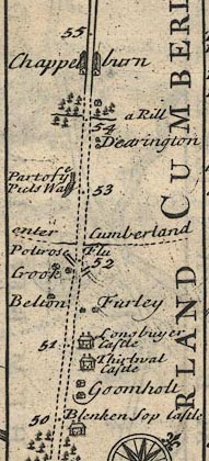 B232m50.jpg "Part of ye Picts Wall" Marked on south side of road; mile 53. item:- JandMN : 65.232 Image © see bottom of page |
|||||||||||||||||||||||||||||||||||||||||||||||
|
|
||||||||||||||||||||||||||||||||||||||||||||||||
| evidence:- | descriptive text:- Defoe 1724-26 placename:- Picts Wall |
|||||||||||||||||||||||||||||||||||||||||||||||
| source data:- | Tour through England and Wales, by Daniel Defoe, published in
parts, London, 1724-26. "... from below this town [Carliel] the famous Picts Wall began, which cross'd the whole island to Newcastle upon Tyne, ..." |
|||||||||||||||||||||||||||||||||||||||||||||||
|
|
||||||||||||||||||||||||||||||||||||||||||||||||
| evidence:- | old map:- Badeslade 1742 placename:- Picts Wall, The |
|||||||||||||||||||||||||||||||||||||||||||||||
| source data:- | Map, uncoloured engraving, A Map of Cumberland North from
London, scale about 11 miles to 1 inch, with descriptive text,
by Thomas Badeslade, London, engraved and published by William
Henry Toms, Union Court, Holborn, London, 1742. click to enlarge click to enlargeBD10.jpg "The Picts Wall" line of wall and regular towers item:- JandMN : 115 Image © see bottom of page |
|||||||||||||||||||||||||||||||||||||||||||||||
|
|
||||||||||||||||||||||||||||||||||||||||||||||||
| evidence:- | old text:- Gents Mag placename:- Roman Wall, The |
|||||||||||||||||||||||||||||||||||||||||||||||
| source data:- | Magazine, The Gentleman's Magazine or Monthly Intelligencer or
Historical Chronicle, published by Edward Cave under the
pseudonym Sylvanus Urban, and by other publishers, London,
monthly from 1731 to 1922. goto source Gentleman's Magazine 1746 p.357 "A Dissertation on the Roman WALL, with Remarks." "IN the present situation of affairs, a plan of the method antiently practic'd by the vigilant Romans for securing the isthmus of Britain, with some remarks on it, will not I believe be unacceptable to the public." "Agricola, lieutenant to the emperor Domitian, seems to be the first of the Roman generals that extended his conquests after the reduction of the Brigantes to this isthmus. Such of the Britons as escaped his arms, retreated behind the long chain of mountains on the skirts of Yorkshire and Northumberland. But these strong barriers of nature avail'd little against the persevering courage of the Roman soldiery; they carry'd on military roads, and supported them with garrisons, thro' the most inaccessible desarts of Britain, and united territories which the mountains had sever'd in vain. Whilst any land remain'd the Britons fled before the Romans, 'till getting beyond the isthmus at Carlisle, a more extended and hilly country, it afforded them not only a safer retreat, but the liberty of returning through defiles of thick and entangling forests, yet unknown to the Romans. But it was not long that the natives could play this game, under the attentive eye of Agricola; he soon perceiv'd the inconvenience, and found out a remedy. He fixed a series of stations in a line across the isthmus, at regular intervals, and, garrisoning them with what soldiery he could spare, proceeded with the rest to reduce the North. At Bodotria another isthmus occurr'd, much straiter than the first; this he fortify'd in like manner, and recall'd the soldiers to keep garrison there as in the former, marching to subdue the countries by the Grampian mountains. But before he could complete his scheme, he was recall'd, and the Caledonians, resuming their independency, carry'd their arms to his first line of stations again." "Hadrian afraid of the consequence, and with a view to suppress the nocturnal excursions of the enemy, through the intervals of Agricola's garrisons, which they frequently perform'd with astonishing celerity and silence, connected all these stations by a mud-wall, two aggers, a ditch, and military way." "Antoninus Pius his successor found means to curb the insolence of the Caledonians, and confine them to their mountains once more, driving them beyond the second isthmus, and fortifying it with an admirable wall of hewn-stone from sea to sea, along the series of Agricola's stations." "After his death Britain was again neglected, and the Caledonians overthrowing his wall stretched their limits to Agricola's first stations, and the wall was never more recover'd from them by the Romans. Whether the succeeding emperors disregarded such a conquest as useless, or whether it was not in their power to retake it, is of no consequence to determine; probably their attention to affairs on the continent, afforded little time for their securing Britain." "After the death of Antoninus, Severus was the first of the Roman emperors that turn'd his eye to Britain, the island being well nigh lost by a general defection. He reduc'd them to obedience once more after several victories, promoted his boundaries to Hadrian's wall, and built one of hewn stone at this isthmus, similar to Antonine's, from sea to sea, which continu'd the limit of the Roman empire in Britain, 'till their final departure from the island. But 'tis to be observ'd that he had several advanc'd stations as exploratory garrisons, for giving signals on any alarms, and preventing surprize: As at * Beu-castle, Netherby, Middleby, &c. (See the map), besides the principal encampments on the wall, each of which appears to have consisted of 1000 foot and 150 horsemen, by the stone lately found at Cast-steeds and publish'd in the Magazine for 1741. p.650. See also Mag. 1742, p.30, 76, 135." "Such was the vigilance, resolution, and military application of the conquerors of the world. They turn'd not their soldiers into an army of useless observation at the East end of the wall, when the West was ravag'd with thieves, nor, amid their banquets, were they idle auditors of the oppression of their friends, without putting a hand to deliver them. Without any other qualifications but the virtues of a military face, and the sincerity of a Roman heart, they disregarded the inclemencies of a British air, nor dreaded the point of a Caledonian lance. Embroidery was no part of their garb, and took up no part of their time; as they dress'd not like mountebanks, they fought not like poltroons. Thus they liv'd, and dying left behind them such" "*See Vol.XII. p.132, 318, 368, 529." |
|||||||||||||||||||||||||||||||||||||||||||||||
|
|
||||||||||||||||||||||||||||||||||||||||||||||||
| evidence:- | old text:- Gents Mag 1746 item:- rebellion, 1745; 1745 Rebellion |
|||||||||||||||||||||||||||||||||||||||||||||||
| source data:- | goto source Gentleman's Magazine 1746 p.358 "standing monuments to perpetuate their memory, that we are at a loss which most to admire, the glory of their actions whilst alive, or their care of transmitting theme to posterity after their death." "I am none of those speculative visionaries that would call the wall from its ruins, tho' in imagination only; I am sensible it would ev'n be in a manner usless in the present practice of war. But had 6 or 7000 regular forces been plac'd in the line of the wall, from Hexham to Brampton these, with the additional garrisons of Carlisle and Newcastle, and the rivers of Tyne and Eden, wou'd have effectively prevented the incursion of the rebels into England." "The cavalry in the extremities, and the foot in the centre, might have united before the Highlanders cou'd get up, as the insuperable desarts on the skirts of Northumberland absolutely determined their march on leaving Jedburgh. His majesty's forces, though timely appriz'd of it, never mov'd westward 'till Carlisle had surrender'd, and ignominious as it was,'twas defended from Saturday noon 'till Friday morning. On the day after the king's troops under the marshal Wade march'd forwards to Hexham, in order to relieve us, and by that step gave the rebels two days march of them, in the prosecution of their journey to London, which had actually been accomplish'd, had not his royal highness just prevented it." "P. S. In my description of the Roman wall, I have follow'd the Notitia of Pancirolus, as the most exact in the rout of the garrisons on the wall, and carefully compared it with the Itinerary of Antoninus, tho' it begins where Cambden and all other antiquaries, except Horsley, end, at the West sea, calling Tuno celum, Bowness, in place of Tinmouth, and so on. For Cambden and his adherents have made scarce a probability ev'n at conjecture with regard to them; for example Tun-ocelum, or Itun-ocelum, signifies a promontory at the mouth of the river Ituna (Eden, by Ptolemy, and all who mention it,) such as Bowness is, and not Tinmouth, which has no highland at all beside it, as Ocelum signifies. Besides, Pancirolus says it was garrison'd by the AEl. Classica, as stones found at Bowness import; now there are no stones, nor any wall carry'd within 4 miles of Tinmouth, and Cambden has not a single reason to support him, but a similitude of names, which proves nothing. Again Amboglana, Cambden translates, because of the likeness of sound, Ambleside, a place in Westmorland, above 30 miles from any part of the wall. Now Pancirolus says Amboglana was upon the wall, and garrison'd by the AElia Dacica, as twenty stones dug up there import, and as Pancirolus affirms also, and therefore must be the great fort of Burdoswald, which is capable to contain 3000 men, with very signal ruins; and their altars expressly assent to Pancirolus, and say the cohors AElia Dacica garrison'd it; and so 'tis impossible to be Ambleside any more than London;- but of this more in a proper time. I beg pardon for dissenting from so great an antiquary, but my reasons will convince every unprejudic'd person" "... ..." |
|||||||||||||||||||||||||||||||||||||||||||||||
|
|
||||||||||||||||||||||||||||||||||||||||||||||||
| evidence:- | descriptive text:- Simpson 1746 placename:- Picts Wall |
|||||||||||||||||||||||||||||||||||||||||||||||
| source data:- | Atlas, three volumes of maps and descriptive text published as
'The Agreeable Historian, or the Compleat English Traveller
...', by Samuel Simpson, 1746. goto source "..." "When it [Cumberland area] was in the Power of the Romans, it was much frequented by their Legions and Soldiers, not only to keep the Inhabitants in Order, but bordering upon their troublesome Neighbours, the Picts and Scots, they were forced continually to guard it against their Invasions; but when the Distractions of the Roman Empire caused the Legions of Britain to be call'd Home, the Scots and Picts, sensible that all Opposition was near remov'd, soon brake thro' the strong Wall, built by the Emperors Adrian and Severus, extending from Sea to Sea about 82 Miles in Length, tho' it had been not long before rebuilt, and made stronger, and now miserably harrass'd the Britons, destitute of their wonted Guard; ..." goto source"..." "The famous Picts-Wall, of which some Remains still appear in this County, and which was the Boundary of the Romans Jurisdiction in this Isle, called in Latin, Vallum Barbaricum, was erected on this Occasion: The Romans having conquer'd the most fruitful and pleasant Parts of Britain, and finding that the more remote they went towards the N. the more barbarous were the People, who had nothing desirable in them, contrived, according to their Custom in other Conquests, to raise Fences, such as might secure and bound the province. It was made in the Fashion of a mural Hedge, of large Stakes driven deep into the Ground, and wreathed together with Wattles, strengthened with huge Heaps of Turf and Earth, and a deep Ditch, extending from the German to the Irish Ocean." |
|||||||||||||||||||||||||||||||||||||||||||||||
|
|
||||||||||||||||||||||||||||||||||||||||||||||||
| evidence:- | old map:- Bickham 1753-54 (Cmd) placename:- Picts Wall |
|||||||||||||||||||||||||||||||||||||||||||||||
| source data:- | Map, uncoloured engraving, perspective map, Map of Cumberland
North from London, by George Bickham, James Street, Bunhill
Fields, London, 1753, published by F Jollie and Sons, Carlisle,
Cumberland, 1811.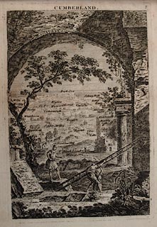 click to enlarge click to enlargeJL05.jpg "Picts Wall" view (sort of) item:- Carlisle Library : 4.2 Image © Carlisle Library |
|||||||||||||||||||||||||||||||||||||||||||||||
|
|
||||||||||||||||||||||||||||||||||||||||||||||||
| evidence:- | old text:- Morgan 1759 placename:- Picts Wall |
|||||||||||||||||||||||||||||||||||||||||||||||
| source data:- | MG02q016.txt "The famous Picts Wall, which begins near Carlisle, and crosses the whole island to Newcastle upon Tyne; ..." |
|||||||||||||||||||||||||||||||||||||||||||||||
|
|
||||||||||||||||||||||||||||||||||||||||||||||||
| evidence:- | old map:- Bowen and Kitchin 1760 placename:- Picts Wall, The |
|||||||||||||||||||||||||||||||||||||||||||||||
| source data:- | Map, hand coloured engraving, A New Map of the Counties of
Cumberland and Westmoreland Divided into their Respective Wards,
scale about 4 miles to 1 inch, by Emanuel Bowen and Thomas
Kitchin et al, published by T Bowles, Robert Sayer, and John
Bowles, London, 1760. BO18NY25.jpg "The Picts Wall Demolish'd" double line, dotted, with ?crenellations  BO18NY35.jpg double line, dotted, with ?crenellations  BO18NY45.jpg double line, dotted 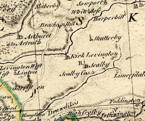 BO18NY46.jpg double line, dotted 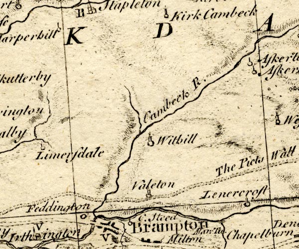 BO18NY56.jpg double line, dotted, with ?crenellations 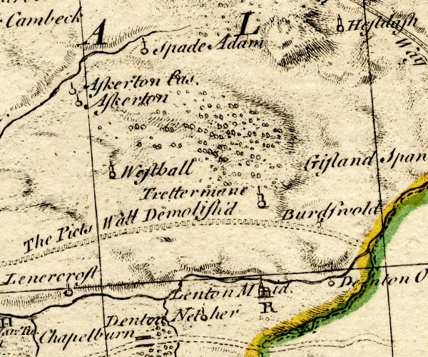 BO18NY66.jpg "The Picts Wall Demolish'd" double line, dotted item:- Armitt Library : 2008.14.10 Image © see bottom of page |
|||||||||||||||||||||||||||||||||||||||||||||||
|
|
||||||||||||||||||||||||||||||||||||||||||||||||
| evidence:- | old text:- Pennant 1773 placename:- Picts Wall placename:- Severus's Wall |
|||||||||||||||||||||||||||||||||||||||||||||||
| source data:- | Book, A Tour from Downing to Alston Moor, 1773, by Thomas
Pennant, published by Edward Harding, 98 Pall Mall, London, 1801. goto source Pennant's Tour 1773, page 179 "At a little distance from Llanercost, I passed over the site of the Picts Wall, as it is styled. Near this place are some remains, about four feet high, on the brow of a hill, but in an adjoining vale rise to eight or ten, with very perfect facing stones on each side: the middle part is composed of small stones and mortar flung in (probably hot) without any order. The facing-stones are from ten to eighteen inches long, and four inches thick. Most of the castles," goto sourcePennant's Tour 1773, page 180 "religious houses, and other ancient buildings near the site of the wall, seem to have been built with the materials." "..." goto sourcePennant's Tour 1773, page 185 "This marsh is washed by the Solway Frith. Severus's Wall, or, as it is vulgarly called, The Picts, commences at the extremity, at Bowness, on which stood the station Blatum Bulgium, the first of the line of forts which was garrisoned by the Romans to secure the obedience of this part of the island. The next was Axelodunum; some very small remains of which, in form of ramparts, are yet to be seen. Burgh, which signifies a fortress, owes its name to the lost fort. The wall runs through this parish, and from thence to Carlisle." |
|||||||||||||||||||||||||||||||||||||||||||||||
|
|
||||||||||||||||||||||||||||||||||||||||||||||||
| evidence:- | old map:- Donald 1774 (Cmd) |
|||||||||||||||||||||||||||||||||||||||||||||||
| source data:- | Map, hand coloured engraving, 3x2 sheets, The County of Cumberland, scale about 1
inch to 1 mile, by Thomas Donald, engraved and published by Joseph Hodskinson, 29
Arundel Street, Strand, London, 1774. double line with ?palings  D4NY26SW.jpg at Bowness-on-Solway  D4NY25NE.jpg  D4NY35NW.jpg "Picts Wall"  D4NY35NE.jpg N of Carlisle  D4NY45NW.jpg  D4NY46SE.jpg "Picts Wall" 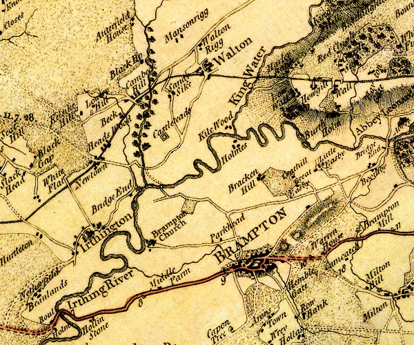 D4NY56SW.jpg 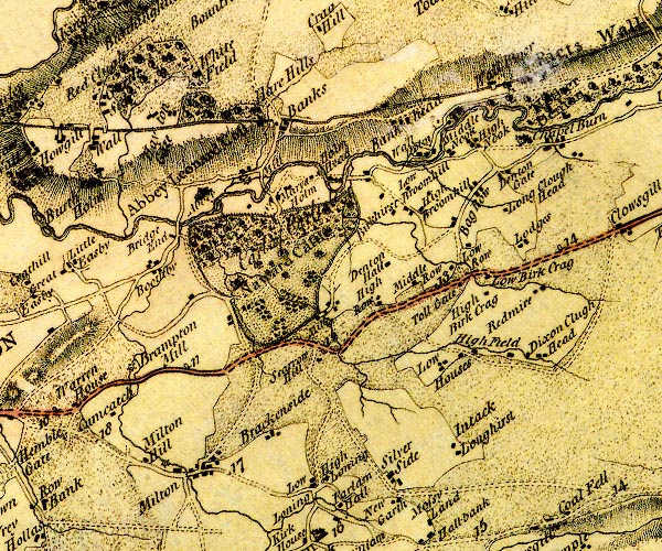 D4NY56SE.jpg 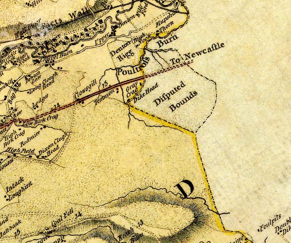 D4NY66SW.jpg "Picts Wall" into Northumberland item:- Carlisle Library : Map 2 Images © Carlisle Library |
|||||||||||||||||||||||||||||||||||||||||||||||
|
|
||||||||||||||||||||||||||||||||||||||||||||||||
| evidence:- | old text:- Camden 1789 (Gough Additions) |
|||||||||||||||||||||||||||||||||||||||||||||||
| source data:- | Book, Britannia, or A Chorographical Description of the Flourishing Kingdoms of England,
Scotland, and Ireland, by William Camden, 1586, translated from the 1607 Latin edition
by Richard Gough, published London, 1789. Gough's Additions, after some descriptive paragraphs, give Mr Horsley's account of the wall in Britannia Romana. These detailed notes include assessments of the appearance of the remains at various places. goto sourcePage 216:- "..." "The following account of the present state of Hadrian's vallum, and the wall of Severus is taken from Mr. Horsley's Britannia Romana: c.9. p.135." ""I shall reduce these remains to four degrees of appearance: As to Hadrian's vallum, I would call it the highest or fourth degree, if in any part the present state could be supposed to be nearly equal to what it originally was, but this I think never is the case; the first and lowest degree is, when there are any certain visible remains or vestiges, though not very large; and the second and third are the intertmediate degrees, as they approach nearer to the highest or lowest. But in the stone wall I call that the fourth degree, where any of the original regular courses are remaining, and usually name the number of courses. Where the original stones remain upon the spot, though not in their regular order, I call it the third degree; where the rubbish is high and distinct, though covered with earth, or grown over with grass, I call it the second; and the first is where there are any remaining vestiges of the wall though faint and obscure." |
|||||||||||||||||||||||||||||||||||||||||||||||
|
|
||||||||||||||||||||||||||||||||||||||||||||||||
| evidence:- | old text:- Camden 1789 (Gough Additions) |
|||||||||||||||||||||||||||||||||||||||||||||||
| source data:- | Book, Britannia, or A Chorographical Description of the Flourishing Kingdoms of England,
Scotland, and Ireland, by William Camden, 1586, translated from the 1607 Latin edition
by Richard Gough, published London, 1789. goto source Page 229:- "..." "For the better representing the present appearance of the ruins of the wall, we have copied Mr. Horsley's general map of the whole wall, which will be found to comprehend all the castella on it expressed in his particular maps of the parts of it upon a larger scale, as well as to represent the course of Hadrian's vallum and its parallellism with that of Severus. The former is marked by the fainter line accompanying the latter expressed by the blacker line." "Severus's wall has manifestly terminated in a square fort above a furlong to the east of a mansion called Cousin's house, where are ruins of a Roman station and town still very discernble, though the site has been plowed, and is now a rich meadow. The site is called Well lawes, q.d. Wall hills, corresponding with Segedunum (a station). Hence it passes a stile, where it makes a little turn. through the outer court of Cousin's house, by the Beehouses, Walker, or Wall kier, Byker hill; descends to Ewsburn, the Red burns, and Pandon gate at New castle (a station). After passing through that town it appears again out at the west gate at the Quarry house. Thence proceeds to Elswick mill, Benwel (a station), Denton, Chapel houses, Walbottle, Newburn deen, Throcklow, Heddon (a station), Rutchester (a station), Harlow hill, Halton sheels, Wall houses, Halton Chester (a station), Watling street gate, Portgate, St. Oswald, North Tine river, Walwick or East Chesters (a station), Walwick, Towerstay, Carrawburgh (a station), Shewen sheels, Buisy gap, House steeds (a station), Haltwistle burn, Little Chester (a station), Great Chesters (a station), Cockmount hill, Waltown, Wintergap cross, Carrvoran (a station), Tippal river to Thirwall castle, Stonegap, Willoford, Burdoswald (a station), Midgham foot, Wallbours, the Banks, Hare-hill (where Mr. Horsley measured the wall three feet and a half high, probably within half a yard of its original height), Birchshaw, Randilands, Waltown, Cambeck, or Castlesteeds (a station), Irthing, New town, Comeranton, Old wall, Wall head, Wallby, Tarraby, Stanwick (a station), cross the Eden, on the north side of which both walls are mostly obscure, but the ditch visible at Beaumont. They both run to Brugh (a station). Whether Hadrian's wall was continued beyond Drumburgh (a station) is uncertain, but Severus's may be traced to Boulness (a station)." goto sourcePage 230:- "The stations per lineam valli, 23 in number, enumerated in the Notitia, were as follows:" "The five last form a line of secondary stations to the south of the wall."
|
|||||||||||||||||||||||||||||||||||||||||||||||
|
|
||||||||||||||||||||||||||||||||||||||||||||||||
| evidence:- | old text:- Camden 1789 placename:- Wall, The placename:- Vallum Barbaricum placename:- Picts Wall placename:- Praetentura placename:- Clusura placename:- Murus placename:- Gual Sever placename:- Gal Sever placename:- Mur Sever placename:- Scottinwaith placename:- Pehits Wall placename:- Keepe Wall placename:- Fossa Severia placename:- Severus's Ditch placename:- Murus Famosus item:- Notitia Dignitatum |
|||||||||||||||||||||||||||||||||||||||||||||||
| source data:- | Book, Britannia, or A Chorographical Description of the Flourishing Kingdoms of England,
Scotland, and Ireland, by William Camden, 1586, translated from the 1607 Latin edition
by Richard Gough, published London, 1789. goto source Page 211:- Pages 211-230 are The Wall "THE VALLUM, OR PICTS WALL." "THE upper edge of Cumberland is crossed by the famous wall, the boundary of the Roman province, called by the antient writers the Vallum Barbaricum, the Praetentura, and Clusura *, by Dio, "When by their valour under Providence the ambition of the Romans crowned with a train of unexpected successes had so extended their empire on every side that they began almost to be jealous of their own greatness, the emperors thought it adviseable to set some bounds to it, considering it as a piece of good policy, "to set some bounds to their greatness, as the Heavens have their proper extent and the sea its limits." These bounds were, according to circumstances of places, either natural as the sea, large rivers, mountains, desarts; or artificial, as lines, viz. ditches, castles, towers, barricadoes of trees, ramparts of earth and walls, along which garrisons were stationed against the barbarians. Hence in the Novellae of Theodosius we read, "Our ancestors contrived the wall on the border to defend against the inroads of the barbarians all the territory comprehended under the Roman allegiance." On these borders soldiers called borderers were quartered in border castles and towns in time of peace: but when there was reason to fear an invasion of the neighbourhood, part of them were staioned in the lands in the country of the barbarians to defend the lands, and part made inroads into the enemy's frontier to watch their motions, and attack them when opportunity offered †." "The Romans in this island seeing the remote parts of Britain, where the soil and air were less favourable, were inhabited by the barbarious Caledonian Britans, the reduction of whom would cost much trouble, and be attended with little advantage, established at various times various Praetenturae to bound and defend the province. The first seems to have been fixed by Julius Agricola when he garrisoned the narrow tract of ground between ‡Bodotria and Glotta, which was presently after fortified." "Hadrian, to whom the God Terminus gave way when he, either through envy of Trajan's glory, who had extended the empire to the utmost, or through fear, retired above 80 miles in this island, formed the second Praetentura. He, says Spartianus, drew a wall for 80 miles to separate the "Romans and Barbarians." From the following words of this author we may collect that this wall was built "of great piles driven deep into the ground, and bound together like a mural §fence." this the wall now under consideration, which runs 80 miles, having on it PONS AELIA, CLASSIS AELIA, COHORS AELIA, ALA SABINIANA, so called after AElius Adrianus and Sabina his wife. The Scotish historian also, who wrote the Rota Temporum, says "Hadrian was the first who drew a rampart of prodgious bulk of sods pared off the ground as high as a mountain, with a very deep ditch in front from the mouth of Tine to the river Esc, from the German ocean to the Irish sea." ..." "..." "When the Caledonian Britans in the reign of Commodus had broken through this, Severus, slighting that immense country beyond it, drew a fortification across the island from Eden mouth, or Solway frith, to Tine mouth, in the same place, if I mistake not, where Hadrian made his wall of piles, and with me agrees Hector Boetius. "Severus, says he, commanded Hadrian's wall to be repaired, stone battlements to be added, and towers at such intervals that the sound of a trumpet might be heard from one to the other, even though the wind was contrary;" and in another place, "Our chronicles relate that the wall began by Adrian was [completed by Severus]"" "The frontiers of provinces were called Clusurae from excluding the enemy, and Praetenturae because praetended or drawn before the enemy. See Pichaeus in Adversar. I. c.14." "..." goto sourcePage 212:- "... Nor has it any other name than Vallum in Antoninus and the Notitia, and it is called in British Guall Sever. In confirmation of this let us hear Ethelwerd the oldest writer after Bede, speaking of Severus. "He drew a ditch in the island aforementioned crossways from sea to sea, and built within it a wall with towers and battlements." He afterwards calls it Fossa Severia, Severus' ditch, as do the antient Saxon Annals, [Severus Brytenland mid dic forgyrd fram sea oth sea], q.d. Severus inclosed Britain with a dike from sea to sea; and others of later date, [Severus on Brytene gethorht theal of turfum fram sea to sea.] Severus in Britain made a wall of turf from sea to sea. Malmesbury also calls it "the famous and well-known ditch." In which place, near 200 years after, was built a wall of stone, of which hereafter. ..." "... ..." goto sourcePage 214:- "..." "But to follow the track of the wall more exactly. It begins at BLATUM BULGIUM or Bulness on the Irish sea, and proceeds along Eden frith by Burgh upon sands to LUGUVALLUM or Carlisle, where it crosses the Ituna or Eden. Thence it runs on above the river Irthing, crossing the little meandering river Cambecke where are great remains of a fort. After crossing the rivers Irthing and Poltrosse it enters Northumberland, and continuing among the chains of mountains along the river called South Tine (except where the river North Tine makes an interruption in it, where was antiently a bridge), advances quite to the German ocean, at (sic) will be shown when we come to Northumberland." The whole chapter in Britannia is about Hadrian's Wall, and is not duplicated in this Place Record; read the transcription of the source. There is discussion of the several walls and ditches, their lengths, construction, and so on. |
|||||||||||||||||||||||||||||||||||||||||||||||
|
|
||||||||||||||||||||||||||||||||||||||||||||||||
| evidence:- | old text:- Camden 1789 |
|||||||||||||||||||||||||||||||||||||||||||||||
| source data:- | Book, Britannia, or A Chorographical Description of the Flourishing Kingdoms of England,
Scotland, and Ireland, by William Camden, 1586, translated from the 1607 Latin edition
by Richard Gough, published London, 1789. goto source Page 173:- "... Bulnesse ... A mile beyond this, as may be seen by the foundations when the tide is out, begin those famous Roman works the Vallum and Wall, formerly the boundary of the Roman province, erected to keep out the barbarians, who, in these parts, were continually, as the writer says, barking at the Roman empire. I was at first surprised at their raising such great fortifications here, when there is so large an aestuary for near eight miles; but I find now, that when the tide is out the water is so low, that robbers and marauders might easily ford over. ..." goto sourcePage 174:- "... This Picts wall afterwards erected on the Vallum of Severus is still visible at Stanwicks, a little village, a little beyond the river Eden, over which is now a wooden bridge, and crosses the river overagainst the castle, where in the bed of the river are still remians of it, huge stones. Pomponius Mela tells us, that Lugus or Lucus signified a tower among the antient Celts, who spoke the same language with the Britans. What Antoninus calls LUGU AUGUSTI he names TURRIS AUGUSTI, so that Lugu-vallum is and signifies the tower or fort on the wall. ..." "..." goto sourcePage 176:- "..." "... Through this [Gilsland] the wall or rampart of Severus, that noblest monument in Britain, runs almost strait from Carlisle, east through the village of Stanwicks, Scalby, ... and from thence the little river Cambec passes under the wall, ... Below the wall it falls into the river Irthing, where is Irthington, ... and here at Castle steed are to be seen great ruins. Near it is Brampton, a mean market-town, which I take for BREMETURACUM ad lineam valli, being scarce a mile from the wall, where antiently was stationed the 1st cohort of the Tungri from Germany, and in the decline of the Roman empire under the Dux Britanniarum a Cuneus Armaturarum. These were horse completely armed, but whether these Armaturae were duplares or simplares, Vegetius leaves uncertain. The former, according to the style of that time, was so called from having a double, and other from having only single allowance of provision. ..." "..." goto sourcePage 177:- "... on the wall [is] Burd Oswald. Below this last, where the Picts wall crosses the river Irthing on arches, was the station of the cohors prima AElia Dacorum, at a place now called Willoford, ..." |
|||||||||||||||||||||||||||||||||||||||||||||||
|
|
||||||||||||||||||||||||||||||||||||||||||||||||
| evidence:- | old text:- Camden 1789 (Gough Additions) |
|||||||||||||||||||||||||||||||||||||||||||||||
| source data:- | Book, Britannia, or A Chorographical Description of the Flourishing Kingdoms of England,
Scotland, and Ireland, by William Camden, 1586, translated from the 1607 Latin edition
by Richard Gough, published London, 1789. goto source Page 187:- "..." "Sir John [Aglionby?] adds 1739 in his letter to Mr. Gale; "... Several walls are here very visible for a mile or two, in some places levelled, in others eight, nine, and ten feet high. The facing square stones, of which 1000 cart loads remain that have not been used for houses or hedges. These were probably brought from the Caledonian side, where the county abounds for several miles with it and limestone. The inside is generally irregular, and sometimes in the herring bone fashion: the cement a mixture of lime and small gravel, with some shells beat together, and poured in with water from the top till the interstices were filled up. I have followed this method, which effectually keeps out air. I cannot think ... nor that the Roman wall, very conspicuous near this place, run further into the sea, but rather ended there, the sea having in the Roman time run higher by several feet than now, for even at Cramond, four miles above Leith, was a Roman harbour, where the sea sometimes washes." ..." |
|||||||||||||||||||||||||||||||||||||||||||||||
|
|
||||||||||||||||||||||||||||||||||||||||||||||||
| evidence:- | old text:- Camden 1789 (Gough Additions) |
|||||||||||||||||||||||||||||||||||||||||||||||
| source data:- | Book, Britannia, or A Chorographical Description of the Flourishing Kingdoms of England,
Scotland, and Ireland, by William Camden, 1586, translated from the 1607 Latin edition
by Richard Gough, published London, 1789. goto source Page 195:- "..." "... The Roman wall is very visible here [Stanwix]. The ditch distinct on the west of the village between it and the Eden, seems to have been Severus's, whose wall forms the north rampart of the station. The ruins of the wall are visible on the brink of the precipice. ..." |
|||||||||||||||||||||||||||||||||||||||||||||||
|
|
||||||||||||||||||||||||||||||||||||||||||||||||
| evidence:- | descriptive text:- Baker 1802 placename:- Picts Wall |
|||||||||||||||||||||||||||||||||||||||||||||||
| source data:- | Perspective road map with sections in Lancashire, Westmorland,
and Cumberland, by J Baker, London 1802. Page 27:- "... The famous Picts Wall also crossed the kingdom by this place [Carlisle]." |
|||||||||||||||||||||||||||||||||||||||||||||||
|
|
||||||||||||||||||||||||||||||||||||||||||||||||
| evidence:- | old map:- Cooke 1802 placename:- Picts Wall |
|||||||||||||||||||||||||||||||||||||||||||||||
| source data:- | Map, Cumberland, scale about 15.5 miles to 1 inch, by George
Cooke, 1802, bound in Gray's New Book of Roads, 1824, published
by Sherwood, Jones and Co, Paternoster Road, London, 1824. click to enlarge click to enlargeGRA1Cd.jpg "Picts Wall" double line item:- Hampshire Museums : FA2000.62.2 Image © see bottom of page |
|||||||||||||||||||||||||||||||||||||||||||||||
|
|
||||||||||||||||||||||||||||||||||||||||||||||||
| evidence:- | old text:- Gents Mag placename:- Roman Wall, The placename:- Wall, The placename:- Picts Wall item:- book; History of the Roman Wall |
|||||||||||||||||||||||||||||||||||||||||||||||
| source data:- | Magazine, The Gentleman's Magazine or Monthly Intelligencer or
Historical Chronicle, published by Edward Cave under the
pseudonym Sylvanus Urban, and by other publishers, London,
monthly from 1731 to 1922. goto source Gentleman's Magazine 1802 p.633 "... The History of the Roman Wall, which crosses the Island of Britain, from the German Ocean to the Irish Sea. Describing its antient State, and its Appearance in the Year 1801. By W. Hutton, F.A.S.S." ""You can never bring in a WALL - what say you, Bottom?" SHAKSPEARE." "WE have received much pleasure in reviewing former topographical works by this writer, who keeps up the ball of curiosity and narrative to the last." ""Having had the pleasure of seeing many antiques of various ages and people, it naturally excited a desire of proceeding in farther research; and the eye, unsatisfied with seeing, induced a wish to see the greatest of all the curiosities left us by the Romans, THE WALL; the wonderful and united works of Agricola, Hadrian, and Severus." ... "What astonishment must arise at the sight of the grandest production of Art in the whole island! the united work of a Commander in Chief and two Emperors, assisted by three powerful armies, and aided by a long series of years!" ... "I consulted all the authors I could procure; which strengthened desire. But I found they were only echoes to each other. Many have written upon the subject; but I could discover that very few had even seen it, and not a soul had penetrated from one end to the other. Besides, if those who paid a transient visit chose to ride, they could not be minute observers. Poor Camden travelled it till he was frightened, ran away, and wrote hastily. Horsley was weary, and retreated; but wrote more correct. The judicious Warburton, whom I regard for his veracity, rode on, desisted, and then remarked, "He believed he had trod upon ground which no foot had ever trodden since the Romans." He also transcribed Horsley, whom Mr. Gough professes to follow. I envied the people in the neighbourhood of the Wall, though I knew they valued it no more than the soil on which it stood. I wished to converse with an intelligent resident, but never saw one. I determined to spend a month, and fifty guineas, in minutely examining the relicks of this first of wonders; began to form my plan of operations, and wrote my sentiments to an eminent printer in London, for whom I have a singular regard; but, receiving no answer, I gave up the design, and, as I thought, for ever; destroyed my remarks, closed with regret all my books of intelligence, and never durst open them, lest it should revive a strong inclination, which I could not gratify. About four years elapsed, when my family agreed with a gentleman and his lady to visit the Lakes. They enlisted me of the party, in which they found no difficulty, becasue the temptation lay in the neighbourhood of that wonder which had long engaged my ideas*. I have given a short sketch of my approach to this famous bulwark; have described it as it appears in the present day, and stated my return. Perhaps I am the first man that ever travelled the whole length of this Wall, and probably the last that ever will attempt it. Who then will say, he has, like me, travelled it twice! Old people are much inclined to accuse youth of their follies; but on this head silence will become me, lest I should be asked, "What can exceed the folly of that man, who, at seventy-eight, walked six hundred miles to see a shattered Wall!" Preface." ""This first and most remarkable piece of Antiquity in the whole island is known by several names, some of them erroneous. It bore that of Agricola, which is now lost. The Picts Wall; but this seems inconsistent, for they had no concern with the Wall, except to pull it down; and I think it should rather bear the name of the man who built it up. Sometimes Hadrian's Wall; but I cannot see why a bank of earth should bear the name of a Wall. Our idea of a wall comprehends an erection of brick or stone. Perhaps Hadrian's Bank would be more in character, as agreeing with the materials of which it is composed. Severus's Wall is more proper, because he erected the stone wall, part of which is remaining. It is often called The Roman Wall, and by way of pre-eminence, The" |
|||||||||||||||||||||||||||||||||||||||||||||||
|
|
||||||||||||||||||||||||||||||||||||||||||||||||
| evidence:- | old map:- Cooper 1808 placename:- Roman Wall |
|||||||||||||||||||||||||||||||||||||||||||||||
| source data:- | Map, uncoloured engraving, Cumberland, scale about 10.5 miles to
1 inch, drawn and engraved by Cooper, published by R Phillips,
Bridge Street, Blackfriars, London, 1808. click to enlarge click to enlargeCOP3.jpg "Roman Wall" drawn from Bowness through Carlisle then N and E to Northumberland item:- JandMN : 86 Image © see bottom of page |
|||||||||||||||||||||||||||||||||||||||||||||||
|
|
||||||||||||||||||||||||||||||||||||||||||||||||
| evidence:- | old map:- Wallis 1810 (Cmd) placename:- Picts Wall |
|||||||||||||||||||||||||||||||||||||||||||||||
| source data:- | Road map, hand coloured engraving, Cumberland, scale about 16
miles to 1 inch, by James Wallis, 77 Berwick Stree, Soho,
London, 1810. click to enlarge click to enlargeWL13.jpg "Picts Wall" item:- Dove Cottage : 2009.81.10 Image © see bottom of page |
|||||||||||||||||||||||||||||||||||||||||||||||
|
|
||||||||||||||||||||||||||||||||||||||||||||||||
| evidence:- | descriptive text:- Ford 1839 (3rd edn 1843) placename:- Roman Wall, The |
|||||||||||||||||||||||||||||||||||||||||||||||
| source data:- | Guide book, A Description of Scenery in the Lake District, by
Rev William Ford, published by Charles Thurnam, Carlisle, by W
Edwards, 12 Ave Maria Lane, Charles Tilt, Fleet Street, William
Smith, 113 Fleet Street, London, by Currie and Bowman,
Newcastle, by Bancks and Co, Manchester, by Oliver and Boyd,
Edinburgh, and by Sinclair, Dumfries, 1839. goto source Page 101:- "..." "... The city [Carlisle] is well supplied with public walks lying around in various directions: these the tourist should by all means perambulate, particularly those on the northern banks of the river, along which passed the Roman Wall. ..." goto sourcePage 115:- "of Denton and Lanercost. The antiquarian will prefer travelling from Lanercost to Gilsland, along the heights of the northern bank, as he will have an opportunity of examining the Roman Wall, more especially at Birdoswald, the Amblogana of the Romans, where the mass of the wall is visible, though its facings are gone." |
|||||||||||||||||||||||||||||||||||||||||||||||
|
|
||||||||||||||||||||||||||||||||||||||||||||||||
| evidence:- | old map:- Ford 1839 map |
|||||||||||||||||||||||||||||||||||||||||||||||
| source data:- | Map, uncoloured engraving, Map of the Lake District of
Cumberland, Westmoreland and Lancashire, scale about 3.5 miles
to 1 inch, published by Charles Thurnam, Carlisle, and by R
Groombridge, 5 Paternoster Row, London, 3rd edn 1843. FD02NY26.jpg 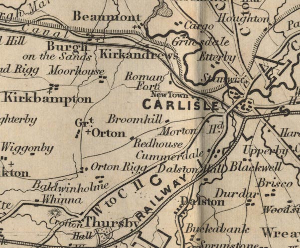 FD02NY35.jpg 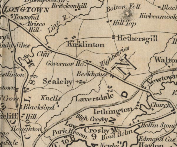 FD02NY46.jpg 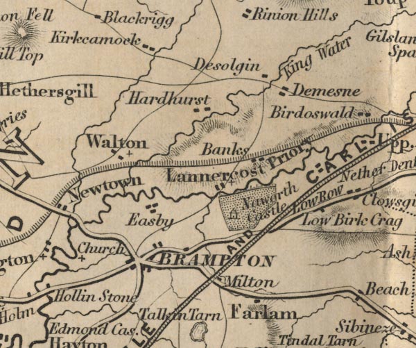 FD02NY56.jpg 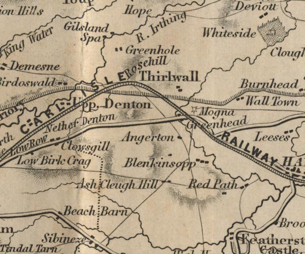 FD02NY66.jpg 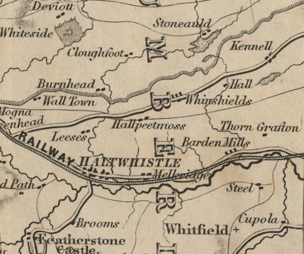 FD02NY76.jpg item:- JandMN : 100.1 Image © see bottom of page |
|||||||||||||||||||||||||||||||||||||||||||||||
|
|
||||||||||||||||||||||||||||||||||||||||||||||||
 GentsMag 1851 part 1 GentsMag 1851 part 1 |
||||||||||||||||||||||||||||||||||||||||||||||||
|
|
||||||||||||||||||||||||||||||||||||||||||||||||
| GentsMag 1851 part 2 |
||||||||||||||||||||||||||||||||||||||||||||||||
|
|
||||||||||||||||||||||||||||||||||||||||||||||||
| evidence:- | old text:- Gents Mag placename:- Roman Wall, The item:- Hadrian the Builder of the Roman Wall |
|||||||||||||||||||||||||||||||||||||||||||||||
| source data:- | Magazine, The Gentleman's Magazine or Monthly Intelligencer or
Historical Chronicle, published by Edward Cave under the
pseudonym Sylvanus Urban, and by other publishers, London,
monthly from 1731 to 1922. goto source Gentleman's Magazine 1853 part 1 p.179 book review "Hadrian the Builder of the Roman Wall: a Paper read at the Monthly Meeting of the Society of Antiquaries, Newcastle-upon-Tyne, 4 Aug. 1852, in reply to "The Roman Wall: an attempt to substantiate the claims of Severus to the authorship of the Roman Wall. By Robert Bell." By the Rev. John Collingwood Bruce, M.A., F.S.A. London and Newcastle. Pp. 38. 1852. - The pamphlet published by Mr. R. Bell, to which this is a reply, has not reached us; but we gather from Mr. Bruce's tract what may be considered as the substance of his arguments. The first, and on which he appears to lay the greatest stress, is founded on the well-known inscription on the upper part of an ancient quarry on the banks of the river Gelt, which mentions a vexillation of the Second legion, with the date of the consulship of Aper and Maximus, A.D. 207, about four years previous to the death of Severus, and shortly before his coming to Britain. From this inscription he maintains that the building of the wall was contemporaneous, and adds that "the Hadrianites endeavour to evade this powerful proof that the wall was built by Severus by the supposition that the inscription was made when the wall was only repaired by Severus, in the year 207. But it must be observed that the inscription is nearly at the top of a rock, and the quarry has been worked to an enormous extent down to the bed of the river, a depth of at least fifty feet."" "Mr. Bruce meets this objection to his own conclusions in favour of Hadrian by observing tha, "because a vexillation of the Second legion carved some lines upon the face of a quarry on the Gelt, we are not necessarilry to infer that they were engaged in extensive operations there, - that it is admitted on all hands that the Second legion was extensively employed upon the Wall, and so was the Sixth, and so was the Twentieth. The inscriptions on the Wall itself do, indeed, prove that the second legion was engaged in the erection of that structure, and in three instances the name of Hadrian is coupled with that of the Second legion on those inscriptions, whilst the inscription at Gelt merely establishes the fact that a part of that legion was in Cumberland in the reign of Severus."" "Mr. Bell ridicules Mr. Bruce's notion that most of the inscriptions recording the Second legion (as well as others) may, from their peculiar character, be supposed to have been executed prior to the reign of Severus. In this he will hardly be supported by any one who has closely studied the general shape of the letters and their ligatures, and has compared the earlier inscriptions with those of a later date. The matter also is essential to be observed, and the form varies as much as the letters. Had Mr. Bell attended to this important key, he would probably have paused before he had cited on his side of the question the suppostitious inscription in Gordon's Itinerarium Septentrionale, SEPT. SEVERO. IMP. QVIMVRVM HVNC CONDIDIT." "The evidence of ancient writers in reference to the building of the Wall is rather obscure and conflicting; but we are inclined, upon taking a careful review of it, to strike a balance in favour of Mr. Bruce. Neither Xiphiline nor Herodian, the latter of whom gives a pretty minute account of the campaign of Severus in Britain, make any mention of Severus as builder of the Wall, which probably they would have done had he really been its constructor. Xiphiline speaks of the Maeatae as dwelling near the barrier wall, a mode of expression which implies its existence at the time of the coming of Severus. Spartian, a writer of inferior merit, who is quoted by Mr. Bell in favour of the claims of Severus, says that this emperor fortified Britain with a wall drawn across the island, ending on each side at the sea, which was the chief glory of his reign, and for which he received the name of Britannicus. But the same author, in a passage overlooked by Mr. Bell, states that Hadrian went to Britain, where he corrected many things, and first drew a wall eighty miles long to sepearate the Romans from the barbarians. Aurelius Victor uses precisely the same words as Spartian in attributing the wall to Severus. Eutropius is on the same side, but he makes the wall one hundred and thirty-two miles in length. Cassiodorus and Paulous Diaconus are late writers, and equally unsatisfactory on this point. Paulus lived five hundred years after Severus, and borrowed the very words of Eutropius, substituting XXXV for CXXXII, M.P. as the length of the wall." "But whatever credit may be attached to the evidence of ancient writers, their testi-" |
|||||||||||||||||||||||||||||||||||||||||||||||
| source data:- | goto source Gentleman's Magazine 1853 part 1 p.180 "[testi]mony cannot be allowed to weigh against the remains as they now exist, and the conclusions deduced from a careful examination of them. Hodgson, the illustrious historian of Northumberland, gave more time and attention to the subject than any one since the days of Horsley, and he came slowly, and in spite of prejudices, to the belief that Hadrian constructed at one and the same time the stone wall, with its ditch on the north and the earthern vallum to the south. In any other point of view they were to him unsatisfactory makeshifts, and misapplied and incomplete fortifications. Considered as one grand work they could be understood and admired as a consummate effort of engineering skill. The circumstances under which Hadrian visited Britain, and the inscriptions discovered along the line of the works, support this view. On the contrary, the insurrection of the Caledonians cost Severus 50,000 men, and it is probable he was hardly in a condition to have projected and completed a work requiring so much labour. But he evdiently did what many of his inscriptions prove; he repaired the fortifications, and probably strengthened them with additional castra. Mr. Bruce has surveyed and re-surveyed the Wall from end to end, conjoining with it a study of the inscriptions, and he arrives, in consequence, at the same conclusion as Hodgson. Mr. Bell does not, it appears to us, attempt to follow him in so extended a view of the question; and, with regard to inscriptions, confines himself to those of his own neighbourhood. In no respect are his objections to Mr. Bruce's theory conclusive, while most of his arguments are forcibly refuted in the reply. But truth is served by discussion, and, as Mr. Bell is evidently an ardent antiquary, we trust he will continue and extend his searches in co-operation with Mr. Bruce, who candidly acknowledges services rendered, and who evidently does not allow difference of opinion to lessen friendship." |
|||||||||||||||||||||||||||||||||||||||||||||||
|
|
||||||||||||||||||||||||||||||||||||||||||||||||
| evidence:- | old text:- Gents Mag placename:- Roman Wall, The item:- Roman Wall, The; Historical and Topographical Description of the Barrier of the Lower Isthmus |
|||||||||||||||||||||||||||||||||||||||||||||||
| source data:- | Magazine, The Gentleman's Magazine or Monthly Intelligencer or
Historical Chronicle, published by Edward Cave under the
pseudonym Sylvanus Urban, and by other publishers, London,
monthly from 1731 to 1922. goto source Gentleman's Magazine 1853 part 1 p.123 book review "THE ROMAN WALL." "The Roman Wall; an Historical and Topographical Description of the Barrier of the Lower Isthmus, extending from the Tyne to the Solway. Deduced from numerous personal surveys. By the Rev. John Collingwood Bruce, M.A. one of the Council of the Society of Antiquaries, Newcastle-upon-Tyne. Second and enlarged edition. London, J. R. Smith. 1852. 8vo." "IT is rare to find a work of an exclusively antiquarian character reaching a second edition after the lapse of so brief a space of time as two years. Our volume for 1851 contains a review of Mr. Bruce's first edition of his Roman Wall, and our Magazine of the same year also contains some notes on the same subject by Mr. Roach Smith, who, in company with the late Mr. Price, passed a week in examining the remains of this remarkable structure, and the castra connected with it, from Walls-End to Carlisle." "On the present occasion we shall restrict our notices to some of the recent discoveries, and to the more remarkable portions of the novel matter introduced into this new and revised edition, premising that, although it appears a champion on the side of Severus has entered the lists against our author, who supports the claim of Hadrian as builder of the wall,*we seen no reason, from any new fact or from any new view of historical evidence, to change our opinion on this question, which is in favour of Mr. Bruce's theory. There are certain discrepancies in the statements made by ancient writers; but, when they are carefully weighed with conclusions drawn from the remains themselves, coupled with the powerful arguments drawn from inscriptions, we cannot resist believing that Hadrian constructed the wall and its attendant lines of earthworks, and that Severus made many reparations, and added, probably, some of the walled castra along the line of the great fortification." "To inscriptions we cannot attach too much importance, and the careful manner in which Mr. Bruce has collected them, and authenticated their discovery, adds much to their value. ..." Notes about roman forts, Moresby, High Rochester, and Birdoswald, qv. |
|||||||||||||||||||||||||||||||||||||||||||||||
|
|
||||||||||||||||||||||||||||||||||||||||||||||||
| evidence:- | old text:- Gents Mag 1853 |
|||||||||||||||||||||||||||||||||||||||||||||||
| source data:- | goto source Gentleman's Magazine 1853 part 1 p.126 "..." "The stations on the line of the Wall were for the most part abandoned after the Romans quitted Britain. Some of them, especially those to the north, were probably given up anterior to that event. In the course of time they fell into ruins, over which earth and herbage gradually accumulated, and up to the present day many of them have remained unmolested, with the exception of parts of the outer walls and more exposed portions of the buildings within, which have served for building materials through many centuries. Still the foundations were untouched. In the south of England, on the contrary, where the population was denser, and the land of greater value for agricultural purposes, the interior of the Roman stations and castles have been almost denuded of the remains of buildings. It is therefore in those of the north that we may expect the more interesting results from well-directed excavations, such as those now being made at Bremenium and one or two other places. ..." |
|||||||||||||||||||||||||||||||||||||||||||||||
|
|
||||||||||||||||||||||||||||||||||||||||||||||||
| evidence:- | old text:- Gents Mag item:- roman inscription; inscription, roman |
|||||||||||||||||||||||||||||||||||||||||||||||
| source data:- | Magazine, The Gentleman's Magazine or Monthly Intelligencer or
Historical Chronicle, published by Edward Cave under the
pseudonym Sylvanus Urban, and by other publishers, London,
monthly from 1731 to 1922. goto source Gentleman's Magazine 1858 part 1 p.188 Archaeological Institute? "... ..." "Mr Maclauchlan, Dr. Bruce observed, is actually engaged on further surveys of ancient Northumbrian vestiges, by direction of his Grace [the Duke of Northumberland], who has, moreover, most liberally encouraged the publication, by the Society of Antiquaries of Newcastle, of a complete Corpus Inscriptionum of the Roman age in Northumberland, more especially in connexion with the Roman Wall and its stations ... These inscriptions, Dr. Bruce remarked, are scattered throughout the district, many of them being in private houses difficult of access. ..." "... ..." |
|||||||||||||||||||||||||||||||||||||||||||||||
|
|
||||||||||||||||||||||||||||||||||||||||||||||||
| evidence:- | old text:- Harper 1907 placename:- |
|||||||||||||||||||||||||||||||||||||||||||||||
| source data:- | Guidebook, The Manchester and Glasgow Road, by Charles G Harper,
published by Chapman and Hall Ltd, London, 1907. HP01p151.txt Page 151:- "..." "CROSSING to Stanwix, we are at last on the Border, for here ran the Roman wall, on its way from Wallsend, near Newcastle-on-Tyne, to Bowness, dividing the civilisation of that time from the unknown savagery further north. Built about A.D. 121, at the instance of the Emperor Hadrian, it kept the painted, skin-clad "Picts" in their own wild country for over three hundred years, and employed a considerable garrison to patrol it and exercise a continual vigilance along those bitter, wind-swept miles. Many a gallant centurion, condemned to mounting guard in these ancient marches, has doubtless in the long ago leant over the ramparts of the Wall, and gazing into the shaggy forest and brushwood beyond, called down curses upon the "forward policy" in Rome, that pushed the limits of Empire into the frozen north, before the southernmost provinces were fully settled. Here was no society, and no glory in fighting with savages, to be compared with that to be gained in campaigns against the armies of Carthage or of Greece." "Here, at this wall-fortress of Convagata, there was, at any rate, the neighbourhood of Luguvallum, apparently well-settled, but the solitary life of these wardens of old Rome in the lonely mile-castles of the wall must have been so exceedingly dull that the dangers of an occasional Pict raid would be welcomed." "Even in times so comparatively modern as the beginning of the seventeenth century the Border was little known. Camden spoke of the northern reaches of this road, before he visited Cumberland in 1607 as a part of the country "lying beyond the mountains toward the Western Ocean," and was greatly exercised with the hazards of even nearing these remote fastnesses. He approached the Lancashire people with a "kind of dread"; but trusting to the protection of God determined at last to "run the hazard of the attempt." He did indeed come to the Border, but found, in exploring the Roman Wall dividing England and Scotland, that the Wall" HP01p152.txt Page 152:- "was not only a division between two countries, but marked the confines of civilisation. He accordingly returned, shivering with apprehension, leaving his projected work incomplete." |
|||||||||||||||||||||||||||||||||||||||||||||||
|
|
||||||||||||||||||||||||||||||||||||||||||||||||
| evidence:- | text:- Mason 1907 (edn 1930) placename:- Roman Wall |
|||||||||||||||||||||||||||||||||||||||||||||||
| source data:- | Text book, The Ambleside Geography Books bk.III, The Counties of
England, by Charlotte M Mason, published by Kegan Paul, Trench,
Trubner and Co, Broadway House, 68-74 Carter Lane, and the
Parents' Educational Union Office, 26 Victoria Street, London,
edn 1930. MSN1P026.txt Page 26:- "..." "... Cumberland contains part of the Roman wall, which ends on the shores of the Solway Frith. ..." |
|||||||||||||||||||||||||||||||||||||||||||||||
|
|
||||||||||||||||||||||||||||||||||||||||||||||||
| evidence:- | database:- Listed Buildings 2010 |
|||||||||||||||||||||||||||||||||||||||||||||||
| source data:- | courtesy of English Heritage "PIECE OF HADRIAN'S WALL IN VICARAGE GARDEN / / / UPPER DENTON / CARLISLE / CUMBRIA / I / 78076 / NY6327066241" |
|||||||||||||||||||||||||||||||||||||||||||||||
| source data:- | courtesy of English Heritage "Roman Wall. Circa 124-130 AD. Calciferous sandstone facing stones, with rubble infill. Narrow Wall or Broad Wall foundations, approximately 200 metres in length and 5 courses high in places. Excavated 1894 and scheduled AM." |
|||||||||||||||||||||||||||||||||||||||||||||||
|
|
||||||||||||||||||||||||||||||||||||||||||||||||
| evidence:- | old map:- Horsley 1732 placename:- Vallum Hadriani |
|||||||||||||||||||||||||||||||||||||||||||||||
| source data:- | Map, uncoloured engraving, Britannia Antiqua, roman Britain,
scale about 50 miles to 1 inch, by John Horsley, perhaps 1732,
edition published about 1869? click to enlarge click to enlargeHOR1Cm.jpg "Vallum Hadriani" item:- JandMN : 429 Image © see bottom of page |
|||||||||||||||||||||||||||||||||||||||||||||||
|
|
||||||||||||||||||||||||||||||||||||||||||||||||
| evidence:- | old map:- Stukeley 1723 placename:- Hadriani Vallum |
|||||||||||||||||||||||||||||||||||||||||||||||
| source data:- | Road map, uncoloured engraving, the Antonine Itineraries through
Britain, scale about 55 miles to 1 inch, plotted by William
Stukeley, 1723, published London, 1724. click to enlarge click to enlargeStu1Cm.jpg From Bowness to the east coast. "HADRIANI VALLUM" item:- Hampshire Museums : FA2001.171 Image © see bottom of page |
|||||||||||||||||||||||||||||||||||||||||||||||
|
|
||||||||||||||||||||||||||||||||||||||||||||||||
| evidence:- | old painting:- placename:- Roman Wall, The item:- goat |
|||||||||||||||||||||||||||||||||||||||||||||||
| source data:- | Painting, watercolour, The Roman Wall, the Nine Nicks of Thirlwall, Northumberland,
by David Mossman, 1880s.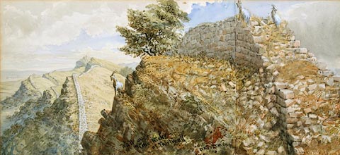 click to enlarge click to enlargePR0788.jpg View of Hadrian's Wall; goats stand on promontory in foreground amongst its scattered masonry. inscribed &signed at bottom centre:- "Wall over Nine Nicks of Thirlwall D Mossmam" annotated at reverse:- "The Roman Wall - The Nine Nicks of Thirlwall Presented by the Artist D Mossman 1893" item:- Tullie House Museum : 1889.8.1 Image © Tullie House Museum |
|||||||||||||||||||||||||||||||||||||||||||||||
|
|
||||||||||||||||||||||||||||||||||||||||||||||||
| evidence:- | old painting:- placename:- Roman, Wall, The |
|||||||||||||||||||||||||||||||||||||||||||||||
| source data:- | Painting, watercolour, The Roman Wall, the Vallum at Limestone Bank, Heddon-on-the-Wall,
Northumberland, by David Mossman, 1880s.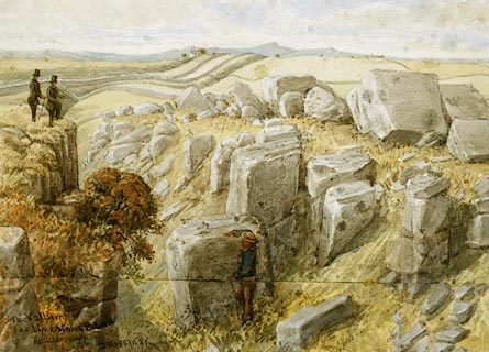 click to enlarge click to enlargePR0790.jpg View of Hadrian's Wall; huge blocks of stone litter the foreground. Behind one of them a man hides from the view of two gentlemen who stand upon a promontory to left of composition. inscribed &signed at bottom left:- "The Vallum at Limestone Bank Heddon on Wall D Mossman" annotated at reverse:- "The Roman Wall - The Vallum at Limestone Bank. Presented by the Artist D Mossman 1893" item:- Tullie House Museum : 1889.8.3 Image © Tullie House Museum |
|||||||||||||||||||||||||||||||||||||||||||||||
|
|
||||||||||||||||||||||||||||||||||||||||||||||||
| evidence:- | old print:- |
|||||||||||||||||||||||||||||||||||||||||||||||
| source data:- | Print, coloured, Hadrian Building the Roman Wall, Northumberland, by Joseph W Simpson,
1937 with text by T Gray on reverse.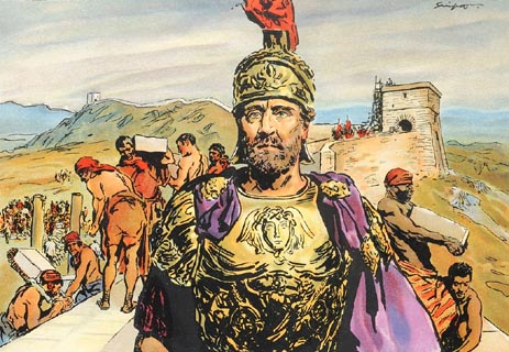 click to enlarge click to enlargePR1420.jpg Emperor Hadrian stands in top of The Wall whislt his troops can be seen building the wall in the background surrounded by the Northumberland landscape. signed at top right on print:- "Simpson" 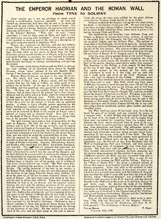 click to enlarge click to enlargePR1421.jpg text by T Gray about Hadrian Building the Roman Wall, on reverse of coloured print by Joseph W Simpson, 1937. item:- Tullie House Museum : 2009.210.4 Images © Tullie House Museum |
|||||||||||||||||||||||||||||||||||||||||||||||
|
|
||||||||||||||||||||||||||||||||||||||||||||||||
| :- |
Odd books; this is not a proper bibliography. |
|||||||||||||||||||||||||||||||||||||||||||||||
| Birley, A R: 1963: Hadrian's Wall: HMSO (London) Birley, E: 1961: Research on Hadrian's Wall: Wilson, Titus (Kendal, Westmorland) Bruce, J Collingwood: 1909 (6th edn) &1965 (12th edn): Handbook to the Roman Wall: Reid, Andrew (Newcastle upon Tyne, Northumberland) Collingwood, R G: 1921: Hadrian's Wall, a History of the Problem: Journal of Roman Studies: vol.2: pp.37-66 Haynes, H W: 1890: Roman Wall in Britain: Journal of the American Geographical Society of New York: vol,23: pp.157-210 Hodgkin, T: 1896: Literary History of the Roman Wall: Archaeologia Aeliana: series 2 vol.18: pp.83-108 Mann, J C: 1969: Northern Frontier of Britain from Hadrian to Honorius: University of Durham:: ancient texts Ordnance Survey: 1964: Map of Hadrian's Wall Shannon, William D: 2007: Murus ille famosus &That Famous Wall: CWAAS:: ISBN 978 1 873124 45 1 Wilson, Roger A: 1975: Roman Remains in Britain: Book Club Associates |
||||||||||||||||||||||||||||||||||||||||||||||||
|
|
||||||||||||||||||||||||||||||||||||||||||||||||
| person:- | manager : English Heritage |
|||||||||||||||||||||||||||||||||||||||||||||||
|
|
||||||||||||||||||||||||||||||||||||||||||||||||
| mapping:- | roman fort, Wallsend Segedunum Milecastle 1, Northumberland Milecastle 2, Northumberland Milecastle 3, Northumberland Milecastle 4, Northumberland roman fort, Newcastle upon Tyne Pons Aelii Milecastle 5, Northumberland Milecastle 6, Northumberland roman fort, Benwell Condercum Milecastle 7, Northumberland Milecastle 8, Northumberland Milecastle 9, Northumberland Milecastle 10, Northumberland Milecastle 11, Northumberland Milecastle 12, Northumberland Milecastle 13, Northumberland roman fort, Rudchester Vindobala Milecastle 14, Northumberland Milecastle 15, Northumberland Milecastle 16, Northumberland Milecastle 17, Northumberland Milecastle 18, Northumberland Milecastle 19, Northumberland Milecastle 20, Northumberland Milecastle 21, Northumberland roman fort, Halton Chesters Onnum Milecastle 22, Northumberland Milecastle 23, Northumberland Milecastle 24, Northumberland Milecastle 25, Northumberland Milecastle 26, Northumberland Milecastle 27, Northumberland roman bridge, Chesters River North Tyne roman fort, Chesters Cilurnum Milecastle 28, Northumberland Milecastle 29, Northumberland Milecastle 30, Northumberland Milecastle 31, Northumberland roman fort, Carrawburgh Brocolitia Milecastle 32, Northumberland Milecastle 33, Northumberland Milecastle 34, Northumberland Milecastle 35, Northumberland Milecastle 36, Northumberland roman fort, Housesteads Vercovicium Milecastle 37, Northumberland Milecastle 38, Northumberland Milecastle 39, Northumberland Milecastle 40, Northumberland Milecastle 41, Northumberland Milecastle 42, Northumberland roman fort, Great Chesters Aesica Milecastle 43, Northumberland Milecastle 45, Northumberland Milecastle 44, Northumberland Milecastle 46, Northumberland Milecastle 47, Northumberland Milecastle 48, Upper Denton Hadrian's Wall, milecastle 48 to 49 turret 48A, Upper Denton turret 48B, Upper Denton roman bridge, Willowford River Irthing Milecastle 49, Waterhead Hadrian's Wall, milecastle 49 to 50 roman fort, Birdoswald Banna turret 49B, Waterhead Milecastle 50, Waterhead Milecastle 51, Waterhead turret 51A, Waterhead turret 51B, Waterhead Milecastle 52, Waterhead signal tower, Waterhead turret 52A, Waterhead Milecastle 53, Burtholme Milecastle 54, Burtholme Milecastle 55, Burtholme Milecastle 58, Irthington Milecastle 59, Irthington Milecastle 60, Irthington Milecastle 61, Stanwix Rural Milecastle 64, Stanwix Rural Milecastle 65, Stanwix Rural roman fort, Stanwix Uxelodunum roman bridge, Stanwix River Eden Milecastle 66, Stanwix Rural Milecastle 67, Beaumont Milecastle 68, Beaumont Milecastle 69, Beaumont Milecastle 70, Beaumont Milecastle 71, Beaumont roman fort, Burgh by Sands Aballava Milecastle 72, Burgh by Sands Milecastle 73, Burgh by Sands Milecastle 74, Burgh by Sands Milecastle 75, Bowness [Milecastle 76, Bowness] roman fort, Drumburgh Concavata [Milecastle 77, Bowness] Milecastle 78, Bowness Milecastle 79, Bowness roman fort, Bowness-on-Solway Maia |
|||||||||||||||||||||||||||||||||||||||||||||||
|
|
||||||||||||||||||||||||||||||||||||||||||||||||
| mapping:- | ||||||||||||||||||||||||||||||||||||||||||||||||
|
|
||||||||||||||||||||||||||||||||||||||||||||||||
| mapping:- | ||||||||||||||||||||||||||||||||||||||||||||||||
|
|
||||||||||||||||||||||||||||||||||||||||||||||||
Lakes Guides menu.