 Old Cumbria Gazetteer
 |
 |
|
||||||||||||||||||||||||
| Windermere lake | ||||||||||||||||||||||||||
| Wonwaldremere | ||||||||||||||||||||||||||
| civil parish:- | Windermere (formerly Westmorland) | |||||||||||||||||||||||||
| civil parish:- | Lakes (formerly Westmorland) | |||||||||||||||||||||||||
| county:- | Cumbria | |||||||||||||||||||||||||
| locality type:- | lake | |||||||||||||||||||||||||
| coordinates:- | SD392950 | |||||||||||||||||||||||||
| 1Km square:- | SD3995 | |||||||||||||||||||||||||
| 10Km square:- | SD39 | |||||||||||||||||||||||||
| 10Km square:- | NY30 | |||||||||||||||||||||||||
| 10Km square:- | SD38 | |||||||||||||||||||||||||
|
|
||||||||||||||||||||||||||
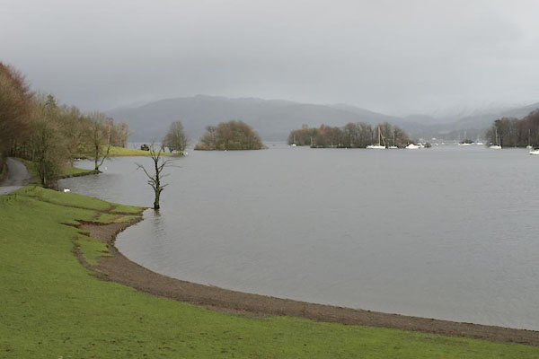 BVV08.jpg From Coatlap Point. (taken 27.1.2012) 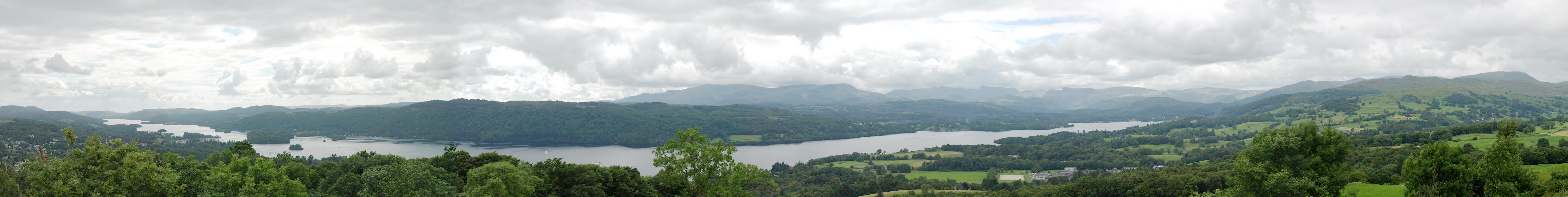 Click to enlarge BTH68.jpg Panorama from Orrest Head. (taken 5.8.2010) |
||||||||||||||||||||||||||
|
|
||||||||||||||||||||||||||
| evidence:- | old map:- OS County Series (Wmd 32 7) placename:- Winder Mere |
|||||||||||||||||||||||||
| source data:- | Maps, County Series maps of Great Britain, scales 6 and 25
inches to 1 mile, published by the Ordnance Survey, Southampton,
Hampshire, from about 1863 to 1948. OS County Series (Wmd 37 10) |
|||||||||||||||||||||||||
|
|
||||||||||||||||||||||||||
| evidence:- | old map:- OS County Series (Lan 2 11) placename:- Windermere |
|||||||||||||||||||||||||
| source data:- | Maps, County Series maps of Great Britain, scales 6 and 25
inches to 1 mile, published by the Ordnance Survey, Southampton,
Hampshire, from about 1863 to 1948. OS County Series (Lan 5 11) OS County Series (Lan 8 7) |
|||||||||||||||||||||||||
|
|
||||||||||||||||||||||||||
| evidence:- | old map:- OS County Series (Wmd 26) |
|||||||||||||||||||||||||
| source data:- | Maps, County Series maps of Great Britain, scales 6 and 25
inches to 1 mile, published by the Ordnance Survey, Southampton,
Hampshire, from about 1863 to 1948. "Sur. of Water 128.0 / July 1889" feet above sea level; labelled at NY377020 "Lowest point of bed of lake / 91 Feet below OS.S. datum" labelled at NY382007 "Sur. of Water 128.0 / July 1889" feet above sea level; labelled at SD395982 |
|||||||||||||||||||||||||
|
|
||||||||||||||||||||||||||
| evidence:- | old map:- Gough 1350s-60s placename:- Wenandremere |
|||||||||||||||||||||||||
| source data:- | Map, colour photozincograph copy, reduced size facsimile, Gough
Map of Britain, scale about 28.5 miles to 1 inch, published by
the Ordnance Survey, Southampton, Hampshire, 1875. click to enlarge click to enlargeGgh1Cm.jpg "Wenandremere" Labelling an outline with some wavy lines. item:- JandMN : 33 Image © see bottom of page |
|||||||||||||||||||||||||
|
|
||||||||||||||||||||||||||
| evidence:- | old map:- Gough 1350s-60s placename:- Wenandremere |
|||||||||||||||||||||||||
| source data:- | Map, lithograph facsimile, Gough Map of Britain, 20 miles to 1
inch? published by the Ordnance Survey, Southampton, Hampshire,
1935. click to enlarge click to enlargeGgh2Cm.jpg "Wenandremere" Labelling an outline with some wavy lines. item:- JandMN : 34 Image © see bottom of page |
|||||||||||||||||||||||||
|
|
||||||||||||||||||||||||||
| evidence:- | old map:- Saxton 1579 placename:- Wynandermere Flu. |
|||||||||||||||||||||||||
| source data:- | Map, hand coloured engraving, Westmorlandiae et Cumberlandiae Comitatus ie Westmorland
and Cumberland, scale about 5 miles to 1 inch, by Christopher Saxton, London, engraved
by Augustinus Ryther, 1576, published 1579-1645.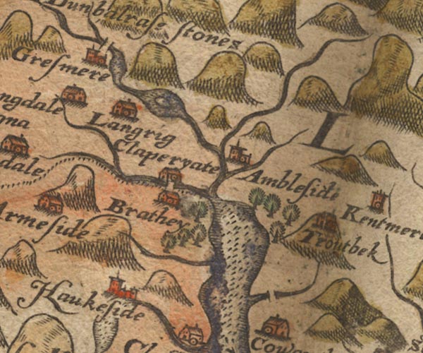 Sax9NY30.jpg 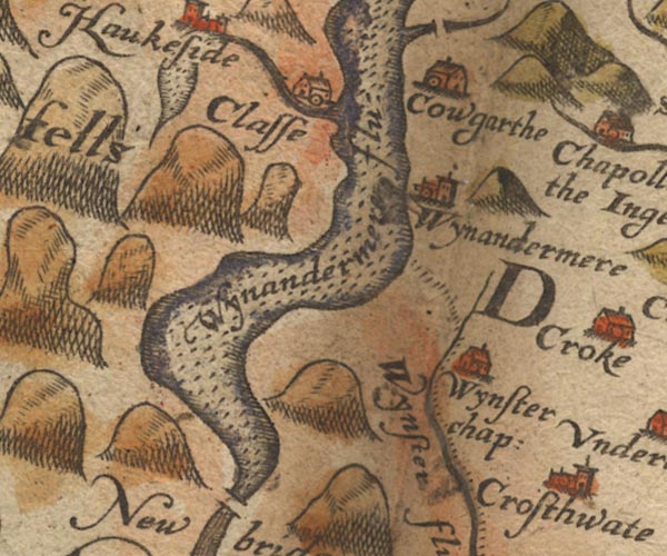 Sax9SD39.jpg "Wynandermere flu:" Lake; the county boundary is in the lake. item:- private collection : 2 Image © see bottom of page |
|||||||||||||||||||||||||
|
|
||||||||||||||||||||||||||
| evidence:- | old map:- Mercator 1595 (edn?) placename:- Winander Mere |
|||||||||||||||||||||||||
| source data:- | Map, hand coloured engraving, Westmorlandia, Lancastria, Cestria
etc, ie Westmorland, Lancashire, Cheshire etc, scale about 10.5
miles to 1 inch, by Gerard Mercator, Duisberg, Germany, 1595,
edition 1613-16. MER5WmdA.jpg "Winander mere" outline, coast shaded, tinted blue; lake, county boundary with Lancashire item:- Armitt Library : 2008.14.3 Image © see bottom of page |
|||||||||||||||||||||||||
|
|
||||||||||||||||||||||||||
| evidence:- | old map:- Keer 1605 |
|||||||||||||||||||||||||
| source data:- | Map, hand coloured engraving, Westmorland and Cumberland, scale
about 16 miles to 1 inch, probably by Pieter van den Keere, or
Peter Keer, about 1605 edition perhaps 1676. click to enlarge click to enlargeKER8.jpg "" outline, shaded; lake; the county boundary is not clear item:- Dove Cottage : 2007.38.110 Image © see bottom of page |
|||||||||||||||||||||||||
|
|
||||||||||||||||||||||||||
| evidence:- | old map:- Speed 1611 (Cum/EW) |
|||||||||||||||||||||||||
| source data:- | Map, hand coloured engraving, Kingdome of Great Britaine and
Ireland, scale about 36 miles to 1 inch, by John Speed, about
1610-11, published by Thomas Bassett, Fleet Street and Richard
Chiswell, St Paul's Churchyard, London, 1676? click to enlarge click to enlargeSPD6Cm.jpg outline, shaded, entirely in Lancashire item:- private collection : 85 Image © see bottom of page |
|||||||||||||||||||||||||
|
|
||||||||||||||||||||||||||
| evidence:- | old map:- Speed 1611 (Wmd) placename:- Wynander mere flud |
|||||||||||||||||||||||||
| source data:- | Map, hand coloured engraving, The Countie Westmorland and
Kendale the Cheif Towne, scale about 2.5 miles to 1 inch, by
John Speed, 1610, published by George Humble, Popes Head Alley,
London, 1611-12. SP14NY30.jpg  SP14SD39.jpg "Wynander mere flud" outline, shore shaded, interior pecked; county boundary through the middle item:- Armitt Library : 2008.14.5 Image © see bottom of page |
|||||||||||||||||||||||||
|
|
||||||||||||||||||||||||||
| evidence:- | poem:- Drayton 1612/1622 text placename:- Wynander mere |
|||||||||||||||||||||||||
| source data:- | Poem, Poly Olbion, by Michael Drayton, published by published by
John Marriott, John Grismand and Thomas Dewe, and others?
London, part 1 1612, part 2 1622. goto source goto sourcepage 136:- "... Where those two mightie Meres, out-stretcht in length do wander, The lesser Thurstan nam'd, the famouser Wynander, ..." |
|||||||||||||||||||||||||
|
|
||||||||||||||||||||||||||
| evidence:- | old map:- Drayton 1612/1622 placename:- |
|||||||||||||||||||||||||
| source data:- | Map, hand coloured engraving, Cumberlande and Westmorlande, by
Michael Drayton, probably engraved by William Hole, scale about
4 or 5 miles to 1 inch, published by John Mariott, John
Grismand, and Thomas Dewe, London, 1622. DRY523.jpg Lake. item:- JandMN : 168 Image © see bottom of page |
|||||||||||||||||||||||||
|
|
||||||||||||||||||||||||||
| evidence:- | table of distances:- Simons 1635 |
|||||||||||||||||||||||||
| source data:- | Table of distances, uncoloured engraving, Lancashire, with a
thumbnail map, by Mathew Simons, published in A Direction for
the English Traviller, 1635. click to enlarge click to enlargeSIM522.jpg outline on thumbnail map item:- private collection : 50.22 Image © see bottom of page |
|||||||||||||||||||||||||
|
|
||||||||||||||||||||||||||
| evidence:- | old map:- Jenner 1643 |
|||||||||||||||||||||||||
| source data:- | Table of distances, with map, hand coloured engraving,
Westmerland ie Westmorland, scale about 16 miles to 1 inch,
engraved by Jacob van Langeren, published by Thomas Jenner,
Cornhill, London, 1643. JEN3Sq.jpg outline, shore shaded item:- private collection : 52.Wmd Image © see bottom of page |
|||||||||||||||||||||||||
|
|
||||||||||||||||||||||||||
| evidence:- | old map:- Ogilby 1675 (plate 96) placename:- Winandermere placename:- Windermere Water |
|||||||||||||||||||||||||
| source data:- | Road strip map, hand coloured engraving, the Road from Kendal to
Cockermouth, and the Road from Egremond to Carlisle, scale about
1 inch to 1 mile, by John Ogilby, London, 1675. OG96m010.jpg In miles 10 to 13, Westmoreland. "Winandermere vulgo Windermere water" alongside the road, on the left for 3 miles. item:- JandMN : 22 Image © see bottom of page |
|||||||||||||||||||||||||
|
|
||||||||||||||||||||||||||
| evidence:- | old map:- Sanson 1679 |
|||||||||||||||||||||||||
| source data:- | Map, hand coloured engraving, Ancien Royaume de Northumberland
aujourdhuy Provinces de Nort, ie the Ancient Kingdom of
Northumberland or the Northern Provinces, scale about 9.5 miles
to 1 inch, by Nicholas Sanson, Paris, France, 1679. click to enlarge click to enlargeSAN2Cm.jpg outline, shore shaded; lake; across the county boundary item:- Dove Cottage : 2007.38.15 Image © see bottom of page |
|||||||||||||||||||||||||
|
|
||||||||||||||||||||||||||
| evidence:- | old map:- Seller 1694 (Wmd) placename:- Wynander Mere flud |
|||||||||||||||||||||||||
| source data:- | Map, hand coloured engraving, Westmorland, scale about 8 miles
to 1 inch, by John Seller, 1694. click to enlarge click to enlargeSEL7.jpg "Wynander mere flud" outline with shaded shore, the label extending northward; lake; on the county boundary item:- Dove Cottage : 2007.38.87 Image © see bottom of page |
|||||||||||||||||||||||||
|
|
||||||||||||||||||||||||||
| evidence:- | old map:- Morden 1695 (EW) |
|||||||||||||||||||||||||
| source data:- | Map, hand coloured engraving, England, including Wales, scale
about 27 miles to 1 inch, by Robert Morden, published by Abel
Swale Awnsham and John Churchil, London, about 1695. click to enlarge click to enlargeMRD3Cm.jpg outline, shaded; lake, drawn in Lancashire item:- JandMN : 339 Image © see bottom of page |
|||||||||||||||||||||||||
|
|
||||||||||||||||||||||||||
| evidence:- | old map:- Morden 1695 (Cmd) placename:- Wynandermere |
|||||||||||||||||||||||||
| source data:- | Map, uncoloured engraving, Cumberland, scale about 4 miles to 1
inch, by Robert Morden, 1695, published by Abel Swale, the
Unicorn, St Paul's Churchyard, Awnsham, and John Churchill, the
Black Swan, Paternoster Row, London, 1695-1715. MD12NY30.jpg  MD12SD39.jpg "Wynandermere" Outline with shore shading, the boundary running through the lake from the Rothay/Brathay to about Fellfoot? item:- JandMN : 90 Image © see bottom of page |
|||||||||||||||||||||||||
|
|
||||||||||||||||||||||||||
| evidence:- | old map:- Morden 1695 (Cmd) placename:- Winander Mere |
|||||||||||||||||||||||||
| source data:- | Map, hand coloured engraving, Westmorland, scale about 2.5 miles to 1 inch, by Robert
Morden, published by Abel Swale, the Unicorn, St Paul's Churchyard, Awnsham, and John
Churchill, the Black Swan, Paternoster Row, London, 1695.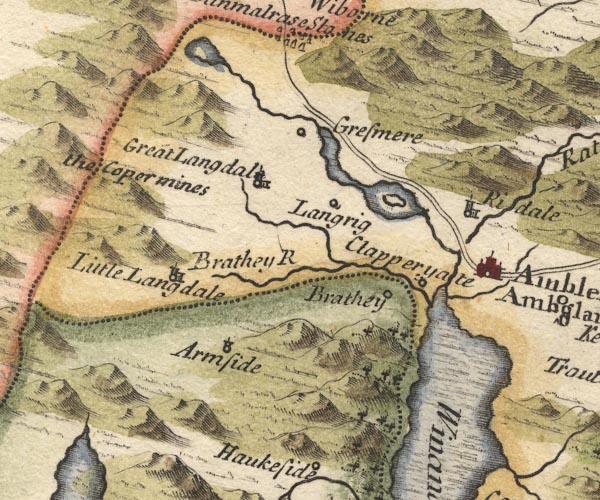 MD10NY30.jpg 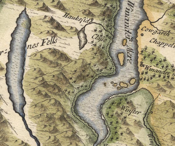 MD10SD39.jpg "Winander Mere" Outline with shore shading, tinted blue; nine unlabelled islands; the county boundary drawn along the east shore. item:- JandMN : 24 Image © see bottom of page |
|||||||||||||||||||||||||
|
|
||||||||||||||||||||||||||
| evidence:- | descriptive text:- Fiennes 1698 placename:- Wiandermer item:- fish, Windermere lake; char; potted char; water; samphire (?) |
|||||||||||||||||||||||||
| source data:- | Travel book, manuscript record of Journeys through England
including parts of the Lake District, by Celia Fiennes, 1698. "... this great lake Wiandermer or great standing water, which is 10 mile long and near halfe a mile over in some places; it has many little hills or isles in it, ... the water is very clear and full of good fish, but the Charr fish being out of season could not easily be taken so I saw none alive, but of other fish I had a very good supper; the season for the Charrfish is between Michaelmas and Christmas, at that tyme I have had of them which they pott with sweete spices, they are as big as a small trout rather slenderer and the skinn full of spots some redish, and part of the whole skinn and the finn and taile is red like the finns of a perch, and the inside flesh looks as red as any salmon; if they are in season their taste is very rich and fatt tho' not so strong or clogging as the lamprys are, but its as fatt and rich a food." "This great water seemes to flow and wave about with the wind or in one motion but it does not ebb and flow like the sea with the tyde, neither does it run so as to be perceivable tho' at the end of it a little rivulet trills from it into the sea, but it seemes to be a standing lake encompass'd with vast high hills that are perfect rocks and barren ground of a vast height from which many little springs out of the rock does bubble up and descend down and fall into this water; notwithstanding great raines the water does not seem much encreased, tho' it must be so, then it does draine off more at the end of the Lake; ..." "... where its so shallow at the shores it is and very cleer you see the bottom, between these stones are weeds which grows up that I had some taken up, just like sampyer [samphire] and I have a fancy its a sort of sampire that indeed is gather'd in the rocks by the sea and water, and this grows in the water but it resembles it in coullour figure and the taste not much unlike, it was somewhat waterish; there was also fine moss growing in the bottom of the water." |
|||||||||||||||||||||||||
|
|
||||||||||||||||||||||||||
| evidence:- | old map, descriptive text:- Bowen 1720 (plate 260) placename:- Winandermere Water placename:- Winander Meer item:- fish |
|||||||||||||||||||||||||
| source data:- | Road strip map, uncoloured engraving, pl.260, The Road from
Kendal to Cockermouth, scale about 2 miles to 1 inch, with
sections in Westmorland and Cumberland, published by Emanuel
Bowen, St Katherines, London, 1720. B260m10.jpg "Winander Meer (at 12) Is reckoned the largest Lake in England &affords great plenty of Fish." item:- private collection : 1.260 Image © see bottom of page |
|||||||||||||||||||||||||
|
|
||||||||||||||||||||||||||
| evidence:- | perhaps old map:- Stukeley 1723 |
|||||||||||||||||||||||||
| source data:- | Road map, uncoloured engraving, the Antonine Itineraries through
Britain, scale about 55 miles to 1 inch, plotted by William
Stukeley, 1723, published London, 1724. click to enlarge click to enlargeStu1Cm.jpg item:- Hampshire Museums : FA2001.171 Image © see bottom of page |
|||||||||||||||||||||||||
|
|
||||||||||||||||||||||||||
| evidence:- | descriptive text:- Defoe 1724-26 placename:- Winander Mere item:- char; golden alpine trout; fish, Windermere lake |
|||||||||||||||||||||||||
| source data:- | Tour through England and Wales, by Daniel Defoe, published in
parts, London, 1724-26. "But I must not forget Winander Mere, which makes the utmost northern bounds of this shire, which is famous for the char fish found here and hereabout, and no where else in England; it is found indeed in some of the rivers or lakes in Swisserland among the Alps, and some say in North Wales; but I question the last. It is a curious fish, and, as a dainty, is potted, and sent far and near, as presents to the best friends; but the quantity they take also is not great. Mr. Cambden's continuator calls it very happily the Golden Alpine Trout." "..." "The great Winander Mere, like the Mediterranean Sea, extends it self on the west side [of Westmorland] for twelve miles and more, reckoning from North Bridge on the south, where it contracts it self again into a river up to Grasmere North, and is the boundary of the county, as I have said, on that side; ..." |
|||||||||||||||||||||||||
|
|
||||||||||||||||||||||||||
| evidence:- | old map:- Badeslade 1742 placename:- Winander Meer |
|||||||||||||||||||||||||
| source data:- | Maps, Westmorland North from London, scale about 10 miles to 1
inch, and Cumberland North from London, scale about 11 miles to
1 inch, with descriptive text, by Thomas Badeslade, London,
engraved and published by William Henry Toms, Union Court,
Holborn, London, 1742; published 1742-49. "The W. side of this County [Westmorland] is divided from Cumberland by Winander Meer, ..." |
|||||||||||||||||||||||||
|
|
||||||||||||||||||||||||||
| evidence:- | old map:- Badeslade 1742 placename:- |
|||||||||||||||||||||||||
| source data:- | Map, uncoloured engraving, A Map of Westmorland North from
London, scale about 10 miles to 1 inch, with descriptive text,
by Thomas Badeslade, London, engraved and published by William
Henry Toms, Union Court, Holborn, London, 1742. click to enlarge click to enlargeBD12.jpg "" outline with form lines, on county boundary, all within Westmorland item:- Dove Cottage : 2007.38.62 Image © see bottom of page |
|||||||||||||||||||||||||
|
|
||||||||||||||||||||||||||
| evidence:- | descriptive text:- Simpson 1746 placename:- Winander Mere placename:- Setantiorum Lacus item:- fish, Windermere lake; char |
|||||||||||||||||||||||||
| source data:- | Atlas, three volumes of maps and descriptive text published as
'The Agreeable Historian, or the Compleat English Traveller
...', by Samuel Simpson, 1746. goto source Page 1020:- "..." "Among the Mountains in the South Part of the County [Westmoreland], on the Borders of Cumberland, lies Winander mere, said to be the greatest Lake in England, and to be so called by [the]" goto sourcePage 1021:- "the Saxons from its winding Banks. It extends itself like a Sea on the West Side from North-bridge on the South, where it contracts itself again into a River to Gresmere North. 'Tis about ten Miles in Length, and paved at the Bottom, as it were, with one continued Rock. 'Tis said to be of a vast Depth in some Parts of it, and is well stored with a Sort of Fish rarely found, except among the Alps, and is reckoned a Sort of Golden Alpine Trout; 'tis baked in Pots, and so sent to London and other Parts, being a most acceptab;e Present. In it are several Isles or Holmes, and the Fishing belongs to Apelthwait a Hamlet in Winander-mere Parish, whose Rector has a Pleasure-boat upon it, and a certain Sum from every Fishing-boat in lieu of Tythes." goto sourcePage 1025:- "..." "Setantiorum Lacus is supposed to be Winander Mere." |
|||||||||||||||||||||||||
|
|
||||||||||||||||||||||||||
| evidence:- | old map:- Simpson 1746 map (Wmd) |
|||||||||||||||||||||||||
| source data:- | Map, uncoloured engraving, Westmorland, scale about 8 miles to 1
inch, printed by R Walker, Fleet Lane, London, 1746.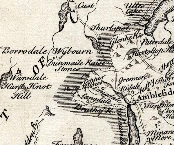 SMP2NYF.jpg  SMP2SDJ.jpg "Winander Mere" Outline with form lines. County boundary along the shore. item:- Dove Cottage : 2007.38.59 Image © see bottom of page |
|||||||||||||||||||||||||
|
|
||||||||||||||||||||||||||
| evidence:- | old text:- Gents Mag placename:- Windermere Lake item:- char; guide; fish, Windermere lake |
|||||||||||||||||||||||||
| source data:- | Magazine, The Gentleman's Magazine or Monthly Intelligencer or
Historical Chronicle, published by Edward Cave under the
pseudonym Sylvanus Urban, and by other publishers, London,
monthly from 1731 to 1922. goto source Gentleman's Magazine 1748 p.563 "[LETTER from Carlisle, June 9, 1746.]" "... When we came to Kendal, 16 miles further [from Lancaster], we enquired after Windermere-lake, we soon procured a guide, then quitted the high-road, and rode 12 miles over some of the wildest hills in Great-Britain. We came upon a high promontory that gave us at once a full view of the bright lake; which, spreading itself under us, in the midst of the mountains, presented one of the most glorious appearances that ever struck the eye of a traveller with transport. It measures 11 miles in length, and two in breadth, and is surrounded, on all sides, with rocks, woods, and inclosures. In some places the crags appear through the trees hanging over the water, in other places little valleys are seen opening between the hills, through which small torrents empty themselves into the lake; and, in all places, the border quite round shows itself delicate and beautiful. In the midst of the lake rise several islands covered with trees, which greatly adorn the prospect. We stayed here sometime to contemplate this surprising scene, and then descended to a small village, but neat, on the verge of the lake, where we procured nets, hired boats, and spent the day on this delightful water, either in fishing or rowing about from island to island, and place to place, exploring the great variety of beauties which surrounded us on all sides. There is one island in this lake containing 30 acres, with an house and garden; as it is the largest, so it is the most admired: but we visited another, which, though much smaller, is greatly more romantic; it is covered all over with trees, and edged all round with rocks; at one end rises a mount to a very considerable height above water, on the top of which is a table and seats, cut out of the rock, agreeably shaded with trees. From this enchanting spot we command a large part of the lake; which, together with the country that incloses it, yields a prospect surpassing all that ever attracted my observation. ... The transparent waters of the lake extend themselves many miles before us, round which shade rises above shade, rock above rock, hill above hill, and mountain above mountain, even to the clouds, forming the most stupendous theatre, presenting the most sublime scenes that human sight can possibly make room for." "I am yours, &c." "(Most of our histories mention that this lake, besides almost all other British fish, is remarkable for the Charr, a fish rarely found but in this county: The Magna Britannia, Nova &Antiqua. Vol.ii. p.1306. gives us the following particulars: "The charr is found in but one part of this mere, the pike destroying them in the other. This fish is about a quarter of a yard long, and thought to be a sort of golden Alpine trout. The male, which is called a milling charr, is the largest, has a red belly, and flesh somewhat white; the female charr is not so red on the belly, but the flesh very red, and, when potted, is delicious meat. Of these great quantities are yearly sent to London from Kendal and Lancaster. They are caught also in Keningston mere, which is about five miles long, and one broad, lying at the foot of Keningston fells, about five miles distant, tho' not in such plenty, but 'tis said, that the charr caught there are fairer and more serviceable than those of Winander mere," - So far the Magna Britannia, which, together with Campden, has furnished the pretended Tours published by some great travellers at home, who, if they had ever been in the counties they describe, could not have published such gross falsities.)" "... ..." |
|||||||||||||||||||||||||
|
|
||||||||||||||||||||||||||
| evidence:- | old map:- Bickham 1753-54 (Wmd) placename:- Winander Meer |
|||||||||||||||||||||||||
| source data:- | Map, uncoloured engraving, perspective view, A Map of
Westmorland, North from London, by George Bickham, James Street,
Bunhill Fields, London, 1753.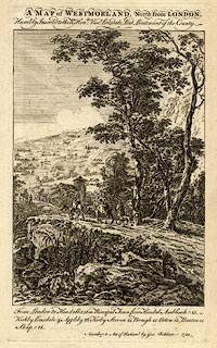 click to enlarge click to enlargeBCK3.jpg "Winander Meer" view (sort of) item:- Armitt Library : 2008.14.71 Image © see bottom of page |
|||||||||||||||||||||||||
|
|
||||||||||||||||||||||||||
| evidence:- | old text:- Gents Mag placename:- Wymansdel Meare item:- earthquake, 1755; Lisbon earthquake |
|||||||||||||||||||||||||
| source data:- | Magazine, The Gentleman's Magazine or Monthly Intelligencer or
Historical Chronicle, published by Edward Cave under the
pseudonym Sylvanus Urban, and by other publishers, London,
monthly from 1731 to 1922. goto source Gentleman's Magazine 1756 p.8 Regarding the Lisbon earthquake:- "Kirkby Lonsdale, in Westmoreland, Nov. 1." "THe lake called Wymansdel-Meare, so famous for the Char-fish, was agitated in a very extraordinary manner; for in an instant the waters rose seven feet, and again as soon subsided; so that two fishermen who were in a boat near the edge of the lake, repairing their fishing tackle, found themselves by one wave carried into it a considerable way, and were so astonished with the sudden transportation, as to declare they expected nothing less than the general consummation." The earthquake that caused troubled waters on Windermere was the Lisbon earthquake 1 November 1755, which is described elsewhere in the Gentleman's Magazine with other articles about earthquakes in general. |
|||||||||||||||||||||||||
|
|
||||||||||||||||||||||||||
| evidence:- | old text:- Morgan 1759 |
|||||||||||||||||||||||||
| source data:- | MG02q030.txt "The lake of Windermere, which the traveller should by no means omit to visit, differs very much from those of Uls-water and Keswick. Here almost every object in view, on the whole lake, confesses fine cultivation. The islands are very numerous, but small and woody, and rather bear a resemblance to the artificial circles raised on gentlemen's ponds for their swans. The great island is a mere bank of sand, and is now under the despoiling hand of a deformer. The innumerable promontories are composed of fine meadow ground, and ranges of trees; the hills, except Furness fell, and those above Ambleside, are tame, and on every hand a vast expense of wood-land is stretched upon the view. The paintings of Poussin describe the nobleness of Uls-water; the works of Salvator Rosa express the romantic and rocky scene of Keswick; and the tender and elegant touches of Claude Loraine pencil forth the rich variety of Windermere." "... ..." |
|||||||||||||||||||||||||
|
|
||||||||||||||||||||||||||
| evidence:- | old map:- Bowen and Kitchin 1760 placename:- Winander Mere |
|||||||||||||||||||||||||
| source data:- | Map, hand coloured engraving, A New Map of the Counties of
Cumberland and Westmoreland Divided into their Respective Wards,
scale about 4 miles to 1 inch, by Emanuel Bowen and Thomas
Kitchin et al, published by T Bowles, Robert Sayer, and John
Bowles, London, 1760. BO18SD29.jpg "Winander Mere" outline with form lines and islands 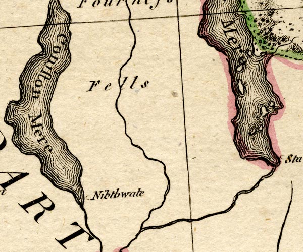 BO18SD28.jpg item:- Armitt Library : 2008.14.10 Image © see bottom of page |
|||||||||||||||||||||||||
|
|
||||||||||||||||||||||||||
| evidence:- | descriptive text:- placename:- Winander Mere item:- fish; char |
|||||||||||||||||||||||||
| source data:- | The Lancashire sheet in the map series has descriptive text:- "Winander Mere is the largest Lake in England being upwards of 18 Miles in Circumference
&its Bottom one continued Rock like a Pavement. It abounds with most Sorts of Fish,
but mostly in the Charr, which are said to be very plentiful in one part of it, the
Pikes destroying them in the other. This Fish is not peculiar to this Mere for 'tis
also found in Coningston Mere about 5 Miles from it." |
|||||||||||||||||||||||||
|
|
||||||||||||||||||||||||||
| evidence:- | old map:- Jefferys 1770 (Wmd) placename:- Winandermere |
|||||||||||||||||||||||||
| source data:- | Map, 4 sheets, The County of Westmoreland, scale 1 inch to 1
mile, surveyed 1768, and engraved and published by Thomas
Jefferys, London, 1770. J5NY30SE.jpg  J5SD39NE.jpg  J5SD39SE.jpg 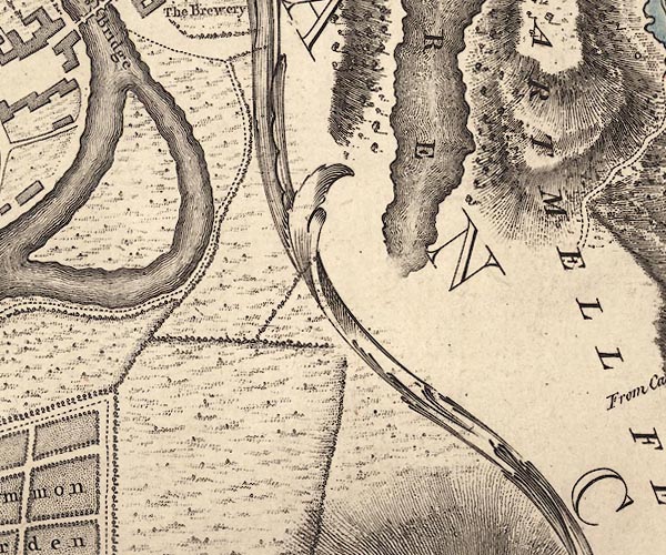 J5SD38NE.jpg "WINANDERMERE" outline with form lines; lake or tarn, tinted as being in Lancashire item:- National Library of Scotland : EME.s.47 Images © National Library of Scotland |
|||||||||||||||||||||||||
|
|
||||||||||||||||||||||||||
| evidence:- | old map:- Pennant 1777 placename:- Winander Mere |
|||||||||||||||||||||||||
| source data:- | Map, hand coloured engraving, A Map of Scotland, Hebrides and
Part of England, drawn for Thomas Pennant, engraved by J Bayly,
published by Benjamin White, London, 1777. click to enlarge click to enlargePEN1Cm.jpg "Winander Mere" lake item:- private collection : 66 Image © see bottom of page |
|||||||||||||||||||||||||
|
|
||||||||||||||||||||||||||
| evidence:- | descriptive text:- West 1778 (11th edn 1821) placename:- Windermere Water placename:- Windermere item:- bulrush; reed; fish, Windermere lake; char; trout; perch; pike; eel; case char; gelt char |
|||||||||||||||||||||||||
| source data:- | Guide book, A Guide to the Lakes, by Thomas West, published by
William Pennington, Kendal, Cumbria once Westmorland, and in
London, 1778 to 1821. goto source Page 56:- "..." "... to the horse-ferry on Windermere-water, four miles. On horseback, this latter is the more eligible rout (sic), as it leads immediately to the centre of the lake, where all its beauties are seen to the greatest advantage." "WINDERMERE." "Windermere-water, like that of Coniston, is viewed to the greatest advantage by facing the mountains, which rise in grandeur on the eye, and swell upon the imagination as they are approached." "The road to the ferry is round the head of Esthwaite-water, through the villages of Colthouse and Sawreys. Ascend a steep" goto sourcePage 57:- "hill, and from its summit, have a view of a long reach of Windermere-water, stretching far to the south, till lost between two high promontories. The road serpentizes round a rocky mountain, till you come under a broken scar, that in some places hangs over the way, and where ancient yews and hollies grow fantastically amongst the fallen rocks. This brings you soon to [station, Windermere 1]" "..." goto sourcePage 71:- "..." "To sum up the peculiar beauties of Windermere, its great variety of landscapes, and enchanting views, after what Mr. Young has said of it is unnecessary. He allowed himself time to examine this lake, and the lakes in Cumberland, and he describes each of them with much taste and judgement, and it is evident he gives the preference to Windermere [1]. Yet this ought not to prejudice the minds of those who have the tour to make, against such as prefer Derwent-water, or" "[1] Mr. Pennant compares it to the chief of the Scotch Lakes and concludes it to be here what Loch Lomond is there." "On the banks of Windermere-water, have been lately built many elegant villas; ... These objects, as works of art, most of which are done in styles suitable to their situation, give an air of consequence to the country, and, with the surrounding natural beauties, have lately made this neighbourhood, and particularly about Ambleside, a place of the greatest celebrity." goto sourcePage 72:- "Ullswater. The styles are all different, and therefore the sensations they excite will also be different; and the idea that gives pleasure or pain in the highest degree, will be the rule of comparative judgement. It will, however, perhaps be allowed by all, that the greatest variety of fine landscape is found at this lake [1]." "These stations will furnish much amusement to those who visit them; and others may perhaps be occasionally found, equally pleasing. And whoever is delighted with water expeditions and entertainments, such as rowing, sailing, fishing, &c., may enjoy them here in the highest perfection." "The principal feeders of Windermere-water, are the rivers Rothay and Brathay.- They unite their streams at the western corner of the head of the lake, below Clappersgate, at a place called the Three-foot-brander, and after a short course boldly enter the lake." "[1] Not one bulrush, or swampy reed defiles the margin of this imperial Lake. No Lake has its border so well ascertained, and of such easy access. Not one, after Lomond, can boast of so vast a guard of mountains, with such variety and diversity of shore." "In Navigating the Lake upwards from the great Island, the extremity appears singularly noble; its parts great and picturesque. The view of the surrounding mountains, from Cove to Kirkstone is astonishing." goto sourcePage 73:- "The fish of this lake are char, trout, perch, pike, and eel. Of the char there are two varieties, the case char, and the gelt char." "The greatest depth of the lake is, opposite to Ecclerigg-cragg, 222 feet. The fall from Newby-bridge, where the current of the lake becomes visible, to the high water-mark of the tide at Low-wood (distant two miles) is 105 feet. The bottom of the lake is therefore 117 feet below the high water-mark of the sea." "..." goto sourcePage 190:- "A TABLE OF THE Height of Mountains and Lakes SEEN IN THIS TOUR, ... TAKEN FROM THE LEVEL OF THE SEA. ... by Mr. John Dalton." "Windermere-water ... 36 [yards]" goto sourceAddendum; Mr Gray's Journal, 1769 Page 212:- "..." "... the afternoon was fine, and the road for the space of full five miles, ran along the side of Windermere [travelling south], with delicious views across it, and almost from one end to the other. It is ten miles in length, and at most a mile over, resembling the course of some vast and magnificent river; but no flat marshy grounds, no osier beds, or patched of scrubby plantations on" goto sourcePage 213:- "its banks: at the head two vallies open among the mountains: one, that by which we came down, the other Langdale, in which Wrynose and Hardknot, two great mountains, rise above the rest: from thence the fells visibly sink, and soften along its sides; sometimes they run into it (but with a gentle declivity) in their own dark and natural complexion: oftener they are green and cultivated, with farms interspersed, and round eminences, on the border covered with trees: towards the south it seemed to break into large bays, with several islands, and a wider extent of cultivation. The way rises continually, till a place called Orrest-head where it turns south-east, losing sight of the water." goto sourceMr Cumberland's Ode to the Sun, 1776 Page 228:- "... Thee, savage Wyburn, now I hail, / Delicious Grasmere's calm retreat, / And stately Windermere I greet, / ..." goto sourceRev Plumtre's Night Piece on Windermere, 1797 Page 229:- "..." "Hark! along his rocky shore, / I hear impetuous Brathay roar; / In sullen majesty he leads, / Among the narrow winding meads, / His tributary tides. / Thee, Rothay, in thy course he meets, / Descending from thy flow'ry bed, / Swift to thee he fondly glides, / With strong embrace thy beauty greets: /" goto sourcePage 230:- "Then, with all your glittering train, / Together your proud course maintain, / And with imperial Windermere, / All your boastful honours share; / With loud acclaim, exulting, hail! / The monarch of the stately vale." "..." goto sourcePage 233:- "..." "Oh! twere endless to declare / Thy charms, imperial Windermere: / Thy prospects, op'ning to the view, / At ev'ry turn delight renew; / The skimming bark, with feath'ry sail, / Flying before the fresh'ning gale, / While Music's voice in aether floats, / And Echo still prolongs the notes.- / What villas on thy banks arise, / T'arrest the far-exploring eyes; / Their vary'd beauties to rehearse, / Might claim for each a Muse's verse. / ..." "But, soft - the rustling leaflets sigh, / Responsive, as the breeze moves by, / In solemn accents, trembling, say, / That Storm and Tempest move this way. / From yonder murky, lab'ring cloud, / Hark! Thunder;s voice rebellows loud: / Heav'ns crystal portals open fly, / And lightning blazes through the sky; /" goto sourcePage 234:- "Wind sweeps along the' afrighted vale; / And pattering rain, with pelting hail, / Commission'd by great Nature's Lord, / Come to fulfil his mighty word, / In many a mingling torrent fall, / While deep to deep, loud answering, call." "..." goto sourceMrs Radcliffe's Ride over Skiddaw, 1794 Page 308:- "[on Skiddaw] ... Over the fells of Borrowdale, and far to the south, the northern end of Windermere appeared, like a wreath of grey smoke that spreads along a mountain's side. ..." |
|||||||||||||||||||||||||
|
|
||||||||||||||||||||||||||
| evidence:- | old map:- Crosthwaite 1783-94 (Win/Ble) placename:- Windermere |
|||||||||||||||||||||||||
| source data:- | Map, uncoloured engraving, An Accurate Map of the Grand Lake of
Windermere, scale about 2 inches to 1 mile, by Peter
Crosthwaite, Keswick, Cumberland, 1783, version published 1819.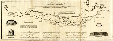 click to enlarge click to enlargeCT09.jpg "An Accurate Map of the Grand Lake of Windermere" item:- Armitt Library : 2008.14.102 Image © see bottom of page |
|||||||||||||||||||||||||
|
|
||||||||||||||||||||||||||
| evidence:- | old map:- West 1784 map placename:- Windermere Water |
|||||||||||||||||||||||||
| source data:- | Map, hand coloured engraving, A Map of the Lakes in Cumberland,
Westmorland and Lancashire, scale about 3.5 miles to 1 inch,
engraved by Paas, 53 Holborn, London, about 1784. Ws02NY30.jpg  Ws02SD39.jpg "WINDERMERE WATER" The county boundary is drawn across the lake at Rawlinson's Nab.  Ws02SD38.jpg item:- Armitt Library : A1221.1 Image © see bottom of page |
|||||||||||||||||||||||||
|
|
||||||||||||||||||||||||||
| evidence:- | old print:- Middiman 1784-92 |
|||||||||||||||||||||||||
| source data:- | Print, uncoloured engraving, Winandermere Lake, Westmorland, painted by G Barrett,
engraved and published by Samuel Middiman, 3 Grafton Street, Tottenham Court Road,
London, 1784.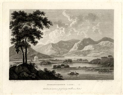 click to enlarge click to enlargeMM0101.jpg "Painted by G. Barrett R.A. / Engrav'd by S. Middiman. / WINNANDERMERE LAKE. / Publish'd as the Act directs, Jany. 1. 1784, by S. Middiman, London." Accompanying text:- "PLATE I." "WINANDERMERE - LAKE," "WESTMORELAND." "AFTER Loch Lomond, no lake boasts such Diversity of Shore and Variety of Landscape as Winandermere; every Station presents the most delightful rural Scenes; and the whole Coup d'Oiel, consisting of a romantic Guard of Mountains, is beautiful and picturesque." "Over this vast Expanse of Water are dispersed several wooded Islands, finely disposed, and rising gently from the Lake, forming, between their Curvatures, a Variety of pleasing Bays. ..." "A Morning Prospect is here represented; Furness-Fells, to the Left, stand in deep Shade; the rays of the Sun having dispersed the vapours from the mountains of Fairfield and Rydal Head, are displayed on the Summits of Troutbeck and Kentmere." "..." item:- Armitt Library : A6858.1 Image © see bottom of page |
|||||||||||||||||||||||||
|
|
||||||||||||||||||||||||||
| evidence:- | old print:- Middiman 1784-92 placename:- Winandermere Lake |
|||||||||||||||||||||||||
| source data:- | Print, uncoloured engraving, View of Winandermere Lake, Westmorland, drawn by F Wheatly,
engraved and published by Samuel Middiman, 3 Grafton Street, Tottenham Court Road,
London, 1786.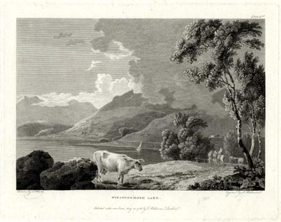 click to enlarge click to enlargeMM0601.jpg "Drawn by F. Wheatly. / Engrav'd by S. Middiman. / WINANDERMERE LAKE. / Publish'd as the Act directs, May 25. 1786, by S. Middiman, London." "Plate 2nd." Accompanying text:- "PLATE XXI." "WINANDERMERE LAKE," "WESTMORELAND." "A VIEW of Winandermere having already been given in the first Number of this Work, accompanied with a short general Description of the Lake; to dwell here upon it, therefore, iin this Place, may be unnecessary, as we shall endeavour, particularly where the View represented may compose Parts of a Whole already described, to confine the Account as nearly as possible to its respective Subject." "A Part of the Lake is here shewn, near its northern Extremity, not far distant from Low-Wood Inn: In the Route from this Place to Ambleside some of the finest natural Beauties of the Lake may be seen; and the Eye perpetually meets a Succession of nameless Mountains in almost every Variety of Form." "At Low-Wood Inn, immediately on the Shore, a small Cannon is kept, in order to entertain the curious Travellers with the remarkable Reverberations of Sound that succeed its reports in these singular Regions." item:- Armitt Library : A6863.1 Image © see bottom of page |
|||||||||||||||||||||||||
|
|
||||||||||||||||||||||||||
| evidence:- | old print:- Middiman 1784-92 placename:- Winandermere Lake |
|||||||||||||||||||||||||
| source data:- | Print, uncoloured engraving, Winandermere Lake, drawn by F Wheatly, engraved and published
by Samuel Middiman, 3 Grafton Street, Tottenham Court Road, London, 1787.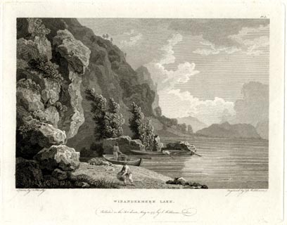 click to enlarge click to enlargeMM0801.jpg "Drawn by F. Wheatly. / Engrav'd by S. Middiman. / WINANDERMERE LAKE. / Publish'd as the Act directs, May 25. 1787, by S. Middiman, London." "Pl.3." Accompanying text:- "PLATE XXIX." "WINANDERMERE LAKE," "WESTMORELAND." "IN the former Numbers of this Work we have been enabled to give Views of some of the most picturesque Stations near the northern Lakes, therefore a few Words on the Nature of their Mountains, may not here improperly be added. These Hills are in general formed of a blue Rag-Stone of a fissile, absorbent Nature, and frequently covered with wet Ling, and Moss: That they imbibe the descending Rains is evident from the numerous temporary Cataracts which are seen pouring down their Sides. In some Parts the Limestone Rock prevails, which is perfectly dry, and the Grass that covers it peculiarly fine." "In these Mountains particularly, is found the blue Slate, which has so many Properties to recommend it as a Covering for Buildings; it is beautiful, light, resist the Waether, and is easily repaired. It is observed of these Rocks, that extraneous Fossils or Petrifactions are rarely to be met with." item:- Armitt Library : A6865.1 Image © see bottom of page |
|||||||||||||||||||||||||
|
|
||||||||||||||||||||||||||
| evidence:- | old sketch map:- Gilpin 1786 placename:- Windermere |
|||||||||||||||||||||||||
| source data:- | Sketch map, Windermere lake, Westmorland, by William Gilpin, 1772-74. goto source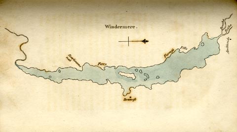 click to enlarge click to enlargeGLP308.jpg Plate vol 1 opposite p.135 in Observations on Picturesque Beauty published by T Cadell and W Davies, Strand, London, 1808 caption from the list of plates:- "This plan of Windermere is not geographically exact; but enough so to give the reader an idea of it's shape, and the situation of the several places mentioned on it's shores." item:- Armitt Library : A918.8 Image © see bottom of page |
|||||||||||||||||||||||||
|
|
||||||||||||||||||||||||||
| evidence:- | old text:- Gilpin 1786 placename:- Windermere placename:- Winander Water |
|||||||||||||||||||||||||
| source data:- | Book, Observations, Relative Chiefly to Picturesque Beauty, Made
in the Year 1772, on Several Parts of England, Particularly the
Mountains, and Lakes of Cumberland Westmoreland, by Rev William
Gilpin, 1772-74; published 1786-1808. goto source vol.1 p.134 "..." "Windermere, or Winander-water, as it is sometimes called, extends from north to south, about twelve or fourteen miles. In breadth it rarely exceeds two; and is seldom narrower than one. The southern end winds a little towards the west. The northern, and western coasts are wild, and mountainous - the eastern, and southern are more depressed; in" goto sourcevol.1 p.135 "some parts cultivated, in others woody. Opposite to Bowness, the lake is divided into two parts by a cluster of islands; one of which is larger than the rest." |
|||||||||||||||||||||||||
|
|
||||||||||||||||||||||||||
| evidence:- | old print:- Gilpin 1786 placename:- Windermere |
|||||||||||||||||||||||||
| source data:- | Print, aquatint, Windermere lake, by William Gilpin, 1772-74 goto source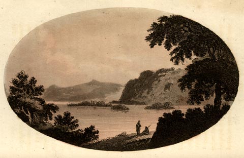 click to enlarge click to enlargeGLP309.jpg plate opposite vol.1 p.135 in Observations on Picturesque Beauty published by T Cadell and W Davies, Strand, London, 1808. caption from the list of plates:- "This view of the middle part of Windermere, is taken from the grounds a little to the north of Bowness. The distance, as the reader will observe from the plan, is composed of that country, which shoots away towards the south. The high grounds make a part of Furness-fell; which is described, in page 143, stretching along the western shores of the lake towards the north.- Below Furness-fells appear some of the islands of the lake, particularly the great island; which is the most southern of them." item:- Armitt Library : A918.9 Image © see bottom of page |
|||||||||||||||||||||||||
|
|
||||||||||||||||||||||||||
| evidence:- | old text:- Clarke 1787 placename:- Lake of Winandermere item:- depth, Windermere lake; depth soundings; fishery; fish, Windermer lake; pike; trout; eels; perch; char; pissmires; ants |
|||||||||||||||||||||||||
| source data:- | Guide book, A Survey of the Lakes of Cumberland, Westmorland,
and Lancashire, written and published by James Clarke, Penrith,
Cumberland, and in London etc, 1787; published 1787-93. goto source Page 143:- "..." "The Lake of Winandermere is the largest in England, and contains, below the Ferry, two thousand acres at low water, and 2574 above the Ferry, (including islands;) deduct for islands forty acres, and there then remain 4534 acres of water in the whole: The length down the middle ten miles and a half; from Ambleside along the road by Troutbeck Bridge and Bowness to Fell-Foot, is eleven miles and a half. This Lake having been reported by the fishermen and others to be in many places 70 and 80 fathoms deep, I determined to try it by experiment: I therefore got a line made up of hair, 90 fathoms long, to which I put an iron weight of eight pounds, hollow up the middle: I then sounded this and all the other Lakes, and found the depths as marked upon the plans where taken. It had also been reported, that these Lakes had gravelly bottoms of clear, white, and red pebbles, &c.; but I found no rocky or pebbly bottom; at two fathoms the weight generally sunk into the mud at the bottom, and the tube came up filled with very small sand like dust; by letting it stay one minute at the bottom, it would have sunk a foot into the mud, which might be easily distinguished by the line; ..." "The fishery in this Lake is a freehold belonging to several men, which together pay a quit-rent of six pounds to the lord of the manor, but is not very valuable; for the pike, the most voracious of all fresh water fish is in plenty here the whole year, and destroys the other fish: Here are also trout, eels, perch, and charr; the trouts are scarce and bad, though some are pretty large; they are, however, ill fed, owing as I suppose, to not venturing to seek food for fear of their natural enemy the pike." |
|||||||||||||||||||||||||
| source data:- | goto source Page 144:- "On the 28th of October 1784, I was upon the shore above Cunza, (see plate XI.) when I observed a boat coming towards me, and near the same time perceived it stop, and the men in it take something out of the water; on their coming ashore, they told me, that in coming, they saw two large trouts floating upon the surface of the Lake with their bellies uppermost, close alongside each other, and seemingly dead. On laying hold of one of them, they seemed to be entangled, but in lifting it out of the water the other made its escape; they then discovered, that these had seized between them a small trout, and each seemed determined to lose its life rather than its prey: they had struggled till life was almost spent, and both might have been easily taken if the fishermen had believed either to have been alive; the lesser, which they took, weighed about a pound and a half, but was very ill fed; they other they supposed to weigh above two pounds; their being obliged to prey upon their own species is a proof of the great scarcity of their proper food. The charr in this lake are of excellent quality for potting, many pots of which are sent to different parts of the kingdom every year; I do not, however, think them superior in quality to the Ulswater trout, and are distinguishable from them more by their colour than taste; so much alike, indeed, are they, that many pots of Ulswater trout are sold for Winandermere charr. They are taken in this Lake in perfection only from the beginning of September to the middle of February, during which time they assemble themselves in what is here called Schools, like herring; sometimes near the shore, sometimes near the middle of the Lake; when thus assembled, (if observed by the fishermen who watch at these seasons,) they surround them with nets, and take them into their boats without dragging them on shore. ... There are two kinds of charr here as well as in Ulswater, (viz.) the silver and the golden charr, which some have distinguished by the male and female: That, however, I deny, from my own observations, too tedious to mention here. They are two different species, commonly here known by the white-belly'd and red-belly'd charr, the white are much more valuable; in this Lake both kinds are larger than in Ulswater; the golden or red-belly'd charr in Ulswater are never used for potting, but are sold at the rate of two-pence or three-pence a pound with the coarser trouts, which here are distinguished in value, not by their size, but their tongue." "In the latter end of Summer, amazing quantities of winged pissmires, (or ants) alight upon the surface of this Lake, upon which animal the charr feed with wonderful greediness, and to this food some attribute the colour of their flesh in the Autumnal season. Pike is taken with nets, and sometimes with the bait, but not very often, and affords little entertainment to the angler; perch, in like manner, and eels, but more frequently with bait. The fishery belongs to the lord of the manor, viz. the King, and is divided into what is called (here) three cables, the rector having the tenth for the tythe; but this is settled by a prescription of so much a boat. The ferry or navigation cross there is a freehold, paying a merk lord's rent, and is the property of Mr Brathwaite of Harrow Slack. The value of the fishing in the several Lakes are as follows, at present:" |
|||||||||||||||||||||||||
|
|
||||||||||||||||||||||||||
| evidence:- | old map:- Clarke 1787 map (Windermere N) placename:- Winandermere |
|||||||||||||||||||||||||
| source data:- | Map, A Map of the Northern Part of the Lake Winandermere and its
Environs, scale about 6.5 ins to 1 mile, by James Clarke,
engraved by Samuel John Neele, 352 Strand, published by James
Clarke, Penrith, Cumberland and in London etc, 1787. click to enlarge click to enlargeCL10.jpg "A MAP of the NORTHERN PART of the LAKE WINANDERMERE, and its ENVIRONS, Surveyed by JAMES CLARKE. ..." item:- private collection : 10.10 Image © see bottom of page |
|||||||||||||||||||||||||
|
|
||||||||||||||||||||||||||
| evidence:- | old map:- Clarke 1787 map (Windermere S) placename:- Winandermere |
|||||||||||||||||||||||||
| source data:- | Map, A Map of the Southern Part of the Lake Winandermere and its
Environs, scale about 6.5 ins to 1 mile, by James Clarke,
engraved by Samuel John Neele, 352 Strand, published by James
Clarke, Penrith, Cumberland and in London etc, 1787. click to enlarge click to enlargeCL11.jpg "A MAP of the SOUTHERN PART of the LAKE WINANDERMERE and its ENVIRONS Surveyed by James Clarke." item:- private collection : 10.11 Image © see bottom of page |
|||||||||||||||||||||||||
|
|
||||||||||||||||||||||||||
| evidence:- | old text:- Camden 1789 placename:- Winander Mere placename:- Winwadre Mer item:- char; fishing |
|||||||||||||||||||||||||
| source data:- | Book, Britannia, or A Chorographical Description of the Flourishing Kingdoms of England,
Scotland, and Ireland, by William Camden, 1586, translated from the 1607 Latin edition
by Richard Gough, published London, 1789. goto source Page 132:- "... among these hills is the largest lake in England, called Winander mere, Saxon [Winƿadre-mer - Anglo Saxon], probably from its windings on a bed of almost one stone continued for near ten miles with crooked banks, and, according to the reports of the inhabitants of an immense depth, abounding with a species of fish peculiar to itself, called by the people thereabouts chare. It has a small village of its own name on it, ..." |
|||||||||||||||||||||||||
|
|
||||||||||||||||||||||||||
| evidence:- | old text:- Camden 1789 (Gough Additions) placename:- Wynermere wath |
|||||||||||||||||||||||||
| source data:- | Book, Britannia, or A Chorographical Description of the Flourishing Kingdoms of England,
Scotland, and Ireland, by William Camden, 1586, translated from the 1607 Latin edition
by Richard Gough, published London, 1789. goto source Page 144:- ""Ther is a very great lake or mere, whereof part is under the edge of Furnes felles called Wynermere wath (q. water), wherein a straunge fish called a char, not sene else there in the country as they say."" "Winander mere is 15 miles long by one broad, 90 feet deep in the middle, in other places 132 feet, and its greatest depth opposite Ecclerigg crag 222 feet, the bottom smooth horizontal slate rocks. Before storms it has a current in the opposite direction to that point whence the wind comes. ..." "The char which abounds in the cold Lapland lakes is found in Winander mere, Llyn Quellyn at the foot of Snowden, and Llynberis, and in certain lakes of Merionethshire and Scotland. In the 2d and 3d of these the copper works have entirely destroyed the fish. The largest and most beautiful are taken in Winandermeer, distinguished into the case, the gelt or baren, and the red char. Some slight variety in these three. The former spawn about Michaelmas, chiefly in the river Brathy, which has a black stoney bottom, and are in highest perfection from May through the summer. The gelt char spawn from January to March, and keep in the smooth sandy parts of the lake, are taken from the end of September to the end of November, and are esteemed more delicate for the table, especially potted. The spawning season of the Westmorland chars agrees nearly with that of the Welsh ones, which from their colour are called torgoch or red belly, the other two being paler. The Snowdon chars are smaller and paler. The division of the counties Lancaster and Westmorland is through the middle of this lake." "..." "All the isles or holmes in Winander mere are in Westmorland, and all the fishing belongs to Apelthwaite in Winander mere parish in the said county, and all the tithe fish to the rector thereof, who has a pleasure boat on the lake and a prescription of so much a boat in lieu of the said tithe. The abbot of Furness by gift of William de Lancaster baron of Kendal, had formerly two boats on it. See more of it in Westmoreland." |
|||||||||||||||||||||||||
|
|
||||||||||||||||||||||||||
| evidence:- | old text:- Camden 1789 (Gough Additions) placename:- Windermere Water item:- tithes; fish; eels; trout; pike; bass; perch; skelly; char; bird; swan; goose; duck; didapper |
|||||||||||||||||||||||||
| source data:- | Book, Britannia, or A Chorographical Description of the Flourishing Kingdoms of England,
Scotland, and Ireland, by William Camden, 1586, translated from the 1607 Latin edition
by Richard Gough, published London, 1789. goto source Page 153:- "..." "The large lake called Windermere water is in Applethwaite division. The islands within it are all in Windermere parish. The rector hath for time immemorial had a pleasure boat upon it; and he hath a prescription of so much a boat, in lieu of all the tithe fish that are caught in the lake." "This lake is from one to two miles broad, and extends with crooked banks for the space of about thirteen miles, but in a straight line drawn from one end to the other, perhaps not above eight or nine miles, being in some places of a wonderful" goto sourcePage 154:- "depth, and of a good clear pebbly bottom; breeding good store of fish, as eels, trouts (both common and grey), pikes, bass or perch, skellies, and particularly char, which is a fish generally about nine inches long, the rareness of which fish occasions many pots of it to be sent to London and other places yearly as presents. There are three sorts of chars; first, the male, being large, with a red belly, but the fish thereof somewhat white within, having a soft roe, these are called milting chars; secondly, the female, being also large, with not so red a belly, but the fish thereof very red within, having its belly full of hard roes or spawn, called roneing chars; thirdly, the female being not so large nor so red on the outside, but the reddest within, having no roes within its belly, and these are called gelt chars." "Sir Daniel Fleming says, there are no chars to be found save only in this lake and Coningston Water. Some other waters (he says) pretend to have chars in them, as Buttermere in Cumberland, and Ulleswater, which is between Westmorland and Cumberland; but these are generally esteemed by knowing persons to be only case, a kind of fish somewhat like unto char, but not near so valuable; but the owners of the fishery in Ulleswater do not assent to this position." "The fishery in the lake is farmed by several persons, who all together pay to the king's receiver for fishing 6l. a year, or for the fishing and ferry together £.6. 13s. 8d. and so it descends to their executors or administrators." "The fishing is divided into three Cables as they call them: 1. The high cable, from the water head to the char bed, half a mile above Culgarth. 2. The middle cable, from thence to below the ferry. The low cable, from thence to Newby. And in each cable there are four fisheries." "..." "Water fowl in great plenty resort to this lake, especially in winter; such as wild swans, wild geese, ducks, mallard, teal, widgeons, didappers, gravyes (which are larger than ducks, and build in hollow trees), and many others." "In this lake are several islands; ..." |
|||||||||||||||||||||||||
|
|
||||||||||||||||||||||||||
| evidence:- | old map:- Cary 1789 (edn 1805) placename:- Winander Mere |
|||||||||||||||||||||||||
| source data:- | Map, uncoloured engraving, Westmoreland, scale about 2.5 miles
to 1 inch, by John Cary, London, 1789; edition 1805. CY24NY30.jpg  CY24SD39.jpg "Winander Mere" outline with shore form lines, county boundary drawn on east shore, shown in Lancashire; lake or tarn item:- JandMN : 129 Image © see bottom of page |
|||||||||||||||||||||||||
|
|
||||||||||||||||||||||||||
| evidence:- | old print with text:- Farington 1789 (plate 17) |
|||||||||||||||||||||||||
| source data:- | Print, engraving, West view across Windermere from the Hill above Ferry House, Cumbria,
painted by Joseph Farington, engraved by W Byrne and J Landseer, published by W Byrne,
69 Titchfield Street, London, 1785.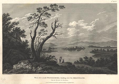 click to enlarge click to enlargeBMZ11.jpg The lake with a fine background of mountains, Belle Isle clear; a group of travellers in the foreground. Plate 17 from Views of the Lakes, &c, in Cumberland and Westmorland, published 1789; with descriptive text:- "VIEW across WINDERMERE, looking over the GREAT ISLAND." "THE Views given of Windermere, when compared with each other, shew that the Style of that Lake and its Environs differs materially from the other Lakes which are exhibited in the Course of this Work. That it is a Landscape of a softer Species, and wears a more cultivated Appearance. In Grandeur and Simplicity it is inferior to Derwentwater and Ulswater; but excels both in Splendour and Extent. Each Lake has a peculiar and striking Character; the Difficulty, therefore, with the Artist, is to determine on those Situations where the Distinction is marked in the strongest Manner. The Islands on Windermere (if they may be so called, many of them being rather wooded Rocks), are ten in number, composing a Kind of Archipelago, and in some Views appearing to separate the upper from the lower Reach of the Lake. In this View, which was taken on the Western Side, nearly opposite the Village of Bowness, the Great-Island, which contains about thirty Acres, forms a principal Object. It is of an oblong Shape, traversing the Lake in an oblique Line, and is the only one on which a Building is erected. From the Ferry-House beneath to Bowness, is the great Pass of Communication from the Western to the Eastern Shore." item:- Dove Cottage : Lowther.12 Image © see bottom of page |
|||||||||||||||||||||||||
|
|
||||||||||||||||||||||||||
| evidence:- | old print with text:- Farington 1789 (plate 14) |
|||||||||||||||||||||||||
| source data:- | Print, engraving, View of Windermere from Gill Head, Cumbria, painted by Joseph Farington,
engraved by T Medland, published by W Byrne, 69 Titchfield Street, London, 1788.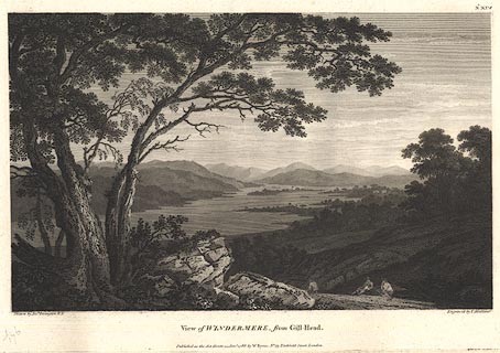 click to enlarge click to enlargeBMZ10.jpg View down the lake, Belle Isle clear in the distance. Plate 14 from Views of the Lakes, &c, in Cumberland and Westmorland, published 1789; with descriptive text:- "VIEW of WINDERMERE from GILL-HEAD." "WINDERMERE or WINANDERMERE as it is sometimes called, is the largest of the Lakes, extending from North to South upwards of ten Miles. In Breadth it rarely exceeds one, and narrows considerably towards the lower End. The Northern and Western Coasts are wild and mountainous, the Eastern and Southern are more depressed, being in some Parts cultivated, in others woody. At about an equal Distance from each Extremity stands the Village of Bowness. Opposite to it the Lake is divided into two Parts by a Cluster of Islands, one of which, being much larger than the rest is usually called the Great-Island. The Drawing of this Subject was made near a Place called Gill-Head, about three Miles below Bowness. It comprehends a general View of the Lake looking towards the North. The Accompanyments of this Lake are highly beautiful, and its Extent gives it an Air of great Magnificence." item:- Dove Cottage : Lowther.11 Image © see bottom of page |
|||||||||||||||||||||||||
|
|
||||||||||||||||||||||||||
| evidence:- | old print with text:- Farington 1789 (plate 19) |
|||||||||||||||||||||||||
| source data:- | Print, engraving, View looking down Windermere, taken above Rarig ie Rayrigg, Lakes,
Cumbria, painted by Joseph Farington, engraved by W Byrne and T Medland, published
by W Byrne, 69 Titchfield Street, London, 1789.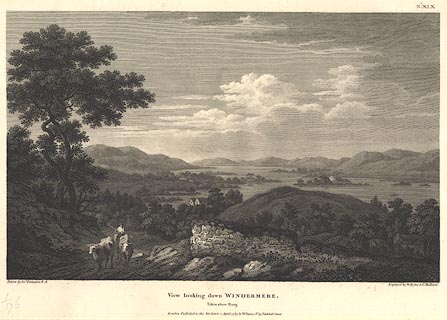 click to enlarge click to enlargeBMZ09.jpg A farmer on horseback drives cattle up Rayrigg Bank in the foreground, Belle Isle is clear in the lake. Plate 19 from Views of the Lakes, &c, in Cumberland and Westmorland, published 1789; with descriptive text:- "VIEW looking down WINDERMERE from above RARIG." "THIS View comprehends the Lower Reach of Windermere looking towards the South, and is the Reverse of that given from Gill-Head. The Lakes here assumes the Appearance of a noble River, indented with wooded Peninsulas intersecting each other: at the Distance of several Miles, it narrows into a Stream of a moderate Width, which passing by the Village of Newby soon enters an Arm of the Sea.- Rarig, which lies below, is placed near the Road leading from Bowness to Ambleside, and is a Situation much admired for the many beautiful Points of View which are found in its Vicinity." item:- Dove Cottage : Lowther.10 Image © see bottom of page |
|||||||||||||||||||||||||
|
|
||||||||||||||||||||||||||
| evidence:- | old print with text:- Farington 1789 (plate 15) |
|||||||||||||||||||||||||
| source data:- | Print, engraving, View from Rydal, looking towards Windermere, Cumbria, painted by
Joseph Farington, engraved by B T Pouncy, published by W Byrne, 69 Titchfield Street,
London, 1789.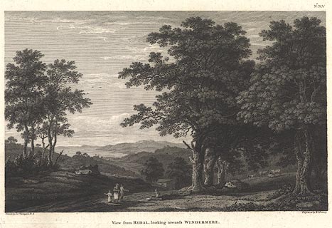 click to enlarge click to enlargeBMZ08.jpg On the hill above Rydal looking south, lake Windermere in the background. Plate 15 from Views of the Lakes, &c, in Cumberland and Westmorland, published 1789; with descriptive text:- "VIEW from RYDAL looking towards WINDERMERE," "IN the Progress of this Work, some of the Features which distinguish the situation of Rydal have been noticed. The View here presented exhibits another Species of Landscape, which will serve to show the great Variety which abounds in this Neighbourhood. The Traveller on his Tour is directed to the Waterfall, passes at the Foot of the Mountain, and pursues his Course by the Side of the Lake. A few Circumstances of Notoriety are habitually recommended; to these he pays his Visit, and leaves the Place, supposing himself sufficiently acquainted with what is remarkable.- But a true Idea of the Beauties of such a Country can only be formed by him who has Time to explore the various Elevations, who considers the different Points of View, and suffers no accidental Circumstance to escape him. In this View, which was taken a little above Rydal-Hall, Part of Windermere-Lake, bounded on the West-Side by Furness-Fells, has a beautiful Effect, over the dark Umbrage that decorates the Hills adjacent to Ambleside, the Situation of which is marked by a few Houses in the middle Distance." item:- Dove Cottage : Lowther.9 Image © see bottom of page |
|||||||||||||||||||||||||
|
|
||||||||||||||||||||||||||
| evidence:- | old map:- Aikin 1790 (Wmd) placename:- Winander Meer |
|||||||||||||||||||||||||
| source data:- | Map, uncoloured engraving, Westmoreland ie Westmorland, scale
about 8.5 miles to 1 inch, by John Aikin, London, 1790. click to enlarge click to enlargeAIK2.jpg "Winander Meer" outline with form lines; lake; on county boundary item:- JandMN : 51 Image © see bottom of page |
|||||||||||||||||||||||||
|
|
||||||||||||||||||||||||||
| evidence:- | old painting:- Green 1790s-1820s item:- boat; rowing boat |
|||||||||||||||||||||||||
| source data:- | Painting, pencil drawing and watercolour, Windermere from the Ferry, Westmorland,
by William Green, Ambleside, Westmorland, 1800s-10s?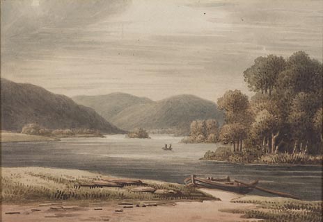 click to enlarge click to enlargePR1755.jpg item:- Dove Cottage : 2011.33.1 Image © see bottom of page |
|||||||||||||||||||||||||
|
|
||||||||||||||||||||||||||
| evidence:- | old map:- Bailey 1797 placename:- Winander Meer |
|||||||||||||||||||||||||
| source data:- | Map, soil etc, uncoloured engraving, Westmoreland, scale about
12 miles to 1 inch, by J Bailey, engraved by Neele, Strand,
published by Messrs Robinson, Paternoster Row and G Nicol, Pall
Mall, London, 1797. click to enlarge click to enlargeBY05.jpg "Winander Meer" outline with form lines; lake; on county boundary item:- Armitt Library : A680.3 Image © see bottom of page |
|||||||||||||||||||||||||
|
|
||||||||||||||||||||||||||
| evidence:- | old map:- Housman 1800 map 4 placename:- Windermere Water |
|||||||||||||||||||||||||
| source data:- | Maps, hand coloured engraving, Lakes in Lancashire and Westmorland, 7 lakes on one
sheet, engraved by McIntyre, Edinburgh, published by F Jollie, Carlisle, Cumberland,
and C Law, Ave Maria Lane, London, 1800. click to enlarge click to enlargeHM02Win.jpg "WINDERMERE WATER" item:- Dove Cottage : 2007.38.97 Image © see bottom of page |
|||||||||||||||||||||||||
|
|
||||||||||||||||||||||||||
| evidence:- | descriptive text:- Baker 1802 placename:- Windermeer |
|||||||||||||||||||||||||
| source data:- | Perspective road map with sections in Lancashire, Westmorland,
and Cumberland, by J Baker, London 1802. pp.25-26:- "... by Sowrey is Windermeer." "..." "The first view of the lake [coming from Kendal] is within six miles of Kendal, at the village of Bowness, where there is also a good inn, from whence boats may be taken to convey visitors across the lake to the several isles of it, or to the distant borders thereof. A most gratifying tour also may be made from hence along part of its eastern border to Ambleside, where Mr. Grey describes delicious views across it, and almost from one end to the other; it is 10 miles in length, and at most a mile over, resembling the course of some vast and magnificent river, with no flat marshy grounds, no osier beds, or patches of scrubby plantations on its banks: at the head two valleys open among the mountains, from thence the fells visibly sink, and soften along its sides; sometimes they run into it, (but with a gentle declivity) in their own dark and natural complexion: often they are green and cultivated, with farms interspersed, and round eminences on the border, covered with trees: towards the south it seemed to break into large bays, with several islands and a wider extent of cultivation." "... Hawswater, which with Ullswater, are ornamented with a variety of abrupt and terrific precipices, of which frowning appendages there is a deficiency at Windermeer. ..." |
|||||||||||||||||||||||||
|
|
||||||||||||||||||||||||||
| evidence:- | old map:- Cooke 1802 placename:- Winandermere |
|||||||||||||||||||||||||
| source data:- | Map, The Lakes, Westmorland and Cumberland, scale about 8.5
miles to 1 inch, engravedby Neele and Son, published by
Sherwood, Jones and Co, Paternoster Road, London, 1824. click to enlarge click to enlargeGRA1Lk.jpg "Winandermere" outline with form lines; lake or tarn; on county boundary item:- Hampshire Museums : FA2000.62.5 Image © see bottom of page |
|||||||||||||||||||||||||
|
|
||||||||||||||||||||||||||
| evidence:- | old map:- Cooke 1802 placename:- Winander Mere |
|||||||||||||||||||||||||
| source data:- | Map, Westmoreland ie Westmorland, scale about 12 miles to 1
inch, by George Cooke, 1802, published by Sherwood, Jones and
Co, Paternoster Road, London, 1824. click to enlarge click to enlargeGRA1Wd.jpg "Winander Mere" outline with form lines; lake or tarn, on the county boundary item:- Hampshire Museums : FA2000.62.4 Image © see bottom of page |
|||||||||||||||||||||||||
|
|
||||||||||||||||||||||||||
| evidence:- | old print:- Green 1804 (plate 4) placename:- Windermere |
|||||||||||||||||||||||||
| source data:- | Print, uncoloured aquatint, Windermere from Bowness, Windermere, Westmorland, by William
Green, Ambleside, Westmorland, 1804.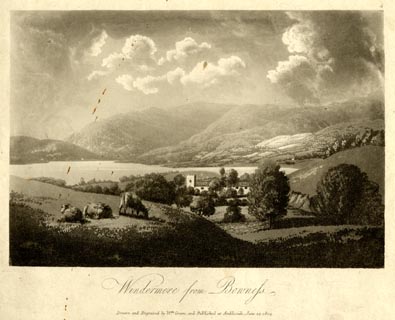 click to enlarge click to enlargeGN1604.jpg Plate 4 from a series. printed at bottom:- "Windermere from Bowness. / Drawn and Engraved by Wm. Green, and Published at Ambleside, June 24, 1804." printed at top right:- "4" item:- Armitt Library : 2014.154 Image © see bottom of page |
|||||||||||||||||||||||||
|
|
||||||||||||||||||||||||||
| evidence:- | old print:- Green 1804 (plate 5) placename:- Windermere item:- boat; sailing boat |
|||||||||||||||||||||||||
| source data:- | Print, uncoloured aquatint, Windermere, from one of the lily of the valley holms,
Windermere, Westmorland, by William Green, Ambleside, Westmorland, 1804.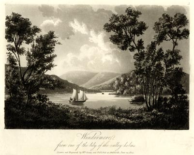 click to enlarge click to enlargeGN1605.jpg Plate 5 from a series. printed at bottom:- "Windermere, / from one of the lily of the valley holms. / Drawn and Engraved by Wm. Green, and Published at Ambleside, June 24, 1804." printed at top right:- "5" item:- Armitt Library : 2014.156 Image © see bottom of page |
|||||||||||||||||||||||||
|
|
||||||||||||||||||||||||||
| evidence:- | old text:- Gents Mag item:- char; trout; perch; eel |
|||||||||||||||||||||||||
| source data:- | Magazine, The Gentleman's Magazine or Monthly Intelligencer or
Historical Chronicle, published by Edward Cave under the
pseudonym Sylvanus Urban, and by other publishers, London,
monthly from 1731 to 1922. goto source Gentleman's Magazine 1805 p.1010 "..." "MONDAY, 20th of August [1805?]; embarked at Low Wood, and made a pleasant voyage of six miles to Mr. Curwen's Island. We could not but admire the stillness and transparency of the Lake, which is in some parts nearly 100 yards deep, and three quarters of a mile across. In the winter season it is frequently so rough as to render the management of a boat extremely hazardous. It abounds with Char, a coarse fish, caught in nets, of which great quantities are potted. In addition to these there are Trout, Perch, and Eel; the former are more numerous in the brooks and rivulets by which the Lake is fed. The Eels are pierced by a sharp instrument, a model of the harpoon, as they coil unwarily on the grassy bottom. ..." |
|||||||||||||||||||||||||
|
|
||||||||||||||||||||||||||
| evidence:- | old text:- Gents Mag |
|||||||||||||||||||||||||
| source data:- | Magazine, The Gentleman's Magazine or Monthly Intelligencer or
Historical Chronicle, published by Edward Cave under the
pseudonym Sylvanus Urban, and by other publishers, London,
monthly from 1731 to 1922. goto source Gentleman's Magazine 1805 p.918 "..." "ON the morning of the 19th we opened our astonished eyes on the glorious expanse of Windermere, floating a tract of country 14 miles in extent. The beams of the rising Sun" goto sourceGentleman's Magazine 1805 p.919 "quivered prettily on the margin of the Lake, and a little fleet of boats rode at anchor in the peaceful harbour of Low-wood. We ascended a gentle eminence in a lane leading to the village of Troutbeck, and frequently turned to survey the prominent beauties of the surrounding landscape. The stupendous chaos of rocks terminating the Northern shore, to us appeared no other than the Pyrenean Chain, and a very moderate exertion of the fancy transported us to the classic borders of the Leman Lake. Notwithstanding the variety of character which the shores of Windermere present, the oblong regularity of its sides is rarely diversified by the jutting of a promontory or the sinuosity of a bay. Before us rose, in a magnificent cluster, the rocks of Hardnose, Wryknot, Rainsbarrow, &c. towering one above another in awful grandeur, and harmonizing all the infinite varieties of shade, while the silver pikes of Langdale undulating fancifully along the verge of the horizon, filled the broken intervals of distance. From these sloped the tame fells of Coniston, degenerating Southward into low and naked downs, shelving to the shores enlivened here and there by inclosures of green pasture and yellow corn. Some handsome knolls, pointed with wood, variegate the ornaments of the Eastern beach. The mediocrity of the Southern boundary, however conspicuous, might have escaped the severity of Criticism, if it were not unfortunately exposed by the splendour of connexion. In scenes like these, where Nature, working in the style of a bold and independent Master, launches into the wild and fanciful, and soars beyond the conception of human genius, we are unable to reconcile an association so distasteful, and would rather have been blind to the beauties, than have witnessed the deformities of the picture. ..." |
|||||||||||||||||||||||||
|
|
||||||||||||||||||||||||||
| evidence:- | old text:- Gents Mag |
|||||||||||||||||||||||||
| source data:- | Magazine, The Gentleman's Magazine or Monthly Intelligencer or
Historical Chronicle, published by Edward Cave under the
pseudonym Sylvanus Urban, and by other publishers, London,
monthly from 1731 to 1922. goto source Gentleman's Magazine 1805 p.806 "... as we approached Bowness, a little village on its Eastern shore. For a few minutes we were tempted to quit our chaise, and walked about 200 yards to the gate of a meadow, which commended the most central view of the Lake. Here, and at this moment; the novelty of the scenery, the serenity of the evening, the glassy stillness of the water, the terrible grandeur of the mountains, and the little hamlets couching at their feet, inspired a charm peculiar to first impressions, and evanescent as the monent that gave it birth! Winding round its cultivated banks, the prospect varying at every turn, we took shelter in the delicious repose of Low Wood, ..." |
|||||||||||||||||||||||||
|
|
||||||||||||||||||||||||||
| evidence:- | old map:- Laurie and Whittle 1806 placename:- Winander Meer |
|||||||||||||||||||||||||
| source data:- | Road map, Completion of the Roads to the Lakes, scale about 10
miles to 1 inch, by Nathaniel Coltman? 1806, published by Robert
H Laurie, 53 Fleet Street, London, 1834. click to enlarge click to enlargeLw18.jpg "Winander Meer" lake; on county boundary item:- private collection : 18.18 Image © see bottom of page |
|||||||||||||||||||||||||
|
|
||||||||||||||||||||||||||
| evidence:- | old text:- Capper 1808 placename:- Winandermere placename:- Windermere item:- fish, Windermere; char; tithes |
|||||||||||||||||||||||||
| source data:- | Gazetteer, A Topographical Dictionary of the United Kingdom,
compiled by Benjamin Pitts Capper, published by Richard
Phillips, Bridge Street, Blackfriars, London, 1808; published
1808-29. goto source "WINANDERMERE, or WINDERMERE, ... This lake is about 15 miles long, and 1 broad, having very winding shores, being from 90 to 222 feet deep. It abounds with excellent fish, but is particularly noted for its delicate char. The tithe of fish belongs to the rector of the parish, who has a pleasure boat on the lake, and takes a fine from each boat instead of a tithe in kind. There are several little islands in the lake, ..." goto source"... It [Ambleside] stands at the upper end of the celebrated lake of Windermere, a branch of which passes through the town. The south shore of this lake is beautifully shaded with wood to the very top of the surrounding hills; the north shore has two extensive hills cut into the finest inclosures; and the west shore is surrounded with rocks and precipices, with interspersed clusters of shrubs: the whole presenting a view to the traveller beyond description. ..." |
|||||||||||||||||||||||||
|
|
||||||||||||||||||||||||||
| evidence:- | old map:- Cooper 1808 placename:- Winander Mere |
|||||||||||||||||||||||||
| source data:- | Map, hand coloured engraving, Westmoreland ie Westmorland, scale
about 9 miles to 1 inch, by H Cooper, 1808, published by R
Phillips, Bridge Street, Blackfriars, London, 1808. click to enlarge click to enlargeCOP4.jpg "Winander Mere" outline, shaded; lake; shown entirely in Lancashire item:- Dove Cottage : 2007.38.53 Image © see bottom of page |
|||||||||||||||||||||||||
|
|
||||||||||||||||||||||||||
| evidence:- | old text:- Green 1810 placename:- Windermere |
|||||||||||||||||||||||||
| source data:- | Set of prints, soft ground etchings, Sixty Studies from Nature,
by William Green, Ambleside, Westmorland, drawn 1808-10,
published 1810. goto source page 10:- "..." "Windermere is the largest lake in England, being twelve miles long; about the head it is considerably more than a mile in breadth, and between the head and the islands which are about half way down the water, it is seldom less than" page 11:- "a mile; but it narrows gradually from the islands to Newby bridge, which lies at the foot of the lake." "Windermere may be conveniently navigated from all the inns around it, there being boats upon that lake belonging to the inns at Ambleside, Low Wood, Bowness, the ferry house, and Newby bridge. Ambleside is little more than half a mile from the head of the lake, and the other houses before spoken of, are all of them near it: the Ambleside boats are usually moored at a place called the landing, which is at the junction of the rivers Rothay and Brathay, not three quarters of a mile from the village. - Nothing can exceed, for beauty, the scenery between the landing and the head of the lake, and the wooded rocks which lie near the river's mouth combine with the Ambleside and Rydal mountains, so as to make excellent pictures - but the finest water view from the head of" goto sourcepage 12:- "Windermere is about half a mile down the lake, having the boat at an equal distance from the eastern and the western shores. This is that anchorage, were it possible to anchor here, from which the mountains of Coniston, Little and Great Langdale, Loughrigg, Rydal, Ambleside, and Troutbeck, the high grounds of Applethwaite, Orrest, Bowness, and Cartmel fell, and the lands above Wray, as from one station on the water, are seen to the greatest advantage." |
|||||||||||||||||||||||||
|
|
||||||||||||||||||||||||||
| evidence:- | old print:- Green 1810 (plate 6) placename:- Windermere lake |
|||||||||||||||||||||||||
| source data:- | Print, soft ground etching, Windermere, Westmorland, by William Green, Ambleside,
Westmorland, 1808.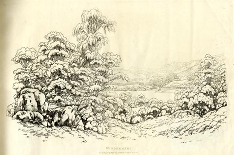 click to enlarge click to enlargeGN1206.jpg Plate 6 in Sixty Studies from Nature, 1810. printed at top right:- "6" printed at bottom:- "WINDERMERE. / Drawn and Engraved by William Green, and Published at Ambleside, June 24, 1808." watermark:- "J WHATMAN / 1813" item:- Armitt Library : A6641.6 Image © see bottom of page |
|||||||||||||||||||||||||
|
|
||||||||||||||||||||||||||
| evidence:- | old print:- Green 1810 (plate 20) placename:- Windermere |
|||||||||||||||||||||||||
| source data:- | Print, soft ground etching, Windermere from Rydal Park, Westmorland, by William Green,
Ambleside, Westmorland, 1810.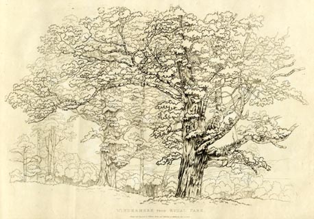 click to enlarge click to enlargeGN1220.jpg Plate 20 in Sixty Studies from Nature, 1810. printed at bottom:- "WINDERMERE FROM RYDAL PARK. / Drawn and Engraved by William Green, and Published at Ambleside, June 24, 1808." watermark:- "J WHATMAN / 1813" item:- Armitt Library : A6641.20 Image © see bottom of page |
|||||||||||||||||||||||||
|
|
||||||||||||||||||||||||||
| evidence:- | old map:- Wallis 1810 (Wmd) placename:- Winander Mere |
|||||||||||||||||||||||||
| source data:- | Road map, Westmoreland, scale about 19 miles to 1 inch, by James
Wallis, 77 Berwick Street, Soho, 1810, published by W Lewis,
Finch Lane, London, 1835? click to enlarge click to enlargeWAL5.jpg "Winander Mere" outline, shaded; lake; county boundary item:- JandMN : 63 Image © see bottom of page |
|||||||||||||||||||||||||
|
|
||||||||||||||||||||||||||
| evidence:- | descriptive text:- Wallis 1810 placename:- Winander Mere |
|||||||||||||||||||||||||
| source data:- | Map, Westmoreland, scale about 19 miles to 1 inch, and
Cumberland, scale about 16 miles to 1 inch, by James Wallis, 77
Berwick Street, Soho, London, 1810; published 1810-36. "... The famous lakes Winander Mere and Ulleswater belong to this county. The former is noted for its fine char." |
|||||||||||||||||||||||||
|
|
||||||||||||||||||||||||||
| evidence:- | old print:- Wilkinson 1810 (plate 9) placename:- Windandermere |
|||||||||||||||||||||||||
| source data:- | Print, uncoloured soft ground etching, View on Winandermere, Westmorland, by Joseph
Wilkinson, engraved by William Frederick Wells, published by R Ackermann, Repository
of Arts, 101 Strand, London, 1810.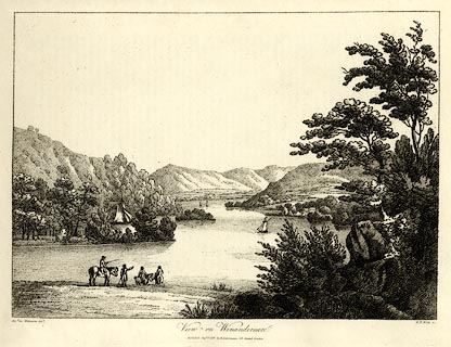 click to enlarge click to enlargeWKN109.jpg Plate 9 in Select Views in Cumberland, Westmoreland, and Lancashire. printed at bottom left, right, centre:- "Revd. Jos: Wilkenson delt. / W. F. Wells sc. / View on Winandermere / Published Sepr. 1. 1810. by R. Ackermann. 101. Strand. London." item:- Fell and Rock Climbing Club : MN4.9 Image © see bottom of page |
|||||||||||||||||||||||||
|
|
||||||||||||||||||||||||||
| evidence:- | old text:- Wordsworth 1810 placename:- Windermere |
|||||||||||||||||||||||||
| source data:- | Guide book, A Description of the Scenery of the Lakes, later A
Guide through the District of The Lakes, by William Wordsworth,
1810-35. goto source page vi "... Windermere ought to be seen both from its shores and from its surface. None of the other lakes unfold so many fresh beauties to him who sails upon them. This is owing to its greater size, to the islands, and to its having two vales at the head, with their accompanying mountains of nearly equal dignity. Nor can the grandeur of these two terminations be seen at once from any point, except from the bosom of the Lake. The Islands may be explored at any time of the day; but one bright unruffled evening, must, if possible, be set apart for the splendour, the stillness, and solemnity of a three hour's voyage upon the higher division of the Lake, not omitting, towards the end of the excursion, to quit the expanse of water, and peep into the close and calm River at the head; which, in its quiet character, at such a time, appears rather like an overflow of the peaceful Lake" goto sourcepage vii "itself, than to have any more immediate connection with the rough mountains whence it has descended, or the turbulent torrents by which it is supplied. Many person content themselves with what they see of Windermere during their progress in a boat from Bowness to the head of the Lake, walking thence to Ambleside. But the whole road from Bowness is rich in diversity of pleasing or grand scenery; there is scarcely a field on the road side, which, if entered, would not give to the landscape some additional charm. ..." |
|||||||||||||||||||||||||
|
|
||||||||||||||||||||||||||
| evidence:- | old print:- Green 1814 (plate 9) placename:- Windermere item:- boat; rowing boat |
|||||||||||||||||||||||||
| source data:- | Print, tinted soft ground etching, Windermere from the Ferry, Windermere, Westmorland,
by William Green, Ambleside, Westmorland, 1814.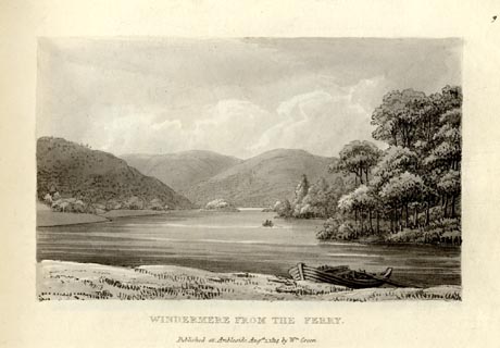 click to enlarge click to enlargeGN1009.jpg Plate 9 in Sixty Small Prints. printed at top right:- "9" printed at bottom:- "WINDERMERE FROM THE FERRY. / Published at Ambleside Augst. 1, 1814, by Wm. Green." item:- Armitt Library : A6653.9 Image © see bottom of page |
|||||||||||||||||||||||||
|
|
||||||||||||||||||||||||||
| evidence:- | old print:- Green 1814 (plate 9) placename:- Windermere item:- boat; rowing boat |
|||||||||||||||||||||||||
| source data:- | Print, uncoloured soft ground etching, Windermere from the Ferry, Windermere, Westmorland,
by William Green, Ambleside, Westmorland, 1814.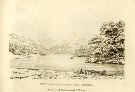 click to enlarge click to enlargeGN0909.jpg Plate 9 in Sixty Small Prints. printed at top right:- "9" printed at bottom:- "WINDERMERE FROM THE FERRY. / Published at Ambleside Augst. 1, 1814, by Wm. Green." item:- Armitt Library : A6656.9 Image © see bottom of page |
|||||||||||||||||||||||||
|
|
||||||||||||||||||||||||||
| evidence:- | old print:- Green 1814 (plate 8) placename:- Windermere item:- cattle |
|||||||||||||||||||||||||
| source data:- | Print, tinted soft ground etching, Windermere from Bellman Ground, Windermere, Westmorland,
by William Green, Ambleside, Westmorland, 1814.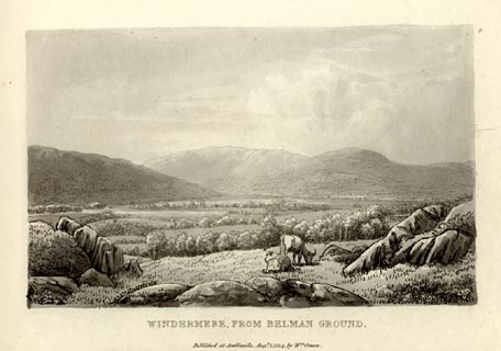 click to enlarge click to enlargeGN1008.jpg Plate 8 in Sixty Small Prints. printed at top right:- "8" printed at bottom:- "WINDERMERE FROM BELLMAN GROUND. / Published at Ambleside Augst. 1, 1814, by Wm. Green." item:- Armitt Library : A6653.8 Image © see bottom of page |
|||||||||||||||||||||||||
|
|
||||||||||||||||||||||||||
| evidence:- | old print:- Green 1814 (plate 8) placename:- Windermere item:- cattle |
|||||||||||||||||||||||||
| source data:- | Print, uncoloured soft ground etching, Windermere from Bellman Ground, Windermere,
Westmorland, by William Green, Ambleside, Westmorland, 1814.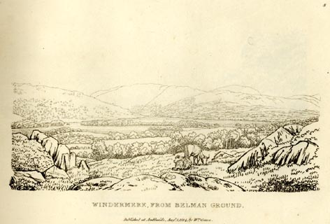 click to enlarge click to enlargeGN0908.jpg Plate 8 in Sixty Small Prints. printed at top right:- "8" printed at bottom:- "WINDERMERE FROM BELLMAN GROUND. / Published at Ambleside Augst. 1, 1814, by Wm. Green." item:- Armitt Library : A6656.8 Image © see bottom of page |
|||||||||||||||||||||||||
|
|
||||||||||||||||||||||||||
| evidence:- | old print:- Green 1814 (plate 7) placename:- Windermere item:- island |
|||||||||||||||||||||||||
| source data:- | Print, tinted soft ground etching, Islands on Windermere from Skelgill, Windermere,
Westmorland, by William Green, Ambleside, Westmorland, 1814.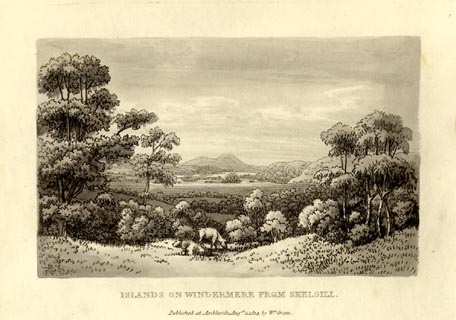 click to enlarge click to enlargeGN1007.jpg Plate 7 in Sixty Small Prints. printed at top right:- "7" printed at bottom:- "ISLANDS ON WINDERMERE FROM SKELGILL. / Published at Ambleside Augst. 1, 1814, by Wm. Green." item:- Armitt Library : A6653.7 Image © see bottom of page |
|||||||||||||||||||||||||
|
|
||||||||||||||||||||||||||
| evidence:- | old print:- Green 1814 (plate 7) placename:- Windermere item:- island |
|||||||||||||||||||||||||
| source data:- | Print, uncoloured soft ground etching, Islands on Windermere from Skelgill, Windermere,
Westmorland, by William Green, Ambleside, Westmorland, 1814.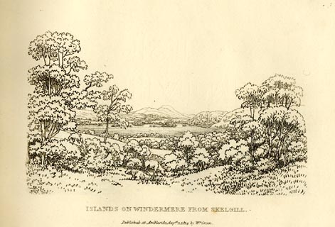 click to enlarge click to enlargeGN0907.jpg Plate 7 in Sixty Small Prints. printed at top right:- "7" printed at bottom:- "ISLANDS ON WINDERMERE FROM SKELGILL. / Published at Ambleside Augst. 1, 1814, by Wm. Green." item:- Armitt Library : A6656.7 Image © see bottom of page |
|||||||||||||||||||||||||
|
|
||||||||||||||||||||||||||
| evidence:- | old print:- Green 1814 (plate 6) placename:- Windermere item:- cattle |
|||||||||||||||||||||||||
| source data:- | Print, tinted soft ground etching, Head of Windermere from Low Wood, Windermere, Westmorland,
by William Green, Ambleside, Westmorland, 1814.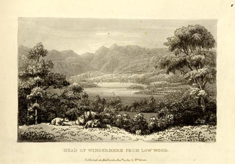 click to enlarge click to enlargeGN1006.jpg Plate 6 in Sixty Small Prints. printed at top right:- "6" printed at bottom:- "HEAD OF WINDERMERE FROM LOW WOOD. / Published at Ambleside Augst. 1, 1814, by Wm. Green." item:- Armitt Library : A6653.6 Image © see bottom of page |
|||||||||||||||||||||||||
|
|
||||||||||||||||||||||||||
| evidence:- | old print:- Green 1814 (plate 6) placename:- Windermere item:- cattle |
|||||||||||||||||||||||||
| source data:- | Print, uncoloured soft ground etching, Head of Windermere from Low Wood, Windermere,
Westmorland, by William Green, Ambleside, Westmorland, 1814.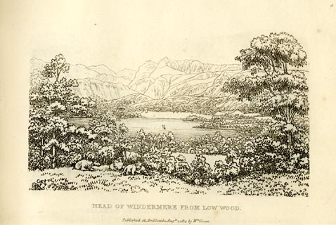 click to enlarge click to enlargeGN0906.jpg Plate 6 in Sixty Small Prints. printed at top right:- "6" printed at bottom:- "HEAD OF WINDERMERE FROM LOW WOOD. / Published at Ambleside Augst. 1, 1814, by Wm. Green." item:- Armitt Library : A6656.6 Image © see bottom of page |
|||||||||||||||||||||||||
|
|
||||||||||||||||||||||||||
| evidence:- | old text:- Green 1814 placename:- Windermere |
|||||||||||||||||||||||||
| source data:- | Set of prints, soft ground etchings, Sixty Small Prints, with
text, A Description of a Series of Sixty Small Prints, by
William Green, Ambleside, Westmorland, 1814. goto source page 6:- "..." "Windermere is the largest lake in England, being twelve miles long; about the head it is considerably more than a mile in breadth, and between the head and the islands, which are about half way down the Water, it is seldom less than a mile; but it narrows gradually from the islands to Newby Bridge, which lies at the foot of the lake." "The lands on the immediate borders of Winderemere are fertile and richly decorated with a profusion of fine trees, many of which are of stately growth, and so disposed, either by chance or intention, as to produce not only the grandest assemblages of massy woods, but sprinklings in every imaginable and tasteful variety." "Some of the highest mountains in Cumberland, Westmorland, and Lancashire, are seen from Windermere, but at such a distance from it, as to be objects rather of beauty than sublimity. The mountains of Coniston, Langdale," goto sourcepage 7:- "Wastdale, Eskdale, and Borrowdale, possess much to interest the inquisitive observer, from his first sight of them, about nine miles from Kendal, and from thence all the way to Ambleside." "..." |
|||||||||||||||||||||||||
|
|
||||||||||||||||||||||||||
| evidence:- | old print:- Green 1815 placename:- Windermere |
|||||||||||||||||||||||||
| source data:- | Print, coloured aquatint, Windermere taken near Low Wood, Westmorland, by William
Green, Ambleside, Westmorland, 1815.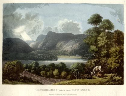 click to enlarge click to enlargeGN0507.jpg The Langdale Pikes in the background. Plate 8 in Lake Scenery. printed at upper right:- "8" printed at bottom:- "WINDERMERE taken near LOW WOOD. / Published at Ambleside, June 1, 1815, by Wm. Green." item:- Armitt Library : A6646.7 Image © see bottom of page |
|||||||||||||||||||||||||
|
|
||||||||||||||||||||||||||
| evidence:- | old print:- Green 1815 |
|||||||||||||||||||||||||
| source data:- | Print, coloured aquatint, North End of Curwens Island on Windermere, Westmorland,
by William Green, Ambleside, Westmorland, 1815.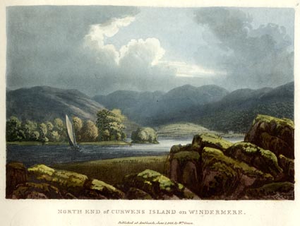 click to enlarge click to enlargeGN0508.jpg Plate 9 in Lake Scenery. printed at upper right:- "9" printed at bottom:- "NORTH END of CURWENS ISLAND on WINDERMERE. / Published at Ambleside, June 1, 1815, by Wm. Green." item:- Armitt Library : A6646.8 Image © see bottom of page |
|||||||||||||||||||||||||
|
|
||||||||||||||||||||||||||
| evidence:- | old print:- Green 1815 placename:- Windermere |
|||||||||||||||||||||||||
| source data:- | Print, coloured aquatint, Curwens Island on Windermere from the Station, Claife, Lancashire,
by William Green, Ambleside, Westmorland, 1815.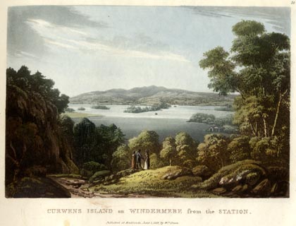 click to enlarge click to enlargeGN0509.jpg Plate 10 in Lake Scenery. printed at upper right:- "10" printed at bottom:- "CURWENS ISLAND on WINDERMERE from the STATION. / Published at Ambleside, June 1, 1815, by Wm. Green." item:- Armitt Library : A6646.9 Image © see bottom of page |
|||||||||||||||||||||||||
|
|
||||||||||||||||||||||||||
| evidence:- | old print:- Green 1815 placename:- Windermere |
|||||||||||||||||||||||||
| source data:- | Print, coloured aquatint, Foot of Windermere from the Station, Claife, Lancashire,
by William Green, Ambleside, Westmorland, 1815.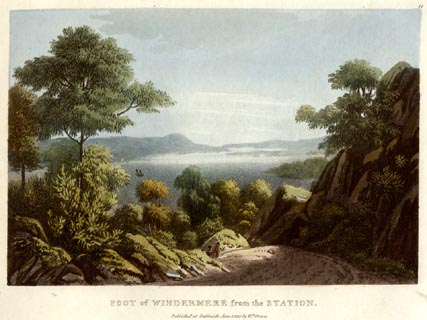 click to enlarge click to enlargeGN0510.jpg Plate 11 in Lake Scenery. printed at upper right:- "11" printed at bottom:- "FOOT of WINDERMERE from the STATION. / Published at Ambleside, June 1, 1815, by Wm. Green." item:- Armitt Library : A6646.10 Image © see bottom of page |
|||||||||||||||||||||||||
|
|
||||||||||||||||||||||||||
| evidence:- | old print:- Green 1815 placename:- Windermere item:- cattle |
|||||||||||||||||||||||||
| source data:- | Print, coloured aquatint, Windermere from Low Wray, Claife, Lancashire, by William
Green, Ambleside, Westmorland, 1815.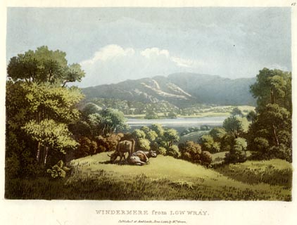 click to enlarge click to enlargeGN0511.jpg Plate 12 in Lake Scenery. printed at upper right:- "12" printed at bottom:- "WINDERMERE from LOW WRAY. / Published at Ambleside, June 1, 1815, by Wm. Green." item:- Armitt Library : A6646.11 Image © see bottom of page |
|||||||||||||||||||||||||
|
|
||||||||||||||||||||||||||
| evidence:- | old map:- Otley 1818 placename:- Windermere |
|||||||||||||||||||||||||
| source data:- | Map, uncoloured engraving, The District of the Lakes,
Cumberland, Westmorland, and Lancashire, scale about 4 miles to
1 inch, by Jonathan Otley, 1818, engraved by J and G Menzies,
Edinburgh, Scotland, published by Jonathan Otley, Keswick,
Cumberland, et al, 1833.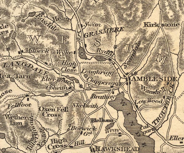 OT02NY30.jpg 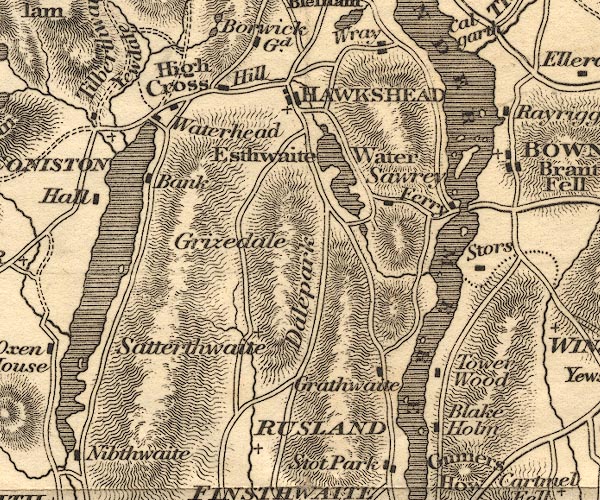 OT02SD39.jpg "WINDERMERE" Some islands are shown. 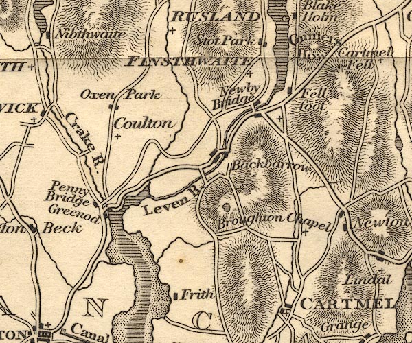 OT02SD38.jpg item:- JandMN : 48.1 Image © see bottom of page |
|||||||||||||||||||||||||
|
|
||||||||||||||||||||||||||
| evidence:- | old map:- Hall 1820 (Wmd) |
|||||||||||||||||||||||||
| source data:- | Map, hand coloured engraving, Westmoreland ie Westmorland, scale
about 14.5 miles to 1 inch, by Sidney Hall, London, 1820,
published by Samuel Leigh, 18 Strand, London, 1820-31. click to enlarge click to enlargeHA18.jpg outline, shaded; lake; on county boundary item:- Armitt Library : 2008.14.58 Image © see bottom of page |
|||||||||||||||||||||||||
|
|
||||||||||||||||||||||||||
| evidence:- | outline view:- Otley 1823 (8th edn 1849) placename:- Windermere |
|||||||||||||||||||||||||
| source data:- | Engraving, outline view of mountains, Windermere looking towards the North East from
Bowness, drawn by T Binns, engraved by O Jewitt, opposite p.2 of A Descriptive Guide
of the English Lakes, by Jonathan Otley, 8th edition, 1849.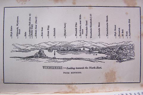 click to enlarge click to enlargeO80E02.jpg item:- Armitt Library : A1180.3 Image © see bottom of page |
|||||||||||||||||||||||||
|
|
||||||||||||||||||||||||||
| evidence:- | outline view:- Otley 1823 (8th edn 1849) placename:- Windermere |
|||||||||||||||||||||||||
| source data:- | Engraving, outline view of mountains, Windermere looking towards the West from the
Road between Troutbeck and Bowness, drawn by T Binns, engraved by O Jewitt, opposite
p.4 of A Descriptive Guide of the English Lakes, by Jonathan Otley, 8th edition, 1849.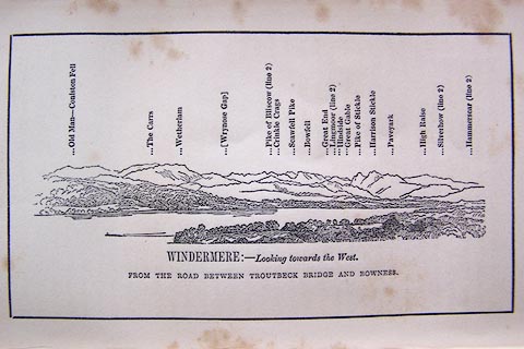 click to enlarge click to enlargeO80E03.jpg item:- Armitt Library : A1180.4 Image © see bottom of page |
|||||||||||||||||||||||||
|
|
||||||||||||||||||||||||||
| evidence:- | descriptive text:- Otley 1823 (5th edn 1834) placename:- Windermere Water item:- lake; mere; fishing; char; trout; depth, Windermere lake; geology; fish, Windermere lake |
|||||||||||||||||||||||||
| source data:- | Guide book, A Concise Description of the English Lakes, the
mountains in their vicinity, and the roads by which they may be
visited, with remarks on the mineralogy and geology of the
district, by Jonathan Otley, published by the author, Keswick,
Cumberland now Cumbria, by J Richardson, London, and by Arthur
Foster, Kirkby Lonsdale, Cumbria, 1823; published 1823-49,
latterly as the Descriptive Guide to the English Lakes. goto source Page 2:- "... Windermere Lake is said to belong to Westmorland, at least its islands are claimed by that county; although the whole of its western and part of its eastern shores belong to Lancashire. ..." "Before this country became so much the resort of strangers, the word LAKE was little known to the native inhabitants; but to the ancient termination mere, WATER was usually superadded, as Windermere-Water, ..." "..." "WINDERMERE" "Having given its name to the adjoining parish, it has been thought necessary in speaking of the lake itself, to add the word water, or lake, by way of distinction. It is the largest of the English Lakes, being upwards of ten miles in length, measured upon the water; by the road on its banks considerably more. Its greatest breadth" goto sourcePage 3:- "is about a mile, and depth nearly forty fathoms. A strait, near the middle of the lake, has a public ferry-boat, on the way between Kendal and Hawkshead." "The numerous islands, with which it is enriched, are chiefly grouped near the middle of the lake; so as to admit greater scope for the exercise of sailing. The principal, called Belle-Isle ... Besides this, are Crow-Holm, two Lily of the Valley-Holms, Thompson's-Holm, House-Holm, Hen-Holm, Lady-Holm, and Rough-Holm; and to the south of the Ferry, Berkshire-Island, Ling-Holm, Grass-Holm, Silver-Holm, and Blake-Holm." "Windermere is stocked with a variety of fish, of which char are the most esteemed. Char being taken by nets in the winter months, are potted, and sent to different parts of the kingdom. The principal feeders of the lake are the Rothay, having its source in Grasmere; and the Brathay, issuing from Langdale. These two rivers unite their streams about half a mile before entering the lake; ..." goto sourcePage 4:- "This lake is situated in a country beautifully diversified by sloping hills, woods, and cultivated grounds, with lofty mountains in the distance. Its banks are adorned with buildings, which combine better with the scenery of this, than they would with that of the more northern lakes. ..." goto sourcePage 5:- "... Towards its foot, the shores of the lake appear beautifully broken, by several promontories stretching far into the water from each side." "Some would like to commence their survey of Windermere at Newby Bridge, and have the scenery to unfold itself as they advance. Others will be more gratified by the prospect bursting upon them at once in full expansion, as it does from the elevated ground, on either of the roads leading from Kendal towards Bowness or Ambleside. All the way, from two miles south of Bowness to the head of the lake, the views are excellent; and every rising ground affords something new in the combination. A station about a mile from Low Wood Inn, on the highest part of the road towards Troutbeck, gives the most distinct view of all the Islands; and Rayrigg-Bank has the most complete view of the whole lake. ..." goto sourcePage 6:- "..." "A walk, or a ride, along the sequestered road from the Ferry towards Ambleside, will be found agreeable to the contemplative mind; and during a voyage on the northern part of the lake (which ought not to be omitted) a variety of both near and distant scenes are presented to the view in delightful succession. ..." "..." goto sourcePage 158:- "The THIRD division - forming only inferior elevations - commences with a bed of dark-blue or blackish transition limestone, containing here and there a few shells and madrepores, and alternating with a slaty rock of the same colour; the different layers of each being in some places several feet, in others only a few inches in thickness. This limestone crosses the river Duddon near Broughton; passing Broughton Mills it runs in a north-east direction through Torver, by the foot of the Old Man mountain, and appears near Low Yewdale and Yew Tree. Here it makes a considerable slip to the eastward, after which it ranges past the Tarns upon the hills above Borwick Ground; and stretching through Skelwith, it crosses the head of Windermere near Low Wood Inn. Then passing above Dovenest and Skelgill, it traverses the vales of Troutbeck, Kentmere, and Long Sleddale;" |
|||||||||||||||||||||||||
|
|
||||||||||||||||||||||||||
| evidence:- | old map:- Perrot 1823 |
|||||||||||||||||||||||||
| source data:- | Map, hand coloured engraving, Cumberland and Westmoreland ie
Westmorland, scale about 38 miles to 1 inch, by Aristide Michel
Perrot, engraved by Migneret, 1823, published by Etienne Ledoux,
9 Rue Guenegaud, Paris, France, 1824-48. click to enlarge click to enlargePER2.jpg outline with form lines; lake, included in Lancashire/Cumberland item:- Dove Cottage : 2007.38.45 Image © see bottom of page |
|||||||||||||||||||||||||
|
|
||||||||||||||||||||||||||
| evidence:- | old text:- Gents Mag placename:- Winandermere item:- echoes |
|||||||||||||||||||||||||
| source data:- | Magazine, The Gentleman's Magazine or Monthly Intelligencer or
Historical Chronicle, published by Edward Cave under the
pseudonym Sylvanus Urban, and by other publishers, London,
monthly from 1731 to 1922. goto source Gentleman's Magazine 1825 part 1 p.516 "Compendium of County History. - Westmorland." "WINANDERMERE is the greatest standing water in England. On Longholme Island is a remarkable echo. ..." |
|||||||||||||||||||||||||
|
|
||||||||||||||||||||||||||
| evidence:- | :- Hullmandel 1826 placename:- Windermere |
|||||||||||||||||||||||||
| source data:- | 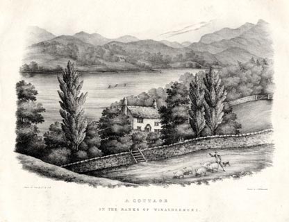 click to enlarge click to enlargeHUL110.jpg Print, uncoloured lithograph, A Cottage on the banks of Windermere, Westmorland, drawn by Miss I Cropper and Miss S Atkins, published by Charles Hullmandel, London, 1826. "Drawn on Stone by I.C & S.A. / Printed by C. Hullmandel. / A COTTAGE / ON THE BANKS OF WINDERMERE." item:- Armitt Library : ALMA370.10 Image © see bottom of page |
|||||||||||||||||||||||||
|
|
||||||||||||||||||||||||||
| evidence:- | old map:- Leigh 1830 map |
|||||||||||||||||||||||||
| source data:- | Map, Windermere, scale about 2 miles to 1 inch, engraved by
Josiah Neele, 352 Strand, published by Leigh and Son, 421
Strand, London, about 1830.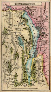 click to enlarge click to enlargeLE03.jpg item:- JandMN : 1.2 Image © see bottom of page |
|||||||||||||||||||||||||
|
|
||||||||||||||||||||||||||
| evidence:- | old print:- Westall 1830s placename:- Lake Windermere |
|||||||||||||||||||||||||
| source data:- | Print, aquatint panorama, Bowness, Lake Windermere, Westmorland, drawn and engraved
by William Westall, published by Ackermann and Co, 96 Strand, London, 1830s.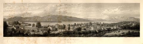 click to enlarge click to enlargeWTL303.jpg "Ferry. New Inn. Curwen's Island.Bowness bay. Furness fells. Langdale Mountains. Gilbert Scar.Rydal Head. Fairfield.Wansfell. Kirkstone. / Drawn & Engraved by W. Westall A.R.A. / Published by Ackermann & Co, 96 Strand." item:- print Armitt Library : A6658.3 Image © see bottom of page |
|||||||||||||||||||||||||
|
|
||||||||||||||||||||||||||
| evidence:- | old print:- Westall 1830s placename:- Lake Windermere |
|||||||||||||||||||||||||
| source data:- | Print, aquatint panorama, Bowness Bay, Lake Windermere, Westmorland, drawn and engraved
by William Westall, published by Ackermann and Co, 96 Strand, London, 1830s.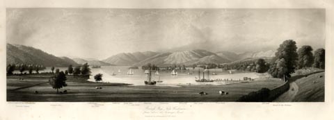 click to enlarge click to enlargeWTL304.jpg "Drawn & Engraved by W. Westall A.R.A. / Curwen's Island, Furness fells. Gilbertscar. Hen Holme. Clappersgate. Nabscar. Rydal Hall. Lady Holme. Fairfield. Kirkstone. Wansfell. Red screes. Trout beck. Hill bell. Road to the Vicarage. / Bowness Bay, Lake Windermere, / from above the Vicarage Road. / Published by Ackermann & Co, 96 Strand." item:- print Armitt Library : A6658.4 Image © see bottom of page |
|||||||||||||||||||||||||
|
|
||||||||||||||||||||||||||
| evidence:- | old print:- Westall 1830s placename:- Lake Windermere |
|||||||||||||||||||||||||
| source data:- | Print, aquatint panorama, Lake Windermere, from the Summer House above the Ferry,
Lancashire and Westmorland, drawn and engraved by William Westall, published by Ackermann
and Co, 96 Strand, London, 1830s.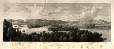 click to enlarge click to enlargeWTL305.jpg "Wansfell. Lilly of the Valley Islands. Kirkstone. Calgarth. Hill Bell. Curwen's, or Berkshire Island. Ellery. Bowness-bay. Bowness. Vicarage. Ferry. Ferney Green. Bellfield. / Lake Windermere, / from the Summer House above the ferry. / Drawn & Engraved by W. Westall A.R.A. / Published by Ackermann & Co, 96 Strand." item:- print Armitt Library : A6658.5 Image © see bottom of page |
|||||||||||||||||||||||||
|
|
||||||||||||||||||||||||||
| evidence:- | old print:- Westall 1830s placename:- Lake Windermere |
|||||||||||||||||||||||||
| source data:- | Print, aquatint panorama, Lake Windermere, near the Kendal Road below Ellery, Westmorland,
drawn and engraved by William Westall, published by R Ackermann, 96 Strand, London,
1830s.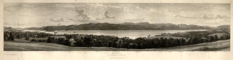 click to enlarge click to enlargeWTL306.jpg "Gumershow Stors point Ferry Curwens Island Lilly of the Valley Islands Furness Fells Miller-ground bay Coniston Old Man 2577ft. Wrynose Bowfell 2911ft. Langdale Pikes 2400ft. Calgarth Loughrig Clappersgate Rydal Head Wansfell / Drawn & Engraved by W. Westall A.R.A. / Lake Windermere, / near the Kendal road below Ellery. / Published by R Ackermann, 96 Strand." item:- Armitt Library : A6658.6 Image © see bottom of page |
|||||||||||||||||||||||||
|
|
||||||||||||||||||||||||||
| evidence:- | old print:- Westall 1830s placename:- Lake Windermere |
|||||||||||||||||||||||||
| source data:- | Print, aquatint panorama, Lake Windermere, from Low Wood Inn, Westmorland, drawn and
engraved by William Westall, published by Ackermann and Co, 96 Strand, London, 1830s.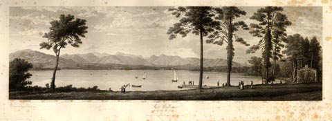 click to enlarge click to enlargeWTL307.jpg "Wetherlam. Borwick. Highwray. Hard knot. Wrynose. Bowfell 2611ft. Scawfell 3100ft. Langdale Pikes 2400ft. Brathay Hall. Gilbertscar. Clappersgate. Loughrig fell. Nabscar. Ambleside & Bowness Road. / Drawn & Engraved by W. Westall A.R.A. / Lake Windermere, / from Low Wood Inn. / Published by Ackermann & Co, 96 Strand." item:- Armitt Library : A6658.7 Image © see bottom of page |
|||||||||||||||||||||||||
|
|
||||||||||||||||||||||||||
| evidence:- | old print:- Rose 1832-35 placename:- Windermere Lake |
|||||||||||||||||||||||||
| source data:- | Print, engraving, Windermere Lake, looking down, by Thomas Allom, engraved by W le
Petit, 1830s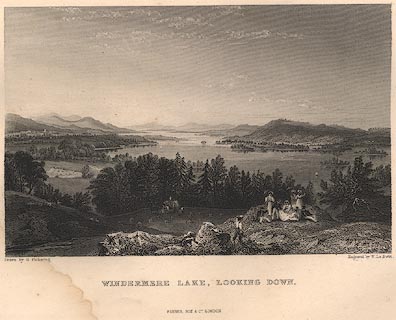 click to enlarge click to enlargeR2FPC.jpg item:- JandMN : 66.36 Image © see bottom of page |
|||||||||||||||||||||||||
|
|
||||||||||||||||||||||||||
| evidence:- | old print:- Rose 1832-35 |
|||||||||||||||||||||||||
| source data:- | Print, engraving, Storrs Hall, Windermere Lake, Westmorland, by Thomas Allom, engraved
by J Starling, 1834.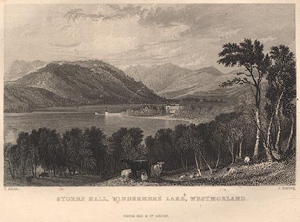 click to enlarge click to enlargeR240.jpg item:- JandMN : 66.13 Image © see bottom of page |
|||||||||||||||||||||||||
|
|
||||||||||||||||||||||||||
| evidence:- | old print:- Rose 1832-35 |
|||||||||||||||||||||||||
| source data:- | Print, engraving, Windermere, Esthwaite Water and Ambleside from Rydal Park, by George
Pickering, engraved by J Engleheart, 1835.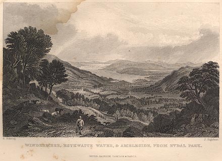 click to enlarge click to enlargeR349.jpg item:- JandMN : 66.47 Image © see bottom of page |
|||||||||||||||||||||||||
|
|
||||||||||||||||||||||||||
| evidence:- | old print:- Rose 1832-35 |
|||||||||||||||||||||||||
| source data:- | Print, engraving, Windermere, Esthwaite Water and Coniston Lakes, by George Pickering,
engraved by le Petit, 1835.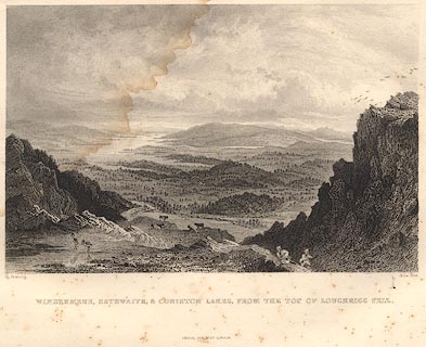 click to enlarge click to enlargeR353.jpg item:- JandMN : 66.62 Image © see bottom of page |
|||||||||||||||||||||||||
|
|
||||||||||||||||||||||||||
| evidence:- | old print:- Rose 1832-35 |
|||||||||||||||||||||||||
| source data:- | Print, engraving, Windermere Lake from Low Wood Inn, by Thomas Allom, engraved by
A W Graham, 1833.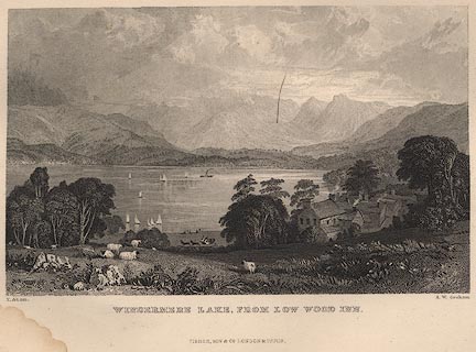 click to enlarge click to enlargeR126.jpg item:- JandMN : 66.6 Image © see bottom of page |
|||||||||||||||||||||||||
|
|
||||||||||||||||||||||||||
| evidence:- | old print:- Rose 1832-35 |
|||||||||||||||||||||||||
| source data:- | Print, engraving, Ferry House, Regatta, Windermere Lake, by Thomas Allom, engraved
by J Starling, 1834.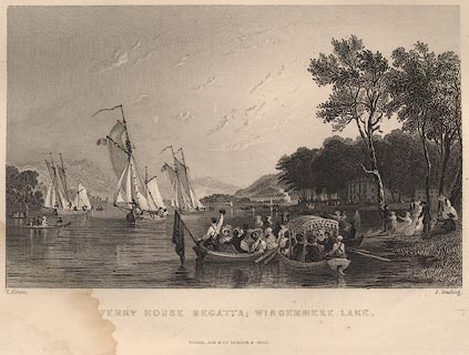 click to enlarge click to enlargeR239.jpg item:- JandMN : 66.4 Image © see bottom of page |
|||||||||||||||||||||||||
|
|
||||||||||||||||||||||||||
| evidence:- | descriptive text:- Ford 1839 (3rd edn 1843) placename:- Windermere placename:- Lake of Windermere item:- depth, Windermere lake |
|||||||||||||||||||||||||
| source data:- | Map, uncoloured engraving, Windermere, engraved by W H Lizars,
published by Charles Thurnam, Carlisle, and by R Groombridge, 5
Paternoster Row, London, 3rd edn 1843. goto source Page 23:- "[N of Ings] ... The Lake of Windermere shortly afterwards bursts upon the eye like a fairy vision - the islands - the mazy windings of the shores, clad with thick wood or skirted with verdant plains. The town of Bowness with its white houses, and the rocky mountains of Rydal at a considerable distance, rivet the gaze of the silently admiring tourist." goto sourcePage 24:- "..." "WINDERMERE" "Is the largest lake, being ten miles and a half long by water, and thirteen by land; its breadth varies, though the extreme does not extend two miles; the same may be said of its depth, which is from five to thirty-seven fathoms. Its circumference is about twenty-six miles, and its waters cover an area of from four to five thousand acres. The chief feeders are the streams of the Rothay and Brathay, which unite at the landing-place. The former, descending from the Raise Gap and from Easedale Tarn, passes through Grasmere and Rydal; the bicipitous sources of the latter, rising in Langdale Head and Wry Nose, mingle their streams in Elter Water, and after dashing over Skelwith Force, flow gently to the lake. A stream from Troutbeck enters the lake at Calgarth Park. The waters of this Mere preserve nearly the same level, there being scarcely any perceptible difference either in wet or dry weather; they discharge themselves by the river Leven, and enter the sea in the Bay of Morecambe. Trout, pike, perch, eels, and char, abound in them; and wild fowl of" goto sourceplate:- 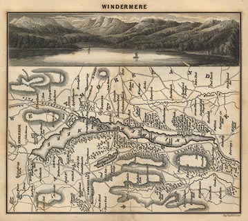 click to enlarge click to enlargeFD03.jpg "WINDERMERE" Map and print, uncoloured engraving, Windermere, engraved by W H Lizars, published by Charles Thurnham, Carlisle, and by R Groombridge, 5 Paternoster Row, London, 1843. goto sourcePage 25:- "various kinds, as swans, geese, ducks, teal, and widgeons, resort to its islands and secluded bays. The islands are clustered together in the middle and narrowest part of the lake." "This lake should be seen both from the shores and surface. It unfolds so many beauties to the sailor, owing to the size, its islands, and its having two vales at the head, with the surrounding mountains of equal dignity, that they can only be seen at once from the bosom of the water. The islands may be explored at any time; but Mr. Wordsworth says, that one bright unruffled evening should be set apart for the splendour, stillness, and solemnity of the upper reach, and a peep into the river, which seems like a gentle overflow of the lake. The best land views are on the east side, three miles south of the head; but very rich views may be obtained from the following points:- First, the Langdale Pikes are seen between Waterhead and Bowness: Second, the islands looking down the lake, beginning north of Skelgill, and ending near Rayrigg: Third, the head of the lake, with the greater and lesser islands in the middle, and the Rydal mountains in the extreme distance, is seen from a hill between Bowness and Bellman Ground: Fourth, the view from the Station over the great island, having Rayrigg and Calgarth on the banks, with Applethwaite and Kentmere mountains in the distance: Fifth, the Rydal and Ambleside mountains, from between Bellegrange and High Wray: Sixth, the sunset view from Grathwaite, having Rawlinson's Nab" goto sourcePage 26:- "and Storrs on the left and right, and the Troutbeck mountains in the background." "The road which encircles the lake, presents very noble views, but the neighbouring high grounds afford more extensive and splendid ones. Its grand characteristics are diffuseness, stately beauty, and magnificence." "... The views [from Belle Isle] most worthy of notice are - First, Rayrigg, with the Lady and Hen Holm Island - the wooded enclosures up to Elleray, Applethwaite, and Kentmere - Hill Bell and High Street closing in the background: Second, the Ferry House and Station, with" goto sourcePage 27:- "the hilly ground above Grathwaite: Third, northward up the lake to the Rydal mountains. Here Dove Nest is a pretty object, and the Pike of Wansfell is seen rising over Calgarth, which is on the banks of the water." "Windermere being so extensive, cannot be thoroughly examined from any one point; the Ferry Inn and Bowness, Low Wood Inn and Ambleside, are the most favourable resting-places, from whence its varied scenes of beauty, grandeur, and sublimity, may be contemplated. Newby Bridge, also, is a delightful situation at the foot, seated under a wooded hill of considerable elevation. The Leven is a noble stream, and higher up above the bridge, gradually widens in sportive curves and charming little bays. At Fellfoot, encompassed by majestic woods, the Coniston mountains peer above the lake. Hence the road skirts Gunner's How past Trover Wood, a little beyond which, Curwen's Island appears as united to both sides, and thus cutting the lake into two parts; beyond is Calgarth, and the distant mountains of Fairfield, Scandale, Coldale, and Hill Bell. Nearer the spectator, stands Storrs Hall, on a far stretching promontory; and on the opposite side the pretty projecting woodlands of the Ferry-Point and Berkshire Islands. The scenery from Bellman Ground exceeds that from any other place south of the island. Storrs Hall, the Rectory, the Ferry House, the Little Islands, Bowness and the elegant winding shores up to Ambleside, and the Rydal" goto sourcePage 28:- "mountains shutting in the scene, engage the attention, and excite the admiration and mute astonishment of the traveller. ..." goto sourcePage 177:- "A TABLE" "OF THE LENGTH, BREADTH, &c. OF THE LAKES," "COLLECTED FROM DIFFERENT AUTHORITIES."
Image © see bottom of page |
|||||||||||||||||||||||||
|
|
||||||||||||||||||||||||||
| evidence:- | old map:- Ford 1839 map placename:- Windermere |
|||||||||||||||||||||||||
| source data:- | Map, uncoloured engraving, Windermere, engraved by W H Lizars,
published by Charles Thurnam, Carlisle, and by R Groombridge, 5
Paternoster Row, London, 3rd edn 1843. click to enlarge FD03.jpg "WINDERMERE" item:- JandMN : 100.2 Image © see bottom of page |
|||||||||||||||||||||||||
|
|
||||||||||||||||||||||||||
| evidence:- | old map:- Ford 1839 map |
|||||||||||||||||||||||||
| source data:- | Map, uncoloured engraving, Map of the Lake District of
Cumberland, Westmoreland and Lancashire, scale about 3.5 miles
to 1 inch, published by Charles Thurnam, Carlisle, and by R
Groombridge, 5 Paternoster Row, London, 3rd edn 1843.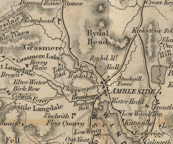 FD02NY30.jpg 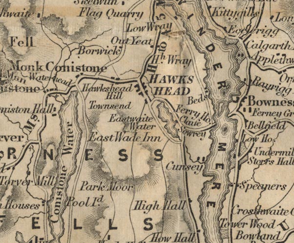 FD02SD39.jpg 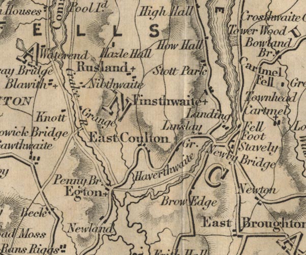 FD02SD38.jpg Outline with form lines. item:- JandMN : 100.1 Image © see bottom of page |
|||||||||||||||||||||||||
|
|
||||||||||||||||||||||||||
 Aspland 1840s-60s drawings Aspland 1840s-60s drawings |
||||||||||||||||||||||||||
|
|
||||||||||||||||||||||||||
| evidence:- | old map:- Wyld 1847 placename:- Windermere Water |
|||||||||||||||||||||||||
| source data:- | Map, uncoloured engraving, Windermere, Rydal, Grasmere,
Esthwaite and Coniston Waters, scale about 3.5 miles to 1 inch,
by James Wyld, published by John Johnstone, Paternoster Row,
London, et al, 1847.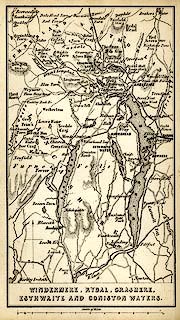 click to enlarge click to enlargeWLD3M1.jpg printed at bottom:- "WINDERMERE, RYDAL, GRASMERE, / ESTHWAITE AND CONISTON WATERS." item:- Armitt Library : A1201.64 Image © see bottom of page |
|||||||||||||||||||||||||
|
|
||||||||||||||||||||||||||
| evidence:- | old print:- Garnett 1850s-60s F placename:- Windermere |
|||||||||||||||||||||||||
| source data:- | Print, uncoloured lithograph, Head of Windermere, from near Millerground Bay, Windermere,
Westmorland, drawn by A Pettit, engraved by William Banks, Edinburgh, published by
John Garnett, Post Office, Windermere, Westmorland, 1850s-60s?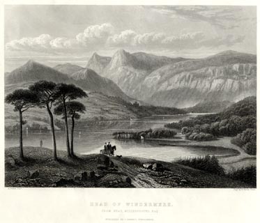 click to enlarge click to enlargeGA1306.jpg printed, bottom left, right, centre "A. Pettitt, Delt. / Engd. by W. Banks, Edinr. / HEAD OF WINDERMERE. / FROM NEAR MILLERGROUND BAY. / PUBLISHED BY J. GARNETT, WINDERMERE." item:- Armitt Library : ALMA335.6 Image © see bottom of page |
|||||||||||||||||||||||||
|
|
||||||||||||||||||||||||||
| evidence:- | old map:- Garnett 1850s-60s H placename:- Winder Mere |
|||||||||||||||||||||||||
| source data:- | Map of the English Lakes, in Cumberland, Westmorland and
Lancashire, scale about 3.5 miles to 1 inch, published by John
Garnett, Windermere, Westmorland, 1850s-60s. GAR2NY30.jpg outline with shore form lines, lake or tarn  GAR2SD39.jpg "WINDER MERE"  GAR2SD38.jpg item:- JandMN : 82.1 Image © see bottom of page |
|||||||||||||||||||||||||
|
|
||||||||||||||||||||||||||
| evidence:- | old print:- Nelson 1853 (edn 1880s) placename:- Windermere |
|||||||||||||||||||||||||
| source data:- | Print, chromolithograph, Waterhead, Windermere, Westmorland, published by Thomas Nelson
and Sons, London, 1880s?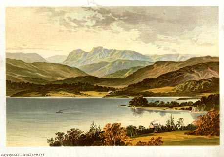 click to enlarge click to enlargeNS0301.jpg Frontispiece to Views of the English Lakes, and Tourists Guide to the English Lakes. printed at lower right:- "T. NELSON &SONS" printed at bottom left:- "WATERHEAD - WINDERMERE" item:- JandMN : 474.1 Image © see bottom of page |
|||||||||||||||||||||||||
|
|
||||||||||||||||||||||||||
| evidence:- | old print:- Nelson 1853 (edn 1880s) placename:- Windermere |
|||||||||||||||||||||||||
| source data:- | Print, uncoloured, Head of Windermere, Westmorland, published by Thomas Nelson and
Sons, London, 1853 edn 1880s?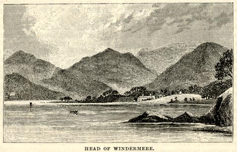 click to enlarge click to enlargeNS0308.jpg On p.28 of Views of the English Lakes, and Tourists Guide to the English Lakes. printed at bottom:- "HEAD OF WINDERMERE." item:- JandMN : 474.9 Image © see bottom of page |
|||||||||||||||||||||||||
|
|
||||||||||||||||||||||||||
| evidence:- | old print:- Pyne 1853 |
|||||||||||||||||||||||||
| source data:- | Print, tinted lithograph, Windermere Water Head, Westmorland, by James Baker Pyne,
engraved by W Gauci, published by Thomas Agnew and Sons, Manchester, Lancashire, 1853.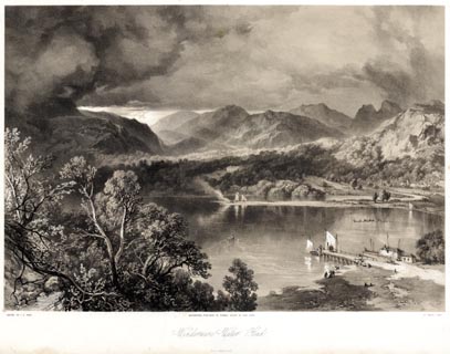 click to enlarge click to enlargePYN204.jpg "PAINTED BY J. B. PYNE. / W. GAUCI LITH. / MANCHESTER, PUBLISHED BY THOMAS AGNEW & SONS, 1853. / Windermere Water Head / M & N HANHART IMPT." item:- Armitt Library : A6678.5 Image © see bottom of page |
|||||||||||||||||||||||||
|
|
||||||||||||||||||||||||||
| evidence:- | old print with text:- Pyne 1853 placename:- Windermere lake ??? |
|||||||||||||||||||||||||
| source data:- | Print, tinted lithograph, Lake Windermere, Regatta, near Waterhead, Westmorland, by
James Baker Pyne, engraved by W Gauci, published by Thomas Agnew and Sons, Manchester,
Lancashire, 1853.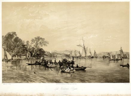 click to enlarge click to enlargePYN209.jpg "PAINTED BY J. B. PYNE. / W. GAUCI LITH. / MANCHESTER, PUBLISHED BY THOMAS AGNEW & SONS, 1853. / Lake Windermere, Regatta. / M & N HANHART IMPT." From the descriptive text:- "... Canning, Sir Walter Scott, Wordsworth, Southey, and Wilson, were all visitors at this mansion [Storrs] on the occasion of the Regatta of 1824. "There were," says Mr. Lockhart, in his "Life of Walter Scott," "brilliant cavalcades in the morning, and delicious boatings by moonlight; and on the last day of their visit Professor Wilson (the Admiral of the Lake, as Canning called him) presided over one of the most splendid regattas that ever enlivened Windermere. There were not fewer than fifty barges following in the Professor's radiant procession when it paused at Storrs, to admit into the place of honour the vessel that carried Mr. Bolton and his distinguished geusts. The three Bards of the Lakes led the cheers that hailed Scott and Canning, and music and sunshine, flags, streamers, and gay dresses, the merry hum of voices, and the rapid splashing of innumerable oars, made up a dazzling mixture of sensations as the flotilla wound its way among the richly-foliaged islands, and along bays and promontories, peopled by enthusiastic spectators." ..." item:- Armitt Library : A6678.10 Image © see bottom of page |
|||||||||||||||||||||||||
|
|
||||||||||||||||||||||||||
| evidence:- | old text:- Pyne 1853 |
|||||||||||||||||||||||||
| source data:- | Descriptive text, by Charles Swain, for the print, Windermere as seen from Orrest
Head, Windermere, Westmorland, by James Baker Pyne, published by Thomas Agnew and
Sons, Manchester, Lancashire, 1853. From the descriptive text:- "... Mr. Wordsworth, than whom no one was better acquainted with, or more able to descriminate between the comparative splendour of lake scenes, dwells with enthusiasm on the beauties of Orrest in his journal on the "Projected Kendal and Windermere railway," and appears to have referred to this neighbourhood in his eloquent denunciation of the projected invasion of its retirement:-" "" ""Is there no nook of English ground secure" "From rash assault? Schemes of retirement sown" "In Youth, and 'mid the busy world kept pure" "As when their earliest flow'rs of hope were blown," "Must perish. How can they this blight endure?" "And must he, too, the ruthless change bemoan" "Who scorns a false utilitarian lure" "'Mid his paternal fields at random thrown?" "Baffle the threat, bright scene, from Orrest Head!" "Given to the pausing traveller's rapturous glance;" "Plead for thy peace, thou beautiful romance" "Of nature; and, if human hearts be dead," "Speak, passing winds; ye torrents, with your strong" "And constant voice, protest against the wrong!"" "it must have been a source of consolation to the indignant poet to have learned before he died that the desecration of his favourite scenes, of which he had complained so eloquently, has not proved, in a pecuniary point of view, a very lucrative speculation. In these days of universal progress, the Lakes must share the fate of all places whose attractions are of an order to draw admiring visitors towards them, and we can therefore hardly help sympathising with Mr. Monckton Milnes in his apostrophe to Mr. Wordsworth on the subject of the above sonnet:-" "" ""The hour may come, - nay must - in these our days," "When the harsh steam-car with the cataract's shout" "Shall mingle its swift roll, and motley rout" "Of multitudes these mountain echoes raise." "And thou, the patriarch of these pleasant ways," "Canst hardly grudge that crowded streets send out" "In Sabbath glee, the sons of care and doubt," "To read these scenes by the light of thy own lays!" "Disorder'd laughter, and encounter rude," "The poet's finer sense perchance may pain," "Yet many a glade and nook of solitude," "For quiet walk and thought, will still remain," "Where he the poor intruders may elude," "Nor lose one golden dream for all their homely gain!"" item:- Armitt Library : A6678.12 Image © see bottom of page |
|||||||||||||||||||||||||
|
|
||||||||||||||||||||||||||
| evidence:- | old print:- Pyne 1853 placename:- Windermere |
|||||||||||||||||||||||||
| source data:- | Print, chromolithograph, Windermere as seen from Orrest Head, Windermere, Westmorland,
by James Baker Pyne, engraved by W Gauci, published by Thomas Agnew and Sons, Manchester,
Lancashire, 1859.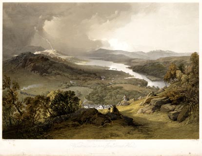 click to enlarge click to enlargePYN311.jpg "PAINTED BY J. B. PYNE. / L. HAGHE, LITH. / MANCHESTER, PUBLISHED BY THOMAS AGNEW & SONS. / Windermere as seen from Orrest Head / PRINTED BY DAY & SON, LITHRS. TO THE QUEEN" item:- Armitt Library : 2016.1944 Image © see bottom of page |
|||||||||||||||||||||||||
|
|
||||||||||||||||||||||||||
| evidence:- | old print with text:- Pyne 1853 placename:- Windermere Lake |
|||||||||||||||||||||||||
| source data:- | Print, tinted lithograph, Windermere Lake, Westmorland, by James Baker Pyne, engraved
by W Gauci, published by Thomas Agnew and Sons, Manchester, Lancashire, 1853.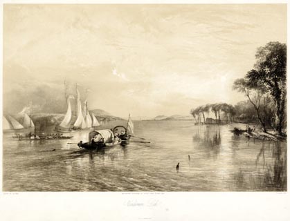 click to enlarge click to enlargePYN226.jpg "PAINTED BY J. B. PYNE. / W. GAUCI LITH. / MANCHESTER, PUBLISHED BY THOMAS AGNEW & SONS, 1853. / Windermere Lake / M.& N. HANHART, IMPT." From the descriptive text:- "The scene is taken from the water, Between Bowcroft and Ferry House ... He [Mr. Pyne] involuntarily sympathises with the listless rowers in the covered barge. The whole atmosphere breathes heat, and the golden sky is reflected back from the gently-rippling water in blended beauty. The snow-white sail of the graceful yacht is tiged by the beams of the departing god of day, and scarcely swells to the zephyr's wing. Mr. Pyne never leaves his story half told, so we have the floating bottles, speaking of frolic, feast, and fun. ..." item:- Armitt Library : A6678.27 Image © see bottom of page |
|||||||||||||||||||||||||
|
|
||||||||||||||||||||||||||
| evidence:- | old print:- Pyne 1853 placename:- Lake Windermere |
|||||||||||||||||||||||||
| source data:- | Print, coloured lithograph, Lake Windermere, Regatta, near Waterhead, Westmorland,
by James Baker Pyne, engraved by W Gauci, published by Thomas Agnew and Sons, Manchester,
Lancashire, 1853.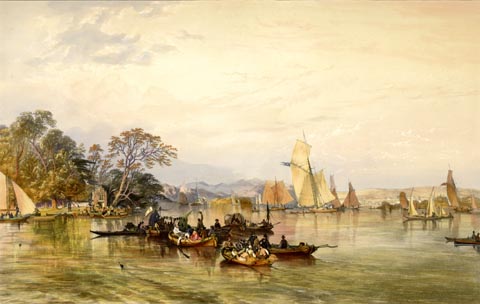 click to enlarge click to enlargePYN409.jpg item:- Armitt Library : A6677.10 Image © see bottom of page |
|||||||||||||||||||||||||
|
|
||||||||||||||||||||||||||
| evidence:- | old print:- Pyne 1853 placename:- Windermere Lake |
|||||||||||||||||||||||||
| source data:- | Print, coloured lithograph, Windermere Lake, Westmorland, by James Baker Pyne, engraved
by W Gauci, published by Thomas Agnew and Sons, Manchester, Lancashire, 1853.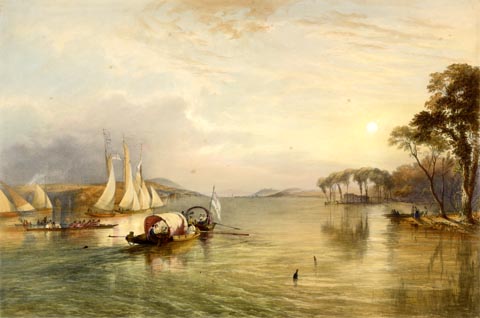 click to enlarge click to enlargePYN426.jpg item:- Armitt Library : A6677.27 Image © see bottom of page |
|||||||||||||||||||||||||
|
|
||||||||||||||||||||||||||
| evidence:- | old text:- Martineau 1855 |
|||||||||||||||||||||||||
| source data:- | Guide book, A Complete Guide to the English Lakes, by Harriet
Martineau, published by John Garnett, Windermere, Westmorland,
and by Whittaker and Co, London, 1855; published 1855-76. goto source Page 3:- "WINDERMERE." "A few years ago there was only one meaning to the word WINDERMERE. It then meant a lake lying among mountains, and so secluded that it was some distinction even for the travelled man to have seen it. Now, there is a ... thriving village of Windermere and a populous locality. ..." "..." goto sourcePage 5:- "... As a general rule, lakes should be approached from the foot, that the ridges may rise, instead of sinking, before the observer's eye. But so happy is the access to Windermere from the station, that it is hard to say that it could have been better; and that access is, not from the south to its lower end, but from the south-east to about its middle. ... the road to Bowness descends, winding for about a mile and a half, striking the shore at a point rather more than half way up the lake, and commanding the group of mountains that cluster about its head." |
|||||||||||||||||||||||||
|
|
||||||||||||||||||||||||||
| evidence:- | old print:- Martineau 1855 |
|||||||||||||||||||||||||
| source data:- | Plate, opposite p.13:- goto source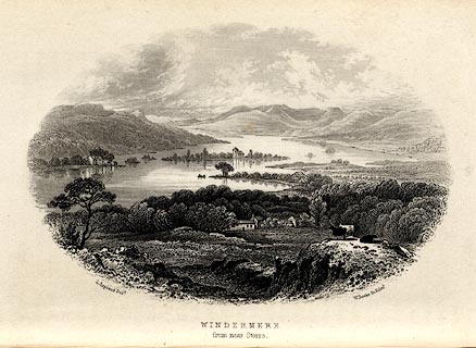 click to enlarge click to enlargeMNU103.jpg Print, engraving, Windermere from near Storrs, drawn by L Aspland, engraved by W Banks, Edinburgh, published by John Garnett, Windermere, Westmorland, and by Whittaker and Co, London, 1855. "L Aspland Delt. / W Banks Sc Edinr. / WINDERMERE / from near Storrs." item:- Armitt Library : A1159.3 Image © see bottom of page |
|||||||||||||||||||||||||
|
|
||||||||||||||||||||||||||
| evidence:- | old text:- Martineau 1855 |
|||||||||||||||||||||||||
| source data:- | Guide book, A Complete Guide to the English Lakes, by Harriet
Martineau, published by John Garnett, Windermere, Westmorland,
and by Whittaker and Co, London, 1855; published 1855-76. goto source Page 14:- "[Professor Wilson] ... No less striking was it to see him in a mood of repose, as he was seen when steering the packet-boat that used to pass between Bowness and Ambleside, before the steamers were put upon the lake. Sitting motionless, with his hand upon the rudder, in the presence of journeymen and market-women, and his eye apparently looking beyond everything into nothing, and his mouth closed above his beard, as if he meant never to speak again, he was quite as impressive and immortal an image as he could have been to the students of his moral philosophy class, or the comrades of his jovial hours. ..." |
|||||||||||||||||||||||||
|
|
||||||||||||||||||||||||||
| evidence:- | old print:- Martineau 1855 |
|||||||||||||||||||||||||
| source data:- | Plate, opposite p.19:- goto source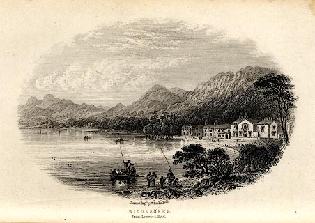 click to enlarge click to enlargeMNU104.jpg Print, engraving, Windermere from Lowood Hotel, drawn and engraved by W Banks, Edinburgh, published by John Garnett, Windermere, Westmorland, and by Whittaker and Co, London, 1855. "Drawn &Eng'd by W Banks Edinr. / WINDERMERE / from Lowood Hotel." item:- Armitt Library : A1159.4 Image © see bottom of page |
|||||||||||||||||||||||||
|
|
||||||||||||||||||||||||||
| evidence:- | old text:- Martineau 1855 item:- sailing boat; boat; wind; rowing boat; fish, Windermere lake; trout; char |
|||||||||||||||||||||||||
| source data:- | Guide book, A Complete Guide to the English Lakes, by Harriet
Martineau, published by John Garnett, Windermere, Westmorland,
and by Whittaker and Co, London, 1855; published 1855-76. Page 20:- "..." "There are plenty of boats to be had at Waterhead and Bowness, ... The stranger should be warned, however, against two dangers which it is rash to encounter. Nothing should induce him to sail on Windermere, or on any lake surrounded by mountains. There is no calculating on, or accounting for, the gusts that come down between the hills; and no skill and practice obtained by boating on rivers or the waters of a flat country are any sure protection here. And nothing should induce him to go out in one of the little skiffs which are too easily attainable and too tempting, from the ease of rowing them. The surface may become rough at any minute, and those skiffs are unsafe in all states of the water but the calmest. The long list of deaths occasioned in this way,- deaths both of residents and strangers,- should have put an end to the use of these light skiffs, long ago. The larger boats are safe enough, and most skilfully managed by their rowers: and the stranger can enjoy no better treat than gliding along, for hours of the summer day, peeping into the coves and bays, coasting the islands, and lying cool in the shadows of the woods. The clearness of the water is a common surprise to the resident in a level country; and it is pleasant sport to watch the movements of the fish, darting, basking, or leaping in the sunshine, or quivering their fins in the reflected ray. What the quality of the trout and char is, the tourist will probably find every day, at breakfast and dinner." goto sourcePage 32:- "... As for the trout, there can be none finer than that of Windermere." |
|||||||||||||||||||||||||
|
|
||||||||||||||||||||||||||
| evidence:- | old text:- Martineau 1855 item:- depth, Windermere lake |
|||||||||||||||||||||||||
| source data:- | Guide book, A Complete Guide to the English Lakes, by Harriet
Martineau, published by John Garnett, Windermere, Westmorland,
and by Whittaker and Co, London, 1855; published 1855-76. goto source Page 180:- "A TABLE OF THE LENGTH, BREADTH, AND DEPTH OF THE LAKES." "No. : Names of Lakes. : Counties : Length in Miles. : Extreme breadth in Miles : Extreme depth in Feet : Height above the Sea" "1 : Windermere : Westmorland : 10 : 1 : 240 : 116" |
|||||||||||||||||||||||||
|
|
||||||||||||||||||||||||||
| evidence:- | old print:- Martineau 1855 |
|||||||||||||||||||||||||
| source data:- | Plate, tipped in with an advertisement for the Windermere Hotel:- goto source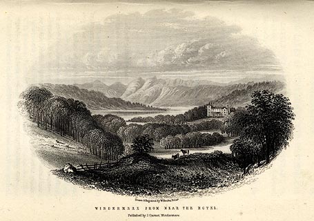 click to enlarge click to enlargeMNU119.jpg Print, engraving, Windermere from near the Hotel, drawn and engraved by W Banks, Edinburgh, published by John Garnett, Windermere, Westmorland, and by Whittaker and Co, London, 1855. "Drawn &Engraved by W Banks Edinr. / WINDERMERE FROM NEAR THE HOTEL. / Published by J. Garnet, Windermere." item:- Armitt Library : A1159.19 Image © see bottom of page |
|||||||||||||||||||||||||
|
|
||||||||||||||||||||||||||
| evidence:- | old print:- Martineau 1855 |
|||||||||||||||||||||||||
| source data:- | Plate, tipped in with an advertisement for the hotel:- goto source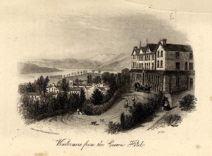 click to enlarge click to enlargeMNU121.jpg Print, engraving, Windermere from the Crown Hotel, by J Harwood, 26 Fenchurch Street, London, published by John Garnett, Windermere, Westmorland, and by Whittaker and Co, London, 1855. item:- Armitt Library : A1159.21 Image © see bottom of page |
|||||||||||||||||||||||||
|
|
||||||||||||||||||||||||||
| evidence:- | old print:- Nelson 1859 placename:- Windermere |
|||||||||||||||||||||||||
| source data:- | Print, Nelson print, Windermere from the Neighbourhood of Clappersgate, Westmorland,
published by T Nelson and Sons, London etc, 1859.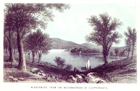 click to enlarge click to enlargeNS0502.jpg printed, bottom "WINDERMERE FROM THE NEIGHBOURHOOD OF CLAPPERSGATE." item:- Armitt Library : 2003.13.2 Image © see bottom of page |
|||||||||||||||||||||||||
|
|
||||||||||||||||||||||||||
| evidence:- | old print:- Nelson 1859 placename:- Windermere |
|||||||||||||||||||||||||
| source data:- | Print, Nelson print, Head of Windermere, Westmorland, published by T Nelson and Sons,
London etc, 1859.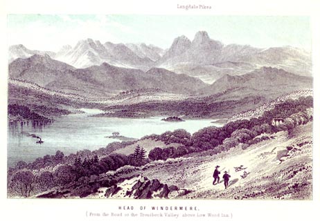 click to enlarge click to enlargeNS0503.jpg printed, bottom "HEAD OF WINDERMERE. / (From the Road to the Ttroutbeck Valley above Low Wood Inn.)" printed, top "Langdale Pikes" item:- Armitt Library : 2003.13.3 Image © see bottom of page |
|||||||||||||||||||||||||
|
|
||||||||||||||||||||||||||
| evidence:- | old photograph:- Payn 1867 placename:- Windermere |
|||||||||||||||||||||||||
| source data:- | Photograph, sepia, Windermere, from Elleray, looking South, Westmorland, by Garnett
and Sproat, published by J Garnett, Windermere, Westmorland, 1867.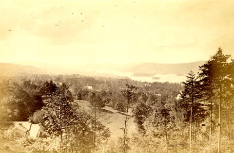 click to enlarge click to enlargePN0304.jpg Tipped in opposite p7 of The Lakes in Sunshine, text by James Payn. printed at bottom:- "WINDERMERE, FROM ELLERAY, LOOKING SOUTH." item:- Fell and Rock Climbing Club : 184.4 Image © see bottom of page |
|||||||||||||||||||||||||
|
|
||||||||||||||||||||||||||
| evidence:- | old print:- Payn 1867 |
|||||||||||||||||||||||||
| source data:- | Print, uncoloured engraving, Head of Windermere, from Skelgill, Westmorland, by T
L Aspland, published by J Garnett, Windermere, Westmorland, 1867.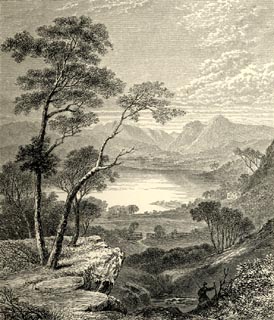 click to enlarge click to enlargePN0312.jpg On p.25 of The Lakes in Sunshine, text by James Payn. printed at bottom:- "HEAD OF WINDERMERE, FROM SKELGILL." item:- Fell and Rock Climbing Club : 184.12 Image © see bottom of page |
|||||||||||||||||||||||||
|
|
||||||||||||||||||||||||||
| evidence:- | old print:- Payn 1867 placename:- Windermere Lake |
|||||||||||||||||||||||||
| source data:- | Print, uncoloured engraving, Windermere Lake and Ambleside, from Claife, Lancashire,
by T L Aspland, published by J Garnett, Windermere, Westmorland, 1867.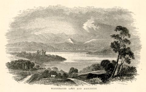 click to enlarge click to enlargePN0327.jpg On p.54 of The Lakes in Sunshine, text by James Payn. printed at bottom:- "WINDERMERE LAKE AND AMBLESIDE." item:- Fell and Rock Climbing Club : 184.27 Image © see bottom of page |
|||||||||||||||||||||||||
|
|
||||||||||||||||||||||||||
| evidence:- | old map:- Prior 1874 map 1 placename:- Winander Mere |
|||||||||||||||||||||||||
| source data:- | Map, uncoloured engraving or lithograph? Winander Mere, scale
about 2.5 miles to 1 inch, published by John Garnett,
Windermere, Westmorland, 1874. click to enlarge click to enlargePI03M1.jpg "WINANDER MERE." outline with form lines; the county boundary is a dotted line across lake from about Cunsey Beck to just N of Black Beck item:- private collection : 133.1 Image © see bottom of page |
|||||||||||||||||||||||||
|
|
||||||||||||||||||||||||||
| evidence:- | old map:- Prior 1874 placename:- Winander Mere |
|||||||||||||||||||||||||
| source data:- | Map, coloured lithograph? Winander Mere and its Vicinity, scale
about 1.5 miles to 1 inch, engraved by W Banks, Edinburgh,
published by John Garnett, Windermere, Westmorland, 1874.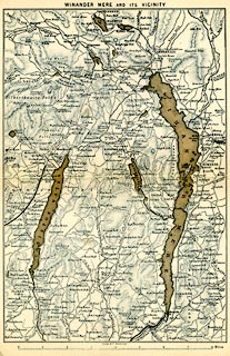 click to enlarge click to enlargePI03M2.jpg "Winander Mere and its Vicinity" Included in A Sail on Winander Mere, by Herman Prior, published by John Garnett, Windermere, Cumberland, 1874. item:- private collection : 133.2 Image © see bottom of page |
|||||||||||||||||||||||||
|
|
||||||||||||||||||||||||||
| evidence:- | old map:- Prior 1874 map 1 placename:- Winander Mere |
|||||||||||||||||||||||||
| source data:- | Map, uncoloured engraving or lithograph? Winander Mere, scale
about 2.5 miles to 1 inch, published by John Garnett,
Windermere, Westmorland, 1874. click to enlarge PI03M1.jpg "WINANDER MERE." outline with form lines; the county boundary is a dotted line across lake from about Cunsey Beck to just N of Black Beck item:- private collection : 133.1 Image © see bottom of page |
|||||||||||||||||||||||||
|
|
||||||||||||||||||||||||||
| evidence:- | old map:- Prior 1874 placename:- Winander Mere |
|||||||||||||||||||||||||
| source data:- | Map, coloured lithograph? Winander Mere and its Vicinity, scale
about 1.5 miles to 1 inch, engraved by W Banks, Edinburgh,
published by John Garnett, Windermere, Westmorland, 1874. click to enlarge PI03M2.jpg "Winander Mere and its Vicinity" Included in A Sail on Winander Mere, by Herman Prior, published by John Garnett, Windermere, Cumberland, 1874. item:- private collection : 133.2 Image © see bottom of page |
|||||||||||||||||||||||||
|
|
||||||||||||||||||||||||||
| evidence:- | old map:- Jenkinson 1875 map1 |
|||||||||||||||||||||||||
| source data:- | Map, Windermere Section, Westmorland and Lancashire, ?colour
lithograph, scale about 1 mile to 1 inch, by Stanford's
Geographical Establishment, published by Edward Stanford, 55
Charing Cross, London, 1875.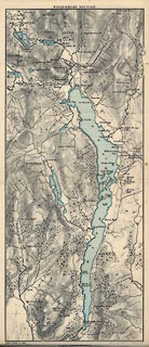 click to enlarge click to enlargeJK04.jpg item:- JandMN : 28.3 Image © see bottom of page |
|||||||||||||||||||||||||
|
|
||||||||||||||||||||||||||
| evidence:- | old print:- Walton 1876 placename:- Windermere |
|||||||||||||||||||||||||
| source data:- | Print, colour lithograph, A Quiet Evening on Windermere, Westmorland, from a painting
by Elijah Walton, published by W M Thompson, 20 Cockspur Street, Pall Mall, and Burlington
Gallery, Piccadilly, London, 1876.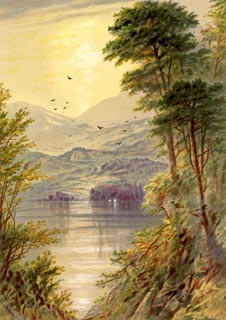 click to enlarge click to enlargeWLT301.jpg Plate 1 in English Lake Scenery, with a description by T G Bonney. item:- JandMN : 469.1 Image © see bottom of page |
|||||||||||||||||||||||||
|
|
||||||||||||||||||||||||||
| evidence:- | old print:- Walton 1876 placename:- Windermere |
|||||||||||||||||||||||||
| source data:- | Print, colour lithograph, Windermere, Early Evening, Westmorland, from a painting
by Elijah Walton, published by W M Thompson, 20 Cockspur Street, Pall Mall, and Burlington
Gallery, Piccadilly, London, 1876.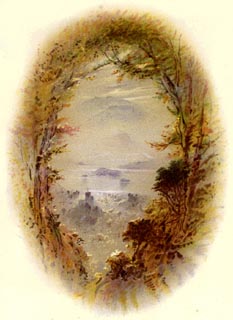 click to enlarge click to enlargeWLT306.jpg Plate 6 in English Lake Scenery, with a description by T G Bonney. item:- JandMN : 469.6 Image © see bottom of page |
|||||||||||||||||||||||||
|
|
||||||||||||||||||||||||||
| evidence:- | old print:- Walton 1876 placename:- Windermere item:- moonlight |
|||||||||||||||||||||||||
| source data:- | Print, colour lithograph, Moonlight on Windermere, Westmorland, from a painting by
Elijah Walton, published by W M Thompson, 20 Cockspur Street, Pall Mall, and Burlington
Gallery, Piccadilly, London, 1876.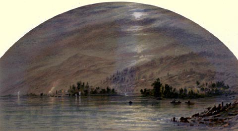 click to enlarge click to enlargeWLT314.jpg Plate 14 in English Lake Scenery, with a description by T G Bonney. item:- JandMN : 469.14 Image © see bottom of page |
|||||||||||||||||||||||||
|
|
||||||||||||||||||||||||||
| evidence:- | old print:- Walton 1876 placename:- Windermere item:- sunrise; steam launch |
|||||||||||||||||||||||||
| source data:- | Print, colour lithograph, Sunrise on the Head of Windermere, Westmorland, from a painting
by Elijah Walton, published by W M Thompson, 20 Cockspur Street, Pall Mall, and Burlington
Gallery, Piccadilly, London, 1876.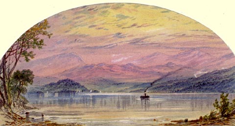 click to enlarge click to enlargeWLT318.jpg Plate 18 in English Lake Scenery, with a description by T G Bonney. item:- JandMN : 469.18 Image © see bottom of page |
|||||||||||||||||||||||||
|
|
||||||||||||||||||||||||||
| Herbert Bell 1880s-1940s (cloud photos) |
||||||||||||||||||||||||||
|
|
||||||||||||||||||||||||||
| Herbert Bell 1880s-1940s (photos) |
||||||||||||||||||||||||||
|
|
||||||||||||||||||||||||||
| Herbert Bell 1880s-1940s (boating photos) |
||||||||||||||||||||||||||
|
|
||||||||||||||||||||||||||
| evidence:- | old print:- Bemrose 1881 placename:- Windermere |
|||||||||||||||||||||||||
| source data:- | Print, uncoloured, Head of Windermere from Low Wood, Westmorland, published by Bemrose
and Sons, 23 Old Bailey, London and Derby, by A B Moss, Carlisle, Cumberland, and
by T Wilson, Kendal, Westmorland, about 1881.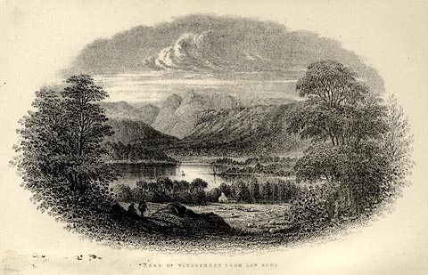 click to enlarge click to enlargeBEM101.jpg Tipped in opposite p.1 of a Handy Guide to the English Lakes and Shap Spa. printed at bottom:- "HEAD OF WINDERMERE FROM LOW WOOD" item:- JandMN : 455.3 Image © see bottom of page |
|||||||||||||||||||||||||
|
|
||||||||||||||||||||||||||
| evidence:- | old map:- Mill and Heawood 1895 placename:- Windermere |
|||||||||||||||||||||||||
| source data:- | Map, Windermere, scale 2 inches to 1 mile, with soundings by
Hugh Robert Mill and Edward Heawood, by Bartholomew, Edinburgh,
Scotland, published by George Philip and Son, 32 Fleet Street,
London, etc, 1895.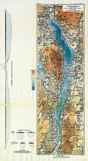 click to enlarge click to enlargeMIL9.jpg - with soundings and sections item:- Kendal Library : 7.8 Image © see bottom of page |
|||||||||||||||||||||||||
|
|
||||||||||||||||||||||||||
| evidence:- | old text:- Gents Mag item:- skating |
|||||||||||||||||||||||||
| source data:- | Magazine, The Gentleman's Magazine or Monthly Intelligencer or
Historical Chronicle, published by Edward Cave under the
pseudonym Sylvanus Urban, and by other publishers, London,
monthly from 1731 to 1922. goto source Gentleman's Magazine 1900 part 2 p.363 "..." "Another night's frolic was a skate on Windermere in 1895, the last time the whole length and breadth of it was bearable. I had already done the thirty-mile round of the lake, before leaving the brilliantly lighted pier at Waterhead for the heavy black woods of Wray. The ice, it will be remembered by those who at this time visited the lake, was furrowed between Bowness and Ambleside by two enormous cracks, and to cross these a course had first to be taken down the Pull shore, not, however, so near as to reach the thin ice around the mouth of the becks. The first seam was about a mile from Waterhead. As I approached it a few skaters were still gliding near me - apparently they were goning as far as the crack and back. Now a long gurgling crackle travelled along the ice; a lady screamed and made for the shore, fourscore yards away. I called out that we were quite safe, but she did not heed, and rushed towards a dangerous bay which I had reconnoitred earlier in the day. I spurted in pursuit and caught up to her; barely in time, however, for the thinning crust rocked like a raft before I could arrest our impetus and swerve to sounder ice. I did not fear drowning for the water was shallow, yet an immersion would have been very unpleasant. The crack now loomed in front like a feathery surf. In daylight it was easily passed, but at night things look different. Across this, the widest part of the lake, gleamed the many windows of Lowwood; at various houses by the shore lamps had been hoisted into the trees, and figures were gliding on the lighted area beneath them; but out with me was utter darkness, loneliness, and silence save for the quiet rasp of my skates. Wray Castle and a few farmhouses showed occasional gleams of light through the black fir woods and narrow snow fields. Suddenly in front appeared something black, a huge dog squatting on the ice it seemed to be. But as I neared, the mass seemed to dwindle in size - was it the head and shoulders of a man clinging for dear life to a splintered ice-egde? I put on speed," |
|||||||||||||||||||||||||
|
|
||||||||||||||||||||||||||
| evidence:- | old text:- Gents Mag 1900 |
|||||||||||||||||||||||||
| source data:- | goto source Gentleman's Magazine 1900 part 2 p.364 "then the bulk seemed again to increase, but not till I was within thirty feet did I recognise the outline of a man kneeling and rebuckling his skate-strap. I hailed him with relief - a companion under such circumstances could not be wearisome - and while the ice roared and snapped in peals like thunder (a common night occurrence on large frozen sheets) we made for the second crack near Rawlinson's Nab. To cross this it was necessary to land and walk or slide a couple of yards. My companion shot round with ease, but my skates struck a chunk of ice or stone and came off, throwing me on my head and partially stunning me. Till this I had not noticed anyone standing by the wood-edge. Two farm servants picked me up, but I was no worse save for a bruise or two. The ice was bad here; at many places it was broken through, so that for a few score yards we had to follow our leader cautiously. ..." |
|||||||||||||||||||||||||
|
|
||||||||||||||||||||||||||
| evidence:- | old text:- Gents Mag item:- boating |
|||||||||||||||||||||||||
| source data:- | Magazine, The Gentleman's Magazine or Monthly Intelligencer or
Historical Chronicle, published by Edward Cave under the
pseudonym Sylvanus Urban, and by other publishers, London,
monthly from 1731 to 1922. goto source Gentleman's Magazine 1900 part 2 p.360 "... Often incidents of an amusing or exciting nature happen. We were once rowing along the top reach of Windermere in pitch darkness when our oarsmen suddenly put on a spurt. For a few secons, the boat simply tore through the water, then from out of space, or maybe the bottom of the lake, sprang a rock, and we crashed into it with tremendous force. We were shot over the thwarts into a confused heap on the boat's floor, and I well remember that someone's red hot pipe reclined for one agonising second on my ear. The difficulty of gauging distances across water is always great, but when night comes on it is doubly hard. Yet a sunrise viewed from a boat is well worth the amount of discomfort incurred. To some, the silence reigning over the waters is an unspeakable delight - when the shadows drop like a curtain into the valleys, and the night glow fringes the northern mountains, the lights begin to glow in the houses by the shore, and the utter loneliness becomes oppresive. But when light after light goes out and the faint whisperings cease to come from the land, your spirits recover and a happy time commences. Don't, however, go to sleep in your boat while waiting for daybreak. When walking early by the shore of Windermere Lake I glanced over a wall and saw, hard and fast on a miniature sandbank, a boat in the stern of which two figures were lying fast asleep. I passed quite close and for a moment thought to waken them, then, thinking that the increased power of the sun would arouse them without the start inseparable to my call, I passed on." "..." |
|||||||||||||||||||||||||
|
|
||||||||||||||||||||||||||
| evidence:- | old map:- Pearson 1900s map (Win/Est) placename:- Windermere Lake |
|||||||||||||||||||||||||
| source data:- | Map, lithograph, Round Windermere Lake and Esthwaite Water,
Westmorland and Cumberland, published by C Arthur Pearson,
Henrietta Street, London, 1900s.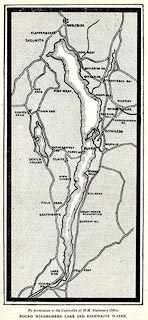 click to enlarge click to enlargePSN1M6.jpg On p.xxxix of Pearson's Gossipy Guide to the English Lakes and Neighbouring Districts. printed at bottom:- "By permission of the Controller of H.M. Stationery Office. / ROUND WINDERMERE LAKE AND ESTHWAITE WATER." item:- Armitt Library : A1188.8 Image © see bottom of page |
|||||||||||||||||||||||||
|
|
||||||||||||||||||||||||||
| evidence:- | old map:- Pearson 1900s map (Win/Ryd/Gra) placename:- Windermere |
|||||||||||||||||||||||||
| source data:- | Map, lithograph, From Windermere to Rydal Water and Grasmere,
Westmorland, published by C Arthur Pearson, Henrietta Street,
London, 1900s.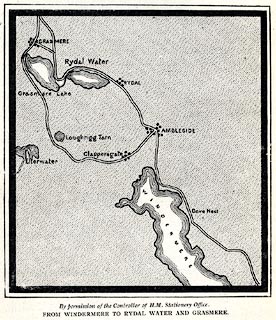 click to enlarge click to enlargePSN1M2.jpg On p.xxviii of Pearson's Gossipy Guide to the English Lakes and Neighbouring Districts. printed at bottom:- "By permission of the Controller of H.M. Stationery Office. / FROM WINDERMERE TO RYDAL WATER AND GRASMERE." item:- Armitt Library : A1188.4 Image © see bottom of page |
|||||||||||||||||||||||||
|
|
||||||||||||||||||||||||||
| evidence:- | old print:- Bradley 1901 placename:- Windermere lake |
|||||||||||||||||||||||||
| source data:- | Print, uncoloured lithograph, Windermere lake, Windermere, Westmorland, by Joseph
Pennell, published by Macmillan and Co, London, 1901.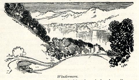 click to enlarge click to enlargeBRL150.jpg On page 203 of Highways and Byways in the Lake District, by A G Bradley. printed at bottom:- "Windermere." item:- JandMN : 464.50 Image © see bottom of page |
|||||||||||||||||||||||||
|
|
||||||||||||||||||||||||||
| evidence:- | old print:- Bradley 1901 placename:- Windermere |
|||||||||||||||||||||||||
| source data:- | Print, uncoloured lithograph, Windermere lake, Windermere, Westmorland, by Joseph
Pennell, published by Macmillan and Co, London, 1901. click to enlarge click to enlargeBRL153.jpg On page 214 of Highways and Byways in the Lake District, by A G Bradley. printed at bottom:- "Windermere." item:- JandMN : 464.53 Image © see bottom of page |
|||||||||||||||||||||||||
|
|
||||||||||||||||||||||||||
| evidence:- | old print:- Bradley 1901 placename:- Windermere lake |
|||||||||||||||||||||||||
| source data:- | Print, uncoloured lithograph, Windermere lake, Windermere, Westmorland, by Joseph
Pennell, published by Macmillan and Co, London, 1901.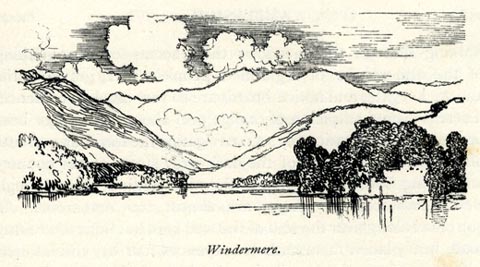 click to enlarge click to enlargeBRL155.jpg On page 217 of Highways and Byways in the Lake District, by A G Bradley. printed at bottom:- "Windermere." item:- JandMN : 464.55 Image © see bottom of page |
|||||||||||||||||||||||||
|
|
||||||||||||||||||||||||||
| evidence:- | old print:- Brabant 1902 placename:- Windermere |
|||||||||||||||||||||||||
| source data:- | Print, uncoloured lithograph, Windermere, Looking South from Orrest Head, Windermere,
Westmorland, by Edmund H New, published by Methuen and Co, 36 Essex Street, Strand,
London, 1902.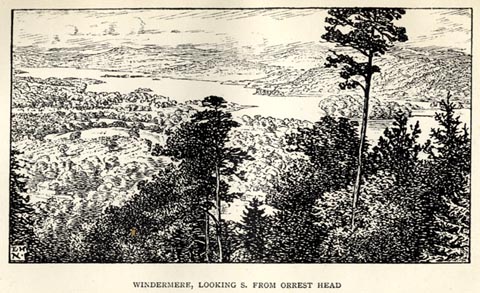 click to enlarge click to enlargeBBT102.jpg Tipped in opposite p.48 of The English Lakes, by F G Brabant. printed at bottom left:- "E H / N." printed at bottom:- "WINDERMERE, LOOKING S. FROM ORREST HEAD" item:- JandMN : 502.4 Image © see bottom of page |
|||||||||||||||||||||||||
|
|
||||||||||||||||||||||||||
| evidence:- | old print:- Heaton Cooper 1905 (edn 1908) placename:- Windermere |
|||||||||||||||||||||||||
| source data:- | Print, colour halftone, Windermere from Wansfell, Sunset, Windermere, Westmorland,
from a watercolour painting by Alfred Heaton Cooper, published by Adam and Charles
Black, London, 2nd edn 1908.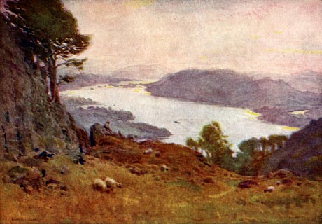 click to enlarge click to enlargeHC0103.jpg Opposite p.8 of The English Lakes, painted by Alfred Heaton Cooper, described by William T Palmer. printed at tissue opposite the print:- "WINDERMERE FROM WANSFELL / Sunset" printed at signed lower left:- "[A HEATON COOPER]" item:- JandMN : 468.3 Image © see bottom of page |
|||||||||||||||||||||||||
|
|
||||||||||||||||||||||||||
| evidence:- | old print:- Heaton Cooper 1905 (edn 1908) placename:- Windermere item:- ice; skating; moonlight |
|||||||||||||||||||||||||
| source data:- | Print, colour halftone, Near the Ferry, Windermere, Skating by Moonlight, Windermere,
Westmorland, from a watercolour painting by Alfred Heaton Cooper, published by Adam
and Charles Black, London, 2nd edn 1908.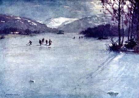 click to enlarge click to enlargeHC0105.jpg Opposite p.16 of The English Lakes, painted by Alfred Heaton Cooper, described by William T Palmer. printed at tissue opposite the print:- "NEAR THE FERRY, WINDERMERE: SKATING / BY MOONLIGHT" printed at signed lower left:- "[A HEATON COOPER]" item:- JandMN : 468.5 Image © see bottom of page |
|||||||||||||||||||||||||
|
|
||||||||||||||||||||||||||
| evidence:- | old print:- Heaton Cooper 1905 (edn 1908) placename:- Windermere item:- rainbow |
|||||||||||||||||||||||||
| source data:- | Print, colour halftone, Windermere and Langdale Pikes from Lowwood, Windermere, Westmorland,
from a watercolour painting by Alfred Heaton Cooper, published by Adam and Charles
Black, London, 2nd edn 1908.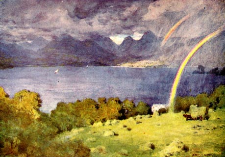 click to enlarge click to enlargeHC0108.jpg Opposite p.28 of The English Lakes, painted by Alfred Heaton Cooper, described by William T Palmer. printed at tissue opposite the print:- "WINDERMERE AND LANGDALE PIKES FROM LOWWOOD" printed at signed lower right:- "[A HEATON COOPER]" item:- JandMN : 468.8 Image © see bottom of page |
|||||||||||||||||||||||||
|
|
||||||||||||||||||||||||||
| evidence:- | old map:- Postlethwaite 1877 (3rd edn 1913) placename:- Windermere Lake |
|||||||||||||||||||||||||
| source data:- | Map, uncoloured engraving, Map of the Lake District Mining Field, Westmorland, Cumberland,
Lancashire, scale about 5 miles to 1 inch, by John Postlethwaite, published by W H
Moss and Sons, 13 Lowther Street, Whitehaven, Cumberland, 1877 edn 1913. PST2NY30.jpg  PST2SD39.jpg  PST2SD38.jpg "WINDERMERE LAKE" lake, county boundary on E side item:- JandMN : 162.2 Image © see bottom of page |
|||||||||||||||||||||||||
|
|
||||||||||||||||||||||||||
| evidence:- | old print:- Reynolds 1915 placename:- Windermere |
|||||||||||||||||||||||||
| source data:- | Print, colour halftone, Windermere from Wansfell, Westmorland, from a painting by
Alfred Heaton Cooper, published by Adam and Charles Black, London, 1915.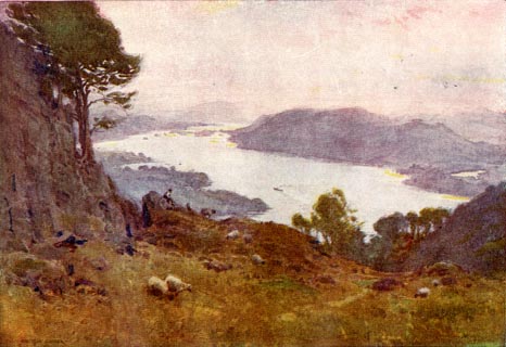 click to enlarge click to enlargeREY601.jpg "A HEATON COOPER" "WINDERMERE FROM WANSFELL." item:- JandMN : 1071.1 Image © see bottom of page |
|||||||||||||||||||||||||
|
|
||||||||||||||||||||||||||
| evidence:- | old photograph:- Marr 1916 placename:- Windermere |
|||||||||||||||||||||||||
| source data:- | Photograph, halftone print, Windermere in Winter, Westmorland, 1916.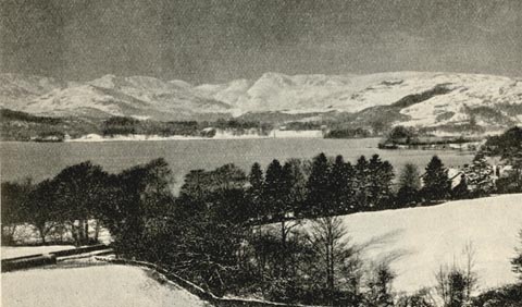 click to enlarge click to enlargeMA1202.jpg item:- JandMN : 173.10 Image © see bottom of page |
|||||||||||||||||||||||||
|
|
||||||||||||||||||||||||||
| evidence:- | old photograph:- Marr 1916 placename:- Windermere |
|||||||||||||||||||||||||
| source data:- | Photograph, halftone print, Foot of Winter, Westmorland, 1916.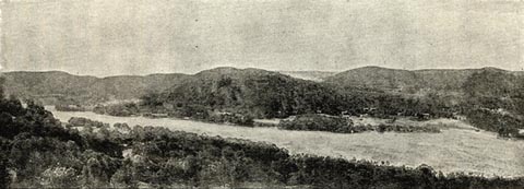 click to enlarge click to enlargeMA1203.jpg item:- JandMN : 173.11 Image © see bottom of page |
|||||||||||||||||||||||||
|
|
||||||||||||||||||||||||||
| evidence:- | old map:- Burrow 1920s |
|||||||||||||||||||||||||
| source data:- | Road book, On the Road, Dunlop Pictorial Road Plans, volume V,
strip maps with parts in Westmorland, Cumberland etc, irregular
scale about 1.5 miles to 1 inch, by E J Burrow and Co,
Cheltenham, Gloucestershire, 1920s.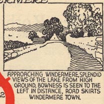 EJB3Vg34.jpg item:- private collection : 17 Image © see bottom of page |
|||||||||||||||||||||||||
|
|
||||||||||||||||||||||||||
| evidence:- | descriptive text:- Burrow 1920s |
|||||||||||||||||||||||||
| source data:- | Road book, strip maps with parts in Westmorland, Cumberland etc,
irregular scales about 1.5 miles to 1 inch, by E J Burrow and
Co, Cheltenham, Gloucestershire, 1920s. "... to Windermere town, which has grown up as a modern holiday centre on the very shore of the beautiful lake of the same name, the largest of the group. Lake Windermere has beautifully wooded banks. The road runs close beside the lake to its northern end at Ambleside, ... Across the lake to the left rise such famous peaks as Coniston Old Man (2,633 feet); farther away and more to the north the loftier forms of Scafell Pike (3,210 feet) and Scafell (3,162 feet). But closer at hand, right upon our course, is the beauty spot of Low Wood, on the shore of the lake, where steamers embark passengers for trips down the long narrow lake. ..." |
|||||||||||||||||||||||||
|
|
||||||||||||||||||||||||||
| evidence:- | old photograph:- Photochrom 1930s placename:- Windermere |
|||||||||||||||||||||||||
| source data:- | Photograph, black and white halftone print, Windermere and Langdale Pikes, Westmorland,
published by Photochrom Co, Tunbridge Wells, Kent, 1930s?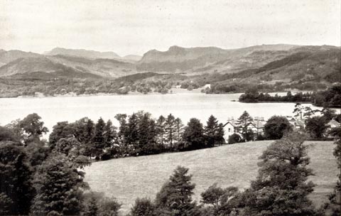 click to enlarge click to enlargePCH101.jpg printed, "Windermere and Langdale / Pikes. / ..." item:- JandMN : 1015.1 Image © see bottom of page |
|||||||||||||||||||||||||
|
|
||||||||||||||||||||||||||
| evidence:- | old photograph:- Photochrom 1930s placename:- Windermere |
|||||||||||||||||||||||||
| source data:- | Photograph, black and white halftone print, Bowness From Furness Fell, including Belle
Isle in Windermere lake, Westmorland, published by Photochrom Co, Tunbridge Wells,
Kent, 1930s?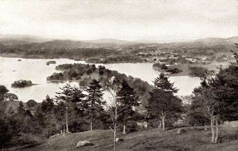 click to enlarge click to enlargePCH102.jpg printed, "Bowness From Furness Fell. / ..." item:- JandMN : 1015.2 Image © see bottom of page |
|||||||||||||||||||||||||
|
|
||||||||||||||||||||||||||
| evidence:- | old photograph:- Photochrom 1930s placename:- Windermere |
|||||||||||||||||||||||||
| source data:- | Photograph, black and white halftone print, Windermere from Orrest Head, Westmorland,
published by Photochrom Co, Tunbridge Wells, Kent, 1930s?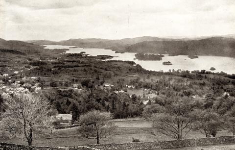 click to enlarge click to enlargePCH103.jpg printed, "Windermere from Orrest / Head. / ..." item:- JandMN : 1015.3 Image © see bottom of page |
|||||||||||||||||||||||||
|
|
||||||||||||||||||||||||||
| evidence:- | old map:- County Associations 1950 placename:- Lake Windermere |
|||||||||||||||||||||||||
| source data:- | Map, uncoloured lithograph, Lake Windermere, Westmorland, scale about 1.5 miles to
1 inch, published by The County Associations, Bourdon Street, Berkeley Square, London,
1950. click to enlarge click to enlargeWMD1M1.jpg Map, uncoloured lithograph, Lake Windermere, Westmorland, scale about 1.5 miles to 1 inch, published in The Westmorland Official County Guide by The County Associations, Bourdon Street, Berkeley Square, London, 1950. item:- JandMN : 1000.1 Image © see bottom of page |
|||||||||||||||||||||||||
|
|
||||||||||||||||||||||||||
| evidence:- | old print:- |
|||||||||||||||||||||||||
| source data:- | Print, uncoloured engraving, Langdale Pikes from Windermere, Westmorland, by ?B Foster,
engraved by E Evans, 1850s-60s?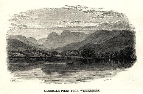 click to enlarge click to enlargePR0497.jpg printed at bottom left, right, centre:- "[B] Foster / E. EVANS SC. / LANGDALE PIKES FROM WINDERMERE" item:- Dove Cottage : 2008.107.446 Image © see bottom of page |
|||||||||||||||||||||||||
|
|
||||||||||||||||||||||||||
| evidence:- | old print:- placename:- Lake Windermere item:- steamer; Dragon Fly item:- water |
|||||||||||||||||||||||||
| source data:- | Print, uncoloured engraving, Launch of the Dragon Fly Steamer on Lake Windermere,
Westmorland, published in the Illustrated London News, 30 November 1850.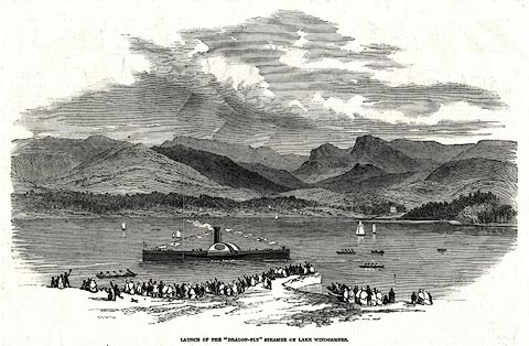 click to enlarge click to enlargePR0565.jpg The text is:- LAUNCH OF THE "DRAGON-FLY" STEAMER ON LAKE WINDERMERE ON Monday, the 18th inst., another vessel, built for the Windermere Iron Steamer Company, was launched at Low Wood, Windermere. Its dimensions are 100 feet in length, 14 feet beam, 50 horse-power, and a very light draught of water, not more than 20 inches. The vessel was launched complete in every respect, and with steam up; so that the moment he reached the water, the engines being started, she immediately steamed around the beautiful bay of Low Wood, amidst the cheers of the spectators. This new steamer was built by Messrs. M'Conochie and Claude, engineers, Liverpool, and was christened the Dragon-Fly by Mrs Rigg, the lady of the Secretary of the Company. After the launch, a large party sat down to an excellent dinner, at Mr. Logan's, Low Wood Hotel. printed at caption:- "LAUNCH OF THE "DRAGON-FLY" STEAMER ON LAKE WINDERMERE" item:- Dove Cottage : 2008.107.513 Image © see bottom of page |
|||||||||||||||||||||||||
|
|
||||||||||||||||||||||||||
| evidence:- | old print:- placename:- Windermere Lake |
|||||||||||||||||||||||||
| source data:- | Print, uncoloured engraving, Windermere Lake from near The Ferry, Westmorland, by
?B Foster, engraved by E Evans, 1850s-60s?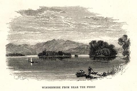 click to enlarge click to enlargePR0492.jpg printed at bottom left, right, centre:- "[B] Foster / E. EVANS SC. / WINDERMERE LAKE FROM NEAR THE FERRY" item:- Dove Cottage : 2008.107.441 Image © see bottom of page |
|||||||||||||||||||||||||
|
|
||||||||||||||||||||||||||
| evidence:- | old print:- Hudson 1842 (4th edn 1853) placename:- Windermere |
|||||||||||||||||||||||||
| source data:- | Print, uncoloured engraving, Head of Windermere from Low Wood, drawn and engraved
by W Banks, Edinburgh, published by John Hudson, Kendal, Westmorland, 1853.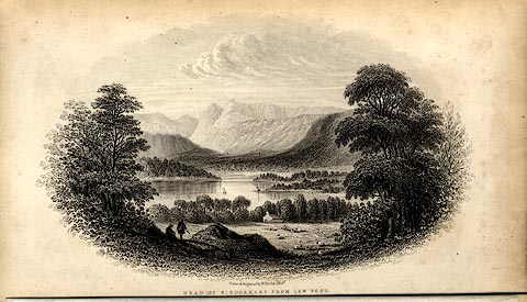 click to enlarge click to enlargeHUD1E1.jpg Frontispiece in A Complete Guide to the Lakes, edited John Hudson. printed at bottom:- "Drawn &Engraved by W. Banks, Edinr. / HEAD OF WINDERMERE FROM LOW WOOD." item:- JandMN : 327.1 Image © see bottom of page |
|||||||||||||||||||||||||
|
|
||||||||||||||||||||||||||
| evidence:- | old print:- placename:- Lake Windermere |
|||||||||||||||||||||||||
| source data:- | Print, uncoloured engraving, General View of the Lake Windermere, from the East, published
in the Saturday Magazine, London, 26 August 1837.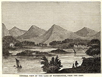 click to enlarge click to enlargePR0570.jpg printed at bottom:- "GENERAL VIEW OF THE LAKE WINDERMERE, FROM THE EAST." item:- Dove Cottage : 2008.107.518 Image © see bottom of page |
|||||||||||||||||||||||||
|
|
||||||||||||||||||||||||||
| evidence:- | old print:- item:- sketching |
|||||||||||||||||||||||||
| source data:- | Print, uncoloured engraving, Dove's Nest, Windermere, Westmorland, drawn by T C Dibdin
from a sketch by Mrs Hughes, engraved by J H Kernot, published by William Blackwood
and Sons, Edinburgh, about 1835?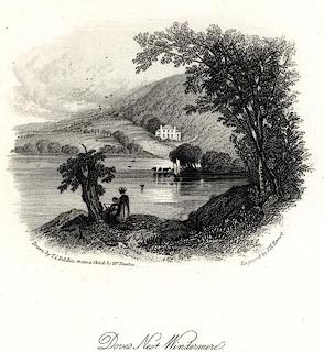 click to enlarge click to enlargePR0533.jpg Two ladies are sketching by the lake, in the foreground. printed at bottom left, right, centre:- "Drawn by T C Dibdin. from a Sketch by Mrs Hughes / Engraved by J H Kernot. / Dove's Nest Windermere. / William Blackwood & Sons, Edinburgh &London." item:- Dove Cottage : 2008.107.482 Image © see bottom of page |
|||||||||||||||||||||||||
|
|
||||||||||||||||||||||||||
| evidence:- | old print:- placename:- Windermere Lake item:- fishing boat; boat; fishing net |
|||||||||||||||||||||||||
| source data:- | Print, uncoloured engraving, Windermere Lake, Windermere, Westmorland, drawn by Harwood,
engraved by Tombleson, published by Fisher, Son and Co, London, 1830s?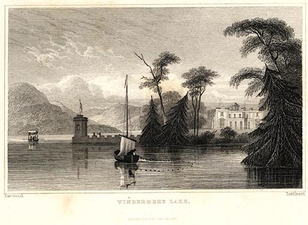 click to enlarge click to enlargePR0652.jpg A fisherman in a small sailing boat is using a seine net in the foreground; Storrs in the middle ground. printed at bottom left, right, centre:- "Harwood. / Tombleson. / WINDERMERE LAKE. / FISHER, SON &Co. LONDON." item:- Dove Cottage : 2008.107.596 Image © see bottom of page |
|||||||||||||||||||||||||
|
|
||||||||||||||||||||||||||
| evidence:- | old print:- Middiman 1784-92 (pl.21) placename:- Winandermere Lake item:- cattle |
|||||||||||||||||||||||||
| source data:- | Print, hand coloured engraving, Winandermere Lake, Windermere, Westmorland, drawn
by F Wheatly, engraved and published by Samuel Middiman, London, 1787.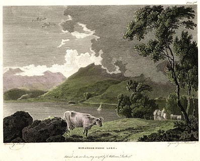 click to enlarge click to enlargePR0508.jpg Plate 21 from Select Views in Great Britain, engraved and published by Samuel Middiman, 3 Grafton Street, Tottenham Court Road, London, 1784-92. printed at bottom left, right, centre:- "Drawn by F. Wheatly. / Engraved by S. Middiman. / WINANDERMERE LAKE. / Published as the Act directs, May 25, 1786, by S. Middiman, London." item:- Dove Cottage : 2008.107.457 Image © see bottom of page |
|||||||||||||||||||||||||
|
|
||||||||||||||||||||||||||
| evidence:- | old print:- placename:- Winander Mere item:- packhorse |
|||||||||||||||||||||||||
| source data:- | Print, uncoloured engraving, A View of Winander Mere, Westmorland, about 1772?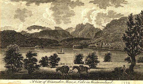 click to enlarge click to enlargePR0581.jpg A cut down plate is used in Walpoole's Guide to the Lakes. printed at caption:- "A View of Winandermere, a Lake in Westmoreland." item:- Dove Cottage : 2008.107.529 Image © see bottom of page |
|||||||||||||||||||||||||
|
|
||||||||||||||||||||||||||
| evidence:- | old print:- Pearson 1900s placename:- Windermere |
|||||||||||||||||||||||||
| source data:- | Print, halftone photograph, Scene on Windermere, Westmorland, published by C Arthur
Pearson, Henrietta Street, London, 1900s.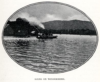 click to enlarge click to enlargePS1E30.jpg On p.77 of Pearson's Gossipy Guide to the English Lakes and Neighbouring Districts. printed at bottom:- "SCENE ON WINDERMERE." item:- Armitt Library : A1188.37 Image © see bottom of page |
|||||||||||||||||||||||||
|
|
||||||||||||||||||||||||||
| evidence:- | old print:- Pearson 1900s placename:- Windermere |
|||||||||||||||||||||||||
| source data:- | Print, halftone photograph, On Windermere, Westmorland, published by C Arthur Pearson,
Henrietta Street, London, 1900s.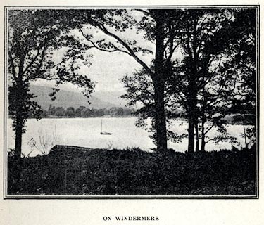 click to enlarge click to enlargePS1E28.jpg On p.69 of Pearson's Gossipy Guide to the English Lakes and Neighbouring Districts. printed at bottom:- "ON WINDERMERE" item:- Armitt Library : A1188.35 Image © see bottom of page |
|||||||||||||||||||||||||
|
|
||||||||||||||||||||||||||
| evidence:- | old print:- Rowbotham 1875 |
|||||||||||||||||||||||||
| source data:- | Print, chromograph, Windermere lake, Westmorland, by T L Rowbotham, published by Marcus
Ward and Co, 67-68 Chandos Street, Covent Garden, London, and Belfast, 1875.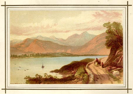 click to enlarge click to enlargeLF1E08.jpg Tipped in opposite p.79 of English Lake Scenery, by W J Loftie. printed at lower right:- "T L Rowbotham" printed at lower left:- "MARCUS WARD &CO. CHROMO" item:- Armitt Library : A963.8 Image © see bottom of page |
|||||||||||||||||||||||||
|
|
||||||||||||||||||||||||||
| evidence:- | old print:- Loftie 1875 |
|||||||||||||||||||||||||
| source data:- | Print, engraving, Head of Windermere, Westmorland, drawn by EMW, published by Marcus
Ward and Co, 67-68 Chandos Street, Covent Garden, London, and Belfast, 1875.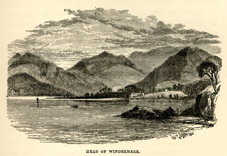 click to enlarge click to enlargeLF1E09.jpg On p.83 of English Lake Scenery, by W J Loftie. printed at lower right, centre:- "EMW del / HEAD OF WINDERMERE." item:- Armitt Library : A963.9 Image © see bottom of page |
|||||||||||||||||||||||||
|
|
||||||||||||||||||||||||||
| evidence:- | old print:- Matthew 1866 placename:- Windermere |
|||||||||||||||||||||||||
| source data:- | Print, engraving, Windermere from Biskay Howe, Westmorland, drawn by R Howe, engraved
by J Saddler, published by J Richardson, Highgate, Kendal, Westmorland, 1866.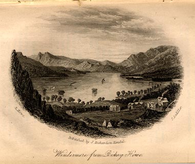 click to enlarge click to enlargeMW1E06.jpg Tipped in opposite p.6 of The English Lakes, Peaks and Passes, from Kendal to Keswick, by George King Matthew. printed at lower left, right, centre:- "R. Howe. / J. Saddler. / Published by J. Richardson, Kendal. / Windermere from Biskay Howe." item:- Armitt Library : A1168.6 Image © see bottom of page |
|||||||||||||||||||||||||
|
|
||||||||||||||||||||||||||
| evidence:- | old print:- Payn 1860s-70s placename:- Winander Mere |
|||||||||||||||||||||||||
| source data:- | Print, colour printed, Winander Mere, Westmorland, published by John Garnett, Windermere,
Westmorland, and by Simpkin, Marshall and Co, London, 1860s-70s?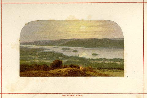 click to enlarge click to enlargePN0102.jpg Tipped in opposite p.6 of England's Lakeland, a Tour Therein, by James Payn. printed at bottom:- "WINANDER MERE." item:- Armitt Library : A1183.2 Image © see bottom of page |
|||||||||||||||||||||||||
|
|
||||||||||||||||||||||||||
| evidence:- | old print:- Payn 1860s-70s placename:- Winandermere item:- steamer; boat |
|||||||||||||||||||||||||
| source data:- | Print, uncoloured woodcut, Head of Winandermere, Westmorland, published by John Garnett,
Windermere, Westmorland, and by Simpkin, Marshall and Co, London, 1860s-70s?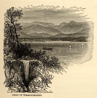 click to enlarge click to enlargePN0101.jpg On page 5 of England's Lakeland, a Tour Therein, by James Payn. printed at bottom:- "HEAD OF WINANDERMERE" item:- Armitt Library : A1183.1 Image © see bottom of page |
|||||||||||||||||||||||||
|
|
||||||||||||||||||||||||||
| evidence:- | old print:- Nelson 1859 placename:- Windermere |
|||||||||||||||||||||||||
| source data:- | Print, engraving, Head of Windermere, drawn by Keeley Halswelle, Edinburgh, published
by T Nelson and Sons, Paternoster Row, London, and Edinburgh and New York, United
States, 1859.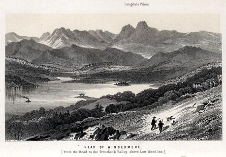 click to enlarge click to enlargeNS0113.jpg Tipped in oppposite p.296 of a guide book, The English Lakes. printed at bottom:- "HEAD OF WINDERMERE. / (From the Road to the Troutbeck Valley above Low Wood Inn.)" item:- JandMN : 336.12 Image © see bottom of page |
|||||||||||||||||||||||||
|
|
||||||||||||||||||||||||||
| evidence:- | old print:- Gibson 1851 placename:- Windermere |
|||||||||||||||||||||||||
| source data:- | Print, uncoloured woodcut, Head of Windermere, from Low Wood, Westmorland, engraved
by G P Nicholls, published by J Jackson, Market Place, Ulverston, Lancashire, and
by Whittaker and Co, London, 1851.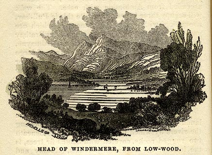 click to enlarge click to enlargeGB05E2.jpg On p.28 of a Hand Book to The Lakes, by James Gibson. printed at lower left:- "NICHOLLS SC." printed at bottom:- "HEAD OF WINDERMERE, FROM LOW-WOOD." item:- Armitt Library : A1131.3 Image © see bottom of page |
|||||||||||||||||||||||||
|
|
||||||||||||||||||||||||||
| evidence:- | old print:- Gibson 1851 placename:- Windermere |
|||||||||||||||||||||||||
| source data:- | Print, engraving, Windermere, Westmorland, engraved by G P Nicholls, published by
J Jackson, Market Place, Ulverston, Lancashire, and by Whittaker and Co, London, 1851.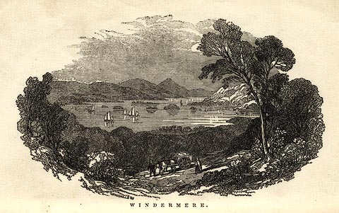 click to enlarge click to enlargeGB05E1.jpg Frontispiece to a Hand Book to The Lakes, by James Gibson. printed at lower left:- "G. P. NICHOLLS SC." printed at bottom:- "WINDERMERE." item:- Armitt Library : A1131.1 Image © see bottom of page |
|||||||||||||||||||||||||
|
|
||||||||||||||||||||||||||
| evidence:- | outline view:- Tattersall 1836 (version 1869) placename:- Windermere item:- boat; sailing boat |
|||||||||||||||||||||||||
| source data:- | Print, hand coloured, Lower Reach, Windermere, Westmorland, drawn by George Tattersall,
1836, engraved by W F Topham, published by T J Allman, 463 Oxford Street, London,
1869.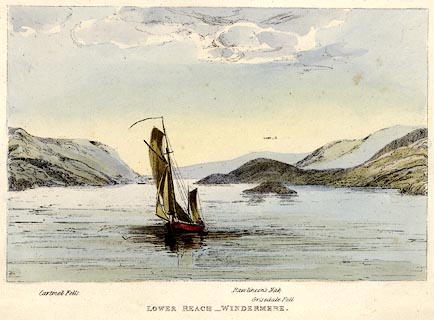 click to enlarge click to enlargeTAT201.jpg Frontispiece to The Lakes of England, by W F Topham. printed at bottom:- "LOWER REACH - WINDERMERE." printed at bottom:- "Cartmel Fells. / Rawlinson's Nab. / Grisedale Fell." item:- Armitt Library : A1067.1 Image © see bottom of page |
|||||||||||||||||||||||||
|
|
||||||||||||||||||||||||||
| evidence:- | outline view:- Tattersall 1836 placename:- Windermere |
|||||||||||||||||||||||||
| source data:- | Print, engraving, Windermere from Rayrigg Bank, Westmorland, drawn by George Tattersall,
engraved by W F Topham, published by Sherwood and Co, Paternoster Row, London, about
1836.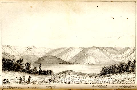 click to enlarge click to enlargeTAT104.jpg The print is captioned with mountain names and acts as an outline view. Tipped in opposite p.31 of The Lakes of England, by George Tattersall. printed at bottom:- "WINDERMERE from RAYRIGG BANK." printed at bottom left to right:- "Furness Fells. / Coniston Old Man. / Wetherlam Foot. / Wrynose. / Langdale Pikes. / Hardknot. / Loughrigg Fell. / Fairfield. / Troutbeck Hundred. / Kirkstone. / Wansfell. / Applethwaite Common. / High Street. / Hill Bell." item:- Armitt Library : A1204.5 Image © see bottom of page |
|||||||||||||||||||||||||
|
|
||||||||||||||||||||||||||
| evidence:- | outline view:- Tattersall 1836 placename:- Windermere item:- boat; sailing boat |
|||||||||||||||||||||||||
| source data:- | Print, engraving, Lower Reach, Windermere, Westmorland, drawn by George Tattersall,
engraved by W F Topham, published by Sherwood and Co, Paternoster Row, London, about
1836.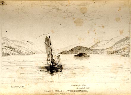 click to enlarge click to enlargeTAT103.jpg The print is captioned with mountain names and acts as an outline view. Tipped in opposite p.30 of The Lakes of England, by George Tattersall. printed at bottom:- "LOWER REACH, WINDERMERE. / Pubd April 15th. 1836, by Sherwood &Co. / [London]" printed at bottom left to right:- "Cartmel Fells. / Rawlinson's Nab. / Grisedale Fell." item:- Armitt Library : A1204.4 Image © see bottom of page |
|||||||||||||||||||||||||
|
|
||||||||||||||||||||||||||
| evidence:- | outline view:- Tattersall 1836 placename:- Windermere item:- boat; rowing boat |
|||||||||||||||||||||||||
| source data:- | Print, engraving, Upper Reach, Windermere, Westmorland, drawn by George Tattersall,
engraved by W F Topham, published by Sherwood and Co, Paternoster Row, London, about
1836.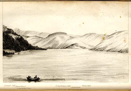 click to enlarge click to enlargeTAT102.jpg The print is captioned with mountain names and acts as an outline view. Tipped in opposite p.25 of The Lakes of England, by George Tattersall. printed at bottom:- "UPPER REACH, WINDERMERE." printed at bottom left to right:- "Furness Fell. / Hard Knot. / Langdale Pikes. / Loughrigg Fell. / Fairfield. / Wansfell." item:- Armitt Library : A1204.3 Image © see bottom of page |
|||||||||||||||||||||||||
|
|
||||||||||||||||||||||||||
| evidence:- | old print:- Green 1819 placename:- Windermere |
|||||||||||||||||||||||||
| source data:- | Print, aquatint, Islands on Windermere, Westmorland, by William Green, 1819, published
by R Lough and Co, Chronicle Office, Finkle Street, Kendal, and others, 1820.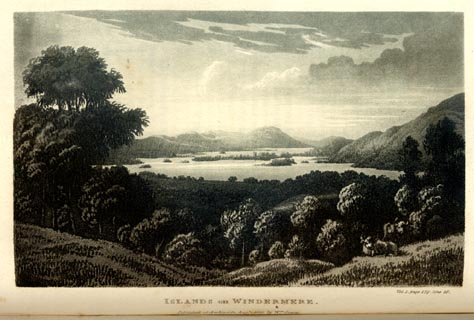 click to enlarge click to enlargeGN0104.jpg Tipped in opposite vol.1 p.179 of The Tourist's New Guide, by William Green. printed at bottom right, centre:- "Vol.I, page 179, line 26. / ISLANDS on WINDERMERE. / Published at Ambleside, Augt. 1. 1819., by Wm. Green." item:- Armitt Library : A1141.5 Image © see bottom of page |
|||||||||||||||||||||||||
|
|
||||||||||||||||||||||||||
| evidence:- | old print:- Green 1819 placename:- Windermere |
|||||||||||||||||||||||||
| source data:- | Print, aquatint, Windermere from Low Wood, Westmorland, by William Green, 1819, published
by R Lough and Co, Chronicle Office, Finkle Street, Kendal, and others, 1820.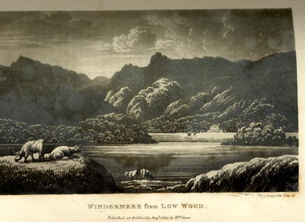 click to enlarge click to enlargeGN0103.jpg Tipped in opposite vol.1 p.174 of The Tourist's New Guide, by William Green. printed at bottom right, centre:- "Vol.I, page 174, line 5. / WINDERMERE from LOW WOOD. / Published at Ambleside, Augt. 1. 1819., by Wm. Green." item:- Armitt Library : A1141.4 Image © see bottom of page |
|||||||||||||||||||||||||
|
|
||||||||||||||||||||||||||
| evidence:- | old print:- placename:- Windermere |
|||||||||||||||||||||||||
| source data:- | Print, uncoloured engraving, Windermere, from above Ambleside, Westmorland, drawn
by W H J Bool, engraved by Whymper, published 1920s-30s?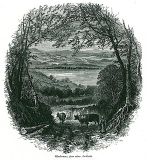 click to enlarge click to enlargePR0349.jpg On page 216 of Picturesque Europe, The Lake Country. printed at lower left, right:- "WHJBool / Whymper Sc" printed at bottom:- "Windermere, from above Ambleside." item:- Dove Cottage : 2008.107.349 Image © see bottom of page |
|||||||||||||||||||||||||
|
|
||||||||||||||||||||||||||
| evidence:- | old print:- placename:- Windermere |
|||||||||||||||||||||||||
| source data:- | Print, uncoloured engraving, Windermere, from Newby Bridge, Westmorland, drawn by
W H J Bool, published 1920s-30s?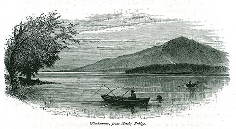 click to enlarge click to enlargePR0357.jpg On page 217 of Picturesque Europe, The Lake Country. There are fishermen in rowing boats with multiple lines. printed at lower left:- "[WHJBool]" printed at bottom:- "Windermere, from Newby Bridge." item:- Dove Cottage : 2008.107.357 Image © see bottom of page |
|||||||||||||||||||||||||
|
|
||||||||||||||||||||||||||
| evidence:- | old print:- Robertson 1911 |
|||||||||||||||||||||||||
| source data:- | Print, lithograph? Islands of Windermere, from a watercolour by Arthur Tucker, published
by Chatto and Windus, London, 1911.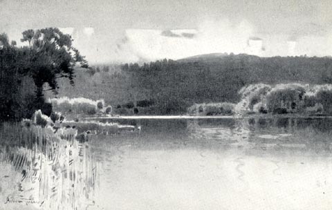 click to enlarge click to enlargeRSN131.jpg Tipped in opposite p.162 of Wordsworthshire by Eric Robertson. printed at bottom:- "ISLANDS OF WINDERMERE" signed at painting lower left:- "Arthur Tucker" item:- JandMN : 197.32 Image © see bottom of page |
|||||||||||||||||||||||||
|
|
||||||||||||||||||||||||||
| evidence:- | illustration:- LNWR 1910 |
|||||||||||||||||||||||||
| source data:- | Print, colour lithograph? Yachts Racing on Windermere, from a painting by R T Roussel,
published by the London and North Western Railway, LNWR, about 1910.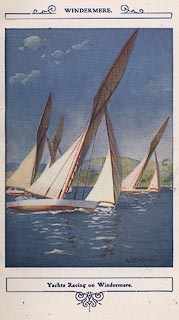 click to enlarge click to enlargeNW01E1.jpg Included in the guide book, The English Lakes, published by the London and North Western Railway about 1910. yacht, 1910, Roussel, R Titem:- JandMN : 49.2 Image © see bottom of page |
|||||||||||||||||||||||||
|
|
||||||||||||||||||||||||||
| evidence:- | old print:- placename:- Windermere |
|||||||||||||||||||||||||
| source data:- | Print, chromolithograph, Waterhead, Windermere, Westmorland, published by T Nelson
and Sons, London, 1900s?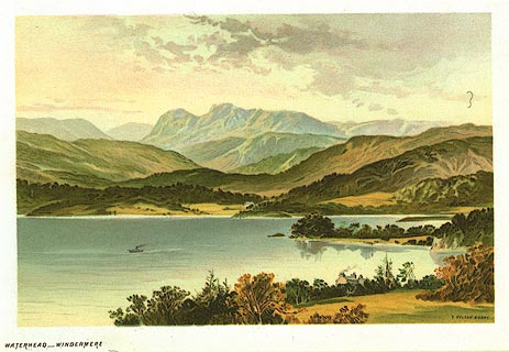 click to enlarge click to enlargePR0160.jpg From a set of prints, The Scenery of the English Lakes printed at lower right:- "T. NELSON &SONS" printed at bottom left:- "WATERHEAD - WINDERMERE" item:- Dove Cottage : 2008.107.160 Image © see bottom of page |
|||||||||||||||||||||||||
|
|
||||||||||||||||||||||||||
| evidence:- | outline view:- Red Guide 1892 |
|||||||||||||||||||||||||
| source data:- | Print, engraving, outline view, Mountains West and North of Windermere Lake, published
by Ward, Lock and Co, Warwick House, Salisbury Square, London, etc, 1892.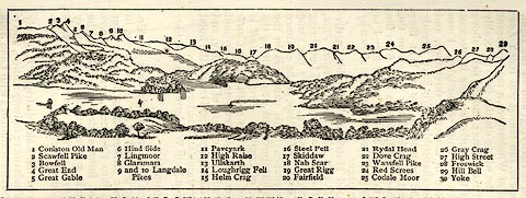 click to enlarge click to enlargeRG0102.jpg "1 Coniston Old Man 2 Scawfell Pike 3 Bowfell 4 Great End 5 Great Gable 6 Hind Side 7 Lingmoor 8 Glaramara 9 and 10 Langdale Pikes 11 Paveyark 12 High Raise 13 Ullskarth 14 Loughrigg Fell 15 Helm Crag 16 Steel Fell 17 Skiddaw 18 Nab Scar 19 Great Rigg 20 Fairfield 21 Rydal Head 22 Dove Crag 23 Wansfell Pike 24 Red Screes 25 Codale Moor 26 Gray Crag 27 High Street 28 Froswick 29 Hill Bell 30 Yoke" On p.74 in the Red Guide guide book, Guide to the English Lakes. item:- JandMN : 102.3 Image © see bottom of page |
|||||||||||||||||||||||||
|
|
||||||||||||||||||||||||||
| evidence:- | old print:- Philip/Wilson 1890s |
|||||||||||||||||||||||||
| source data:- | Print, engraving, view from the Windermere Hydropathic
establishment, published by George Philip and Son, London,
Philip, Son and Nephew, Liverpool, Lancashire, and Titus Wilson,
Kendal, Westmorland, about 1895.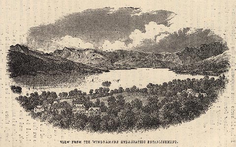 click to enlarge click to enlargePW1E12.jpg "VIEW FROM THE WINDERMERE HYDROPATHIC ESTABLISHMENT." item:- JandMN : 58.13 Image © see bottom of page |
|||||||||||||||||||||||||
|
|
||||||||||||||||||||||||||
| evidence:- | old print:- |
|||||||||||||||||||||||||
| source data:- | Print, colour lithograph? Windermere, Looking up the Lake, Westmorland, perhaps published
by John Walker and Co, Farringdon Street, London, late 19th century.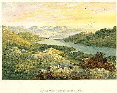 click to enlarge click to enlargePR0134.jpg item:- Dove Cottage : 2008.107.134 Image © see bottom of page |
|||||||||||||||||||||||||
|
|
||||||||||||||||||||||||||
| evidence:- | old print:- placename:- Windermere |
|||||||||||||||||||||||||
| source data:- | Print, colour lithograph? Windermere, Head of the Lake, Westmorland, perhaps published
by John Walker and Co, Farringdon Street, London, late 19th century.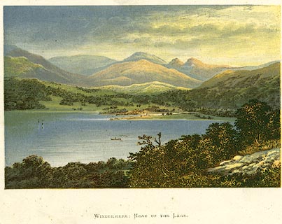 click to enlarge click to enlargePR0136.jpg item:- Dove Cottage : 2008.107.136 Image © see bottom of page |
|||||||||||||||||||||||||
|
|
||||||||||||||||||||||||||
| evidence:- | old print:- |
|||||||||||||||||||||||||
| source data:- | Print, colour lithograph? Windermere and Easthwaite, Westmorland and Lancashire, perhaps
published by John Walker and Co, Farringdon Street, London, late 19th century.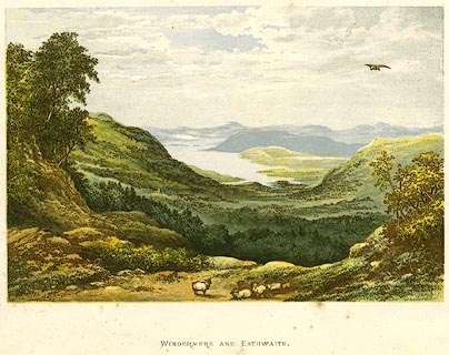 click to enlarge click to enlargePR0137.jpg item:- Dove Cottage : 2008.107.137 Image © see bottom of page |
|||||||||||||||||||||||||
|
|
||||||||||||||||||||||||||
| evidence:- | outline view:- Jenkinson 1875 placename:- Windermere |
|||||||||||||||||||||||||
| source data:- | Print, lithograph, outline view, Panoramic Sketches from Helvellyn, Westmorland, by
Edwin A Pettitt, London, published by Edward Stanford, 55 Charing Cross, London, 1875. click to enlarge click to enlargeJk01E1.jpg "... Windermere ..." item:- JandMN : 28.5 Image © see bottom of page |
|||||||||||||||||||||||||
|
|
||||||||||||||||||||||||||
| evidence:- | outline view:- Jenkinson 1875 placename:- Windermere |
|||||||||||||||||||||||||
| source data:- | Print, lithograph, outline view, Panoramic Sketches from Scawfell Pike, Cumberland,
by Edwin A Pettitt, London, published by Edward Stanford, 55 Charing Cross, London,
1875. click to enlarge click to enlargeJk01E3.jpg "... Windermere ..." item:- JandMN : 28.9 Image © see bottom of page |
|||||||||||||||||||||||||
|
|
||||||||||||||||||||||||||
| evidence:- | old print:- Barber 1873 |
|||||||||||||||||||||||||
| source data:- | Print, ?colour lithograph, Windermere from near Newby Bridge,
published by The Graphotyping Co, 7 Garrick Street and Simpkin,
Marshall and Co, Stationers' Hall Court, London, and by J
Atkinson, King Street, Ulverston, Cumberland, about 1873.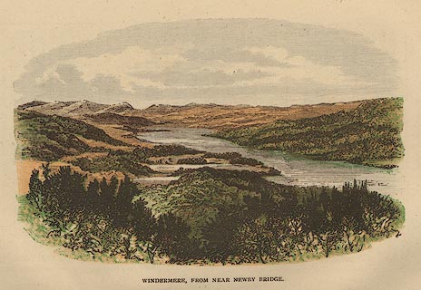 click to enlarge click to enlargeBB1E07.jpg "WINDERMERE, FROM NEAR NEWBY BRIDGE" item:- JandMN : 69.8 Image © see bottom of page |
|||||||||||||||||||||||||
|
|
||||||||||||||||||||||||||
| evidence:- | old print:- placename:- Windermere |
|||||||||||||||||||||||||
| source data:- | Print, uncoloured engraving, Windermere, from the Bowness Ferry, Westmorland, published
late 19th century?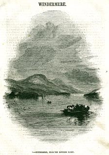 click to enlarge click to enlargePR0335.jpg On page 65 of The Land We Live In. The ferry carrying a cart and horses has just set out from the Bowness side. printed at bottom:- "1.- WINDERMERE, FROM THE BOWNESS FERRY." item:- Dove Cottage : 2008.107.335 Image © see bottom of page |
|||||||||||||||||||||||||
|
|
||||||||||||||||||||||||||
| evidence:- | old print:- placename:- Windermere |
|||||||||||||||||||||||||
| source data:- | Print, uncoloured engraving, Head of Windermere, Westmorland, drawn by T H Hair, published
late 19th century?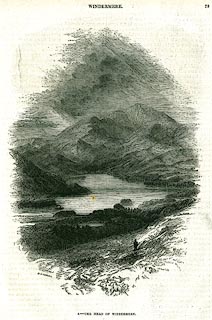 click to enlarge click to enlargePR0336.jpg On page 73 of The Land We Live In. printed at lower left:- "T. H. HAIR [D]EL." printed at bottom:- "3.- THE HEAD OF WINDERMERE," item:- Dove Cottage : 2008.107.336 Image © see bottom of page |
|||||||||||||||||||||||||
|
|
||||||||||||||||||||||||||
| evidence:- | old print:- Pyne 1853 |
|||||||||||||||||||||||||
| source data:- | Windermere Water Head drawn by James Barker Pyne, 1848-1853, lithographed by T Picken,
1859.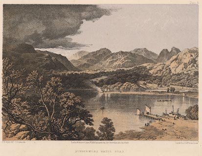 click to enlarge click to enlargePY06.jpg "Windermere Water Head" item:- JandMN : 97.7 Image © see bottom of page |
|||||||||||||||||||||||||
|
|
||||||||||||||||||||||||||
| evidence:- | old print:- Pyne 1853 |
|||||||||||||||||||||||||
| source data:- | Drawn by James Barker Pyne, 1848-1853, lithographed by T Picken, 1859.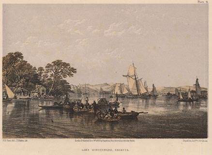 click to enlarge click to enlargePY04.jpg "Lake Windermere, Regatta" item:- JandMN : 97.6 Image © see bottom of page |
|||||||||||||||||||||||||
|
|
||||||||||||||||||||||||||
| evidence:- | old print:- Pyne 1853 placename:- Lake Windermere |
|||||||||||||||||||||||||
| source data:- | Drawn by James Barker Pyne, 1848-1853, lithographed by T Picken, 1859.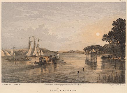 click to enlarge click to enlargePY03.jpg "Lake Windermere" item:- JandMN : 97.5 Image © see bottom of page |
|||||||||||||||||||||||||
|
|
||||||||||||||||||||||||||
| evidence:- | old print:- Garnett 1850s-60s F |
|||||||||||||||||||||||||
| source data:- | Print, uncoloured engraving, The Ferry, Windermere, Westmorland, drawn and engraved
by William Banks and Son, Edinburgh, published by John Garnett, Windermere, Westmorland,
1850s-60s?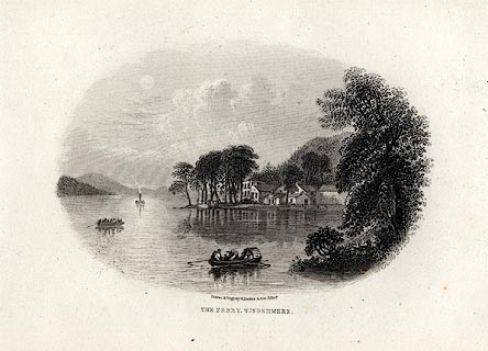 click to enlarge click to enlargeGAR712.jpg Found with Views of the English Lakes. printed at bottom:- "Drawn & Engd. by W. Banks &Son, Edinr. / THE FERRY, WINDERMERE." item:- JandMN : 165.12 Image © see bottom of page |
|||||||||||||||||||||||||
|
|
||||||||||||||||||||||||||
| evidence:- | old print:- Garnett 1850s-60s A |
|||||||||||||||||||||||||
| source data:- | Print, coloured print, Windermere Lake, from Elleray, published
by John Garnett, Windermere, Westmorland, and by Simpkin,
Marshall and Co, London, 2nd edn 1860s?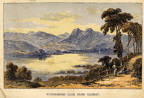 click to enlarge click to enlargeGAR6E1.jpg Frontispiece to A Guide to the English Lake District, by a Cambridge Man. item:- JandMN : 149.2 Image © see bottom of page |
|||||||||||||||||||||||||
|
|
||||||||||||||||||||||||||
| evidence:- | outline view:- Garnett 1850-60s E |
|||||||||||||||||||||||||
| source data:- | Print, outline view, engraving with litho colour, Mountains on the West Side of Windermere,
drawn by L Aspland, engraved by W Banks, Edinburgh, published by J Garnett, Windermere,
Westmorland, 1850s-60s?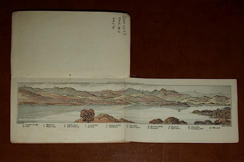 click to enlarge click to enlargeGAR3E1.jpg Frontispiece in The Lake District of England. item:- Dove Cottage : 2005.18.1.1 Image © see bottom of page |
|||||||||||||||||||||||||
|
|
||||||||||||||||||||||||||
| evidence:- | old print:- Harwood 1842 placename:- Windermere Lake |
|||||||||||||||||||||||||
| source data:- | Print, uncoloured engraving, Windermere Lake, Westmoreland, engraved and published
by John and Frederick Harwood, 26 Fenchurch Street, London, 1842.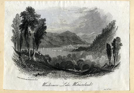 click to enlarge click to enlargeHRW221.jpg printed at bottom left, centre, right:- "London, J &F. Harwood, 26, Fenchurch Street. / Windermere Lake, Westmoreland. / June 19th. 1842." item:- JandMN : 166.21 Image © see bottom of page |
|||||||||||||||||||||||||
|
|
||||||||||||||||||||||||||
| evidence:- | old print:- |
|||||||||||||||||||||||||
| source data:- | Print, uncoloured engraving, Elleray Park, published 1831.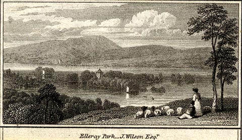 click to enlarge click to enlargePR0441.jpg Home of J Wilson. printed at bottom:- "Elleray Park - Seat of J. Wilson Esqr." item:- private collection : 105 Image © see bottom of page |
|||||||||||||||||||||||||
|
|
||||||||||||||||||||||||||
| evidence:- | old print:- placename:- Windermere |
|||||||||||||||||||||||||
| source data:- | Print, uncoloured engraving, Windermere from near Ambleside, Westmorland, drawn by
R Caunter, engraved by J Gellatly, published by J Menzies, 61 Princes Street, Edinburgh,
1820s-30s?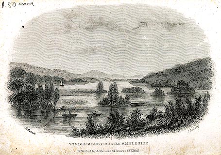 click to enlarge click to enlargePR0268.jpg A number of islands are shown. printed at bottom left, right, centre:- "R. Caunter. / J. Gellatly. / WINDERMERE FROM NEAR AMBLESIDE / Published by J. Menzies, 61, Princes St. Edinr." item:- Dove Cottage : 2008.107.268 Image © see bottom of page |
|||||||||||||||||||||||||
|
|
||||||||||||||||||||||||||
| evidence:- | old print:- Westall 1819-21 (plate 13) placename:- Windermere, Lake |
|||||||||||||||||||||||||
| source data:- | Print, uncoloured aquatint, Lake Windermere from above Storrs, drawn and engraved
by William Westall, published by Rodwell and Martin, New Bond Street, London, 1821.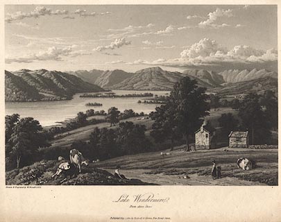 click to enlarge click to enlargeBNV40.jpg Plate 13, in part 4, of A Series of Views of the Lakes of Cumberland and Westmorland. printed at bottom:- "... Lake Windermere. From above Storrs. ..." item:- private collection : 79 Image © see bottom of page |
|||||||||||||||||||||||||
|
|
||||||||||||||||||||||||||
| evidence:- | old map:- Langley 1818 placename:- Lake of Windermere placename:- Windermere Lake placename:- Winander Mere |
|||||||||||||||||||||||||
| source data:- | Map, hand coloured engraving, Langley's New Map of Westmoreland,
scale about 6 miles to 1 inch, by Edward Langley, published by
Langley and Belch, 173 High Street, Borough, London, 1818.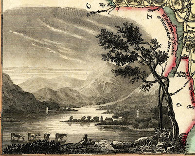 click to enlarge click to enlargeLNG2Vgn2.jpg "A View looking up the Lake of Windermere." item:- Dove Cottage : 2007.38.119 Image © see bottom of page |
|||||||||||||||||||||||||
|
|
||||||||||||||||||||||||||
| evidence:- | old print:- Green 1815 (plate 8) placename:- Windermere |
|||||||||||||||||||||||||
| source data:- | Print, colour aquatint, Windermere taken near Low Wood, Westmorland, by William Green,
Ambleside, Westmorland, 1815.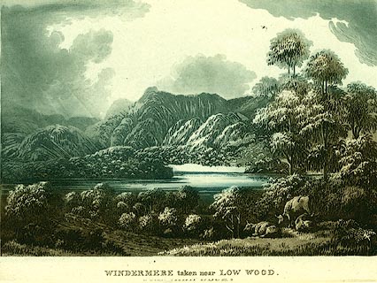 click to enlarge click to enlargePR0115.jpg Plate 8 in a set of prints, Lake Scenery. printed at bottom:- "WINDERMERE taken near LOW WOOD. / Published at Ambleside, June 1, 1815, by Wm. Green." item:- Dove Cottage : 2008.107.115 Image © see bottom of page |
|||||||||||||||||||||||||
|
|
||||||||||||||||||||||||||
| evidence:- | old print:- Green 1815 (plate 12) placename:- Windermere |
|||||||||||||||||||||||||
| source data:- | Print, colour aquatint, Windermere from Low Wray, Lancashire, by William Green, Ambleside,
Westmorland, 1815.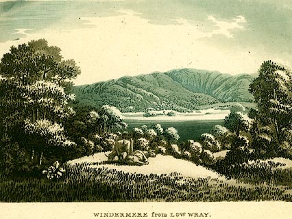 click to enlarge click to enlargePR0117.jpg Plate 12 in a set of prints, Lake Scenery. printed at bottom:- "WINDERMERE from LOW WRAY." item:- Dove Cottage : 2008.107.117 Image © see bottom of page |
|||||||||||||||||||||||||
|
|
||||||||||||||||||||||||||
| evidence:- | old print:- placename:- Winandermere |
|||||||||||||||||||||||||
| source data:- | Print, uncoloured engraving, Winandermere, Westmorland, published 1815.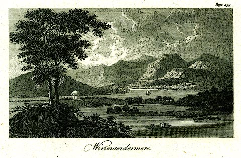 click to enlarge click to enlargePR0289.jpg printed at bottom:- "Winandermere" item:- Dove Cottage : 2008.107.289 Image © see bottom of page |
|||||||||||||||||||||||||
|
|
||||||||||||||||||||||||||
| evidence:- | old print:- placename:- Winander Mere |
|||||||||||||||||||||||||
| source data:- | Print, uncoloured engraving, A View of Winander Mere, Westmorland, engraved by Lodge,
published by Alexander Hogg, The Kings Arms, 16 Paternoster Row, London, about 1794.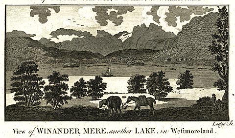 click to enlarge click to enlargePR0223.jpg It has been suggested that this is from Walpoole's Guide to the Lakes. printed at caption:- "View of WINANDER MERE, another LAKE, in Westmoreland." printed at bottom right:- "Lodge Sc." item:- Dove Cottage : 2008.107.223 Image © see bottom of page |
|||||||||||||||||||||||||
|
|
||||||||||||||||||||||||||
| evidence:- | old print:- Middiman 1784-92 placename:- Winander Mere Lake |
|||||||||||||||||||||||||
| source data:- | Print, uncoloured engraving, Winandermere Lake, Windermere, Westmorland, drawn by
F Wheatly, engraved and published by Samuel Middiman, London, 1787.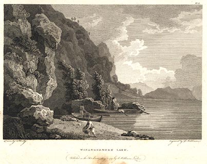 click to enlarge click to enlargeBNF33.jpg "...WINANDER MERE LAKE. ..." item:- Dove Cottage : 2007.38.126 Image © see bottom of page |
|||||||||||||||||||||||||
|
|
||||||||||||||||||||||||||
| evidence:- | old print with text:- Lowther 1780s-90s |
|||||||||||||||||||||||||
| source data:- | Print, engraving, View on Winander Meer ie Windermere, Lakes, Cumbria, painted by
P J de Loutherbourg, engraved by W Birch, published London, early 19th century; with
descriptive text:-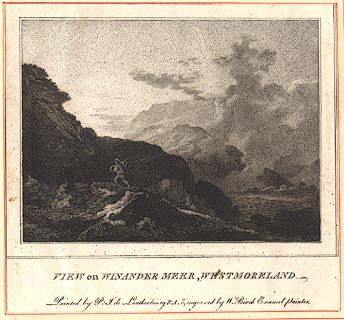 click to enlarge click to enlargeBMZ07.jpg "View on Winander Meer, Westmorland." "MR. De Loutherbourg has curiously introduced into this corner of a lake all the characteristic beauties lakes are capable of: smoaking streams of mist mounting into the bright expanse of calm sun-rise, the wild horror of rocks, with goats, their natural inhabitants; and simple, but manly peasantry. How beautiful the art of that pencil who so easily can express so much!" "The picture is two feet six inches wide, by one foot ten, and in the possession of Mr. Cosway." item:- Dove Cottage : Lowther.8 Image © see bottom of page |
|||||||||||||||||||||||||
|
|
||||||||||||||||||||||||||
| evidence:- | old print:- Gresham Publishing 1900s placename:- Windermere |
|||||||||||||||||||||||||
| source data:- | Print, colour halftone, Windermere from Orrest Head, Westmorland, by Ernest W Haslehurst,
published by The Gresham Publishing Co, 66 Chandos Street, London, 1900s?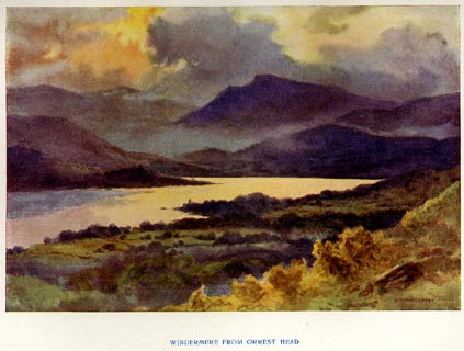 click to enlarge click to enlargePR1559.jpg Tipped in opposite p.6 of The English Lakes section of a volume of Our Beautiful Homeland. printed at bottom:- "WINDERMERE FROM ORREST HEAD." printed at lower right:- "[E. W.] HASLEHURST" item:- JandMN : 381.1 Image © see bottom of page |
|||||||||||||||||||||||||
|
|
||||||||||||||||||||||||||
| evidence:- | old painting:- item:- cattle |
|||||||||||||||||||||||||
| source data:- | Painting, watercolour over a lithograph print, Windermere, A Storm, by Ford Madox
Brown, about 1855.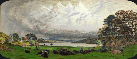 click to enlarge click to enlargePR0959.jpg Windermere from the head of the lake with Bowness on the far distant shore. In the foreground a scattered herd of cattle lie in a sloping field enclosed by drystone walls on left. Two figures pass across it from right to left. Beyond lies the lake fringed on the nearside with trees; beyond it rise distant hills. A heavy bank of cloud hovers over the horizon. Brown seldom left his studio to paint outdoors and only painted two pictures on the spot in his career. However, Brown was encouraged to visit the Lake District in 1848 by fellow artist Rossetti, to study the outdoor effects of light. Brown spent six days in the Lake District and was only affected by rain on his last day when he had to sketch under an umbrella. Brown completed a larger version of this view in oils which is now in the Lady Lever Art Gallery; the print was made from that painting. Brown decided to paint over the surface of the print entirely in opaque watercolour to hide its surface. He also decided to add a very fanciful sky and group of trees on the right hand side which are absent in the original painting. Brown captures a moment in time in this picture. Two people are walking across the bright green grassy field filled with cattle, while above, storm clouds are brewing. On 31st January 1858 the artist recorded in his diary 'coloured at one of my lithographs of Windermere to give John Marshall [an eminent surgeon]'. item:- Tullie House Museum : 1949.125.26 Image © Tullie House Museum |
|||||||||||||||||||||||||
|
|
||||||||||||||||||||||||||
| evidence:- | old drawing:- |
|||||||||||||||||||||||||
| source data:- | Drawing, Windermere and Langdale Pikes, Rayrigg, Windermere, Westmorland, by John
Harper, 1840.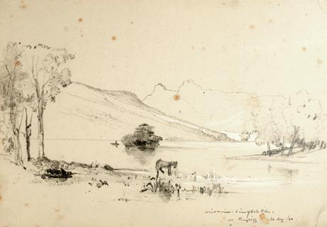 click to enlarge click to enlargePR1386.jpg View of Winderemere from the shore with Langdale Pikes in the background. Sheep in foreground at waters edge. Executed in pencil with touches of white gouache on buff coloured paper. Preparatory sketch drawn on the spot by the artist. at bottom right:- "Windermere &Langdale Pikes, Rayrigg. 26 Aug./40" item:- Tullie House Museum : 2009.89.29 Image © Tullie House Museum |
|||||||||||||||||||||||||
|
|
||||||||||||||||||||||||||
| evidence:- | old drawing:- placename:- Windermere |
|||||||||||||||||||||||||
| source data:- | Drawing, Windermere from Bella Grange, Westmorland, by William Havell, Windermere,
Cumbria.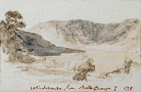 click to enlarge click to enlargePR1402.jpg View of Windermere from Belle Grange, Claife, surrounded by hills. One of a set of twenty views of the lake district executed by the artist on one sheet of paper. at bottom:- "Windermere from Bella Grange I 173" item:- Tullie House Museum : 2009.89.46 Image © Tullie House Museum |
|||||||||||||||||||||||||
|
|
||||||||||||||||||||||||||
| evidence:- | old drawing:- placename:- Windermere |
|||||||||||||||||||||||||
| source data:- | Drawing, Windermere from Low Wood, Westmorland, by William Havell, 1800s-10s.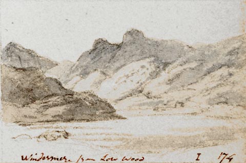 click to enlarge click to enlargePR1403.jpg View of Windermere from Low Wood from lake side with large hills in background. One of a set of twenty views of the lake district executed by the artist on one sheet of paper. at bottom:- "Windermere from Low Wood I 174" item:- Tullie House Museum : 2009.89.47 Image © Tullie House Museum |
|||||||||||||||||||||||||
|
|
||||||||||||||||||||||||||
| evidence:- | old print:- |
|||||||||||||||||||||||||
| source data:- | Print, engraving, A View of Winander Meer near Ambleside, A Lake between Lancashire
and Westmoreland, by William Bellers, Fleet Street, London, 1774.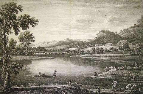 click to enlarge click to enlargePR1347.jpg View of Lake Windermere; on the shore are gathered groups of fishermen in boats and with nets. Also a family group relaxing by the shore and a farm in the background. engraving at base:- "To Sr William Fleming baronet of Ryedale this plate is inscribed by his most obliged humble servant, Willm. Bellers" item:- Tullie House Museum : 1997.704.16 Image © Tullie House Museum |
|||||||||||||||||||||||||
|
|
||||||||||||||||||||||||||
| evidence:- | old print:- Goodwin 1887 (edn 1890) placename:- Windermere |
|||||||||||||||||||||||||
| source data:- | Print, etching? Windermere, Westmorland, by Harry Goodwin, published by Swan Sonnenschein
and Co, Paternoster Square, London, 1890.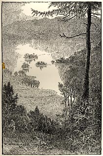 click to enlarge click to enlargePR1581.jpg Tipped in opposite p.44 of Through the Wordsworth Country, by William Knight. printed at lower left:- "Windermere" item:- JandMN : 382.11 Image © see bottom of page |
|||||||||||||||||||||||||
|
|
||||||||||||||||||||||||||
| evidence:- | old drawing:- item:- boat |
|||||||||||||||||||||||||
| source data:- | Drawing, Fell Foot, Windermere, Seat of Townley Esq, Staveley-in-Cartmel, Lancashire,
by William Havell, 1817.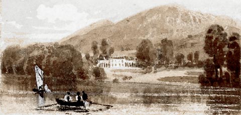 click to enlarge click to enlargePR1412.jpg Windermere lake in foreground with rowing boat and sailing boat. In the centre of the composition on the far distant shore stands a large residence surrounded by trees with hills behind. One of a set of eight 'Drawings for a Pocket Book' intended to be engraved executed on the spot by the artist. Eight drawings pasted to one piece of paper all executed in pencil, brown wash and white gouache. at bottom right:- "October 1817" item:- Tullie House Museum : 2009.89.60 Image © Tullie House Museum |
|||||||||||||||||||||||||
|
|
||||||||||||||||||||||||||
| evidence:- | old print:- Green 1809 placename:- Windermere |
|||||||||||||||||||||||||
| source data:- | Print, soft ground etching, Windermere lake, Westmorland, by William Green, published
by William Green, Ambleside, Westmorland, and Longman, Hurst, Rees and Orme, Paternoster
Row, London, 1809.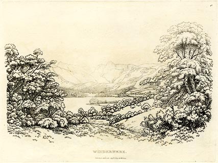 click to enlarge click to enlargeGN0348.jpg Plate 48 in Seventy Eight Studies from Nature. printed in introductory pages to set of prints:- "Number 48. This view of Windermere is from a field above the Inn at Low Wood. The promontory is called Holm Point. Brathay House, the property of Henry Law, Esq. and the present residence of John Harden, Esq. a gentleman of fine taste, is seen surrounded by wood: Langdale Pikes, and the mountains of Eskdale and Borrowdale, close the view." printed at bottom:- "WINDERMERE. / Published Ambleside, Augst. 1st. 1809, by W. Green." item:- Armitt Library : A6637.48 Image © see bottom of page |
|||||||||||||||||||||||||
|
|
||||||||||||||||||||||||||
| evidence:- | old print:- Green 1809 placename:- Windermere |
|||||||||||||||||||||||||
| source data:- | Print, soft ground etching, Islands of Windermere, Westmorland, by William Green,
published by William Green, Ambleside, Westmorland, and Longman, Hurst, Rees and Orme,
Paternoster Row, London, 1809.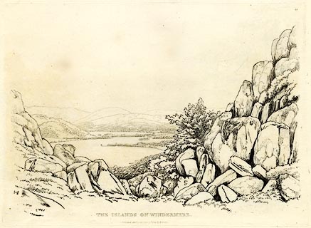 click to enlarge click to enlargeGN0349.jpg Plate 49 in Seventy Eight Studies from Nature. printed in introductory pages to set of prints:- "Number 49. Curwen Island, the property of John Christian Curwen, Esq. and the largest Island on Windermere, apparently uniting with the promontories, seems to cut the lake in two; Storrs, on the first projecting land, is the property of Colonel Bolton, who has lately made vast additions to the house; the improvements, which are in good taste, do credit to the architect. The two ferry points, with Berkshire Island, lie between the houses of Mr. Bolton and Mr. Curwen. Calgarth, the seat of the Right Rev. the Bishop of Llandaff, is among the enclosures on the banks of the lake, and is seen beyond the Island House. The distant mountains are Fairfield, Scandale, Wansfell, Colda, and Hill Bell. This view is from the Fellside, above Beech Hill." printed at bottom:- "THE ISLANDS OF WINDERMERE. / Published Ambleside, Augst. 1st. 1809, by W. Green." item:- Armitt Library : A6637.49 Image © see bottom of page |
|||||||||||||||||||||||||
|
|
||||||||||||||||||||||||||
| evidence:- | old drawing:- |
|||||||||||||||||||||||||
| source data:- | Drawing, Island on Windermere, Westmorland, by William Havell, 1800s-10s.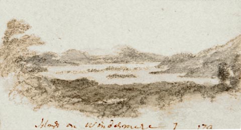 click to enlarge click to enlargePR1409.jpg View of an island on Windermere lake from elevated perspective with woods below, lake in centre and hills in the distance. One of a set of twenty views of the lake district executed by the artist on one sheet of paper. at bottom:- "Island on Windermere" item:- Tullie House Museum : 2009.89.53 Image © Tullie House Museum |
|||||||||||||||||||||||||
|
|
||||||||||||||||||||||||||
| hearsay:- |
According to the Kendal and County News there were about ten thousand people skating
on Windermere on 17 February 1895. They came from Lancaster, Liverpool and Manchester
in special trains and by charabanc. |
|||||||||||||||||||||||||
| Arthur Ransome, age eleven, a pupil at Old College, Bowness-on-Windermere, was there
skating. The headmaster and pupils spent whole days on the ice. |
||||||||||||||||||||||||||
| "Those weeks of clear ice with that background of snow-covered, sunlit, blue-shadowed
hills were, 40 years later, to give me a book called Winter Holiday." |
||||||||||||||||||||||||||
|
|
||||||||||||||||||||||||||
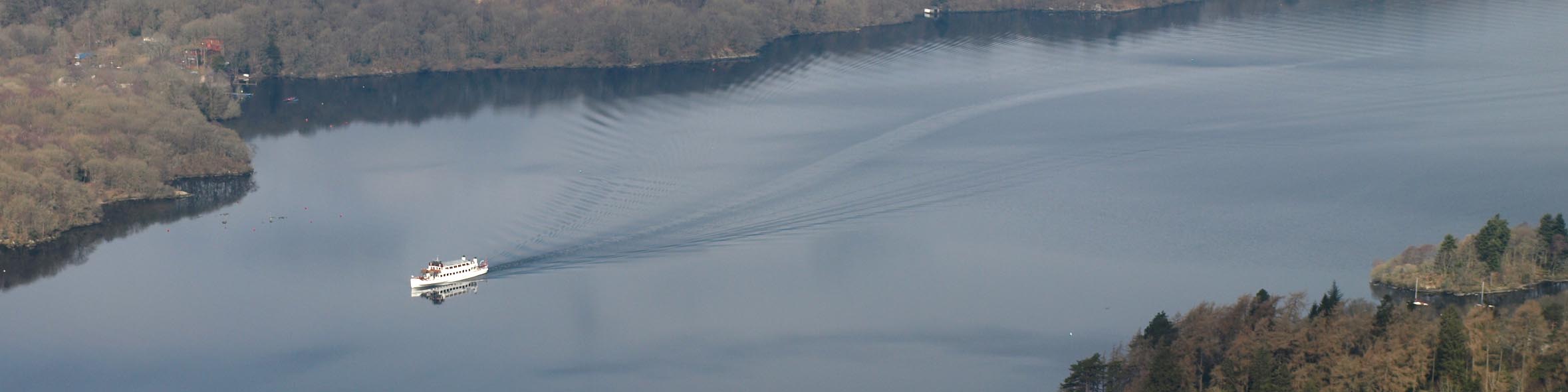 Click to enlarge BYC83.jpg Boat and wake. (taken 11.4.2103) 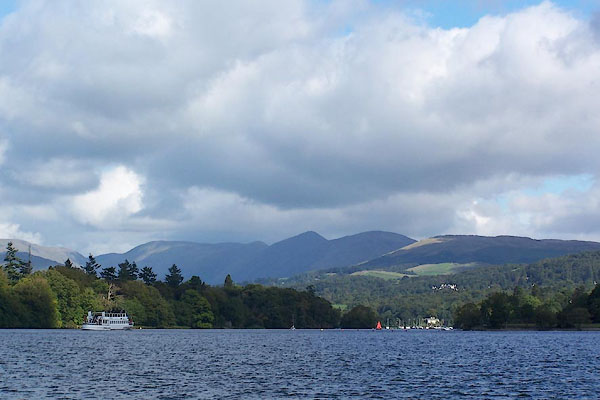 BJV10.jpg North from the ferry. (taken 16.9.2005)  Click to enlarge BRS42.jpg (taken 7.10.2009)  BJV13.jpg North from the ferry landing, west side. (taken 16.9.2005)  Click to enlarge BTY28.jpg From Troutbeck area. (taken 22.1.2011)  BZS53.jpg From Longmire Road. (taken 4.12.2013) 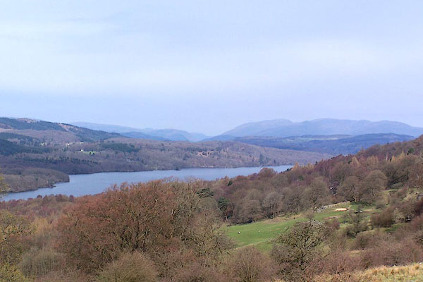 BLV91.jpg From the road by Astley's Plantation. (taken 16.9.2005)  BOE52.jpg (taken 11.9.2007) 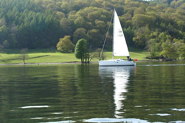 BWH87.jpg Yacht. (taken 3.5.2012) 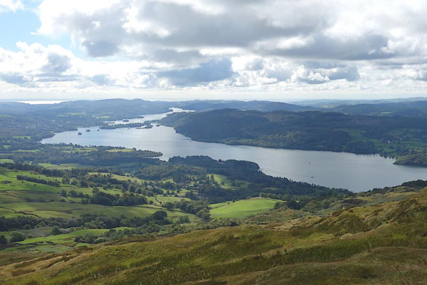 CDZ69.jpg From Wansfell. (taken 22.9.2015) |
||||||||||||||||||||||||||
|
|
||||||||||||||||||||||||||
| see:- | viewpoint, Claife Thomas West I viewpoint, Belle Isle S Thomas West II viewpoint, Belle Isle N Thomas West III viewpoint, Rawlinson Nab Thomas West IV viewpoint, Brant Fell Thomas West V viewpoint, Harrow Farm Thomas West viewpoint, Low Cat Crag Thomas West viewpoint, Rayrigg Hall Thomas West viewpoint, Windermere by boat West, Green, Martineau viewpoint, Queen Adelaide's Hill Peter Crosthwaite 1 viewpoint, Cook's Corner Peter Crosthwaite 2 viewpoint, Low Wood Peter Crosthwaite 3 viewpoint, Jenkyn's Crag Peter Crosthwaite 4 |
|||||||||||||||||||||||||
|
|
||||||||||||||||||||||||||
Lakes Guides menu.