 Old Cumbria Gazetteer
 |
 |
|
||||||||||||||||||||||||||||||||||||||
| Cumberland | ||||||||||||||||||||||||||||||||||||||||
| county:- | Cumbria | |||||||||||||||||||||||||||||||||||||||
| locality type:- | county, old | |||||||||||||||||||||||||||||||||||||||
|
|
||||||||||||||||||||||||||||||||||||||||
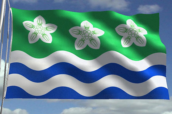 CCR44.jpg New flag. courtesy of Jason Saber |
||||||||||||||||||||||||||||||||||||||||
|
|
||||||||||||||||||||||||||||||||||||||||
| evidence:- | old map:- Lloyd 1573 placename:- Comberland |
|||||||||||||||||||||||||||||||||||||||
| source data:- | Map, hand coloured copper plate engraving, Angliae Regni,
Kingdom of England, with Wales, scale about 24 miles to 1 inch, authored by Humphrey
Lloyd, Denbigh, Clwyd, drawn and engraved
by Abraham Ortelius, Netherlands, 1573. click to enlarge click to enlargeLld1Cm.jpg "COMBERLAND" item:- Hampshire Museums : FA1998.69 Image © see bottom of page |
|||||||||||||||||||||||||||||||||||||||
|
|
||||||||||||||||||||||||||||||||||||||||
| evidence:- | old map:- Saxton 1579 placename:- Cumberlandia |
|||||||||||||||||||||||||||||||||||||||
| source data:- | Map, Westmorlandiae et Cumberlandiae Comitatus ie Counties of
Westmorland and Cumberland, scale about 5 miles to 1 inch, by
Christopher Saxton, London, engraved by Augustinus Ryther, 1576
and presumably available from that date, published with other
county maps in an atlas 1579; published 1579-1645. "Cumberlandia" |
|||||||||||||||||||||||||||||||||||||||
|
|
||||||||||||||||||||||||||||||||||||||||
| evidence:- | old map:- Keer 1605 placename:- Comberland |
|||||||||||||||||||||||||||||||||||||||
| source data:- | Map, hand coloured engraving, Westmorland and Cumberland, scale
about 16 miles to 1 inch, probably by Pieter van den Keere, or
Peter Keer, about 1605 edition perhaps 1676. click to enlarge click to enlargeKER8.jpg "Comberland" county item:- Dove Cottage : 2007.38.110 Image © see bottom of page |
|||||||||||||||||||||||||||||||||||||||
|
|
||||||||||||||||||||||||||||||||||||||||
| evidence:- | descriptive text:- Keer 1605 (edn 1620) item:- placename, Cumberland; Cumberland, extent |
|||||||||||||||||||||||||||||||||||||||
| source data:- | Map, Westmorlandia et Comberlandia, ie Westmorland and
Cumberland now Cumbria, scale about 16 miles to 1 inch, probably
by Pieter van den Keere, or Peter Keer, about 1605, published
about 1605 to 1676. goto source goto sourcefirst page:- "CUMBERLAND." "CHAPTER XLI." "CUMBERLAND, the furthest North-west Province in this Realme of England, confronteth upon the South of Scotland, and is divided from that Kingdome partly by the River Kirsop, then crossing Eske, by a tract thorow Solome-Mosse, until it come to the Solway Frith, by Ptolemie called the Ituna Baye. The North-west part is neighboured by Northumberland, more East-ward with Westmerland, the South with Lancashire, and the West is wholly washed with the Irish Seas." "(2) The forme whereof is long and narrow, pointing wedge-like into the South, which part it is altogether pestred with copped-hilles, and therefore hath the name of Copland. The middle is more levell, and better inhabited, yeelding sufficient for the sustenance of man: but the North is wilde and solitary, combred with hilles, as Copland is." "(3) The ayre is piercing, and of a sharpe temperature, and would be more biting, were it not that those high hilles breake off the Northerne stormes, and cold falling snowes." "(4) Notwithstanding, rich is this Province, and with great varieties thereof is replenished: the hilles, though rough, yet smile upon their beholders, spread with sheepe and cattle, the vallies stored with grasse and corne sufficient: the Sea affordeth great store of fish, the land over-spread with varietie of fowles, ..." goto sourcesecond page:- "..." "(5) The ancient Inhabitants knowne to the Romanes, were the Brigantes, whom Ptolemie disperseth into Westmorland, Richmond, Durham, York-shire, and Lancashire. But when the Saxons had over borne the Britaines, and forced them out of the best, to seeke their resting among the vast Mountaines, these by them were entred into, where they held play with those enemies maugre their force, and from them, as Marianus doth witnesse, the land was called Cumber, of those Kumbri the Britaines. But when the State of the Saxons was fore shaken, by the Danes, this Cumberland was accounted a Kingdome itselfe; for so the Flower-gatherer of Westminster recordeth; King Edmund (saith he) with the helpe of Leoline Prince of South-Wales, wasted all Cumberland, and having put out the eyes of the two sonnes of Dunmail King of that Province, granted that Kingdome unto Malcolm King of Scots, whereof their eldest sonnes became Prefects. This Province, King Stephen, to purchase favour with the Scots, what time he stood in most need of ayd, confirmed by gift under their Crowne; which Henry the second notwithstanding, made claime unto and got, as Newbrigensis writeth, and laid it againe in the Marches of England: since when, many bickerings betwixt these Nations herein have hapned, ..." goto sourcethird page:- "..." "(7) The chiefest Citie in this Shire is Carlile, ..." "..." "(10) This County, as it stood in the fronts of assaults, so was it strengthned with twentie-five Castles, and preserved with the prayers (as then was thought) of the Votaries in the houses erected at Carlile, Lenecost, Wetherall, Holme, Daker, and Saint Bees. These with others were dissolved by" goto sourcefourth page:- "King Henry the eight, and their revenues shadowed under his Crowne: but the Province being freed from charge of subsidie, is not therefore divided into Huundreds in the Parliament Rowles, whence we have taken the divisions of the rest: onely this is observed, that therein are seated nine Maraket-Townes, fiftie eight Parish-Churches, besides many other Chappels of ease." |
|||||||||||||||||||||||||||||||||||||||
|
|
||||||||||||||||||||||||||||||||||||||||
| evidence:- | old map:- Speed 1611 (Cum/EW) placename:- Cumberlandshire |
|||||||||||||||||||||||||||||||||||||||
| source data:- | Map, hand coloured engraving, Kingdome of Great Britaine and
Ireland, scale about 36 miles to 1 inch, by John Speed, about
1610-11, published by Thomas Bassett, Fleet Street and Richard
Chiswell, St Paul's Churchyard, London, 1676? click to enlarge click to enlargeSPD6Cm.jpg "CUMBERLANDSHIRE" county item:- private collection : 85 Image © see bottom of page |
|||||||||||||||||||||||||||||||||||||||
|
|
||||||||||||||||||||||||||||||||||||||||
| evidence:- | poem:- Drayton 1612/1622 text placename:- Cumberland |
|||||||||||||||||||||||||||||||||||||||
| source data:- | Poem, Poly Olbion, by Michael Drayton, published by published by
John Marriott, John Grismand and Thomas Dewe, and others?
London, part 1 1612, part 2 1622. goto source Preceding this page is the map for Westmorland and Cumberland. page 161; Westmorland and Cumberland:- "The thirtieth Song." "THE ARGUMENT." "Of Westmerland the Muse now sings, And fetching Eden from her Springs, Sets her along, and Kendall then Surveying, beareth back agen; And climbing Skidows loftie Hill, By many a River, many a Rill, To Cumberland, where in her way, Shee Copland calls, and doth display Her Beauties, backe to Eden goes, Whose Floods, and Fall shee aptly showes." goto sourcepage 167:- "... And for my [Eden's] Country here, (of which I am the chiefe Of all her watry kind) know that shee lent reliefe," goto sourcepage 168:- "To those old Britans once, who from the Saxons they For succour hither fled, as farre out of their way. Amongst her mighty Wylds, and Mountains freed from feare, And from the British race, residing long time here, Which in their Genuine tongue, themselves did Kimbri name, Of Kimbri-land, the name of Cumberland first came; ..." |
|||||||||||||||||||||||||||||||||||||||
|
|
||||||||||||||||||||||||||||||||||||||||
| evidence:- | table of distances:- Simons 1635 placename:- Cumberland |
|||||||||||||||||||||||||||||||||||||||
| source data:- | Table of distances, uncoloured engraving, Cumberland, with a
thumbnail map, scale about 41 miles to 1 inch, by Mathew Simons,
published in A Direction for the English Traviller, 1635.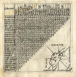 click to enlarge click to enlargeSIM4.jpg "Cu~berland" in title cartouche; adjacent counties given on thumbnail map "The sea West / Scotlande North / Northu~berland & Duresme East / Westmorla~d &Lancashire S." item:- private collection : 50.11 Image © see bottom of page |
|||||||||||||||||||||||||||||||||||||||
|
|
||||||||||||||||||||||||||||||||||||||||
| evidence:- | old map:- Jenner 1643 placename:- Cumberland |
|||||||||||||||||||||||||||||||||||||||
| source data:- | Tables of distances with a maps, Westmerland, scale about 16
miles to 1 inch, and Cumberland, scale about 21 miles to 1 inch,
published by Thomas Jenner, London, 1643; published 1643-80. JEN4Sq.jpg "Cumberland" |
|||||||||||||||||||||||||||||||||||||||
|
|
||||||||||||||||||||||||||||||||||||||||
| evidence:- | old map:- Sanson 1679 placename:- Cumberland |
|||||||||||||||||||||||||||||||||||||||
| source data:- | Map, hand coloured engraving, Ancien Royaume de Northumberland
aujourdhuy Provinces de Nort, ie the Ancient Kingdom of
Northumberland or the Northern Provinces, scale about 9.5 miles
to 1 inch, by Nicholas Sanson, Paris, France, 1679. click to enlarge click to enlargeSAN2Cm.jpg "CUMBERLAND" county; included in the 'Royaume de Northumberland' item:- Dove Cottage : 2007.38.15 Image © see bottom of page |
|||||||||||||||||||||||||||||||||||||||
|
|
||||||||||||||||||||||||||||||||||||||||
| evidence:- | old map:- Seller 1694 (Cmd) placename:- Cumberland |
|||||||||||||||||||||||||||||||||||||||
| source data:- | Map, uncoloured engraving, Cumberland, scale about 12 miles to 1
inch, by John Seller, 1694. click to enlarge click to enlargeSEL9.jpg "Cumberland" title in cartouche; county item:- Dove Cottage : 2007.38.89 Image © see bottom of page |
|||||||||||||||||||||||||||||||||||||||
|
|
||||||||||||||||||||||||||||||||||||||||
| evidence:- | old map:- Morden 1695 (EW) placename:- Cumberland |
|||||||||||||||||||||||||||||||||||||||
| source data:- | Map, hand coloured engraving, England, including Wales, scale
about 27 miles to 1 inch, by Robert Morden, published by Abel
Swale Awnsham and John Churchil, London, about 1695. click to enlarge click to enlargeMRD3Cm.jpg "CUMBERLAND" county item:- JandMN : 339 Image © see bottom of page |
|||||||||||||||||||||||||||||||||||||||
|
|
||||||||||||||||||||||||||||||||||||||||
| evidence:- | descriptive text:- Fiennes 1698 |
|||||||||||||||||||||||||||||||||||||||
| source data:- | Travel book, manuscript record of Journeys through England
including parts of the Lake District, by Celia Fiennes, 1698. "... hereabout [Pooley Bridge?] we leave those desart and barren rocky hills, not that they are limitted to Westmorland only, for had I gone farther to the left hand on into Cumberland I should have found more such and they tell me farr worse for height and stony-nesse about White haven side and Cockermouth, so that tho' both the County's have very good land and fruitfull, so they equally partake of the bad, tho' indeed Westmorland takes its name from its abounding in moorish ground yet Cumberland has its share, and more of the hilly stony part; indeed I did observe those grounds were usually neighbours to each other, the rocks abounding in springs which distilling it self on lower ground if of a spungy soile made it marshy or lakes, and in many places very fruitfull in summer graine and grasse, but the northerly winds blow cold so long on them that they never attempt sowing their and with wheate or rhye." |
|||||||||||||||||||||||||||||||||||||||
|
|
||||||||||||||||||||||||||||||||||||||||
| evidence:- | old map, descriptive text:- Bowen 1720 (plate 259) item:- hundreds (wards); climate; soil; corn; fish; salmon; coal; lead; copper; silver; lapis calaminaris; pearl; mussel; roman antiquity |
|||||||||||||||||||||||||||||||||||||||
| source data:- | Map, uncoloured engraving, pl.259, Cumberland, scale about 16.5
miles to 1 inch, published by Emanuel Bowen, St Katherines,
London, 1720.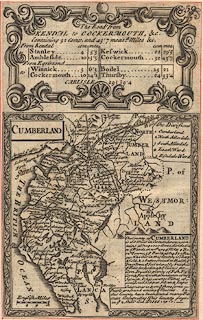 click to enlarge click to enlargeB259.jpg "The Divisions 1 Cumberland 2 North Allerdale 3 South Allerdale 4 Leath Ward 5 Eskdale Ward" "The County of CUMBERLAND is 168 Miles in Circumference contains abt. 1040000 Acres, divided in to 5 Wards, in wch. are 4 Mt. & 2 Boro. Towns, 58 Pars. & abt. 14825 Houses. The Air in this County is sharp & Cold, & a better freind to Health yn Fruit Trees, ye Soil tolerably fruitfull ye Hills for feeding & ye Valleys for Corn. It yields plenty of Fish, Flesh, Corn & Fowl with abundance of large Salmon. It has several Mines of Coal, Lead, Copper, Silver, & Lapis Calaminaris, &on ye Shore some Pearls are found among ye Muscles. In this County have been found many Roman Antiquities. This County pays in ye [Q|2] Shitt: Aid L1856:19:1." item:- Dove Cottage : Lowther.35 Image © see bottom of page |
|||||||||||||||||||||||||||||||||||||||
|
|
||||||||||||||||||||||||||||||||||||||||
| evidence:- | descriptive text:- Defoe 1724-26 placename:- |
|||||||||||||||||||||||||||||||||||||||
| source data:- | Tour through England and Wales, by Daniel Defoe, published in
parts, London, 1724-26. "They have innumerable marks of antiquity in this county [Cumberland], as well as in that of Westmoreland, mentioned before; and if it was not, as I said before, that antiquity is not my search in this work [Tour of England and Wales], yet the number of altars, monuments, and inscriptions, is such, that it would take up a larger work than this to copy them, and record them by themselves; ..." |
|||||||||||||||||||||||||||||||||||||||
|
|
||||||||||||||||||||||||||||||||||||||||
| evidence:- | old map:- Badeslade 1742 placename:- Cumberland |
|||||||||||||||||||||||||||||||||||||||
| source data:- | Map, uncoloured engraving, A Map of Cumberland North from
London, scale about 11 miles to 1 inch, with descriptive text,
by Thomas Badeslade, London, engraved and published by William
Henry Toms, Union Court, Holborn, London, 1742. click to enlarge click to enlargeBD10.jpg "Cumberland" county "Cumberland sends 6 Membrs. to Parliament, containing one City, one Borough, 13 Market Towns, &58 Parish Churches, besides Chapels." item:- JandMN : 115 Image © see bottom of page |
|||||||||||||||||||||||||||||||||||||||
|
|
||||||||||||||||||||||||||||||||||||||||
| evidence:- | descriptive text:- Simpson 1746 placename:- Cumberland item:- hundreds; climate |
|||||||||||||||||||||||||||||||||||||||
| source data:- | Atlas, three volumes of maps and descriptive text published as
'The Agreeable Historian, or the Compleat English Traveller
...', by Samuel Simpson, 1746. goto source "IN the Time of the Romans Cumberland was Part of the large Country inhabited by the Brigantes, containing besides this County, Yorkshire, Durham, Lancashire, and Westmoreland. During the Time of the Saxon Heptarchy, it made Part of the Kingdom of Northumberland." "When it was in the Power of the Romans, it was much frequented by their Legions and Soldiers, not only to keep the Inhabitants in Order, but bordering upon their troublesome Neighbours, the Picts and Scots, they were forced continually to guard it against their Invasions; but when the Distractions of the Roman Empire caused the Legions of Britain to be call'd Home, the Scots and Picts, sensible that all Opposition was near remov'd, soon brake thro' the strong Wall, built by the Emperors Adrian and Severus, extending from Sea to Sea about 82 Miles in Length, tho' it had been not long before rebuilt, and made stronger, and now miserably harrass'd the Britons, destitute of their wonted Guard; in which almost continual Conflicts they lived, 'till the Saxons brought them, with the rest of the Kingdom, into a Subjection to them, dividing it into seven Parts, or Principalities. In this Settlement, Cumberland became a Part of the Kingdom of Northumberland, and was then called Cumberland." "This County, which is 168 Miles in Circumference, is bounded by Scotland on the N. by the Irish Sea on the W. and S. and on the E. by Part of Lancashire, Westmoreland, Yorkshire, Durham, and Northumberland." "It lies partly in the Dioceses of Chester and Carlisle," goto source"and contains about 1,040,000 Acres, and 14,825 Houses. It is not divided into Hundreds, as most other Counties are, but Wards, of which there are five, viz. South-Ward, North-Ward, West-Ward, Leath-Ward, and Eskdale-Ward, wherein are 58 Parishes, containing one City, one Borough, and 12 other Market Towns; and sends six Members to Parliament, two for the County, two for the City of Carlisle, and two for the Borough of Cockermouth." "The Air is cold and sharp, tho' not so much as might be expected from its Northern Situation, being shelter'd by Hills on the Side next Scotland. The Soil is for the most Part fruitful of Corn and Grass, the Plains affording good Plenty of the one, and the rich Mountains of the other, which are therefore always stocked with great Store of Sheep. The County affords pleasant Prospects, which would be still more agreeable, if Trees could be brought to thrive better than they generally do. The chief Commodities are Coal, Lead, Copper, Lapis Calaminaris, Black Lead, (call'd by the Inhabitants Wadd,) Fish, especially Salmon, Wild Fowl, Pearls, &c. ..." "..." goto source"..." "This County has given the Title of Earl, or Duke, to the following Persons, since the Conquest:" "Ranulph, or Ralph de Meschines, was the first Lord of Cumberland, by the Conqueror's Donation, and his Son" "Ranulph succeeded him in that Dignity and Power; but being Heir by his Mother to the Earldom of Chester, he removed thither, and resigned the Lordship of Cumberland into the King's Hands, which King Stephen gave to Malcolm, King of Scots, to hold of him, on Condition that he should protect the N. Parts of England by Sea and Land, against the Incursions of all Enemies. From which Time" "The eldest Sons of the Kings of Scotland were stiled Lord of Cumberland: But King Henry II. considering how great a Prejudice this Grant was to the Kingdom, resum'd it, and gave him the Earldom of Huntingdon: And so this Honour remain'd in the Crown 'till King Henry VIII. created" "Henry Clifford, descended from the Lord Vipont, or de Vetere Ponte, Earl of Cumberland, in which Family" goto source"it continu'd 'till the Year 1643, when Henry Lord Clifford, the then Earl of Cumberland, died at York, leaving only a Daughter, and the Times being disturbed, the Honour ceas'd for a Time, 'till King Charles I. was pleased to create his Nephew." "Rupert, Count Palatine of the Rhine, second Son of Frederick, Prince Elector Palatine, and the Princess Elizabeth, his Wife, Duke of Cumberland, and Earl of Holderness. He died unmarried in the Year 1682, and seven Years after" "Prince George of Denmark, then Consort to the Princess (afterwards Queen) Anne, was created Duke of Cumberland, Earl of Kendal, and Baron of Ockingham. The present Duke of Cumberland is," "His Royal Highness Prince William, second Son of his Majesty, King George II." |
|||||||||||||||||||||||||||||||||||||||
|
|
||||||||||||||||||||||||||||||||||||||||
| evidence:- | old text:- Gents Mag |
|||||||||||||||||||||||||||||||||||||||
| source data:- | Map, uncoloured engraving, New Map of England and Wales, scale
about 25 miles to 1 inch, by Thomas Jefferys, published in the
Gentleman's Magazine, London, 1757. goto source Gentleman's Magazine 1757 opp p.584 A New Map of England and Wales, by Thomas Jefferys, published in the Gentleman's Magazine, London, 1757. 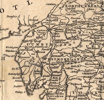 click to enlarge click to enlargeGNT8Cm.jpg "A New MAP of ENGLAND and WALES By Thos. Jefferys Geographer to his Royal Highness the Prince of WALES." item:- Hampshire Museums : B1999.518.1757.13.1 Image © see bottom of page |
|||||||||||||||||||||||||||||||||||||||
|
|
||||||||||||||||||||||||||||||||||||||||
| evidence:- | old text:- Morgan 1759 placename:- Cumberland |
|||||||||||||||||||||||||||||||||||||||
| source data:- | MG02q011.txt "CUMBERLAND." "THIS county abounds more with the wonders of nature than art, and claims the particular attention of every curious traveller." |
|||||||||||||||||||||||||||||||||||||||
|
|
||||||||||||||||||||||||||||||||||||||||
 Gents Mag 1766 Land Tax Gents Mag 1766 Land Tax |
||||||||||||||||||||||||||||||||||||||||
|
|
||||||||||||||||||||||||||||||||||||||||
| evidence:- | old map:- Crosthwaite 1783-94 (Ull) placename:- Cumberland |
|||||||||||||||||||||||||||||||||||||||
| source data:- | Map, uncoloured engraving, Accurate Map of the Beautiful Lake of
Ullswater, scale about 3 inches to 1 mile, by Peter Crosthwaite,
Keswick, Cumberland, 1783, version published 1800. CT5NY31Z.jpg "Cumberland" item:- Armitt Library : 1959.191.7 Image © see bottom of page |
|||||||||||||||||||||||||||||||||||||||
|
|
||||||||||||||||||||||||||||||||||||||||
| evidence:- | old text:- Clarke 1787 placename:- Cumberland item:- 1745 rebellion; land tax |
|||||||||||||||||||||||||||||||||||||||
| source data:- | Guide book, A Survey of the Lakes of Cumberland, Westmorland,
and Lancashire, written and published by James Clarke, Penrith,
Cumberland, and in London etc, 1787; published 1787-93. goto source Page 119:- "..." "Cumberland hath been rent and torn by its restless inhabitants or envious neighbours; yet hath, since the time of William and Mary, been as loyal subjects to the crown of Great Britain as any county in England; and who distinguished themselves more than its inhabitants in the year 1745? for the natives, though undisciplined as they were, rose in great numbers, harassed the enemy, and took many prisoners. And when the Duke of Cumberland's army came, and were much fatigued with long and hasty marches, having scarcely time allowed to take their victuals, the gentlemen and farmers went to the roads where the soldiers passed, with beef, bread, butter, cheese, ale, &c. and gave them as much as they wanted; walking along with them and bearing their arms till they had eaten and quenched their thirst, for so urgent was their haste that they were not allowed to stop." "The Duke was so well pleased with their loyalty and behaviour, that he procured them a settled rate to the land-tax; so that they do not pay a pound rate after the manner of other counties, but raise a sum by what they call purvey; a favour little enough, considering what they suffered, and the expence they were at in assisting the King's troops, and is not much less than what some counties pay by the book of rates." |
|||||||||||||||||||||||||||||||||||||||
|
|
||||||||||||||||||||||||||||||||||||||||
| evidence:- | old text:- Clarke 1787 placename:- Cumberland |
|||||||||||||||||||||||||||||||||||||||
| source data:- | Guide book, A Survey of the Lakes of Cumberland, Westmorland,
and Lancashire, written and published by James Clarke, Penrith,
Cumberland, and in London etc, 1787; published 1787-93. goto source Page 189:- "APPENDIX." "MY Printer having, by accident, missed a page in the manuscript, which being an illustration of the history I shall here insert it; it ought to be read in page the 20. - At the time of the Norman conquest, the counties of Northumberland, Westmorland, and Cumberland, were in the possession of the Scots, but soon after taken from them. However, the Scots, for a long time after, continued to claim the said three counties, and we find William King of Scotland demanding them of John King of England. In the 1209, when John was greatly distressed for want of money, he ceded them to William for a 15,000 marks of silver, or, as the Scots Historians say, 11,000, and other conditions, none of which were ever performed. Afterwards Alexander, son of William, demanded of Henry, son of John, the said counties, or to fulfil their father's bargain: after divers messengers being sent from the one to the other, the two Kings themselves met at York in 1237 and settled the differences; Alexander giving up his pretensions to the counties on condition of Henry giving him a pension of 800 marks and 200 librates of land: But Henry neglecting to perform some other part of the agreements, (viz) that Henry's brother, Richard, should marry Alexander's sister, the Court of Scotland grew uneasy, and Henry was obliged again, in the same year, to meet Alexander at York, and bring with him the Pope's legate." "After much conversation and debate, a new convention was drawn up by the legate, to the following purport: That the King of Scots do quit all his pretensions in England, upon the counties of Northumberland, Westmorland, and Cumberland; and grant a full acquitance for fifteen thousand marks borrowed from the late King of Scotland by King John, in consideration of two hundred pounds in land yearly, with the counties of Northumberland, Cumberland, and Westmorland, with this remarkable provision, That if the revenues of the said counties did not make up two hundred pounds a-year, (exclusive of those towns which had castles in them,) then the King of Scots was to receive the balance in proper lands, out of the adjoining counties; the King of Scots paying, by way of redendo, every year a soar-hawk to the constable of Carlisle. The fide jussor on the part of Henry was the Earl of Warren; on the part of Alexander, the Earl of Monteith. ..." |
|||||||||||||||||||||||||||||||||||||||
|
|
||||||||||||||||||||||||||||||||||||||||
| evidence:- | old map:- Clarke 1787 map (Ambleside to Keswick) placename:- Cumberland |
|||||||||||||||||||||||||||||||||||||||
| source data:- | Map, A Map of the Roads Lakes etc between Keswick and Ambleside,
scale about 2.5 ins to 1 mile, by James Clarke, engraved by S J
Neele, 352 Strand, published by James Clarke, Penrith,
Cumberland and in London etc, 1787. CL9NY31A.jpg "CUMBERLAND" The county boundary is drawn at Dunmail Raise. item:- private collection : 10.9 Image © see bottom of page |
|||||||||||||||||||||||||||||||||||||||
|
|
||||||||||||||||||||||||||||||||||||||||
| evidence:- | old map:- Clarke 1787 map (Ullswater) placename:- Cumberland |
|||||||||||||||||||||||||||||||||||||||
| source data:- | Map, A Map of the Lake Ullswater and its Environs, scale about
6.5 ins to 1 mile, by James Clarke, engraved by S J Neele, 352
Strand, published by James Clarke, Penrith, Cumberland and in
London etc, 1787. CL4NY31U.jpg "Glencoyn Beck divides the Countys" "CUMBERLAND" The county name is engraved at the top of the map, and along the lake margin. item:- private collection : 10.4 Image © see bottom of page |
|||||||||||||||||||||||||||||||||||||||
|
|
||||||||||||||||||||||||||||||||||||||||
| evidence:- | old text:- Camden 1789 (Gough Additions) placename:- Cumberland placename:- Cumbreland item:- Cumberland, extent; wards; markets |
|||||||||||||||||||||||||||||||||||||||
| source data:- | Book, Britannia, or A Chorographical Description of the Flourishing Kingdoms of England,
Scotland, and Ireland, by William Camden, 1586, translated from the 1607 Latin edition
by Richard Gough, published London, 1789. goto source Page 179:- "THE county of Cumberland is in length from the Peel of Fouldry on the south to the north near Langford above 70 miles, and in breadth from Allenby on the west to Newbiggin bridge on the east 30 miles and upwards, 230 in circumference, contains about 1,040,000 acres, about 20,000 houses, and near 100,000 inhabitants. It is divided (as Westmorland, and for the same reason), into five wards, in which are eight market and two borough towns, and 58 parishes." ""The length of Cumberland by the shore is from a water called Dudden, the which devideth Furnesland from Cumbreland onto a lytle water or mere called Polt Rosse, the which devideth the county of Northumberland on the east side from Cumbreland. The bredeth of Cumbreland is from a water called Emot that divideth on the south side the one part Cumbreland from Westmorland until he enter into the river of Edon two miles from Pereth by east, and so on the east side of Edon unto a broke called... the which divideth likewise Cumbreland from Westmerland unto the ryver of Eske in the north side, the which divideth Cumbreland from the batable ground until it come to the arm of the se which divideth England from Scotland."" |
|||||||||||||||||||||||||||||||||||||||
|
|
||||||||||||||||||||||||||||||||||||||||
| Camden 1789 |
||||||||||||||||||||||||||||||||||||||||
|
|
||||||||||||||||||||||||||||||||||||||||
| evidence:- | old text:- Camden 1789 placename:- Cumberland placename:- Cumbrorum Terra |
|||||||||||||||||||||||||||||||||||||||
| source data:- | Book, Britannia, or A Chorographical Description of the Flourishing Kingdoms of England,
Scotland, and Ireland, by William Camden, 1586, translated from the 1607 Latin edition
by Richard Gough, published London, 1789. goto source Pages 169-210 are Cumberland. Page 169:- "CUMBERLAND." "BEFORE Westmorland to the west lies Cumberland, the last county of England this way, being bounded on the north by Scotland, washed on the south and west by the Irish sea, and on the east joining to Northumberland above Westmorland. It takes its name from its inhabitants, who were true and genuine Britans, and in their own language called themselves Kumbri and Kambri. History informs us, that the Britans long resided here during the Saxon tyrany; and Marianus himself says the same thing, and calls this country Cumbrorum terra; not to mention the British names continually recurring as Caer-luel, Caer-dronoc, Pen-rith, Pen-rodoc &c. which plainly bespeak this, and are the strongest proof of my assertion." "The country, though it may seem colder by reason of its northern situation and rough with mountains, affords an agreeable variety to travellers. For after the swelling rocks and thickest mountains pregnant with all kinds of wild-fowl succeed verdant hills of rich pasturage, covered with flocks, and below them extensive plains yielding plenty of corn. Besides all these the sea which beats against the coast maintains innumerable shoals of excellent fish, and seems to reproach the inhabitants for their inattention to fishery." "..." goto sourcePage 177:- "..." "Having thus in a manner perlustrated the coast and interior parts of Cumberland, the east part though thin, hungry, and waste, remains to be visited. It affords only the sources of South Tine in a swampy soil, and a Roman way eight yards broad, paved with stones, and called the Maiden way, ..." "..." "..." "In the decline of the Roman empire in Britain, though this country was miserably harrassed by the Scots and Picts, it long preserved the original Britans for its inhabitants, and fell late into the power of the Saxons. But when the Saxon government was subverted by the Danish wars, it had princes of its own, styled kings of Cumberland, till the year 946, at which time as Matthew of Westminster informs us, "king Edmund, assisted by Lewellin king of Demetia, plundered Cumberland of all its wealth, and having put out the eyes of the two sons of Dunmail king of that province, gave the kingdom to Malcolm king of Scotland, to hold of him and to defend the north parts of England from the invasion of enemies by sea and land." From that time the eldest sons of the kings of Scotland were for a long while styled governors of Cum-" goto sourcePage 178:- "[Cum]berland, both under the Saxons and Danes. But when England submitted to the Normans, this part of it also came into their power, and fell to the share of Radulph de Meschines, whose eldest son Ranulph was lord of Cumberland, and in right of his mother and by favour of the king earl of Chester. King Stephen to gratify the Scots restored it to them to be holden of him and the kings of England. But his successor Henry II. finding this liberality of Stephen likely to prove prejudicial to himself and kingdom, demanded Northumberland, Cumberland, and Westmorland, of the Scots. "The Scottish king, as Neubrigensis relates, wisely considering that the king of England had the advantage in this demand both by strength of arms and justice of claim, though he might have alledged the oath which he was said to have taken to his grandfather David when he received knighthood from him, honestly restored the borders aforesaid upon demand, and in return received from him the county of Huntingdon, to which he had an antient right."" "Before the time of Henry VIII. there were no earls of Cumberland. He created Henry Clifford, descended from the lords Vipont, first earl of Cumberland, who by Margaret daughter of Henry Percy earl of Northumberland, had Henry 2d earl, who by his first wife daughter of Charles Brandon duke of Suffolk, had Margaret countess of Derby, by his 2d wife daughter of lord Dacre of Gillesland, two sons George and Francis. George, the 3d earl, distinguished himself in the sea-service, indefatigable and brave, and died 1605, leaving an only daughter Anne. He was succeeded by his brother Francis 4th earl, who discovers an ambition to equal the virtues of such ancestors." "This county contains 58 parish churches besides chapels." |
|||||||||||||||||||||||||||||||||||||||
|
|
||||||||||||||||||||||||||||||||||||||||
| evidence:- | old map:- Cooke 1802 placename:- Cumberland |
|||||||||||||||||||||||||||||||||||||||
| source data:- | Map, Cumberland, scale about 15.5 miles to 1 inch, by George
Cooke, 1802, bound in Gray's New Book of Roads, 1824, published
by Sherwood, Jones and Co, Paternoster Road, London, 1824. click to enlarge click to enlargeGRA1Cd.jpg "CUMBERLAND" map title item:- Hampshire Museums : FA2000.62.2 Image © see bottom of page |
|||||||||||||||||||||||||||||||||||||||
|
|
||||||||||||||||||||||||||||||||||||||||
| evidence:- | old map:- Cooper 1808 placename:- Cumberland item:- population, Cumberland; Cumberland, size; Cumberland, population |
|||||||||||||||||||||||||||||||||||||||
| source data:- | Map, uncoloured engraving, Cumberland, scale about 10.5 miles to
1 inch, drawn and engraved by Cooper, published by R Phillips,
Bridge Street, Blackfriars, London, 1808. click to enlarge click to enlargeCOP3.jpg "CUMBERLAND / in which every Parish &Place is laid down / containing upwards of 40 Houses. / Cities. ... 1 / Boroughs. ... 1 / Market Towns. ... 10 / Parishes. ... 90 / Inhabited House. ... 21,573 / Inhabitants. ... 117,230 / Square Acres. ... 970,000 / Cultivated. ... 470,000 / Uncultivated. ... 460,000 / Members of Parliament 6." title cartouche, etc item:- JandMN : 86 Image © see bottom of page |
|||||||||||||||||||||||||||||||||||||||
|
|
||||||||||||||||||||||||||||||||||||||||
| evidence:- | old text:- Gents Mag item:- inclosure |
|||||||||||||||||||||||||||||||||||||||
| source data:- | Magazine, The Gentleman's Magazine or Monthly Intelligencer or
Historical Chronicle, published by Edward Cave under the
pseudonym Sylvanus Urban, and by other publishers, London,
monthly from 1731 to 1922. goto source Gentleman's Magazine 1808 p.940 "The Earl of Lonsdale has signified his intention of enfranchising his numerous copy-holders throughout Cumberland and Westmoreland, by which measure he will be enabled to enclose more than 20,000 acres of land in those countries, at this time in a state of commonage." |
|||||||||||||||||||||||||||||||||||||||
|
|
||||||||||||||||||||||||||||||||||||||||
| Gents Mag 1816 |
||||||||||||||||||||||||||||||||||||||||
|
|
||||||||||||||||||||||||||||||||||||||||
| Gents Mag 1819 |
||||||||||||||||||||||||||||||||||||||||
|
|
||||||||||||||||||||||||||||||||||||||||
| evidence:- | old text:- Gents Mag item:- Lithographic View of the Several Counties in England |
|||||||||||||||||||||||||||||||||||||||
| source data:- | Magazine, The Gentleman's Magazine or Monthly Intelligencer or
Historical Chronicle, published by Edward Cave under the
pseudonym Sylvanus Urban, and by other publishers, London,
monthly from 1731 to 1922. goto source Gentleman's Magazine 1820 part 1 p.307 book review "A LITHOGRAPHIC VIEW OF THE SEVERAL COUNTIES IN ENGLAND; BY THE LATE MR. EMANUEL MENDEZ DA COSTA, F.R.S." "..." "Cumberland. A county full of mines and minerals. Whitehaven, the great coal-pits that even run under the bed of the sea. Petrifactions abound in this county. The awful slate fells, and slate quarries at Newlands. Keswick and Barrowdale black-lead mines, fine haematites and rubrica or Reddle ore at Langtron near Whitehaven, and at Egremont, &c. Copper mines at Caudbeck, Goldscalp, &c.; lead mines at Nenthead, Newlands, Alston Moor, Thornthwaite, Barrow, and the many lead mines of the Derwentwater estate. In Barrow, Brickhilburn, and several other of these mines, fine and curious Spathose lead ores are found; the fibrous kinds thay call stringy ores. Lead, copper, and iron mines in the manor of Millom. Salt pans at Bransty Cliff near Whitehaven." |
|||||||||||||||||||||||||||||||||||||||
|
|
||||||||||||||||||||||||||||||||||||||||
| evidence:- | old map:- Hall 1820 (Cmd) placename:- Cumberland |
|||||||||||||||||||||||||||||||||||||||
| source data:- | Map, hand coloured engraving, Cumberland, scale about 21 miles
to 1 inch, engraved by Sidney Hall, published by S Leigh, 18
Strand, London, 1820-31. click to enlarge click to enlargeHA14.jpg "Cumberland" in title cartouche; county item:- JandMN : 91 Image © see bottom of page |
|||||||||||||||||||||||||||||||||||||||
|
|
||||||||||||||||||||||||||||||||||||||||
| evidence:- | descriptive text:- Otley 1823 (5th edn 1834) item:- boundary; county boundary; geology |
|||||||||||||||||||||||||||||||||||||||
| source data:- | Guide book, A Concise Description of the English Lakes, the
mountains in their vicinity, and the roads by which they may be
visited, with remarks on the mineralogy and geology of the
district, by Jonathan Otley, published by the author, Keswick,
Cumberland now Cumbria, by J Richardson, London, and by Arthur
Foster, Kirkby Lonsdale, Cumbria, 1823; published 1823-49,
latterly as the Descriptive Guide to the English Lakes. goto source Page 1:- "DESCRIPTION OF THE ENGLISH LAKES AND ADJACENT MOUNTAINS." "THE LAKES." "THE Mountainous District, in which the English Lakes are situated, extends into three Counties, Cumberland, Westmorland, and Lancashire, which form their junction at a point upon the mountain Wrynose, near the road side. Lancashire is separated from Cumberland by the river Duddon; from Westmorland by the stream running through Little Langdale, and by Elterwater and Windermere, until south of Storrs Hall; after which the river Winster forms the boundary till it enters the sands near Medup; and the latter county is parted from Cumberland by the mountain ridge leading over Bowfell to Dunmail Raise, from thence over the top of Helvellyn, and through Glencoin" goto sourcePage 2:- "to Ullswater, and by the river Eamont till it enters the Eden. Windermere Lake is said to belong to Westmorland, at least its islands are claimed by that county; although the whole of its western and part of its eastern shores belong to Lancashire. Coniston and Esthwaite Lakes, with Blelham and the tarns of Coniston, are wholly in Lancashire. Grasmere, Rydal, and Hawes Water, with several tarns, lie in Westmorland. The head of Ullswater is in Westmorland, but below Glencoin it constitutes the boundary between that and Cumberland. Derwent, Bassenthwaite, Buttermere, Ennerdale, and Wastwater, are in Cumberland." goto source"... Near the road on Wrynose are the three shire stones of Cumberland, Westmorland, and Lancashire. ... crossing the head of the Duddon at Cockley-beck, we enter into Cumberland. ..." A clear statement that there are three separate stones. goto sourcePage 110:- "... Dunmail Raise ... At the highest part of the road, a wall separates the counties of Westmorland and Cumberland; ..." goto sourcePage 149:- "THE GEOLOGY OF THE LAKE DISTRICT." "AT the time this essay was first published, the structure of the mountainous district of Cumberland, Westmorland, and Lancashire, was but little understood; scientific travellers had contented themselves with procuring specimens of the different rocks, without taking time to become acquainted with their relative position. Since then, the subject has received more attention from persons conversant with geological inquiries; especially from the distinguished Professor Sedgwick. ..." |
|||||||||||||||||||||||||||||||||||||||
|
|
||||||||||||||||||||||||||||||||||||||||
| evidence:- | old map:- Perrot 1823 placename:- Cumberland |
|||||||||||||||||||||||||||||||||||||||
| source data:- | Map, hand coloured engraving, Cumberland and Westmoreland ie
Westmorland, scale about 38 miles to 1 inch, by Aristide Michel
Perrot, engraved by Migneret, 1823, published by Etienne Ledoux,
9 Rue Guenegaud, Paris, France, 1824-48. click to enlarge click to enlargePER2.jpg "CUMBERLAND" county, includes Lancashire north of the sands item:- Dove Cottage : 2007.38.45 Image © see bottom of page |
|||||||||||||||||||||||||||||||||||||||
|
|
||||||||||||||||||||||||||||||||||||||||
| evidence:- | old map:- Cobbett 1832 placename:- CUMBERLAND |
|||||||||||||||||||||||||||||||||||||||
| source data:- | Map, uncoloured engraving, Cumberland, scale about 20 miles to 1
inch, by William Cobbett, 11 Bolt Court, Fleet Street, London,
1832. click to enlarge click to enlargeCOB5.jpg "CUMBERLAND" in a plain cartouche; the county shape is badly distorted item:- JandMN : 117 Image © see bottom of page |
|||||||||||||||||||||||||||||||||||||||
|
|
||||||||||||||||||||||||||||||||||||||||
| evidence:- | descriptive text:- Ford 1839 (3rd edn 1843) placename:- Cumberland |
|||||||||||||||||||||||||||||||||||||||
| source data:- | Guide book, A Description of Scenery in the Lake District, by
Rev William Ford, published by Charles Thurnam, Carlisle, by W
Edwards, 12 Ave Maria Lane, Charles Tilt, Fleet Street, William
Smith, 113 Fleet Street, London, by Currie and Bowman,
Newcastle, by Bancks and Co, Manchester, by Oliver and Boyd,
Edinburgh, and by Sinclair, Dumfries, 1839. goto source "THE Lake district extends over a portion of the three counties of Cumberland, Westmorland, and Lancashire, being bounded on the south and west by the sea, which combines beautifully from many elevated points with the inland scenery, and occupying an area of about thirty miles in diameter. It consists of large masses or clusters of mountains, generally terminating in one aspiring and pre-eminent point, with the intermediate valleys occupied either by lakes and their subsidiary tarns, or by winding rivers." |
|||||||||||||||||||||||||||||||||||||||
|
|
||||||||||||||||||||||||||||||||||||||||
| evidence:- | old map:- placename:- Cumberland |
|||||||||||||||||||||||||||||||||||||||
| source data:- | Map, hand coloured engraving, wood jigsaw puzzle, England, scale
about 26 miles to 1 inch, by Gall and Inglis, Bernard Terrace,
Edinburgh, and 25 Paternoster Square, London, cut by E J
Peacock, King's Cross, London, 1850s?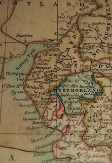 click to enlarge click to enlargeBXX11.jpg Map, hand coloured engraving, wood jigsaw puzzle, England, scale about 26 miles to 1 inch, by Gall and Inglis, Bernard Terrace, Edinburgh, and 25 Paternoster Square, London, cut by E J Peacock, King's Cross, London, 1850s? printed on box lid:- "A / DISSECTED / MAP / OF / ENGLAND / Manufactured by E. J. PEACOCK, 10 Upper [W house] Street, King's Cross." printed on jigsaw "CUMBERLAND" item:- JandMN : JIG388 Image © see bottom of page |
|||||||||||||||||||||||||||||||||||||||
|
|
||||||||||||||||||||||||||||||||||||||||
| evidence:- | old text:- Martineau 1855 item:- county boundary mark |
|||||||||||||||||||||||||||||||||||||||
| source data:- | Guide book, A Complete Guide to the English Lakes, by Harriet
Martineau, published by John Garnett, Windermere, Westmorland,
and by Whittaker and Co, London, 1855; published 1855-76. goto source Page 165:- "... There are two cairns on two summits [of Helvellyn], not far apart, ... These Men, (as such piles of stones are called) mark the" goto sourcePage 166:- "dividing line between Cumberland and Westmorland. ..." |
|||||||||||||||||||||||||||||||||||||||
|
|
||||||||||||||||||||||||||||||||||||||||
| |
||||||||||||||||||||||||||||||||||||||||
|
|
||||||||||||||||||||||||||||||||||||||||
| evidence:- | old text:- Gents Mag item:- poem; Scene in Cumberland |
|||||||||||||||||||||||||||||||||||||||
| source data:- | Magazine, The Gentleman's Magazine or Monthly Intelligencer or
Historical Chronicle, published by Edward Cave under the
pseudonym Sylvanus Urban, and by other publishers, London,
monthly from 1731 to 1922. goto source Gentleman's Magazine 1860 part 2 p.601 "A SCENE IN CUMBERLAND." " EARTH hath not many a fairer spot I ween Than this lone vale, approached by paths as rude As ever led to Alpine solitude! From early morn to noon my steps have been Still wending upwards through a stern wild scene Of shaggy fells, besprinkled here and there With many a marshy pool or sullen mere; Till, having passed these portal rocks between, My eyes were gladdened by this soft green vale, Smiling in silent beauty, far apart From town or highway. There's no poet's tale Need'st to revisit oft the gazer's heart, Fairest yet loveliest of the mountain dells My devious steps have traced on Cumbria's fells." "X." |
|||||||||||||||||||||||||||||||||||||||
|
|
||||||||||||||||||||||||||||||||||||||||
| Cumberland, Population |
||||||||||||||||||||||||||||||||||||||||
| Figures from Census returns. |
||||||||||||||||||||||||||||||||||||||||
|
||||||||||||||||||||||||||||||||||||||||
|
|
||||||||||||||||||||||||||||||||||||||||
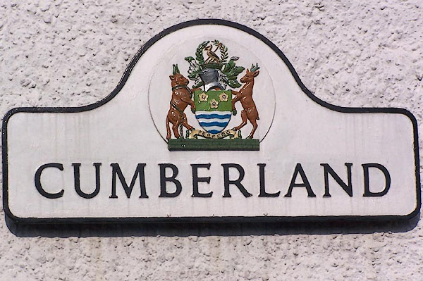 BLX75.jpg Old roadsign:- "CUMBERLAND" Now used as a house name in Orton. (taken 21.4.2006) 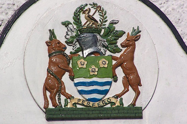 BLX76.jpg Old roadsign, coat of arms:- (taken 21.4.2006) |
||||||||||||||||||||||||||||||||||||||||
|
|
||||||||||||||||||||||||||||||||||||||||
| notes:- |
A county of Combes; according to Robert Anderson:- |
|||||||||||||||||||||||||||||||||||||||
| "There's Cumwhitton, Cumwhinton, Cumranton" |
||||||||||||||||||||||||||||||||||||||||
| "Cumrangan Cumrew, and Cumcatch" |
||||||||||||||||||||||||||||||||||||||||
| "And mony mair Cums in the County" |
||||||||||||||||||||||||||||||||||||||||
| "But none with Cumdivock can match." |
||||||||||||||||||||||||||||||||||||||||
|
|
||||||||||||||||||||||||||||||||||||||||
| new county:- | Cumbria |
|||||||||||||||||||||||||||||||||||||||
|
|
||||||||||||||||||||||||||||||||||||||||
Lakes Guides menu.