Old Cumbria Gazetteer
 |
 |
|
|||||||||||||||||||||
| included in:- |
 road, Penrith to Workington road, Penrith to Workington |
||||||||||||||||||||||
| road, Penrith to Keswick | |||||||||||||||||||||||
| Penrith to Keswick | |||||||||||||||||||||||
| Keswick to Penrith | |||||||||||||||||||||||
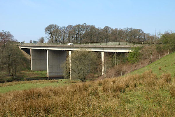
| A66 | |||||||||||||||||||||||
| civil parish:- | Penrith (formerly Cumberland) | ||||||||||||||||||||||
| civil parish:- | Dacre (formerly Cumberland) | ||||||||||||||||||||||
| civil parish:- | Hutton (formerly Cumberland) | ||||||||||||||||||||||
| civil parish:- | Mungrisdale (formerly Cumberland) | ||||||||||||||||||||||
| civil parish:- | Matterdale (formerly Cumberland) | ||||||||||||||||||||||
| civil parish:- | Threlkeld (formerly Cumberland) | ||||||||||||||||||||||
| civil parish:- | St John's Castlerigg and Wythburn (formerly Cumberland) | ||||||||||||||||||||||
| civil parish:- | Keswick (formerly Cumberland) | ||||||||||||||||||||||
| county:- | Cumbria | ||||||||||||||||||||||
| locality type:- | route | ||||||||||||||||||||||
| 10Km square:- | NY53 | ||||||||||||||||||||||
| 10Km square:- | NY52 | ||||||||||||||||||||||
| 10Km square:- | NY42 | ||||||||||||||||||||||
| 10Km square:- | NY32 | ||||||||||||||||||||||
| 10Km square:- | NY22 | ||||||||||||||||||||||
|
|
|||||||||||||||||||||||
| evidence:- | old map:- Ogilby 1675 (plate 96) |
||||||||||||||||||||||
| source data:- | Road strip map, hand coloured engraving, the Road from Kendal to
Cockermouth, and the Road from Egremond to Carlisle, scale about
1 inch to 1 mile, by John Ogilby, London, 1675.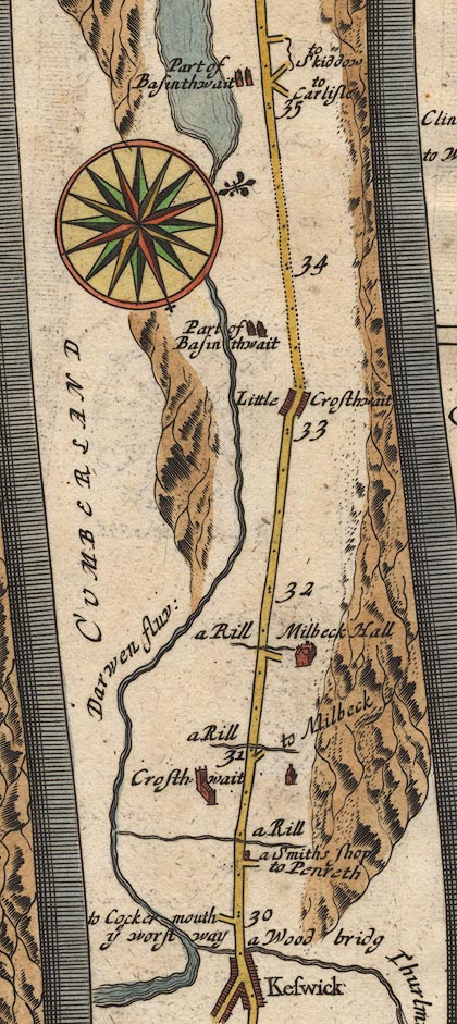 OG96m030.jpg In mile 30, Cumberland. Turning right:- "to Penreth" item:- JandMN : 22 Image © see bottom of page |
||||||||||||||||||||||
|
|
|||||||||||||||||||||||
| evidence:- | old map:- Jefferys 1770 (Wmd) |
||||||||||||||||||||||
| source data:- | Map, 4 sheets, The County of Westmoreland, scale 1 inch to 1
mile, surveyed 1768, and engraved and published by Thomas
Jefferys, London, 1770. J5NY42NE.jpg "From Keswick"  J5NY52NW.jpg double line; road; bold, main road item:- National Library of Scotland : EME.s.47 Images © National Library of Scotland |
||||||||||||||||||||||
|
|
|||||||||||||||||||||||
| evidence:- | old map:- Donald 1774 (Cmd) |
||||||||||||||||||||||
| source data:- | Map, hand coloured engraving, 3x2 sheets, The County of Cumberland, scale about 1
inch to 1 mile, by Thomas Donald, engraved and published by Joseph Hodskinson, 29
Arundel Street, Strand, London, 1774. double line, solid or dotted, with a dot or milestone and number at 1 mile intervals, tinted red; turnpike road  D4NY22SE.jpg  D4NY32SW.jpg 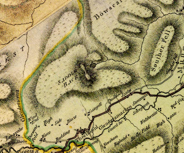 D4NY32NW.jpg 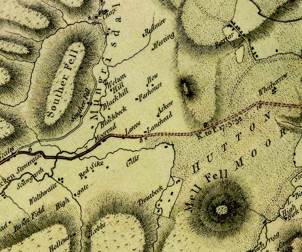 D4NY32NE.jpg "K. to P. 17:5:32" miles.furlongs.poles; Keswick to Penrith 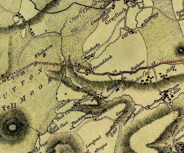 D4NY42NW.jpg 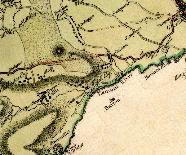 D4NY42NE.jpg 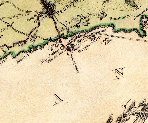 D4NY52NW.jpg item:- Carlisle Library : Map 2 Images © Carlisle Library |
||||||||||||||||||||||
|
|
|||||||||||||||||||||||
| evidence:- | descriptive text:- West 1778 (11th edn 1821) |
||||||||||||||||||||||
| source data:- | Guide book, A Guide to the Lakes, by Thomas West, published by
William Pennington, Kendal, Cumbria once Westmorland, and in
London, 1778 to 1821. goto source Page 144:- "From Keswick to Penrith, seventeen miles, of very good road, through an open wild country." "..." goto sourcePage 151:- "..." "Those that do not choose to go as far as Penrith, may, near the eighth mile-post [from Keswick]," goto sourcePage 152:- "turn off to the right (leaving Mell-fell, a round green hill, on the left) to Matterdale, and proceed to Gowbarrow-park, which will bring them upon Ulls-water," goto sourceAddendum; Mr Gray's Journal, 1769 Page 202:- "..." "Oct. 2. I set out at ten for Keswick, by the road we went in 1767; say (sic) Greystock town and castle to the right, which lie about three miles from Ulls-water over the fells; passed through Penruddock and Threlkeld at the foot of Saddleback, whose furrowed sides were gilt by the noon-day sun, whilst its brow appeared of a sad purple, from the shadow of the clouds as they sailed slowly by it. The broad and green vallies of Gardies and Lowside, with a swift stream glittering among the cottages and meadows, lay to the left, and the much finer, but narrower valley of St. John, opening into it: Hill-top, the large, though low mansion of the Gasgarth's, now a farm-house, seated on an eminence among the woods, under a steep fell, was what appeared the most conspicuous, and beside it a great rock, like some ancient tower nodding to its fall. Passed by the side of Skiddaw and its cub, called Latrigg; and saw from an eminence at two miles distance, the vale of Elysium in all its verdure; the sun then playing on the bosom of the lake, and lighting up all the mountains with its lustre. Dined by two o'clock at the Queen's-head, ..." |
||||||||||||||||||||||
|
|
|||||||||||||||||||||||
| evidence:- | old map:- Clarke 1787 map (Der) placename:- |
||||||||||||||||||||||
| source data:- | Map, uncoloured engraving, Map of Derwentwater and its Environs,
scale about 13 ins to 1 mile, by James Clarke, engraved by S J
Neele, published by James Clarke, Penrith, Cumberland and in
London etc, 1787.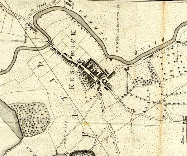 CL152623.jpg road item:- private collection : 169 Image © see bottom of page |
||||||||||||||||||||||
|
|
|||||||||||||||||||||||
| evidence:- | road map:- Cary 1790 (Cmd/edn 1789) |
||||||||||||||||||||||
| source data:- | Road map, hand coloured engraving, Cumberland, scale about 15
miles to 1 inch, by John Cary, 181 Strand, London, 1790, edn
1789.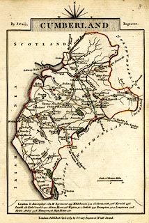 click to enlarge click to enlargeCY47.jpg double line item:- JandMN : 419 Image © see bottom of page |
||||||||||||||||||||||
|
|
|||||||||||||||||||||||
| evidence:- | road book:- Cary 1798 (2nd edn 1802) |
||||||||||||||||||||||
| source data:- | Road book, itineraries, Cary's New Itinerary, by John Cary, 181
Strand, London, 2nd edn 1802. goto source click to enlarge click to enlargeC38267.jpg page 267-268 "At Penrith, on l. a T.R. to Keswick." goto source click to enlarge click to enlargeC38281.jpg page 281-282 "Penrith ... On l. a T.R. to Keswick." goto source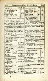 click to enlarge click to enlargeC38317.jpg page 317-318 "At Keswick, on r. a T.R. to Penrith" item:- JandMN : 228.1 Image © see bottom of page |
||||||||||||||||||||||
|
|
|||||||||||||||||||||||
| evidence:- | road book:- Cary 1798 (2nd edn 1802) |
||||||||||||||||||||||
| source data:- | Road book, itineraries, Cary's New Itinerary, by John Cary, 181
Strand, London, 2nd edn 1802. goto source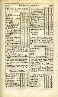 click to enlarge click to enlargeC38733.jpg page 733-734 "PENRITH to Keswick." item:- JandMN : 228.2 Image © see bottom of page |
||||||||||||||||||||||
|
|
|||||||||||||||||||||||
| evidence:- | old map:- Cooke 1802 |
||||||||||||||||||||||
| source data:- | Map, Cumberland, scale about 15.5 miles to 1 inch, by George
Cooke, 1802, bound in Gray's New Book of Roads, 1824, published
by Sherwood, Jones and Co, Paternoster Road, London, 1824. click to enlarge click to enlargeGRA1Cd.jpg double line, light dark solid; road AND double line, light dark dotted; unfenced road item:- Hampshire Museums : FA2000.62.2 Image © see bottom of page |
||||||||||||||||||||||
|
|
|||||||||||||||||||||||
| evidence:- | old map:- Laurie and Whittle 1806 |
||||||||||||||||||||||
| source data:- | Road map, Completion of the Roads to the Lakes, scale about 10
miles to 1 inch, by Nathaniel Coltman? 1806, published by Robert
H Laurie, 53 Fleet Street, London, 1834. click to enlarge click to enlargeLw18.jpg "Keswick to Penrith 17½" dotted line; 'Cross Roads' item:- private collection : 18.18 Image © see bottom of page |
||||||||||||||||||||||
|
|
|||||||||||||||||||||||
| evidence:- | old map:- Cooper 1808 |
||||||||||||||||||||||
| source data:- | Map, uncoloured engraving, Cumberland, scale about 10.5 miles to
1 inch, drawn and engraved by Cooper, published by R Phillips,
Bridge Street, Blackfriars, London, 1808. click to enlarge click to enlargeCOP3.jpg double line; road item:- JandMN : 86 Image © see bottom of page |
||||||||||||||||||||||
|
|
|||||||||||||||||||||||
| evidence:- | old map:- Wallis 1810 (Cmd) |
||||||||||||||||||||||
| source data:- | Road map, hand coloured engraving, Cumberland, scale about 16
miles to 1 inch, by James Wallis, 77 Berwick Stree, Soho,
London, 1810. click to enlarge click to enlargeWL13.jpg double line, light bold; 'Turnpike Road' item:- Dove Cottage : 2009.81.10 Image © see bottom of page |
||||||||||||||||||||||
|
|
|||||||||||||||||||||||
| evidence:- | old map:- Hall 1820 (Cmd) |
||||||||||||||||||||||
| source data:- | Map, hand coloured engraving, Cumberland, scale about 21 miles
to 1 inch, engraved by Sidney Hall, published by S Leigh, 18
Strand, London, 1820-31. click to enlarge click to enlargeHA14.jpg single line, solid; minor road; Penrith, Penruddock, Scales, Threskeld, Keswick item:- JandMN : 91 Image © see bottom of page |
||||||||||||||||||||||
|
|
|||||||||||||||||||||||
| evidence:- | notice:- |
||||||||||||||||||||||
| source data:- | "To Road Makes AND LABOURERS. / THE TRUSTEES OF THE PENRITH AND KESWICK TURNPIKE ROADS,
/ Will receive Proposals in Writing, at the New Crown Inn, PENRITH, On TUESDAY, 29th
of NOVEMBER next, AT 12 O'CLOCK AT NOON, / For repairing and keeping in repair for
12 Months, from 1st day of January next, 1837, of part of the Turnpike Road leading
from Penrith to Keswick." "LOT 1. - From the Toll Gate to the second Milestone, 300 yards of hard cobble and quarry Stones, broken sufficiently small for Road Making, and laid on wherever the Surveyor may direct. Also to clean and open all Watercourses and Conduits at proper seasons, to scrape the Road, and pick off all loose Stones when requisite, and to do every other matter and thing connected with keeping the Road in a proper state. To find all Labour Tools, except Barrows, and to impound all Cattle found straying upon the Road." "LOT 2. - From the second Milestone to the fifth, 80 yards of hard cobble and quarry Stones. (Conditions as above.)" "LOT 3. - From the fifth Milestone to the ninth, 100 yards of hard cobble and quarry Stones. (Conditions as above.)" "LOT 4. - From the ninth Milestone to the twelfth, 80 yards of hard cobble and quarry Stones. (Conditions as above.)" "LOT 5. - From the twelfth Milestone to Threlkeld Chapel. 30 yards of hard cobble and quarry Stones. (Conditions as above.)" "Conditions will be produced at the time of Letting, and particulars may, in the interim, be known on application to G. WATSON, surveyor, Keswick." "N.B. The Trustees will not pledge themselves to take the lowest offer." "Penrith, Nov. 1, 1836." "J. BROWN, PRINTER, PENRITH." |
||||||||||||||||||||||
|
|
|||||||||||||||||||||||
| evidence:- | descriptive text:- Ford 1839 (3rd edn 1843) |
||||||||||||||||||||||
| source data:- | Guide book, A Description of Scenery in the Lake District, by
Rev William Ford, published by Charles Thurnam, Carlisle, by W
Edwards, 12 Ave Maria Lane, Charles Tilt, Fleet Street, William
Smith, 113 Fleet Street, London, by Currie and Bowman,
Newcastle, by Bancks and Co, Manchester, by Oliver and Boyd,
Edinburgh, and by Sinclair, Dumfries, 1839. goto source Page 174:- "XVII. KESWICK TO PENRITH.- 17½M."
|
||||||||||||||||||||||
|
|
|||||||||||||||||||||||
| evidence:- | old map:- Ford 1839 map |
||||||||||||||||||||||
| source data:- | Map, uncoloured engraving, Map of the Lake District of
Cumberland, Westmoreland and Lancashire, scale about 3.5 miles
to 1 inch, published by Charles Thurnam, Carlisle, and by R
Groombridge, 5 Paternoster Row, London, 3rd edn 1843.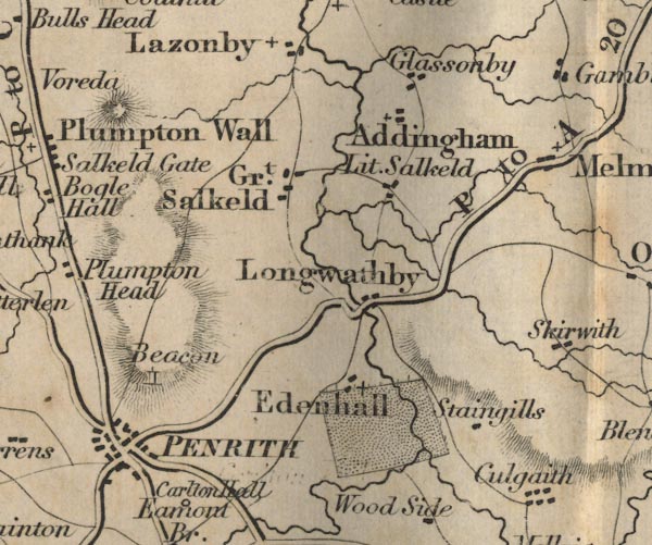 FD02NY53.jpg 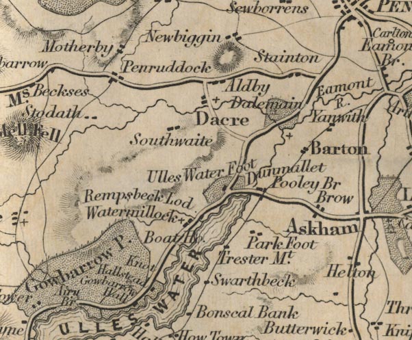 FD02NY42.jpg 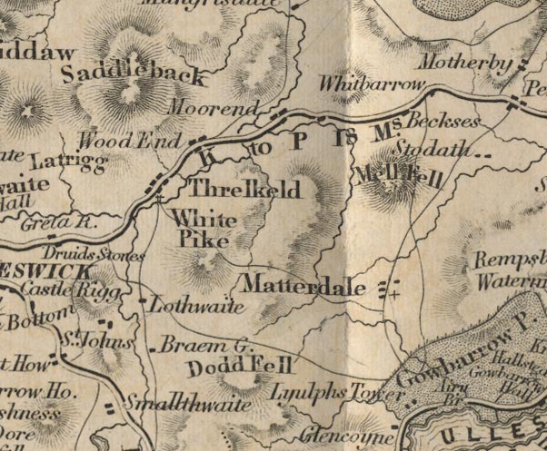 FD02NY32.jpg "K to P 18 Ms." 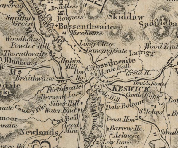 FD02NY22.jpg item:- JandMN : 100.1 Image © see bottom of page |
||||||||||||||||||||||
|
|
|||||||||||||||||||||||
| evidence:- | gradient diagram:- Gall and Inglis 1890s-1900s (Roads) |
||||||||||||||||||||||
| source data:- | Contour Road Book of England, Northern Division, by Harry R G Inglis, published by
Gall and Inglis, 25 Paternoster Square, London and Edinburgh, 1898.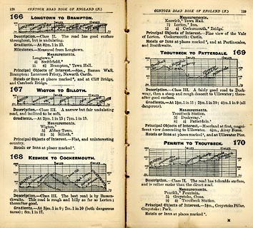 click to enlarge click to enlargeIG5166.jpg Itinerary, with gradient diagram, routes 166, Longtown to Brampton, 167, Wigton to Silloth, 168, Keswick to Cockermouth, 169, Troutbeck to Patterdale, and 170, Penrith to Troutbeck, Cumberland, 1898. item:- JandMN : 763.11 Image © see bottom of page |
||||||||||||||||||||||
|
|
|||||||||||||||||||||||
| evidence:- | gradient diagram:- Gall and Inglis 1890s-1900s (Roads) |
||||||||||||||||||||||
| source data:- | Contour Road Book of England, Northern Division, by Harry R G Inglis, published by
Gall and Inglis, 25 Paternoster Square, London and Edinburgh, 1898.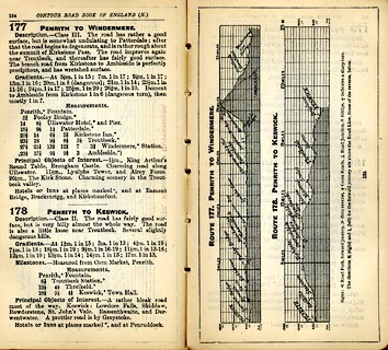 click to enlarge click to enlargeIG5177.jpg Itinerary, with gradient diagram, route 177, Penrith to Windermere, and route 178, Penrith to Keswick, Westmorland and Cumberland, 1898. item:- JandMN : 763.14 Image © see bottom of page |
||||||||||||||||||||||
|
|
|||||||||||||||||||||||
| evidence:- | old map:- Bell 1892 |
||||||||||||||||||||||
| source data:- | Map, colour lithograph, Road Map of Cumberland, by George Joseph
Bell, scale about 2.5 miles to 1 inch, printed by Charles
Thurnam and Sons, Carlisle, Cumberland, 1892.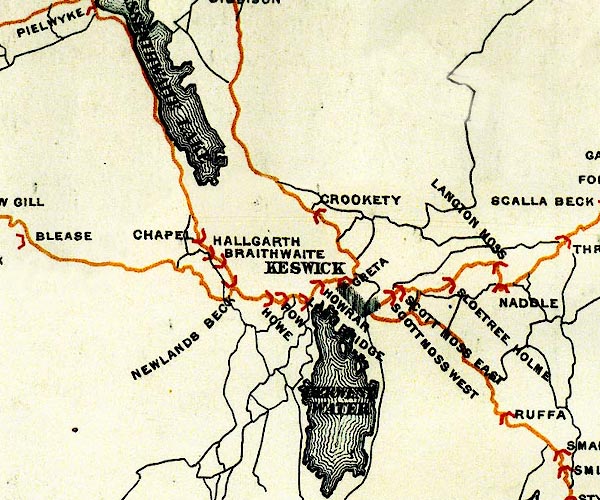 BEL9NY22.jpg 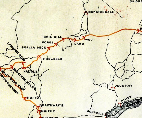 BEL9NY32.jpg 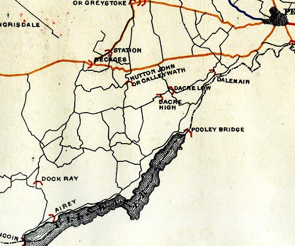 BEL9NY42.jpg 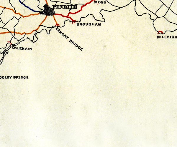 BEL9NY52.jpg orange - disturnpiked 'main road' under section 13 of the Highways Act 1878 since 1 September 1883 Road map of Cumberland showing County Bridges item:- Carlisle Library : Map 38 Images © Carlisle Library |
||||||||||||||||||||||
|
|
|||||||||||||||||||||||
| evidence:- | old print:- Bradley 1901 |
||||||||||||||||||||||
| source data:- | Print, uncoloured lithograph, The Road, Keswick, to Penrith, Cumberland, by Joseph
Pennell, published by Macmillan and Co, London, 1901.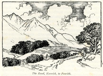 click to enlarge click to enlargeBRL112.jpg On page 74 of Highways and Byways in the Lake District, by A G Bradley. printed at bottom:- "The Road, Keswick, to Penrith." item:- JandMN : 464.12 Image © see bottom of page |
||||||||||||||||||||||
|
|
|||||||||||||||||||||||
| evidence:- | old print:- Bradley 1901 |
||||||||||||||||||||||
| source data:- | Print, uncoloured lithograph, Road to Keswick, Cumberland, by Joseph Pennell, published
by Macmillan and Co, London, 1901.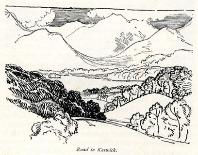 click to enlarge click to enlargeBRL168.jpg On page 261 of Highways and Byways in the Lake District, by A G Bradley. printed at bottom:- "Road to Keswick." item:- JandMN : 464.68 Image © see bottom of page |
||||||||||||||||||||||
|
|
|||||||||||||||||||||||
| evidence:- | old text:- Harper 1907 item:- mail coach |
||||||||||||||||||||||
| source data:- | Guidebook, The Manchester and Glasgow Road, by Charles G Harper,
published by Chapman and Hall Ltd, London, 1907. HP01p108.txt Page 108:- "..." "Parson Bird was also said to be "well up to his work," [as an amateur coachman] and was so good-hearted a fellow that when the regular coachman from Keswick to Kendal broke his leg, he took his place for six weeks, and collected the fees for him. A story is told of a lady giving the parson-coachman half-a-crown at the end of the journey one afternoon, and being introduced to him at a ball the same evening at Kendal. He at once asked for a dance, but she was highly indignant that a coachman should so presume. However, the matter was explained, and to such satisfaction that not only did she dance, but eventually became Mrs. Bird." |
||||||||||||||||||||||
|
|
|||||||||||||||||||||||
| evidence:- | gradient diagram:- Watson 1912 |
||||||||||||||||||||||
| source data:- | Gradient diagram, black and white halftone, roads from Keswick, Cumberland, in a guide
book, Keswick on Derwentwater, published by George Watson, after 1913.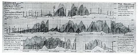 click to enlarge click to enlargeWT4Gd.jpg item:- Keswick Museum : 2145.5 Image © see bottom of page |
||||||||||||||||||||||
|
|
|||||||||||||||||||||||
 Act of Parliament Act of Parliament |
|||||||||||||||||||||||
|
|
|||||||||||||||||||||||
| evidence:- | old strip map:- Rumney 1899 |
||||||||||||||||||||||
| source data:- | Road map, strip map, gradient diagram, and itinerary for Route XIII, The Ullswater
Round from Keswick, Cumberland and Westmorland, scale about 2 miles to 1 inch, by
A W Rumney, published by George Philip and Son, 32 Fleet Street, London, and Liverpool,
1899.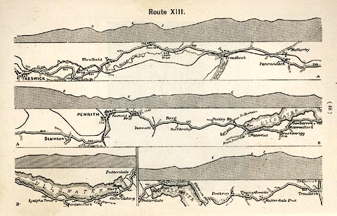 click to enlarge click to enlargeRUM116.jpg On p.48 of the Cyclist's Guide to the English Lake District, by A W Rumney. printed at top:- "Route XIII." item:- JandMN : 147.17 Image © see bottom of page |
||||||||||||||||||||||
|
|
|||||||||||||||||||||||
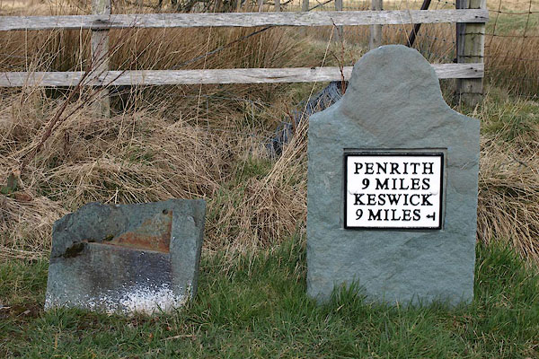
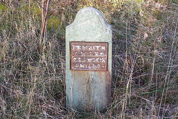
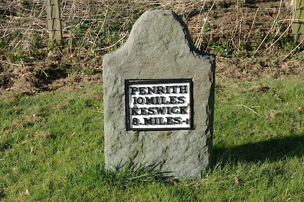
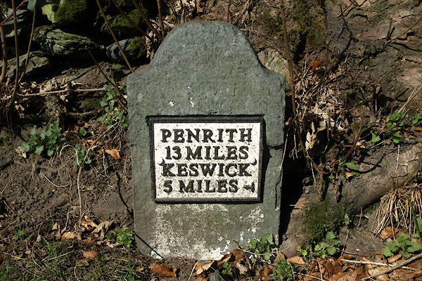
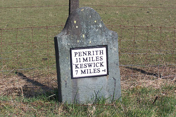
| places:- | Penrith Stainton Penruddock Scales, Threlkeld Threlkeld Keswick |
||||||||||||||||||||||
|
|
|||||||||||||||||||||||
| places:- |
|
||||||||||||||||||||||
|
|||||||||||||||||||||||
|
|||||||||||||||||||||||
|
|||||||||||||||||||||||
|
|||||||||||||||||||||||
|
|||||||||||||||||||||||
|
|||||||||||||||||||||||
|
|||||||||||||||||||||||
|
|||||||||||||||||||||||
|
|||||||||||||||||||||||
|
|||||||||||||||||||||||
|
|||||||||||||||||||||||
|
|||||||||||||||||||||||
|
|||||||||||||||||||||||
|
|||||||||||||||||||||||
|
|||||||||||||||||||||||
|
|||||||||||||||||||||||
|
|||||||||||||||||||||||
|
|||||||||||||||||||||||
|
|||||||||||||||||||||||
Lakes Guides menu.