Old Cumbria Gazetteer
 |
 |
|
||
| Brathay, River | ||||
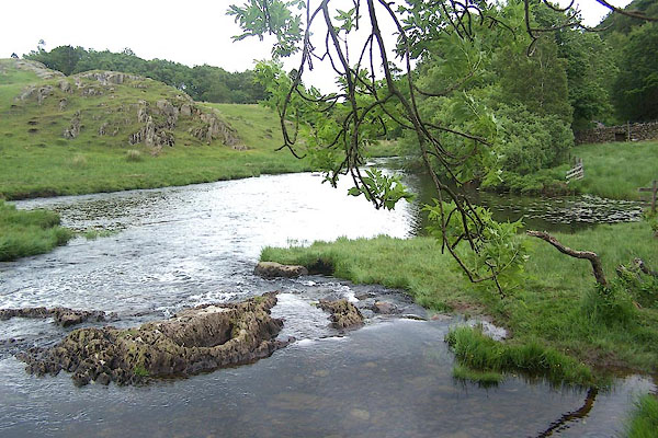
| runs into:- |  Little Langdale Tarn, Little Langdale Elter Water Windermere lake Little Langdale Tarn, Little Langdale Elter Water Windermere lake |
|||
|
|
||||
| civil parish:- | Skelwith (formerly Lancashire) | |||
| civil parish:- | Lakes (formerly Westmorland) | |||
| civil parish:- | Coniston (formerly Lancashire) | |||
| county:- | Cumbria | |||
| locality type:- | river | |||
| 1Km square:- | NY3503 | |||
| 1Km square:- | NY3303 | |||
| 10Km square:- | NY30 | |||
|
|
||||
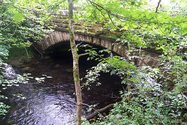
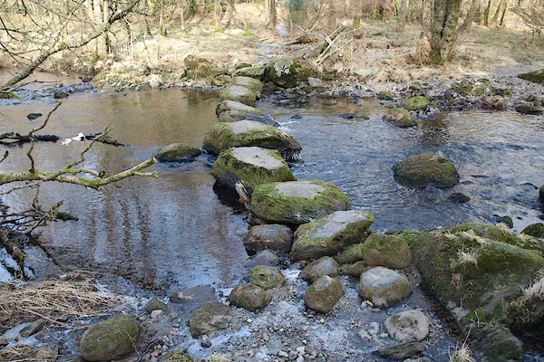
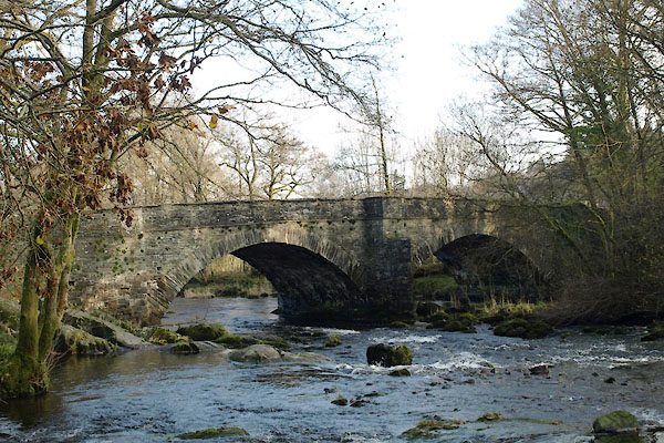
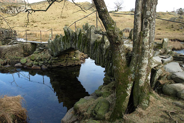
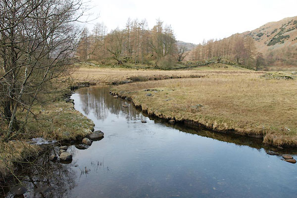
 BMH01.jpg At Slater Bridge. (taken 23.6.2006) 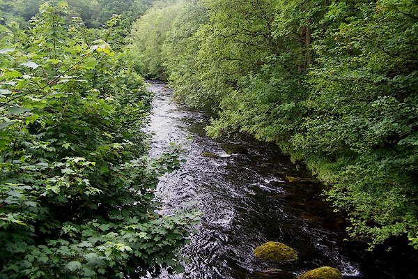 BMG91.jpg At Colwith Bridge. (taken 23.6.2006) |
||||
|
|
||||
| evidence:- | old map:- OS County Series (Wmd 25 11) placename:- Brathay, River |
|||
| source data:- | Maps, County Series maps of Great Britain, scales 6 and 25
inches to 1 mile, published by the Ordnance Survey, Southampton,
Hampshire, from about 1863 to 1948. OS County Series (Wmd 26 9) OS County Series (Wmd 26 10) OS County Series (Lan 1 8) "River Brathay" |
|||
|
|
||||
| evidence:- | old map:- Saxton 1579 |
|||
| source data:- | Map, hand coloured engraving, Westmorlandiae et Cumberlandiae Comitatus ie Westmorland
and Cumberland, scale about 5 miles to 1 inch, by Christopher Saxton, London, engraved
by Augustinus Ryther, 1576, published 1579-1645.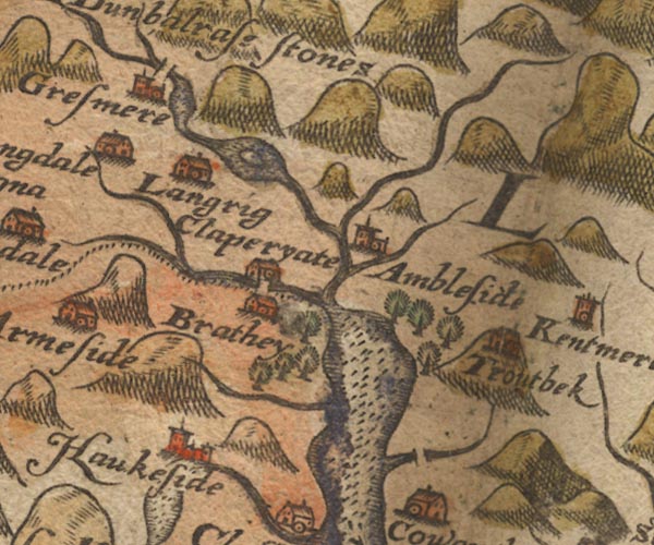 Sax9NY30.jpg County boundary. item:- private collection : 2 Image © see bottom of page |
|||
|
|
||||
| evidence:- | old map:- Mercator 1595 (edn?) placename:- |
|||
| source data:- | Map, hand coloured engraving, Westmorlandia, Lancastria, Cestria
etc, ie Westmorland, Lancashire, Cheshire etc, scale about 10.5
miles to 1 inch, by Gerard Mercator, Duisberg, Germany, 1595,
edition 1613-16. MER5WmdA.jpg "" double line with stream lines; river, running into Windermere lake, county boundary with Lancashire item:- Armitt Library : 2008.14.3 Image © see bottom of page |
|||
|
|
||||
| evidence:- | old map:- Speed 1611 (Wmd) |
|||
| source data:- | Map, hand coloured engraving, The Countie Westmorland and
Kendale the Cheif Towne, scale about 2.5 miles to 1 inch, by
John Speed, 1610, published by George Humble, Popes Head Alley,
London, 1611-12.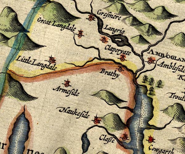 SP14NY30.jpg double line, into Windermere; county boundary item:- Armitt Library : 2008.14.5 Image © see bottom of page |
|||
|
|
||||
| evidence:- | old map:- Jansson 1646 |
|||
| source data:- | Map, hand coloured engraving, Cumbria and Westmoria, ie
Cumberland and Westmorland, scale about 3.5 miles to 1 inch, by
John Jansson, Amsterdam, Netherlands, 1646.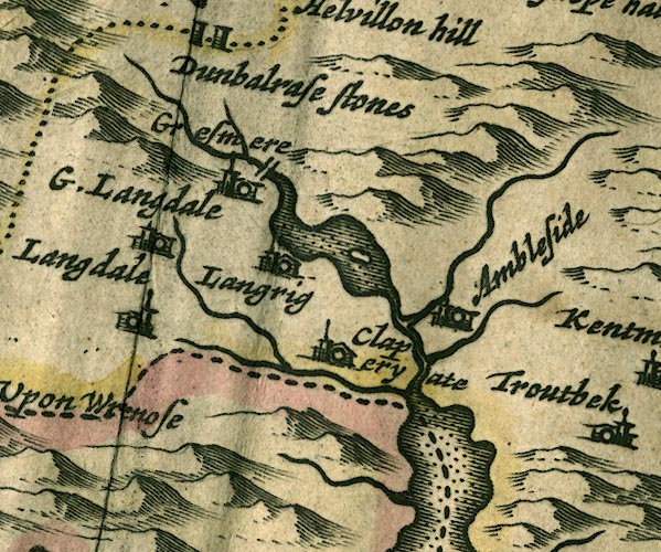 JAN3NY30.jpg Single wiggly line; county boundary. item:- JandMN : 88 Image © see bottom of page |
|||
|
|
||||
| evidence:- | old map:- Ogilby 1675 (plate 96) |
|||
| source data:- | Road strip map, hand coloured engraving, the Road from Kendal to
Cockermouth, and the Road from Egremond to Carlisle, scale about
1 inch to 1 mile, by John Ogilby, London, 1675.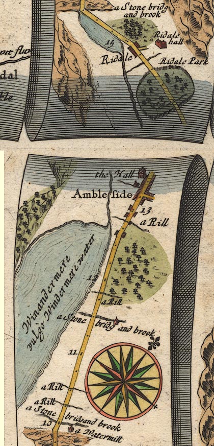 OG96m010.jpg In mile 13, Westmoreland. River alongside off the left of the road, running into lake Windermere. item:- JandMN : 22 Image © see bottom of page |
|||
|
|
||||
| evidence:- | old map:- Sanson 1679 |
|||
| source data:- | Map, hand coloured engraving, Ancien Royaume de Northumberland
aujourdhuy Provinces de Nort, ie the Ancient Kingdom of
Northumberland or the Northern Provinces, scale about 9.5 miles
to 1 inch, by Nicholas Sanson, Paris, France, 1679. click to enlarge click to enlargeSAN2Cm.jpg tapering wiggly line; river, county boundary item:- Dove Cottage : 2007.38.15 Image © see bottom of page |
|||
|
|
||||
| evidence:- | old map:- Seller 1694 (Wmd) |
|||
| source data:- | Map, hand coloured engraving, Westmorland, scale about 8 miles
to 1 inch, by John Seller, 1694. click to enlarge click to enlargeSEL7.jpg tapering wiggly line; river; county boundary item:- Dove Cottage : 2007.38.87 Image © see bottom of page |
|||
|
|
||||
| evidence:- | old map:- Morden 1695 (Wmd) placename:- Brathey River |
|||
| source data:- | Map, hand coloured engraving, Westmorland, scale about 2.5 miles to 1 inch, by Robert
Morden, published by Abel Swale, the Unicorn, St Paul's Churchyard, Awnsham, and John
Churchill, the Black Swan, Paternoster Row, London, 1695.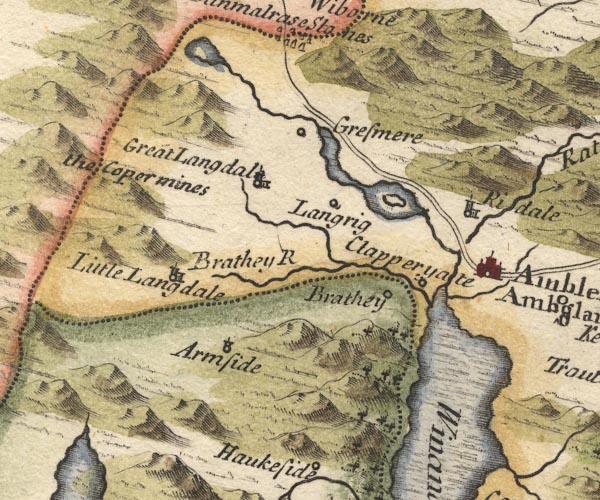 MD10NY30.jpg "Brathey R" item:- JandMN : 24 Image © see bottom of page |
|||
|
|
||||
| evidence:- | old map:- Badeslade 1742 placename:- |
|||
| source data:- | Map, uncoloured engraving, A Map of Westmorland North from
London, scale about 10 miles to 1 inch, with descriptive text,
by Thomas Badeslade, London, engraved and published by William
Henry Toms, Union Court, Holborn, London, 1742. click to enlarge click to enlargeBD12.jpg "" tapering wiggly line; county boundary item:- Dove Cottage : 2007.38.62 Image © see bottom of page |
|||
|
|
||||
| evidence:- | old map:- Simpson 1746 map (Wmd) placename:- Brathy River |
|||
| source data:- | Map, uncoloured engraving, Westmorland, scale about 8 miles to 1
inch, printed by R Walker, Fleet Lane, London, 1746. SMP2NYF.jpg "Brathy R." Wiggly line; shown as the county boundary with Lancashire. item:- Dove Cottage : 2007.38.59 Image © see bottom of page |
|||
|
|
||||
| evidence:- | old map:- Bowen and Kitchin 1760 placename:- Brathy River |
|||
| source data:- | Map, hand coloured engraving, A New Map of the Counties of
Cumberland and Westmoreland Divided into their Respective Wards,
scale about 4 miles to 1 inch, by Emanuel Bowen and Thomas
Kitchin et al, published by T Bowles, Robert Sayer, and John
Bowles, London, 1760. BO18SD29.jpg "Brathy R." wiggly line, into Windermere, county boundary Westmorland Lancashire item:- Armitt Library : 2008.14.10 Image © see bottom of page |
|||
|
|
||||
| evidence:- | old map:- Jefferys 1770 (Wmd) |
|||
| source data:- | Map, 4 sheets, The County of Westmoreland, scale 1 inch to 1
mile, surveyed 1768, and engraved and published by Thomas
Jefferys, London, 1770.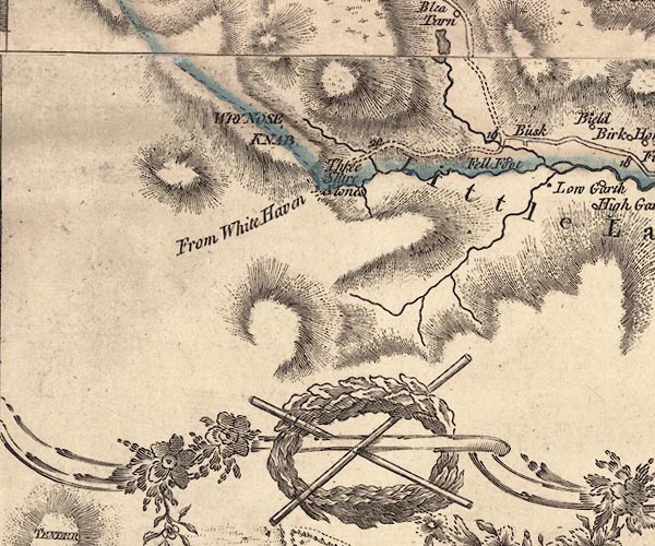 J5NY20SE.jpg 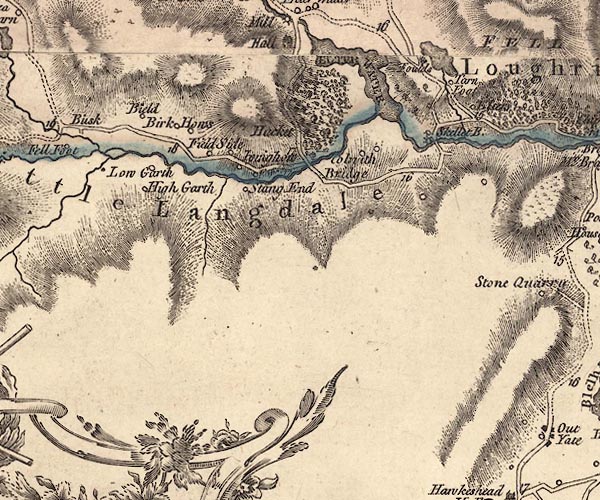 J5NY30SW.jpg 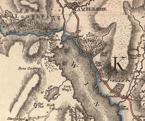 J5NY30SE.jpg single or double wiggly line; river; county boundary item:- National Library of Scotland : EME.s.47 Images © National Library of Scotland |
|||
|
|
||||
| evidence:- | descriptive text:- West 1778 (11th edn 1821) |
|||
| source data:- | Guide book, A Guide to the Lakes, by Thomas West, published by
William Pennington, Kendal, Cumbria once Westmorland, and in
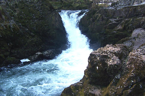
London, 1778 to 1821. goto source Page 72:- "..." "The principal feeders of Windermere-water, are the rivers Rothay and Brathay.- They unite their streams at the western corner of the head of the lake, below Clappersgate, at a place called the Three-foot-brander, and after a short course boldly enter the lake." goto sourceRev Plumtre's Night Piece on Windermere, 1797 Page 229:- "..." "Hark! along his rocky shore, / I hear impetuous Brathay roar; / In sullen majesty he leads, / Among the narrow winding meads, / His tributary tides. / Thee, Rothay, in thy course he meets, / Descending from thy flow'ry bed, / Swift to thee he fondly glides, / With strong embrace thy beauty greets: /" goto sourcePage 230:- "Then, with all your glittering train, / Together your proud course maintain, / And with imperial Windermere, / All your boastful honours share; / With loud acclaim, exulting, hail! / The monarch of the stately vale." "Say, Brathay, as I walk your side, / List'ning to your murmuring tide, / What sights, what wonders have you seen, / Passing your barrier hills between? / View'd you old Langdale's solid towers, / And Elter-water's peaceful bowers; / Where the quarry's yawning scar / Hangs hideous in the midnight air! / Or, rather higher Langdale's rocks, / Hardknot and his mountain twin, / At whose rude base your streams begin, / Where the widely-straying floods, / And the fragrant smelling kine, / Their ample wealth combine, / And to their happy peasant's board, / A frugal, friendly meal afford; / Bestowing health and calm content, / The greatest blessing heaven has lent: / I heard you rattling through the wood, / and pass by Colwith's foaming flood; / His loose, dishevel'd, hoary head, / Affrighted, seeks a calmer bed, / Tumbling, from rock to rock, his course, / With wild majestic, sullen force; /" goto sourcePage 231:- "Till to his sister's [1] arms he flies, / And, wide-expanded to the skies, / On oozy bed supinely lies.- / Again behold him raise his head, / As if awaken'd from the dead, / Plumb down the rock of Skelwith dash, / With hoarse reverberated crash; / And, boist'rous boiling from below, / Again across the peaceful meadows flow." "So the lorn maniac, in his moods, / Sullen o'er his sorrows broods; / With unaverted eye, he strays / Along the lonely desert ways, / With solemn, measur'd, thoughtful pace, / Despair depicted in his face: / Then starts, and with a stedfast gaze, / Replete with horror and amaze, / From rock to rock, from steep to steep, / Reckless he takes the dangerous leap; / Then scours along the level plain / Till, all his strength exhaust again, / He sinks upon the earth's cold breast, / Toil-worn, to take his broken rest." "..." "[1] The river Brathay is formed chiefly from two steams,- the one rising in Little Langdale, the other in Great Langdale, where it passes the Pikes and the slate quarry: these join in the small lake of Elter-water. Another of its feeders is the stream from Loughrigg Tarn, a very small but beautiful lake, in the bosom of the mountains, a little to the right of the road as you cross over from Elter-water, or Skelwith-bridge, to Grasmere. /" goto sourcePage 232:- "..." "O Rothay! yours, and Brathay's stream, / Enfold (Well worth the Muse's theme) / A spot where Art with Nature vies / To catch the enraptur'd poet's eyes. / But be it most his pride to tell, / There Elegance and Virtue dwell; / There Hospitality is found / Dealing delight to all around, /" goto sourcePage 233:- "With innocence the hour beguiles, / And joys to see another's smiles." "..." |
|||
|
|
||||
| evidence:- | old map:- Crosthwaite 1783-94 (Win/Ble) placename:- Brathay River |
|||
| source data:- | Map, uncoloured engraving, An Accurate Map of the Grand Lake of
Windermere, scale about 2 inches to 1 mile, by Peter
Crosthwaite, Keswick, Cumberland, 1783, version published 1819.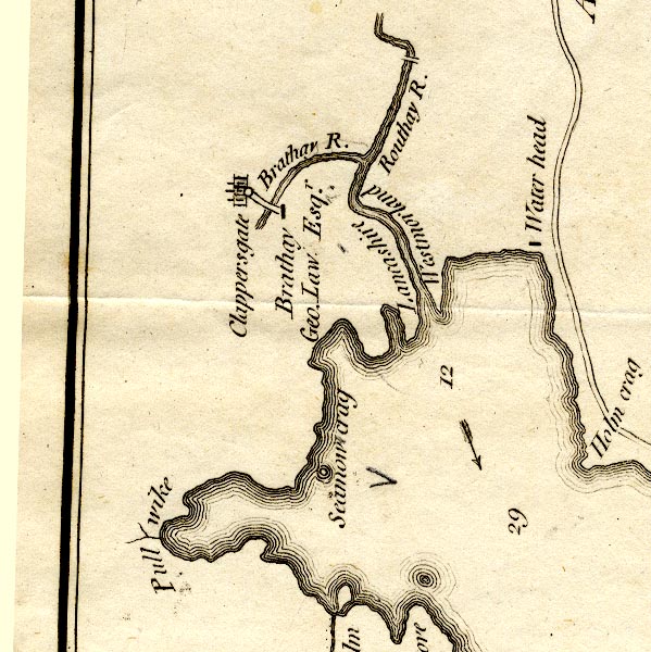 CT9NY30R.jpg "Brathay R." item:- Armitt Library : 2008.14.102 Image © see bottom of page |
|||
|
|
||||
| evidence:- | old map:- West 1784 map |
|||
| source data:- | Map, hand coloured engraving, A Map of the Lakes in Cumberland,
Westmorland and Lancashire, scale about 3.5 miles to 1 inch,
engraved by Paas, 53 Holborn, London, about 1784. Ws02NY20.jpg  Ws02NY30.jpg The county boundary. item:- Armitt Library : A1221.1 Image © see bottom of page |
|||
|
|
||||
| evidence:- | old map:- Clarke 1787 map (Windermere N) |
|||
| source data:- | Map, A Map of the Northern Part of the Lake Winandermere and its
Environs, scale about 6.5 ins to 1 mile, by James Clarke,
engraved by Samuel John Neele, 352 Strand, published by James
Clarke, Penrith, Cumberland and in London etc, 1787. CLANY30R.jpg The county boundary. item:- private collection : 10.10 Image © see bottom of page |
|||
|
|
||||
| evidence:- | old text:- Camden 1789 (Gough Additions) placename:- Brathey, River item:- char; case char |
|||
| source data:- | Book, Britannia, or A Chorographical Description of the Flourishing Kingdoms of England,
Scotland, and Ireland, by William Camden, 1586, translated from the 1607 Latin edition
by Richard Gough, published London, 1789. goto source Page 154:- "..." "Out of this lake there yearly passes up the river Routhey many very large trouts, and up the river Brathey great store of case, which are like char, but spawn at another season of the year. And although these two rivers do run a good way together in one channel before they disembogue into Windermere water, they are both very clear and bottomed alike, yet scarce ever any trouts are found in Brathey, or case in Rowthey. Some few salmon also, at the spawning season, come from the sea through the lake and up the river Rowthey, but none ever up the Brathey." |
|||
|
|
||||
| evidence:- | old map:- Cary 1789 (edn 1805) |
|||
| source data:- | Map, uncoloured engraving, Westmoreland, scale about 2.5 miles
to 1 inch, by John Cary, London, 1789; edition 1805. CY24NY20.jpg river; county boundary 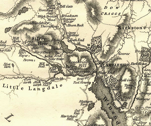 CY24NY30.jpg river running into Windermere item:- JandMN : 129 Image © see bottom of page |
|||
|
|
||||
| evidence:- | old drawing:- Green 1790s-1820s |
|||
| source data:- | Drawing, pen and wash, Confluence of the Rivers Rothay and Brathay, Westmorland, by
William Green, Ambleside, Westmorland, 1810.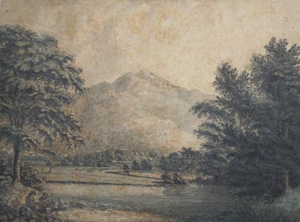 click to enlarge click to enlargePR1728.jpg courtesy of Abbot Hall Art Gallery, Kendal item:- Abbot Hall : AH334.63 Image © see bottom of page |
|||
|
|
||||
| evidence:- | old map:- Cooke 1802 |
|||
| source data:- | Map, The Lakes, Westmorland and Cumberland, scale about 8.5
miles to 1 inch, engravedby Neele and Son, published by
Sherwood, Jones and Co, Paternoster Road, London, 1824. click to enlarge click to enlargeGRA1Lk.jpg tapering wiggly line; river item:- Hampshire Museums : FA2000.62.5 Image © see bottom of page |
|||
|
|
||||
| evidence:- | old map:- Laurie and Whittle 1806 placename:- Brathay River |
|||
| source data:- | Road map, Completion of the Roads to the Lakes, scale about 10
miles to 1 inch, by Nathaniel Coltman? 1806, published by Robert
H Laurie, 53 Fleet Street, London, 1834. click to enlarge click to enlargeLw18.jpg "Brathay R." river; on county boundary item:- private collection : 18.18 Image © see bottom of page |
|||
|
|
||||
| evidence:- | old map:- Cooper 1808 |
|||
| source data:- | Map, hand coloured engraving, Westmoreland ie Westmorland, scale
about 9 miles to 1 inch, by H Cooper, 1808, published by R
Phillips, Bridge Street, Blackfriars, London, 1808. click to enlarge click to enlargeCOP4.jpg tapering wiggly line; river; county boundary item:- Dove Cottage : 2007.38.53 Image © see bottom of page |
|||
|
|
||||
| evidence:- | old map:- Otley 1818 |
|||
| source data:- | Map, uncoloured engraving, The District of the Lakes,
Cumberland, Westmorland, and Lancashire, scale about 4 miles to
1 inch, by Jonathan Otley, 1818, engraved by J and G Menzies,
Edinburgh, Scotland, published by Jonathan Otley, Keswick,
Cumberland, et al, 1833.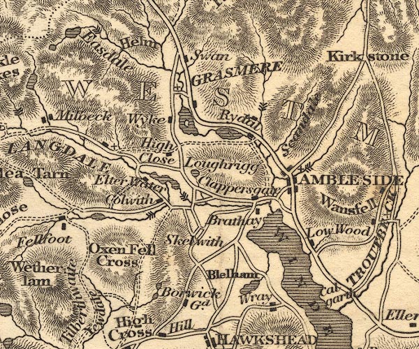 OT02NY30.jpg item:- JandMN : 48.1 Image © see bottom of page |
|||
|
|
||||
| evidence:- | old map:- Hall 1820 (Wmd) |
|||
| source data:- | Map, hand coloured engraving, Westmoreland ie Westmorland, scale
about 14.5 miles to 1 inch, by Sidney Hall, London, 1820,
published by Samuel Leigh, 18 Strand, London, 1820-31. click to enlarge click to enlargeHA18.jpg tapering wiggly line; river; county boundary item:- Armitt Library : 2008.14.58 Image © see bottom of page |
|||
|
|
||||
| evidence:- | descriptive text:- Otley 1823 (5th edn 1834) item:- fishing; char; trout |
|||
| source data:- | Guide book, A Concise Description of the English Lakes, the
mountains in their vicinity, and the roads by which they may be
visited, with remarks on the mineralogy and geology of the
district, by Jonathan Otley, published by the author, Keswick,
Cumberland now Cumbria, by J Richardson, London, and by Arthur
Foster, Kirkby Lonsdale, Cumbria, 1823; published 1823-49,
latterly as the Descriptive Guide to the English Lakes. goto source Page 3:- "... The principal feeders of the lake [Windermere] are the Rothay, having its source in Grasmere; and the Brathay, issuing from Langdale. These two rivers unite their streams about half a mile before entering the lake; and a remarkable circumstance is, that the trout and char, both leaving the lake about the same time to deposit their spawn, separate themselves into the two different rivers; the trout making choice of the Rothay, and the char the Brathay." goto sourcePage 41:- "The becks of Great and Little Langdale combined form the Brathay, and those of Grasmere the Rothay, which unite in Windermere: ..." |
|||
|
|
||||
| evidence:- | descriptive text:- Ford 1839 (3rd edn 1843) |
|||
| source data:- | Guide book, A Description of Scenery in the Lake District, by
Rev William Ford, published by Charles Thurnam, Carlisle, by W
Edwards, 12 Ave Maria Lane, Charles Tilt, Fleet Street, William
Smith, 113 Fleet Street, London, by Currie and Bowman,
Newcastle, by Bancks and Co, Manchester, by Oliver and Boyd,
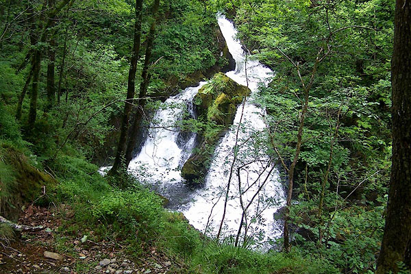
Edinburgh, and by Sinclair, Dumfries, 1839. goto source Page 24:- "..." "[Windermere] ... The chief feeders are the streams of the Rothay and Brathay, which unite at the landing-place. ... the bicipitous sources of the latter, rising in Langdale Head and Wry Nose, mingle their streams in Elter Water, and after dashing over Skelwith Force, flow gently to the lake. ..." |
|||
|
|
||||
| evidence:- | old drawing:- Aspland 1840s-60s |
|||
| source data:- | Drawing, pencil, view from Holy Trinity, Brathay, Lancashire, by Theophilus Lindsey
Aspland, 28 August 1845.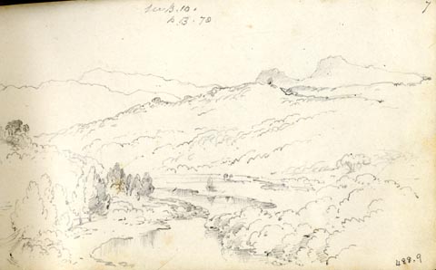 click to enlarge click to enlargeAS0209.jpg "from Brathay Church / Thursd. / Aug 28 / 45." "see B.10. / p.13.70" page number "7" item:- Armitt Library : 1958.488.9 Image © see bottom of page |
|||
|
|
||||
| evidence:- | old drawing:- Aspland 1840s-60s |
|||
| source data:- | Drawing, pencil, view from the porch of Holy Trinity Church, Brathay, Skelwith, Lancashire,
by Theophilus Lindsey Aspland, 20 August 1849.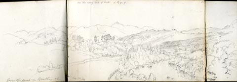 click to enlarge click to enlargeAS0118.jpg "from the porch of Brathay ch. Aug 20. 1849" item:- Armitt Library : 1958.487.18 Image © see bottom of page |
|||
|
|
||||
| evidence:- | old map:- Garnett 1850s-60s H placename:- Brathay, River |
|||
| source data:- | Map of the English Lakes, in Cumberland, Westmorland and
Lancashire, scale about 3.5 miles to 1 inch, published by John
Garnett, Windermere, Westmorland, 1850s-60s. GAR2NY30.jpg "Brathay R." wiggly line, river; and county boundary item:- JandMN : 82.1 Image © see bottom of page |
|||
|
|
||||
| evidence:- | old text:- Martineau 1855 |
|||
| source data:- | Guide book, A Complete Guide to the English Lakes, by Harriet
Martineau, published by John Garnett, Windermere, Westmorland,
and by Whittaker and Co, London, 1855; published 1855-76. goto source Page 19:- "..." "Two rivers fall into the lake, uniting just before they reach it;- the Rothay, ... and the Brathay, which issues from Elterwater, a group of pools, rather than a lake, lying at the foot of the hills near Langdale. The valleys of the Rothay and the Brathay are separated by Loughrigg ..." |
|||
|
|
||||
| evidence:- | old map:- Prior 1874 map 1 placename:- Brathay, River |
|||
| source data:- | Map, uncoloured engraving or lithograph? Winander Mere, scale
about 2.5 miles to 1 inch, published by John Garnett,
Windermere, Westmorland, 1874. click to enlarge click to enlargePI03M1.jpg "R. Brathay" double line with stream lines; river item:- private collection : 133.1 Image © see bottom of page |
|||
|
|
||||
| evidence:- | old photograph:- Bell 1880s-1940s |
|||
| source data:- | Photograph, sepia, the River Brathay near Brathay, Skelwith, Lancashire, by Herbert
Bell, photographer, Ambleside, Westmorland, 1890s.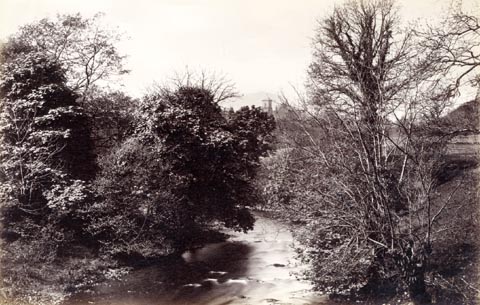 click to enlarge click to enlargeHB0876.jpg item:- Armitt Library : ALPS547 Image © see bottom of page |
|||
|
|
||||
| evidence:- | old photograph:- Bell 1880s-1940s |
|||
| source data:- | Photograph, black and white, River Brathay, Lancashire and Westmorland, by Herbert
Bell, Ambleside, Westmorland, 1890s.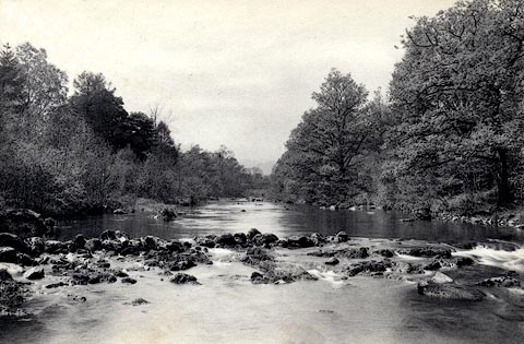 click to enlarge click to enlargeHB0420.jpg stamped at reverse:- "HERBERT BELL / Photographer / AMBLESIDE" item:- Armitt Library : ALPS74 Image © see bottom of page |
|||
|
|
||||
| evidence:- | old photograph:- Bell 1880s-1940s |
|||
| source data:- | Photograph, black and white, Brathay Bridge, Clappersgate, Skelwith, by Herbert Bell,
Ambleside, Westmorland, 1890s.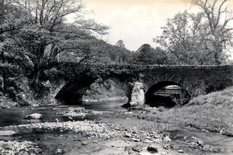 click to enlarge click to enlargeHB0192.jpg stamped at rev:- "HERBERT BELL / Photographer / AMBLESIDE" item:- Armitt Library : ALPS4 Image © see bottom of page |
|||
|
|
||||
| evidence:- | old print:- placename:- Brathay, River |
|||
| source data:- | Print, uncoloured engraving, View on the River Brathay, near Ambleside, Skelwith,
Westmorland, drawn by William Havell, engraved by E J Havell, 1800s-10s?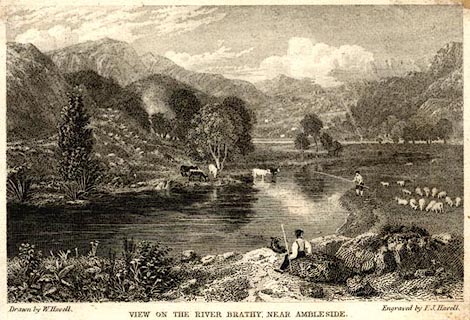 click to enlarge click to enlargePR0580.jpg printed at bottom left, right, centre:- "Drawn by W. Havell. / Engraved by E. J. Havell. / VIEW ON THE RIVER BRATHAY, NEAR AMBLESIDE." item:- Dove Cottage : 2008.107.528 Image © see bottom of page |
|||
|
|
||||
| evidence:- | old print:- placename:- Brathay, River |
|||
| source data:- | Print, uncoloured engraving, View on the River Brathay, Westmorland, drawn by R R
Reinagle, engraved by John Pye, 1800s?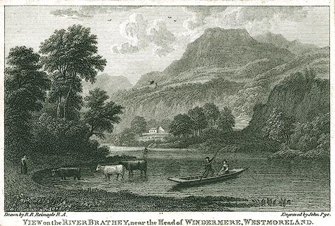 click to enlarge click to enlargePR0297.jpg printed at bottom left, right, centre:- "Drawn by R. R. Reinagle R.A. / Engraved by John Pye. / VIEW on the RIVER BRATHAY, near the Head of WINDERMERE, WESTMORELAND." item:- Dove Cottage : 2008.107.297 Image © see bottom of page |
|||
|
|
||||
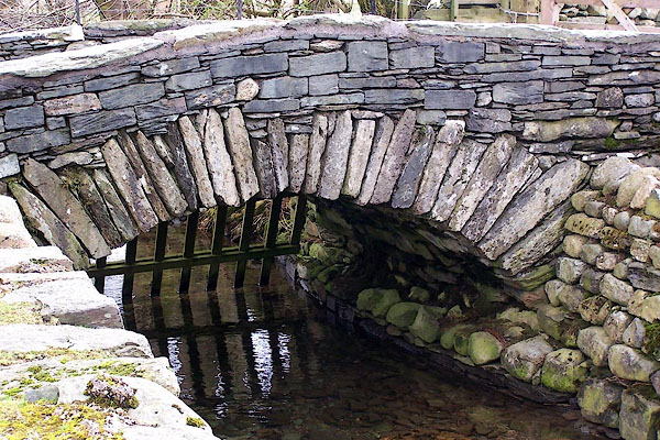
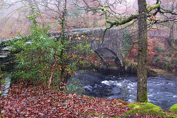
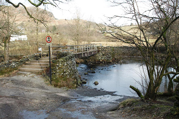
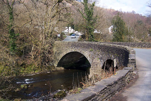
 BSA80.jpg At Slater Bridge. (taken 1.2.2010) 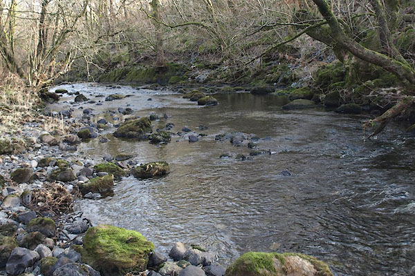 BSB01.jpg At Forge Steps (taken 1.2.2010) 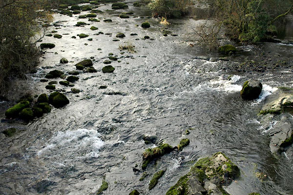 BVR47.jpg At Skelwith Bridge, (taken 15.11.2011) 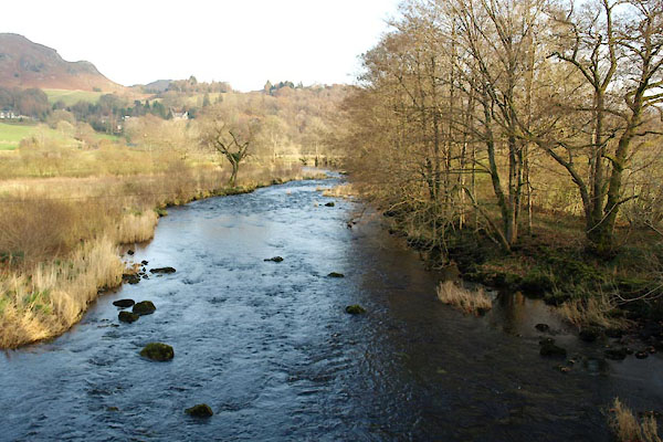 BVR48.jpg At Skelwith Bridge, (taken 15.11.2011) |
||||
|
|
||||
| places:- |
|
|||
|
||||
|
||||
|
||||
|
||||
|
||||
|
||||
|
||||
|
||||
|
||||
|
||||
|
||||
|
||||
|
||||
|
||||
|
||||
|
||||
Lakes Guides menu.