 Garnett 1850s-60s SD49


|

|
|
|
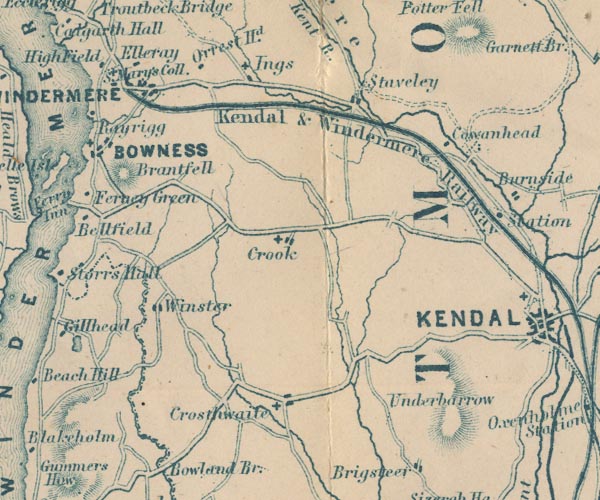
gazetteer links places may or may not be labelled on the map |
||

|
-- Brant Fell -- "Brantfell" |
|
|
|
-- Cowan Head -- "Cowanhead" |
|
|
|
-- Crook -- "Crook" |
|
|
|
-- Crosthwaite -- "Crosthwaite" |
|
|
|
-- Elleray -- "Elleray" |
|
|
|
-- Holy Trinity Church |
|
|
|
-- Ings -- "Ings" |
|
|
|
-- Kendal and Windermere Railway -- "Kendal & Windermere
Railway" |
|
|
|
-- Rayrigg Hall -- "Rayrigg" |
|
|
|
-- Kendal to Windermere |
|
|
|
-- St Anne's Church |
|
|
|
-- St Catherine's Church |
|
|
|
-- St Mary's Church |
|
|
|
-- St Mary's Church |
|
|
|
-- St Mary's College -- "S. Mary's Coll." |
|
|
|
-- Staveley -- "Staveley" |
|
|
|
-- Underbarrow -- "Underbarrow" |
|
|
|
-- Windermere -- "WINDERMERE" |
|
|
|
-- Winster -- "Winster" |
|
|
civil parishes The area roughly includes parts of parishes:- Crosthwaite and Lyth Cartmel Fell Helsington Strickland Ketel Windermere Underbarrow and Bradleyfield Hugill Strickland Roger Over Staveley Nether Staveley Crook |
||
|
|
||
|
|
Lakes Guides menu. | |