Old Cumbria Gazetteer
 |
 |
|
||
| Crosthwaite, Crosthwaite and Lyth | ||||
| Crosthwaite | ||||
| Crossthat | ||||
| civil parish:- | Crosthwaite and Lyth (formerly Westmorland) | |||
| county:- | Cumbria | |||
| locality type:- | locality | |||
| locality type:- | buildings | |||
| coordinates:- | SD43749150 (etc) | |||
| 1Km square:- | SD4391 | |||
| 10Km square:- | SD49 | |||
|
|
||||
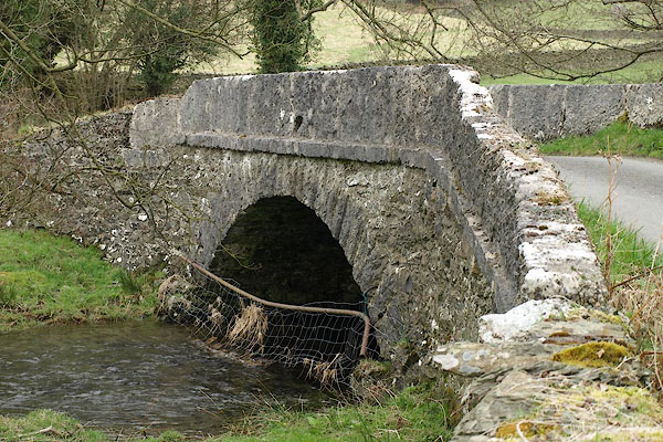
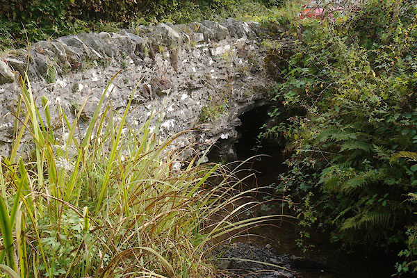
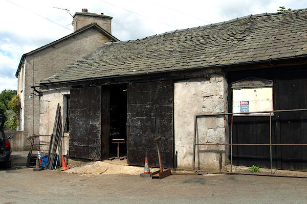
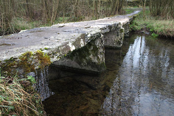
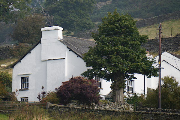
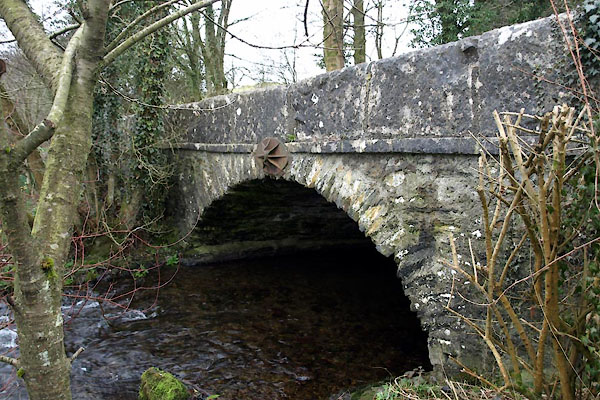
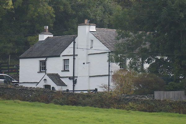
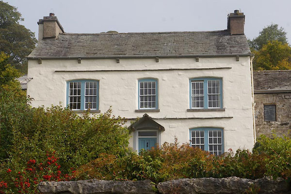
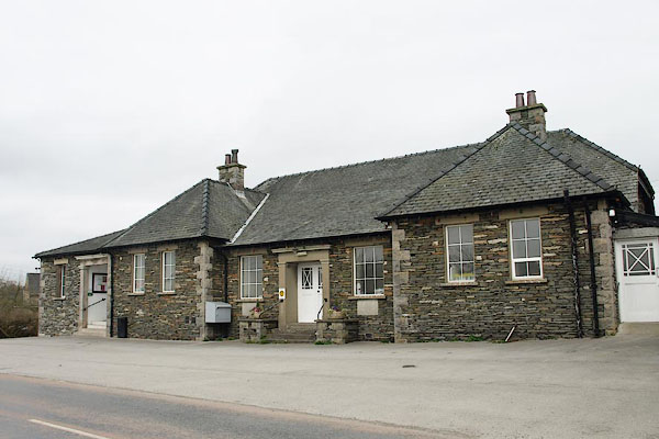
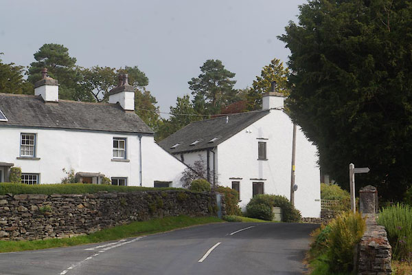 CBQ85.jpg (taken 12.9.2014) 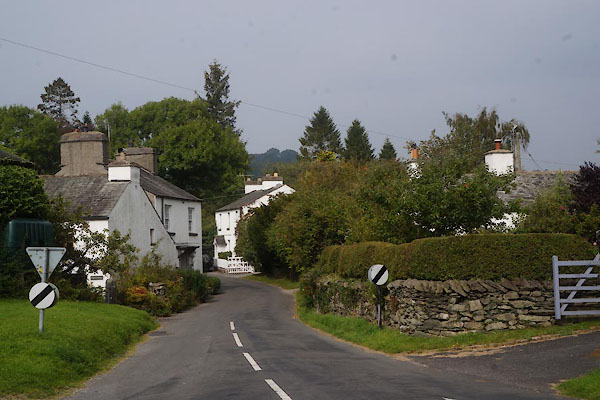 CBQ86.jpg (taken 12.9.2014) |
||||
|
|
||||
| evidence:- | old map:- Saxton 1579 placename:- Crosthwate |
|||
| source data:- | Map, hand coloured engraving, Westmorlandiae et Cumberlandiae Comitatus ie Westmorland
and Cumberland, scale about 5 miles to 1 inch, by Christopher Saxton, London, engraved
by Augustinus Ryther, 1576, published 1579-1645.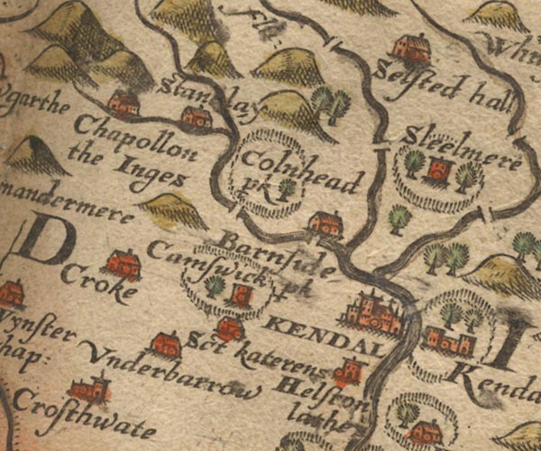 Sax9SD49.jpg Church, symbol for a parish or village, with a parish church. "Crosthwate" item:- private collection : 2 Image © see bottom of page |
|||
|
|
||||
| evidence:- | old map:- Mercator 1595 (edn?) placename:- Crosthwate |
|||
| source data:- | Map, hand coloured engraving, Westmorlandia, Lancastria, Cestria
etc, ie Westmorland, Lancashire, Cheshire etc, scale about 10.5
miles to 1 inch, by Gerard Mercator, Duisberg, Germany, 1595,
edition 1613-16. MER5WmdA.jpg "Crosthwate" circle item:- Armitt Library : 2008.14.3 Image © see bottom of page |
|||
|
|
||||
| evidence:- | old map:- Speed 1611 (Wmd) placename:- Crosthwaite |
|||
| source data:- | Map, hand coloured engraving, The Countie Westmorland and
Kendale the Cheif Towne, scale about 2.5 miles to 1 inch, by
John Speed, 1610, published by George Humble, Popes Head Alley,
London, 1611-12.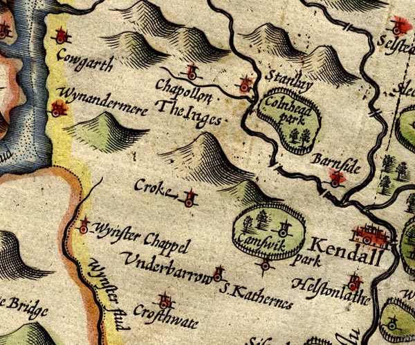 SP14SD49.jpg "Crosthwaite" circle, building and tower item:- Armitt Library : 2008.14.5 Image © see bottom of page |
|||
|
|
||||
| evidence:- | old map:- Jansson 1646 placename:- Crosthwat |
|||
| source data:- | Map, hand coloured engraving, Cumbria and Westmoria, ie
Cumberland and Westmorland, scale about 3.5 miles to 1 inch, by
John Jansson, Amsterdam, Netherlands, 1646.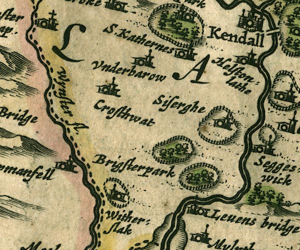 JAN3SD48.jpg "Crosthwat" Buildings and tower. item:- JandMN : 88 Image © see bottom of page |
|||
|
|
||||
| evidence:- | hearth tax returns:- Hearth Tax 1675 placename:- Crosthwaite |
|||
| source data:- | Records, hearth tax survey returns, Westmorland, 1674/75. "Crosthwaite" in "Crosthwaite and Lyth" |
|||
|
|
||||
| evidence:- | old map:- Morden 1695 (Wmd) placename:- Crosthwate |
|||
| source data:- | Map, hand coloured engraving, Westmorland, scale about 2.5 miles to 1 inch, by Robert
Morden, published by Abel Swale, the Unicorn, St Paul's Churchyard, Awnsham, and John
Churchill, the Black Swan, Paternoster Row, London, 1695.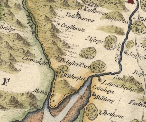 MD10SD48.jpg "Crosthwate" Circle. item:- JandMN : 24 Image © see bottom of page |
|||
|
|
||||
| evidence:- | old map:- Bowen and Kitchin 1760 placename:- Crosthwate |
|||
| source data:- | Map, hand coloured engraving, A New Map of the Counties of
Cumberland and Westmoreland Divided into their Respective Wards,
scale about 4 miles to 1 inch, by Emanuel Bowen and Thomas
Kitchin et al, published by T Bowles, Robert Sayer, and John
Bowles, London, 1760.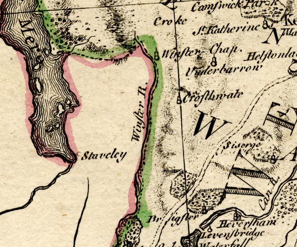 BO18SD38.jpg "Crosthwate" circle, tower item:- Armitt Library : 2008.14.10 Image © see bottom of page |
|||
|
|
||||
| evidence:- | old map:- Jefferys 1770 (Wmd) placename:- Crosthwaite placename:- Crosthwaite Green |
|||
| source data:- | Map, 4 sheets, The County of Westmoreland, scale 1 inch to 1
mile, surveyed 1768, and engraved and published by Thomas
Jefferys, London, 1770.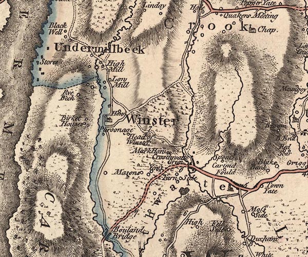 J5SD49SW.jpg "Crosthwaite" blocks, labelled in italic lowercase text; settlement, village?, and locality; or "Crosthwaite Green" blocks, labelled in italic lowercase text; settlement, village? item:- National Library of Scotland : EME.s.47 Image © National Library of Scotland |
|||
|
|
||||
| evidence:- | old map:- West 1784 map placename:- Crosthwaite |
|||
| source data:- | Map, hand coloured engraving, A Map of the Lakes in Cumberland,
Westmorland and Lancashire, scale about 3.5 miles to 1 inch,
engraved by Paas, 53 Holborn, London, about 1784.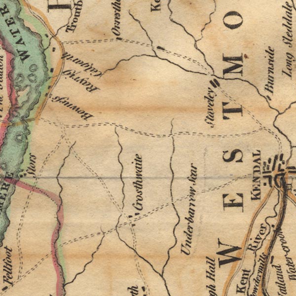 Ws02SD49.jpg item:- Armitt Library : A1221.1 Image © see bottom of page |
|||
|
|
||||
| evidence:- | old map:- Cary 1789 (edn 1805) placename:- Crosthwaite Green |
|||
| source data:- | Map, uncoloured engraving, Westmoreland, scale about 2.5 miles
to 1 inch, by John Cary, London, 1789; edition 1805.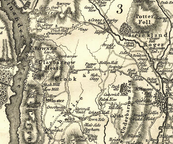 CY24SD49.jpg "Crosthwaite Green" block/s, labelled in italic lowercase; house, or hamlet 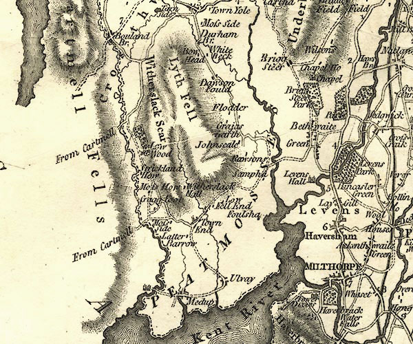 CY24SD48.jpg "Crosthwaite" area item:- JandMN : 129 Image © see bottom of page |
|||
|
|
||||
| evidence:- | old map:- Cooke 1802 placename:- Crossthwaite Green |
|||
| source data:- | Map, Westmoreland ie Westmorland, scale about 12 miles to 1
inch, by George Cooke, 1802, published by Sherwood, Jones and
Co, Paternoster Road, London, 1824. click to enlarge click to enlargeGRA1Wd.jpg "Crossthwaite Gr." blocks, italic lowercase text, village, hamlet, locality item:- Hampshire Museums : FA2000.62.4 Image © see bottom of page |
|||
|
|
||||
| evidence:- | old map:- Laurie and Whittle 1806 placename:- Crossthwaite |
|||
| source data:- | Road map, Completion of the Roads to the Lakes, scale about 10
miles to 1 inch, by Nathaniel Coltman? 1806, published by Robert
H Laurie, 53 Fleet Street, London, 1834. click to enlarge click to enlargeLw18.jpg "Crossthwaite" village or other place item:- private collection : 18.18 Image © see bottom of page |
|||
|
|
||||
| evidence:- | old map:- Cooper 1808 placename:- Crossthwaite |
|||
| source data:- | Map, hand coloured engraving, Westmoreland ie Westmorland, scale
about 9 miles to 1 inch, by H Cooper, 1808, published by R
Phillips, Bridge Street, Blackfriars, London, 1808. click to enlarge click to enlargeCOP4.jpg "Crossthwaite" circle; village or hamlet item:- Dove Cottage : 2007.38.53 Image © see bottom of page |
|||
|
|
||||
| evidence:- | old map:- Wallis 1810 (Wmd) placename:- Crossthwaite Green |
|||
| source data:- | Road map, Westmoreland, scale about 19 miles to 1 inch, by James
Wallis, 77 Berwick Street, Soho, 1810, published by W Lewis,
Finch Lane, London, 1835? click to enlarge click to enlargeWAL5.jpg "Crossthwaite Gr." village, hamlet, house, ... item:- JandMN : 63 Image © see bottom of page |
|||
|
|
||||
| evidence:- | old map:- Otley 1818 placename:- Crosthwaite |
|||
| source data:- | Map, uncoloured engraving, The District of the Lakes,
Cumberland, Westmorland, and Lancashire, scale about 4 miles to
1 inch, by Jonathan Otley, 1818, engraved by J and G Menzies,
Edinburgh, Scotland, published by Jonathan Otley, Keswick,
Cumberland, et al, 1833.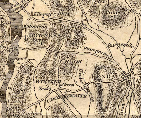 OT02SD49.jpg "CROSTHWAITE" item:- JandMN : 48.1 Image © see bottom of page |
|||
|
|
||||
| evidence:- | descriptive text:- Otley 1823 (5th edn 1834) item:- geology |
|||
| source data:- | Guide book, A Concise Description of the English Lakes, the
mountains in their vicinity, and the roads by which they may be
visited, with remarks on the mineralogy and geology of the
district, by Jonathan Otley, published by the author, Keswick,
Cumberland now Cumbria, by J Richardson, London, and by Arthur
Foster, Kirkby Lonsdale, Cumbria, 1823; published 1823-49,
latterly as the Descriptive Guide to the English Lakes. goto source goto sourcePage 159:- "A rock of fine-grained sienite is observed near the foot of Coniston Lake; and one containing a large portion of mica appears in Crosthwaite. ..." |
|||
|
|
||||
| evidence:- | old map:- Ford 1839 map placename:- Crosthwaite Green |
|||
| source data:- | Map, uncoloured engraving, Map of the Lake District of
Cumberland, Westmoreland and Lancashire, scale about 3.5 miles
to 1 inch, published by Charles Thurnam, Carlisle, and by R
Groombridge, 5 Paternoster Row, London, 3rd edn 1843.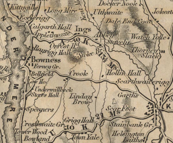 FD02SD49.jpg "Crosthwaite Gr." item:- JandMN : 100.1 Image © see bottom of page |
|||
|
|
||||
| evidence:- | old map:- Garnett 1850s-60s H placename:- Crosthwaite |
|||
| source data:- | Map of the English Lakes, in Cumberland, Westmorland and
Lancashire, scale about 3.5 miles to 1 inch, published by John
Garnett, Windermere, Westmorland, 1850s-60s. GAR2SD49.jpg "Crosthwaite" blocks, settlement, and a cross, a church item:- JandMN : 82.1 Image © see bottom of page |
|||
|
|
||||
| evidence:- | perhaps market notes:- item:- market |
|||
| source data:- | www.history.ac.uk/cmh/gaz/gazweb2.htm | |||
|
|
||||
| places:- |
|
|||
|
||||
|
||||
|
||||
|
||||
|
||||
|
||||
|
||||
|
||||
|
||||
|
||||
|
||||
|
||||
|
||||
|
||||
|
||||
|
||||
|
||||
|
||||
|
||||
|
||||
|
||||
|
||||
|
||||
|
||||
|
||||
|
||||
Lakes Guides menu.