 Old Cumbria Gazetteer
 |
 |
|
| Rayrigg Hall, Windermere | ||
| Rayrigg Hall | ||
| locality:- | Windermere | |
| civil parish:- | Windermere (formerly Westmorland) | |
| county:- | Cumbria | |
| locality type:- | buildings | |
| coordinates:- | SD40289811 | |
| 1Km square:- | SD4098 | |
| 10Km square:- | SD49 | |
|
|
||
| evidence:- | old map:- OS County Series (Wmd 32 7) placename:- Rayrigg Hall |
|
| source data:- | Maps, County Series maps of Great Britain, scales 6 and 25
inches to 1 mile, published by the Ordnance Survey, Southampton,
Hampshire, from about 1863 to 1948. |
|
|
|
||
| evidence:- | old map:- Jefferys 1770 (Wmd) placename:- Rayrigg |
|
| source data:- | Map, 4 sheets, The County of Westmoreland, scale 1 inch to 1
mile, surveyed 1768, and engraved and published by Thomas
Jefferys, London, 1770.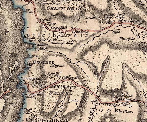 J5SD49NW.jpg "Rayrigg / Fletcher Fleming Esqr." house item:- National Library of Scotland : EME.s.47 Image © National Library of Scotland |
|
|
|
||
| evidence:- | descriptive text:- West 1778 (11th edn 1821) placename:- Rayrig |
|
| source data:- | Guide book, A Guide to the Lakes, by Thomas West, published by
William Pennington, Kendal, Cumbria once Westmorland, and in
London, 1778 to 1821. goto source goto sourcePage 74, footnote:- "This place [Rayrig] is said to have some resemblance to Ferney, on the lake of Geneva, the seat of the late celebrated Voltaire." |
|
|
|
||
| evidence:- | old map:- Crosthwaite 1783-94 (Win/Ble) placename:- Rayrig |
|
| source data:- | Map, uncoloured engraving, An Accurate Map of the Grand Lake of
Windermere, scale about 2 inches to 1 mile, by Peter
Crosthwaite, Keswick, Cumberland, 1783, version published 1819. CT9SD49E.jpg "Rayrig / John Fleming Esq." block, building/s item:- Armitt Library : 2008.14.102 Image © see bottom of page |
|
|
|
||
| evidence:- | probably old map:- West 1784 map placename:- Rayrig |
|
| source data:- | Map, hand coloured engraving, A Map of the Lakes in Cumberland,
Westmorland and Lancashire, scale about 3.5 miles to 1 inch,
engraved by Paas, 53 Holborn, London, about 1784. Ws02SD49.jpg item:- Armitt Library : A1221.1 Image © see bottom of page |
|
|
|
||
| evidence:- | old map:- Clarke 1787 map (Windermere N) placename:- Rayrigg |
|
| source data:- | Map, A Map of the Northern Part of the Lake Winandermere and its
Environs, scale about 6.5 ins to 1 mile, by James Clarke,
engraved by Samuel John Neele, 352 Strand, published by James
Clarke, Penrith, Cumberland and in London etc, 1787. CLASD49E.jpg "Rayrigg / Raincock Esqr." item:- private collection : 10.10 Image © see bottom of page |
|
|
|
||
| evidence:- | old map:- Cary 1789 (edn 1805) placename:- Rayrugg |
|
| source data:- | Map, uncoloured engraving, Westmoreland, scale about 2.5 miles
to 1 inch, by John Cary, London, 1789; edition 1805.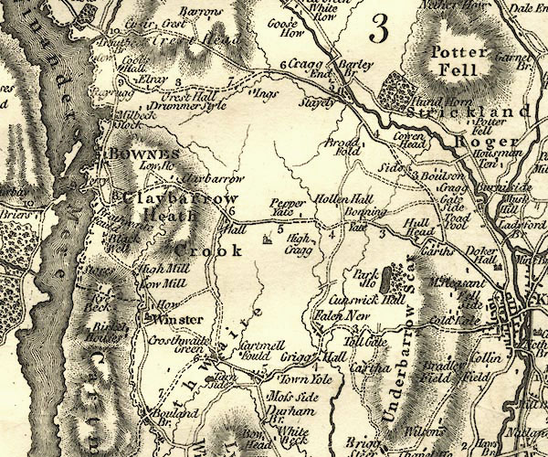 CY24SD49.jpg "Rayrugg" block/s, labelled in italic lowercase; house, or hamlet item:- JandMN : 129 Image © see bottom of page |
|
|
|
||
| evidence:- | road book:- Cary 1798 (2nd edn 1802) placename:- Rayrigg |
|
| source data:- | Road book, itineraries, Cary's New Itinerary, by John Cary, 181
Strand, London, 2nd edn 1802. goto source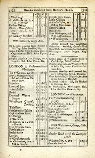 click to enlarge click to enlargeC38317.jpg page 317-318 "Between Staveley and Lowood Inn, on l. is Rayrigg, Rev. J. Fleming." item:- JandMN : 228.1 Image © see bottom of page |
|
|
|
||
| evidence:- | probably old map:- Otley 1818 placename:- Rayrigg |
|
| source data:- | Map, uncoloured engraving, The District of the Lakes,
Cumberland, Westmorland, and Lancashire, scale about 4 miles to
1 inch, by Jonathan Otley, 1818, engraved by J and G Menzies,
Edinburgh, Scotland, published by Jonathan Otley, Keswick,
Cumberland, et al, 1833.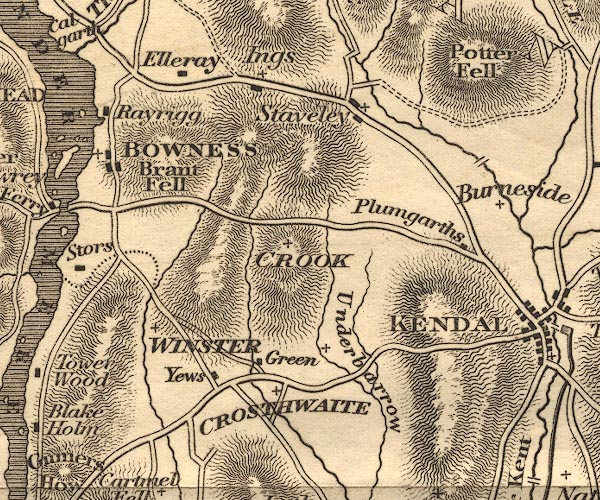 OT02SD49.jpg item:- JandMN : 48.1 Image © see bottom of page |
|
|
|
||
| evidence:- | presumably descriptive text:- Otley 1823 (5th edn 1834) placename:- Rayrigg |
|
| source data:- | Guide book, A Concise Description of the English Lakes, the
mountains in their vicinity, and the roads by which they may be
visited, with remarks on the mineralogy and geology of the
district, by Jonathan Otley, published by the author, Keswick,
Cumberland now Cumbria, by J Richardson, London, and by Arthur
Foster, Kirkby Lonsdale, Cumbria, 1823; published 1823-49,
latterly as the Descriptive Guide to the English Lakes. goto source Page 4:- "... Rayrigg, the residence of the Rev. John Fleming, upon a bay of the lake. ..." |
|
|
|
||
| evidence:- | old text:- Gents Mag |
|
| source data:- | Magazine, The Gentleman's Magazine or Monthly Intelligencer or
Historical Chronicle, published by Edward Cave under the
pseudonym Sylvanus Urban, and by other publishers, London,
monthly from 1731 to 1922. goto source Gentleman's Magazine 1825 part 1 p.516 "Compendium of County History. - Westmorland." "... Rayrigg Hall is said to resemble Ferney, the seat of Voltaire on the Lake of Geneva. ..." |
|
|
|
||
| evidence:- | old map:- Ford 1839 map placename:- Rayrigg Hall |
|
| source data:- | Map, uncoloured engraving, Map of the Lake District of
Cumberland, Westmoreland and Lancashire, scale about 3.5 miles
to 1 inch, published by Charles Thurnam, Carlisle, and by R
Groombridge, 5 Paternoster Row, London, 3rd edn 1843.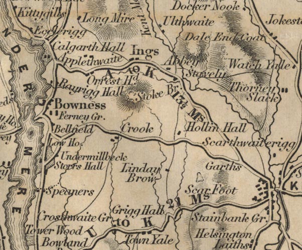 FD02SD49.jpg "Rayrigg Hall" item:- JandMN : 100.1 Image © see bottom of page |
|
|
|
||
| evidence:- | old map:- Garnett 1850s-60s H placename:- Rayrigg |
|
| source data:- | Map of the English Lakes, in Cumberland, Westmorland and
Lancashire, scale about 3.5 miles to 1 inch, published by John
Garnett, Windermere, Westmorland, 1850s-60s.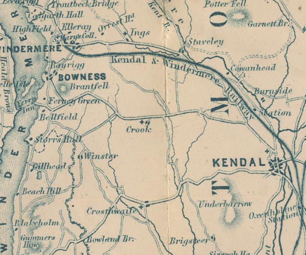 GAR2SD49.jpg "Rayrigg" blocks, settlement item:- JandMN : 82.1 Image © see bottom of page |
|
|
|
||
| evidence:- | old text:- Martineau 1855 placename:- Rayrigg item:- stone wall |
|
| source data:- | Guide book, A Complete Guide to the English Lakes, by Harriet
Martineau, published by John Garnett, Windermere, Westmorland,
and by Whittaker and Co, London, 1855; published 1855-76. goto source Page 14:- "..." "... through Bowness on the Ambleside road, and round by Cook's House. The first noticeable abode that he will see is Rayrigg,- a rather low, rambling, grey house, standing on the grass near a little bay of" goto sourcePage 15:- "the lake. It is a charming old-fashioned house, and its position has every advantage, except that it stands too low. On the high wall by the road side, immediately before reaching the gate of Rayrigg, the stranger will be struck with the variety of ferns. That wall is an excellent introduction to the stone fences of the region, richly adorned as many of them are with mosses and ferns." |
|
|
|
||
| evidence:- | probably old map:- Prior 1874 map 1 placename:- Rayrigg |
|
| source data:- | Map, uncoloured engraving or lithograph? Winander Mere, scale
about 2.5 miles to 1 inch, published by John Garnett,
Windermere, Westmorland, 1874. click to enlarge click to enlargePI03M1.jpg "Rayrigg" block/s; building/s item:- private collection : 133.1 Image © see bottom of page |
|
|
|
||
| evidence:- | database:- Listed Buildings 2010 placename:- Rayrigg Hall |
|
| source data:- | courtesy of English Heritage "RAYRIGG HALL / / RAYRIGG ROAD / WINDERMERE TOWN / SOUTH LAKELAND / CUMBRIA / II[star] / 351703 / SD4028898088" |
|
|
|
||
| evidence:- | old print:- Robertson 1911 placename:- Rayrigg |
|
| source data:- | Print, lithograph? Rayrigg, Windermere, from a watercolour by Arthur Tucker, published
by Chatto and Windus, London, 1911.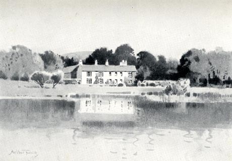 click to enlarge click to enlargeRSN118.jpg Tipped in opposite p.72 of Wordsworthshire by Eric Robertson. printed at bottom:- "RAYRIGG, WINDERMERE" signed at painting lower left:- "Arthur Tucker" item:- JandMN : 197.18 Image © see bottom of page |
|
|
|
||
| hearsay:- |
William Wilberforce, 1759-1833, spent time at Rayrigg. From here he would row to Lady
Holme where he planned legislation against the slave trade. |
|
|
|
||
Lakes Guides menu.