 Garnett 1850s-60s NY32


|

|
|
|
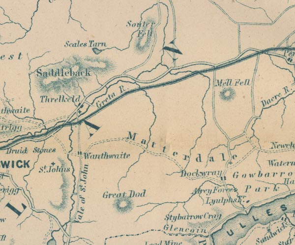
gazetteer links places may or may not be labelled on the map |
||

|
-- Aira Beck |
|
|
|
-- Aira Force -- "Airey Force" |
|
|
|
-- Cockermouth, Keswick and Penrith Railway |
|
|
|
-- Dockray -- "Dockwray" |
|
|
|
-- Great Dodd -- "Great Dod" |
|
|
|
-- Great Mell Fell -- "Mell Fell" |
|
|
|
-- Greta, River -- "Greta R." |
|
|
|
-- Lyulph's Tower -- "Lyulphs Tr." |
|
|
|
-- Matterdale Church |
|
|
|
-- Matterdale -- "Matterdale" |
|
|
|
-- Saddleback -- "Saddleback" |
|
|
|
-- Scales Tarn -- "Scales Tarn" |
|
|
|
-- Souther Fell -- "Souter Fell" |
|
|
|
-- St John's Church -- "St. Johns" |
|
|
|
-- St John's Beck |
|
|
|
-- St John's in the Vale -- "Vale of St. John" |
|
|
|
-- Stybarrow Crag -- "Stybarrow Crag" |
|
|
|
-- Threlkeld -- "Threlkeld" |
|
|
|
-- Wanthwaite -- "Wanthwaite" |
|
|
civil parishes The area roughly includes parts of parishes:- St John's Castlerigg and Wythburn Matterdale Hutton Mungrisdale Threlkeld |
||
|
|
||
|
|
Lakes Guides menu. | |