 Old Cumbria Gazetteer
 |
 |
|
| Great Dodd, St John's Castlerigg etc | ||
| Great Dodd | ||
| civil parish:- | St John's Castlerigg and Wythburn (formerly Cumberland) | |
| civil parish:- | Matterdale (formerly Cumberland) | |
| civil parish:- | St John's Castlerigg and Wythburn (formerly Cumberland) | |
| county:- | Cumbria | |
| locality type:- | hill | |
| locality type:- | boundary feature | |
| locality type:- | parish boundary feature | |
| coordinates:- | NY34192056 (etc) | |
| 1Km square:- | NY3420 | |
| 10Km square:- | NY32 | |
| altitude:- | 2808 feet | |
| altitude:- | 856m | |
|
|
||
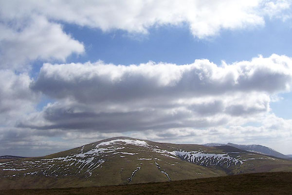 BOV20.jpg From the N. (taken 17.3.2008) 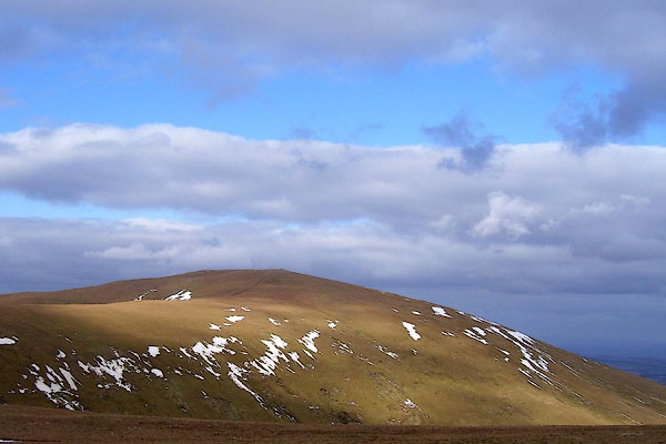 BOV27.jpg From the S. (taken 17.3.2008) |
||
|
|
||
| evidence:- | old map:- OS County Series (Cmd 65 9) placename:- Great Dodd placename:- Dodd, Great |
|
| source data:- | Maps, County Series maps of Great Britain, scales 6 and 25
inches to 1 mile, published by the Ordnance Survey, Southampton,
Hampshire, from about 1863 to 1948. |
|
|
|
||
| evidence:- | old map:- Donald 1774 (Cmd) placename:- Dodd Fell |
|
| source data:- | Map, hand coloured engraving, 3x2 sheets, The County of Cumberland, scale about 1
inch to 1 mile, by Thomas Donald, engraved and published by Joseph Hodskinson, 29
Arundel Street, Strand, London, 1774.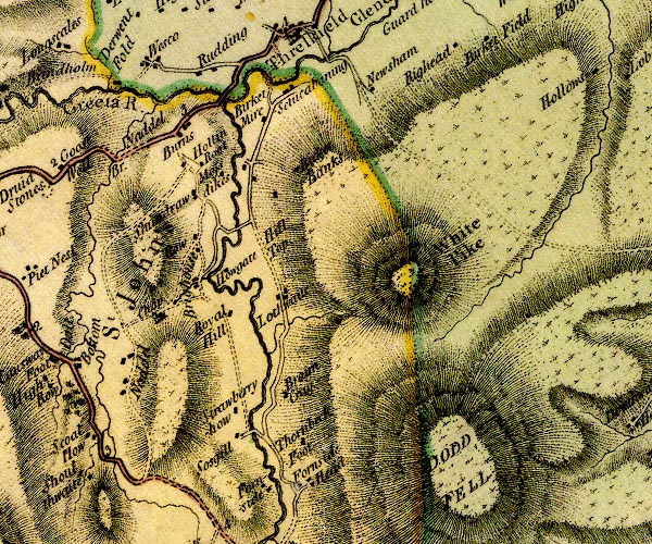 D4NY32SW.jpg 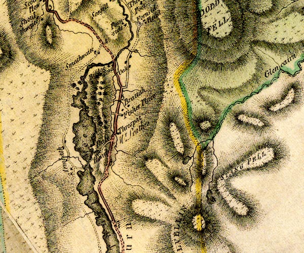 D4NY31NW.jpg "DODD FELL" hill hachuring; a hill or mountain item:- Carlisle Library : Map 2 Images © Carlisle Library |
|
|
|
||
| evidence:- | old map:- Cooper 1808 placename:- Dod Fell |
|
| source data:- | Map, uncoloured engraving, Cumberland, scale about 10.5 miles to
1 inch, drawn and engraved by Cooper, published by R Phillips,
Bridge Street, Blackfriars, London, 1808. click to enlarge click to enlargeCOP3.jpg "Dod Fell" hill hachuring; mountain or hill, on ward boundary item:- JandMN : 86 Image © see bottom of page |
|
|
|
||
| evidence:- | old map:- Otley 1818 placename:- Great Dod |
|
| source data:- | Map, uncoloured engraving, The District of the Lakes,
Cumberland, Westmorland, and Lancashire, scale about 4 miles to
1 inch, by Jonathan Otley, 1818, engraved by J and G Menzies,
Edinburgh, Scotland, published by Jonathan Otley, Keswick,
Cumberland, et al, 1833.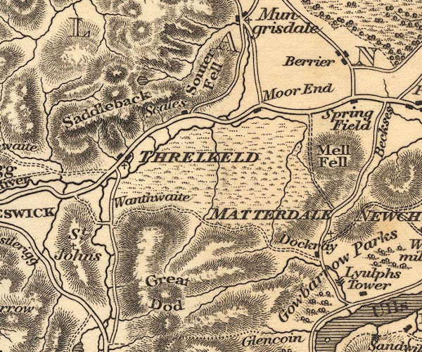 OT02NY32.jpg item:- JandMN : 48.1 Image © see bottom of page |
|
|
|
||
| evidence:- | old map:- Ford 1839 map placename:- Dodd Fell |
|
| source data:- | Map, uncoloured engraving, Map of the Lake District of
Cumberland, Westmoreland and Lancashire, scale about 3.5 miles
to 1 inch, published by Charles Thurnam, Carlisle, and by R
Groombridge, 5 Paternoster Row, London, 3rd edn 1843.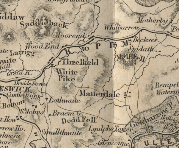 FD02NY32.jpg "Dodd Fell" Hill hachuring. item:- JandMN : 100.1 Image © see bottom of page |
|
|
|
||
| evidence:- | old map:- Garnett 1850s-60s H placename:- Great Dod |
|
| source data:- | Map of the English Lakes, in Cumberland, Westmorland and
Lancashire, scale about 3.5 miles to 1 inch, published by John
Garnett, Windermere, Westmorland, 1850s-60s.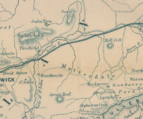 GAR2NY32.jpg "Great Dod" hill hachuring item:- JandMN : 82.1 Image © see bottom of page |
|
|
|
||
| evidence:- | outline view:- Jenkinson 1875 placename:- Great Dodd |
|
| source data:- | Print, lithograph, outline view, Panoramic Sketches from Helvellyn, Westmorland, by
Edwin A Pettitt, London, published by Edward Stanford, 55 Charing Cross, London, 1875. click to enlarge click to enlargeJk01E1.jpg "... Great Dodd ..." item:- JandMN : 28.5 Image © see bottom of page |
|
|
|
||
| evidence:- | outline view:- Jenkinson 1875 placename:- Great Dodd |
|
| source data:- | Print, lithograph, outline view, Panoramic Sketches from Skiddaw, Cumberland, by Edwin
A Pettitt, London, published by Edward Stanford, 55 Charing Cross, London, 1875. click to enlarge click to enlargeJk01E2.jpg "... Great Dodd ..." item:- JandMN : 28.8 Image © see bottom of page |
|
|
|
||
| evidence:- | outline view:- Matthew 1866 placename:- Great Dodd |
|
| source data:- | Print, engraving, outline view, Helvellyn from above Harrop Tarn, Poney Road from
Wythburn to Whatendlath and Borrowdale, Cumberland, published by J Richardson, Highgate,
Kendal, Westmorland, 1866.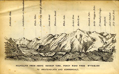 click to enlarge click to enlargeMW1E02.jpg Tipped in before p.1 of The English Lakes, Peaks and Passes, from Kendal to Keswick, by George King Matthew. printed at bottom:- "HELVELLYN FROM ABOVE HARROP TARN, PONEY ROAD FROM WYTHBURN TO WHATENDLATH AND BORROWDALE." printed at caption to mountains:- "... Great Dodd. ..." item:- Armitt Library : A1168.2 Image © see bottom of page |
|
|
|
||
| evidence:- | outline view:- Martineau 1855 placename:- Great Dod |
|
| source data:- | Print, engraving, outline view, Mountains seen from the West Side of Thirlmere, drawn
by L Aspland, engraved by W Banks, Edinburgh, published by John Garnett, Windermere,
Westmorland, and by Whittaker and Co, London, 1855.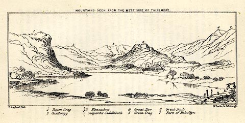 click to enlarge click to enlargeMNU110.jpg Opposite p.69 in A Complete Guide to the English Lakes, by Harriet Martineau. The view is captioned, numbers refering to mountains in the image - 1 Raven Crag, 2 Castlerigg, 3 Blancathra vulgariter Saddleback, 4 Great How, 5 Green Crag, 6, Great Dod, 7 Part of Helvellyn. printed at top:- "MOUNTAINS SEEN FROM THE WEST SIDE OF THIRLMERE." printed at bottom left, right:- "L Aspland Delt. / W Banks Sc Edinr." item:- Armitt Library : A1159.10 Image © see bottom of page |
|
|
|
||
 Lakes Guides menu.