 Ford 1839 map SD47


|

|
|
|
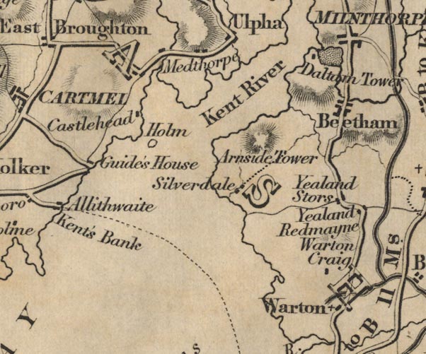
gazetteer links places may or may not be labelled on the map |
||

|
-- Arnside Tower -- "Arnside Tower" |
|
|
|
-- Beetham -- "Beetham" |
|
|
|
-- Castle Head -- "Castlehead" |
|
|
|
-- Dallam Tower -- "Daltam Tower" |
|
|
|
-- Guides Farm -- "Guide's House" |
|
|
|
-- Holme Island -- "Holm" |
|
|
|
-- Kent, River -- "Kent River" |
|
|
|
-- Meathop -- "Medthorpe" |
|
|
|
-- Morecambe Bay -- "MORECAMBE BAY" |
|
|
|
-- Lancaster Sands Road -- "from Hest Bank to Kent's
Bank" |
|
|
|
-- Silverdale -- "Silverdale" |
|
|
|
-- Warton Crag -- "Warton Craig" |
|
|
|
-- Warton -- "Warton" |
|
|
|
-- Yealand Redmayne -- "Yealand Redmayne" |
|
|
|
-- Yealand Storrs -- "Yealand Stors" |
|
|
civil parishes The area roughly includes parts of parishes:- Broughton East Lower Allithwaite Lower Holker Upper Allithwaite Beetham Arnside Grange-over-Sands Meathop and Ulpha |
||
|
|
||
|
|
Lakes Guides menu. | |