 |
 |
   |
|
|
|
Warton Crag |
| county:- |
Lancashire |
| locality type:- |
hill |
| locality type:- |
rocks |
| coordinates:- |
SD493727 |
| 1Km square:- |
SD4972 |
| 10Km square:- |
SD47 |
| altitude:- |
535 feet |
| altitude:- |
163m |
|
|
| evidence:- |
descriptive text:- West 1778 (11th edn 1821)
|
| source data:- |
Guide book, A Guide to the Lakes, by Thomas West, published by
William Pennington, Kendal, Cumbria once Westmorland, and in
London, 1778 to 1821.
 goto source goto source
Page 28:- "... [crossing Lancaster Sands] To the right, Warton-cragg presents itself in a bold
style. On its arched summit are the vestiges of a square encampment, and the ruins
of a beacon. ..."
|
|
|
| evidence:- |
descriptive text:- Otley 1823 (5th edn 1834)
item:- geology; limestone pavement
|
| source data:- |
Guide book, A Concise Description of the English Lakes, the
mountains in their vicinity, and the roads by which they may be
visited, with remarks on the mineralogy and geology of the
district, by Jonathan Otley, published by the author, Keswick,
Cumberland now Cumbria, by J Richardson, London, and by Arthur
Foster, Kirkby Lonsdale, Cumbria, 1823; published 1823-49,
latterly as the Descriptive Guide to the English Lakes.
 goto source goto source
Page 93:- "... Warton Crag on the left, and Farlton Knot on the right of the road, are two stratified
hills of limestone, rising to a considerable height: ..."
"..."
 goto source goto source
Page 161:- "A superincumbent bed of limestone, by some called the mountain, by others the upper
transition limestone, mantles round these mountains, in a position unconformable to
the strata of the slaty and other rocks upon which it reposes. It bassets out near
..."
 goto source goto source
Page 162:- "... it may be seen upon the surface as far as Warton and Farleton Crags, ..."
|
|
|
| evidence:- |
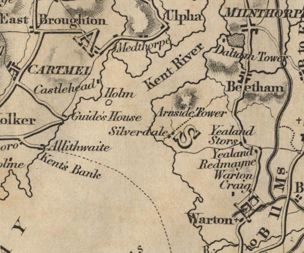
old map:- Ford 1839 map
placename:- Warton Craig
|
| source data:- |
Map, uncoloured engraving, Map of the Lake District of
Cumberland, Westmoreland and Lancashire, scale about 3.5 miles
to 1 inch, published by Charles Thurnam, Carlisle, and by R
Groombridge, 5 Paternoster Row, London, 3rd edn 1843.

FD02SD47.jpg
"Warton Craig"
item:- JandMN : 100.1
Image © see bottom of page
|
|
|
| evidence:- |
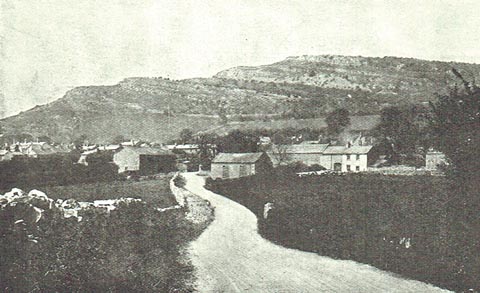
old photograph:- Marr 1916
placename:- Warton Crag
|
| source data:- |
Photograph, halftone print, Warton Crag near Carnforth, Lancashire, 1916.
 click to enlarge click to enlarge
MA1210.jpg
item:- JandMN : 173.18
Image © see bottom of page
|
|
|


 goto source
 goto source
 goto source
 goto source
 click to enlarge