 Old Cumbria Gazetteer
 |
 |
|
||
| Silverdale, Lancashire | ||||
| Silverdale | ||||
| county:- | Lancashire | |||
| locality type:- | locality | |||
| locality type:- | buildings | |||
| coordinates:- | SD46287544 (etc) | |||
| 1Km square:- | SD4675 | |||
| 10Km square:- | SD47 | |||
|
|
||||
| evidence:- | old map:- Ford 1839 map placename:- Silverdale |
|||
| source data:- | Map, uncoloured engraving, Map of the Lake District of
Cumberland, Westmoreland and Lancashire, scale about 3.5 miles
to 1 inch, published by Charles Thurnam, Carlisle, and by R
Groombridge, 5 Paternoster Row, London, 3rd edn 1843.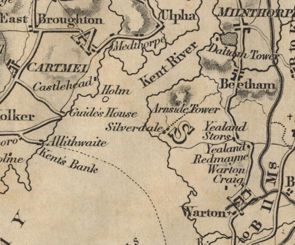 FD02SD47.jpg "Silverdale" item:- JandMN : 100.1 Image © see bottom of page |
|||
|
|
||||
| hearsay:- |
Once a port visited by steamers from Morecambe, now silted up and far from the sea. |
|||
|
|
||||
| places:- |
|
|||
|
||||
 Lakes Guides menu.