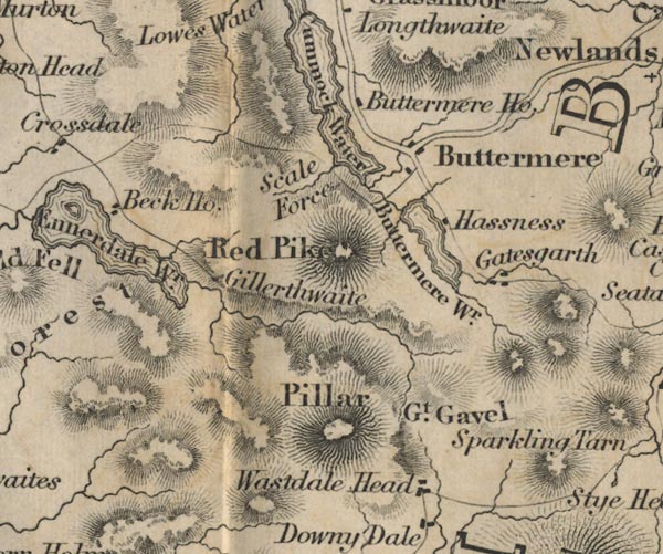
 Ford 1839 map NY11


|

|
|
|
gazetteer links places may or may not be labelled on the map |
||

|
-- Beck House -- "Beck Ho." |
|
|
|
-- Buttermere Hause -- "Buttermere Ho." |
|
|
|
-- Buttermere -- "Buttermere Wr." |
|
|
|
-- Buttermere -- "Buttermere" |
|
|
|
-- Crummock Water -- "Crummock Water" |
|
|
|
-- Ennerdale Water -- "Ennerdale Wr."-- Ennerdale Water
-- "Ennerdale Wr." |
|
|
|
-- Gatesgarth -- "Gatesgarth" |
|
|
|
-- Gillerthwaite -- "Gillerthwaite" |
|
|
|
-- Great Gable -- "Gt. Gavel" |
|
|
|
-- Hassness -- "Hassness" |
|
|
|
-- Pillar -- "Pillar" |
|
|
|
-- Red Pike -- "Red Pike" |
|
|
|
-- Scale Force -- "Scale Force" |
|
|
|
-- Wasdale Head -- "Wastdale Head" |
|
|
civil parishes The area roughly includes parts of parishes:- Lamplugh Nether Wasdale Ennerdale and Kinniside Buttermere Loweswater Above Derwent |
||
|
|
||
|
|
Lakes Guides menu. | |