Old Cumbria Gazetteer
 |
 |
|
||
| Rydal | ||||
| civil parish:- | Lakes (formerly Westmorland) | |||
| county:- | Cumbria | |||
| locality type:- | locality | |||
| locality type:- | buildings | |||
| coordinates:- | NY36470616 (etc) | |||
| 1Km square:- | NY3606 | |||
| 10Km square:- | NY30 | |||
|
|
||||
| evidence:- | old map:- OS County Series (Wmd 26 1) placename:- Rydal and Loughrigg |
|||
| source data:- | Maps, County Series maps of Great Britain, scales 6 and 25
inches to 1 mile, published by the Ordnance Survey, Southampton,
Hampshire, from about 1863 to 1948. |
|||
|
|
||||
| evidence:- | old map:- OS County Series (Wmd 26 2) placename:- Rydal |
|||
| source data:- | Maps, County Series maps of Great Britain, scales 6 and 25
inches to 1 mile, published by the Ordnance Survey, Southampton,
Hampshire, from about 1863 to 1948. |
|||
|
|
||||
| evidence:- | hearth tax returns:- Hearth Tax 1675 placename:- Rydall |
|||
| source data:- | Records, hearth tax survey returns, Westmorland, 1674/75. "Rydall" in "Loughrigge and Rydall" |
|||
|
|
||||
| evidence:- | hearth tax returns:- Hearth Tax 1675 placename:- Loughrigge and Rydall |
|||
| source data:- | Records, hearth tax survey returns, Westmorland, 1674/75. "Loughrigge and Rydall" |
|||
|
|
||||
| evidence:- | hearth tax returns:- Hearth Tax 1670 placename:- Rydall and Loughrigg |
|||
| source data:- | Records, hearth tax returns, exchequer duplicates, Westmorland,
1670. "Rydall &Loughrigg" |
|||
|
|
||||
| evidence:- | old map:- Ogilby 1675 (plate 96) placename:- Ridale |
|||
| source data:- | Road strip map, hand coloured engraving, the Road from Kendal to
Cockermouth, and the Road from Egremond to Carlisle, scale about
1 inch to 1 mile, by John Ogilby, London, 1675.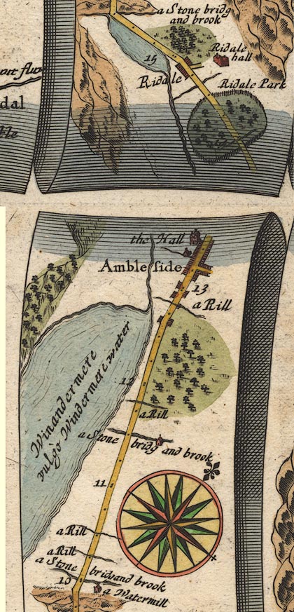 OG96m010.jpg In mile 14, Westmerland. "Ridale" houses each side of the road. item:- JandMN : 22 Image © see bottom of page |
|||
|
|
||||
| evidence:- | old map:- Berry 1679 placename:- Ridale |
|||
| source data:- | Road map, diagram, The Grand Roads of England, engraved by John
Rich, made and published by William Berry, at the Sign of the
Globe, London, 1679. "Ridale" |
|||
|
|
||||
| evidence:- | old map:- Morden 1695 (Wmd) placename:- Ridale |
|||
| source data:- | Map, hand coloured engraving, Westmorland, scale about 2.5 miles to 1 inch, by Robert
Morden, published by Abel Swale, the Unicorn, St Paul's Churchyard, Awnsham, and John
Churchill, the Black Swan, Paternoster Row, London, 1695.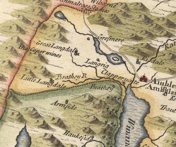 MD10NY30.jpg "Ridale" Circle, building and tower. item:- JandMN : 24 Image © see bottom of page |
|||
|
|
||||
| evidence:- | old map:- Bowen 1720 (plate 260) placename:- Ridal |
|||
| source data:- | Road strip map, uncoloured engraving, pl.260, The Road from
Kendal to Cockermouth, scale about 2 miles to 1 inch, with
sections in Westmorland and Cumberland, published by Emanuel
Bowen, St Katherines, London, 1720.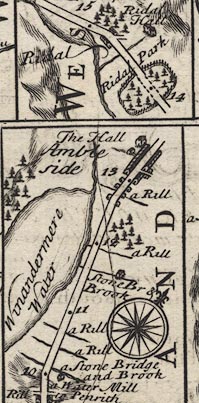 B260m10.jpg At mile 14-15. item:- private collection : 1.260 Image © see bottom of page |
|||
|
|
||||
| evidence:- | old map:- Badeslade 1742 placename:- Ridale |
|||
| source data:- | Map, uncoloured engraving, A Map of Westmorland North from
London, scale about 10 miles to 1 inch, with descriptive text,
by Thomas Badeslade, London, engraved and published by William
Henry Toms, Union Court, Holborn, London, 1742. click to enlarge click to enlargeBD12.jpg "Ridale" circle, italic lowercase text; village, hamlet or locality item:- Dove Cottage : 2007.38.62 Image © see bottom of page |
|||
|
|
||||
| evidence:- | old map:- Simpson 1746 map (Wmd) placename:- Ridale |
|||
| source data:- | Map, uncoloured engraving, Westmorland, scale about 8 miles to 1
inch, printed by R Walker, Fleet Lane, London, 1746.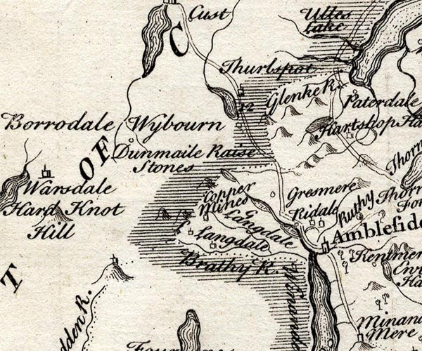 SMP2NYF.jpg "Ridale" Circle. item:- Dove Cottage : 2007.38.59 Image © see bottom of page |
|||
|
|
||||
| evidence:- | old map:- Bowen and Kitchin 1760 placename:- Rydal |
|||
| source data:- | Map, hand coloured engraving, A New Map of the Counties of
Cumberland and Westmoreland Divided into their Respective Wards,
scale about 4 miles to 1 inch, by Emanuel Bowen and Thomas
Kitchin et al, published by T Bowles, Robert Sayer, and John
Bowles, London, 1760.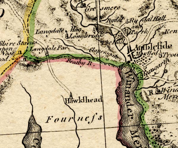 BO18SD29.jpg "Rydal" blocks, on road item:- Armitt Library : 2008.14.10 Image © see bottom of page |
|||
|
|
||||
| evidence:- | old map:- Jefferys 1770 (Wmd) placename:- Rydal |
|||
| source data:- | Map, 4 sheets, The County of Westmoreland, scale 1 inch to 1
mile, surveyed 1768, and engraved and published by Thomas
Jefferys, London, 1770.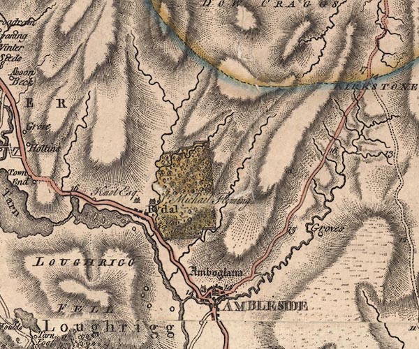 J5NY30NE.jpg "Rydal" blocks, labelled in upright lowercase text; settlement; town? item:- National Library of Scotland : EME.s.47 Image © National Library of Scotland |
|||
|
|
||||
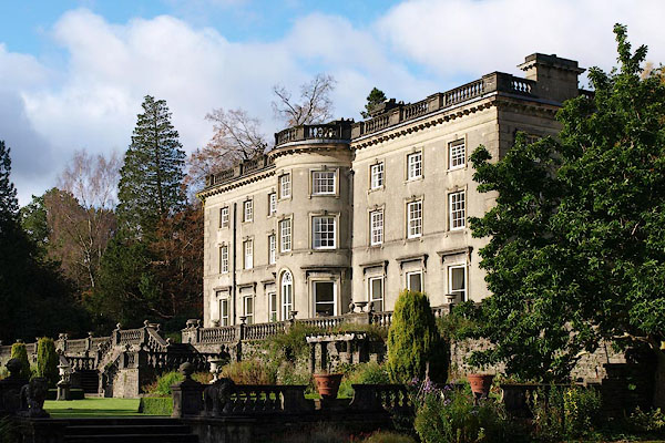
| evidence:- | old text:- Clarke 1787 placename:- Rydale item:- border service |
|||
| source data:- | Guide book, A Survey of the Lakes of Cumberland, Westmorland,
and Lancashire, written and published by James Clarke, Penrith,
Cumberland, and in London etc, 1787; published 1787-93. goto source goto sourcePage 125:- "..." "Rydale is a small scattered village; the hall, with the manor, belongs to Sir Michael le Fleming, Baronet, member of parliament for the county of Westmorland. ..." "..." "Rydale is in the parish of Grassmere, which takes in half the town of Ambleside; ..." "..." goto sourcePage 126:- "... It is a manor within the barony of Kendale, but not held under it, and was granted by Margaret de Brus (or Bruce) to Roger de Lancaster, a natural son of William de Lancaster, Baron of Kendale. This Margaret de Brus was grand-daughter to the said William, and I have seen a copy of the original grant: I shall not, however, insert it, as it contains, like many others, not much more than the boundary marks." "Rydale came into the family of the Flemings by the marriage of Sir Thomas le Fleming of Coniston in 1420, with Isabel, second daughter of Sir John de Lancaster of Howgill-Castle in this county. Mr Burn has employed 23 folio pages in tracing this family, most of which he copied from the manuscripts of a Sir Daniel Fleming of Rydale, Dr Fleming, bishop of Carlisle, and several others of the Flemings of Rydale." "The first, says he, "was Michael le Fleming, commonly called also Flandrensis. He came with William the Conqueror, and had lands given him by William de Meschiens," and adds, "that he was of a great family, and of especial favour; for when Stephen of Boulogne, (afterwards King of England,) built Furness Abbey, he granted all the lands in Furness thereto, except those of Michael Fleming; and that Pope Eugenius confirmed the same grant with the same exception."" "Of this family there have been several public and valuable characters, who have married into some of the first families in the kingdom; as the Nevil, Brandon Duke of Suffolk, &c. others forfeited their estates, as most of the northern Barons did at one time or other. I shall here transcribe an indenture made between Ralph Lord Greystoke and John Fleming, Esq; of Rydale-Hall: I cannot, however, find any tradition of the particular occasion upon which it was made: It runs as follows:" "THIS indenture, made the 9th day of December in the 7th year of the reign of King Edward the IV. betwixt Rauf Lord Greystoke and Wemm on the ton party, and John Fleming Esquire the todir party, wittness, that the said John is reteined and behest with the said Lord for terme of his life, as well in were as in peace, against all manner of men, except his legeance. The John taking yearly of the said Lord four pounds of lawfull money of England; and in the time of were, such wages as the king giffs to such men of such degree, and he go with the said lord. And the said John to take his said fee be the hands of the receiver of Greystoke, that is, or shall be, that is to say at Whitsuntide and Martynmas. And if the said John go with the said Lord over the sea, or into Scotland, and then it happen the said John Fleming, or any of his servants, to take any prisoners, that then the said Lord to have the third and the third of thirds. And if it happen that the said Lord send for the said John, to come to him and to ryde with him to London, or for any other matter, that then the said Lord to pay for his costs, and to give him bouche court for him and his feliship. In witness hereof, ayther party to the partyes of these indentures enterchangably hath set to their seales, wretyn the day and yere aforesaid." "By the above the reader will form some idea of border or knight-service, and that the Knights and Esquires held their estates of the Barons by that service, and were under the necessity of keeping in pay a certain number of men, ready at all times for war. The wages of Knights and Esquires were not generally paid in money as appears from the above, but in certain portions of land: Coin they had little," |
|||
|
|
||||
| evidence:- | old map:- Clarke 1787 map (Ambleside to Keswick) placename:- Rydale |
|||
| source data:- | Map, A Map of the Roads Lakes etc between Keswick and Ambleside,
scale about 2.5 ins to 1 mile, by James Clarke, engraved by S J
Neele, 352 Strand, published by James Clarke, Penrith,
Cumberland and in London etc, 1787.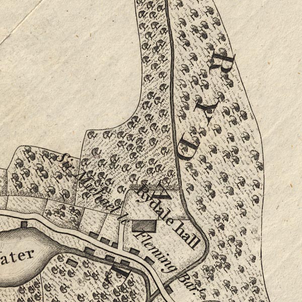 CL9NY30T.jpg "RYDALE" item:- private collection : 10.9 Image © see bottom of page |
|||
|
|
||||
| evidence:- | old map:- Cary 1789 (edn 1805) placename:- Rydal |
|||
| source data:- | Map, uncoloured engraving, Westmoreland, scale about 2.5 miles
to 1 inch, by John Cary, London, 1789; edition 1805.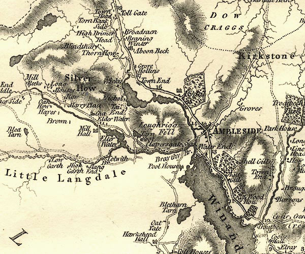 CY24NY30.jpg "Rydal" house symbol, and outline with fence palings; large house and park item:- JandMN : 129 Image © see bottom of page |
|||
|
|
||||
| evidence:- | road book:- Cary 1798 (2nd edn 1802) placename:- Rydal |
|||
| source data:- | Road book, itineraries, Cary's New Itinerary, by John Cary, 181
Strand, London, 2nd edn 1802. goto source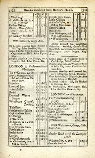 click to enlarge click to enlargeC38317.jpg page 317-318 "Rydal" item:- JandMN : 228.1 Image © see bottom of page |
|||
|
|
||||
| evidence:- | old map:- Cooke 1802 placename:- Rydal |
|||
| source data:- | Map, Westmoreland ie Westmorland, scale about 12 miles to 1
inch, by George Cooke, 1802, published by Sherwood, Jones and
Co, Paternoster Road, London, 1824. click to enlarge click to enlargeGRA1Wd.jpg "Rydal" blocks, italic lowercase text, village, hamlet, locality item:- Hampshire Museums : FA2000.62.4 Image © see bottom of page |
|||
|
|
||||
| evidence:- | old map:- Laurie and Whittle 1806 placename:- Rydal |
|||
| source data:- | Road map, Completion of the Roads to the Lakes, scale about 10
miles to 1 inch, by Nathaniel Coltman? 1806, published by Robert
H Laurie, 53 Fleet Street, London, 1834. click to enlarge click to enlargeLw18.jpg "Rydal" village or other place item:- private collection : 18.18 Image © see bottom of page |
|||
|
|
||||
| evidence:- | old map:- Cooper 1808 placename:- Rydal |
|||
| source data:- | Map, hand coloured engraving, Westmoreland ie Westmorland, scale
about 9 miles to 1 inch, by H Cooper, 1808, published by R
Phillips, Bridge Street, Blackfriars, London, 1808. click to enlarge click to enlargeCOP4.jpg "Rydal" circle; village or hamlet item:- Dove Cottage : 2007.38.53 Image © see bottom of page |
|||
|
|
||||
| evidence:- | old text:- Green 1810 placename:- Rydal |
|||
| source data:- | Set of prints, soft ground etchings, Sixty Studies from Nature,
by William Green, Ambleside, Westmorland, drawn 1808-10,
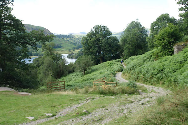
published 1810. goto source page 30:- "..." "The whole township of Rydal is calculated by nature for producing effects in the highest degree beautiful and picturesque; the middle and lower grounds are composed of elegantly undulating surfaces, which, if properly attended to, might render its whole and its parts, probably, at least, equal to any thing of the kind to be met with elsewhere." |
|||
|
|
||||
| evidence:- | old map:- Wallis 1810 (Wmd) placename:- Rydal |
|||
| source data:- | Road map, Westmoreland, scale about 19 miles to 1 inch, by James
Wallis, 77 Berwick Street, Soho, 1810, published by W Lewis,
Finch Lane, London, 1835? click to enlarge click to enlargeWAL5.jpg "Rydal" outline with fence palings; park item:- JandMN : 63 Image © see bottom of page |
|||
|
|
||||
| evidence:- | old print:- Wilkinson 1810 (plate 15) placename:- Rydal |
|||
| source data:- | Print, uncoloured soft ground etching, Cottage near Rydal, Westmorland, by Joseph
Wilkinson, engraved by William Frederick Wells, published by R Ackermann, Repository
of Arts, 101 Strand, London, 1810.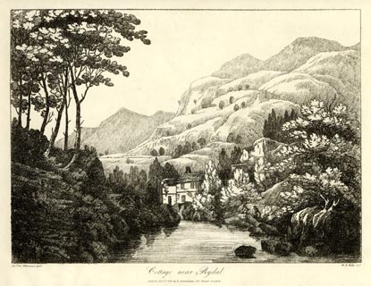 click to enlarge click to enlargeWKN115.jpg Plate 15 in Select Views in Cumberland, Westmoreland, and Lancashire. printed at bottom left, right, centre:- "Revd. Jos: Wilkenson delt. / W. F. Wells sct. / Cottage near Rydal. / Publish'd Novr. 1. 1810. by R. Ackermann. 101. Strand. London." item:- Fell and Rock Climbing Club : MN4.15 Image © see bottom of page |
|||
|
|
||||
| evidence:- | old map:- Otley 1818 placename:- Rydal |
|||
| source data:- | Map, uncoloured engraving, The District of the Lakes,
Cumberland, Westmorland, and Lancashire, scale about 4 miles to
1 inch, by Jonathan Otley, 1818, engraved by J and G Menzies,
Edinburgh, Scotland, published by Jonathan Otley, Keswick,
Cumberland, et al, 1833.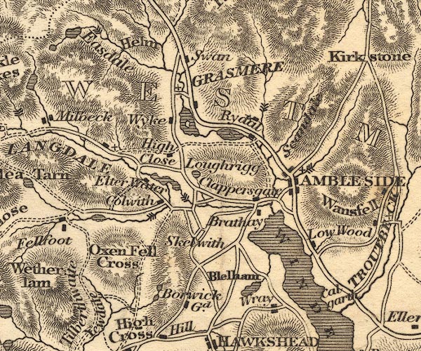 OT02NY30.jpg item:- JandMN : 48.1 Image © see bottom of page |
|||
|
|
||||
| evidence:- | old map:- Hall 1820 (Wmd) placename:- Rydal |
|||
| source data:- | Map, hand coloured engraving, Westmoreland ie Westmorland, scale
about 14.5 miles to 1 inch, by Sidney Hall, London, 1820,
published by Samuel Leigh, 18 Strand, London, 1820-31. click to enlarge click to enlargeHA18.jpg "Rydal" circle, italic lowercase text; settlement item:- Armitt Library : 2008.14.58 Image © see bottom of page |
|||
|
|
||||
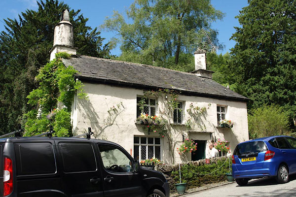
| evidence:- | old print:- Green 1822 (plate 14) placename:- Rydal item:- chimney |
|||
| source data:- | Print, uncoloured soft ground etching, South Entrance into Rydal, Westmorland, by
William Green, Ambleside, Westmorland, 1822.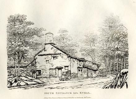 click to enlarge click to enlargeGN0814.jpg Plate 14 in Forty Etchings from Nature. printed at bottom:- "SOUTH ENTRANCE into RYDAL. / Etched from Nature by William Green, &Published at Ambleside, Feby. 1, 1822." item:- Armitt Library : A6644.14 Image © see bottom of page |
|||
|
|
||||
| evidence:- | old print:- Green 1822 (plate 15) placename:- Rydal |
|||
| source data:- | Print, uncoloured etching, Buildings in Rydal, Westmorland, by William Green, Ambleside,
Westmorland, 1822.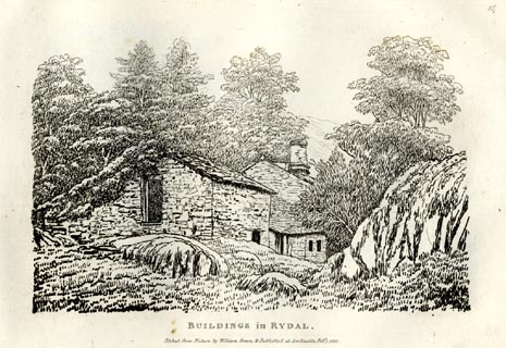 click to enlarge click to enlargeGN0815.jpg Plate 15 in Forty Etchings from Nature. printed at bottom:- "BUILDINGS in RYDAL. / Etched from Nature by William Green, &Published at Ambleside, Feby. 1, 1822." item:- Armitt Library : A6644.15 Image © see bottom of page |
|||
|
|
||||
| evidence:- | old print:- Green 1822 (plate 16) placename:- Rydal item:- bank barn |
|||
| source data:- | Print, uncoloured soft ground etching, Cottage in Rydal, Westmorland, by William Green,
Ambleside, Westmorland, 1822.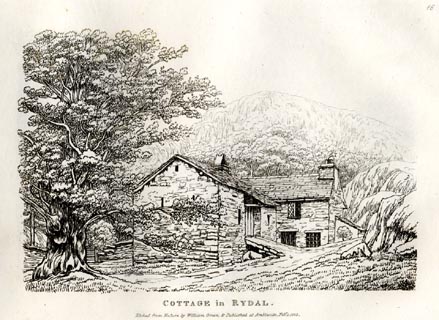 click to enlarge click to enlargeGN0816.jpg Plate 16 in Forty Etchings from Nature. printed at bottom:- "COTTAGE in RYDAL. / Etched from Nature by William Green, &Published at Ambleside, Feby. 1, 1822." item:- Armitt Library : A6644.16 Image © see bottom of page |
|||
|
|
||||
| evidence:- | old drawing:- Flower 1830s |
|||
| source data:- | Drawing, pencil, Rydal? Westmorland, by John Flower, 1830s?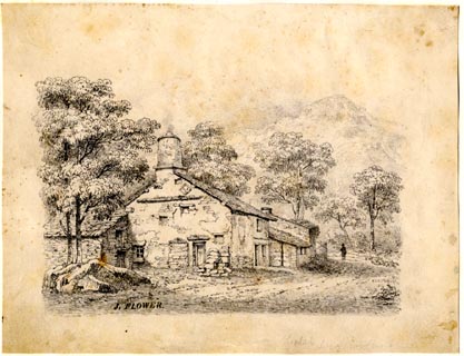 click to enlarge click to enlargePR1859.jpg ms, lower left "J. FLOWER." item:- Armitt Library : 1959.66.2 Image © see bottom of page |
|||
|
|
||||
| evidence:- | old print:- Westall 1830s placename:- Rydal |
|||
| source data:- | Print, aquatint panorama, Rydal, from Mr Wordsworth's Field under Rydal Mount, Westmorland,
drawn and engraved by William Westall, published by R Ackermann, 96 Strand, London,
1830s.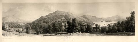 click to enlarge click to enlargeWTL309.jpg "Rydal Chapel & Village. Wansfell. Lake Windermere. Gate Crag. Loughrigg fell. Ivy Cottage. River Rotha. Bowfell. Rydal Lake. Silverhow. White moss. / Drawn & Engraved by W. Westall A.R.A. / Rydal, from Mr Wordsworth's field under Rydal Mount. / Published by R. Ackermann, 96 Strand." item:- Armitt Library : A6658.9 Image © see bottom of page |
|||
|
|
||||
| evidence:- | descriptive text:- Ford 1839 (3rd edn 1843) |
|||
| source data:- | Guide book, A Description of Scenery in the Lake District, by
Rev William Ford, published by Charles Thurnam, Carlisle, by W
Edwards, 12 Ave Maria Lane, Charles Tilt, Fleet Street, William
Smith, 113 Fleet Street, London, by Currie and Bowman,
Newcastle, by Bancks and Co, Manchester, by Oliver and Boyd,
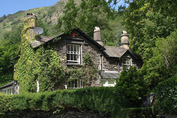
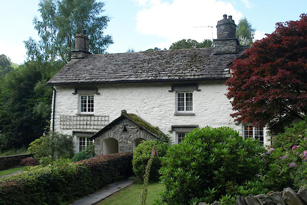
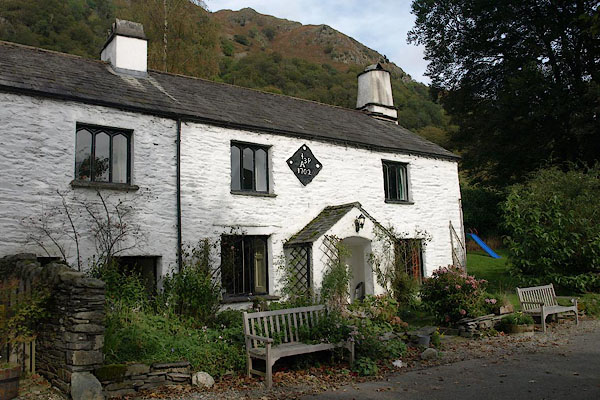
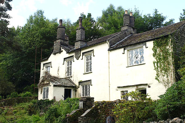
Edinburgh, and by Sinclair, Dumfries, 1839. goto source Page 40:- "..." "... The houses at Rydal are prettily covered with ivy and other creepers, and the old-fashioned picturesque chimneys are retained. ..." |
|||
|
|
||||
| evidence:- | old drawing:- Aspland 1840s-60s placename:- Rydal |
|||
| source data:- | Drawing, pencil, Rydal, Westmorland, by Theophilus Lindsey Aspland, 16 July 1852.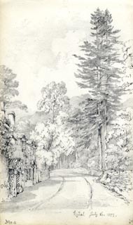 click to enlarge click to enlargeAS0311.jpg "Rydal July 16. 1852." page number "7a" item:- Armitt Library : 1958.390.11 Image © see bottom of page |
|||
|
|
||||
| evidence:- | old drawing:- Aspland 1840s-60s placename:- Rydal |
|||
| source data:- | Drawing, pencil, Rydal, Westmorland, by Theophilus Lindsey Aspland, 16 July 1852.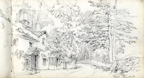 click to enlarge click to enlargeAS0313.jpg "Rydal July 16./52." page number "8" item:- Armitt Library : 1958.390.13 Image © see bottom of page |
|||
|
|
||||
| evidence:- | old drawing:- Aspland 1840s-60s placename:- Rydal |
|||
| source data:- | Drawing, pencil, Rydal, Westmorland, by Theophilus Lindsey Aspland, 16 July 1852.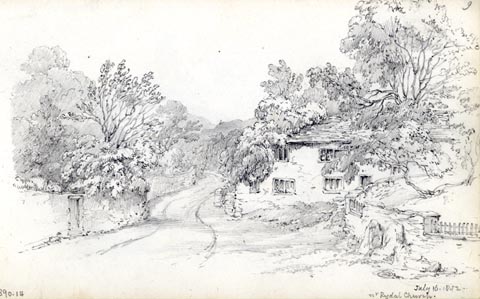 click to enlarge click to enlargeAS0314.jpg "July 16. 1852. / nr. Rydal Church." page number "9" item:- Armitt Library : 1958.390.14 Image © see bottom of page |
|||
|
|
||||
| evidence:- | old map:- Garnett 1850s-60s H placename:- Rydal |
|||
| source data:- | Map of the English Lakes, in Cumberland, Westmorland and
Lancashire, scale about 3.5 miles to 1 inch, published by John
Garnett, Windermere, Westmorland, 1850s-60s.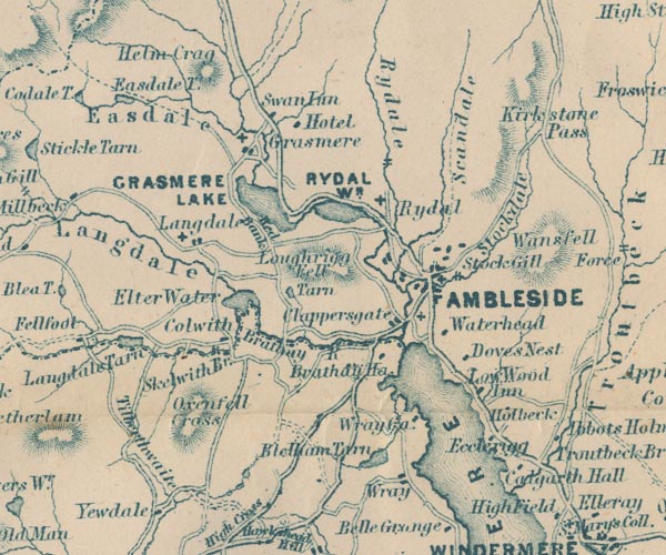 GAR2NY30.jpg "Rydal" cross, a church item:- JandMN : 82.1 Image © see bottom of page |
|||
|
|
||||
| evidence:- | old itinerary:- Tinsley 1877 (Roads/Cum) placename:- Rydal |
|||
| source data:- | Itinerary, route 7, London to Whitehaven via the Lake Districts, including from Settle,
Lancashire; through Kirkby Lonsdale, Kendal, Ambleside, Westmorland; then Keswick,
Cockermouth to Whitehaven, Cumberland, published by Tinsley Bros, 8 Catherine Street,
Strand, London, 1877. click to enlarge click to enlargeTLY188.jpg item:- private collection : 270.2 Image © see bottom of page |
|||
|
|
||||
| evidence:- | old photograph:- Bell 1880s-1940s |
|||
| source data:- | Photograph, sepia, Rydal, Westmorland, by Herbert Bell, photographer, Ambleside, Westmorland,
1890s.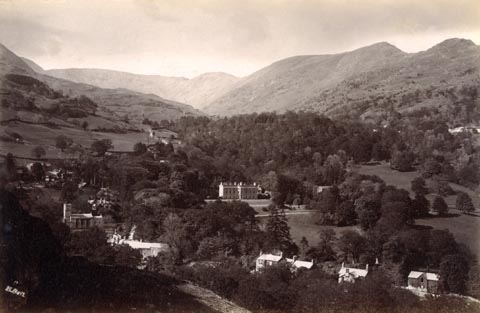 click to enlarge click to enlargeHB0864.jpg internegative at lower left:- "H. Bell" item:- Armitt Library : ALPS535 Image © see bottom of page |
|||
|
|
||||
| evidence:- | old photograph:- Bell 1880s-1940s |
|||
| source data:- | Photograph, black and white, Rydal, Westmorland, by Herbert Bell, photographer, Ambleside,
Westmorland, 1890s.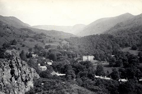 click to enlarge click to enlargeHB0666.jpg stamped on reverse:- "HERBERT BELL / Photographer / AMBLESIDE" item:- Armitt Library : ALPS329 Image © see bottom of page |
|||
|
|
||||
| evidence:- | old photograph:- Bell 1880s-1940s item:- snow |
|||
| source data:- | Photograph, sepia, trees and snow, near Fox Ghyll, Rydal, Westmorland, by Herbert
Bell, photographer, Ambleside, Westmorland, 1890s.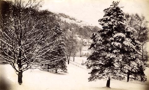 click to enlarge click to enlargeHB0665.jpg item:- Armitt Library : ALPS328 Image © see bottom of page |
|||
|
|
||||
| evidence:- | old photograph:- Bell 1880s-1940s |
|||
| source data:- | Photograph, b/w, Rydal from Brow Head, Westmorland, by Herbert Bell, Ambleside, Westmorland,
1890s?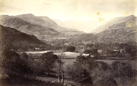 click to enlarge click to enlargeHB0278.jpg item:- Armitt Library : ALPS635 Image © see bottom of page |
|||
|
|
||||
| evidence:- | old print:- Bradley 1901 placename:- Rydal |
|||
| source data:- | Print, uncoloured lithograph, Rydal, Westmorland, by Joseph Pennell, published by
Macmillan and Co, London, 1901.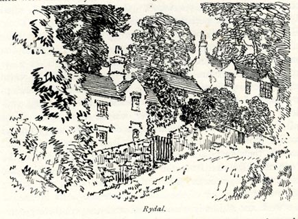 click to enlarge click to enlargeBRL158.jpg On page 228 of Highways and Byways in the Lake District, by A G Bradley. printed at bottom:- "Rydal." item:- JandMN : 464.58 Image © see bottom of page |
|||
|
|
||||
| evidence:- | old print:- Sylvan 1847 placename:- Rydal |
|||
| source data:- | Print, engraving, Entrance to Rydal, Westmorland, published by John Johnstone, Paternoster
Row, London, et al, 1847.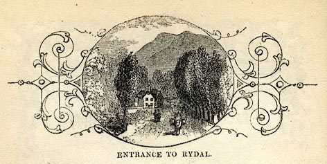 click to enlarge click to enlargeSYL114.jpg On p.50 of Sylvan's Pictorial Guide to the English Lakes. printed at bottom:- "ENTRANCE TO RYDAL." item:- Armitt Library : A1201.14 Image © see bottom of page |
|||
|
|
||||
| evidence:- | old print:- Cooke c1827 placename:- Rydal |
|||
| source data:- | Print, engraving, Rydal, Westmorland, engraved by J and H S Storer, published by Sherwood,
Jones and Co, Paternoster Row, London, about 1827?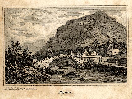 click to enlarge click to enlargeCOK7E2.jpg Part of the frontispiece to The Tourist's and Traveller's Companion to the Lakes, by Charles Cooke. printed at bottom left, centre:- "J. &H. S. Storer sculpt. / Rydal." item:- Armitt Library : A1121.2 Image © see bottom of page |
|||
|
|
||||
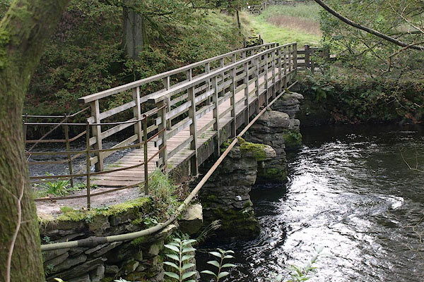
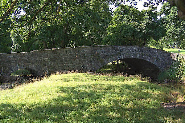
| evidence:- | old print with text:- Farington 1789 (plate 20) |
|||
| source data:- | Print, engraving, The Bridge and part of the Village of Rydal, Westmorland, painted
by Joseph Farington, engraved by W Byrne and J Landseer, published by W Byrne, 69
Titchfield Street, London, 1785.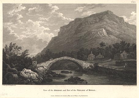 click to enlarge click to enlargeBMZ06.jpg Pelter Bridge over the River Rothay, Heron Pike in the background. Plate 20 from Views of the Lakes, &c, in Cumberland and Westmorland, published 1789; with descriptive text:- "VIEW near the VILLAGE of RYDAL." "THE Scene here represented includes Part of the Neighbourhood of Ambleside, which may contribute to justify the Description we gave of its Environs. Were a person at Leisure to attend to the various picturesque Situations he would meet with, he would allow the Subjects we have selected are not single instances, but are to be considered only as Specimens of the Style of the Country. The Bridge, which is thrown over the River Rothay, is happily situated in this View; and, with the Group of little Cottages near it, forms a beautiful Contrast to Rydal-fell, which rising in Alpine Grandeur, overshadows the Vale." item:- Dove Cottage : Lowther.7 Image © see bottom of page |
|||
|
|
||||
| evidence:- | old drawing:- |
|||
| source data:- | Drawing, ink, Rydal, Westmorland, by Jane Arnold, no date.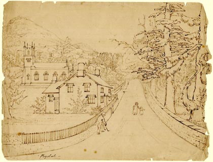 click to enlarge click to enlargePR1880.jpg "Rydal" item:- Armitt Library : 1958.3774.9 Image © see bottom of page |
|||
|
|
||||
| evidence:- | old drawing:- |
|||
| source data:- | Drawing, ink, a garden in Rydal, Westmorland, by Jane Arnold, no date.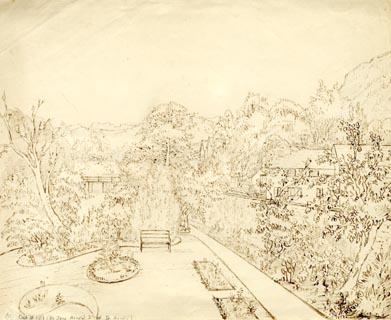 click to enlarge click to enlargePR1881.jpg item:- Armitt Library : 1958.3774.10 Image © see bottom of page |
|||
|
|
||||
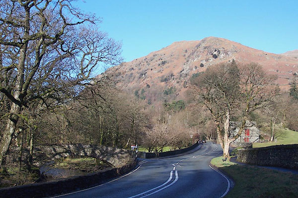 BNE31.jpg Jospeh Farington's view near Rydal. (taken 17.2.2007) |
||||
|
|
||||
| hearsay:- |
In the Act against vermin, 1566, Parliament decided that each parish should be responsible
for exterminating the fox. The bounty on a fox's head was one shilling; Sir Daniel
Fleming, Rydal, would only pay sixpence in the 17th century. |
|||
|
|
||||
| hearsay:- |
"A Professor of Physics at Rydal Would maintain the lakes were all tidal, And to this he adhered, Though the scientists jeered And assured him his theories were idle." |
|||
|
|
||||
| places:- |
|
|||
|
||||
|
||||
|
||||
|
||||
|
||||
|
||||
|
||||
|
||||
|
||||
|
||||
|
||||
|
||||
|
||||
|
||||
|
||||
|
||||
|
||||
|
||||
|
||||
|
||||
|
||||
|
||||
|
||||
|
||||
|
||||
|
||||
|
||||
|
||||
|
||||
|
||||
|
||||
|
||||
|
||||
|
||||
|
||||
|
||||
|
||||
|
||||
|
||||
|
||||
|
||||
|
||||
|
||||
|
||||
|
||||
|
||||
|
||||
|
||||
|
||||
|
||||
|
||||
|
||||
|
||||
|
||||
|
||||
|
||||
|
||||
|
||||
|
||||
|
||||
|
||||
|
||||
|
||||
|
||||
|
||||
|
||||
|
||||
|
||||
|
||||
|
||||
|
||||
|
||||
|
||||
|
||||
|
||||
|
||||
|
||||
|
||||
|
||||
|
||||
|
||||
|
||||
|
||||
|
||||
|
||||
|
||||
|
||||
|
||||
|
||||
Lakes Guides menu.