 Old Cumbria Gazetteer
 |
 |
|
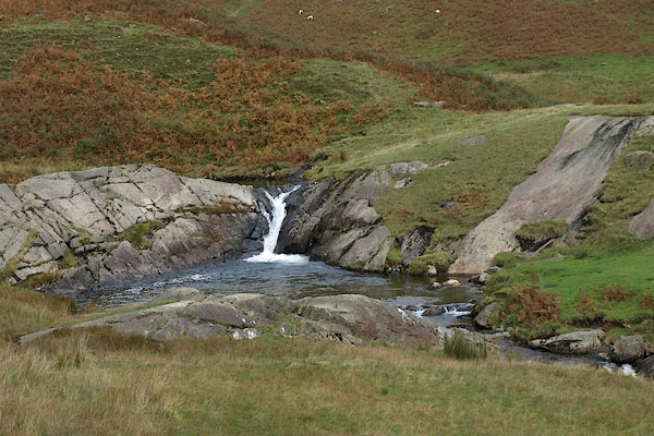
| Buckstones Jump, Rydal | ||
| Buckstones Jump | ||
| site name:- | Rydal Beck | |
| locality:- | Rydal | |
| civil parish:- | Lakes (formerly Westmorland) | |
| county:- | Cumbria | |
| locality type:- | waterfall | |
| coordinates:- | NY36660775 | |
| 1Km square:- | NY3607 | |
| 10Km square:- | NY30 | |
|
|
||
 BRR89.jpg (taken 7.10.2009) 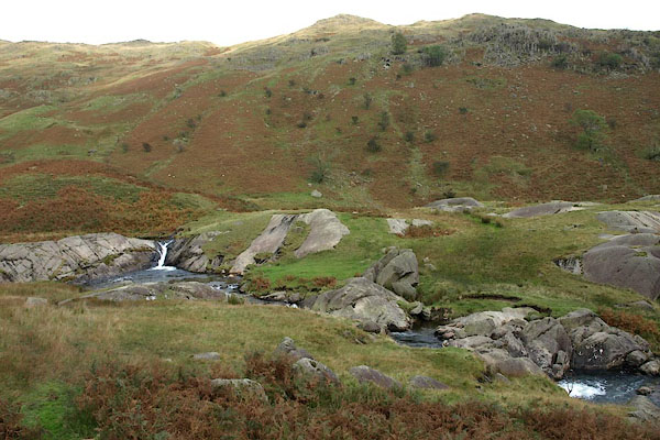 BRR90.jpg (taken 7.10.2009) |
||
|
|
||
| evidence:- | old map:- OS County Series (Wmd 19 14) placename:- Buckstones Jum |
|
| source data:- | Maps, County Series maps of Great Britain, scales 6 and 25
inches to 1 mile, published by the Ordnance Survey, Southampton,
Hampshire, from about 1863 to 1948. |
|
|
|
||
| evidence:- | old map:- Garnett 1850s-60s H |
|
| source data:- | Map of the English Lakes, in Cumberland, Westmorland and
Lancashire, scale about 3.5 miles to 1 inch, published by John
Garnett, Windermere, Westmorland, 1850s-60s.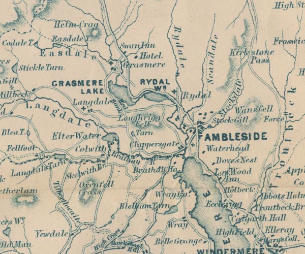 GAR2NY30.jpg two lines across a stream, waterfall item:- JandMN : 82.1 Image © see bottom of page |
|
|
|
||
 Lakes Guides menu.