Old Cumbria Gazetteer
 |
 |
|
||
| Rydal Beck | ||||
| runs into:- |  Rothay, River Rothay, River |
|||
|
|
||||
| civil parish:- | Lakes (formerly Westmorland) | |||
| county:- | Cumbria | |||
| locality type:- | river | |||
| 1Km square:- | NY3608 (etc) | |||
| 10Km square:- | NY30 | |||
|
|
||||
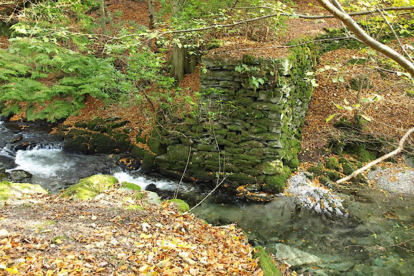
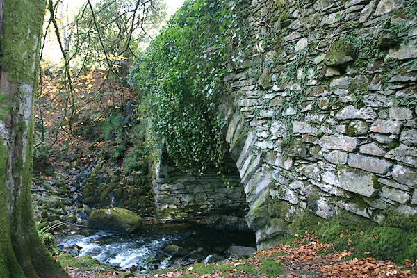
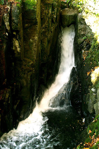
 BOE54.jpg (taken 11.9.2007) 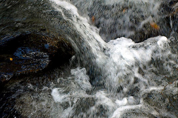 BPU35.jpg (taken 31.10.2008) courtesy of Rydal Hall |
||||
|
|
||||
| evidence:- | old map:- OS County Series (Wmd 19 10) placename:- Rydal Beck |
|||
| source data:- | Maps, County Series maps of Great Britain, scales 6 and 25
inches to 1 mile, published by the Ordnance Survey, Southampton,
Hampshire, from about 1863 to 1948. OS County Series (Wmd 19 14) OS County Series (Wmd 26 2) |
|||
|
|
||||
| evidence:- | old map:- Mercator 1595 (edn?) placename:- |
|||
| source data:- | Map, hand coloured engraving, Westmorlandia, Lancastria, Cestria
etc, ie Westmorland, Lancashire, Cheshire etc, scale about 10.5
miles to 1 inch, by Gerard Mercator, Duisberg, Germany, 1595,
edition 1613-16. MER5WmdA.jpg "" double line with stream lines; river, running into the Rothay item:- Armitt Library : 2008.14.3 Image © see bottom of page |
|||
|
|
||||
| evidence:- | old map:- Jansson 1646 |
|||
| source data:- | Map, hand coloured engraving, Cumbria and Westmoria, ie
Cumberland and Westmorland, scale about 3.5 miles to 1 inch, by
John Jansson, Amsterdam, Netherlands, 1646.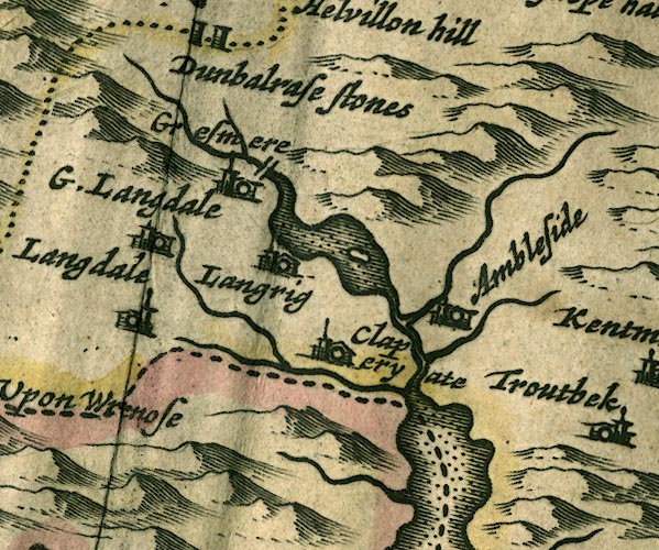 JAN3NY30.jpg Single wiggly line. item:- JandMN : 88 Image © see bottom of page |
|||
|
|
||||
| evidence:- | old map:- Ogilby 1675 (plate 96) |
|||
| source data:- | Road strip map, hand coloured engraving, the Road from Kendal to
Cockermouth, and the Road from Egremond to Carlisle, scale about
1 inch to 1 mile, by John Ogilby, London, 1675.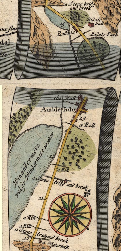 OG96m010.jpg In mile 14, Westmerland. River crosses under the road, joins the River Rothay? no bridge drawn. item:- JandMN : 22 Image © see bottom of page |
|||
|
|
||||
| evidence:- | old map:- Morden 1695 (Wmd) placename:- Rathey |
|||
| source data:- | Map, hand coloured engraving, Westmorland, scale about 2.5 miles to 1 inch, by Robert
Morden, published by Abel Swale, the Unicorn, St Paul's Churchyard, Awnsham, and John
Churchill, the Black Swan, Paternoster Row, London, 1695.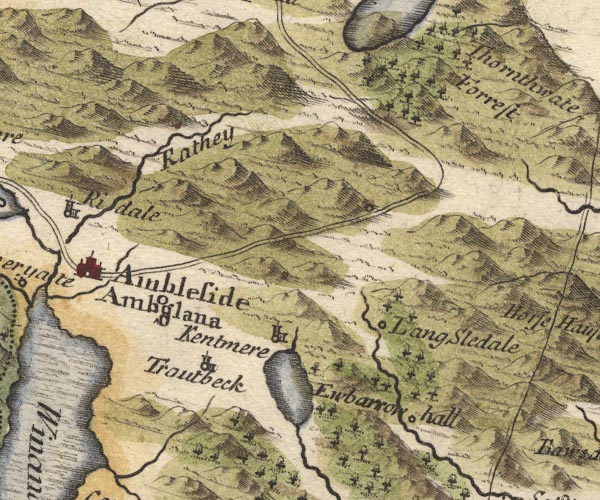 MD10NY40.jpg "Rathey" Labelling the wrong river. item:- JandMN : 24 Image © see bottom of page |
|||
|
|
||||
| evidence:- | old map:- Simpson 1746 map (Wmd) placename:- Ruthy |
|||
| source data:- | Map, uncoloured engraving, Westmorland, scale about 8 miles to 1
inch, printed by R Walker, Fleet Lane, London, 1746.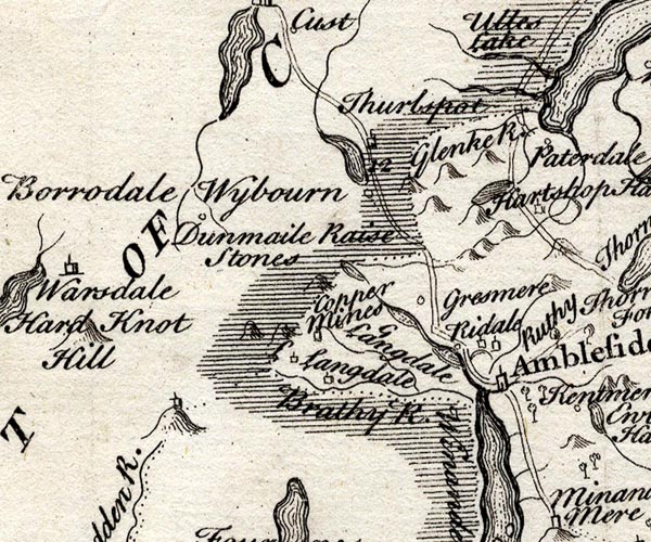 SMP2NYF.jpg "Ruthy" Wiggly line; through Rydal Park. item:- Dove Cottage : 2007.38.59 Image © see bottom of page |
|||
|
|
||||
| evidence:- | old map:- Bowen and Kitchin 1760 |
|||
| source data:- | Map, hand coloured engraving, A New Map of the Counties of
Cumberland and Westmoreland Divided into their Respective Wards,
scale about 4 miles to 1 inch, by Emanuel Bowen and Thomas
Kitchin et al, published by T Bowles, Robert Sayer, and John
Bowles, London, 1760.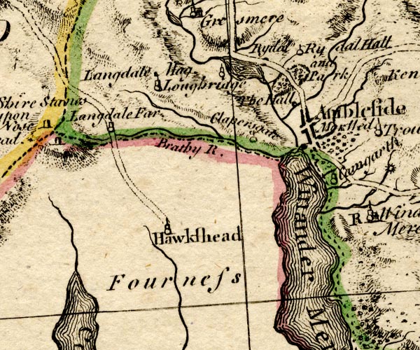 BO18SD29.jpg wiggly line, into the Rothay item:- Armitt Library : 2008.14.10 Image © see bottom of page |
|||
|
|
||||
| evidence:- | old map:- Jefferys 1770 (Wmd) |
|||
| source data:- | Map, 4 sheets, The County of Westmoreland, scale 1 inch to 1
mile, surveyed 1768, and engraved and published by Thomas
Jefferys, London, 1770.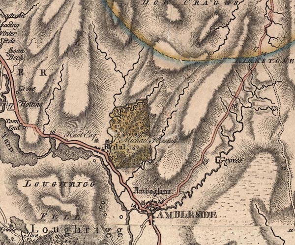 J5NY30NE.jpg single or double wiggly line; river item:- National Library of Scotland : EME.s.47 Image © National Library of Scotland |
|||
|
|
||||
| evidence:- | old text:- Clarke 1787 |
|||
| source data:- | Guide book, A Survey of the Lakes of Cumberland, Westmorland,
and Lancashire, written and published by James Clarke, Penrith,
Cumberland, and in London etc, 1787; published 1787-93. goto source Page 125:- "..." "... runs from Rydale-head through Rydale-park, forming two noble cascades, (one of which is near the hall.) ..." |
|||
|
|
||||
| evidence:- | old map:- Clarke 1787 map (Ambleside to Keswick) |
|||
| source data:- | Map, A Map of the Roads Lakes etc between Keswick and Ambleside,
scale about 2.5 ins to 1 mile, by James Clarke, engraved by S J
Neele, 352 Strand, published by James Clarke, Penrith,
Cumberland and in London etc, 1787.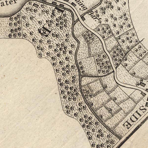 CL9NY30S.jpg item:- private collection : 10.9 Image © see bottom of page |
|||
|
|
||||
| evidence:- | old print:- Green 1810 (plate 19) placename:- Rydal Beck |
|||
| source data:- | Print, soft ground etching, Rydal Beck above the Lower Waterfall, Rydal, Westmorland,
by William Green, Ambleside, Westmorland, 1810.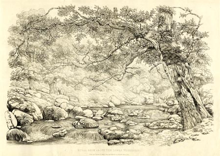 click to enlarge click to enlargeGN1219.jpg Plate 19 in Sixty Studies from Nature, 1810. printed at top right:- "19" printed at bottom:- "RYDAL BECK ABOVE THE LOWER WATERFALL. / Drawn and Engraved by William Green, and Published at Ambleside, June 24, 1810." watermark:- "J WHATMAN / 1813" item:- Armitt Library : A6641.19 Image © see bottom of page |
|||
|
|
||||
| evidence:- | old map:- Garnett 1850s-60s H |
|||
| source data:- | Map of the English Lakes, in Cumberland, Westmorland and
Lancashire, scale about 3.5 miles to 1 inch, published by John
Garnett, Windermere, Westmorland, 1850s-60s.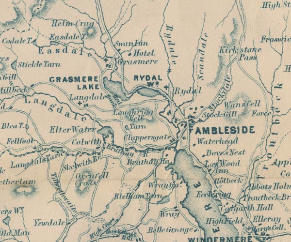 GAR2NY30.jpg wiggly line, river item:- JandMN : 82.1 Image © see bottom of page |
|||
|
|
||||
| evidence:- | old photograph:- Bell 1880s-1940s item:- waterfall |
|||
| source data:- | Photograph, sepia, waterfall, Rydal Beck, Rydal, Westmorland, by Herbert Bell, photographer,
Ambleside, Westmorland, 1890s.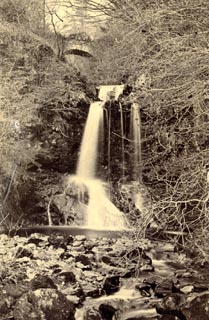 click to enlarge click to enlargeHB0699.jpg item:- Armitt Library : ALPS363 Image © see bottom of page |
|||
|
|
||||
| evidence:- | old photograph:- Bell 1880s-1940s item:- waterfall |
|||
| source data:- | Photograph, sepia, waterfall, Rydal Beck, Rydal, Westmorland, by Herbert Bell, photographer,
Ambleside, Westmorland, 1890s.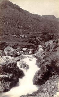 click to enlarge click to enlargeHB0700.jpg internegative at lower right:- "H. Bell" item:- Armitt Library : ALPS364 Image © see bottom of page |
|||
|
|
||||
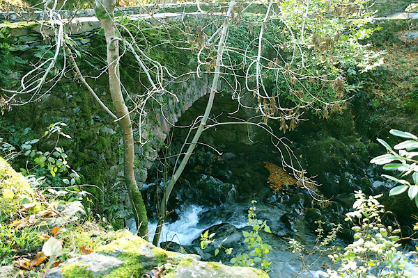
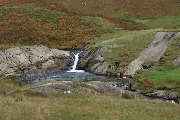
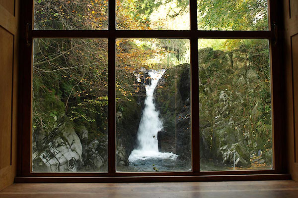
 BRS43.jpg (taken 7.10.2009)  BPU36.jpg (taken 31.10.2008) courtesy of Rydal Hall 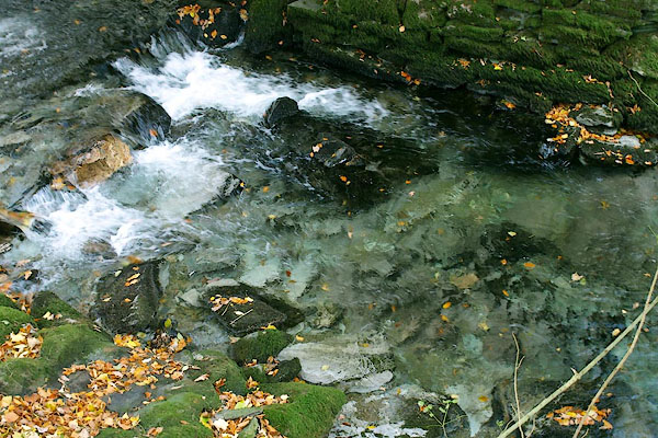 BPU16.jpg A little below Low Fall. (taken 31.10.2008) courtesy of Rydal Hall 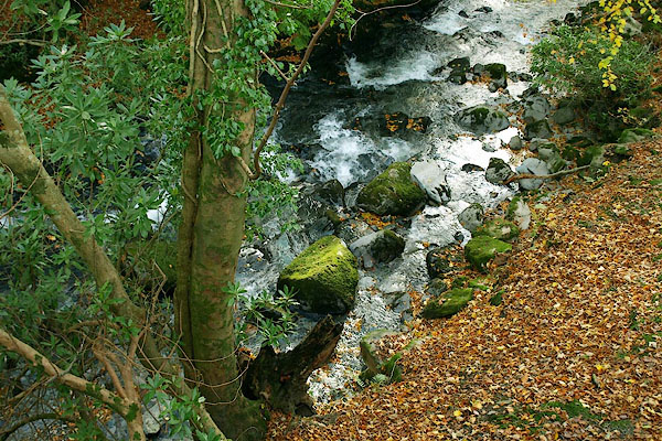 BPU17.jpg A little below Low Fall. (taken 31.10.2008) courtesy of Rydal Hall |
||||
|
|
||||
| places:- |
|
|||
|
||||
|
||||
|
||||
|
||||
|
||||
|
||||
Lakes Guides menu.