Old Cumbria Gazetteer
 |
 |
|
||
| Rothay, River | ||||
| runs into:- |  Grasmere Rydal Water Brathay, River Grasmere Rydal Water Brathay, River |
|||
|
|
||||
| civil parish:- | Lakes (formerly Westmorland) | |||
| county:- | Cumbria | |||
| locality type:- | river | |||
| 1Km square:- | NY3308 (etct) | |||
| 10Km square:- | NY30 | |||
|
|
||||
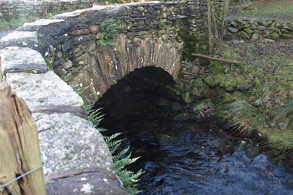
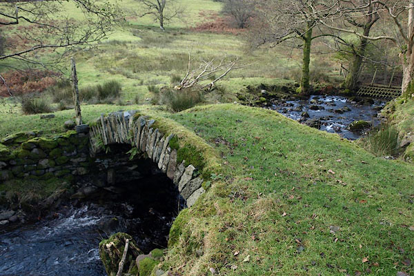
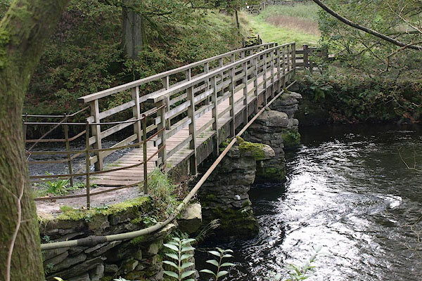
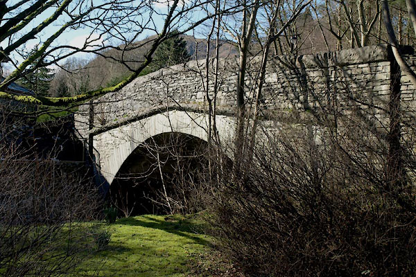
 BRV21.jpg At the bridge, (taken 11.11.2009) 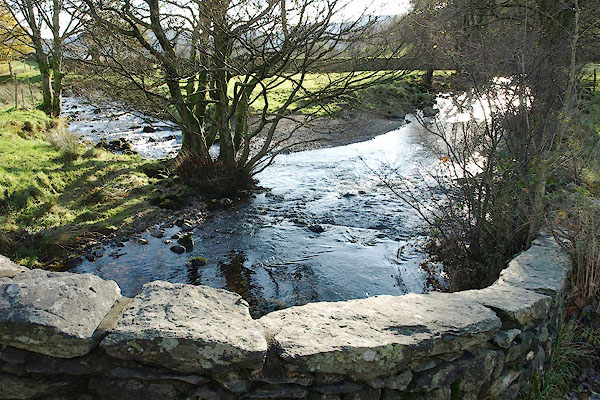 BRV11.jpg At Low Mill Bridge, Tongue Gill entering on the left. (taken 11.11.2009) |
||||
|
|
||||
| evidence:- | old map:- OS County Series (Wmd 26 10) placename:- Rothay, River |
|||
| source data:- | Maps, County Series maps of Great Britain, scales 6 and 25
inches to 1 mile, published by the Ordnance Survey, Southampton,
Hampshire, from about 1863 to 1948. |
|||
|
|
||||
| evidence:- | old map:- Saxton 1579 |
|||
| source data:- | Map, hand coloured engraving, Westmorlandiae et Cumberlandiae Comitatus ie Westmorland
and Cumberland, scale about 5 miles to 1 inch, by Christopher Saxton, London, engraved
by Augustinus Ryther, 1576, published 1579-1645.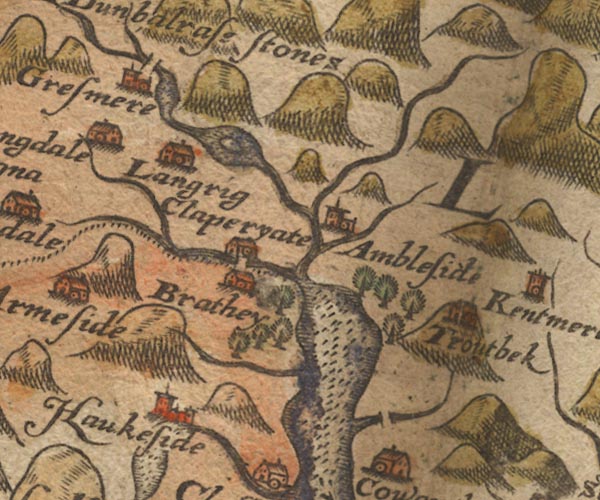 Sax9NY30.jpg item:- private collection : 2 Image © see bottom of page |
|||
|
|
||||
| evidence:- | old map:- Mercator 1595 (edn?) placename:- |
|||
| source data:- | Map, hand coloured engraving, Westmorlandia, Lancastria, Cestria
etc, ie Westmorland, Lancashire, Cheshire etc, scale about 10.5
miles to 1 inch, by Gerard Mercator, Duisberg, Germany, 1595,
edition 1613-16. MER5WmdA.jpg "" double line with stream lines; river, running into Windermere lake not into the Brathay item:- Armitt Library : 2008.14.3 Image © see bottom of page |
|||
|
|
||||
| evidence:- | old map:- Speed 1611 (Wmd) |
|||
| source data:- | Map, hand coloured engraving, The Countie Westmorland and
Kendale the Cheif Towne, scale about 2.5 miles to 1 inch, by
John Speed, 1610, published by George Humble, Popes Head Alley,
London, 1611-12.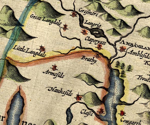 SP14NY30.jpg double line, from Rydal Water into Grasmere, from thence into Windermere item:- Armitt Library : 2008.14.5 Image © see bottom of page |
|||
|
|
||||
| evidence:- | old map:- Jansson 1646 |
|||
| source data:- | Map, hand coloured engraving, Cumbria and Westmoria, ie
Cumberland and Westmorland, scale about 3.5 miles to 1 inch, by
John Jansson, Amsterdam, Netherlands, 1646. JAN3NY30.jpg Double wiggly line. item:- JandMN : 88 Image © see bottom of page |
|||
|
|
||||
| evidence:- | old map:- Ogilby 1675 (plate 96) |
|||
| source data:- | Road strip map, hand coloured engraving, the Road from Kendal to
Cockermouth, and the Road from Egremond to Carlisle, scale about
1 inch to 1 mile, by John Ogilby, London, 1675.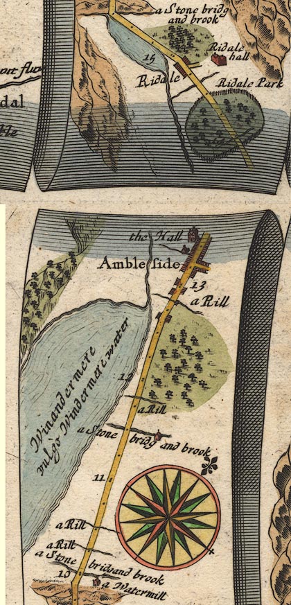 OG96m010.jpg In mile 13, Westmoreland. River alongside off the left of the road, running into lake Windermere. In mile 14, Westmerland. River alongside the road on the left, running out of Rydal Water. item:- JandMN : 22 Image © see bottom of page |
|||
|
|
||||
| evidence:- | old map:- Sanson 1679 |
|||
| source data:- | Map, hand coloured engraving, Ancien Royaume de Northumberland
aujourdhuy Provinces de Nort, ie the Ancient Kingdom of
Northumberland or the Northern Provinces, scale about 9.5 miles
to 1 inch, by Nicholas Sanson, Paris, France, 1679. click to enlarge click to enlargeSAN2Cm.jpg tapering wiggly line; river item:- Dove Cottage : 2007.38.15 Image © see bottom of page |
|||
|
|
||||
| evidence:- | old map:- Seller 1694 (Wmd) |
|||
| source data:- | Map, hand coloured engraving, Westmorland, scale about 8 miles
to 1 inch, by John Seller, 1694. click to enlarge click to enlargeSEL7.jpg tapering wiggly line; river item:- Dove Cottage : 2007.38.87 Image © see bottom of page |
|||
|
|
||||
| evidence:- | old map:- Morden 1695 (Wmd) |
|||
| source data:- | Map, hand coloured engraving, Westmorland, scale about 2.5 miles to 1 inch, by Robert
Morden, published by Abel Swale, the Unicorn, St Paul's Churchyard, Awnsham, and John
Churchill, the Black Swan, Paternoster Row, London, 1695.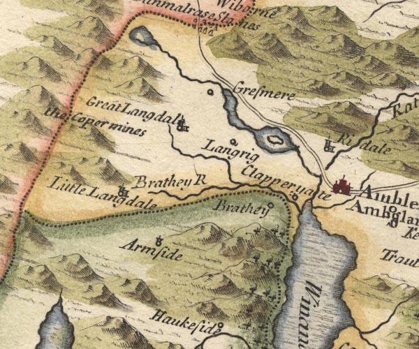 MD10NY30.jpg River from Rydal Water into Windermere. item:- JandMN : 24 Image © see bottom of page |
|||
|
|
||||
| evidence:- | old map:- Badeslade 1742 placename:- |
|||
| source data:- | Map, uncoloured engraving, A Map of Westmorland North from
London, scale about 10 miles to 1 inch, with descriptive text,
by Thomas Badeslade, London, engraved and published by William
Henry Toms, Union Court, Holborn, London, 1742. click to enlarge click to enlargeBD12.jpg "" tapering wiggly line item:- Dove Cottage : 2007.38.62 Image © see bottom of page |
|||
|
|
||||
| evidence:- | old map:- Simpson 1746 map (Wmd) |
|||
| source data:- | Map, uncoloured engraving, Westmorland, scale about 8 miles to 1
inch, printed by R Walker, Fleet Lane, London, 1746.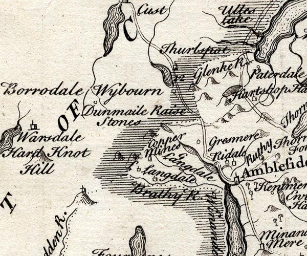 SMP2NYF.jpg Wiggly line; into Windermere. item:- Dove Cottage : 2007.38.59 Image © see bottom of page |
|||
|
|
||||
| evidence:- | old map:- Bowen and Kitchin 1760 placename:- Rothey, River |
|||
| source data:- | Map, hand coloured engraving, A New Map of the Counties of
Cumberland and Westmoreland Divided into their Respective Wards,
scale about 4 miles to 1 inch, by Emanuel Bowen and Thomas
Kitchin et al, published by T Bowles, Robert Sayer, and John
Bowles, London, 1760. BO18NY20.jpg wiggly line, into Grasmere lake 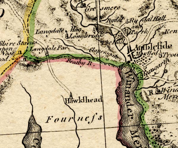 BO18SD29.jpg wiggly line, into Windermere item:- Armitt Library : 2008.14.10 Image © see bottom of page |
|||
|
|
||||
| evidence:- | old map:- Jefferys 1770 (Wmd) |
|||
| source data:- | Map, 4 sheets, The County of Westmoreland, scale 1 inch to 1
mile, surveyed 1768, and engraved and published by Thomas
Jefferys, London, 1770.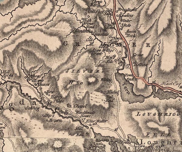 J5NY30NW.jpg 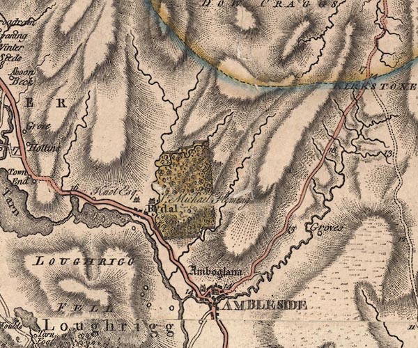 J5NY30NE.jpg 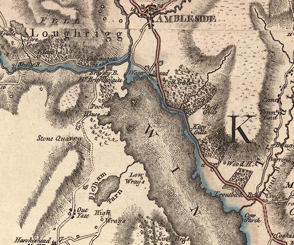 J5NY30SE.jpg single or double wiggly line; river item:- National Library of Scotland : EME.s.47 Images © National Library of Scotland |
|||
|
|
||||
| evidence:- | descriptive text:- West 1778 (11th edn 1821) |
|||
| source data:- | Guide book, A Guide to the Lakes, by Thomas West, published by
William Pennington, Kendal, Cumbria once Westmorland, and in
London, 1778 to 1821. goto source Page 72:- "..." "The principal feeders of Windermere-water, are the rivers Rothay and Brathay.- They unite their streams at the western corner of the head of the lake, below Clappersgate, at a place called the Three-foot-brander, and after a short course boldly enter the lake." goto sourceRev Plumtre's Night Piece on Windermere, 1797 Page 229:- "..." "Hark! along his rocky shore, / I hear impetuous Brathay roar; / In sullen majesty he leads, / Among the narrow winding meads, / His tributary tides. / Thee, Rothay, in thy course he meets, / Descending from thy flow'ry bed, / Swift to thee he fondly glides, / With strong embrace thy beauty greets: /" goto sourcePage 230:- "Then, with all your glittering train, / Together your proud course maintain, / And with imperial Windermere, / All your boastful honours share; / With loud acclaim, exulting, hail! / The monarch of the stately vale." "..." goto sourcePage 231:- "..." "But, Rothay, you a gentler tide, / Serenely through the valleys glide. / Peaceful Grasmere's wooded hills, / Pour forth for you their tinkling rills." goto sourcePage 232:- "Through Rydal's lake, with placid stream, / You, murmuring, in the valley gleam; / And, at the neighbouring water's fall, / Pass your Fleming's stately hall; / For, O 'tis your delight to boast / The falls down Rydal's mountains tost; / The high cascade, with dashing spray, / O'er rugged rocks maintains its way, / With stubbed trees, by storms despoil'd - / A scene most picturesquely wild, / Sublime the next cascade appears, / The lower, softer features wears." "Such scenes nor Poussin could, nor Claude, / In living canvas e'er afford; / For nature ev'ry effort tried / To form your Fleming's wat'ry pride. / - Nor be forgot thy force, Stock-gill, / Rushing from the shatter'd hill, / Down in frothy torrents tost, / Till in the dark abysm lost, / And foaming through the woody glen, / Thund'ring from rock to rock amain, / You seek a refuge in the plain." "O Rothay! yours, and Brathay's stream, / Enfold (Well worth the Muse's theme) / A spot where Art with Nature vies / To catch the enraptur'd poet's eyes. / But be it most his pride to tell, / There Elegance and Virtue dwell; / There Hospitality is found / Dealing delight to all around, / ..." |
|||
|
|
||||
| evidence:- | old map:- Crosthwaite 1783-94 (Win/Ble) placename:- Routhay River |
|||
| source data:- | Map, uncoloured engraving, An Accurate Map of the Grand Lake of
Windermere, scale about 2 inches to 1 mile, by Peter
Crosthwaite, Keswick, Cumberland, 1783, version published 1819.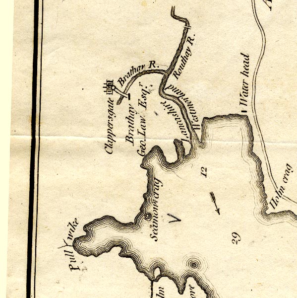 CT9NY30R.jpg "Routhay R." "Lancashire / Westmorland" labelled either side of the river item:- Armitt Library : 2008.14.102 Image © see bottom of page |
|||
|
|
||||
| evidence:- | old map:- West 1784 map |
|||
| source data:- | Map, hand coloured engraving, A Map of the Lakes in Cumberland,
Westmorland and Lancashire, scale about 3.5 miles to 1 inch,
engraved by Paas, 53 Holborn, London, about 1784.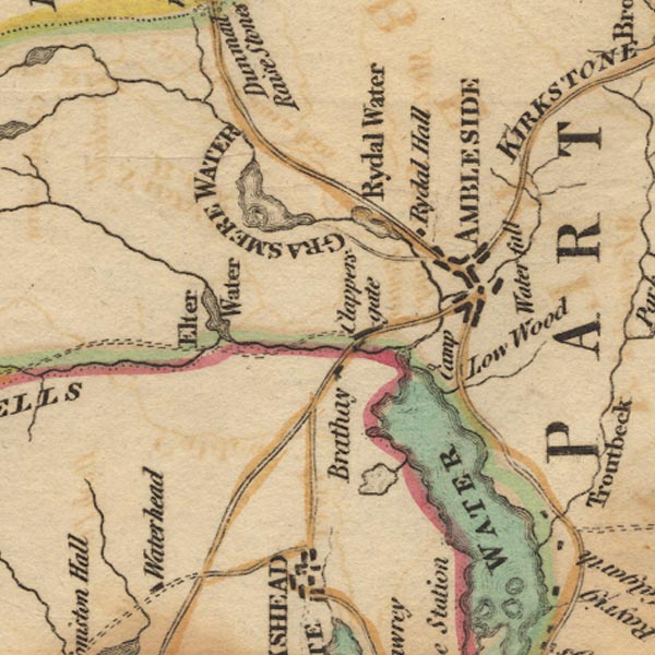 Ws02NY30.jpg item:- Armitt Library : A1221.1 Image © see bottom of page |
|||
|
|
||||
| evidence:- | old map:- Clarke 1787 map (Ambleside to Keswick) |
|||
| source data:- | Map, A Map of the Roads Lakes etc between Keswick and Ambleside,
scale about 2.5 ins to 1 mile, by James Clarke, engraved by S J
Neele, 352 Strand, published by James Clarke, Penrith,
Cumberland and in London etc, 1787. CL9NY30J.jpg  CL9NY30I.jpg 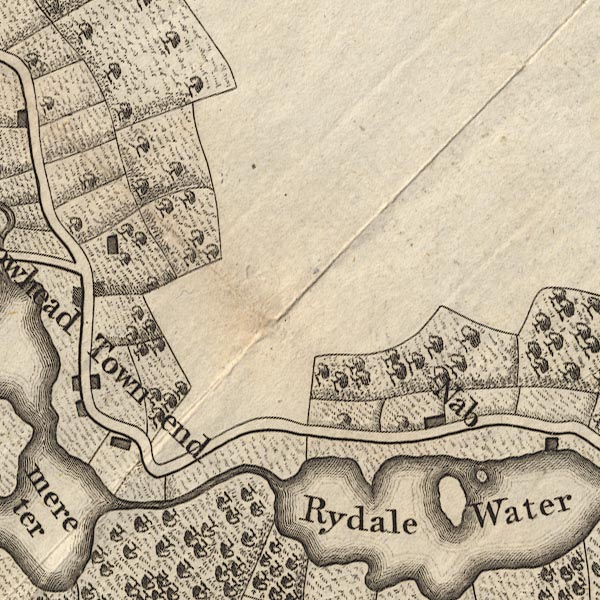 CL9NY30N.jpg 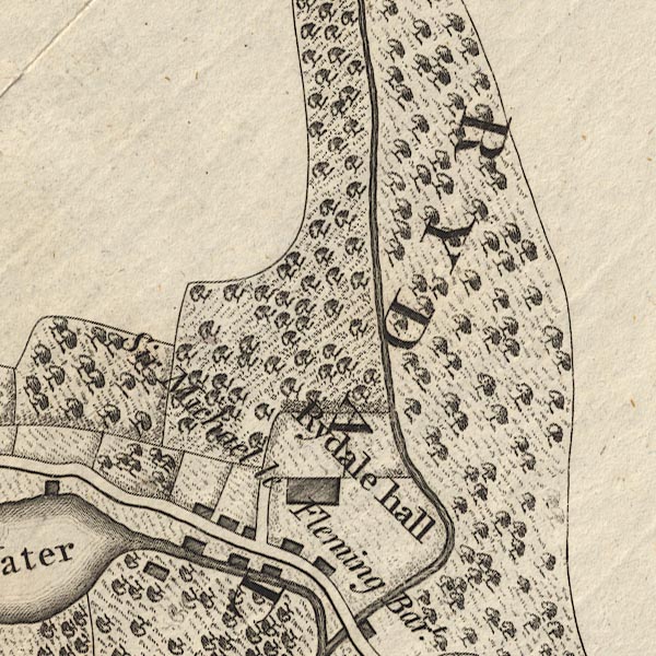 CL9NY30T.jpg 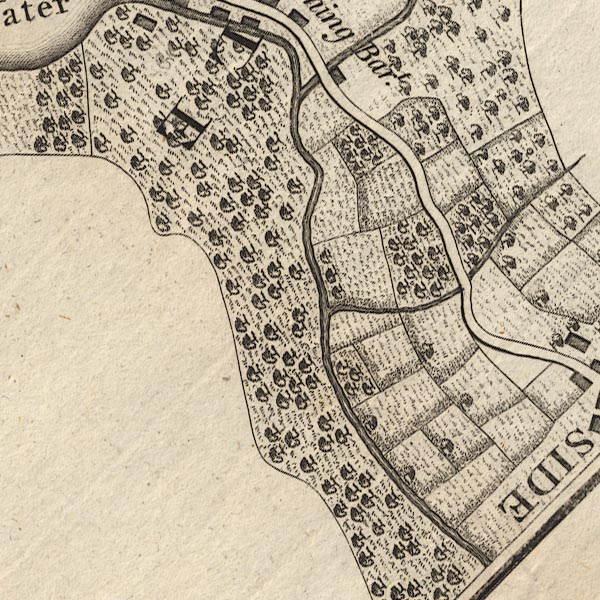 CL9NY30S.jpg item:- private collection : 10.9 Image © see bottom of page |
|||
|
|
||||
| evidence:- | old map:- Clarke 1787 map (Windermere N) placename:- Rothay, River |
|||
| source data:- | Map, A Map of the Northern Part of the Lake Winandermere and its
Environs, scale about 6.5 ins to 1 mile, by James Clarke,
engraved by Samuel John Neele, 352 Strand, published by James
Clarke, Penrith, Cumberland and in London etc, 1787.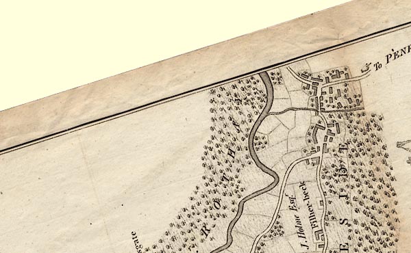 CLANY30S.jpg 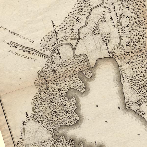 CLANY30R.jpg "Rr. ROTHAY" item:- private collection : 10.10 Image © see bottom of page |
|||
|
|
||||
| evidence:- | old map:- Cary 1789 (edn 1805) |
|||
| source data:- | Map, uncoloured engraving, Westmoreland, scale about 2.5 miles
to 1 inch, by John Cary, London, 1789; edition 1805.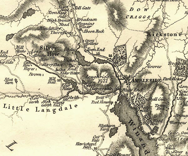 CY24NY30.jpg river running through Grasmere and Rydal lakes and into the Brathay item:- JandMN : 129 Image © see bottom of page |
|||
|
|
||||
| evidence:- | old drawing:- Green 1790s-1820s |
|||
| source data:- | Drawing, pen and wash, Confluence of the Rivers Rothay and Brathay, Westmorland, by
William Green, Ambleside, Westmorland, 1810.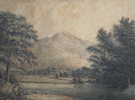 click to enlarge click to enlargePR1728.jpg courtesy of Abbot Hall Art Gallery, Kendal item:- Abbot Hall : AH334.63 Image © see bottom of page |
|||
|
|
||||
| evidence:- | old map:- Cooke 1802 |
|||
| source data:- | Map, The Lakes, Westmorland and Cumberland, scale about 8.5
miles to 1 inch, engravedby Neele and Son, published by
Sherwood, Jones and Co, Paternoster Road, London, 1824. click to enlarge click to enlargeGRA1Lk.jpg tapering wiggly line; river item:- Hampshire Museums : FA2000.62.5 Image © see bottom of page |
|||
|
|
||||
| evidence:- | old map:- Cooper 1808 |
|||
| source data:- | Map, hand coloured engraving, Westmoreland ie Westmorland, scale
about 9 miles to 1 inch, by H Cooper, 1808, published by R
Phillips, Bridge Street, Blackfriars, London, 1808. click to enlarge click to enlargeCOP4.jpg tapering wiggly line; river item:- Dove Cottage : 2007.38.53 Image © see bottom of page |
|||
|
|
||||
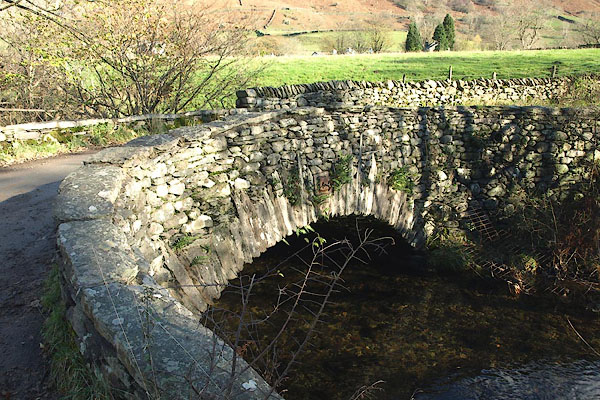
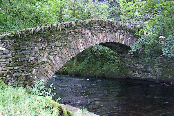
| evidence:- | old print:- Green 1810 (plate 16) |
|||
| source data:- | Print, soft ground etching, Pelter Bridge, Rydal, Westmorland, by William Green, Ambleside,
Westmorland, 1808.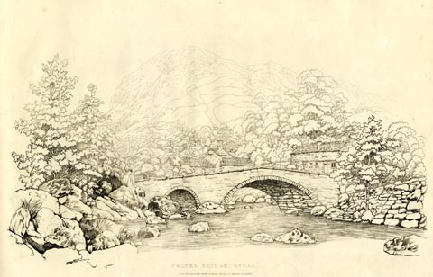 click to enlarge click to enlargeGN1216.jpg Plate 16 in Sixty Studies from Nature, 1810. printed at top right:- "16" printed at bottom:- "PELTER BRIDGE, RYDAL. / Drawn and Engraved by William Green and Published at Ambleside, June 24, 1808." watermark:- "J WHATMAN / 1813" item:- Armitt Library : A6641.16 Image © see bottom of page |
|||
|
|
||||
| evidence:- | old print:- Green 1810 (plate 17) item:- chimney |
|||
| source data:- | Print, soft ground etching, Cottage at Rydal, Westmorland, by William Green, Ambleside,
Westmorland, 1810.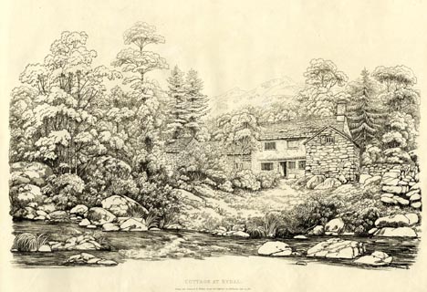 click to enlarge click to enlargeGN1217.jpg This might be Manor Cottage? Plate 17 in Sixty Studies from Nature, 1810. printed at top right:- "17" printed at bottom:- "COTTAGE AT RYDAL. / Drawn and Engraved by William Green, and Published at Ambleside, June 24, 1810." watermark:- "J WHATMAN / 1813" item:- Armitt Library : A6641.17 Image © see bottom of page |
|||
|
|
||||
| evidence:- | old print:- Green 1815 item:- cattle |
|||
| source data:- | Print, coloured aquatint, Outlet to Grasmere Lake, Westmorland, by William Green,
Ambleside, Westmorland, 1815.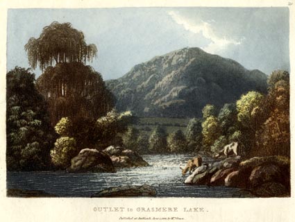 click to enlarge click to enlargeGN0527.jpg The River Rothay. Plate 29 in Lake Scenery. printed at upper right:- "29" printed at bottom:- "OUTLET to GRASMERE LAKE. / Published at Ambleside, June 1, 1815, by Wm. Green." item:- Armitt Library : A6646.27 Image © see bottom of page |
|||
|
|
||||
| evidence:- | old map:- Hall 1820 (Wmd) |
|||
| source data:- | Map, hand coloured engraving, Westmoreland ie Westmorland, scale
about 14.5 miles to 1 inch, by Sidney Hall, London, 1820,
published by Samuel Leigh, 18 Strand, London, 1820-31. click to enlarge click to enlargeHA18.jpg tapering wiggly line; river item:- Armitt Library : 2008.14.58 Image © see bottom of page |
|||
|
|
||||
| evidence:- | descriptive text:- Otley 1823 (5th edn 1834) item:- fishing; char; trout |
|||
| source data:- | Guide book, A Concise Description of the English Lakes, the
mountains in their vicinity, and the roads by which they may be
visited, with remarks on the mineralogy and geology of the
district, by Jonathan Otley, published by the author, Keswick,
Cumberland now Cumbria, by J Richardson, London, and by Arthur
Foster, Kirkby Lonsdale, Cumbria, 1823; published 1823-49,
latterly as the Descriptive Guide to the English Lakes. goto source Page 3:- "... The principal feeders of the lake [Windermere] are the Rothay, having its source in Grasmere; and the Brathay, issuing from Langdale. These two rivers unite their streams about half a mile before entering the lake; and a remarkable circumstance is, that the trout and char, both leaving the lake about the same time to deposit their spawn, separate themselves into the two different rivers; the trout making choice of the Rothay, and the char the Brathay." goto sourcePage 41:- "The becks of Great and Little Langdale combined form the Brathay, and those of Grasmere the Rothay, which unite in Windermere: ..." |
|||
|
|
||||
| evidence:- | descriptive text:- Ford 1839 (3rd edn 1843) |
|||
| source data:- | Guide book, A Description of Scenery in the Lake District, by
Rev William Ford, published by Charles Thurnam, Carlisle, by W
Edwards, 12 Ave Maria Lane, Charles Tilt, Fleet Street, William
Smith, 113 Fleet Street, London, by Currie and Bowman,
Newcastle, by Bancks and Co, Manchester, by Oliver and Boyd,
Edinburgh, and by Sinclair, Dumfries, 1839. goto source Page 24:- "..." "[Windermere] ... The chief feeders are the streams of the Rothay and Brathay, which unite at the landing-place. The former, descending from the Raise Gap and from Easedale Tarn, passes through Grasmere and Rydal; ..." |
|||
|
|
||||
| evidence:- | old drawing:- Aspland 1840s-60s |
|||
| source data:- | Drawing, pencil, River Rothay, Westmorland, by Theophilus Lindsey Aspland, about 1849.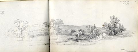 click to enlarge click to enlargeAS0123.jpg "Rothay / Wray Castle" item:- Armitt Library : 1958.487.23 Image © see bottom of page |
|||
|
|
||||
| evidence:- | old map:- Garnett 1850s-60s H |
|||
| source data:- | Map of the English Lakes, in Cumberland, Westmorland and
Lancashire, scale about 3.5 miles to 1 inch, published by John
Garnett, Windermere, Westmorland, 1850s-60s.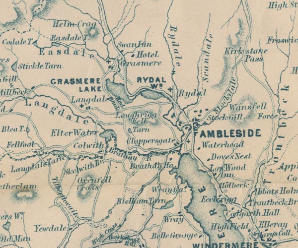 GAR2NY30.jpg wiggly line, river item:- JandMN : 82.1 Image © see bottom of page |
|||
|
|
||||
| evidence:- | old text:- Martineau 1855 |
|||
| source data:- | Guide book, A Complete Guide to the English Lakes, by Harriet
Martineau, published by John Garnett, Windermere, Westmorland,
and by Whittaker and Co, London, 1855; published 1855-76. goto source Page 19:- "..." "Two rivers fall into the lake, uniting just before they reach it;- the Rothay, which comes down from Dunmail Raise, beyond Grasmere, and the Brathay, ... The valleys of the Rothay and the Brathay are separated by Loughrigg ..." |
|||
|
|
||||
| evidence:- | old map:- Prior 1874 map 1 placename:- Rothay, River |
|||
| source data:- | Map, uncoloured engraving or lithograph? Winander Mere, scale
about 2.5 miles to 1 inch, published by John Garnett,
Windermere, Westmorland, 1874. click to enlarge click to enlargePI03M1.jpg "R. Rothay" double line with stream lines; river item:- private collection : 133.1 Image © see bottom of page |
|||
|
|
||||
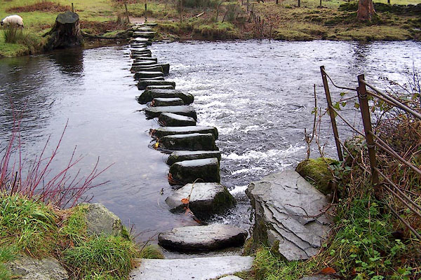
| evidence:- | probably old photograph:- Bell 1880s-1940s |
|||
| source data:- | Photograph, black and white, stereo photo, Near Stepping Stones, presumably on the
Rothay River, Loughrigg, Westmorland, by Herbert Bell, photographer, Ambleside, Westmorland,
1900s?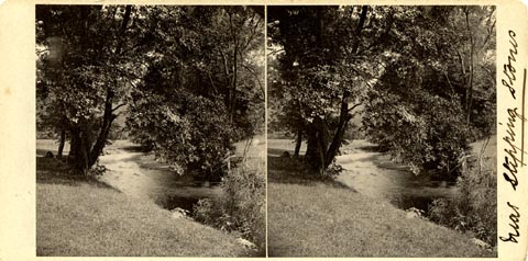 click to enlarge click to enlargeHB0979.jpg ms at mount:- "Near Stepping Stones" printed at rev of mount:- "Herbert Bell / Ambleside." item:- Armitt Library : 2005.159 Image © see bottom of page |
|||
|
|
||||
| evidence:- | old photograph:- Bell 1880s-1940s |
|||
| source data:- | Photograph, black and white, River Rothay near the stepping stones, Rydal, Westmorland,
by Herbert Bell, photographer, Ambleside, Westmorland, 1890s.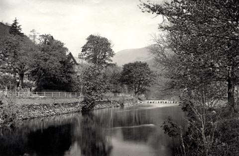 click to enlarge click to enlargeHB0921.jpg item:- Armitt Library : ALPS596 Image © see bottom of page |
|||
|
|
||||
| evidence:- | old photograph:- Bell 1880s-1940s |
|||
| source data:- | Photograph, black and white, the River Rothay, near Foz How, Rydal, Westmorland, by
Herbert Bell, photographer, Ambleside, Westmorland, 1890s.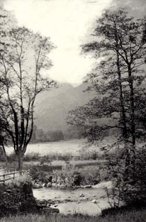 click to enlarge click to enlargeHB0868.jpg item:- Armitt Library : ALPS539 Image © see bottom of page |
|||
|
|
||||
| evidence:- | old photograph:- Bell 1880s-1940s |
|||
| source data:- | Photograph, black and white, River Rothay, Rydal, Westmorland, by Herbert Bell, photographer,
Ambleside, Westmorland, 1890s.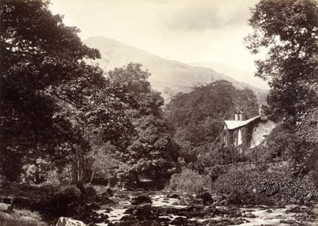 click to enlarge click to enlargeHB0862.jpg item:- Armitt Library : ALPS533 Image © see bottom of page |
|||
|
|
||||
| evidence:- | old photograph:- Bell 1880s-1940s |
|||
| source data:- | Photograph, black and white, River Rothay north of Pelter Bridge, Rydal, Westmorland,
by Herbert Bell, photographer, Ambleside, Westmorland, 1890s.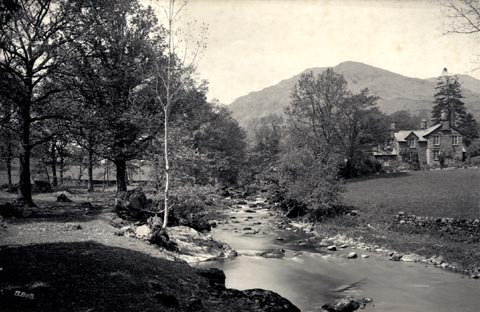 click to enlarge click to enlargeHB0848.jpg internegative at lower left:- "H. Bell" stamped at reverse:- "HERBERT BELL / Photographer / AMBLESIDE" item:- Armitt Library : ALPS519 Image © see bottom of page |
|||
|
|
||||
| evidence:- | old photograph:- Bell 1880s-1940s |
|||
| source data:- | Photograph, black and white, mouth of the River Rothay, Windermere, Westmorland, by
Herbert Bell, photographer, Ambleside, Westmorland, 1890s.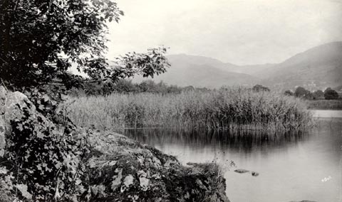 click to enlarge click to enlargeHB0824.jpg internegative at lower right:- "H. Bell" item:- Armitt Library : ALPS487 Image © see bottom of page |
|||
|
|
||||
| evidence:- | old photograph:- Bell 1880s-1940s |
|||
| source data:- | Photograph, black and white, River Rothay running into Windermer lake, from Loughrigg
Fell, Westmorland, by Herbert Bell, photographer, Ambleside, Westmorland, 1890s.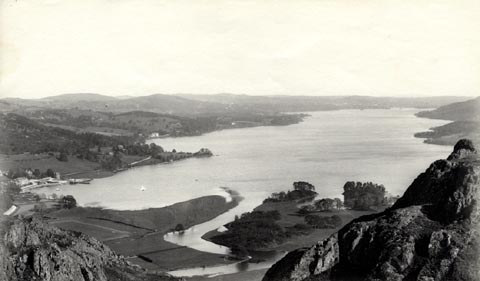 click to enlarge click to enlargeHB0800.jpg stamped at reverse:- "HERBERT BELL / Photographer / AMBLESIDE" item:- Armitt Library : ALPS463 Image © see bottom of page |
|||
|
|
||||
| evidence:- | old photograph:- Bell 1880s-1940s |
|||
| source data:- | Photograph, black and white, River Rothay from Pelter Bridge, Rydal, Westmorland,
by Herbert Bell, photographer, Ambleside, Westmorland, 1890s.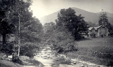 click to enlarge click to enlargeHB0696.jpg stamped on reverse:- "HERBERT BELL / Photographer / AMBLESIDE" item:- Armitt Library : ALPS360 Image © see bottom of page |
|||
|
|
||||
| evidence:- | old photograph:- Bell 1880s-1940s |
|||
| source data:- | Photograph, black and white, River Rothay, and Nab Scar, Rydal, Westmorland, by Herbert
Bell, photographer, Ambleside, Westmorland, 1890s.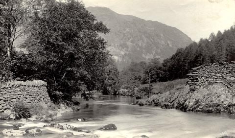 click to enlarge click to enlargeHB0695.jpg internegative at lower right:- "H. Bell" item:- Armitt Library : ALPS359 Image © see bottom of page |
|||
|
|
||||
| evidence:- | old photograph:- Bell 1880s-1940s |
|||
| source data:- | Photograph, sepia, footbridge, River Rothay, Rydal, by Herbert Bell, photographer,
Ambleside, Westmorland, 1890s.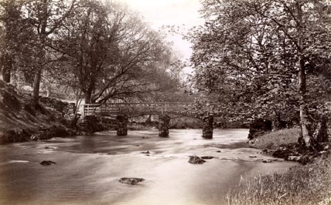 click to enlarge click to enlargeHB0683.jpg internegative at lower right:- "H. Bell" item:- Armitt Library : ALPS346 Image © see bottom of page |
|||
|
|
||||
| evidence:- | old photograph:- Bell 1880s-1940s |
|||
| source data:- | Photograph, sepia, Helm Crag and the River Rothay, Grasmere, Westmorland, by Herbert
Bell, photographer, Ambleside, Westmorland, 1890s.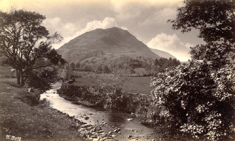 click to enlarge click to enlargeHB0571.jpg internegative at lower left:- "H. Bell" item:- Armitt Library : ALPS231 Image © see bottom of page |
|||
|
|
||||
| evidence:- | old photograph:- Bell 1880s-1940s |
|||
| source data:- | Photograph, black and white, River Rothay from Pelter Bridge, Rydal, Westmorland,
by Herbert Bell, photographer, Ambleside, Westmorland, 1875?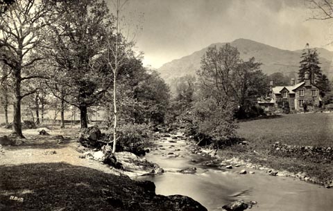 click to enlarge click to enlargeHB0539.jpg internegative at lower left:- "H. Bell" item:- Armitt Library : 1958.4919 Image © see bottom of page |
|||
|
|
||||
| evidence:- | old photograph:- Bell 1880s-1940s |
|||
| source data:- | Photograph, black and white, River Rothay near Fox How, Rydal, Westmorland, by Herbert
Bell, Ambleside, Westmorland, 1890s.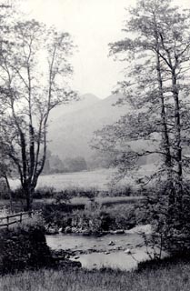 click to enlarge click to enlargeHB0534.jpg stamped at reverse:- "HERBERT BELL / Photographer / AMBLESIDE" item:- Armitt Library : ALPS197 Image © see bottom of page |
|||
|
|
||||
| evidence:- | old photograph:- Bell 1880s-1940s |
|||
| source data:- | Photograph, b/w, River Rothay from Pelter Bridge, Rydal, Westmorland, by Herbert Bell,
Ambleside, Westmorland, 1890s?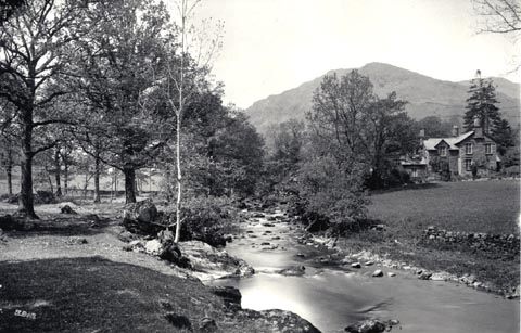 click to enlarge click to enlargeHB0284.jpg item:- Armitt Library : ALPS641 Image © see bottom of page |
|||
|
|
||||
| evidence:- | old photograph:- Bell 1880s-1940s |
|||
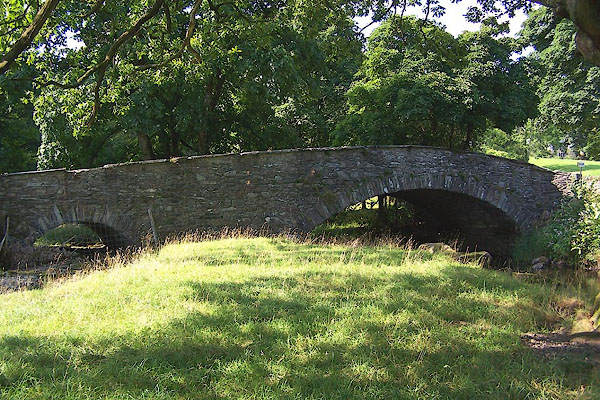
| source data:- | Photograph, black and white, Miller Bridge over the River Rothay, Ambleside, by Herbert
Bell, Ambleside, Westmorland, 1890s.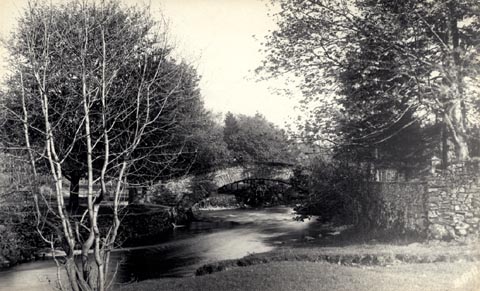 click to enlarge click to enlargeHB0200.jpg stamped at rev:- "HERBERT BELL / Photographer / AMBLESIDE" item:- Armitt Library : ALPS18 Image © see bottom of page |
|||
|
|
||||
| evidence:- | old print:- Heaton Cooper 1905 (edn 1908) item:- sunset |
|||
| source data:- | Print, colour halftone, Sunset, Rydal Water, Rydal, Westmorland, from a watercolour
painting by Alfred Heaton Cooper, published by Adam and Charles Black, London, 2nd
edn 1908.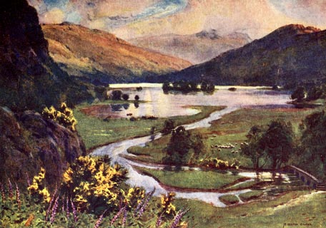 click to enlarge click to enlargeHC0114.jpg Opposite p.42 of The English Lakes, painted by Alfred Heaton Cooper, described by William T Palmer. printed at tissue opposite the print:- "SUNSET, RYDAL WATER" printed at signed lower right:- "[A HEATON COOPER]" item:- JandMN : 468.14 Image © see bottom of page |
|||
|
|
||||
| evidence:- | old print:- Pearson 1900s |
|||
| source data:- | Print, halftone photograph, Rydal Mere, from the West, Westmorland, published by C
Arthur Pearson, Henrietta Street, London, 1900s.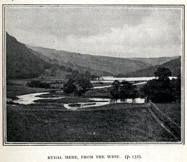 click to enlarge click to enlargePS1E43.jpg On p.117 of Pearson's Gossipy Guide to the English Lakes and Neighbouring Districts. printed at bottom:- "RYDAL MERE, FROM THE WEST. (p.132)." item:- Armitt Library : A1188.50 Image © see bottom of page |
|||
|
|
||||
| evidence:- | old print:- Pyne 1853 |
|||
| source data:- | Windermere Water Head drawn by James Barker Pyne, 1848-1853, lithographed by T Picken,
1859.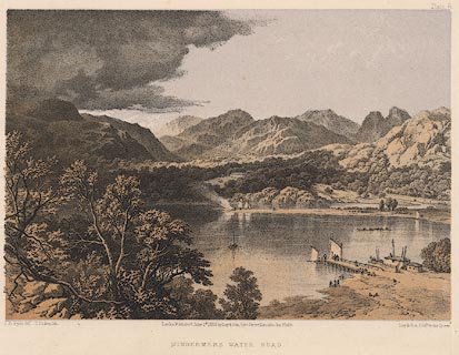 click to enlarge click to enlargePY06.jpg "Windermere Water Head" item:- JandMN : 97.7 Image © see bottom of page |
|||
|
|
||||
| evidence:- | old print with text:- Farington 1789 (plate 20) |
|||
| source data:- | Print, engraving, The Bridge and part of the Village of Rydal, Westmorland, painted
by Joseph Farington, engraved by W Byrne and J Landseer, published by W Byrne, 69
Titchfield Street, London, 1785.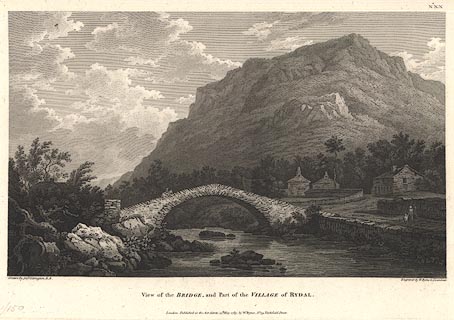 click to enlarge click to enlargeBMZ06.jpg Pelter Bridge over the River Rothay, Heron Pike in the background. Plate 20 from Views of the Lakes, &c, in Cumberland and Westmorland, published 1789; with descriptive text:- "VIEW near the VILLAGE of RYDAL." "... The Bridge, which is thrown over the River Rothay, is happily situated in this View; ..." item:- Dove Cottage : Lowther.7 Image © see bottom of page |
|||
|
|
||||
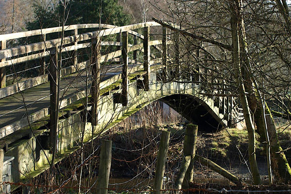
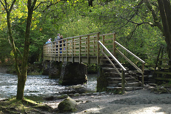
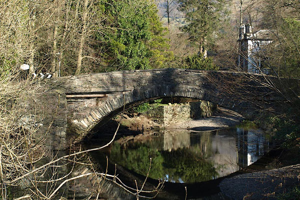
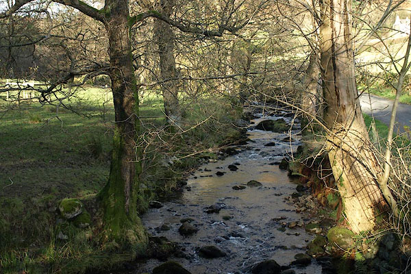
 BRR66.jpg At the foot of Rydal Water. (taken 7.10.2009) 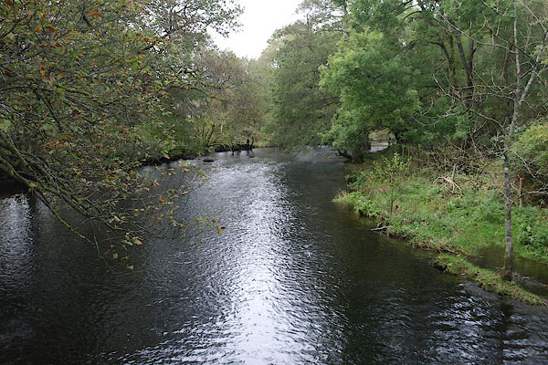 BRR65.jpg At a footbridge, between the lakes, (taken 7.10.2009) 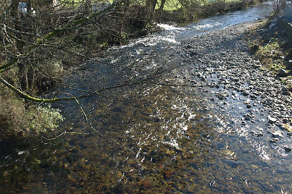 BUF44.jpg At White Bridge, Grasmere, (taken 14.3.2011) 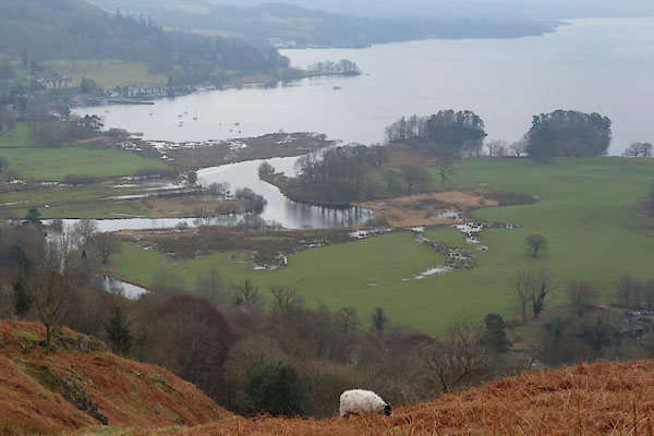 BZT94.jpg Into lake Windermere. (taken 30.1.2014) |
||||
|
|
||||
| places:- |
|
|||
|
||||
|
||||
|
||||
|
||||
|
||||
|
||||
|
||||
|
||||
|
||||
|
||||
Lakes Guides menu.