Old Cumbria Gazetteer
 |
 |
|
||
| Longtown | ||||
| civil parish:- | Arthuret (formerly Cumberland) | |||
| county:- | Cumbria | |||
| locality type:- | locality | |||
| locality type:- | buildings | |||
| locality type:- | selected place | |||
| coordinates:- | NY37936868 | |||
| 1Km square:- | NY3768 | |||
| 10Km square:- | NY36 | |||
| latitude; longitude:- | 2d 58.2m W; 55d 0.5m N | |||
|
|
||||
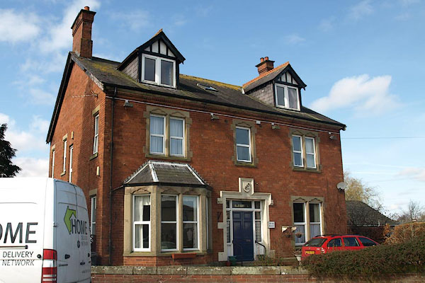
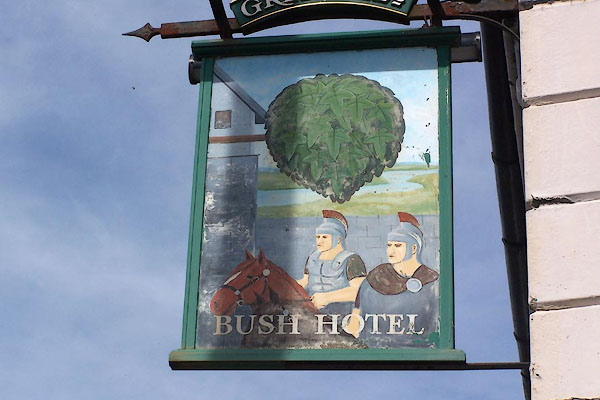
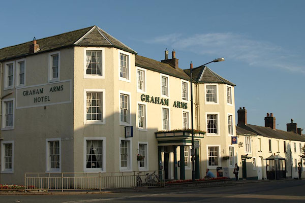
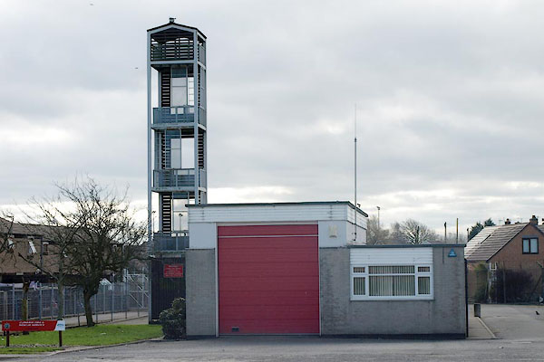
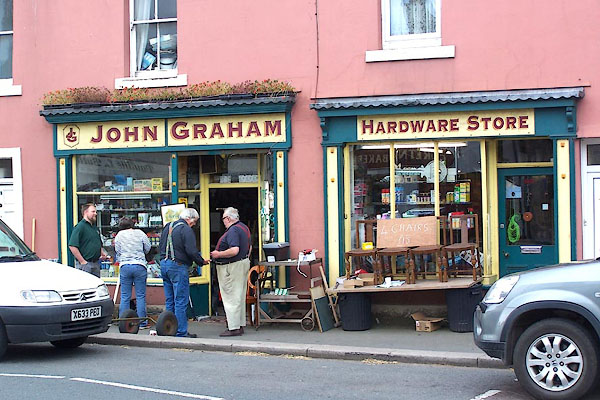
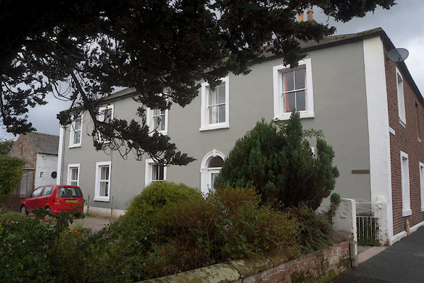
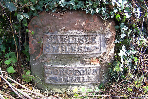
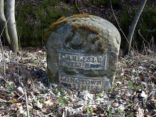
 BMQ12.jpg (taken 15.9.2006) |
||||
|
|
||||
| evidence:- | old map:- OS County Series (Cmd 10 3) placename:- Longtown |
|||
| source data:- | Maps, County Series maps of Great Britain, scales 6 and 25
inches to 1 mile, published by the Ordnance Survey, Southampton,
Hampshire, from about 1863 to 1948. OS County Series (Cmd 10 2) |
|||
|
|
||||
| evidence:- | old map:- Burghley 1590 (facsimile) placename:- Longtowne |
|||
| source data:- | Facsimile map, A Platt of the Opposete Border of Scotland to ye West Marches of England,
parts of Cumberland and Scotland including the Debateable Land, from a manuscript
drawn for William Cecil, Lord Burghley, about 1590, published by R B Armstrong, 1897. courtesy of the National Library of Scotland 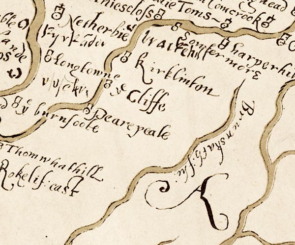 M048NY46.jpg "Longtowne" circle, tower item:- National Library of Scotland : MS6113 f.267 Image © National Library of Scotland |
|||
|
|
||||
| evidence:- | old map:- Morden 1695 (EW) placename:- Longtown |
|||
| source data:- | Map, hand coloured engraving, England, including Wales, scale
about 27 miles to 1 inch, by Robert Morden, published by Abel
Swale Awnsham and John Churchil, London, about 1695. click to enlarge click to enlargeMRD3Cm.jpg "Longtown" circle; village or town item:- JandMN : 339 Image © see bottom of page |
|||
|
|
||||
| evidence:- | old map:- Morden 1695 (Cmd) placename:- Long Town |
|||
| source data:- | Map, uncoloured engraving, Cumberland, scale about 4 miles to 1
inch, by Robert Morden, 1695, published by Abel Swale, the
Unicorn, St Paul's Churchyard, Awnsham, and John Churchill, the
Black Swan, Paternoster Row, London, 1695-1715.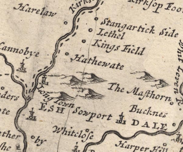 MD12NY47.jpg "Long Town" Circle, building and tower. item:- JandMN : 90 Image © see bottom of page |
|||
|
|
||||
| evidence:- | old map:- Badeslade 1742 placename:- Long Town |
|||
| source data:- | Map, uncoloured engraving, A Map of Cumberland North from
London, scale about 11 miles to 1 inch, with descriptive text,
by Thomas Badeslade, London, engraved and published by William
Henry Toms, Union Court, Holborn, London, 1742. click to enlarge click to enlargeBD10.jpg "Long Town" circle, tower/s, upright lowercase text; town item:- JandMN : 115 Image © see bottom of page |
|||
|
|
||||
| evidence:- | old text:- Gents Mag item:- rebellion, 1745; 1745 Rebellion |
|||
| source data:- | Magazine, The Gentleman's Magazine or Monthly Intelligencer or
Historical Chronicle, published by Edward Cave under the
pseudonym Sylvanus Urban, and by other publishers, London,
monthly from 1731 to 1922. goto source goto sourceGentleman's Magazine 1745 p.603 "... ..." "... On Friday the 8th they march'd, part of the cavalry to Longholm, and infansry (sic) to Cannoby, on the Scotch side, and the rest of the cavalry cross'd the river and lay at Longtown, ..." |
|||
|
|
||||
| evidence:- | descriptive text:- Simpson 1746 placename:- Logtown |
|||
| source data:- | Atlas, three volumes of maps and descriptive text published as
'The Agreeable Historian, or the Compleat English Traveller
...', by Samuel Simpson, 1746. goto source "Longtown, near where the Eske and Kirksop Rivers meet: It is a small Town, the Market of which is kept on Thursdays; and it is 234 Miles computed, and 315 measured from London." |
|||
|
|
||||
| evidence:- | old map:- Bickham 1753-54 (Cmd) placename:- Long Town |
|||
| source data:- | Map, uncoloured engraving, perspective map, Map of Cumberland
North from London, by George Bickham, James Street, Bunhill
Fields, London, 1753, published by F Jollie and Sons, Carlisle,
Cumberland, 1811.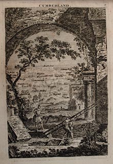 click to enlarge click to enlargeJL05.jpg "Long Town" view (sort of) item:- Carlisle Library : 4.2 Image © Carlisle Library |
|||
|
|
||||
| evidence:- | old map:- Bowen and Kitchin 1760 placename:- Longtown |
|||
| source data:- | Map, hand coloured engraving, A New Map of the Counties of
Cumberland and Westmoreland Divided into their Respective Wards,
scale about 4 miles to 1 inch, by Emanuel Bowen and Thomas
Kitchin et al, published by T Bowles, Robert Sayer, and John
Bowles, London, 1760.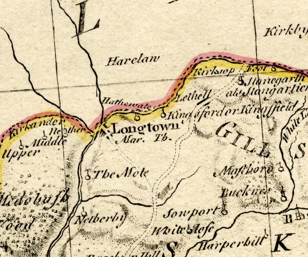 BO18NY47.jpg "Longtown / Mar. Th." blocks, on road, town, market item:- Armitt Library : 2008.14.10 Image © see bottom of page |
|||
|
|
||||
| evidence:- | old map:- Donald 1774 (Cmd) placename:- Longtown |
|||
| source data:- | Map, hand coloured engraving, 3x2 sheets, The County of Cumberland, scale about 1
inch to 1 mile, by Thomas Donald, engraved and published by Joseph Hodskinson, 29
Arundel Street, Strand, London, 1774.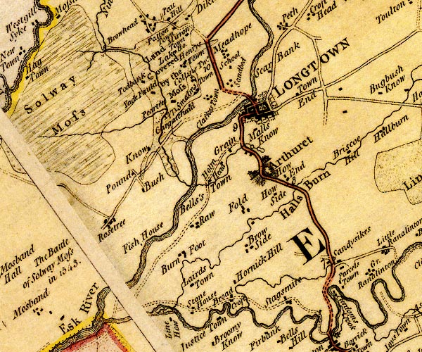 D4NY36NE.jpg "LONGTOWN" blocks, perhaps a church, labelled in block caps; a town with street plan and garden plots item:- Carlisle Library : Map 2 Image © Carlisle Library |
|||
|
|
||||
| evidence:- | old map:- Donald 1774 (Cmd) placename:- Longtown |
|||
| source data:- | Map, hand coloured engraving, 3x2 sheets, The County of Cumberland, scale about 1
inch to 1 mile, by Thomas Donald, engraved and published by Joseph Hodskinson, 29
Arundel Street, Strand, London, 1774.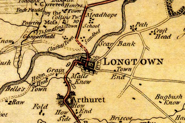 DN04Lngt.jpg "LONGTOWN" Labelled in block caps for a market town; street map; the church at Arthuret. item:- Carlisle Library : Map 2 Image © Carlisle Library |
|||
|
|
||||
| evidence:- | old map:- Donald 1774 (Cmd) placename:- Longtown |
|||
| source data:- | Map, hand coloured engraving, 3x2 sheets, The County of Cumberland, scale about 1
inch to 1 mile, by Thomas Donald, engraved and published by Joseph Hodskinson, 29
Arundel Street, Strand, London, 1774. D4NY36NE.jpg "LONGTOWN" blocks, perhaps a church, labelled in block caps; a town with street plan and garden plots item:- Carlisle Library : Map 2 Image © Carlisle Library |
|||
|
|
||||
| evidence:- | old map:- Donald 1774 (Cmd) placename:- Longtown |
|||
| source data:- | Map, hand coloured engraving, 3x2 sheets, The County of Cumberland, scale about 1
inch to 1 mile, by Thomas Donald, engraved and published by Joseph Hodskinson, 29
Arundel Street, Strand, London, 1774. DN04Lngt.jpg "LONGTOWN" Labelled in block caps for a market town; street map; the church at Arthuret. item:- Carlisle Library : Map 2 Image © Carlisle Library |
|||
|
|
||||
| evidence:- | old map:- Aikin 1790 (Cmd) placename:- Longtown |
|||
| source data:- | Map, uncoloured engraving, Cumberland, by John Aikin, London,
1790. click to enlarge click to enlargeAIK3.jpg "Longtown" circle; town item:- JandMN : 145 Image © see bottom of page |
|||
|
|
||||
| evidence:- | old map:- Bailey 1797 placename:- Longtown |
|||
| source data:- | Map, soil etc, uncoloured engraving, Cumberland, scale about 21
miles to 1 inch, by J Bailey, engraved by Neele, Strand,
published by Messrs Robinson, Paternoster Row and G Nicol, Pall
Mall, London, 1797. click to enlarge click to enlargeBY04.jpg "Longtown" group of blocks; town item:- Armitt Library : A680.2 Image © see bottom of page |
|||
|
|
||||
| evidence:- | road book:- Cary 1798 (2nd edn 1802) placename:- Longtown |
|||
| source data:- | Road book, itineraries, Cary's New Itinerary, by John Cary, 181
Strand, London, 2nd edn 1802. goto source click to enlarge click to enlargeC38267.jpg page 267-268 "Longtown - Graham's Arms" market town goto source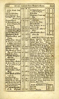 click to enlarge click to enlargeC38269.jpg page 269-270 "INNS. ... Longtown, Graham's Arms. ..." goto source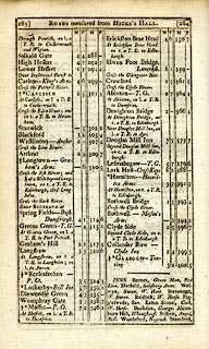 click to enlarge click to enlargeC38283.jpg page 283-284 "Longtown - Graham's Arms" post office goto source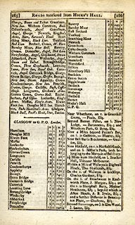 click to enlarge click to enlargeC38285.jpg page 285-286 "INNS. Longtown, Graham's Arms. ..." goto source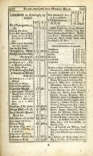 click to enlarge click to enlargeC38337.jpg page 337-338 "To Longtown, p.283" market town, post office item:- JandMN : 228.1 Image © see bottom of page |
|||
|
|
||||
| evidence:- | old map:- Cooke 1802 placename:- Longtown |
|||
| source data:- | Map, Cumberland, scale about 15.5 miles to 1 inch, by George
Cooke, 1802, bound in Gray's New Book of Roads, 1824, published
by Sherwood, Jones and Co, Paternoster Road, London, 1824. click to enlarge click to enlargeGRA1Cd.jpg "Longtown / 308" blocks, upright lowercase text; town, distance from London item:- Hampshire Museums : FA2000.62.2 Image © see bottom of page |
|||
|
|
||||
| evidence:- | old map:- Laurie and Whittle 1806 placename:- Longtown |
|||
| source data:- | Road map, Continuation of the Roads to Glasgow and Edinburgh,
scale about 10 miles to 1 inch, by Nathaniel Coltman? 1806,
published by Robert H Laurie, 53 Fleet Street, London, 1834. click to enlarge click to enlargeLw21.jpg "Longtown 310¼" market town; distance from London; travellers supplied with post horses or carriages item:- private collection : 18.21 Image © see bottom of page |
|||
|
|
||||
| evidence:- | old text:- Capper 1808 placename:- Longtown item:- population; market; fair |
|||
| source data:- | Gazetteer, A Topographical Dictionary of the United Kingdom,
compiled by Benjamin Pitts Capper, published by Richard
Phillips, Bridge Street, Blackfriars, London, 1808; published
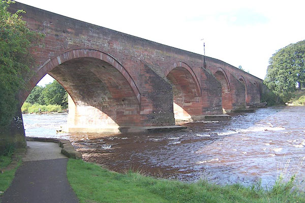
1808-29. goto source "..." "LONGTOWN, a township in the parish of Arthuret, Eskdale ward, Cumberland, 7 miles from Carlisle, and 310 from London; it contains 176 houses and 1335 inhabitants, of whom 648 were employed in various trades and manufactures. Longtown lies on the borders of Scotland, near the conflux of the Esk and Liddel. It has a good charity school, with a market on Thursday. Fairs Thursday after Whitsunday, Thursday after Martinmas, and 22d of November. At the north end of the town is a good stone bridge over the river Esk. The houses are built in the modern stile, and the streets are regular and spacious. It is the property of sir James Graham. - Housman's Tour in Cumberland." "..." |
|||
|
|
||||
| evidence:- | old map:- Cooper 1808 placename:- Longtown |
|||
| source data:- | Map, uncoloured engraving, Cumberland, scale about 10.5 miles to
1 inch, drawn and engraved by Cooper, published by R Phillips,
Bridge Street, Blackfriars, London, 1808. click to enlarge click to enlargeCOP3.jpg "Longtown" circle; village or hamlet item:- JandMN : 86 Image © see bottom of page |
|||
|
|
||||
| evidence:- | old map:- Wallis 1810 (Cmd) placename:- Longtown |
|||
| source data:- | Road map, hand coloured engraving, Cumberland, scale about 16
miles to 1 inch, by James Wallis, 77 Berwick Stree, Soho,
London, 1810. click to enlarge click to enlargeWL13.jpg "Longtown" town item:- Dove Cottage : 2009.81.10 Image © see bottom of page |
|||
|
|
||||
| evidence:- | old text:- Gents Mag placename:- Longton item:- rebellion, 1745; 1745 Rebellion |
|||
| source data:- | Magazine, The Gentleman's Magazine or Monthly Intelligencer or
Historical Chronicle, published by Edward Cave under the
pseudonym Sylvanus Urban, and by other publishers, London,
monthly from 1731 to 1922. goto source Gentleman's Magazine 1819 part 1 p.506 From the Compendium of County History:- "1745. Near Longton, Nov. 8, advanced guard of Prince Charles Stuart's army entered Cumberland. ..." |
|||
|
|
||||
| evidence:- | old map:- Hall 1820 (Cmd) placename:- Longtown |
|||
| source data:- | Map, hand coloured engraving, Cumberland, scale about 21 miles
to 1 inch, engraved by Sidney Hall, published by S Leigh, 18
Strand, London, 1820-31. click to enlarge click to enlargeHA14.jpg "Longtown / 319" circle, upright lowercase text; town; distance from London item:- JandMN : 91 Image © see bottom of page |
|||
|
|
||||
| evidence:- | old map:- Greenwood 1824 placename:- Long Town |
|||
| source data:- | Map, engraving, Map of the County of Cumberland, scale about 1
inch to 1 mile, etc, by Christopher and John Greenwood,
published by George Pringle jnr, 70 Queen Street, Cheapside,
London, 1823.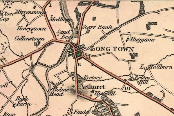 gw12lngt.jpg "LONG TOWN" street map; labelled in block caps for a market town; the church is at Arthuret. item:- National Library of Scotland : EME.b.3.11 Image © National Library of Scotland |
|||
|
|
||||
| evidence:- | old map:- Cobbett 1832 placename:- Longtown |
|||
| source data:- | Map, uncoloured engraving, Cumberland, scale about 20 miles to 1
inch, by William Cobbett, 11 Bolt Court, Fleet Street, London,
1832.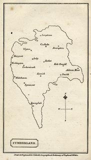 click to enlarge click to enlargeCOB5.jpg "Longtown" dot and circle; town item:- JandMN : 117 Image © see bottom of page |
|||
|
|
||||
| evidence:- | old map:- Ford 1839 map placename:- Longtown |
|||
| source data:- | Map, uncoloured engraving, Map of the Lake District of
Cumberland, Westmoreland and Lancashire, scale about 3.5 miles
to 1 inch, published by Charles Thurnam, Carlisle, and by R
Groombridge, 5 Paternoster Row, London, 3rd edn 1843.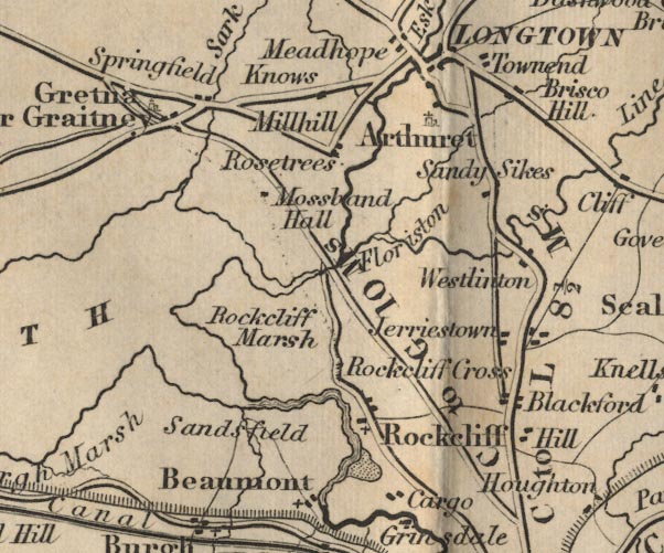 FD02NY36.jpg "Longtown" item:- JandMN : 100.1 Image © see bottom of page |
|||
|
|
||||
| evidence:- | old strip map:- Tinsley 1877 (Roads/Cum) placename:- Longtown |
|||
| source data:- | Strip map, road map, part of London to Edinburgh via Boroughbridge and Carlisle, including
from before Longtown, Cumberland; and into Scotland, published by Tinsley Bros, 8
Catherine Street, Strand, London, 1877.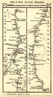 click to enlarge click to enlargeTLY1M3.jpg Map pp.37-38 in British High Roads, North and North Eastern Routes. printed at top:- "BRITISH HIGH ROADS. / 37 LONDON TO EDINBURGH, VIA BOROUGHBRIDGE &CARLISLE. 38" item:- private collection : 270.5 Image © see bottom of page |
|||
|
|
||||
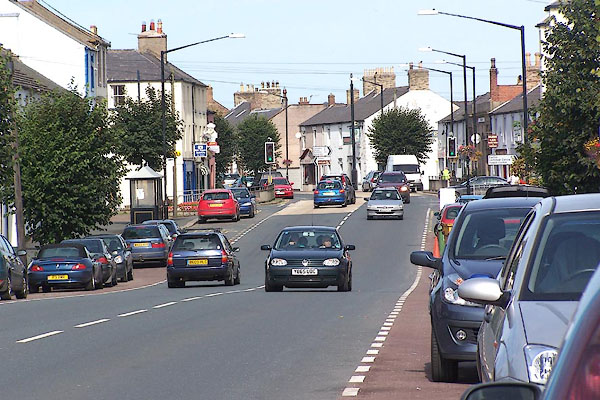
| evidence:- | old text:- Harper 1907 placename:- Longtown |
|||
| source data:- | Guidebook, The Manchester and Glasgow Road, by Charles G Harper,
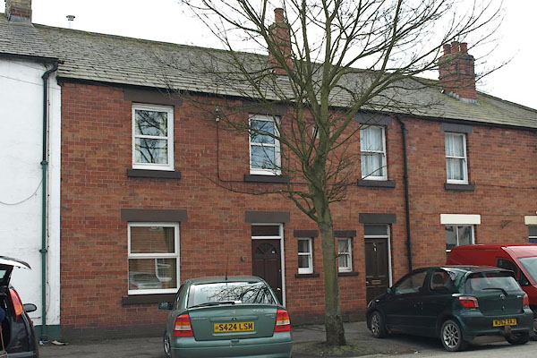
published by Chapman and Hall Ltd, London, 1907. HP01p157.txt Page 157:- "..." "There are no architectural graces in Longtown. Each house is like its fellow and every street resembles every other street. How then do the strayed revellers, returning home "fou," find the way to their respective domiciles? An attempt to subdue the stark angularity of Longtown, though not to give its streets variety, is seen in the somewhat recent planting of the road with trees." "Many people suppose the river Esk at Longtown to be the division between England and Scotland. The supposition is reasonable enough, for the actual divisor, the Sark, four miles further on, approaching Springfield, is a very insignificant stream in appearance. The political and social significances of it were, however, of very serious import indeed." |
|||
|
|
||||
| evidence:- | old itinerary:- Johnson 1908 (Roads/Cum) placename:- Longtown |
|||
| source data:- | Itinerary, Route 43 in Roads Made Easy by Picture and Pen, Doncaster to Glasgow, through
Alston, by Claude Johnson, edited by Lord Montagu, published by The Car Illustrated,
168 Piccadilly, London, 1908.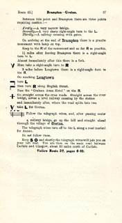 click to enlarge click to enlargeJS5097.jpg pp.93-97 in the road book, Roads Made Easy by Picture and Pen, vol.3. printed at beginning, p.93:- "ROUTE 43. / DONCASTER via Boroughbridge (43½), Scotch Corner (72½), Barnard Castle (85½), Middleton-in-Teesdale (96½), Alston (118½), Longtown (148½), Gretna (155¼), to GLASGOW (240½)." item:- private collection : 268.14 Image © see bottom of page |
|||
|
|
||||
| evidence:- | old itinerary:- Johnson 1908 (Roads/Cum) placename:- Longtown |
|||
| source data:- | Itinerary, Route 43 reverse in Roads Made Easy by Picture and Pen, Glasgow to Doncaster,
through Alston, by Claude Johnson, edited by Lord Montagu, published by The Car Illustrated,
168 Piccadilly, London, 1908.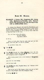 click to enlarge click to enlargeJS5098.jpg pp.98-106 in the road book, Roads Made Easy by Picture and Pen, vol.3. printed at beginning, p.98:- "ROUTE 43. Reverse. / GLASGOW via Gretna (85¼), Longtown (92), Alston (122), Middleton-in-Teesdale (144), Barnard Castle (155), Scotch Corner (168), Boroughbridge (197) to DONCASTER 240½)." 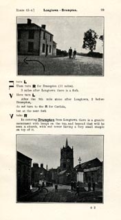 click to enlarge click to enlargeJS5099.jpg item:- private collection : 268.15 Image © see bottom of page |
|||
|
|
||||
| evidence:- | market notes:- placename:- Arcwret item:- market |
|||
| source data:- | www.history.ac.uk/cmh/gaz/gazweb2.htmPalmer's Index No.93:: Public Record OfficeOwen: 1792: New Book of Fairs: 1889: Market Rights and Tolls: HM GovernmentBowen, Emanuel &Kitchin, Thomas: 1760: New Map of the Counties of Cumberland and Westmoreland | |||
|
|
||||
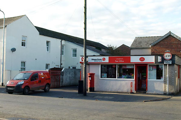
 Post Office maps Post Office maps |
||||
|
|
||||
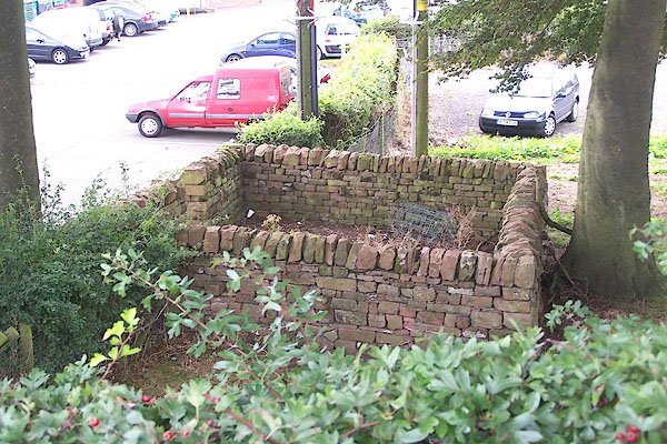
| notes:- |
site of tower or early stone house |
|||
| Perhaps misinterpreting a map symbol for the town? |
||||
| Perriam, D R &Robinson, J: 1998: Medieval Fortified Buildings of Cumbria: CWAAS::
ISBN 1 873124 23 6 |
||||
|
|
||||
| places:- |
|
|||
|
||||
|
||||
|
||||
|
||||
|
||||
|
||||
|
||||
|
||||
|
||||
|
||||
|
||||
|
||||
|
||||
|
||||
|
||||
|
||||
|
||||
|
||||
|
||||
|
||||
|
||||
|
||||
|
||||
|
||||
|
||||
|
||||
|
||||
|
||||
|
||||
|
||||
|
||||
|
||||
|
||||
|
||||
|
||||
|
||||
|
||||
|
||||
|
||||
|
||||
|
||||
|
||||
|
||||
|
||||
|
||||
Lakes Guides menu.