 Old Cumbria Gazetteer
 |
 |
|
| milestone, Arthuret (6) | ||
| site name:- | road, Carlisle to Longtown | |
| locality:- | Longtown | |
| civil parish:- | Arthuret (formerly Cumberland) | |
| county:- | Cumbria | |
| locality type:- | milestone | |
| coordinates:- | NY38886697 | |
| 1Km square:- | NY3866 | |
| 10Km square:- | NY36 | |
|
|
||
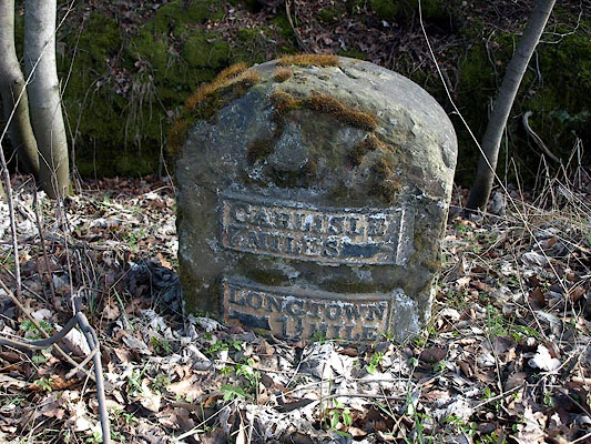 BSK24.jpg Cast iron plates on stone:- "CARLISLE / 7 MILES [hand]" "LONGTOWN / [hand] 1½MILE" (taken 2.4.2010) 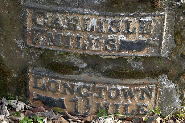 BSK25.jpg Cast iron plates on stone:- (taken 2.4.2010) |
||
|
|
||
| evidence:- | database:- Listed Buildings 2010 |
|
| source data:- | courtesy of English Heritage "MILESTONE, HOPESIKE WOODS AT NGR 388 669 / / A7 / ARTHURET / CARLISLE / CUMBRIA / II / 78087 / NY3887266983" |
|
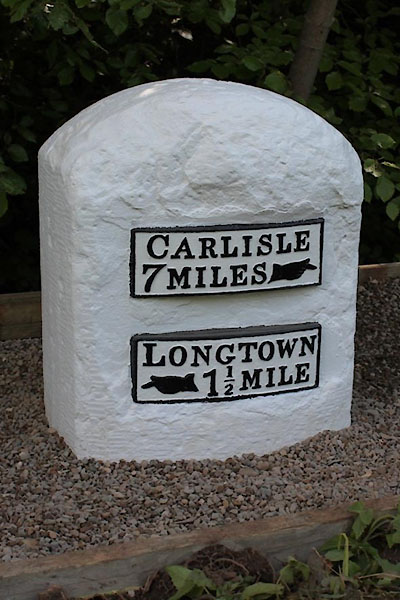
| source data:- | courtesy of English Heritage "Milestone. Probably early C19 for Carlisle to Longtown Turnpike. Red sandstone, cast iron plates. Squared stone with rounded top has 2 plates to front, one with indication to CARLISLE 7 MILES and plate below LONGTOWN 1 1/2 MILE. Whitewashed and lettering picked out in black. Bench mark on top of stone." |
|
|
|
||
 CEL86.jpg Cast iron plates on stone:- "CARLISLE / 7 MILES [hand]" "LONGTOWN / [hand] 1½MILE" (taken 1.6.2013) courtesy of Terry Moore Image © Terry Moore |
||
|
|
||
 Lakes Guides menu.