Old Cumbria Gazetteer
 |
 |
|
||
| included in:- |
 road, Carlisle to Berwick road, Carlisle to Berwick |
|||
| road, Longtown to Newcastleton | ||||
| Longtown to Newcastleton | ||||
| Newcastleton to Longtown | ||||
| civil parish:- | Arthuret (formerly Cumberland) | |||
| civil parish:- | Kirkandrews (formerly Cumberland) | |||
| civil parish:- | Nicholforest (formerly Cumberland) | |||
| county:- | Cumbria | |||
| locality type:- | road route | |||
| 10Km square:- | NY36 | |||
| 10Km square:- | NY37 | |||
| locality:- | Newcastleton | |||
| country:- | Scotland | |||
| locality type:- | road | |||
| locality type:- | route | |||
|
|
||||
| evidence:- | old map:- Ford 1839 map |
|||
| source data:- | Map, uncoloured engraving, Map of the Lake District of
Cumberland, Westmoreland and Lancashire, scale about 3.5 miles
to 1 inch, published by Charles Thurnam, Carlisle, and by R
Groombridge, 5 Paternoster Row, London, 3rd edn 1843.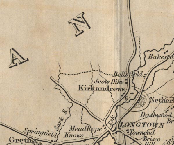 FD02NY37.jpg item:- JandMN : 100.1 Image © see bottom of page |
|||
|
|
||||
| evidence:- | old map:- Bell 1892 |
|||
| source data:- | Map, colour lithograph, Road Map of Cumberland, by George Joseph
Bell, scale about 2.5 miles to 1 inch, printed by Charles
Thurnam and Sons, Carlisle, Cumberland, 1892.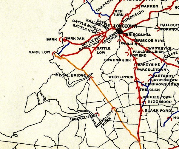 BEL9NY36.jpg 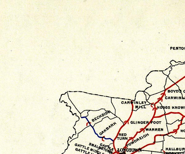 BEL9NY37.jpg 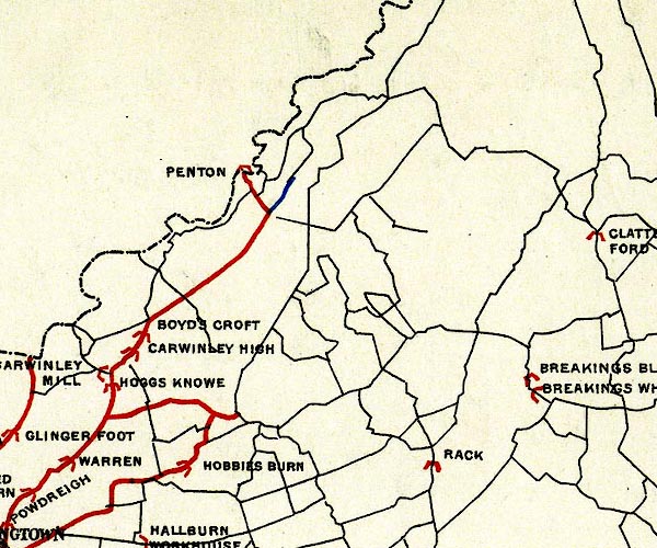 BEL9NY47.jpg red - disturnpiked 'main road' under section 13 of the Highways Act 1878 Road map of Cumberland showing County Bridges item:- Carlisle Library : Map 38 Images © Carlisle Library |
|||
|
|
||||
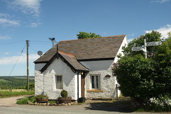
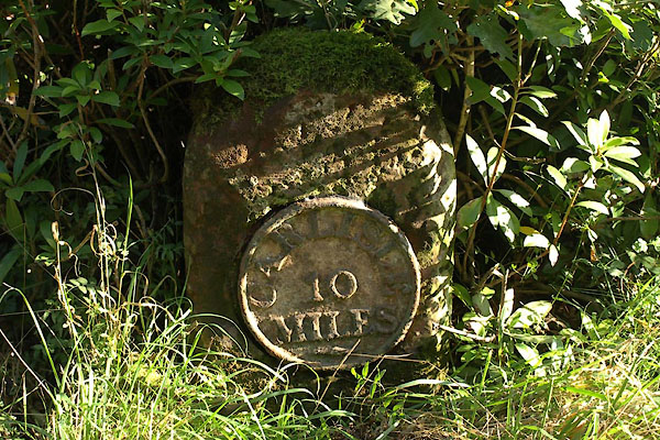
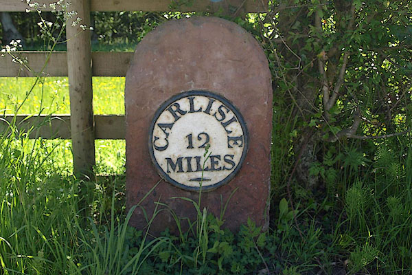
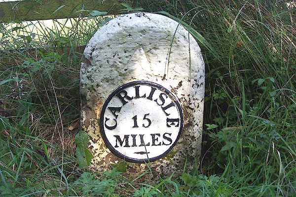
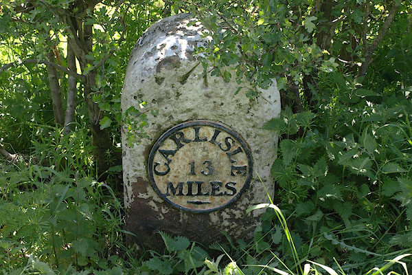
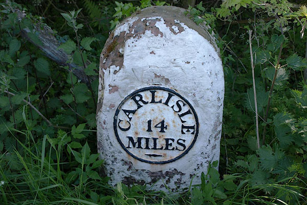
| places:- | Longtown Moat Common, Kirkandrews Penton Bridge, Nicholforest Newcastleton, Scotland |
|||
|
|
||||
| places:- |
|
|||
|
||||
|
||||
|
||||
|
||||
|
||||
|
||||
|
||||
Lakes Guides menu.