 Old Cumbria Gazetteer
 |
 |
|
| milestone, Nicholforest (2) | ||
| site name:- | road, Longtown to Newcastleton | |
| civil parish:- | Nicholforest (formerly Cumberland) | |
| civil parish:- | Kirkandrews (formerly Cumberland) | |
| county:- | Cumbria | |
| locality type:- | milestone | |
| coordinates:- | NY42117466 | |
| 1Km square:- | NY4274 | |
| 10Km square:- | NY47 | |
|
|
||
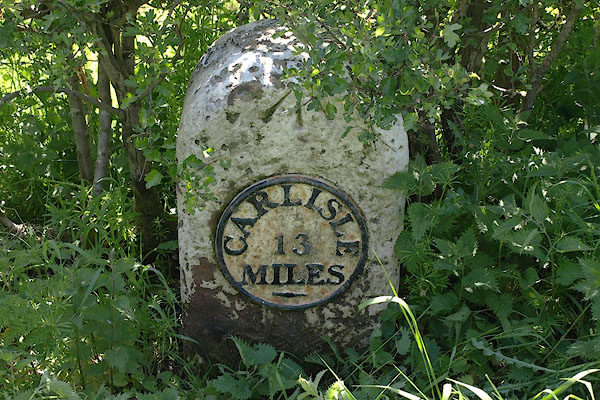 BSV81.jpg Cast iron plate on stone:- "CARLISLE / 13 / MILES" (taken 4.6.2010) |
||
|
|
||
| evidence:- | old map:- OS County Series (Cmd 6 8) |
|
| source data:- | Maps, County Series maps of Great Britain, scales 6 and 25
inches to 1 mile, published by the Ordnance Survey, Southampton,
Hampshire, from about 1863 to 1948. "M.S. Carlisle 13" |
|
|
|
||
| evidence:- | database:- Listed Buildings 2010 |
|
| source data:- | courtesy of English Heritage "MILESTONE NORTH EAST OF TILEKILN WOOD AT NGR 421 746 / / / NICHOLFOREST / CARLISLE / CUMBRIA / II / 78161 / NY4211574675" |
|
| source data:- | courtesy of English Heritage "Milestone. Early C19, for the Longtown-Penton road. Red sandstone, cast iron plate. Squared stone with rounded top has circular plate to front: CARLISLE 13 MILES. Whitewashed with lettering picked out in black. Bench mark on top of stone." |
|
|
|
||
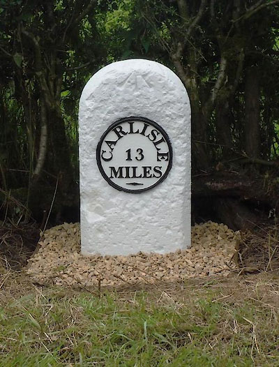 CEL74.jpg Cast iron plate on stone:- "CARLISLE / 13 / MILES" (taken 7.2015) courtesy of Terry Moore Image © Terry Moore |
||
|
|
||
 Lakes Guides menu.