 Old Cumbria Gazetteer
 |
 |
|
|
| road, Clappersgate to Windermere Ferry | |||
| Clappersgate to Windermere Ferry | |||
| Windermere Ferry to Clappersgate | |||
| civil parish:- | Lakes (formerly Westmorland) | ||
| civil parish:- | Skelwith (formerly Lancashire) | ||
| civil parish:- | Hawkshead (formerly Lancashire) | ||
| civil parish:- | Claife (formerly Lancashire) | ||
| county:- | Cumbria | ||
| locality type:- | route | ||
| 10Km square:- | NY30 | ||
| 10Km square:- | SD39 | ||
| SummaryText:- | Mostly footpaths | ||
|
|
|||
| evidence:- | old map:- Clarke 1787 map (Windermere N) |
||
| source data:- | Map, A Map of the Northern Part of the Lake Winandermere and its
Environs, scale about 6.5 ins to 1 mile, by James Clarke,
engraved by Samuel John Neele, 352 Strand, published by James
Clarke, Penrith, Cumberland and in London etc, 1787.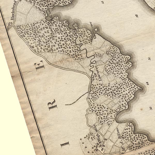 CLANY30Q.jpg  CLASD39U.jpg 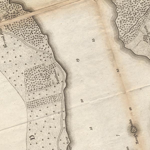 CLASD39Z.jpg 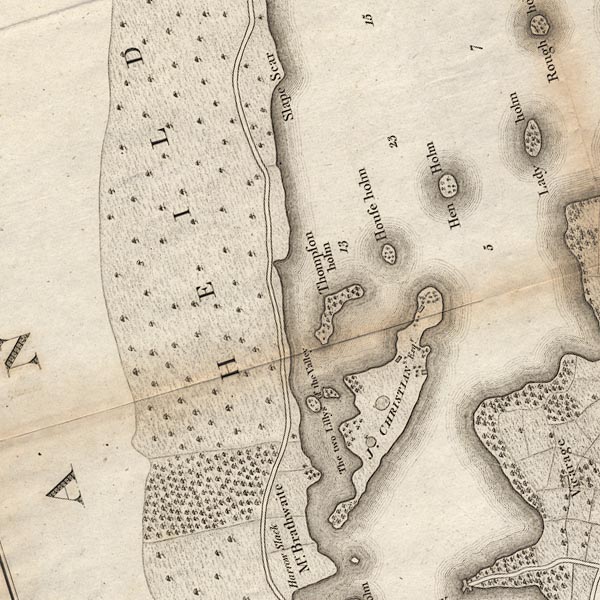 CLASD39Y.jpg 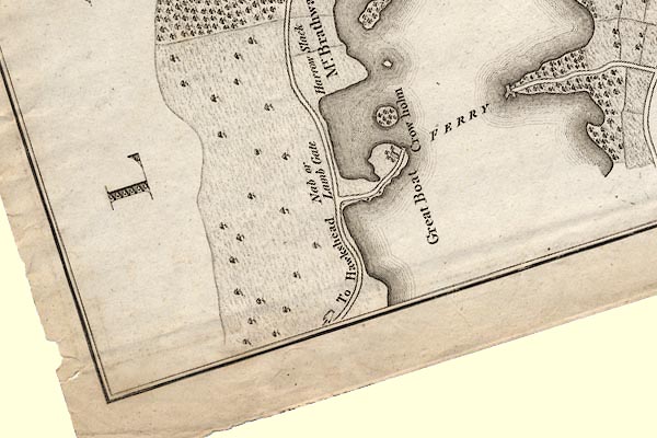 CLASD39X.jpg "To Hawkshead" item:- private collection : 10.10 Image © see bottom of page |
||
|
|
|||
| evidence:- | old map:- Prior 1874 map 1 |
||
| source data:- | Map, uncoloured engraving or lithograph? Winander Mere, scale
about 2.5 miles to 1 inch, published by John Garnett,
Windermere, Westmorland, 1874. click to enlarge click to enlargePI03M1.jpg double line; road item:- private collection : 133.1 Image © see bottom of page |
||
|
|
|||
| places:- |  Clappersgate, Lakes Pull Wyke House, Skelwith Low Wray, Claife High Wray, Claife Belle Grange, Claife Far Sawrey, Claife Windermere Ferry, Windermere lake Clappersgate, Lakes Pull Wyke House, Skelwith Low Wray, Claife High Wray, Claife Belle Grange, Claife Far Sawrey, Claife Windermere Ferry, Windermere lake |
||
|
|
|||
Lakes Guides menu.