Old Cumbria Gazetteer
 |
 |
|
||
| Low Wray, Claife | ||||
| Low Wray | ||||
| civil parish:- | Claife (formerly Lancashire) | |||
| county:- | Cumbria | |||
| locality type:- | locality | |||
| locality type:- | buildings | |||
| coordinates:- | NY37250117 (etc) | |||
| 1Km square:- | NY3701 | |||
| 10Km square:- | NY30 | |||
|
|
||||
| evidence:- | old map:- OS County Series (Lan 2 11) placename:- Low Wray placename:- Wray, Low |
|||
| source data:- | Maps, County Series maps of Great Britain, scales 6 and 25
inches to 1 mile, published by the Ordnance Survey, Southampton,
Hampshire, from about 1863 to 1948. |
|||
|
|
||||
| evidence:- | old map:- Jefferys 1770 (Wmd) placename:- Low Wrays placename:- Wrays, Low |
|||
| source data:- | Map, 4 sheets, The County of Westmoreland, scale 1 inch to 1
mile, surveyed 1768, and engraved and published by Thomas
Jefferys, London, 1770.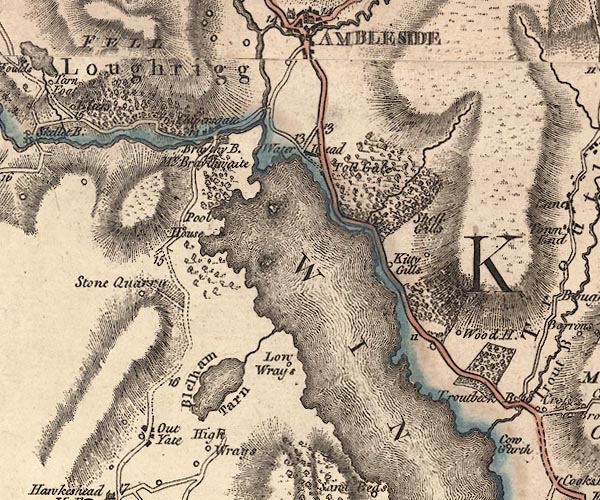 J5NY30SE.jpg "Low Wrays" circle, labelled in italic lowercase text; settlement, farm, house, or hamlet? item:- National Library of Scotland : EME.s.47 Image © National Library of Scotland |
|||
|
|
||||
| evidence:- | old map:- Crosthwaite 1783-94 (Win/Ble) placename:- Low Wray |
|||
| source data:- | Map, uncoloured engraving, An Accurate Map of the Grand Lake of
Windermere, scale about 2 inches to 1 mile, by Peter
Crosthwaite, Keswick, Cumberland, 1783, version published 1819.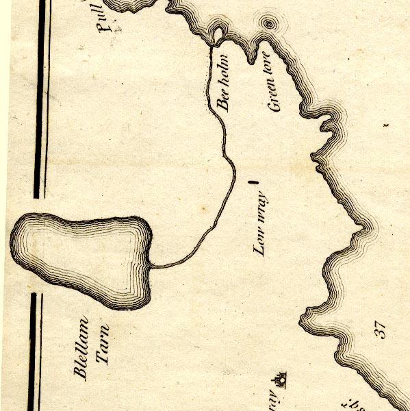 CT9NY30Q.jpg "Low wray" block, building/s item:- Armitt Library : 2008.14.102 Image © see bottom of page |
|||
|
|
||||
| evidence:- | old map:- Clarke 1787 map (Windermere N) placename:- Low Wray |
|||
| source data:- | Map, A Map of the Northern Part of the Lake Winandermere and its
Environs, scale about 6.5 ins to 1 mile, by James Clarke,
engraved by Samuel John Neele, 352 Strand, published by James
Clarke, Penrith, Cumberland and in London etc, 1787.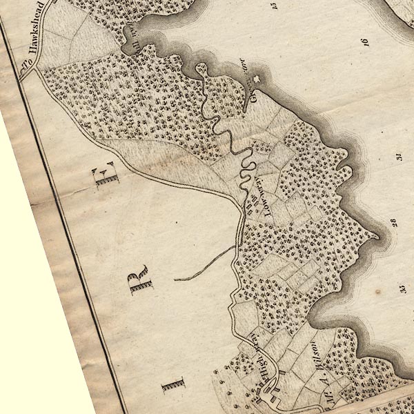 CLANY30Q.jpg "Low-wray" item:- private collection : 10.10 Image © see bottom of page |
|||
|
|
||||
| evidence:- | probably old text:- Green 1810 placename:- Low Kay placename:- Kay, Low |
|||
| source data:- | Set of prints, soft ground etchings, Sixty Studies from Nature,
by William Green, Ambleside, Westmorland, drawn 1808-10,
published 1810. goto source goto sourcepage 13:- "... on the Lancashire side [of Windermere lake] are High and Low Kay." |
|||
|
|
||||
| evidence:- | old print:- Green 1815 placename:- Low Wray item:- cattle |
|||
| source data:- | Print, coloured aquatint, Windermere from Low Wray, Claife, Lancashire, by William
Green, Ambleside, Westmorland, 1815.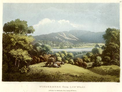 click to enlarge click to enlargeGN0511.jpg Plate 12 in Lake Scenery. printed at upper right:- "12" printed at bottom:- "WINDERMERE from LOW WRAY. / Published at Ambleside, June 1, 1815, by Wm. Green." item:- Armitt Library : A6646.11 Image © see bottom of page |
|||
|
|
||||
| evidence:- | old map:- Ford 1839 map placename:- Low Wray |
|||
| source data:- | Map, uncoloured engraving, Map of the Lake District of
Cumberland, Westmoreland and Lancashire, scale about 3.5 miles
to 1 inch, published by Charles Thurnam, Carlisle, and by R
Groombridge, 5 Paternoster Row, London, 3rd edn 1843.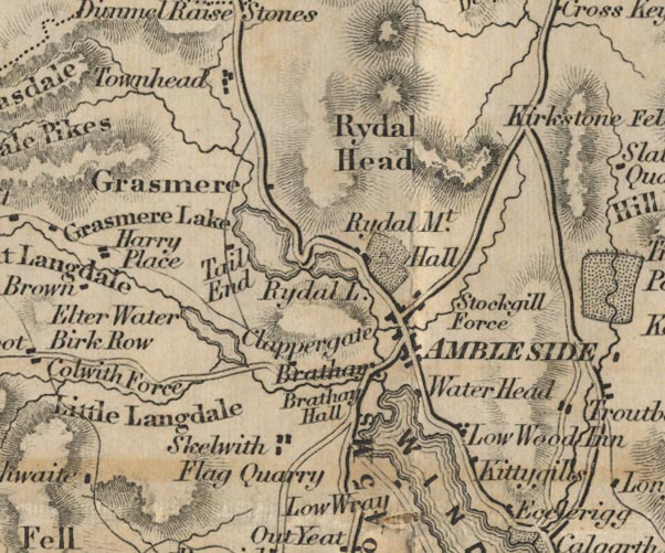 FD02NY30.jpg "Low Wray" item:- JandMN : 100.1 Image © see bottom of page |
|||
|
|
||||
| evidence:- | old map:- Prior 1874 map 1 placename:- Low Wray |
|||
| source data:- | Map, uncoloured engraving or lithograph? Winander Mere, scale
about 2.5 miles to 1 inch, published by John Garnett,
Windermere, Westmorland, 1874. click to enlarge click to enlargePI03M1.jpg "Low Wray" block/s; building/s item:- private collection : 133.1 Image © see bottom of page |
|||
|
|
||||
| places:- |
|
|||
|
||||
|
||||
|
||||
|
||||
|
||||
|
||||
|
||||
|
||||
|
||||
|
||||
|
||||
Lakes Guides menu.